Blog

  • New 2-book set explores 21st-century PNT

    New 2-book set explores 21st-century PNT

    By Jade Morton,
    Guest Author

    Cover PNT21After more than five years of hard work by 131 authors from 18 countries, the new book set Position, Navigation, and Timing Technologies in the 21st Century (PNT21) is finally ready to meet readers.

    Published by Wiley-IEEE Press, PNT21 offers a uniquely comprehensive coverage of the latest developments in the field of PNT by world-renowned experts. The two-volume set contains 64 chapters organized into six parts.


    Position, Navigation, and Timing Technologies in the 21st Century
    Integrated Satellite Navigation, Sensor Systems, and Civil Applications
    Y. Jade Morton, Frank van Diggelen, James J. Spilker Jr. and Bradford W. Parkinson, editors; Sherman Lo and Grace Gao, associate editors
    Publisher: Wiley-IEEE Press
    Hardcover Publication Date: January 2021
    Vol. 1: ISBN: 978-1-119-45841-8, 1288 Pages
    Vol 2: ISBN: 978-1-119-45849-4, 912 Pages


    Volume 1 focuses on satellite navigation systems, technologies, and applications. It starts with a historical perspective on GPS and other related PNT development.

    Part A consists of 12 chapters on fundamentals of and latest developments in global and regional satellite navigation systems (GNSS and RNSS), the need for their coexistence and mutual benefits, signal quality monitoring, satellite orbit and time synchronization, and satellite- and ground-based augmentation systems that provide information to improve the accuracy of navigation solutions.

    Part B contains 13 chapters on recent progress in satellite navigation receiver technologies such as vector processing, assisted and high sensitivity GNSS, precise point positioning (PPP) and real time kinematic (RTK) systems, direct position estimation techniques, and GNSS antennas and array signal processing. Also included are the challenges of multipath-rich urban environments, handling spoofing and interference, and ensuring PNT integrity.

    Part C finishes the volume with eight chapters on satellite navigation for engineering and scientific applications. A review of global geodesy and reference frames sets the stage for discussions on the broad field of geodetic sciences, followed by a chapter on GNSS-based time and frequency distribution. One chapter each is dedicated to severe weather, ionospheric effects and hazardous event monitoring. Finally, comprehensive treatments of GNSS radio occultation and reflectometry are provided.
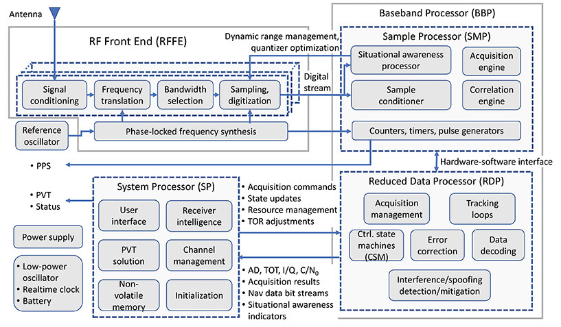
    This simplified block diagram of a modern GNSS receiver — one of many illustrations in the book set — appears in Chapter 14, “Fundamentals and Overview of GNSS Receivers,” by Sanjeev Gunawardena and Y. Jade Morton. (Image: Wiley-IEEE Press)
    This simplified block diagram of a modern GNSS receiver — one of many illustrations in the book set — appears in Chapter 14, “Fundamentals and Overview of GNSS Receivers,” by Sanjeev Gunawardena and Y. Jade Morton. See excerpt below. (Image: Wiley-IEEE Press)

    Volume 2 addresses PNT using alternative signals and sensors and integrated PNT technologies for consumer and commercial applications. An overview chapter provides the motivation and organization of the volume, followed by a chapter on nonlinear estimation methods which are often employed in navigation system modeling and sensor integration.

    Part D provides seven chapters devoted to using various radio signals-of-opportunity transmitted from sources on the ground, from aircraft, or from low Earth orbit (LEO) satellites for PNT purposes.

    In Part E, eight chapters cover a broad range of non-radio frequency sensors operating in passive and active modes to produce navigation solutions, including MEMS inertial sensors, advances in clock technologies, magnetometers, imaging, lidar, digital photogrammetry, and signals received from celestial bodies.

    A tutorial-style chapter on GNSS/INS integration methods is included in Part E. Also included are chapters on the neuroscience of navigation and animal navigation.

    Finally, Part F presents a collection of contemporary PNT applications such as surveying and mobile mapping, precision agriculture, wearable systems, automated driving, train control, commercial unmanned aircraft systems, aviation, satellite orbit determination and formation flying, and navigation in the unique Arctic environment.


    Table of Contents

    Volume 1: Satellite Navigation Systems, Technologies, and Applications

    • Part A: Satellite Navigation Systems
    • Part B: Satellite Navigation Technologies
    • Part C: Satellite Navigation for Engineering and Scientific Applications

    Volume 2: Integrated Navigation Systems, Technologies, and Applications

    • Part D: Position, Navigation, and Timing Using Radio Signals-of-Opportunity
    • Part E: Position, Navigation, and Timing Using Non-Radio Signals-of-Opportunity
    • Part F: Position, Navigation, and Timing for Consumer and Commercial Applications

    Collective Goal. Because of the diverse authorship and topics covered in PNT21, the chapters were written in a variety of styles. Some offer high-level reviews of progress in specific subject areas, while others are tutorials. A few chapters include links to MatLab or Python example code as well as test data for readers who desire hands-on practice.

    The collective goal is to appeal to industry professionals, researchers and academics involved with the science, engineering and application of PNT technologies. The website pnt21book.com provides downloadable code examples, data, homework problems, select high-resolution figures, errata and a way for readers to provide feedback.
    Jade Morton is a professor at the University of Colorado Boulder and director of the Colorado Center for Astrodynamics Research (CCAR).


    Jade Morton is a professor at the University of Colorado Boulder and director of the Colorado Center for Astrodynamics Research (CCAR).


    Excerpt from PNT21

    14.1 Anatomy of a GNSS Receiver

    Irrespective of the receiver type, the functionality of all GNSS receivers can be broken down into three major blocks: RFFE, baseband processor (BBP), and system processor (SP). In the literature, the term “baseband processor” may be used to refer to the combination of both the BBP and SP defined here. The general anatomy of a GNSS receiver is shown in Figure 14.3.

    The RFFE converts the signals induced at one or more antennas into digitized sample streams. Depending on the application and market segment, data rates for these streams may be as low as 0.4 Mbytes/s (e.g. L1 band sampled at 3.5 MSPS and 1-bit sampling in an asset tracking device) to greater than 3 GB/s (e.g. L1 and L2 bands sampled at 60 MSPS and 16 bits across seven elements in an anti-jam military GPS receiver).

    The BBP performs digital signal processing to acquire and track GNSS signals present in the digitized sample streams to produce raw GNSS observables for each visible satellite. These observables include time of transmission (TOT), accumulated Doppler Range (ADR), signal quality metrics such as carrier-to-noise density ratio (C/N0), in-phase and quadrature prompt correlator output (I/Q), and raw symbols of a GNSS signal’s broadcast navigation message (which are subsequently decoded). In addition, modern receivers typically perform varying degrees of situational awareness processing to monitor in-band interference such that a level of confidence can be assigned to these raw observables. Some advanced receivers have the ability to identify spoofing signals. Depending on the application, situational awareness outputs may be as rudimentary as the automatic gain control (AGC) voltage used to adjust front-end amplification or as sophisticated as spectrogram, histogram, and sample statistics for all streams evaluated at full sample precision.

    The BBP also contains a counter that is driven by a digital clock signal that is phase-locked to the receiver’s reference oscillator. This counter is the basis for the receiver’s clock and is used to generate time-of-reception (TOR) epochs. Raw observables for all satellites in view that lead to range measurements are computed with respect to TOR epochs. Since the receiver clock is based on its reference oscillator, it drifts with respect to GNSS system times. Although possible, the frequency bias, drift, and drift rate of the reference oscillator are typically not adjusted to align with GNSS system time because dynamic adjustment of the oscillator can lead to instabilities. Instead, these parameters are estimated and used to drive a separate adjustable-rate counter that compensates for the reference oscillator errors. This forms the basis for GNSS disciplined oscillators.

    It is possible to partition all baseband processing into two categories: sample processor (SMP) and reduced-data processor (RDP). The SMP performs high-rate but simple and algorithmically regular operations which largely comprise multiply-accumulate operations performed at the sample rate. The SMP may also contain configurable timers and pulse/event generators that determine sample processing intervals, as well as output precise timing pulses that are synchronized down to the nanosecond level with respect to GNSS system times (timing accuracy and precision are dependent on the application and market segment). The RDP performs low-rate but algorithmically complex operations. Some representative software functions running within the RDP are illustrated in Figure 14.3.

    Bidirectional communications occur between the SMP and RDP at regular timed intervals corresponding to a kilohertz rate. This rate is easily handled by all modern microprocessors. Since these SMP/RDP transactions are time critical, the RDP runs either bare-metal code (i.e. no operating system) or a real-time operating system. The operations within the BBP are inherently parallel and largely independent of each other at the signal processing level. Some coupling occurs, for example‚ in code-carrier aiding, inter-frequency aiding (see Chapter 15), inter-satellite aiding (referred to as vector tracking, described in Chapter 16), and multi-element processing. However, this coupling is typically implemented at higher levels of abstraction. Modern multi-band and multi-constellation receivers are capable of tracking hundreds of GNSS signals simultaneously. To facilitate this highly complex command and control structure – which also needs to be dynamically scalable and adaptive depending on the number of satellites in view, environmental conditions‚ and operating modes – the control architecture is typically layered (i.e. hierarchical). Control at the individual signal acquisition and tracking layers is performed using simple configurable finite state machines (FSMs) whose state transitions are based on signal condition indicators such as code lock, phase lock, C/N0, and code-carrier divergence (CCD). These FSMs operate independently but are typically managed at a high level by the SP.

    The SP takes the raw signal observables produced by the BBP and transforms them to the standard GNSS receiver measurements. These measurements include pseudorange (PR), accumulated Doppler range (ADR), carrier phase (CP), carrier Doppler, and C/N0. All modern GNSS receivers also compute position, velocity, and time (PVT) at configurable rates (1 to 100 Hz depending on the receiver type). The SP encodes these in one or more industry-standard data formats for distribution. These formats include Receiver Independent Exchange Format (RINEX), the National Marine Electronics Association (NMEA) format, the Radio Technical Commission for Maritime Services (RTCM) format, and vendor-specific proprietary binary formats.

    The SP also performs all high-level functions that include receiver initialization, channel management, and user interface functions. Unlike the BBP, the operations within the SP are generally not time critical. In modern GNSS receivers, the SP is often an embedded computer running an advanced non-real-time operating system. It may also support modern data interfaces (wired USB and Ethernet, or wireless/cellular connectivity) and an advanced graphical user interface with touchscreen support. While too numerous to mention, representative software processes running within the SP are illustrated in Figure 14.3.

    Although not shown in Figure 14.3, modern receivers (or the navigation system to which they are interfaced) may also support aiding from external sensors such as inertial measurement units (IMUs), magnetometers, inclinometers, barometers, wheel sensors, RADAR, lidar, infrared (IR), and electro-optical (EO) sensors. This external aiding to GNSS can occur at three levels: loose coupling (position level), tight coupling (measurement level), or ultra-tight coupling (sampled signal processing level). GNSS aiding using various non-GNSS sensors is described in Chapters 43–51 in Volume II, Part E.

    As shown in Figure 14.3, a stand-alone GNSS receiver contains battery-powered low-power circuitry to keep track of absolute time while it is turned off. A real-time clock (RTC) driven by a low-power crystal oscillator accomplishes this task. In some cases, this crystal may be the same as the reference oscillator. Knowledge of absolute time, along with the last known location and previously decoded almanac/ephemeris data stored in the receiver’s non-volatile memory, allows it to estimate satellites in view and their Doppler offsets, thereby significantly reducing the TTFF: the time needed to acquire satellites and produce the initial PVT solution. In the case of modern military receivers such as M-Code, or subscription-based services such as the Galileo Public Regulated Service (PRS), the receiver must acquire the cryptographically generated spreading code that may never repeat. In this case, the initial time uncertainty has a significant impact on the acquisition search space and consequently the computational resources consumed by the acquisition engine as well as power consumption. The TTFF can be dramatically reduced when absolute time, the satellites in view, their Doppler frequencies, and ephemerides are sent to the receiver from a nearby reference station via a communications link. This describes the basis of Assisted GNSS (A-GNSS) technology, covered in Chapter 17 of this book.

    In some respects, the reference oscillator can be considered the single most important component that affects GNSS receiver performance. Although the PVT solution estimates the deterministic components of the reference oscillator’s frequency error (i.e. short-term bias, drift, and drift rate), the stochastic component cannot be estimated and hence represents additional dynamics that must be tracked (i.e. in addition to satellite motion, user motion, satellite clock motion, and any ionospheric scintillation and multipath). The bandwidth of the carrier tracking loops must be increased to accommodate this close-in phase noise of the reference oscillator. This in turn increases the variance of the range measurements. The reference oscillator is also the only “moving part” in the receiver since it is based on the resonance of a quartz crystal or microelectromechanical systems (MEMS) structure. In addition to microphonics, which are small phase variations that may occur within the RFFE due to external forces (particularly if the RFFE comprises large discrete components), these forces couple through the resonating element leading to shock and vibration sensitivity [6]. Similarly, thermal expansion of the crystal as well as analog components in the RFFE due to changing ambient temperature, unless appropriately compensated or isolated, causes temperature sensitivity. The frequency synthesizer in the RFFE multiplies the oscillator phase noise and dynamics by the ratio of the synthesizer output frequency to the oscillator fundamental frequency, thus placing a significant short-term stability requirement on the reference oscillator. Oscillator short-term stability limits the coherent integration time, which is proportional to the processing gain. Hence, the quality of the reference oscillator directly impacts the recever’s attainable sensitivity (i.e. the minimum observable signal levels) as well as the rate at which it can output statistically independent measurements. Oscillator effects are covered in detail in Chapter 47.

    The receiver intelligence process within the SP shown in Figure 14.3 performs functions such as determining what satellites are in view, how best to mitigate any in-band interference (as observed by the situational awareness indicators), dynamically adapting to varying operating conditions, determining the best set of range measurements to use for the PVT solution based on optimum satellite geometry and estimated range error metrics indicated by C/N0 (for signal blockage) and CCD fluctuations (for multipath and ionospheric effects), and many such highly complex decisions. Typically, these high-level functions occur at a lower rate such as 1 Hz or less. To a large degree, the level of sophistication and engineering embedded within the receiver intelligence block, as well as the other low-level control functions determines the receiver’s performance in the real world, as expressed by established figures of merit. These include measurement accuracy, update rate, TTFF, sensitivity, dynamics handling capability, multipath mitigation performance, interference detection and mitigation capability, receiver autonomous integrity monitoring, and fault detection and exclusion (see Chapter 23). In other words, for a given market segment and its associated SWaP-C constraints, the receiver’s hardware and available signal processing capabilities can only do so much. The rest, and quite often the attributes that distinguish it in the marketplace, lies within the hundreds of thousands of person-hours and centuries of combined experience baked into its sophisticated software/firmware.


  • Editorial Advisory Board PNT Q&A: PPP versus RTK

    Editorial Advisory Board PNT Q&A: PPP versus RTK

    Every month, we ask members of our Editorial Advisory Board to weigh in on a topic. For the January 2021 issue, we asked,

    Will precise point positioning (PPP) replace real-time kinematic (RTK)? If so, for which applications and when?

    Headshot: Miguel Amor
    Miguel Amor

    “Recently, Hexagon’s Autonomy & Positioning division demonstrated RTK levels of performance — globally —through PPP technology; we call it RTK From the Sky (see page 29). I believe that PPP adoption rates will grow significantly in the coming years and eventually replace RTK — especially in areas that are not well served by RTK networks or similar services. Adoption rates will depend on which applications can field GNSS receivers capable of the signals and constellations to perform like RTK.”

    Miguel Amor
    Hexagon’s Autonomy & Positioning division


    Headshot: Alison Brown
    Alison Brown

    “For many applications, the improved accuracy provided by PPP (10 cm) is sufficient and RTK solutions are not needed. However, the typical convergence time of PPP is between 20 and 40 minutes, depending on the number of satellites available, satellite geometry, the quality of the correction products, the receiver’s multipath environment, and atmospheric conditions. This slow convergence compared to RTK solutions will limit application for many real-time applications such as mobile solutions.”

    Alison Brown
    NAVSYS Corporation


    Jean-Marie Sleewaegen
    Jean-Marie Sleewaegen

    “PPP-RTK combines near-RTK accuracy and quick initialization times with the broadcast nature of PPP, over internet or L-band. PPP-RTK can be seamlessly integrated into GNSS receivers, bringing convenient sub-decimeter accuracy to applications where configuring RTK is not practical or where there is no internet connection. PPP-RTK is likely to be adopted by emerging mass-market applications such as UAVs, while RTK will probably remain prevalent in applications where it is already well established, such as precision agriculture.”

    Jean-Marie Sleewaegen
    Septentrio


    Photo:
    Bernard Gruber

    “I do not believe that PPP will replace RTK technology solutions anytime soon. Satellite-based GNSS correction services with an emphasis on global provide worldwide access, but achieving the required accuracy, due to convergence, can be slow. Today, myriad users and emerging customers may utilize corrections augmented with RTK transmitter/base stations that hybrid solutions can provide, thus solving both the age-old navigation issue of obscuration and near real-time positioning simultaneously.”

    Bernard Gruber
    Northrop Grumman

  • ION announces 2020 Annual Awards winners

    ION announces 2020 Annual Awards winners

    Logo: ION

    The Institute of Navigation (ION) presented its Annual Awards during the ION International Technical Meeting and Precise Time and Time Interval Systems and Applications Meeting, both held virtually Jan. 25-28.

    The ION Annual Awards Program recognizes individuals making significant contributions or demonstrating outstanding performance relating to the art and science of navigation.

    Robert Odolinski received the Per Enge Early Achievement Award for development of multi-GNSS models for precise real-time kinematic positioning and for the sustained dedication to the research community, future surveyors and navigation professionals. The Per Enge Early Achievement Award is presented in recognition of outstanding contributions made early in one’s career.

    Capt. Andrew P. Zimmerman received the Superior Achievement Award for validating critical navigation processes and collaborating with Air Force tacticians to provide the highest standards of navigation and protection for the Air Force’s premier electronic attack asset. The Superior Achievement Award is presented to recognize an individual who has demonstrated an outstanding performance as a practicing navigator of any vehicle, in any medium — marine, land, air, undersea and space.

    Michael A. Lombardi received the Distinguished PTTI Service Award for system development and leadership in the successful delivery of the U.S. time and frequency standards signals to a variety of domestic and international PTTI users. The Distinguished PTTI Service Award is presented to recognize outstanding contributions related to the management of PTTI systems.

    Jennifer E. Donaldson, Joel J. K. Parker, Michael C. Moreau, Dolan E. Highsmith and Philip D. Martzen received the Dr. Samuel M. Burka Award for their paper “Characterization of On-orbit GPS Transmit Antenna Patterns for Space Users.” Their paper was published in the Summer 2020 issue of Navigation, Journal of The Institute of Navigation, Vol 67, No. 2. The Dr. Samuel M. Burka Award recognizes outstanding achievement in the preparation of a paper advancing the art and science of positioning, navigation and timing.

    Charles K. Toth received the Captain P. V. H. Weems Award for significant contributions to the development and implementation of multi-sensor integrated navigation systems and for demonstrated excellence as an academic mentor and professional leader. The Captain P. V. H. Weems Award is presented to individuals for continuing contributions to the art and science of navigation.

    Karen L. Van Dyke received the Norman P. Hays Award for her significant contributions to civil GPS applications, for her lead role directing the Adjacent Band Compatibility study, and for her commitment to international PNT coordination. The Norman P. Hays Award is given in recognition of outstanding encouragement, inspiration and support contributing to the advancement of navigation.

    Mingquan Lu received the Thomas L. Thurlow Award for significant and sustained contributions to the BDS-3 signals design and BDS-3/GNSS interoperable receivers development. The Thomas L. Thurlow Award recognizes outstanding contributions to the science of navigation.

    Finally, Y. Jade Morton received the Distinguished Service Award for extraordinary service to The Institute of Navigation. The Distinguished Service Award recognizes extraordinary service to The Institute of Navigation.


    ION also announced the new members of its Executive Committee, Council and Standing Committee Chairs following its Annual Awards during the ION International Technical Meeting and Precise Time and Time Interval Systems and Applications Meeting. Find out who they are here.

  • Antenna innovator Q&As spotlight advancements

    Antenna innovator Q&As spotlight advancements

    Photo: Trimble
    Photo: Trimble

    Antenna development, going all the way back to the first antennas, has been one of continuous innovation,” Richard Langley wrote in our September issue. Even after more than 30 years of GNSS technology development, he pointed out, GNSS antenna development continues.

    His statement is borne out by the responses submitted by manufacturers of GNSS antennas to four questions we posed to them:

    • What specific challenges are your antennas designed to address?
    • Over the past three years and the next three years, what have been/will be your key innovations?
    • How are advances in real-time kinematic (RTK) and precise point positioning (PPP) changing requirements for GNSS antennas?
    • What technical challenges or industry trends do you find most interesting or noteworthy?

    The responses display a wide range of antenna designs for a wide range of applications. They show how manufacturers must constantly balance requirements for positioning accuracy, form factor, interference management and cost. For the GNSS user segment, antennas are the first link in the processing chain and the first line of defense against jamming, spoofing, multipath  and, increasingly, adjacent band interference. Antenna designers are also challenged by the growing adoption and sophistication of RTK, PPP and similar technologies. All these variables, challenges and scenarios are reasons for the constant evolution of GNSS antennas.

    Finally, it is not always obvious whether a device should be classified as a receiver or an antenna. For example, what Harxon calls a “smart antenna” others might call a receiver.


    NOVATEL HARXON TALLYSMAN WIRELESS
    TAOGLAS TOPCON TRIMBLE

    Headshot: Sandy Kennedy

    NovAtel

    With Sandy Kennedy, VP of Innovation

    Specific challenges
    NovAtel antennas enable exceptional tracking for multi-constellation precision and are packaged for practical use in the field. Our antennas are designed to be the first link in the processing chain to deliver centimeter-level precision in harsh operating environments and applications, including contested or crowded RF environments through our CRPA antennas.

    Key innovations
    Over the past three years, we have focused on multi-frequency support and simultaneous L-band reception (seen in the NovAtel GNSS-850) to provide exceptional positioning solutions and support future technology like RTK From the Sky. Optimized to work with OEM7 receivers, NovAtel antennas leverage patented multi-point feeding networks to providΩe symmetric radiation patterns across all frequencies for excellent multipath rejection and minimal phase-center variation and offset. In the next three years, we expect to further reduce the size of antennas needed in a resilient high-precision solution. At the same time, we are continuing to improve robustness to adjacent band interference. We work to optimize the full GNSS ecosystem, from the signal in space reaching the antenna, to the final position, velocity and time (PVT) solution exiting the receiver.

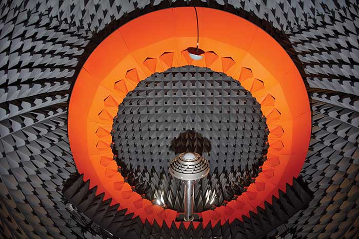
    Anechoic chamber testing. (Photo: NovAtel)
    Anechoic chamber testing. (Photo: NovAtel)

    Advances in RTK and PPP
    Advances in corrections expose measurements from low-quality antennas. You need an antenna with sub-millimeter phase-center variation (PCV) accuracy and stability on par with the algorithms delivering centimeter-level solutions. When the processing chain eliminates errors down to the centimeter level (or less), you must avoid adding errors from unstable phase centers, for example.

    Technical challenges and industry trends
    A difficult challenge facing the antenna industry is the commercial demand to reduce the size and weight of antennas while maintaining functionality and performance. The industry will need to continue balancing between size and performance while producing innovative GNSS antenna solutions integrated with other technologies, for example with anti-jam capabilities.


    Headshot: Leo Wang

    Harxon

    With Leo Wang, Product Technical Director

    Specific challenges
    The design of Harxon’s GNSS antennas aims to achieve a perfect balance between easy integration with RTK solutions and the ultimate product performance by meticulously dealing with wideband, positioning accuracy, form factor, and interference management.

    Key innovations
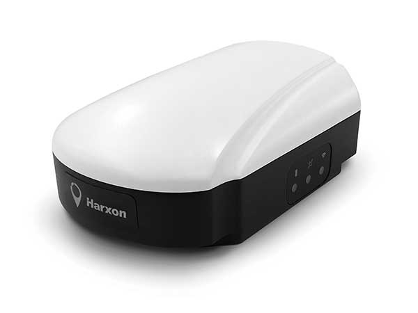
    Over the past three years, our signature antenna innovation is our 4-in-1 X-Survey HX-CSX100A multifunctional GNSS antenna, which integrates a GNSS antenna, 4G, Bluetooth and Wi-Fi in one compact enclosure. This multifunctional antenna simplifies receiver integration into an RTK solution and facilitates industry development. In the next three years, Harxon looks forward to more breakthroughs in positioning technology and delivering pragmatic innovations.

    Photo: Harxon
    Photo: Harxon

    Advances in RTK and PPP
    The development and maturity of these technologies require a higher standard for more delicate GNSS antenna structure design that takes product form factor into consideration while upgrading performance via wideband, high gain and positioning accuracy.

    Technical challenges and industry trends
    The 5G era has arrived, and the application of 5G technology for the internet of things (IoT) is extensive. China has also proposed the integration of 5G technology and BeiDou. We believe that, in the next few decades, GNSS positioning and 5G technology will be widely applied in the IoT industry and create huge benefits.


    Headshot: Gyles Panther

    Tallysman Wireless

    With Gyles Panther, President and CTO

    Specific challenges
    The challenge faced by Tallysman was manufacturing a full-band GNSS and L-band correction antenna, with high efficiency, tight PCV, low-gain roll-off and low axial ratio down to the horizon, and minimized multipath. Plus, a narrowly filtered low noise amplifier (LNA) to mitigate interference, all in the smallest possible package.

    Key innovations
    Over the past three years, Tallysman has released the VeraChoke, helical and VeroStar lines. The VeraChoke serves the geodetic and survey reference station markets with PCV and full-band GNSS coverage.

    Our helical GNSS and Iridium antennas are lightweight, compact and robust. They provide a precise phase center and radically reduced dependence on a ground plane because of their differential mode of operation. Their exceptional low weight makes them an excellent choice for copter-style UAVs.

    Photo: Tallysman
    Photo: Tallysman

    The patented VeroStar element combines full coverage of the upper and lower GNSS bands, plus L-band corrections service, with reception of L-band downlink Mobile Satellite Service (MSS) signals and exceptional low elevation angle reception. It is rugged, compact and lightweight — ideal for land and marine rover applications. It also provides minimal and symmetric PCV with outstanding all-around performance.

    Advances in RTK and PPP
    Both correction systems require rover receivers to phase-lock on low-amplitude GNSS satellite signal carriers, and both are hugely dependent upon the GNSS antenna. The corrections are critical for precision agriculture and land survey applications. Our precision antennas are specifically designed to minimize phase-lock loop (PLL) cycle slips.

    Technical challenges and industry trends
    Interference, accidental or intentional, is a major challenge and threat to GNSS, particularly from encroaching L-band 5G cellular systems. Tallysman offers tightly filtered LNAs and single-band omnidirectional anti-jam antennas with a deep null at low elevations. We plan to introduce a new multiband omnidirectional antijam antenna in the second quarter of 2021.


    Headshot: Dave Ghilarducci

    Taoglas

    With Dave Ghilarducci, VP of Worldwide Engineering

    Specific challenges
    Our antennas are designed for key internet of things (IoT) verticals. Our high-precision, multi-band GNSS antennas offer centimeter-level positioning and timing accuracy for applications where small size and high performance are required. We address the industry’s most compact form factors with out-of-band rejection for operation near transmitters.

    Key innovations
    Over the past three years, we have focused development on a portfolio of GNSS antennas with centimeter-level positioning accuracy in different form factors:

    • Photo: Taoglas
      EDGE Locate GNSS with RTK. (Photo: Taoglas)

      lighter, more robust antennas through our patent-pending Terrablast-based products (the GGBTP.35); which are impact resistant and 35% lighter than traditional ceramic patches

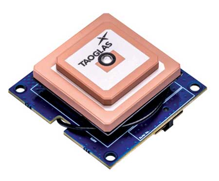
    • developing low-cost, compact, high-performance, multi-band antennas for OEM integrations (XAHP.50, AA.200, GPDF5012).
    • high-rejection internal patch modules for rejection for OEM integrations (AGGBP.SL and AGGBP.SLS series)
    • surface-mount active patch antennas with embedded active circuitry for easier integration (ASGGB Simplicity series)
    • off-the-shelf module with an integrated multi-band RTK antenna, electronics and receiver technology for ease of integration.

    Over the next three years, we expect to expand our portfolio and support additional bands like E6, L6 and the L-band correction band. Plus, we are working with the European Space Agency to design IoT devices with integrated high-precision RTK and GNSS technologies.

    Advances in RTK and PPP
    Expansion of RTK, PPP and similar technologies into new domains has demanded better performance from mainline and OEM antennas. These correction technologies stress antenna gain and polarization purity to maximize signal strength. We address these issues in our integrated designs to mitigate multipath errors and maximize ease of integration.

    Technical challenges and industry trends
    The release of lower-cost multi-band receivers and modules could be the most significant shift the GNSS industry has seen in the last decade. This innovation is already expanding applications and challenging suppliers to provide better performance for size, weight and cost.


    Headshot: Alok Srivastava

    Topcon

    With Alok Srivastava, Senior Director, Product Management, Topcon Positioning Group

    Specific challenges
    Topcon is a proven provider of GNSS antennas for innovative products. Our GNSS product portfolio offers antennas with excellent multipath mitigation, near-band interference rejection, and quality signal tracking from zenith to the horizon. We strive to provide affordable solutions for our geodetic, machine control and agricultural customers.

    Key innovations
    Topcon antenna technology is applied within standalone antennas along with integrated GNSS receivers. Antennas inside our integrated receivers, such as the HiPer HR, are distinctive in supporting Bluetooth and Wi-Fi in a common antenna stack without sacrificing GNSS tracking and positioning performance. These offerings also support compact designs of integrated receivers.

    As the number of GNSS constellations expands and new communication methods become available, potential inference from neighboring signals grows with congestion of the RF spectrum. Our standalone antennas, PN-A5 and CR-G5 with cavity filter option, uniquely address these challenges.

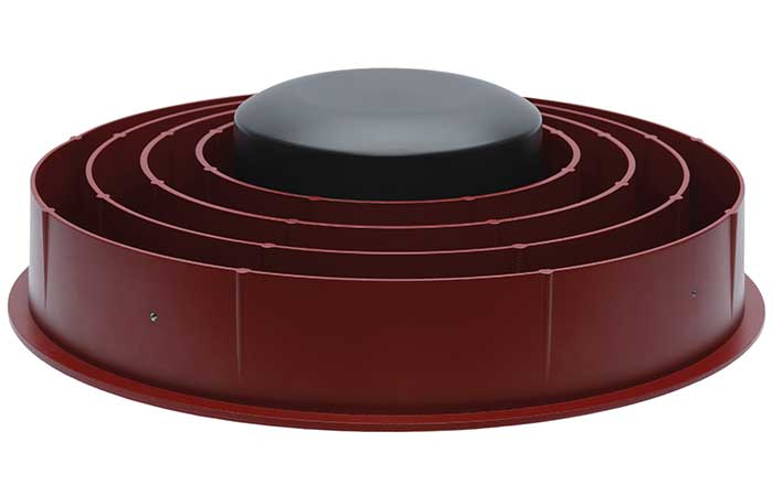
    Topcon’s PN-A5 semi-hemispherical ground plane GNSS antenna. (Photo: Topcon)
    Topcon’s PN-A5 semi-hemispherical ground plane GNSS antenna. (Photo: Topcon)

    In the coming years, antenna technology will need to stay strongly focused on interference rejection and mitigation, lower cost and smaller size. These demands challenge antenna providers to make technical advancements while investing in cost-sensitive manufacturing along with higher testing standards. In this regard, our new antenna test facility in Concordia sulla Secchia, Italy, will soon be offering robotic calibration services.

    Advances in RTK and PPP
    With increased demand and services available for PPP, Topcon antennas support both GNSS and L-band frequencies, such as in the HiPer VR/HR receivers, and standalone antennas (PG-F1, G5-A1, PN-A5 and CR-G5). As data communications continue to expand beyond L-band and RTK/network RTK, Topcon systems will support them without compromising positioning performance.

    Technical challenges and industry trends
    As GNSS antennas are one of the integral items within the GNSS system, the significance of delivering a cost-effective and miniaturized solution that provides robust positioning is critical to meeting needs in ever-growing precise positioning markets and applications. Topcon will continue to emphasize innovative antenna products through our research.


    Headshot: Stuart Riley

    Trimble

    With Stuart Riley, Vice President of GNSS Technology

    Specific challenges

    Each application has different requirements. For applications that require the highest position accuracy, the stability of the phase center, multipath mitigation, and the unit-to-unit production consistency are critical.

    Some markets require high performance, and often in challenging environments such as high vibration experienced on construction equipment. Other customers require smaller, lower cost antennas and can tolerate a slight accuracy reduction.

    The antenna is typically a combination of a passive antenna element with an active low-noise amplifier (LNA). The LNA needs to be carefully designed to remain linear in the presence of in-band jamming while rejecting out-of-band signals.

    Key Innovations
    For high-precision applications, Trimble first released the Zephyr series of antennas in the late 1990s. This antenna provides excellent phase center stability and unit-to-unit production repeatability; the antenna has exceptional multipath mitigation performance, which is enhanced in the geodetic version.

    Since the Zephyr was first introduced, we have added support for additional GNSS systems and RF bands (L1/E1, L2, L5/E5 and L6/E6), transitioned to a RoHS-compliant manufacturing process, improved the LNA performance, developed rugged versions for construction vehicle mounting, and produced a smaller version used in the Trimble R10, R12 and SPS986 GNSS receivers.

    More recently, we developed a lower cost high-performance antenna for the Trimble Catalyst software-defined GNSS receiver for Android phones and tablets. We also introduced an antenna in the Nav-900 guidance controller for agriculture that implements a meta-material design.

    Looking forward, we will continue to innovate by providing antennas optimized to meet the needs of the markets, including cost, performance and morphology. Enhancements will include novel antenna architectures, production technique improvements, and careful material selection.

    Advances in RTK and PPP
    Applications for GNSS are expanding to include more non-technical users, and the markets are calling for small, light and low-cost antennas — especially for technologies like PPP and positioning products such as Catalyst. These requirements extend across all arenas, especially in applications served by RTX. The needs must be balanced against increased technical demands stemming from the expansion in GNSS bands supporting new frequencies and signals, including PPP correction data.

    Technical challenges and industry trends
    The challenges come in balancing seemingly conflicting needs for performance, size, weight and cost for the various applications.

    Because Trimble focuses on specific user segments, we can provide antenna solutions that are the best fit for the various applications. For example, an antenna in a handheld device must be small and lightweight; however, on a construction machine, durability takes precedence over size and weight.

  • TCarta unveils Global Satellite Derived Bathymetry product line

    Image: TCarta
    Image: TCarta

    TCarta Marine has introduced a Global Satellite Derived Bathymetry (G-SDB) product line developed with a new seafloor depth measurement technique that leverages Machine Learning and NASA ICESat-2 laser data. According to the company, this G-SDB offering covers the entire Red Sea, with additional sets rolled out through the end of this year.

    The commercial TCarta G-SDB data sets and the seafloor measurement workflow that produces them were made possible through a Small Business Innovation Research Grant from the National Science Foundation (NSF).

    According to TCarta, G-SDB data sets contain bathymetric measurements to depths of more than 30 meters, depending on water clarity, at 10-meter resolution. The depth values for every 10-meter pixel are the combined result of numerous measurements, resulting in accuracy within 10% of depth or less, and providing a seamless water bottom surface map. G-SDB will be available globally for all oceans and seas, as well as large freshwater lakes where water conditions permit.

    “The new satellite-derived bathymetry technology extracts seafloor measurements by integrating multiple SDB algorithms and sensor types at scale and over broad geographic areas with a degree of confidence in data accuracy not previously possible,” said TCarta president Kyle Goodrich.

    TCarta launched Project Trident with NSF funding in 2018 with the goal of refining traditional satellite-derived bathymetry technology to extend its application into areas where it had not typically been successful, usually due to the turbidity or clarity of the water column. TCarta developed the new method using machine learning to iteratively evaluate Sentinel 2A/B multispectral satellite images, and even individual pixels within images, to select the sharpest and clearest ones for application of SDB extraction.

    “Thanks to the power and speed of cloud computing, we run the extraction algorithm repeatedly and on multiple satellite images acquired over the same geographic area on different dates. This dramatically increased the accuracy confidence in each depth measurement and minimizes data gaps,” Goodrich said.

    To further enhance the accuracy of the SDB measurements, TCarta developed an artificial intelligence-based technique for leveraging ICESat-2 data to train the SDB algorithm and validate results. Designed for polar ice elevation and tree canopy measurements, the ICESat-2 satellite carries a laser that captures remarkably accurate bathymetric data, the company said.

    TCarta Marine is a global provider of hydrospatial solutions. The TCarta product lines include high-resolution satellite-derived water depth and seafloor map products as well as 90- and 30-meter GIS-ready bathymetric data aggregated from numerous information sources.

  • Why geospatial data needs artificial intelligence

    Why geospatial data needs artificial intelligence

    By San Gunawardana, Guest Author

    Advances in geospatial technology have opened up many new possibilities in areas such as national security, urban planning and emergency preparedness. When I was embedded with the U.S. Army as a scientist in Afghanistan, I got to experience firsthand the exceptional value of 3D data. The military used nation-scale imagery and lidar to generate 3D maps that then informed their safety-critical operations. However, since lidar—like most three-dimensional unstructured data—contains incredible complexity and detail, it was painfully slow to analyze manually.

    As a result, the impact of this technology was severely restricted by speed and cost due to the significant manual effort required to extract actionable insights. As we looked to the future, where lidar would become commonplace in consumer electronics and automobiles, it became clear that there was an opportunity to combine computer vision/AI with large-scale cloud computing to rapidly and automatically generate actionable insights from 3D data.

    Screenshot: Enview
    Screenshot: Enview

    After returning from Afghanistan, I reconnected with Krassimir Piperkov, a former colleague from ICON Aircraft, and fellow Stanford alum, to launch Enview. Our objective was to automate 3D geospatial analytics and create a living 3D model of the world to help organizations to protect their critical infrastructure and communities.

    Powering geospatial data with AI can take the limits off 3D data analytics, prevent threats from becoming incidents, and protect critical infrastructure. What used to take days or months to process can now be done in minutes, enabling analysts, operators, and decision-makers across the public sector to make timely and accurate decisions. By enhancing our understanding of the physical world, this technology empowers us to tackle pressing challenges like wildfire prevention, humanitarian assistance, disaster response, and more.

    Let’s take a look at how AI-powered 3D modeling is being put to use.

    Digital twins

    A living 3D model of the world, or a digital twin, can be used for many purposes. Enview’s software fuses many different data sets together to create digital twins that are global in scale but have high-resolution to enable local decision-making. These digital twins include 3D terrain, vegetation, buildings, and infrastructure such as power lines, roads, and water works. Enview also fuses real-time and forecasted conditions, such as wind, temperature, humidity, traffic, and IoT (internet of things).

    This sort of rich representation of the physical world is an incredibly complex big data challenge. Data comes from radically different sensor modalities, with different resolutions, formats, time-domains, and accuracy. AI plays a critical role in automating the fusion of these datasets, by helping to intelligently align and then fuse them into a cohesive entity. 3D geospatial data is particularly challenging, as it is unstructured data, which requires a new generation of deep learning frameworks whose convolutional kernels are specifically developed from the ground up to work on unstructured data. Further, the datasets are massive in scale. A square-mile of 3D lidar data can have hundreds of millions of points; the magnitude of the data easily passes the petabyte scale when one considers applications that span nation-scale areas. In order to process this volume of data, modern geospatial AI architectures must be containerized and dynamically deployable across cloud compute resources to generate timely insights.

    AI is essential to help human experts to extract meaningful insight from this overabundance of data. The application of automated workflows allows experts to look at larger areas, with more speed and higher frequencies. This machine-assisted cognition draws upon the respective strengths of people and computers to do what neither could do on their own.

    Humanitarian aid and disaster relief

    3D models can be built to monitor hurricane hotspots, such as the Gulf Coast, before major storms strike. By layering in real-time weather information such as rainfall, winds, and flooding, these models can help with planning, emergency response, and relief efforts.

    This data also provides life-saving insight that can assess damage to buildings, transportation, and downed power lines, in addition to determining where to send medical and relief supplies, and how to best get them there. 3D data can help to lessen the impact of future weather events by updating the baseline understanding of how storms impact coastal communities so they can plan for the future.

    Screenshot: Enview
    Screenshot: Enview

    Infrastructure protection

    Inadequate clearances between vegetation and power lines can result in wildfires and unplanned power outages. Many federal, state, and local regulations are in place to mandate clearances, and power line operators monitor their networks continuously to ensure that they abide by these regulations and prevent incidents and outages. However, doing so by walking or flying the lines and judging distances with the human eye is challenging and inaccurate.

    The ability to identify the exact location and clearances of high-risk vegetation early, and at scale, lets operators identify, prioritize, and address problem areas proactively. Lidar-driven programs have helped with risk-reduction, but are constrained by the massive levels of manual data manipulation required to derive insights from this 3D data. The automation of 3D geospatial analytics through AI, machine vision, and parallel computing enables the accurate and rapid identification of at-risk areas, protecting critical infrastructure and communities.

    Screenshot: Enview
    Screenshot: Enview

    Fighting wildfires

    Devastating wildfires resulting in the loss of life and property have become commonplace in the western U.S. and other parts of the world. The tools and methods previously relied on to keep communities and infrastructure safe are now struggling to keep up with this increased threat.

    Geospatial information, including 3D data, provides a digital view of the physical world and, when paired with AI, gives stakeholders the informational edge they need to minimize wildfire damage, injuries, and deaths. This technology can be used to automatically build and update real-time, high-resolution wildfire risk maps that give firefighters and communities more notice when threats are imminent, and provide firefighters with real-time situational awareness when they’re fighting the blazes.

    Change detection

    According to the Pipeline and Hazardous Materials Safety Administration (PHSMA), third-party excavations are one of the leading causes of pipeline incidents in the U.S. These incidents can lead to service disruptions, expensive repairs, and sometimes serious injuries or deaths.

    Detecting signs of excavation or earth movement via aerial patrolling is challenging and costly, while resource limitations make it difficult for pipeline operators to continuously monitor remote areas such as farms. AI-powered 3D maps can be used to monitor topography and accurately detect changes that threaten pipelines in real time.

    3D data provides remarkable value when it comes to decision-making as it relates to many different applications—from military defense to protecting neighborhoods from wildfires. However, its success hinges on one thing: speed. The ability to process 3D geospatial data rapidly, and at scale, is made possible through advances in AI and cloud computing. In the future, we can expect to see more exciting and innovative use cases for AI-powered geospatial technology.


    Headshot: San Gunawardana

    San Gunawardana is co-founder and CEO of Enview, a geospatial analytics company. After finishing a Ph.D. in aerospace engineering at Stanford, Gunawardana went to Afghanistan, where he combined data analytics and remote sensing to detect threats and prevent incidents. He is excited to apply those insights to help the energy sector solve problems. He has done computer vision at NASA, built imaging satellites with the Air Force, and was an early employee at ICON Aircraft.

  • GNSS Winter School set to take place in Islamabad

    GNSS Winter School 2021 is planned for Feb. 22-26 in Islamabad, Pakistan. The Institute of Space Technology is hosting the event, in collaboration with the Space Education Research Lab of the National Center of GIS and Space Applications.

    GNSS Winter School will be held on the institute’s campus; however, in case of severe circumstances (such as COVID-19), it will take place virtually online either partially or entirely.

    GNSS Winter School will focus on GNSS positioning, coordinate and time reference systems, satellite orbit and position determination, signals, receivers, and specialized areas of inertial and integrated navigation systems.

    A special session is planned on GNSS applications and opportunities in the current GNSS market.

    The school is intended for engineers, researchers and students working in aeronautics and astronautics; guidance, navigation and controls; satellite or radio navigation; inertial and integrated navigation systems; space systems; constellation designs; interplanetary navigation; remote sensing; geoinformation science; and similar allied areas.

    Registration is open through Feb. 15.

  • New GNSS receiver front-end integrates, simplifies

    New GNSS receiver front-end integrates, simplifies

    Photo: STMicroelectronics
    Photo: STMicroelectronics

    STMicroelectronics’ latest RF front-end for GNSS receivers offers a simplified design and smaller footprint. The BPF8089-01SC6 integrates the impedance-matching and electrostatic discharge (ESD) protection circuitry typically implemented using discrete components.

    The BPF8089-01SC6 provides a 50-ohm matched interface between the receiver’s antenna and low-noise amplifier (LNA), and is ready for plug-and-play with the company’s STA8089 and STA8090 LNAs.

    The BPF8089-01SC6 is suitable for use in portable receivers for the GPS, Galileo, GLONASS, BeiDou and QZSS constellations, which can be used in applications such as consumer satellite navigation, radio base stations, drones and tracking of assets or livestock.

    The BPF8089-01SC6’s compact, integrated front-end can replace a matching network containing up to five capacitors, resistors and inductors, as well as two discrete protection devices, resulting in a much smaller footprint. Designers can also leverage PCB-track specifications provided in the device datasheet to ease design challenges and ensure optimal performance.

    The ESD protection provided complies with IEC 61000-4-2 (C = 150 pF, R = 330 ohm) and exceeds level 4: 8 kV for contact discharge and 15 kV for air discharge. The device also withstands 2 kV pulse voltage in accordance with MIL-STD 883 C (C = 100 pF, R = 1.5k ohm).

    Part of ST’s Application Specific Integrated Passives (ASIP) product range, the BPF8089-01SC6 is housed in a SOT23-6L package compatible with automatic optical inspection.

  • James Litton, GPS and precision ag pioneer, dies

    James Litton, GPS and precision ag pioneer, dies

    James Litton
    James Litton

    James D. Litton, GPS pioneer and founder of NavCom Technology Inc., died over the weekend at his home in California with his family at his side. He was 89 years old.

    Litton was an early contributor to the development of GPS user equipment. He also played a pivotal role in the GPS-driven transformation of global agriculture that has greatly benefited humanity.

    Litton was the director of engineering at Magnavox Research Labs when researchers were working on using CDMA for range measurements, a precursor to the GPS system. He also worked on the original proposal for GPS Phase I.

    Later, as general manager of Magnavox’s Marine and Survey Systems Division, he helped develop new and advanced commercial navigation and survey receivers for both the Navy’s TRANSIT system and the Air Force’s GPS.

    His team developed the first microprocessor-based commercial satellite navigation receivers and the first commercial GPS survey software. This led to Magnavox eventually having more than a 90 percent share of the survey receiver market.
    The firm eventually held more than two dozen patents for improvements in GPS technology.

    In 1992, Litton left Magnavox to start a consulting business. Two years later, with Ron Hatch, K.T. Woo and Jalal Alisobhani, he founded NavCom Technology Inc. With Litton as CEO, NavCom became a significant player in the GPS marketplace. Among its achievements was development — under contract — of a single-frequency WAAS-capable GPS aircraft navigation receiver.

    NavCom also began a relationship with Deere & Company, supporting more efficient and productive agriculture. This relationship was so successful that Deere purchased NavCom in 1999. Litton continued to lead the company and serve as part of Deere’s senior management team for eight more years.

    In recognition of his many achievements to the field, Jim Litton was presented the Institute of Navigation’s Hays Award in 2006.

    Among his many contributions, his impact on global agriculture might well have been his greatest, according to Brad Parkinson, the original chief architect for GPS.

    “His work transformed agriculture into a data-driven, technological industry that was incredibly more efficient,” Parkinson said. “The cost savings and increases in productivity have impacted billions around the world.”

    Jim’s family has created a memorial fund at Doctors Without Borders for those wishing to make a donation in honor of his life and many good works. Click here.

  • Contracts awarded for next-generation Galileo satellites

    Contracts awarded for next-generation Galileo satellites

    Image: ESA
    Image: ESA

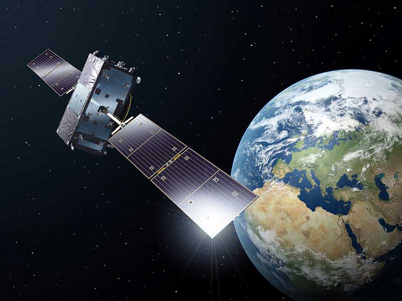
    The European Commission has issued industrial contracts worth €1.47 billion ($1.97 billion) to build next-generation Galileo satellites to Airbus and Thales Alenia Space, reports BBC News.

    Both companies told BBC News that they will not speak publicly about their contracts wins until documents are signed, which could take several weeks.


    Read more about Galileo and its plans in Directions 2021: Galileo expands and modernizes global PNT by Javier Benedicto and Rodrigo da Costa.


    Each contract is for manufacture of six satellites, to orbit no earlier than 2024. They will feature digitally configurable antennas, inter-satellite links, new atomic clocks and propulsion systems that use electric engines.

    Airbus and TAS built the four Pathfinder in-orbit validation satellites that first demonstrated Galileo. A consortium of OHB-System and Surrey Satellite Technology Ltd. built the first operational Galileo satellites, but the consortium ended following Brexit.

  • University revises PNT backgrounder In response to concerns

    University revises PNT backgrounder In response to concerns

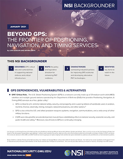
    Beyond GPS report. (cover: NSI)
    Beyond GPS report. Check out the report here. (Cover: NSI)

    George Mason University has revised a briefing paper on positioning, navigation and timing (PNT) in response to concerns about its accuracy.

    The university’s National Security Institute “NSI Backgrounder — Beyond GPS: The Frontier of Positioning, Navigation, and Timing Services” was first issued on Dec. 2. Some staff on Capitol Hill and members of industry soon had concerns about several of its assertions.

    Responding to letters from industry, National Security Institute (NSI) Executive Director and Professor Jamil Jaffer said he determined that three of the issues raised, while not fatal to the document, warranted clarification.

    ELoran callout. The first was a statement in the backgrounder that the National Timing Resilience and Security Act (NTRSA) “specifies 13 technical requirements for a GPS backup, which essentially define the eLoran system.”

    This was a concern to some on the hill as Congress is generally reluctant to specify solutions. Legislators prefer to specify outcomes and then defer to the executive branch on how to make them happen.

    Members of industry pointed out that government systems like WWVB and the low-frequency portion of DARPA’s STOIC program, as well as commercial systems like NextNav and Locata, could meet or be adapted to meet the NTRSA requirement.

    The revised backgrounder says the NTRSA “specifies 13 mainly technical requirements for a GPS back-up, which align closely with the capabilities of the eLoran system. Other systems may meet the Act’s requirements to varying degrees.”

    Multiple technologies. The revised backgrounder also corrects a statement that the NTRSA requires the Department of Transportation to establish an eLoran system. It now says “a system that complies with the Act, and DOT may pursue multiple technologies in implementing the Act.”

    Department officials had previously said they were taking a system-of-systems approach and expected to employ multiple technologies. Subsequently, a DOT report was released that documents the need for several diverse systems. It lists transmissions using low frequency (eLoran, STOIC), ultra high frequency (NextNav, Locata) and L-band from space (GPS, Satelles). It also says the terrestrial transmitters should be interconnected by fiber.

    Public-private partnership. A third correction was made in the document to reflect how the Congressional Budget Office regarded the possibility of using a public-private partnership in previously proposed legislation.

    Members of industry also expressed concern that one of the authors of the document serves on the advisory board for Satelles Inc. and that this was not disclosed in the paper. The backgrounder appeared on the Satelles website the same day it was published.

    The university concluded that such disclosure was not necessary as the paper said the author “provides advisory services to industry, including in the PNT area.” At the author’s request, though, his profile on NSI’s webpage will be updated to show his relationship with Satelles.

  • 2021 Defense Act signals turning point for Congress and PNT

    2021 Defense Act signals turning point for Congress and PNT

    Photo: Toshe_O/iStock / Getty Images Plus/Getty Images
    Photo: Toshe_O/iStock / Getty Images Plus/Getty Images

    Senate joined House to override Trump’s veto, making bill into law

    The U. S. Congress, especially the Armed Services Committees, have long been concerned about GPS and positioning, navigation and timing (PNT) issues. Over the past two decades, Congressional hearings, demands for reports and investigations have dealt with acquisition, contingency plans for when space is not available, deliberate interference, and a host of other issues.

    While these all evidenced Congress’ interest and concern, they were relatively passive measures.

    This began to change in 2018 with passage of the National Timing Resilience and Security Act. It requires the Department of Transportation to establish a terrestrial timing system to backup GPS signals.

    Then in 2019, Congress appropriated money for a GPS Backup Technology Demonstration. And the National Defense Authorization Act (NDAA) for 2020 required the Air Force to develop a prototype multi-GNSS receiver as part of its resiliency efforts.

    The NDAA for 2021 seems to finalize Congress’ transition from an interested observer, mostly on the sidelines, to an active player in national PNT issues and policy.

    GPS Under Threat

    Capitol Hill observers say this is the result of several factors that have come to a head over the last year. Taken together, they have convinced many legislators that GPS is under threat and PNT issues are not being taken seriously enough by the executive branch. These include increased jamming and spoofing (especially by China and Russia), full implementation of China’s BeiDou system and its marketing to other nations as a superior alternative to GPS, the Federal Communications Commission’s (FCC) decision on Ligado Networks, and the Pentagon’s failure to respond to combatant commanders’ Joint Urgent Operational Needs Statements for non-GPS PNT.

    Here are some of the provisions of the 2021 NDAA of interest to the PNT community.

    Military Multi-GNSS Prototype

    The 2018 NDAA required the Defense Department to incorporate Europe’s Galileo and Japan’s QZSS satellite navigation signals into military user equipment. The idea was to make it more resilient to disruption. Also required was an investigation into using non-allied signals.

    Apparently not satisfied with progress on this project, Congress mandated a project to develop a prototype multi-GNSS receiver as part of the 2020 NDAA.

    The 2021 NDAA seems to indicate Congress is still not happy. It withholds 20% of the funding for the Office of the Secretary of the Air Force until the department certifies the prototype project is underway and provides briefings to the Senate and House Armed Services Committees.

    Resilient, Survivable PNT

    Language in the 2021 NDAA also seems to show Congress is impatient with the Pentagon’s lack of responsiveness to combatant commanders’ requests for non-GPS PNT systems.

    Section 1611 of the act is entitled “Resilient and Survivable Positioning, Navigation, and Timing Capabilities.” It requires development, integration and deployment of these capabilities for combatant commanders within two years. This, it says, is “… consistent with the timescale applicable to joint urgent operational needs statements…”

    The act says the new PNT capabilities shall “generate resilient and survivable alternative positioning, navigation, and timing signals” and “process resilient survivable data provided by signals of opportunity and on-board sensor systems…”

    The act also addresses the Defense Department’s 2018 PNT Strategy’s plan for future systems to be classified and for military use only. It directs the department to work with the National Security Council, Departments of Transportation, Homeland Security and others “…to enable civilian and commercial adoption of technologies and capabilities for resilient and survivable alternative positioning, navigation, and timing capabilities to complement the global positioning system.”

    To help ensure prompt action on this, the act requires a report to Congress within six months and authorizes the department to reprogram funds from other areas to finance the effort.

    Responding to Ligado Decision

    By far the most PNT-related text in the 2021 NDAA includes a host of measures responding to FCC Order 20-48 approving an application by Ligado Networks. An order that the executive branch is on record as strongly opposing, saying it will degrade GPS service for many.

    Senator Jim Inhofe, chair of the Senate Armed Services Committee, has regularly expressed outrage at the FCC’s decision and has called for its reversal.

    Among its provisions, the act:

    • requires the Department of Defense to estimate and report to Congress the cost of damage to department systems as a result of the FCC order.
    • prohibits using department funds to upgrade or modify military equipment to make it resilient to interference caused by broadcasts in the spectrum allocated (the FCC order requires this to be funded by Ligado).
    • prohibits contracting with any entity using the frequency bands allocated to Ligado unless the Secretary of Defense certifies the use will not interfere with GPS services.
    • requires the Secretary of Defense to contract with the National Academies of Sciences, Engineering, and Medicine for an independent technical review of the FCC order.

    Dana Goward is president of the Resilient Navigation and Timing Foundation (rntfnd.org).