Blog

  • Part 1: Receiver innovator Q&As capture technology trends

    Part 1: Receiver innovator Q&As capture technology trends

    This is part one of a two-part series.

    As in January 2020, we are starting the year by providing insights from manufacturers of GNSS receivers. We asked these industry leaders to look back at the past two years and forward at the next two, and discuss key innovations in the following areas:

    • utilizing Galileo and BeiDou
    • dealing with jamming and spoofing
    • integration with inertial measurement units (IMUs) and other sensors
    • positioning using cell phones and other consumer devices
    • any other areas or challenges they find particularly significant
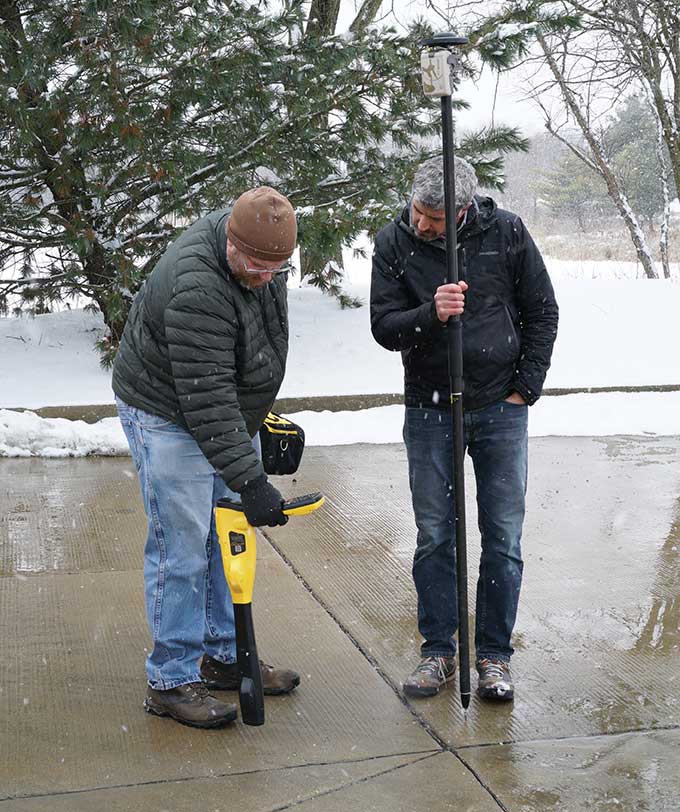
    Photo: Emma Hardy/Eos Positioning Systems
    Photo: Emma Hardy/Eos Positioning Systems

    The single most important trend that emerges from manufacturers’ responses is the improvement in receiver performance due to the increase in the number of satellites (now 150) and signals (now more than 100). With four usable constellations, GNSS is now a reality. Multi-constellation receivers are quickly becoming the norm, even in consumer devices, and new user segments are benefiting from satellite-based PNT. Already, some smartphones and tablets are achieving decimeter-level or even centimeter-level accuracy. Over the next two years, new GNSS services will become available and, as the GNSS constellations continue to develop, the availability, reliability and repeatability of their signals will improve further.

    A second important trend is the growth in satellite-delivered correction data, which substantially lowers the entry barrier for high accuracy applications by obviating the need for costly local infrastructure. This is starting to change the traditional cost-benefit calculation regarding real-time kinematic (RTK) vs. precise point positioning (PPP) corrections (see also our Editorial Advisory Board PNT Q&A).

    A third and continuing trend is the increasing threat from intentional and unintentional jamming and interference across the globe, paralleling the increasing ubiquity of GNSS and potentially impacting most users. Therefore, receiver manufacturers continue to improve hardware and software techniques to defeat, or at least mitigate, this threat, greatly assisted by the increase in the number of available signals.

    Finally, as automakers and high technology companies continue their efforts to develop autonomous vehicles (aka “self-driving cars”), the concept of GNSS integrity is getting renewed attention. Here, too, the increase in the number of available signals is extremely helpful.


    CHC NAVIGATION EOS POSITIONING SYSTEMS
    HEMISPHERE GNSS HEXAGON | NOVATEL
    JAVAD GNSS SEPTENTRIO TRIMBLE

    Headshot: François Martin

    CHC Navigation

    With François Martin, Vice General Manager, International Division

    Utilizing Galileo and BeiDou
    The addition of Galileo and BeiDou to GPS and GLONASS not only extends GNSS positioning to more obstructed environments, but also allows the use of new survey methods, such as the hybrid IMU-GNSS pole-tilt compensated surveying and stakeout with survey-grade accuracy. Further expansion of GNSS navigation systems will result in even greater availability, reliability and repeatability.

    Dealing with jamming and spoofing
    As an integrator and developer of GNSS systems, we focus our design on strong electromagnetic shielding and sealed isolation chambers. From a technology standpoint, the combination of advanced GNSS signal processing, optimized antenna design, and advanced filtering ensures minimal interference.
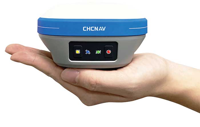
    Photo: CHC Navigation
    Photo: CHC Navigation

    Integration with IMUs and other sensors
    The integration of interference-free, high-dynamic IMU fused with GNSS technology brings an obvious benefit to surveying and autonomous navigation applications. The latest algorithm developments make it possible to get rid of tedious initialization processes, increase the productivity of typical survey tasks, bring extra safety to operators, and compensate for transient GNSS outages.

    Positioning with consumer devices
    Multi-constellation GNSS chips are accelerating the development of untapped user segments, but the repeatability of position accuracy remains an issue. The integration of high-performance GNSS chips and helical antennas as high-precision add-on modules on smartphones and tablets enables centimeter- or decimeter-level accuracy. This democratization of technology is increasing earlier adoption of GNSS technologies by a broader user base.


    Headshot: Jean-Yves Lauture

    Eos Positioning Systems

    With Jean-Yves Lauture, Chief Technology Officer

    Utilizing Galileo and BeiDou
    The past two years have seen considerable maturation of the Galileo and BeiDou constellations. Considering the now four usable GNSS constellations and the aggressive launches of Galileo and BeiDou, the number of available satellites and the list of frequencies they use have considerably increased. Accuracy itself is slightly improving with the availability of BeiDou phase 3 signals, whereas performance and productivity experience a significant boost under tougher conditions with more satellites and stronger signal availability. It is not uncommon for our customers to use 30 to 35 satellites out of 40+ in view using an Arrow Series GNSS receiver. We are waiting for the availability of the High Accuracy Service (HAS) (PPP) on the Galileo E6 frequency, hopefully in a couple of years.
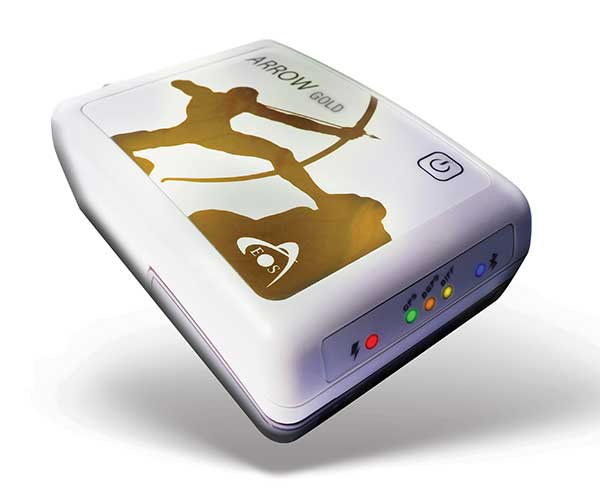
    Photo: Eos Positioning Systems
    Photo: Eos Positioning Systems

    Integration with IMUs and other sensors
    Eos has put a lot of effort recently in supporting external sensors and accessories to facilitate mapping of certain types of assets or mapping in certain types of conditions. For instance, this past year Eos released our underground mapping solution called Eos Locate for ArcGIS (see cover photo), which integrates with external utility locate devices to allow a user to precisely map buried assets. Eos Laser for ArcGIS interfaces with laser rangefinders to map assets in GNSS-impaired environments.

    Positioning using consumer devices
    With our bring-your-own-device (BYOD) approach on the market to support high-accuracy data collection for GIS, we have made it possible to override the consumer devices’ locations with accuracies down to the centimeter from our Arrow receivers. Customers can use any of their cell phones or tablets and immediately start mapping with submeter or centimeter accuracy.


    Headshot: Kirk Burnell

    Hemisphere GNSS

    With Kirk Burnell, Senior Product Manager

    Utilizing Galileo and BeiDou
    The Galileo and BeiDou phase 3 systems introduce modern signal structures that allow more accurate measurements to be made than GPS first introduced. The new signals and increased satellite count are significantly improving receiver performance. Our Phantom and Vega product lines harness these new signals.

    Dealing with jamming and spoofing
    The increasing number of incidents of intentional and unintentional jamming and interference across the globe has impacted nearly every type of GNSS user. Our Cygnus interference mitigation technology automatically detects and mitigates the interference in real time, as well as providing spectrum analysis of the GNSS signal bands.
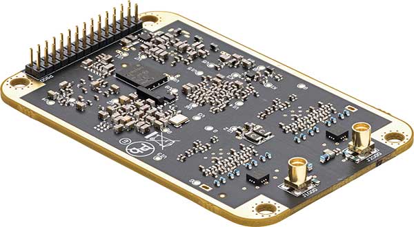
    Photo: Hemisphere GNSS
    Photo: Hemisphere GNSS

    Integration with IMUs and other sensors
    Today’s autonomous-focused environment increases the need to share data across platforms. Both Vector and Vega provide robust GNSS heading, position and velocity to marine, machine control, UAV and internet of things (IoT) integrators, helping augment their sensor data.

    Positioning with consumer devices
    Positioning in consumer products will continue to drive innovation, while chasing accuracy and precision requires a strong understanding of geodesy fundamentals. As design requirements push well beyond the limits of what consumer GNSS delivers, and with the help of our knowledgeable staff, our precision receivers are delivering reliable performance in some very impressive applications.

    Other significant challenges and opportunities
    New GNSS signals and new surrounding technologies continue to come online, and the RF environment continues to see increased activities. Our underlying Lyra II ASIC technology and Cygnus enable our Phantom and Vega integrators and users to reliably coexist with these changes.


    Headshot: Sandy Kennedy

    Hexagon | Novatel

    With Sandy Kennedy, Vice President Innovation, Hexagon’s Autonomy & Positioning division

    Utilizing Galileo and BeiDou
    GNSS is now reality, not just inclusive phrasing to replace GPS. We are well into the era of multi-constellation receivers, and users will notice distinct improvements in solution availability with the addition of Galileo and BeiDou measurements. Over the next two years, we expect users in a variety of applications to start exploiting our globally available, fast-converging RTK From the Sky technology, which is enabled by the addition of quad-frequency signals supplied by Galileo and BeiDou (see page 29).

    Dealing with jamming and spoofing
    The RF spectrum is crowded and will only become more crowded over time. In 2020, we introduced our GNSS Resilience and Integrity Technology (GRIT), a suite of firmware options for the OEM7 receiver family. In addition to interference detection and mitigation, GRIT adds spoofing detection and time-tagged digitized samples for advanced situational awareness of the RF spectrum. With GRIT’s spoofing detection, opponents can try to spoof us. But fool us? Not a chance.

    Photo: Hexagon | NovAtel
    Photo: Hexagon | NovAtel

    Integration with IMUs and other sensors
    IMUs have become more accessible to more applications due to size, weight, power and cost reductions. At the same time, our algorithmic capability has significantly advanced to use lower quality inertial measurements for greater benefit. Originally reserved for truth systems, high-end mapping, and aerospace and defense applications, GNSS+INS solutions are now available in products like our SMART7 line of smart antennas for precision agriculture applications. Closer integration of the inertial and GNSS processing will bring further benefits in hostile RF or just plain difficult positioning environments. There is no perfect single sensor, but you can get more accurate by combining a set of sensors that offset each other’s vulnerabilities and limitations.

    Positioning with consumer devices
    The general population is accustomed to looking at their smartphone to see not only their location, but also the size of the “blue dot” of positioning uncertainty that accompanies it. We have always said accuracy is addictive, and we will no doubt start to see consumer demands for smaller blue dots with increasingly accurate positions. Making the digital reality match our real world demands continuously available and reliable positioning. Being lost is a terrifying feeling, especially for those who have been staring at their phone for the past 30 minutes and have no recollection of the physical world through which they have passed.

    Other challenges and opportunities
    The transition to autonomous vehicles, for both on-road consumer and off-road industrial applications, is inevitable. It is becoming increasingly necessary to prioritize the development of functional safety and integrity requirements to achieve the safe operations of autonomous systems. These requirements are necessary and entirely non-trivial to develop.


    Photo: Stephen Drake
    Photo: Stephen Drake

    Javad GNSS

    With the Javad GNSS Team

    Utilizing Galileo and BeiDou
    Simultaneous RTK and PPK processing of all available GPS, GLONASS, Galileo and BeiDou signals in receivers powered by our 874-channel TRIUMPH chip has resulted in significant productivity gains. User Darren Clemons told us “These Plus units are at least 40%–50% faster… The combination of the four super engines and the RTPK is unbeatable. You can get an accurate shot just about anywhere.”

    Dealing with jamming and spoofing
    Usually, more than 100 signals are available at any given time, and we need only a small number to compute a position. By tracking and verifying all these constellations and their signals, it is extremely unlikely that we can be spoofed without our knowledge. Javad GNSS receivers will immediately recognize spoofing and take corrective actions. Spoofing protection is available on all Javad GNSS receivers and OEM boards.

    Integration with IMUs and other sensors
    The Javad GNSS engineering team relentlessly works to identify and integrate the latest sensor technologies that can boost productivity. Our TRIUMPH-LS’s integrated camera sensor has for years supported onboard photogrammetry, and now our TRIUMPH-3 receiver’s integrated IMU provides high-precision tilt compensation.

    Other challenges and opportunities
    Our innovative RTPK feature is improving GNSS surveying and monitoring. Our Triumph-LS and Triumph-3 RTK rover systems combine the strengths of RTK and PPK into a system that can post-process RTK data and verify its results in parallel and real time. Users get the best of both worlds. If RTK fails, RTPK comes to the rescue in a fraction of a second.


    Photo: Gustavo Lopez

    Septentrio

    With Gustavo Lopez (pictured) and Stef van der Loo, Market Access Managers

    Utilizing Galileo and BeiDou [GL]
    With 150 GNSS satellites in space, multi-constellation has been a natural transition for improved GNSS availability. We see this in rover applications and in upgraded reference networks modernizing correction services. The next two years will be transcendent as constellations finally start delivering new services. We see our products soon integrating
    GAL-OSNMA for anti-spoofing and then moving to new high-accuracy services.

    Dealing with jamming and spoofing [GL]
    We have witnessed a large increase in jamming and spoofing events as GNSS ubiquity increases. Users are becoming conscious of this, yet many integrations are still using vulnerable receivers, and we see manufacturers falsely claiming to have proper resilience. Septentrio’s AIM+ technology uniquely mitigates all these risks, and users come to us for expert advice on this area. In the coming years, we expect further receiver innovations and developments in adjacent technologies.

    Aerial shot of Espoo, Finland, from a drone. (Photo: izhairguns/iStock/Getty Images Plus/Getty Images)
    In 2020, Septentrio opened an R&D center in Espoo, Finland. (Photo: izhairguns/iStock/Getty Images Plus/Getty Images)

    Integration with IMUs and other sensors [SVL]
    Integration of sensors and sensor fusion moved from the research stage to the major production and adoption phase as an element in autonomous systems. Using a GNSS/INS (see our AsteRx-i products) is crucial for various applications — for example, being able to work in difficult environments — and for vehicle orientation. The development of lower cost IMUs while keeping high performance will enable a shift in focus from hardware to software. This will result in multi-sensor technology that is better scalable, easier to use, and more stable to integrate in relation to a full system with various sensors.

    Positioning with consumer devices [GL]
    We see further integration of dual-frequency GNSS chipsets in mobile technology for increased accuracy, which is key for future consumer applications. Septentrio has also witnessed the important involvement of telecom operators in GNSS correction services. Septentrio products (such as the PolaRx5 or AsteRx-SB) are deployed on new generation networks as operators prepare for the new generation of positioning in cell technology.

    Other significant challenges and opportunities [GL]
    Two areas are emerging thanks to the autonomy era and due to further regulations in the market. The first is the concept of GNSS integrity, which has a strong link to the reliability of autonomous solutions. The second is security, which, beyond anti-spoofing, is linked to the cybersecurity of GNSS systems as the demand increases for the protection of electronics and software.


    Headshot: Stuart Riley

    Trimble

    With Stuart Riley, Vice President of GNSS Technology

    Utilizing Galileo and BeiDou
    Most Trimble precision receivers can utilize any combination of GNSS satellite constellations (GPS, GLONASS, Galileo, BeiDou and QZSS) to deliver centimeter accuracy and optimize performance, even in degraded conditions. Users can select the constellations they want the receiver to use.

    Dealing with jamming and spoofing
    Spoofing is rare and low risk in locations in which Trimble’s precision GNSS agriculture, construction and geospatial customers operate. However, to protect users, modern Trimble Maxwell-based GNSS receivers implement hardware- and software-based techniques to detect and mitigate spoofing. Jamming sometimes impacts customers, but is not their primary challenge. The same issues are still present today as they were in the early days of precision GNSS. The main productivity concerns remain related to multipath and problems around obstructions and trees. Trimble continues to improve our GNSS systems’ robustness with advances in processing algorithms and hardware enhancements such as integrating inertial technology.
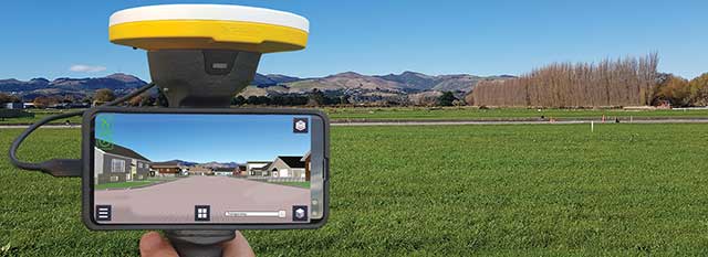
    Trimble SiteVision uses Catalyst and augmented reality to preview a new housing development in an open field. (Photo: Trimble)
    Trimble SiteVision uses Catalyst and augmented reality to preview a new housing development in an open field. (Photo: Trimble)

    Integration with IMUs and other sensors
    The Trimble R12i and SPS986 represent Trimble’s third-generation receivers (preceded by the R10 and the R12) capable of integrating inertial measurements into 3D GNSS positioning. In addition to speed and convenience for the user, integration with IMU provides immunity to magnetic interference and real-time integrity monitoring.

    With the introduction of the Trimble R12 with the ProPoint GNSS positioning engine, we significantly improved the performance in challenging environments. This was further enhanced with the addition of an IMU for tilt compensation in the R12i. The new solution provides a system that delivers more accurate results in more places and in less time.

    Positioning with consumer devices
    The Trimble SiteVision augmented reality solution and Trimble Catalyst GNSS receiver operate on Android devices. Trimble Catalyst technology provides a software-defined GNSS receiver capable of survey-grade accuracy. Catalyst is the ideal solution for third-party applications that benefit from precise real-time positioning. Trimble SiteVision combines Catalyst positioning with augmented reality to deliver real-time, on-site visualization of proposed structures and existing underground assets.

    Other significant challenges and opportunities
    An ongoing challenge in GNSS positioning is the ability to obtain positions with suitable accuracy when and where they are needed. Solutions such as RTK and VRS provide solid performance at local and regional levels. Today, these technologies are complemented by subscription-based Trimble RTX positioning services, a global approach that uses a network of GNSS tracking stations and satellite-delivered correction data to achieve required accuracies. In 2020, coverage for Trimble CenterPoint RTX Fast, which enables users to achieve two-centimeter or better accuracy with initialization time of less than one minute, was expanded to cover the continental United States as well as much of Canada and Western Europe. The CenterPoint RTX Fast network now covers more than 5 million square miles worldwide. Trimble RTX coverage enables global users such as farmers, land surveyors and GIS professionals using RTX-capable receivers, to untether from the cost and complexities of GNSS base stations. In addition, the service offers a single, continuous corrections network ideal for enabling a broad range of safety-critical autonomous applications in markets such as automotive, agriculture and construction.


    Feature photo: Emma Hardy/Eos Positioning Systems

  • Verizon’s Skyward and UPS announce connected drone delivery at CES 2021

    Verizon’s Skyward and UPS announce connected drone delivery at CES 2021

    Skyward, a Verizon company, and UPS Flight Forward will collaborate to deliver retail products with drones connected to Verizon 4G LTE, as well as testing and integrating 5G for delivery.

    The companies made the announcement during the 2021 Consumer Electronics Show, taking place virtually.

    The companies aim to deliver retail products via connected drones at The Villages in Florida.


    The Villages is also the site of a driverless shuttle service test.


    “We will need the ability to manage and support multiple drones, flying simultaneously, dispatched from a centralized location, operating in a secure and safe environment,” said Carol B. Tomé, CEO of UPS. “To do this at scale, alongside Verizon and Skyward, we’ll need the power of 5G.”

    “We’re just beginning to see how the power of 5G Ultra Wideband will transform the way businesses operate,” said Rima Qureshi, chief strategy officer at Verizon. “By partnering with UPS and other innovative companies, we can learn from each other’s expertise and collaborate to create solutions that help move the world forward.”

    Photo: Verizon
    Photo: Verizon

    In 2020, Verizon, UPS Flight Forward and Skyward started testing 4G LTE in delivery drones to demonstrate cellular reliability and performance at altitude.

    “The low latency of 5G and edge compute is ideal for monitoring air traffic in and out of a busy logistics hub, especially those using mixed fleets of autonomous vehicles like drones, trucks and planes,” said Mariah Scott, Skyward President. “This year, we’ll be taking the collaboration with UPS further by testing 5G Ultra Wideband integrations to connect the sky.”

    UPS has operated more than 3,800 successful drone delivery flights since the creation of UPS Flight Forward, its drone delivery company, certified by the Federal Aviation Administration in 2019. But in 2020, drone delivery emerged as much more than rapid delivery of essential healthcare items — during the global pandemic it provided high-risk seniors a rapid and contactless delivery option to remain healthy at home.

    “Using Verizon’s 5G and Skyward, we’ll be able to transform the delivery experience — more personal, more on-demand and with the same safety, efficiency and reliability our customers trust today,” said Bala Ganesh, vice president, Advanced Technology Group at UPS.

  • Wetlands software integrated with Esri ArcGIS

    Wetlands software integrated with Esri ArcGIS

    Photo: Ecobot
    Photo: Ecobot

    Ecobot, developer of environmental data reporting software, is now integrating enhanced Esri ArcGIS mapping and data capabilities via a partnership begun in 2019 through Esri’s Emerging Partner with the Startup Program.

    The partnership enabled the addition of familiar geospatial modeling, mapping, georeferencing and data-collection capabilities within the wetland delineation app.

    The new capabilities will further automate and speed the process of wetland delineations, allowing Ecobot customers to support paperless mapping of wetlands — scientists and engineers can walk the perimeter of a wetland, dropping virtual flags with a tap on the screen.

    The Ecobot natural resources platform includes comprehensive reference materials, automated calculations, and instant generation of U.S. Army Corps of Engineers (USACE) Wetland Determination forms, along with Esri-ready shapefiles.

    The addition of Esri ArcGIS technology is expected to slash project time and costs by an additional 5%-8%.

    “Ecobot has been used to prepare more than 6,000 USACE forms for jurisdictional determinations,” said Lee Lance, Ecobot co-founder and CEO.

    “Accurate and efficient wetland mapping and data collection by scientists is critical to sound construction practices, especially in an era of climate change, when sea rise and heavy precipitation events are predicted to increase across the country,” said Dawn Wright, chief scientist at Esri.

    “We are thrilled to see one of our Emerging Business Partners taking advantage of our larger partner network to deliver Esri technology inside of a critical tool.”

  • SPH Engineering provides drone-integrated metal detection

    SPH Engineering provides drone-integrated metal detection

    Screenshot: UgSC
    Screenshot: UgSC

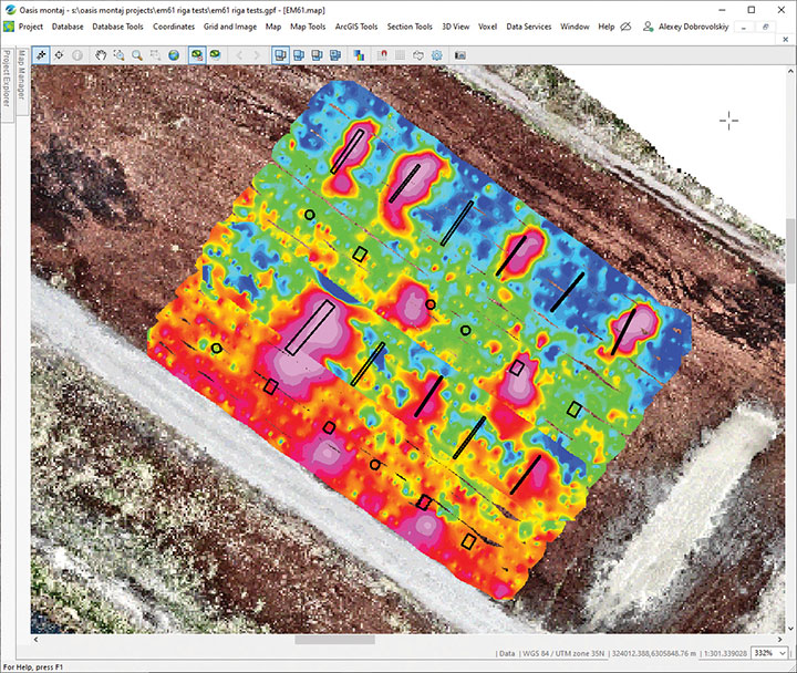
    SPH Engineering has launched a drone-integrated metal detection system with a Geonics EM61Lite metal detector, a new product of UgCS Industrial Solutions. The same performance and robustness available for users of the standard EM61-MK2 time domain metal detector are now available for airborne use.

    The new system is capable of detecting metallic (magnetic and non-magnetic) items in the first few meters under the surface, finding metallic objects in hard-to-reach or dangerous areas.

    Applications include unexploded ordnance (UXO) search, detection of underground infrastructure and archaeology. The integrated system has been extensively tested at SPH Engineering’s test range, and has shown excellent performance and repeatability for targets such as pipes (steel, stainless steel, reinforced concrete) and steel drums.

    The system uses an airborne (less heavy) modification of the Geonics EM61-MK2 ground metal detector. The EM61 Lite airborne variant integrates with the UgCS SkyHub onboard computer and ground control station.

    Features include automatic data logging in geotagged form and automatic terrain following with radar altimeter. The use of UgCS SkyHub enables the drone to fly in true terrain following (TTF) mode with the help of the radar altimeter and to log geotagged sensor data.

    An optional RTK/PPK GNSS receiver on the drone will geotag the data with centimeter-level precision.

  • ESA-funded GIDAS helps protect critical systems

    ESA-funded GIDAS helps protect critical systems

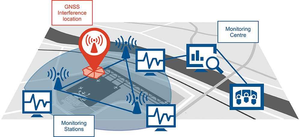
    Schematic of the GNSS interference detection and analysis system GIDAS. (Image: OHB Digital Solutions)
    Schematic of the GNSS interference detection and analysis system GIDAS. (Image: OHB Digital Solutions)

    In September 2020, the first GIDAS monitoring stations were installed at the Czech airport in Brno.

    GIDAS — GNSS Interference Detection and Analysis System — enables continuous 24/7 monitoring of the GNSS frequency bands within a defined region to automatically detect, classify and localize intentional interference from jamming and spoofing.

    GIDAS can raise the alarm in real time, identify the type of interference, and then pinpoint the location of these dangerous portable devices causing the interference so the authorities can take immediate remedial action. It considerably improves safe and robust operation of GNSS receivers, terminals and applications.

    GIDAS was developed by OHB Digital Solutions and Joanneum University of Applied Sciences through ESA’s Navigation Innovation and Support Programme (NAVISP).

    The system works autonomously and is designed to be easily deployed. It is scalable and flexible; it can be used as a standalone monitoring station or upgraded to a network of stations.

    Recent GNSS interference attacks include:

    • shutdown of navigation equipment at Newark airport
    • GNSS attacks of North Korea against South Korea
    • 117 incidents within one day at Kaohsiung airport in Taiwan
    • a U.S. military drone forced to land
    • a 65-meter yacht drifting off course during field trials
    • failure of emergency pagers, traffic management systems and ATMs in San Diego caused by U.S. Navy jamming.

    “In recent years, GNSS applications have increasingly become the target of intentional interference attacks, since GNSS is widely used in safety and value-critical applications,” said Andreas Lesch, CEO of OHB Digital Solutions. “GIDAS detects, classifies and localizes GNSS interference signals and thus reduces the already existing threat of receiving worse accuracies or even denial of service.”

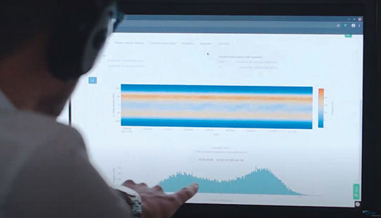
    The GIDAS system user interface helps to pinpoint interference.  (Image: OHB Digital Solutions)
    The GIDAS system user interface helps to pinpoint interference. (Image: OHB Digital Solutions)

    GIDAS monitors the GNSS L1/E1 frequency band and reliably detects and classifies intentional and unintentional interference sources using sophisticated algorithms. GIDAS consists of a high performance data processing unit including antenna and RF front-end, and a sophisticated software solution.

    GIDAS is able not only to monitor GNSS-based position, velocity and time solutions, it monitors the received signal and baseband processing.

    The system is composed of the following software modules:

    • Software-defined GNSS radio
    • Position, baseband and C/N0 monitoring
    • Jammer and spoofing parameter estimation
    • Localization capabilities through synchronization of several GIDAS systems
    • Graphical user interface

    Initial GIDAS reports show an average of seven GNSS interference events per day. GIDAS was able to successfully classify the signal type in 96% of jamming cases that have occurred.

  • SkyTraq offers multi-band GNSS receiver with 1-cm position accuracy

    SkyTraq offers multi-band GNSS receiver with 1-cm position accuracy

    Photo: SkyTraq
    Photo: SkyTraq

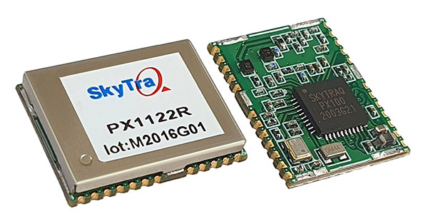
    SkyTraq is offering a 12 x 16 millimeter multi-band real-time kinematic (RTK) receiver for centimeter-level accuracy positioning applications. The PX1122R works with all the four GNSS, using GPS L1/L2C, Galileo E1/E5b, GLONASS L1/L2 and Beidou B1I/B2I signals concurrently to maximize positioning availability even in difficult urban environments.

    A single-chip system-on-chip, the PX1122R is designed to deliver reliable, centimeter-level accuracy positioning for autonomous unmanned ground or aerial vehicles, the internet of things, and traditional land surveying and precision farming applications.

    The PX1122R has an RTK initialization time under 10 seconds and a maximum update rate of 10 Hz. Its update rate provides in-time positioning with a fast response time and improved guidance for fast-moving applications, the company said.

    Moving-base RTK for GNSS precise heading is also supported. By using two PX1122R and two antennas with 1-meter separation, highly accurate 1-sigma heading accuracy of 0.13 degree can be obtained; such heading accuracy is immune to magnetic interference and unaffected by the receiver’s speed.

    The PX1122R can serve as a key component to provide precise position and heading information for autonomous applications. PX1122R sample, data sheet and evaluation boards are available now.

    Founded in 2005, SkyTraq Technology Inc. develops high-performance chipset and module solutions for the consumer market. Its initial product is L1-GPS-centric, and now its products cover L1, L2, L5, L6 band GPS/GLONASS /Beidou/Galileo/QZSS/NavIC/SBAS applications.

  • Spanish elite units first to receive GMV Seeker drones

    Spanish elite units first to receive GMV Seeker drones

    Photo: Spanish Armed Forces/GMV
    Photo: Spanish Armed Forces/GMV

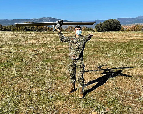
    The Spanish Army and Navy have received the first Seeker Remotely Piloted Aircraft Systems (RPAS) from GMV and Aurea Avionics. The unmanned aircraft is designed to boost the intelligence, surveillance and reconnaissance capabilities of two elite forces, the Spanish Army’s 6th Almogávares Paratroopers Brigade and the Marine Infantry Protection Force.

    Seeker has a 90-minute endurance and 15-km range, and weighs 3.5 kg. The UAV’s design and manufacture in Spain proved crucial during the COVID-19 epidemic, with the manufacture, test flights and delivery of the aircraft all performed within the project deadlines.

    In the final phase of the project, intensive training courses took place on the Madrid site of Aurea Avionics and the Los Alijares Firing and Maneuvering Range (CMT) of Toledo. There, future Seeker users put the RPAS through its paces with mission simulations, engaged in vehicle-tracking exercises and learned about  its theoretical and practical uses.

    Seeker will provide BRIPAC (Paratrooper Brigade) and BRIMAR (Marine Infantry Brigade) with real-time thermal-infrared and visible-spectrum video, augmented by metadata that can be mined by the operators and remotely by the command-and-control centers.

    New digitized ground-station architecture makes Seeker compatible with NATO’s standard command centers. This means any allied force will be able to integrate the aircraft into its fleet and command centers, ensuring joint operability between all troops and systems.

    The RPAS is financed by the Subdirectorate General of Planning, Technology and Innovation of the Directorate General of Armaments and Material.

  • Galileo chalks up 500th ESA Engineering Board

    Galileo chalks up 500th ESA Engineering Board

    Image: ESA
    Image: ESA

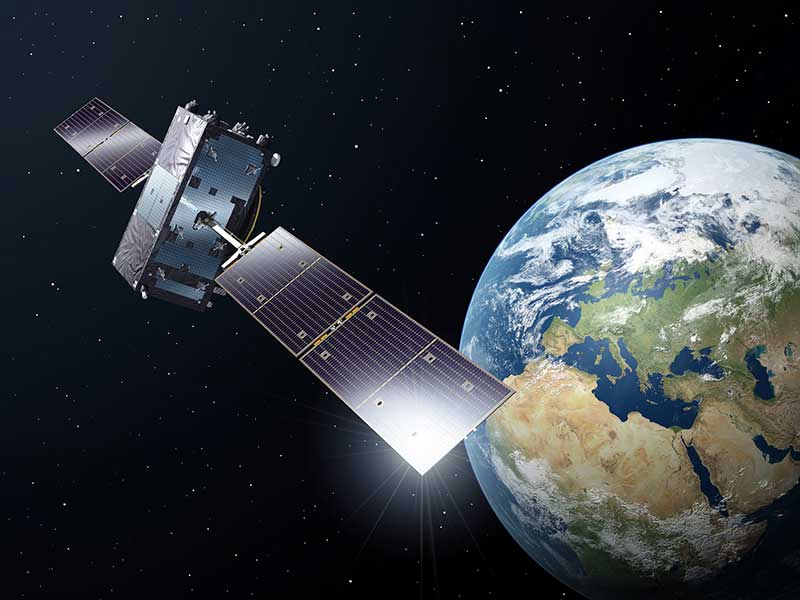
    The end of 2020 marked a milestone for the Galileo First Generation, as the program chalked up its 500th European Space Agency (ESA) Engineering Board.

    For more than 12 years, ESA and industry engineers from all relevant disciplines — system, satellite, ground, signal, radio navigation, RAMS (reliability, availability, maintainability and safety), security and infrastructure — have put their best skills at the disposal of the board.

    The board is a forum where technical experts regularly meet to maintain, review and update the Galileo Project technical baseline, known as the System Technical Requirements Baseline (STRB). The STRB drives the implementation of the Galileo System and its infrastructure, the space and ground segments, along with associated interfaces and operations.

    The G1 system technical specification under ESA adds up to more than 22,000 separate requirements. These requirements are both unclassified and classified, with considerable interdependencies which all that need to be controlled in configuration.

    The Galileo G1 Engineering Board is chaired by ESA in accordance with its role as Galileo System Design Authority, assigned to it by the European Commission.

    Since the building of the first G1 Engineering Board in 2008, 26 Galileo satellites have been built, tested and flown. The Galileo system’s globe-spanning ground system has also been put in place and made operational. The board continues to be a crucial enabler for further robustness improvements and new service evolutions.

    A further 12 Batch 3 satellites are set to join the constellation in the coming decade. These satellites are being finalized at OHB Systems in Bremen, Germany, and then tested at ESA’s ESTEC Test Centre in the Netherlands.

    The worldwide Galileo ground segment includes two control centers (Italy and Germany) as well as various tracking, uplink and sensor stations and monitoring and test centers. (Image: ESA)
    The worldwide Galileo ground segment includes two control centers (Italy and Germany) as well as various tracking, uplink and sensor stations and monitoring and test centers. (Image: ESA)

    Galileo began initial operations in December 2016 and today serves more than 1.5 billion smartphones and devices.

    The G1 Engineering Board meetings will continue, complemented with Engineering Boards for the new Galileo Second Generation (G2 satellites are planned for later this decade), which are already well underway.

  • Protected: GPS World COVID-19 Social Media Campaign

    This content is password-protected. To view it, please enter the password below.

  • Hemisphere GNSS presents Phantom, Vega GNSS OEM boards at Intergeo 2019

    Hemisphere GNSS’ Miles Ware gives GPS World an overview of the company’s Phantom and Vega series GNSS OEM boards at Intergeo 2019, which took place in Stuttgart, Germany.

  • Coast Guard provides GPS III antenna phase-center data

    Coast Guard provides GPS III antenna phase-center data

    CGSIC logo

    Lockheed Martin Space has released the GPS-III satellite antenna phase-center data, as well as the group delay and inter-signal correction data, for SVN-76 and SVN-77 as measured at the factory, announced the U.S. Coast Guard’s Civil GPS Service Interface Committee (CGSIC).

    The information is available on the U.S. Coast Guard Navigation Center’s website underneath the IIR/IIR-M antenna pattern data files.

    The phase center and inter-signal bias data included in this new release provide additional information that supplements the antenna gain pattern data previously available.

    Note that the GPS III satellite vehicles (SVNs) also broadcast the Inter-Signal Corrections (ISCs) in the various LNAV/CNAV messages in accordance with all the external IS/ICDs.  The value that is being broadcast by the on-orbit constellation is not the factory measured ISCs but the ISCs estimated on-orbit by the Stanford Research Institute (SRI).

  • First Fix: New year, new opportunities for GNSS industry

    First Fix: New year, new opportunities for GNSS industry

    Headshot: J. David Grossman
    J. David Grossman

    By J. David Grossman
    Executive Director
    GPS Innovation Alliance

    As we embark on a new year, 2021 ushers in a new administration and the start of the 117th Congress. With these changes comes a litany of opportunities, as well as challenges, for the nearly four-decade-old GPS industry.

    Next month, the GPS Innovation Alliance (GPSIA) will mark its eighth anniversary as the voice of the GPS industry, educating policymakers and regulators about the GPS success story of innovation, economic growth and job creation. It is a uniquely American story made possible because of bipartisan support for protecting the spectrum used by GPS and maintaining funding to enable the modernization of the GPS constellation, ground control and military ground user equipment.

    Congressional Support. This commitment was evident in the last Congress through broad support from both parties for two Congressional resolutions, H.Res.219 and S.Res.216, that affirmed the importance of continuous availability, accuracy, efficiency, robustness, reliability and resiliency of the GPS constellation.

    Innovation and modernization of the GPS constellation are well underway. Last year, under the emerging leadership of the U.S. Space Force, two new Lockheed Martin-built GPS III satellites were launched into space. This new generation of GPS satellites offers three times greater accuracy, up to eight times improved anti-jamming capability for military users, and the addition of the L1C signal to enable interoperability with other navigation systems, such as Europe’s Galileo.

    GPS modernization also has led to the introduction of M-code, an advanced, new signal designed to improve anti-jamming and anti-spoofing, as well as to increase secure access to military GPS signals for U.S. and allied armed forces. In GPS-denied environments, M-code reduces the jamming radius, giving military planners and targeteers options to minimize or avoid collateral strike damage.

    With at least two additional GPS III satellites set to launch this year and a new ground control segment known as the Next Generation Operational Control System (OCX), the continued success of the GPS program remains bright.

    Ligado Still Looms

    As GPSIA continues to urge Congress to allocate the funding needed to support the modernization of GPS, we also are fighting to ensure uninterrupted operation of the estimated 900 million GPS devices in the United States ranging from precision agriculture to consumer gadgets.

    Last year, we were deeply disappointed by the Federal Communications Commission’s (FCC) decision approving the applications of Ligado Networks, despite the well-documented objections of the expert agencies charged with preserving the integrity of GPS, specifically, on the critical issue of what constitutes harmful interference to users of GNSS.

    Regrettably, the FCC chose to ignore the established “1-dB Standard,” which has a long history of protecting GPS operations from harmful interference in both international and domestic regulatory proceedings.


    “All Americans benefit from a competitive 5G landscape.”


    At the same time, Ligado and its supporters continue to argue that their proposal is the fastest way to bring 5G to all Americans. In actuality, millions of Americans already have access to 5G services and, thanks to the efforts of the FCC, hundreds of megahertz of 5G spectrum in low-, mid- and high-band frequencies have been or will soon be made available for commercial use. GPSIA believes all Americans benefit from a competitive 5G landscape.

    5G without compromise. However, that goal can be achieved without undermining GPS receivers and devices that are foundational to wireless technology in general, including 5G. We remain hopeful that a new administration and congress will commit to protecting GPS receivers from harmful interference using the appropriate standard for determining such interference to ensure that the more than $1 billion per day in U.S. economic impact created by GPS continues to flourish.

    2020 also brought the issue of GPS resiliency into the national forefront. In February, the president signed an Executive Order aimed at fostering greater resiliency for positioning, navigation and timing (PNT)-based systems, including GPS.

    GPSIA supported this order and outlined in subsequent regulatory filings why GPS remains the gold standard for delivering PNT functions to our military as well as a wide range of other sectors, including transportation, agriculture, electricity and finance.

    Complementing GPS. As the federal government considers alternative PNT solutions, it is critical that they be complementary to GPS, able to easily integrate into current or future devices, and based on a recognition that each PNT application has unique requirements driven by its intended function, environment and design factors. In sum, there is no one-size-fits-all solution.

    Protecting Consumer Privacy. Looking ahead, GPSIA expects 2021 will bring a robust discussion around consumer privacy protections. While GPS satellite broadcasts are one-directional and cannot track a user’s location, we recognize that GPS is one of many data points that can contribute to application-specific location tracking. As such, GPSIA would urge Congress to ensure that geolocation data is appropriately addressed as part of any U.S. federal privacy legislation. In doing so, we believe protections for precise geolocation information will empower consumer choice, enhance transparency, and strengthen security.

    On the surface, infrastructure modernization, protecting GPS spectrum, PNT resiliency, and consumer privacy may seem like distinctly different issues. What they have in common, though, is an ability to garner bipartisan support, deliver substantial consumer benefits, and strengthen our nation’s economy. GPSIA stands ready as a resource and looks forward to working with the Biden-Harris Administration and leaders in the House and Senate to promote, protect and enhance GPS.