Blog

  • AUVSI Xponential 2020 goes virtual

    AUVSI Xponential 2020 goes virtual

    AUVSI Xponential 2020 logo

    The Association for Unmanned Vehicle Systems International (AUVSI) has decided to convert AUVSI Xponential 2020 to a virtual event. It will still take place Oct. 5-8.

    “For decades, the unmanned systems industry has reshaped critical missions and business operations by meeting challenges head-on with innovation and resolve,” said Brian Wynne, president and CEO of AUVSI. “Our commitment to supporting the unmanned systems community remains unwavering, so amidst the current global health crisis we, too, must adapt to fulfill that mission.”

    Xponential 2020 was originally scheduled to take place May 4-7 at the Boston Convention and Exhibition Center. It was then rescheduled to take place Oct. 5-8 at the Kay Bailey Hutchison Convention Center in Dallas.

    “While we are disappointed to not be convening in person this year, the health and safety of Xponential exhibitors and attendees is our utmost priority,” Wynne said. “It may not look like the Xponential we are used to, but we look forward to offering attendees the opportunity to virtually network, learn from and collaborate with one another just as they have in years past.”

    According to AUVSI, those who have already registered for Xponential will receive an email in the coming weeks to confirm options for participation in the virtual event.


    Check out other trade shows that have been canceled, gone virtual or have been rescheduled because of COVID-19.

  • Multi-platform lidar enables digital twin cities

    Multi-platform lidar enables digital twin cities

    Digital twin technology emerged a decade ago to provide 3D virtual replicas of physical assets. Today, with Big Data and internet of things (IoT) capabilities, it is a complex and comprehensive method to support the construction of smart cities.

    Mapping Shanghai with the AlphaUni 900. (Image: CHC Navigation)
    Mapping Shanghai with the AlphaUni 900. (Image: CHC Navigation)

    As a virtual model, a digital city can be an indispensable tool to visualize the life of a city in real time. It provides layered data about buildings, urban infrastructure, utilities, businesses, and the movement of people and vehicles. By providing this information, digital twins enable intelligent urban development and modernization.

    Traditional methods of collecting and representing 2D spatial data, such as maps and images, are insufficient to meet the requirements for digital twin city models, where digital data provides the foundation for large-scale projects.

    For example, the derived 3D models must have a high capacity to be merged and correlated with social or economic spatial data from IoT and Big Data. Because of this, a high demand exists for global, accurate, real-time geospatial data that provides high-precision 2D and 3D information.

    Proof-of-concept

    To illustrate a typical digital cities project, CHC Navigation (CHCNAV) carried out a proof-of-concept demonstration in the Jinshan district of Shanghai for one month in March and April.

    The total area of the Jinshan district is approximately 600 km2. This area contains rich terrain features and typical characteristics of large, modern cities, such as high buildings, power lines, rivers and vegetation.

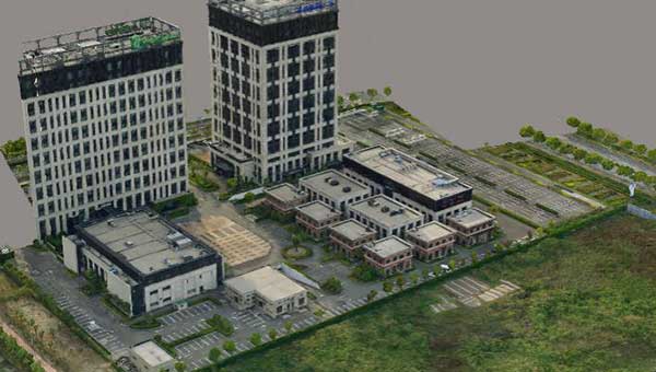
    Extracted 3D mesh created from the data. (Image: CHC Navigation)
    Extracted 3D mesh created from the data. (Image: CHC Navigation)

    The traditional method of capturing with a single-platform lidar system may leave some areas blank in the point-cloud data. CHCNAV’s AlphaUni 900 lidar solution, with its multi-platform capability, was able to capture complete data with four different platforms: an unmanned aerial vehicle (UAV), a car, a backpack and a boat or unmanned surface vehicle (USV).

    The AlphaUni series provides optimized data sets powered by advanced GNSS/inertial navigation system (INS) sensors and long-range scanners.

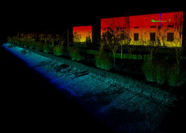
    Point cloud from aboard an Apache6 USV mapping a water channel. (Image: CHC Navigation)
    Point cloud from aboard an Apache6 USV mapping a water channel. (Image: CHC Navigation)

    During the project, the CHCNAV AlphaUni 900 seamlessly integrated the district’s buildings in the data sets and provided a sophisticated 3D image from both indoor and outdoor environments. Its high-accuracy capability and multi-platform design can improve the way high-precision data is collected. It successfully provides an innovative solution for the problems of 3D geospatial data acquisition required for the development of smart cities.

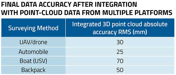
    Table Data: CHC Navigation
    Table data: CHC Navigation


  • Launchpad: RTK motion sensor, agriculture package, wearable mapper

    Launchpad: RTK motion sensor, agriculture package, wearable mapper

    A roundup of recent products in the GNSS and inertial positioning industry from the August 2020 issue of GPS World magazine.


    OEM

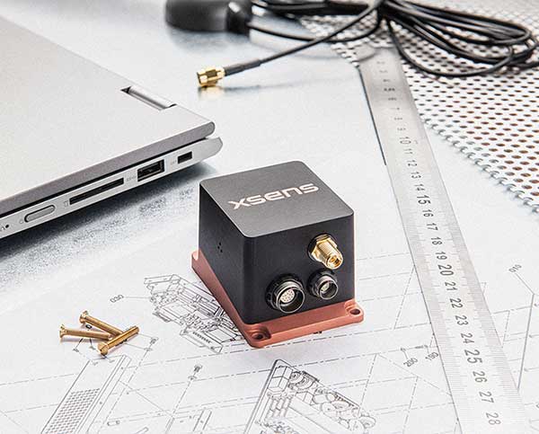
    The MTi-680G GNSS/INS module. (Photo: Xsens)
    Photo: Xsens

    RTK motion sensor

    Provides Centimeter positioning

    The MTi-680G is an integrated GNSS/inertial navigation system (INS) module that features an integrated real-time-kinematic (RTK) GNSS receiver, as well as providing synchronized 3D attitude and heading outputs. Its firmware accelerates the module’s internal signal processing compared to non-RTK modules. Synchronizing the global position coordinates with the module’s attitude, heading and velocity outputs, the MTi-680G can provide a comprehensive positioning and navigation output for any carrier device, including high-speed drones, at a maximum output data rate of 400 Hz. Other applications include precision agriculture, autonomous vehicles and coastal maritime equipment. Xsens provides out-of-the-box operation with MTi development kits.

    Xsens, xsens.com

    Photo: Parker LORD
    Photo: Parker LORD

    RTK + inertial system

    Accurate measurements

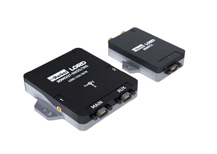
    The 3DM-GQ7 is a dual-antenna real-time kinematic (RTK) inertial navigation system with multiple integrated aiding sensors and support for external aiding. It has two integrated RTK-capable multi-band multi-constellation GNSS receivers, integrated barometric pressure sensor, magnetometer, and hardware support for wheel odometry. It also has an application programming interface (API) for external sensor measurements. The 3DM-GQ7 provides seamless operation during temporary GNSS signal outages and online tracking of inertial measurement unit (IMU) error sources for superior dead reckoning. An optional network RTK receiver, the 3DM-RTK, allows users to communicate with the company’s SensorCloud RTK Connection network for an all-in-one solution.

    Parker LORD, lord.com

    Logo: ROS

    ROS driver

    Supports OEM7 GNSS receivers

    Hexagon | NovAtel has released its first purpose-built driver, powered by Robot Operating System (ROS), to support its OEM7 family of GNSS receivers. The driver provides an optimized interface enabling users to accelerate autonomous development projects by quickly incorporating NovAtel OEM7 receivers into custom applications. The driver is available for immediate download through the new NovAtel GitHub repository or as a ROS Binary Package for direct installation.

    Hexagon | NovAtel, novatel.com

    Photo: EndRun
    Photo: EndRun

    Timing module

    Compact, high performance

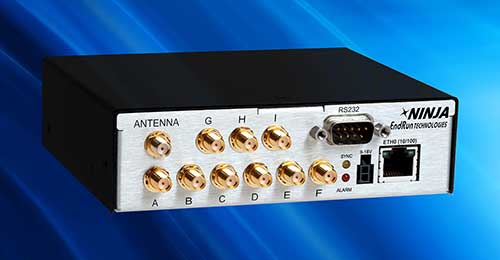
    The third-generation Ninja Precision Timing Module (PTM) — optimized for size, weight and power (SWaP) — can be easily integrated into 1U host systems or deployed as a cost-effective standalone time and frequency standard. The resilient GPS-synchronized Ninja is based on the core of EndRun’s Meridian II Precision TimeBase instrument, providing time accuracy of <10 nanoseconds RMS to UTC(USNO). Up to nine optional, user configurable, time and frequency outputs are available with accuracy, stability and ultra-low phase noise. Ninja’s network interface includes a robust Network Time Protocol (NTP) server as well as secure management.

    EndRun Technologies, endruntechnologies.com

    Photo: Tersus GNSS
    Photo: Tersus GNSS

    RTK board

    Supports 576 channels

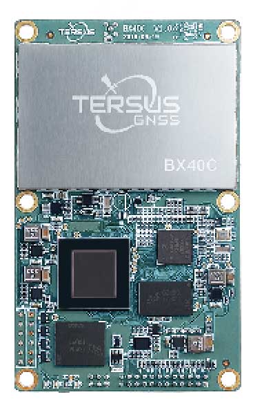
    Powered by ExtremeRTK GNSS technology, the BX40C board can support multi-constellation and multi-frequency all-in-view satellite tracking to achieve centimeter-level positioning and improve the continuity and reliability of the RTK solution, even in harsh environments. Its enhanced positioning accuracy and constellation tracking can control deviation within 3 centimeters for surveying and mapping applications. It also is suitable for high-precision positioning. It can be integrated with autopilots and inertial navigation units. It offers 4 GB of built-in memory for data collection, and is compatible with other GNSS boards via flexible interfaces, smart hardware design and commonly used log/command formats.

    Tersus GNSS, tersus-gnss.com

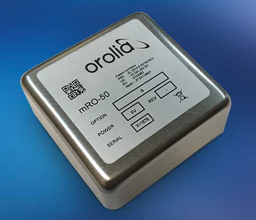
    Photo: Orolia
    Photo: Orolia

    Rubidium oscillator

    Miniature design for low SWAP-C

    The Spectratime mRO-50 is designed to meet the latest commercial, military and aerospace requirements where time stability and power consumption are critical. It provides a one-day holdover below 1 microsecond and a retrace below 1 x 10⁻¹⁰ in a form factor sized 50.8 x 50.8 x 19.5 millimeters. It takes up only 51 cc of volume and consumes only 0.45 W of power. The Spectratime mRO-50 provides accurate frequency and precise time synchronization to mobile applications, such as military radio-pack systems in GNSS-denied environments. It is also suitable for UAVs and underwater applications.

    Orolia, orolia.com

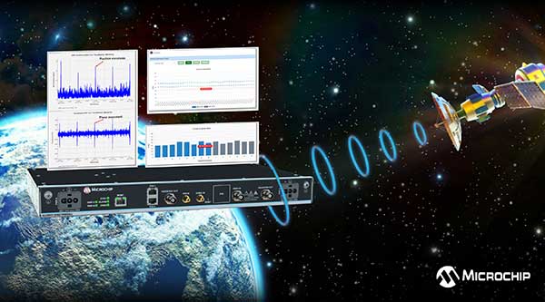
    Photo: Microsemi
    Photo: Microsemi

    Firewall software

    For critical infrastructure

    The BlueSky GNSS Firewall has received a major software update. The firewall provides a higher level of resiliency against GPS vulnerabilities for systems dependent on GPS signal reception. Microchip developed Release 2.0 to address operators’ evolving requirements after participating in GPS Testing for Critical Infrastructure events hosted by the Department of Homeland Security. It performs real-time analysis to detect jamming and spoofing for protecting reception of the GPS signal and hardening response and recovery to avoid signal disruption. Release 2.0 includes charting and advanced threshold settings of GNSS observables such as satellites-in-view, carrier-to-noise, position dispersion, phase time deviation and radio frequency power level to simplify system turn-up and deployment.

    Microchip Technologies, microsemi.com

    Transportation

    Photo: Particle
    Photo: Particle

    Tracking system

    Supports IoT deployments

    Particle’s Tracker SOM (system-on-module) provides a powerful GNSS receiver, microcontroller and advanced peripherals in a compact form factor. Tracker SOM can be tailored for organizations or serve as a fully certified foundation for OEMs developing commercial products. A high-gain GNSS antenna accurate to 1.8 meters is provided. The asset-tracking system is built on the Particle platform, spanning integrated internet-of-things (IoT) hardware, edge software, connectivity and cloud-based management software. It can track the real-time location of critical assets and capture additional intelligence such as temperature and acceleration as well as remotely control mobile equipment and vehicles.

    Particle, particle.io

    Photo: THEPALMER/E+/Getty Images
    Photo: THEPALMER/E+/Getty Images

    Fleet management

    Public works solution for government fleets

    The Geotab Public Works solution for North America helps state and municipal government agencies improve fleet operations and increase operational efficiencies. Fleet managers receive operational data on all government vehicle types on a single platform, with toolsets to remain compliant, reduce costs and maintain road safety. Vehicles tracked include salt spreaders, snowplows, street sweepers and waste-management vehicles. It supports material management, compliance, accountability and liability. Fleets can more accurately measure material usage, such as salt, and are better able to control costs and environmental impact. It is available as a configurable add-on for the MyGeotab platform, allowing municipalities of all sizes to customize their databases to help meet specific needs.

    Geotab, geotab.com

    UAV

    Photo: Altitude Angel
    Photo: Altitude Angel

    Remote ID platform

    Unmanned aircraft system traffic management (UTM)

    Scout provides the capability to securely obtain and broadcast a form of network remote ID. Because it is open source, both hardware and firmware can be enhanced and incorporated into a virtually limitless set of scenarios. Altitude Angel also has made available a surveillance API that allows integrators to both share and receive flight data from a variety of sensors and devices in near real time, providing a comprehensive real-time picture of the airspace. Scout offers two-way communication enabling the Altitude Angel UTM service to help the drone avoid collisions or restricted airspace. It will work in combination with a pre-flight (flight-plan sharing) service and is supported through integration with Altitude Angel’s Tactical Conflict Resolution Service. Scout will enable the drone to report its real-time location using GPS-type sensors and relay this data via a secure, encrypted mobile communications link to Altitude Angel.

    Altitude Angel, altitudeangel.com

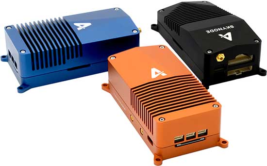
    Photo: Auterion
    Photo: Auterion

    UAV platform

    Unifies flight controller, mission computer and connectivity

    Skynode unifies a flight controller, mission computer and wireless connectivity in a compact embedded design. It enables the complete Auterion software platform to accelerate the development of enterprise-ready products for drone manufacturers.Skynode can be integrated into any type of airframe: quads, multi-rotors, vertical-takeoff-and-landing (VTOL) and fixed-wing drones. Skynode enables the Auterion software platform with enterprise workflow integration, advanced autonomy features, mission planning, live video streams, operations dashboard, flight analytics and cloud-based predictive maintenance. Built on stable open-source software and industry standards, Auterion is highly interoperable with integrations from a host of partners in an open, future-proof ecosystem.

    Auterion, auterion.com

    The Draganflyer Commander Ag-Pro Package. (Photo: Draganfly)
    Photo: Draganfly

    Agriculture package

    For crop imaging, data

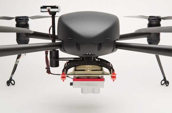
    The Draganflyer Commander Ag-Pro Package includes everything needed to perform crop health assessment, irrigation monitoring and yield optimization. It combines the MicaSense RedEdge-MX multispectral sensor and the Draganflyer Commander UAV for projects requiring long flight times, a high level of data resolution and accuracy and data security. The Commander is an electric multirotor UAV built on Draganfly’s patented carbon fiber folding airframe. Its dual-battery system powers 35-minute flight times, and its automated flight planning tool allows users to quickly create coverage areas and flight plans. The RedEdge-MX features five narrowband imagers that capture high-quality images that can produce maps for a multitude of agricultural uses and has two calibration methods to produce accurate data that can be compared across time, allowing for temporal analysis throughout the season and from year to year.

    Draganfly, draganfly.com;
    MicaSense, micasense.com

    Photo: GeoCue
    Photo: GeoCue Group

    3D imaging systems

    Creates bare Earth models, cross sections, contours, volumetric analysis

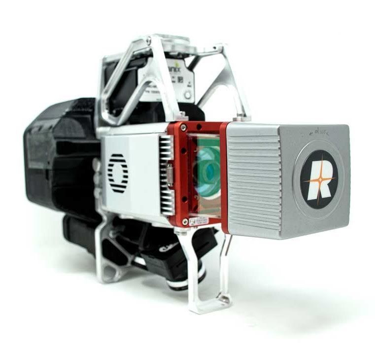
    The True View 615 and 620 UAS lidar 3D imaging systems are compact, survey-grade sensors designed for small UAS. They are equipped with Riegl’s miniVUX-2UAV laser scanner integrated with dual photogrammetric cameras. Position and orientation is provided by an Applanix APX-15 (True View 615) or extreme accuracy APX-20 (True View 620). The systems are bundled with Applanix POSPac, True View EVO post-processing software and True View Reckon data-management solution. The system includes full post-processing software that generates a ray-traced 3D colorized point cloud and geocoded images.

    GeoCue Group, geocue.com;
    Riegl, riegl.com; Applanix, applanix.com

    Mapping

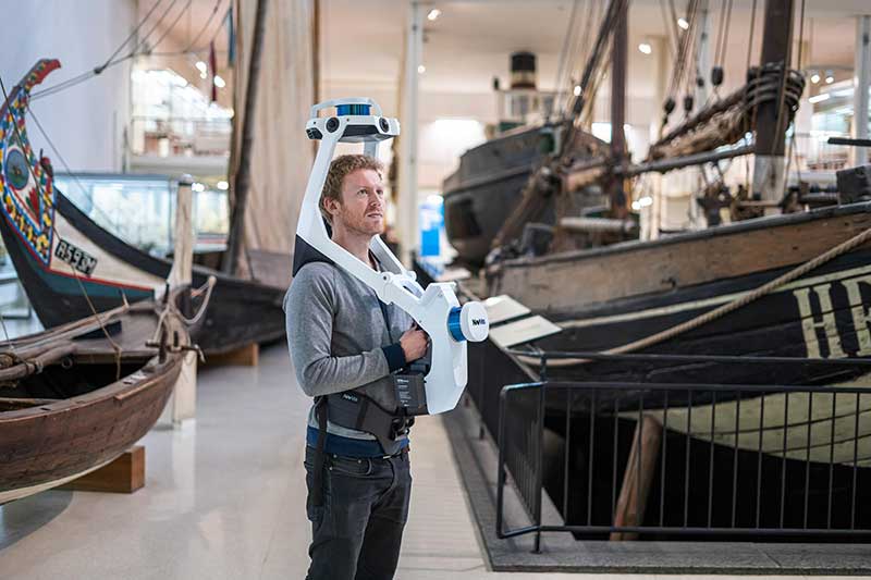
    The all-in-one reality capture capabilities of NavVis VLX include both survey-grade point clouds and high-resolution panoramas. (Photo: NavVis)
    Photo: NavVis

    Wearable mapper

    Generates both survey-grade point clouds and high-resolution panoramas

    The NavVis VLX wearable mapping system captures high-quality data in built environments such as construction sites, staircases and technical rooms. The compact, economical design enables high-quality data to be captured for architecture, engineering and construction (AEC) projects. Uses include conventional building documentation such as CAD drawings and BIM models, as well as web-based digital-twin solutions. NavVis VLX is equipped with two lidar sensors and captures survey-grade point clouds using the company’s SLAM technology, originally developed for the NavVis M6 indoor mobile mapping system. NavVis VLX also captures high-resolution panoramic images in a 360-degree field of view. The wearable device gives the operator more control over where the sensors are scanning. A built-in screen provides live feedback of what has been scanned and the quality of the data being captured.

    NavVis, navvis.com

    Photo: Esri
    Photo: Esri

    Mapping app

    Supports Eos Arrow GNSS receivers

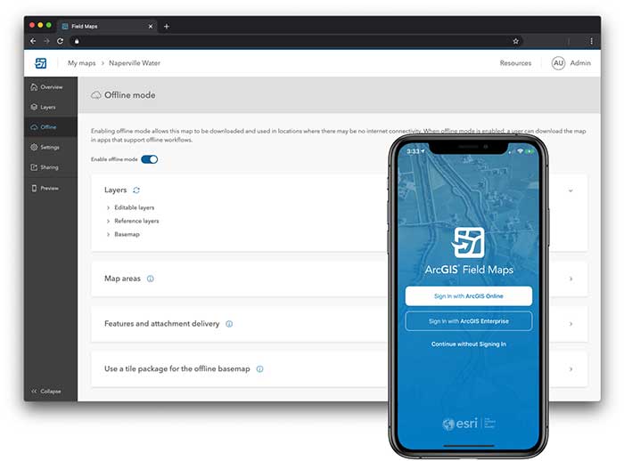
    ArcGIS Field Maps, coming in September, will combine the following capabilities into a single app: map viewing and markup, high-accuracy field data collection and inspection, battery-optimized location tracking, work planning and task management and turn-by-turn navigation. Field Maps also will include a new web app, integrated with ArcGIS, that can be used to configure and deploy maps optimized for your mobile workforce needs, create and assign tasks to mobile workers, and create and share views of worker locations. ArcGIS Field Maps combines the functionality of five Esri ArcGIS mobile apps: Collector, Explorer, Tracker, Workforce and Navigator. Field Maps will also support the two formerly Collector-exclusive Eos solutions: Eos Locate and Eos Laser Mapping.

    Esri, esri.com;
    Eos Positioning, eos-gnss.com

  • New players offering GNSS correction services

    New players offering GNSS correction services

    Thirty years ago, more than a decade before most people had even heard of GPS, receiver manufacturers and surveyors were already improving on it by providing and using correction services to compensate for errors in the system—including clock drift, orbit errors, signal errors, atmospheric errors and multipath.

    Today, dozens of public and commercial correction services enable users to achieve accuracies of decimeters, centimeters or even millimeters. Also, many GNSS processing services correct measurements taken in the field using data from reference points. Increasing positioning accuracy has become the cornerstone of modern GNSS practice.

    The current boom for correction services is driven mostly by the demand for high accuracy from the automotive industry (including the development of self-driving cars), as well as smart consumer devices and various forms of automation. Automotive companies and telecoms are deploying infrastructure around the globe to provide centimeter-level positioning. GNSS satellites also can transmit corrections directly, as the Japanese CLAS service from the QZSS constellation does, and Galileo’s High-Accuracy Service (HAS) soon will. To compensate for receiver-side issues — multipath, jamming and spoofing — some GNSS receivers also incorporate advanced positioning algorithms.

    Clock and orbit errors are specific to each satellite; they do not depend on the position of the receiver. But atmospheric errors are introduced when the signal travels from the satellites to the user. Reference stations (base stations) of GNSS receivers installed at fixed and precisely surveyed positions provide corrections that compensate for both sets of errors to the rovers carried by field crews. When connected, reference receivers spread over a geographic area form reference networks, such as that of continuously operating reference stations (CORS). Achieving maximum accuracy requires initializing the receiver, which can take a few seconds to several minutes, depending on the type of corrections.

    Established and new methods

    Two established methods have been used for decades.

    Real-time kinematic (RTK). In RTK, a receiver obtains correction data from a single base station or a local reference network in the same area.

    Precise point positioning (PPP). While accessible from anywhere in the world, receiver initialization for PPP can take up to 30 minutes. Also, a few PPP correction services only provide corrections for satellite clock and orbit errors and not for atmospheric errors, limiting users to a lower accuracy level than with RTK.

    Hybrid PPP-RTK. In recent years, new methods have emerged. Hybrid PPP-RTK combines near-RTK accuracy and quick initialization times with the global access of PPP. It relies on a network of reference stations within about 150 kilometers of each other. The stations collect GNSS data and calculate both satellite and atmospheric correction models. The network then broadcasts these corrections via internet, satellites or cellphone towers to subscribers, who can use them to achieve sub-decimeter accuracy.

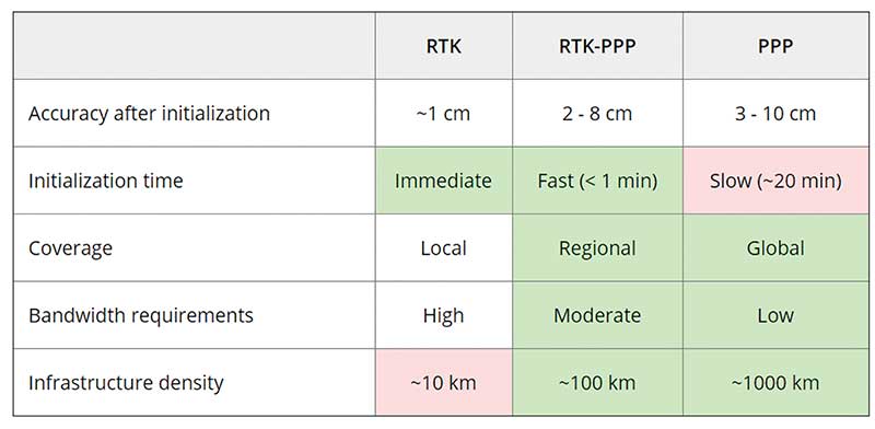
    Each of these methods has advantages and disadvantages (see table 1). RTK, which relies on communication between the user and the local correction service, provides centimeter accuracy over small areas. PPP-RTK and PPP broadcast corrections and require a lighter infrastructure, making them scalable for mass-market and industrial applications. The new services are cheaper and more user-friendly than traditional correction services.

    TABLE 1: Differences of various correction methods. (Chart: Septentrio)
    TABLE 1: Differences of various correction methods. (Chart: Septentrio)

    CORS/VRS

    Traditional reference networks — often called CORS or virtual reference station (VRS) networks — have long been a source of differential GPS (DGPS) and RTK corrections, mainly for surveying and mapping applications, which require high accuracies.

    “Most CORS in the United States are strictly for providing high-accuracy correction data to GNSS users who need to know their position to less than an inch,” said Alex Ngu, applications engineer at Trimble. “However, some — like Utah’s TurnGPS network and the North Carolina Geodetic Survey (NCGS) — have considered dabbling in using them to double up for weather monitoring.” In some regions, such as Japan and Washington state, CORS are also used to study plate tectonics and provide early warning of earthquakes.
    CORS receivers often operate in remote locations and may be powered by solar panels. Therefore, they require low power consumption and the ability to configure, run and update remotely. They also need to archive on-board measurements and withstand harsh environments.

    Changes in the market

    As the market for GNSS corrections changes, so does the role of CORS networks. They are increasingly used for industrial automation that needs centimeter accuracy, including construction and agriculture. “Now, due to the growth in autonomous systems, such as autonomous cars, people are looking at corrections in a completely different way and with more focus on mass markets,” said Gustavo Lopez, market access manager at Septentrio. Septentrio lets customers choose which correction service to use.

    “CORS/VRS networks will keep focus on performance and on adding constellations and signals, but nothing major is expected to happen in these traditional systems,” Lopez said. They will continue to exist because they focus on centimeter-level accuracy for survey, construction, mining, machine control and precision agriculture. “What will really change the market are these new services with 10-cm to 20-cm accuracies, which also offer a new way of delivering the data, namely broadcasting rather than using two-way communication methods.” This helps with adoption by emerging applications, Lopez said.

    He predicts that applications needing 10- to 50-centimeter acurcy will migrate to cheaper services, including new consumer applications, advanced driver-assistance systems (ADAS), professional applications such as robotics, UAVs, logistics and internet of things (IoT) applications.

    Mobile technologies adopting dual-frequency chipsets also will need correction services. “We will see more and more telecoms interested in providing GNSS corrections as a service, as is already the case in Asia and Europe,” Lopez said. “A few CORS/VRS networks will try to capture part of this emerging applications market by reusing their technology or partnering with other companies to provide a more transparent solution.”

    One might think that the rapid expansion of the market for corrections would make it possible for traditional CORS networks to make 1-cm accuracy available at a much lower price. The roadblock is high infrastructure costs, Lopez explained. CORS/VRS networks are expensive to maintain because they require a high density of stations. New services that use broadcasting technology and PPP-RTK positioning modes rely on less dense networks.

    New uses for old CORS

    A key benefit of a VRS is that performing RTK positioning across the area it covers does not require guarding a separate GPS base station. Using VRS, the CORS network acts essentially as a continuous reference station within the entire network, enabling RTK positioning using a single rover in the field.

    Randy Osborne, VRS network manager at Louisiana State University’s Center for GeoInformatics, reports a growth in new applications beyond surveyors. VRS expanded to precision agriculture, and then into applications such as lidar and UAVs. “We are also seeing strange applications that we never thought of. For example, plumbing companies use it to navigate underground from a truck that has a position on the network, and then they vector from the truck underground into pipelines,” Osborne said. Subscribers also include companies performing survey work for fracking and petrochemical projects.

    OSR vs. SSR

    Most GNSS correction services are based either on the observation state representation (OSR) or on a state space representation (SSR) of the errors. OSR and SSR use different techniques, delivery mechanisms and core technologies.

    OSR. Legacy GNSS correction service providers supply OSR correction services; examples are RTK and networked RTK (RTN). They rely on transferring corrected GNSS observations from the nearest reference station to the rover using a standardized format. They focus on a geographic region and target surveying, machine control and precision agriculture, providing centimeter-level accuracy up to about 30 kilometers of the nearest reference station. Because these services require bi-directional communications and large bandwidth, it is hard to ramp them up for mass-market applications.

    SSR. By contrast, new players in the market for correction services, as well as some of the larger legacy ones, provide SSR correction services. SSR uses a network of reference stations to model major errors over large areas. They then transfer this model to the rovers, which create local error models and apply them to their GNSS observations. Depending on the service, accuracy ranges from less than 5 cm to 20 cm, convergence times from 10 seconds to 30 minutes, and coverage from continental to global. Because SSR corrections are broadcast, they can be more easily distributed through internet connections and L-band satellite channels. Because all the rovers rely on the same stream of GNSS correction data, SSR services work well for mass-market applications. The growth in SSR technology is driven mainly by the needs of the automotive industry but is sufficiently generic for adoption in other markets.

    The challenge of vertical accuracy

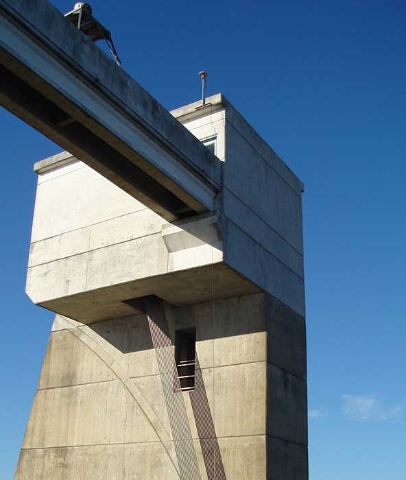
    A CORS receiver stands atop the Old River Auxiliary Control Structure, a floodgate system in a branch of the Mississippi in central Louisiana. (Photo: Trimble)
    A CORS receiver stands atop the Old River Auxiliary Control Structure, a floodgate system in a branch of the Mississippi in central Louisiana. (Photo: Trimble)

    While OSR and SSR have comparable accuracies on a horizontal plane, they differ greatly in their vertical accuracy and initialization times, Osborne said. “When we look at CORS for active control and positioning in the National Spatial Reference System, we are mainly trying to get a handle on the vertical part, as it is the hard problem to solve,” he said.

    High-precision vertical accuracy is a challenge for any GNSS-based method. Conventional surveying is still the gold standard. With differential leveling, like with digital levels, results in millimeters are possible. Post-processed GNSS, using data from a good geometry of CORS or base data, can yield results under 2 cm vertical, as can real-time OSR methods like RTK and RTN. SSR solutions, like PPP and hybrids, are presently achieving 5 cm at best. An Achilles heel for SSR vertical solutions is the lack of data for localized sources of error, like tropospheric conditions. Semi-dense networks of CORS can feed ionospheric data to speed PPP convergence, but not the level of tropospheric data needed to match the vertical results that OSR and conventional methods can.

    Trimble

    Trimble GNSS base-station receivers have been used for 40 years on every continent, according to the company. Today, products in use as CORS stations typically are Alloys, NetR9s and NetR5s. The company operates more than 300 networks worldwide, incorporating more than 5,000 CORS receivers.

    Trimble offers a full spectrum of solutions, services and subscriptions related to CORS networks. They range from supplying CORS software, hardware and services, to providing network management services to run a secondary backup system for a network, or even operating a network on behalf of its owner. For those who just want a high-accuracy correction to support their surveying, GIS or machine guidance and control work, “Trimble operates one of the largest CORS networks in the world to which users can subscribe — Trimble VRS Now, Trimble RTX and OmniSTAR services,” Ngu said.


    Feature photo:

    In Long Beach, California, correction services support the 250-foot-high Gerald Desmond Bridge project. Trevor Rice (left), president of D. Woolley & Associates, joins Kimberley Holtz, director of survey, Port of Long Beach. (Photo: Trimble)

  • Case studies reveal survey tech advances

    Case studies reveal survey tech advances

    The creed “Neither snow nor rain nor heat” may apply to postal workers, but it also could apply to land surveyors.

    Today’s surveyors rely on GNSS as a critical tool to enable completion of their tasks, whether defining a property boundary or mapping mining drill sites.

    In the articles that follow, surveyors share their success stories using the latest GNSS receivers, software and correction services, all of which are constantly improving to make their tasks easier — despite the terrain or weather conditions.


    How one man triumphs

    Adam Plumley is a one-man surveying shop in North Carolina. He also wears another hat as a sales, support and product development consultant to Javad GNSS.

    “As a land surveyor, I use the equipment every day,” Plumley said. “Javad’s equipment has made it possible for me to operate solo.”

    Photo: Stephen Drake
    Photo: Stephen Drake

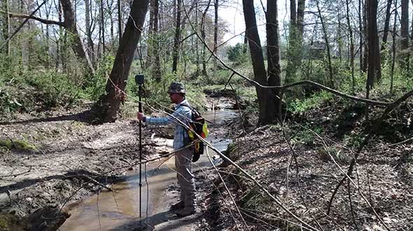
    In the project pictured above, Plumley surveyed a 50-acre farm parcel to separate out the six-acre improved northeast corner. “I located the creek, building and improvements on the property east of the road and ran the lines to the creek on the west side of the road.”

    The difficult locations on this 2016 survey were at the creeks. It took Plumley up to a half hour to locate the corners and creek points under the tree canopy.

    “It would have taken much longer than it did if I had traversed the boundary conventionally,” he said, “not to mention I would have been much more tired at the end of the day.”

    Instead, Plumley used a Javad GNSS Triumph LS and Triumph 2 base/rover system with corrections broadcast over the internet.

    “I set up the Triumph 2 base about one mile away in an open yard with great sky view. It took me one day to do the initial recon and locations, and another couple of hours to set the new corners the next day,” he said.

    Plumley has since upgraded his base receiver to another Triumph LS and added a J-Link 35-watt external radio to his toolbox.

    “One thing this and other challenging surveys have taught me is to be patient. To obtain accurate results that you can be confident in takes time.”

    About our cover

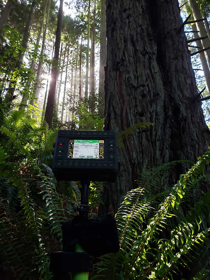
    Our cover photo this month was taken in June 2019 by surveyor Stephen Drake, near his home on the north coast of California. “These redwood forests and very rugged, remote coastal mountains can really test you,” he said. He was using his Javad Triumph-LS rover with the J-Field built-in surveying software, communicating to a Javad GNSS Triumph-2 base station attached to his house. A Verizon Jetpac mobile hotspot (in the black pack hanging below the Triumph-LS in the photo) picks up signals from his home router; the port-forwarded corrections are configured with Javad software.

    Stephen calls this his standard configuration, but finds it very flexible. When he is more than 20 miles from home base, he relies on a Triumph-2 and a radio modem placed near the site. He can also use the California Real Time Network (CRTN) with the Jetpac.

    He also relies on Javad’s Hybrid RTK, automated post-processing with Javad’s DPOS, automatically generated raw data and quality reports, and the many built-in indicators in J-Field that provide real-time feedback and “give me assurance on almost every measurement before I walk away from it,” he said.

    The efficiency that his equipment provides has made Stephen valuable even to firms that already have in-house surveyors, he said. “I honestly do not think I would be here without Javad. It has been a true potent business partner.”

    Read about another one of Stephen’s projects here.


    Check out more surveying case studies here.


    Feature image: AP Surveying PLLC

  • Tersus GNSS goes ultimate with new generation of tilt survey receiver

    Tersus GNSS goes ultimate with new generation of tilt survey receiver

    Photo: Tersus GNSS
    Photo: Tersus GNSS

    Empowered by a high-precision inertial measurement unit (IMU) on the Ultimate version, the Oscar from Tersus GNSS is a new generation of tilt survey receiver. Its calibration-free tilt compensation is immune to magnetic disturbances ­— holding the survey pole upright is no longer necessary. Powered by Tersus ExtremeRTK GNSS technology, Oscar can provide high accuracy and stable signal detection.

    The built-in high-performance antenna can speed the time to first fix (TTFF) and improves anti-jamming performance. With a Nano-SIM card, Oscar can access the internet and transmit and receive correction data through 4G/Wi-Fi. The built-in UHF radio module supports long-distance communication. A detachable smart battery can display power levels. Two batteries support up to 16 hours of fieldwork in 4G/3G/2G-network and rover-radio mode. Oscar can be configured through a 1.54-inch interactive screen on the Ultimate and Advanced versions. The IP67-rated rugged housing protects it from harsh environments.

    The Tersus Caster Service (TCS) helps surveyors set up a GNSS base station quickly to broadcast a correction stream via mobile networks. Natively supported by FieldGenius and Nuwa App, Oscar can be configured to different work modes to suit various daily jobs.

    Satellite Tracking. Oscar supports multi-constellation and multi-frequency satellite tracking, including GPS, GLONASS, BeiDou, Galileo, SBAS and QZSS.

    Accuracy. With enhanced positioning accuracy and constellation tracking, even in harsh environments, Oscar controls deviation within 3cm in surveying and mapping applications.

    Quick Fix. Oscar can fix integer ambiguity rapidly after tracking satellites and receiving correction data: 3–5 seconds in the open sky, and 10–30 seconds under canopy or near buildings.

  • Smart surveying in the Outback

    Smart surveying in the Outback

    When someone imagines the Australian outback, they’re picturing Australia’s largest state, Western Australia (WA), which occupies an entire third of the continent.

    Nearly all WA residents live in Perth, with the rest of WA reminiscent of the United States’ historic Wild West — sparsely populated towns with little infrastructure. That wild beauty and remoteness can also make surveying a less-than-beautiful experience.

    “The outback of WA is a real test on my adaptability and logistics skills,” said Phil Richards, a professional surveyor and associate director with Perth-based RM Surveys. “It can take 1.5 days to get to your first site and once there, you’re totally isolated with no resources — and climate conditions that can range from 0 to 50 degrees Celsius. The sparse, rugged road systems make navigating anywhere a long journey. And if the weather turns bad on your job and you didn’t plan well, you could be completely stranded.”

    Technological challenges that add to the complexity: limited mobile phone service, time-consuming RTK base station setups, inconsistent RTK cellular or radio communication, and geodetic control points that are difficult to access.

    Advances in precise point positioning (PPP) technology, however, have been helping to resolve these obstacles and enable surveyors to optimize their real-time productivity without sacrificing accuracy. For Richards, who specializes in remote surveying work, this modern GNSS enhancement has helped bring a little tameness to the wilds of WA, enabling him to increase data collection efficiencies, reduce costs and boost the company’s bottom line.

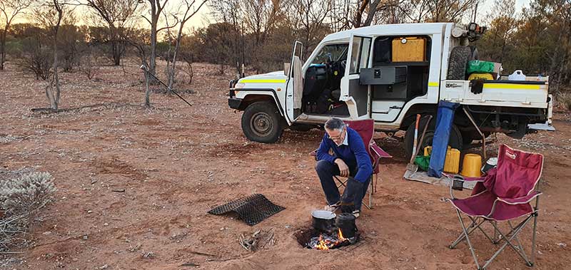
    Camp breakfast: The R10 receiver rests on a spur while Phil Richards dines out. (Photo: Trimble)
    Camp breakfast: The R10 receiver rests on a spur while Phil Richards dines out. (Photo: Trimble)

    The case for a new approach

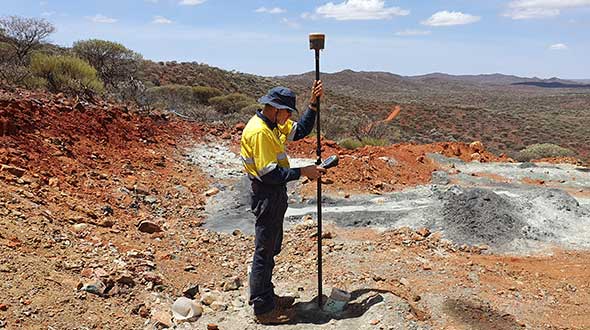
    With his aptitude for remote surveying, much of Richards’ project work in WA has been in support of heavily active mining companies. For example, for the past 15 years, one iron ore producer has contracted him to travel more than 600 kilometers from Perth to measure exploratory drill hole collars. Drill collars, the remnants of drilling activity, are 3-millimeter-thick segments of PVC, about 150 mm in diameter, which protrude about 300 mm out of the ground, typically at a 60-degree angle. Measuring the center of that above-surface collar is a crucial stage in the exploration process to enable the client to develop a geological model of the mineral resource underground.

    Managing 10 prospect sites across 300 km, the number of drill holes can vary from year to year, but there can be as many as 100 holes spread out over a few prospects at a time. Since 2007, Richards has been using Trimble R8 and, more recently, Trimble R10 GNSS receivers and RTK technology to acquire the drill-collar measurements.

    On average, each prospect is 5 km by 2 km and has its own coordinate network. Depending on the number of collars and the distance to each, Richards would set up between two and nine RTK base stations on known control points to set project control. Using his Trimble GNSS receiver, he’d either drive or walk to each drill collar, set the foot of the range pole on the center of the collar at ground level, take a reading and record the measurement in Trimble Access field software on a Trimble TSC3 controller. Although the need for multiple base stations had added hours onto the projects, the RTK method consistently provided the needed accuracy.

    X hits the spot

    In 2015, the iron ore company restructured its mineral exploration program. Rather than drill numerous exploratory holes across a few prospects, the new focus was to drill fewer holes spread over the entire project area. That was going to be problematic for Richards’ traditional RTK routine.

    “Previously, when it was predominantly surveying and less traveling, the RTK approach worked well for the project, even though setting up base stations is time consuming,” said Richards. “But when that switched to less surveying and more traveling, continuing with RTK was going to increase costs because each time I have to set up my base station, that’s an extra hour. If I have 10 drill-collar zones, that’s 10 hours. And if my base station is 10 minutes away, it adds more time and expense if I have a problem with it, or I can’t get a reliable signal, and I have to travel back to it to fix it or move it. The reduced number of collars and the increased distances between them required a more efficient method to make the project profitable.”

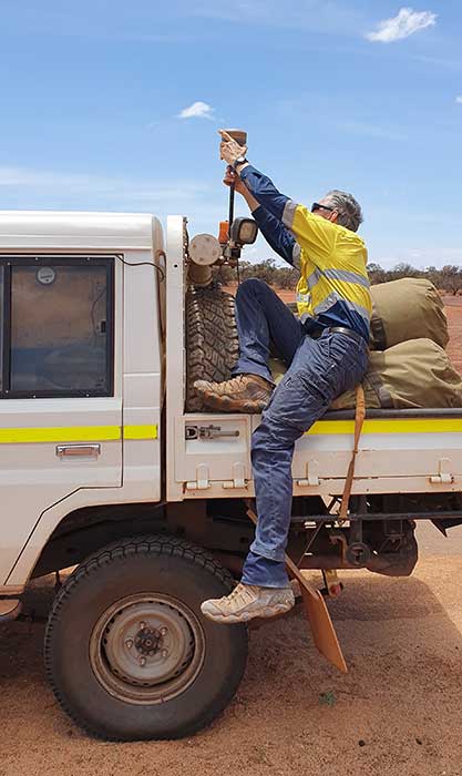
    Taking the R10 off the vehicle mount. (Photo: Trimble)
    Taking the R10 off the vehicle mount. (Photo: Trimble)

    Richards decided to test Trimble’s CenterPoint RTX correction service as an alternative. CenterPoint RTX is built on a network of GNSS tracking stations around the world that stream multi-frequency, multi-constellation data to the company’s network control centers. Advanced data processing algorithms analyze the three main error sources: satellite orbits, clock offsets and atmospheric effects, and develop models and correction data. This information is delivered to GNSS rovers via L-band satellite communications. The rover combines the correction data with its own satellite observations to produce accurate positions.

    Richards ran five trials in conjunction with varied exploration surveys at test sites across 1,000 km of terrain. He took RTX measurements of survey control points with his R10 and compared them to the same positions acquired with RTK. Although the CenterPoint RTX can take up to 15 minutes to reach sub-2-centimeter horizontal accuracy in WA, Richards said the technology regularly delivered on performance. Most importantly, this technique enabled him to work without a base station and obtain real-time GNSS positions with centimeter accuracy even in isolated WA.

    Integrating Trimble’s CenterPoint RTX into his workflows enabled Richard to use a single GNSS receiver system, much like working within the VRS networks available in the more populated areas of Australia.

    Into the Outback

    For the 2019 campaign, Richards and a colleague were contracted to acquire accurate 3D positions for 13 drill-collar holes stretched across two major prospects about 150 km apart. Their area of interest was 700 km northeast of Perth.

    Within a 15-km-wide area, they had to acquire measurements for eight drill-collar holes. They calibrated the R10 receiver to the nearest control point to tie into the site’s coordinate system and moved through the area, methodically recording the positions of each collar hole. Despite the rough terrain, they finished both prospect sites in 1.5 days, compared to 2.5 days had they used RTK.

    “Given the project format, with so much travel time and less surveying time, RTX is really the only way to do it,” Richards said. “It’s far quicker than setting up base stations — I saved 50% of the time using RTX on this campaign. I’m more efficient; I’m able to keep costs down; and I have the confidence in the system that I know I’ll deliver on accuracy. It’s hard to justify using any other method.”


    Featured photo: Trimble

  • Remembering all fixes for verification

    Remembering all fixes for verification

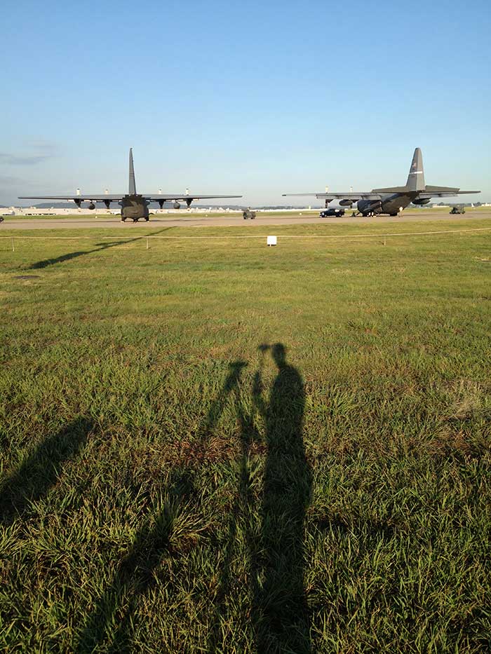
    Helping the guard: For the Kentucky Air National Guard, Sibole surveyed for paint lines on the taxiway for C-130 aircraft. (Photo: Matt Sibole)
    Helping the guard: For the Kentucky Air National Guard, Sibole surveyed for paint lines on the taxiway for C-130 aircraft. (Photo: Matt Sibole)

    Like Adam Plumley, Matt Sibole is also a solo surveyor and a Javad GNSS advocate. Based in Kentucky, Sibole tackles up to 140 jobs a year, which he would be unable to do using only a total station or a robotic station. Instead, he relies on the accuracy of GNSS.

    He particularly relies on J-Field, the Javad GNSS data-collection software. When using the software’s “Boundary Profile” feature, he can get a fix, then re-initialize and get another fix that he can then compare in real time to the previous fix.

    “J-Field keeps all fixes in memory to compare to each other, until you get a group of fixes that agree with each other to verify which fix is the correct fix,” Sibole explained. “We all know that a fix is not necessarily the ‘right’ fix. Javad’s J-Field program will give the user the confidence to know in real time that the shot is correct.”

    “J-Field also has a relative accuracy calculator built in to verify that I meet minimum standards in the field before I leave the site,” Sibole said.

  • Blue Marble releases Global Mapper Mobile v2.1 with advanced GPS support

    Image: Blue Marble
    Image: Blue Marble Geographics

    Blue Marble Geographics has released version 2.1 of its mobile mapping application Global Mapper Mobile, with updates to both the free and Pro versions.

    Global Mapper Mobile is an iOS and Android application for viewing and collecting GIS data. It utilizes the GPS capabilities of mobile devices to provide situational awareness and locational intelligence for remote mapping projects.

    A complement to the desktop version of Global Mapper, the mobile edition can display all of the supported vector, raster, and elevation data formats and offers a powerful and efficient data collection tool. The latest release includes improvements to its vector feature styling, terrain layer support, and layer transparency setting.

    For advanced field mapping functionality, the latest release of the optional Pro version (available for purchase) introduces advanced GPS support. This allows users to connect to external, high-accuracy Bluetooth GPS devices from vendors such as Bad Elf and EOS, among others, directly from Global Mapper Mobile, allowing users to access detailed information including the current satellite constellation, precise location information and the raw NMEA stream.

    “Global Mapper Mobile v2.1 brings exciting new functionality to the application, much of which was highly driven by user requests and feedback,” said Jeffrey Hatzel, senior application specialist at Blue Marble Geographics.

    Blue Marble’s GIS software is used by hundreds of thousands of satisfied customers throughout the world who need affordable, user-friendly, yet powerful GIS solutions. Users come from a wide range of industries including software, oil and gas, mining, civil engineering, surveying, and technology companies, as well as government departments and academic institutions.

    Visit the website to learn more and download Global Mapper Mobile v.2.1.

  • An overview of GPS/GNSS shows canceled or postponed because of COVID-19

    GPS/GNSS-related trade shows and conferences have been canceled or postponed because of the coronavirus pandemic. Below is an overview of these shows so far, starting with the most recent updates.


    AUVSI Xponential 2020: Virtual

    AUVSI Xponential 2020 logo

    The Association for Unmanned Vehicle Systems International (AUVSI) decided to convert AUVSI Xponential 2020 to a virtual event. It will still take place Oct. 5-8.

    Xponential 2020 was originally scheduled to take place May 4-7 at the Boston Convention and Exhibition Center. It was then rescheduled to take place Oct. 5-8 at the Kay Bailey Hutchison Convention Center in Dallas.

    “While we are disappointed to not be convening in person this year, the health and safety of Xponential exhibitors and attendees is our utmost priority,” Wynne said. “It may not look like the Xponential we are used to, but we look forward to offering attendees the opportunity to virtually network, learn from and collaborate with one another just as they have in years past.”

    Logo: ION JNC

    ION 2020 Joint Navigation Conference: Canceled

    The Institute of Navigation (ION) canceled its 2020 Joint Navigation Conference, which was scheduled to take place Sept. 8-11 in Covington, Kentucky/Cincinnati, Ohio.

    According to show organizers, the decision was made because of COVID-19 and the current U.S. Department of Defense and government travel restrictions that are limiting travel.

    ION JNC 2021 will be held June 7-10 at the Northern Kentucky Convention Center in Covington, Kentucky/Cincinnati, Ohio, with the classified session hosted at the Air Force Institute of Technology.


    Logo: ITSF Online

    ITSF 2020: Virtual

    The International Timing and Sync Forum (ITSF) is a time and synchronization conference and exhibition showcasing solutions for 4G/5G, finance, broadcast, automotive, smart grids, IoT, distributed datacenters, transport and defense. The 2020 event will be held virtually Nov. 3-5.

    “In the light of the current global situation, we are please to announce that ITSF 2020 will now be a fully virtual event — #ITSFOnline,” show organizers said.


    TU-Automotive: Virtual

    TU-Automotive will be held Aug. 18-20 in a virtual format.

    “After continuously reviewing the best ways to serve the Automotive community, we are thrilled to announce the launch of the Virtual edition of TU-Automotive Detroit, ADAS & Autonomous Vehicles, WardsAuto Interiors Conference and WardsAuto UX Conference,” show organizers said.

    The virtual event will feature keynotes, conference tracks, workshops, roundtables and working groups.


    Logo: Commercial UAV Expo Americas

    Commercial UAV Expos (America and Europe): Virtual

    Commercial UAV Expo Americas 2020 is going virtual, according to event organizer Diversified Communications. The event is slated to take place Sept. 15-17.

    “Due to ongoing health and safety concerns stemming from the COVID-19 pandemic, members of the commercial drone community we serve have made it clear that it would be impossible to hold the live event as originally planned. In the interests of ensuring our community still has an opportunity learn from and connect with each other, we have reimagined Commercial UAV Expo Americas as a fully virtual event taking place September 15-17, 2020,” said Lisa Murray, group director at Diversified Communications, organizer of Commercial UAV Expo Americas.

    Commercial UAV Expo Europe also will take place as a virtual event Dec. 1-3.

    “Due to ongoing concerns caused by the COVID-19 pandemic, and for the health and safety of the members of the commercial drone community we serve, we have made the decision to reimagine Commercial UAV Expo Europe as a fully virtual event this year which will take place as part of a hybrid live-virtual Amsterdam Drone Week 1-3 December, 2020,” Murray added.


    Logo: Intergeo 2020

    Intergeo 2020: Virtual

    Intergeo 2020, originally slated to take place Oct. 13-15 in Berlin, Germany, will now take place entirely virtually. Organizers announced in early June that the show would take place partially in person and partially virtually, but made the decision in early July to move the entire show to a digital platform.


    Logo: GEO Business

    GEO Business 2020: Postponed

    The venue and date have both been changed for GEO Business 2020. The show, organized by Diversified Communications U.K., will now take place May 19-20, 2021 at ExCel London. This event aims to connect those involved in the gathering, storing, processing and delivery of geospatial information.

    Read more about the conference here.


    5th annual FAA UAS Symposium: Virtual conference

    Logo: FAA UAS SymposiumThe Federal Aviation Administration (FAA) and the Association for Unmanned Vehicle Systems International (AUVSI) will host the 5th annual FAA UAS Symposium virtually, rather than in-person in Baltimore. The event will take place June 16-18.

    The FAA and AUVSI also will be hosting a series of virtual events that will address the content already planned for this year’s program. The fist will take place in early summer and will focus on UTM and international UAS integration. The second will take place in late summer with a focus on updates to the Integration Pilot Program and public safety operations.

    Learn more about the show here.


    AUVSI Xponential: Postponed

    AUVSI Xponential 2020 logoThe AUVSI Xponential trade show, originally scheduled to take place May 4-7 in Boston, has been rescheduled to take place Oct. 5-8 in Dallas.

    Because of the rescheduled conference, AUVSI will be hosting Xponential Virtual Sessions, a week-long webinar series, May 4-8. Find out how you can participate here.

    Read more about the conference here.


    Logo: Trimble Dimensions 2020

    Trimble Dimensions 2020: Canceled

    Trimble Dimensions 2020, which was scheduled to take place Nov. 2-4 at the Gaylord Opryland Resort and Convention Center in Nashville, Tennessee, has been canceled.

    “Unfortunately, the overwhelming concerns and ongoing impact of COVID-19 inhibit our ability to deliver a conference that meets the high standards of safety and excellence our attendees expect and deserve,” Trimble said in a press release.

    Read more about the show here.


    Logo: IAC 2020

    International Astronautical Congress 2020: Virtual conference

    The 71st International Astronautical Congress (IAC): The CyberSpace Edition will take place virtually Oct. 12-14. The show, originally scheduled to take place in Dubai, brings together stakeholders from space agencies and institutions around the world to exchange information and ideas, share developments and advancements, and swap insights and rising trends.

    According to show organizers, the IAC is a one-of-a-kind assemblage, unmatched in scale and in scope, unequalled in its reach and its attendance.

    Read more about the virtual conference here.


    Esri User Conference: Virtual conference

    Logo: Esri

    The Esri User Conference, which typically takes place every July in San Diego, will be held virtually July 13-15. The plenary session, technical workshops and Esri Showcase will be virtual, featuring demonstrations and live discussions during the conference.

    Read more about the virtual conference here.


    AIxSPACE: Postponed

    AIxSPACE will now be taking place Nov. 2 in Montreal, Québec, Canada. According to show organizers, AIxSPACE brings together stakeholders in space and artificial intelligence industries to allow everyone to obtain concrete information on these markets and connect with potential business partners.

    Read more about the conference here.


    ENC logo

    European Navigation Conference: Postponed

    The European Navigation Conference has been rescheduled to take place Nov. 22-25 at the Maritim Hotel & Internationales Congress Center in Dresden, Germany. The conference, hosted by the German Society for Positioning and Navigation, brings together scientists, engineers and international experts to discuss new ideas, latest research results, future developments and new applications.

    Read more about the conference here.


    Connected & Autonomous Vehicles Conference: Postponed

    The Connected & Autonomous Vehicles Conference has been postponed and will now be taking place Aug. 10-13 at the San Jose Convention Center in California. The conference aims to highlight the latest automotive industry developments, as well as allow participants to engage with experts and form strategic alliances.

    Read more about the conference here.


    Logo: ION

    ION Joint Navigation Conference: Postponed

    The Institute of Navigation’s (ION) Joint Navigation Conference (JNC) has been rescheduled for Sept. 8-11 at the Northern Kentucky Convention Center. JNC is a U.S. military positioning, navigation and timing conference with joint service and government participation. According to ION, the rescheduled conference will host the original program, which was scheduled to take place in June.

    Read more about the conference here.


    36th Space Symposium: Postponed

    The 36th Space Symposium will now take place Oct. 31 to Nov. 2 at The Broadmoor in Colorado Springs. According to the Space Foundation, the 36th Space Symposium will gather leaders, innovators and entrepreneurs from the civil, commercial, military, research and international sectors to share, explore and partner on efforts that will impact our lives beyond Earth and upon it.

    Read more about the conference here.


    IEEE/ION PLANS Conference: Canceled

    The IEEE/ION PLANS Conference, originally scheduled to take place April 20-23 in Portland, Oregon, was canceled.

    Read more about the cancellation here.


    Munich Satellite Navigation Summit: Canceled

    Logo: Munich Satellite Navigation Summit

    The Munich Satellite Navigation Summit, originally scheduled to take place March 16-18, was canceled.

    “In light of the current situation caused by the coronavirus as well as related travel restrictions and resulting cancellations we unfortunately are forced to cancel the Munich Satellite Navigation Summit 2020 as we are no longer able to provide a well-ordered and appropriate program,” show organizers said in a press release.

    Read more about the cancellation here.


    Logo: Mobile World Congress 2020

    Mobile World Congress: Canceled

    Mobile World Congress, which was slated to take place Feb. 24-27 in Barcelona, Spain, was canceled.

    “With due regard to the safe and healthy environment in Barcelona and the host country today, the GSMA has cancelled MWC Barcelona 2020 because the global concern regarding the coronavirus outbreak, travel concern and other circumstances, make it impossible for the GSMA to hold the event,” said GSMA CEO John Hoffman in a statement.

    Read more about the cancellation here.


    Read more of GPS World‘s coronavirus coverage here.


    Featured image: rclassenlayouts/iStock / Getty Images Plus/Getty Images

  • Surveying switchbacks in the Northern California mountains

    Surveying switchbacks in the Northern California mountains

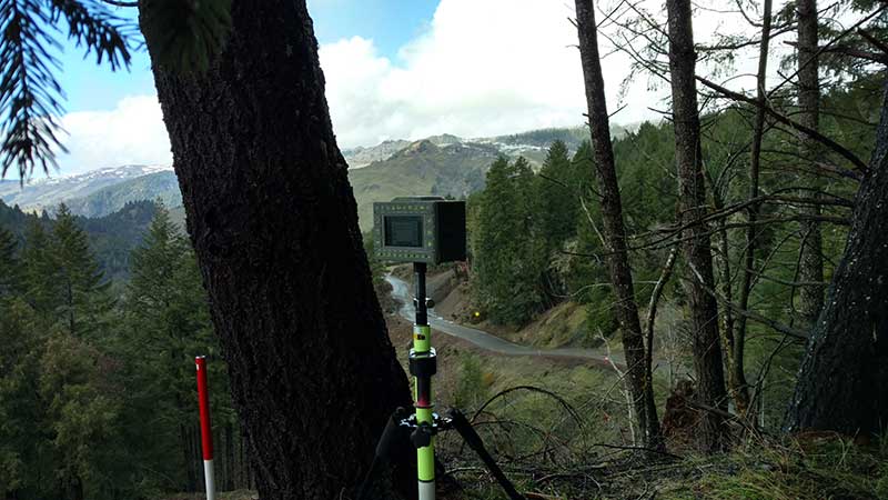
    Up to the challenge: In a nine-month project, Drake’s team used a Triumph-LS for slope-staking along a four-mile stretch of California’s SR 36 near Dinsmore. The federal project will realign and improve the deadly switchback single-lane curves of the mountain pass. (Photo: Stephen Drake)

    Up to the challenge: In a nine-month project, Drake’s team used a Triumph-LS for slope-staking along a four-mile stretch of California’s SR 36 near Dinsmore. The federal project will realign and improve the deadly switchback single-lane curves of the mountain pass. (Photo: Stephen Drake)

    In the mountains of Northern California, a dangerously twisting stretch of road — the site of numerous fatal accidents — is being widened and realigned. Because it passes through the Six Rivers National Forest, the Highway 36 project is managed by the Federal Highway Administration (FHWA) in partnership with Caltrans.

    Surveyor Stephen Drake and his wife and business partner Mary Drake are using the Javad GNSS Triumph-LS to tackle the tricky assignment.

    “We started this job in June 2017 shortly after founding Lost Coast Land Surveying,” Stephen explained.

    “We ran slope staking and culvert cross-section/staking through about March 2018. We returned off and on to do topo mapping in areas that had landslides and other control surveys to support Mercer-Fraser [the construction contractor] grade-checking crews. We provided the control they calibrated their GPS systems to, based on the control we received from FHWA and Caltrans.”

    Because of various troubles, such as landslides, the project is still a season from finishing, though the Drakes’ contribution is mostly complete.

    The Drakes had tackled similar jobs, including on the Chiniak Highway near Kodiak, Alaska. Still, the task was daunting. The surveyors had to set catch points every 50 feet for four miles on both sides of the highway, 200 feet upslope and 100 feet downslope. “I have learned that the way to the end is one stake at a time, start, and keep going,” Stephen said.

    The couple had to juggle home life with three boys with long days at the job site. Sometimes Mary had to remain home. “Usually I tried to hit more moderate slopes on those days,” Stephen said. “We bounced around the project a bit, some days only covering a 250-foot stretch because it was slow going scaling the slopes.”

    The FHWA contracting officer, a veteran Federal Highways engineer, marveled at the efficiency of the modern surveying methods used by the Drakes, telling Stephen that two six-man crews used to be needed to accomplish what the couple could today.

    “I will attribute a huge part of our efficiency to the Triumph-LS advantage,” Drake said, as well as the couple’s 20-year track record in environments as diverse as the Arctic, the Everglades and Arizona.

    “During the course of the project we received a lot of comments from ‘I don’t know how you are doing this’ to ‘You are superhuman’ at one point,” Stephen said. “But it is just being tough, tenacious and Javad.”

    All told, the surveyors set more than 2,000 stakes. “We got the toughest part of the job going for them,” Stephen said.

  • Cesium adds global layer of 3D buildings

    Cesium adds global layer of 3D buildings

    Cesium users now have access to Cesium OSM Buildings, a global base layer of more than 350 million 3D buildings.

    Cesium OSM Buildings expands the suite of Cesium Global Base Layers including worldwide terrain, aerial imagery and streetmaps already available on Cesium ion.

    “As digital twins and urban mapping gain momentum in 3D geospatial, we are excited to offer a global layer of 3D buildings that can be easily visualized, styled and analyzed in an efficient and interoperable manner using 3D Tiles,” said Cesium CEO Patrick Cozzi. “Cesium OSM Buildings will help geospatial developers innovate by giving urban context to 3D applications for a broad range of use cases.”


    Take a tour of Cesium OSM Buildings.


    Cesium OSM Buildings are built for efficient visualization and are streamable to any device thanks to 3D Tiles, the OGC open standard developed by Cesium to stream massive 3D geospatial datasets. Adherence to open standards means the buildings can be used in any compatible viewer, including Cesium’s free open-source offering, CesiumJS.

    Seattle's Space Needle. (Image: Cesium)
    Seattle’s Space Needle. (Image: Cesium)

    “Cesium OSM Buildings will be useful for everyone from builders sharing planned construction projects, to government agencies seeking tools for planning, training, and simulation,” said Kevin Ring, lead developer on the project.

    Cesium OSM Buildings are derived from OpenStreetMap, a community-driven mapping project that welcomes anyone to improve the dataset. Buildings are also regularly updated, firmly clamped to terrain, and are individually selectable and styleable.

    “Thanks to the OpenStreetMap project, most cities contain rich metadata that is useful for on-the-fly styling, like highlighting hospitals in a certain color or filtering buildings by the year they were constructed,” Ring said.

    Cesium OSM Buildings is included in every Cesium ion subscription.

    Cesium is a complete platform that makes the world’s ever-growing collection of real-world 3D data more useful and accessible by enabling the creation of applications that visualize, analyze and share this data – all from your browser.

    Rooted in the aerospace industry, Cesium was built to track satellites orbiting the Earth with sub-millimeter accuracy. Cesium continues to aggressively develop and enhance the platform for a range of customers in government agencies, startups and Fortune 500 companies alike.