Blog

  • Everest survey succeeds with Trimble GNSS

    Everest survey succeeds with Trimble GNSS

    The Government of Nepal has completed fieldwork for measuring Everest’s height using GNSS equipment from Trimble, including the robust R10 receiver.

    The Survey Department of the Government of Nepal has completed fieldwork for the National Initiative for the Measurement of the Height of Sagarmatha (Mount Everest). The Nepali survey team summited at 3 (local time) May 22, 2019 (by the Nepali calendar, that’s २०७६ जेठ ८, or June 8, 2076).

    The summit team of Chief Survey Officer Khim Lal Gautam and Survey Officer Rabin Karki was supported by mountain guide Tshiring Jangbu and two of his fellow Sherpas.

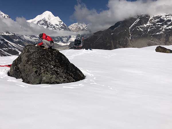
    The ascent was dark, windy and treacherous — the team had to make optimal use of the limited time that the hazardous conditions and their oxygen supplies afforded. The primary surveying task was to collect GNSS observations with the Trimble R10 GNSS receiver they carried.
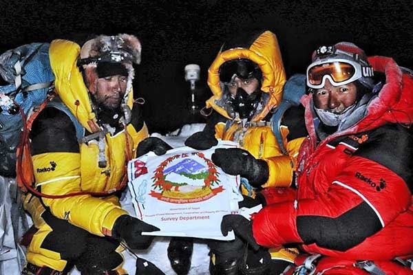
    On the summit: Chief Officer Khim Lal Gautam, Survey Officer Rabin Karki, Sherpa Tshiring Jangbu, and the Trimble R10. (Photo: Trimble)
    On the summit: Chief Officer Khim Lal Gautam, Survey Officer Rabin Karki, Sherpa Tshiring Jangbu, and the Trimble R10. (Photo: Trimble)

    Due to the limited time window on the summit, they had essentially one shot at the GNSS observations. The R10 was configured to begin collecting observations on power-up. During training and test observations before the ascent, the R10 had proven to be exceptionally reliable, with no malfunctions.

    Compact size, light weight and durability were important factors for the receiver chosen for the summit observations. The IP67-rated R10 with internal battery weighs 1.12 kg (2.5 lb.) and operates in a temperature range of –40° C to +65° C (–40°F to +149° F). Its solid alloy housing withstands a 1-meter drop. The only concern for the team on the final ascent was to keep the battery and spares warm.

    The R10 recorded 1 hour and 16 minutes of GNSS observations. The static data (observations from GPS, GLONASS, Galileo and BeiDou) was post-processed using Trimble Business Center software together with observations from eight GNSS reference stations established as an active control network for the survey. Several of the reference stations were Trimble NetR9 network receivers with Zephyr Geodetic antennas.

    The team also used a compact ground penetrating radar (GPR) instrument to determine the distance between the top of the ice/snow cap on the summit and the highest point of solid rock beneath.

    Many of the successive accepted heights for Everest have been to the top of the ice cap, which can vary seasonally by several meters. A goal of the survey is to provide heights for both aspects of the peak. An additional reason to establish a new height for Everest is to determine whether, and by how much, the 2015 earthquakes in the region altered the mountain.
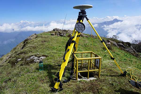
    Photo: Trimble
    Photo: Trimble

    While the Nepalese survey team’s GNSS observations on the summit will yield the height, the final orthometric elevation will be achieved by applying an updated gravity model. The gravity model was refined from supporting surveys on the mountain and surrounding region.

    A total of 298 new gravity observations were performed over several years, with companion GNSS observations on each control point. More than 248 kilometers of precise leveling, supplemented with trigonometric leveling, was performed for the network of control and base receiver locations. Instruments employed for these terrestrial surveys included Trimble DiNi levels and S9 total stations.

    Trimble GPS/GNSS instruments have been to the Sagarmatha summit on multiple occasions, including in 1990, 1998, 2005 and 2012. The R10 represents the lightest and most compact of these to date.

    By prior agreement between Nepal and China, the results of the 2019 Nepali survey, and a May 2020 Chinese survey, will be jointly announced. Official results are expected this summer.


    Featured photo: A GNSS reference station network was established before the survey to provide data for post processing, and to support additional surveying and geophysical studies of the region. (Photo: Trimble)
  • UrsaNav installs eLoran testbed in South Korea

    UrsaNav installs eLoran testbed in South Korea

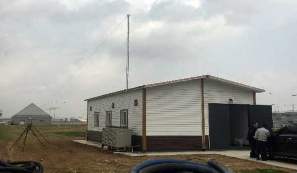
    The eLoran transmission site at Incheon, South Korea. (Photo: UrsaNav)
    The eLoran transmission site at Incheon, South Korea. (Photo: UrsaNav)

    South Korean is in the early stages of evaluating its eLoran system, but great results are expected based on the UrsaNav-supplied station in Incheon.

    In August 2018, the Korea Research Institute of Ships and Oceans Engineering (KRISO) awarded UrsaNav, through its agent Dong Kang M-Tech, a contract to supply and install an eLoran transmitter testbed system in South Korea. UrsaNav is the exclusive, worldwide distributor of Nautel’s NL Series transmitters, provided eLoran transmitter technology, as well as timing, control and differential reference station equipment for the testbed. The contract represented the first phase in a broader program to upgrade Korea’s Loran-C stations to be the foundation of a sovereign Enhanced Loran (eLoran) positioning, navigation and timing (PNT) service.

    “The Republic of Korea recognizes the challenges associated with relying solely on space-based signals, the relative ease with which those signals can be jammed or spoofed, and the necessity to provide trusted time and trusted position to its citizens and critical national infrastructure,” said Charles Schue, CEO of UrsaNav.

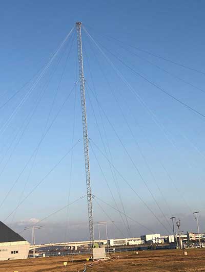
    The 35-meter eLoran transmit antenna in Incheon. (Photo: UrsaNav)
    The 35-meter eLoran transmit antenna in Incheon. (Photo: UrsaNav)

    Many critical infrastructure sectors rely on accurate time and position, including maritime, aviation, electrical distribution, telecommunications, finance/banking, and digital broadcast. A complementary PNT (CPNT) service provides continuity of operations through alternative and diverse timing and positioning information. CPNT is a vital element in ensuring national security and assuring trusted time and position.

    KRISO, in conjunction with the Korea Ministry of Oceans and Fisheries (MOF), is developing an Initial Operating Capability eLoran system to provide complementary PNT services as a part of its Electronic Navigation (E-Navigation) mission. KRISO selected UrsaNav Inc. as its prime eLoran systems contractor through a competitive tender offer.

    UrsaNav provided, installed and tested an eLoran transmission system at a temporary location near Incheon, South Korea, in November 2019. The company also provided ancillary equipment for Additional Secondary Factor (ASF) map measurements and map-generation software, as well as differential reference station equipment to KRISO. Because of land size restrictions at the temporary site at Incheon, the eLoran transmission system was paired to a small footprint 35-meter top-loaded monopole antenna.

    In addition to the equipment provided by UrsaNav, MOF separately contracted a local Korean firm to provide an interim GPS receiver set to synchronize the existing Loran-C sites at Pohang and Kwangju to UTC.

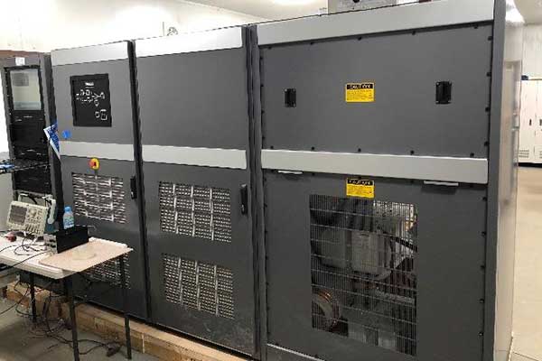
    UN-1300 eLoran transmission equipment. (Photo: UrsaNav)
    UN-1300 eLoran transmission equipment. (Photo: UrsaNav)

    KRISO is in the early stages of measuring the performance of the Korea eLoran system, but results are expected to show better than 20-meter navigational accuracy within 30 kilometers of the differential reference station at the port of Pyeongtaek.

    Once the eLoran performance has been proven, MOF plans to move the Incheon eLoran equipment to a permanent site, potentially on the island of Socheongdo, and pair it with a larger “Tee” antenna to increase the output power and coverage area of the system.

    MOF also plans to upgrade the existing UTC synchronized Loran-C transmission sites at Pohang and Kwangju with new eLoran transmission equipment systems. The ministry will potentially add two additional transmission sites to provide complete coverage of the land and territorial waters of South Korea.

  • DHS on the mark with PNT report, industry says

    DHS on the mark with PNT report, industry says

    DHS report cover
    DHS report cover

    The U.S. Department of Homeland Security “did exactly what was required by Congress” in issuing its report in June on positioning, navigation and timing (PNT), according to a letter sent by numerous PNT companies to the DHS.

    The July 17 letter to Chad F. Wolf, acting secretary of Homeland Security, refutes a previous letter from Congressional representatives that the report contained numerous errors and failed to address many of the things Congress had required.

    “We believe that some key claims made in the members’ letter of June 9 are either exaggerated, irrelevant to the report’s Congressional tasking, or simply wrong,” states the July 17 letter, which is signed by senior executives of Satelles, Orolia, Iridium, Navsys, Jackson Labs, Seven Solutions and Qulsar.

    The group takes on the claims of the representatives point by point, finding them exaggerated, irrelevant or incorrect.

    For instance, the letter critical of the DHS report states:

    “The report focuses on the needs of ‘industry’ largely ignoring the needs and impacts on public services (including first responders), government operations, and individual citizens.”

    In response, the industry representatives state:

    “The focus of the report, as directed by the NDAA, is on the requirements of the owners and operators of national critical infrastructure. This includes “public services, government operations,” and its beneficiaries, “individual citizens.” To the extent that the report focuses on incentivizing the industry, it is in order for it to be able to meet these requirements.

    “While the report only highlights PNT use cases from a subset of the 16 critical infrastructure sectors, their pragmatic recommendations address a range of requirements across all sectors. With respect to PNT needs for backing up GPS, DHS acknowledges the differences between and commonalities among the sectors and offers exceptional guidance for leveraging the capabilities of diverse forms of commercially available alternative PNT rather than endorsing a single, anti-competitive, government-imposed solution.”

    Read the full text of the industry letter here.

    logos

  • UP42 partners with Vultus for precision ag solutions

    UP42 partners with Vultus for precision ag solutions

    Photo: UP42
    Photo: UP42

    UP42 has partnered with Vultus, which specializes in precision farming technologies.

    According to UP42, its customers can now use Vultus Fertilization Zoning Maps algorithms to fine-tune crop management — with more agricultural technologies coming soon.

    Founded in 2016 in Lund, Sweden, Vultus AB provides a geospatial infrastructure for precision farming. Vultus analyzes Earth observation satellite data with advanced artificial intelligence algorithms to give farmers insights into the health of crops within small sections of their fields, enabling them to apply fertilizers variably across the field.

    “Growers reduce nitrogen-based fertilizer use by up to one third while increasing yield by three to five percent with the Vultus technology,” said Robert Schmitt, Vultus CEO. “This results in lower operating costs and significantly less environmental harm.”

    Fertilization Zoning Maps — the first in a series of proprietary algorithms Vultus brings to UP42 as a partner — shows farmers which parts of their fields need more or less fertilizer. Fertilization Zoning Maps divide fields into five zones that are classified according to the variable fertilization rate the soil requires, Vultus said.

    By partnering with Vultus, UP42 also brings precision farming technologies to the users of its geospatial developer platform and marketplace for Earth observation data and analytics. With the addition of Vultus technologies, UP42 customers can now pick and choose combinations of data and processing algorithms for their area of interest and retrieve results on a single scalable platform.

    “We’re very happy to announce a new partnership with Vultus, an emerging leader in the agritech industry,” said Sean Wiid, UP42 CEO. “Our partnership is a key step towards providing UP42 users with a simplified way of building precision agriculture solutions. We look forward to launching new capabilities and supporting the agritech industry together.”

  • FCC’s Ligado decision broadens, deepens opposition

    FCC’s Ligado decision broadens, deepens opposition

    U.S. Capitol Building. (Photo: RNTF)
    U.S. Capitol Building. (Photo: RNTF)

    Last week, 27 members of the U.S. House Agriculture Committee sent a letter to Federal Communications Commission (FCC) Chairman Ajit Pai. In it, they urged him to reconsider the FCC’s decision to allow Ligado Networks to operate a terrestrial nationwide network that the executive branch says will cause harmful interference to GPS signals for many users.

    This concern and opposition from a sector not traditionally engaged in GPS or positioning, navigation and timing (PNT) issues is just one example of how the FCC’s decision — rather than putting the issue to rest — has instead recruited a whole new set of actors from across multiple sectors for the opposition.

    Many observers don’t see this as surprising.

    According to one observer, previously it was easy for many to assume the FCC would reject Ligado’s proposal. The entire executive branch had been vehemently opposed for years. So had aviation groups, the weather community, geospatial interests and some satellite communications concerns. With such opposition from so many important quarters, it was reasonable for many to assume they need not become involved. Now that the FCC has acted to the contrary, these interests have become well energized.

    The FCC decision also empowered opponents to educate and recruit others who don’t normally think or worry about GPS and PNT issues, folks like farmers and agricultural interests.

    As one insider said, “The existing opposition can now go to just about anyone in any sector and say, ‘This is going to happen and it will harm your operation. There are no ifs, ands, or buts. The FCC has decided’.”

    Photo: Avalon_Studio/E+/Getty Images
    Photo: Avalon_Studio/E+/Getty Images

    Agriculture’s reliance on GPS

    Agriculture is a good example. While not the sector that first springs to mind when most people think about GPS, farming has become dependent on augmented GPS for precisely and automatically driving machinery, minimizing fertilizer and pesticide use, and a wide variety of other productivity gains over pre-GPS operations.

    As last week’s letter signed by the 27 members of Congress pointed out:

    “GPS is critically important to the commercial agriculture, mining, forestry and rural manufacturing industries. In fact, GPS has become the single most significant technological advancement for American farm equipment in the past two decades… [A 2019 RTI study] found that during planting season, if GPS were interrupted, the economic impact to the agriculture sector could amount to losses of $15 billion due to lower crop yields. Moreover, an earlier study suggested GPS-enabled precision agriculture could save farmers an estimated 10 to 15 percent in operating costs and purchased inputs. This same study estimated the benefits of GPS to precision agriculture between $10 and $17 billion.”

    Department of Transportation studies have shown that high-precision GPS receivers, such as those used in agriculture, could be impacted within 3,000 meters of a Ligado transmitters. With tens of thousands of transmitters deployed in a nationwide network, this could pose a real problem for American farming.

    Other sectors have also become involved in the opposition. The recently formed Keep GPS Working Coalition has members representing aviation, surface transportation, maritime, agriculture and equipment manufacturing.

    This formal and public coalition, though, seems to be just the tip of the opposition iceberg.

    Almost 100 dissenting organizations

    According to some involved with protesting the FCC’s decision, there are nearly a hundred organizations and companies that are working in some way to have it overturned. These include multiple aviation, delivery service, agriculture, surface transportation, geospatial, weather, maritime, space and technology interests.

    One sign of the influence they are having is an increase in concerns being expressed by members of Congress.

    In addition to the agriculture letter, some of the most powerful recent examples are statements made during meetings of the influential House Committee on Appropriations. Rep. Ken Calvert (R-CA), ranking member of the Defense Appropriations subcommittee, spoke at length in opposition to the FCC’s action. His comments were followed in a similar vein by the vice chair of the Appropriations Committee, Rep. Peter Aguilar (D-CA).

    Many of the questions being asked by the public and members of Congress alike were reflected in the letter from the Agriculture Committee members:

    • How did the FCC know that “its” tests were representative and valid?
    • Why does the FCC find that some degradation of GPS reception is acceptable?
    • Why did the FCC reject the executive branch’s testing criteria?
    • Was there a cost/benefit analysis?

    The letter also asked the question that is on almost everyone’s mind: If and when there are problems, who is going to fix them?

  • Real-time interference detection by GIDAS makes satnav safer

    Real-time interference detection by GIDAS makes satnav safer

    It is estimated that there are currently the same number of satnav receivers on Earth as there are people. (Image: ESA)
    It is estimated that there are currently the same number of satnav receivers on Earth as there are people. (Image: ESA)

    News from the European Space Agency (ESA)

    A new monitoring system developed through an ESA-backed project works like a bodyguard for satellite navigation in use at strategic or safety-critical sites. Known as GIDAS, the scalable system immediately detects, identifies and pinpoints satnav interference sources in its vicinity.

    It is estimated that there are currently the same number of satnav receivers on Earth as there are people. Positioning, navigation and timing signals from space-based constellations such as Galileo and GPS form an invisible, essential infrastructure, underpinning numerous modern aspects of modern life: communications, power and transportation.

    Satellite navigation helps guide a growing number of aircraft, boats, trains and autonomous vehicles. Meanwhile satnav-based time stamps authentic multi-billion euro financial transactions, and coordinate the synchronised running of power grids. Satellite navigation is always on, available everywhere on Earth, so it is easy to take its availability for granted. But as crucial as these signals from space are, they are also vulnerable to ground-based interference.

    “It’s simply a matter of output power,” said Andreas Lesch of Austria-based OHB Digital Solutions. “A navigation signal on the ground is equivalent to the light from a 60-watt lamp aboard a satellite, some 23,222 km away in space in the case of Galileo. So these faint signals can be jammed by more powerful local radio signals, either accidentally or deliberately, or even misleading fake navigation signals, known as spoofing.”

    “Our new GNSS Interference Detection and Analysis System, GIDAS, is designed to safeguard critical infrastructure against jamming or spoofing, by performing continuous monitoring of key signal bands. By doing so, GIDAS can raise the alarm in real time, identify the type of interference then pinpoint the location of these dangerous portable devices causing the interference so the authorities can take immediate remedial action.”

    GIDAS can provide interference detection and directionality with a single reporting station, although a minimum of three stations are required for pinpointing interference sources, linked to an overall monitoring center. Monitoring centers can also be connected together, making the GIDAS system easily scalable, from safeguarding an individual harbour, airport or system critical site up to an entire city or region.

    GIDAS can provide interference detection and directionality with a single reporting station, although a minimum of three stations are required for pinpointing interference sources, linked to an overall monitoring center. (Photo: ESA)
    GIDAS can provide interference detection and directionality with a single reporting station, although a minimum of three stations are required for pinpointing interference sources, linked to an overall monitoring center. (Photo: ESA)

    “People are only now catching up to the seriousness of this problem,” adds Andreas. “Surveys of the highest-density parts of Europe surveys report around three to four jammers hourly.

    “These small devices are technically illegal but are easily available online for a few hundred euros or less, often marketed as personal privacy devices. Jammers are sold as having a range of only a few metres, but can turn out to have a practical range of dozens of metres or more — leading to unintentionally widespread interference, like the famous jammer-equipped U.S. truck driver who shut down Newark Airport navigation systems whenever he drove past.

    “Spoofing is more serious still, with a strong criminal element, where false satellite navigation signals replace real ones, to mislead receivers about their position, employed in the past to down put drones or divert boats.

    “Working in this field for eight to nine years, we have seen a strong growth in interference, even as GNSS becomes ever more crucial. With our passion for GNSS and signal processing, we decided to something practical to combat this development, delivering rapid detection, classification and localisation of interference to our customers.”

    GIDAS was developed by OHB Digital Solutions and Joanneum University through ESA’s Navigation Innovation and Support Programme (NAVISP), working with European industry and academia to develop innovative navigation technology.

    “The company initiated the project through NAVISP’s second element, focused on strengthening European competitiveness in the navigation arena, proceeding on a co-funded basis,” said engineer Thomas Burger, overseeing GIDAS project for ESA. “The plan was to enable a commercially attractive business to get started, and I’m happy to say we made it.”

    “Considering the budget, the project had a wide scope, including the development of a multi-constellation GNSS receiver with all processing stages, an extended digital front end for jamming and spoofing detection, processing blocks transferred to a parallel processor based on a customised fully programmable gate array.

    “And that was only one ingredient of the overall GIDAS system, also including the actual interference detection machinery, the interference locating subsystem, and all the communication, database, and graphical user interface elements needed to create a distributed, human-usable system — which is able to go on working autonomously, only asking for human involvement when events are detected.”

    Now that its two-year NAVISP project has concluded, GIDAS is now being rolled out to several Europe-based governmental and private sector customers.

  • MyGalileoDrone competition seeks UAV innovations

    MyGalileoDrone competition seeks UAV innovations

    The European GNSS Agency (GSA) has launched the MyGalileoDrone competition.

    The contest targets the design and development of drone-based applications or services, using a Galileo-enabled receiver, to address the European Union’s (EU’s) key priorities such as the Green Deal, and support the EU Recovery Plan for Europe.

    Initial ideas should be submitted by Aug. 31. Wide participation from all EU Member States is expected.

    According to ESA, the MyGalileoDrone competition seeks to tap into the EU’s innovative spirit to deliver applications and services to boost Europe’s competitiveness, resilience and sustainability. Applications should leverage and demonstrate Galileo’s added value, such as increased accuracy, availability and robustness of position, as well as integrity for a solution based on drone operations.

    Drones applications

    Photo: © GSA
    Photo: ©GSA

    The market related to drone applications and services is growing rapidly, and European drone service revenues are expected to reach EUR 250 million by 2025. The European demand is estimated to reach EUR 10 billion annually, in nominal terms, to 2035 and over EUR 15 billion annually to 2050, creating more than 100,000 jobs.

    With GNSS receivers implemented on almost all new commercial drones, Galileo’s and EGNOS’ added value is pivotal for the development and growth of drone services and applications.
    In addition to designing and developing the application, contestants should prepare their drone- based application or service for commercial launch.

    The solution should leverage Galileo to provide a position fix. The use of EGNSS is understood in the broad sense, and Galileo can be integrated in the flying platform, the ground control station, or in other devices supporting the operation, such as a smartphone or even in the frame of U-Space services.

    “GNSS is a key enabling technology in this segment, ensuring robust navigation and reliability for a wide range of applications. The MyGalileoDrone competition aims to bring oxygen to European SMEs and entrepreneurs driving innovation. It will create jobs and growth in this promising market,” said Pascal Claudel, acting executive director at the GSA.

    Focus on EU priorities

    In times of post-COVID recovery focus, submissions should target applications and services that support key EU priorities, but the sky’s the limit. The GSA is looking for trailblazing ideas in applications such as smart mobility, sustainable agriculture or environmental protection, or solutions that exploit synergies between 5G and space data, or support the internet of things, or whatever might be the next big thing.

    Deadlines and Prizes

    The first prize in the MyGalileoDrone competition amounts to EUR 100,000, with EUR 60,000 for second, EUR 40,000 for third, and a fourth prize of EUR 30,000.

    After Aug. 31, projects selected to advance to the development phase of the contest will be announced on Sept. 15. Participants will  have until Nov. 30 to develop a demo version of their proposed application or service.

    In the finals, the selected teams will perform a live demonstration and pitch their ideas to investors. During the development process, the applicants will receive mentoring and coaching from recognized experts in the drone market. These experts will accompany them as they build their application, develop tests and get ready from the business perspective to attract investors and move to market.

    To register or for more information, visit the competition page on the GSA website.

  • Hitec Commercial Solutions expands with aerial services

    Hitec Commercial Solutions expands with aerial services

    Hitec-drone-services logoHitec Commercial Solutions has opened an aerial service division, named Hitec Commercial Drone Services.

    Hitec Commercial Drone Services expects to provide training, precision aerial missions and comprehensive data collection to a variety of industries, including
    agriculture, construction, excavation, mining and aggregates, oil and gas, engineering and surveying, public safety and many other vertical sectors. Hitec maintains a fleet of unmanned vehicles. It offers proprietary mission-control software and data and photogrammetry collection techniques with its comprehensive unmanned aviation experience.

    The new division’s field services director is Jim Bonnardel, an innovative entrepreneur with a history steeped in unmanned flight. Bonnardel established his own successful business in 1982, providing aerial services to business-to-business entities. His inventive nature and extensive flying prowess led him to become a certified and insured UAS service pilot and instructor.

    Bonnardel has logged more than 1,750 precision mapping missions, inspected 2,000 utility structures, and flown more than 2,500 commercial and residential property shoots, as well as dozens of missions for creative projects involving both television and music videos.

    He is also an instructor at Grossmont College in El Cajon, California. He has provided 850 hours of commercial instruction, as well as 550 hours of instructional field training and vetting for utility inspection crews. As a result of his training experience, Jim has issued 150 sUAS Utility Training Certificates.

  • UAV Navigation launches compact autopilot VECTOR-400

    UAV Navigation launches compact autopilot VECTOR-400

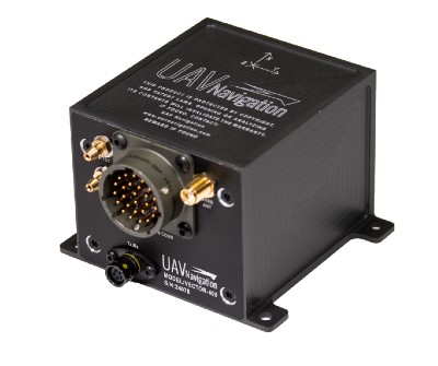
    Photo: UAV Navigation
    Photo: UAV Navigation

    UAV Navigation has launched the VECTOR-400, a compact autopilot designed specifically for unmanned aerial targets (UAT). It features a robust enclosure and a military-grade connector designed to withstand the harshest environments, in accordance with MIL-STD 810 and MIL-STD 461.

    “We wanted to develop a solution specifically for manufacturers of aerial targets,” said Tobias Webster, managing director of UAV Navigation. “That is why it was important for the autopilot to have the features required by this kind of UAV, such as sea-skimming (extremely low-level flight) or the capability to navigate without a GNSS signal.”

    Thanks to its physical and logical redundancy, the VECTOR-400 is able to continue a mission in case of individual sensor failure and even when subject to jamming, maintaining accurate estimations of attitude and position. It features advanced algorithms for stall prevention and the ability to carry out an efficient gliding maneuver in case of engine failure.

    The VECTOR-400 uses an air data attitude and heading reference system (ADAHRS) and inertial navigation system (INS) developed by UAV Navigation, which provides high precision attitude information and which allows reliable navigation even under the most demanding circumstances.

    The ADAHRS gives the VECTOR-400 the capability to operate in GNSS-denied environments (less than 30 m/min drift) and also to execute highly dynamic maneuvers.

    “The VECTOR-400 is not a product in isolation, rather it forms part of our global strategy. Some of its main features, such as the execution of completely automatic functions or its compact and easy to integrate software, which also allow it to be operated in case of data-link failure, are already used in other products in our autopilot family, such as the VECTOR-600” explained Webster.

    In addition to its advanced technology, the VECTOR-400 benefits from the same stringent quality standards that UAV Navigation insists upon for all of its products. The company carries out rigorous calibration processes and acceptance testing on every single unit before it ships, together with its individual certificate of conformity.

    UAV Navigation has designed the VECTOR-400 to meet MIL-STD 810 and MIL-STD 461 standards. The design and development of its software and hardware has been carried out in accordance with DO-178C, DO-254 and also ASTM F3201-16 — a certification available for unmanned aerial systems.

    “Not all autopilots are able to control highly dynamic platforms; even fewer are able to carry out advanced, high-speed maneuvers and low-level flight such as sea-skimming,” Webster said. “That is why we are extremely pleased with this new product, which we believe meets a requirement in the market that had yet to be covered.”

  • Brandt acquires Sokkia Canada from Topcon

    Brandt acquires Sokkia Canada from Topcon

    Brandt logoEffective July 2, the Brandt Group of Companies successfully acquired the assets of Ontario-based Sokkia Canada in a deal with owner Topcon Positioning Systems.

    The acquisition, which directly affects the Ontario and Quebec markets, makes Brandt the exclusive dealer for Sokkia optical survey instruments, accessories and parts for the Canadian market.

    The news signals Brandt’s entry into Central Canada’s geopositioning technology market and is the latest in a growing list of acquisitions and dealer agreements made by the Regina, SK-based company since its purchase of Ontario/Quebec/Newfoundland and Labrador John Deere Construction & Forestry dealer Nortrax in late 2019.

    “Expanding our Sokkia offering into Ontario and Quebec has been a high priority for Brandt,” said Brandt CEO Shaun Semple. “Central Canada is an important new market for us and we are 100% committed to delivering exceptional value for the survey, engineering and construction industry here. This addition is a big step forward for us.”

    The survey-focused Sokkia brand has a 100-year history and is owned and marketed by Topcon Positioning Systems, a U.S.-based division of Japanese precision equipment manufacturer Topcon Corporation.

    The Sokkia product lineup will be distributed and supported through the company’s Brandt Positioning Technology division and includes total stations, GNSS receivers, data collectors, digital levels and a full complement of field accessories.

    The move will consolidate Sokkia distribution for the first time under one banner and will further establish the Brandt’s position as a premier privately-held Canadian company.

    The Brandt Group of Companies — headquartered in Regina, Saskatchewan, Canada — is comprised of Brandt Agricultural Products, Brandt Engineered Products, Brandt Equipment Solutions, Brandt Road Rail, Brandt Positioning Technology, Brandt Truck Rigging & Trailers, Brandt Finance, Brandt Developments Ltd., Brandt Road Technology, Brandt Mineral Technology and Brandt Tractor Ltd. (the world’s largest privately owned John Deere Construction & Forestry equipment dealer.)

    Brandt has more than 100 locations in Canada and the U.S., more than 3,400 employees, and a growing international customer base. It serves the construction, forestry, agriculture, rail, mining, steel and energy industries.

  • Riding Earth’s magnetism: An alternative approach to PNT

    Riding Earth’s magnetism: An alternative approach to PNT

    There are many ways to navigate. For most applications, none surpass the accuracy, affordability and convenience of satellite navigation.

    However, given the threats to GNSS from spoofing and jamming, and the possibility that GNSS satellites could be destroyed accidentally by space debris or intentionally during a war, the search is on for alternative sources of positioning, navigation and timing (PNT) data.

    Potential alternative PNT (APNT) approaches include computer vision, terrain contour matching (TERCOM, which was used to guide cruise missiles in the 1970s and 1980s), and using magnetic anomalies (MAGNAV).

    Diverse animals — such as sea turtles, spiny lobsters, and birds — use magnetoreception for orientation and navigation. However, while animals likely perform wayfinding using the direction of the magnetic field, similarly to how humans use a compass, high-resolution maps used in conjunction with atomic instruments enable us to perform absolute positioning to tens of meters, explained Major Aaron Canciani.

    Canciani, an assistant professor of electrical engineering at the Air Force Institute of Technology, has been designing algorithms for MAGNAV flight testing for several years.

    Earth’s crustal magnetic field varies from location to location as much as topographic features do and, like them, it changes very little over time. However, unlike topographic features, which only occur on the third of the planet’s surface covered by land, magnetic variations also occur on the oceans. This makes them potentially very useful as landmarks to the Navy and Air Force. Magnetic variations have the additional benefit that they cannot be jammed or spoofed.

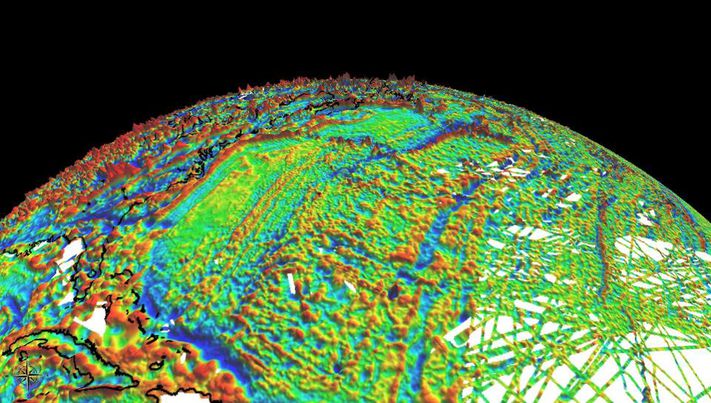
    NOAA’s EMAG2 World Digital Magnetic Anomaly Map. (Image: NOAA National Geophysical Data Center)
    NOAA’s EMAG2 World Digital Magnetic Anomaly Map. (Image: NOAA National Geophysical Data Center)

    Just like other features of Earth, magnetic fields can be mapped, using scalar magnetometer sensors to measure their strength and direction. In fact, government agencies and mining companies have been making these maps for many decades, for geological exploration and other purposes, though mostly on land.

    Conversely, these maps can be used to navigate by comparing the data from magnetometers to the map, just like cruise missiles used to use on-board radar altimeters to match the contours of the land beneath them to contour lines on a digital map and navigators on vessels in shallow waters compare the depths reported by their fathometers to those marked on a chart.

    Before this approach to navigation can be widely implemented, however, magnetic maps need to greatly improve in coverage and quality. In addition to magnetic maps and sensors, MAGNAV also requires sophisticated algorithms and careful calibration, to do such things as subtract errors from space weather and the local magnetic field of the aircraft or ship.

    The greater the platform’s speed, the greater MAGNAV’s accuracy, because the magnetometers can collect more varying magnetic information per unit of time of INS drift, Canciani explains. On a platform moving fast and at low altitudes, MAGNAV could achieve 10-meter accuracy. In less ideal conditions and relying on lower quality magnetic maps, the accuracy could be as low as one kilometer — which is sufficient for many missions, such as navigating ships at sea.

    Off-the-shelf scalar magnetometers about the size of a quarter have already been flight tested. Corporations, the military and civilian government agencies such as NOAA, NASA and NGA already have suitable magnetic maps, though they need to be improved and expanded, particularly at sea. This would require gathering new data using calibrated sensors on airplanes, ships and submarines.

    Could magnetic sensors be installed on thousands of aircraft, land vehicles and sea vessels to collect magnetic data during their routine operations? “With proper calibration, yes, but it should not be downplayed how difficult it is to get 1 nanoTesla measurements on a platform,” Canciani said. “Mapping and navigation are inverse problems so any platform that has been calibrated well enough to navigate could, in turn, also be used for mapping.”

    However, he points out, the task is much more complicated than just putting a magnetometer on a platform. “Getting clean data on complex platforms remains the largest challenge for magnetic navigation,” Canciani said, “although we are making excellent progress with projects like the Air Force Accelerated AI program with MIT and Lincoln Lab. In this project we are using state of the art scientific machine learning approaches to calibrate complex magnetic fields on operational platforms. Without excellent calibration algorithms the only sure-fire way to get clean magnetic data is putting a sensor out on a boom or wing-tip, which might not be practical for all use cases.”

    Two F-16 Fighting Falcons fly over Edwards AFB during a 2009 air show. (Photo: U.S. Air Force/Chad Bellay)
    Two F-16 Fighting Falcons fly over Edwards AFB during a 2009 air show. (Photo: U.S. Air Force/Chad Bellay)

    Canciani admits that MAGNAV is often met with skepticism but hopes that realistic testing on realistic platforms will lead to more interest and funding for this approach.

    While some such testing has already been performed using private survey aircraft, a much more important test will take place in September, when F-16s from the Air Force Test Pilots School will fly MAGNAV sensors and software over a test range next to Edwards Air Force Base in Nevada.

  • Number of trained US geodesists at crisis level

    Number of trained US geodesists at crisis level

    By David Zilkoski, contributing editor, survey scene

    David B. Zilkoski
    David B. Zilkoski

    I attended The Ohio State University (OSU) to obtain my graduate degree in Geodetic Science in 1979. Therefore, I will admit that I am a little biased — once a geodesist, always a geodesist. The basic definition of geodesy is the applied science for determining the size and shape of the Earth, designing and realizing reference frames, and determining where you (and anything else) is on the Earth.

    In OSU’s geodesy heyday (1960–1990s), many Americans trained were sent by federal agencies: National Geospatial-Intelligence Agency (NGA), NOAA/National Geodetic Survey (NGS), USGS, Army, Navy and Air Force. During the 1970s, NGS was sending two employees back to school every year. These agencies needed geodesists because they were undertaking major projects such as NGS’ to readjust the U.S. national horizontal (NAD83) and vertical geodetic (NAVD88) networks.

    I was one of the employees that NGS sent to OSU to be trained to support the NAD83 and NAVD88.

    The advancements in satellites and computers have enabled geodesy to expand into many different disciplines. Geodetic science and technology now underpin many sciences, large areas of engineering (such as driverless vehicles and drones), navigation, precision agriculture, smart cities and location-based services. Geodesy is actually more important than ever.

    Today, the environment is different. U.S. federal agencies still need geodesists for developing enhanced and refined geodetic models and tools. However, major U.S. companies, such as Google and FedEx, as well as the automobile industry, precision farming companies and mining companies also need more accurate geodetic models, tools and algorithms. Therefore, these companies also need trained geodesists to perform important research on topics that address their specific geodetic requirements.

    Today, OSU’s Geodesy Department is training very few American citizens. As the U.S. moves toward achieving geodetic-grade positioning in real-time in support of new applications such as driverless vehicles and drones, the number of trained geodesists should be increasing, not decreasing [Note: In 1990, there were 92 geodetic science graduate students. In 2019, there were 25; only three were U.S. citizens]. OSU and other universities need to educate and train the next generation of the nation’s scientific workforce of highly skilled research geodetic scientists that will expand industry’s research expertise.

    The shortage of American geodesists poses a significant economic risk for the U.S. Europe and China train many more geodesists than the US. There are very few geodetic science programs in the U.S. today, and education in geodetic proficiencies has been fragmented. The OSU graduate program is one of few surviving geodetic science programs.

    Users of geodetic products and services need to support geodetic departments in universities so that U.S. geodesy programs can grow to meet the geospatial demands of the future. The geospatial component of the economy is worth about $500 billion/year. So why are we allowing its foundational discipline to shrink in this country?