German drone manufacturer wins two prizes at renowned Lake Kivu Challenge in Rwanda
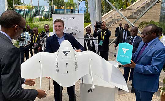
On May 5, the organizing committee of the Lake Kivu Challenge announced the results and named Wingcopter the winner of the Emergency Delivery category.
Wingcopter also received a special award for its safety procedures. As a winner, the company receives a prize money of GBP 65,000.
The Lake Kivu Challenge is a collaboration between the Government of Rwanda, the United Kingdom’s Department for International Development (DFID/UKAID), and the World Bank Group. The drone competition sought to demonstrate use cases for unmanned aircraft systems (UAS) on the African continent.
The challenge took place at the 2020 African Drone Forum in Rwanda in February — a first of its kind on the continent. Hosted by the Rwandan government and inaugurated by President Paul Kagame, the forum showcased advances in autonomous drone delivery — advances that can make a significant difference for isolated communities and rural areas across Africa.
Tom Plümmer, Wingcopter CEO, accepts the award from Rwanda’s President Paul Kagame. (Photo: Wingcopter)
The challenge received 92 applications from 35 countries. Only the top 10 drone companies were invited to put their drones and operators to the test through real-life scenarios at Lake Kivu in Western Rwanda.
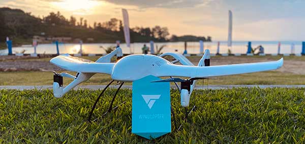
Throughout the three weeks of flights, Wingcopter was able to impress a panel of judges with perfect mission performance. This included fully automated delivery of an emergency package from a droneport on the mainland to Bugarura Island and a secure return landing.
The roundtrip, beyond-visual-line-of-sight-flight (BVLOS) was 40 kilometers and was completed without a battery swap. Wingcopter drones were able to complete the one-way route to the island within 12 minutes, a drastic reduction compared to more than 50 minutes by boat.
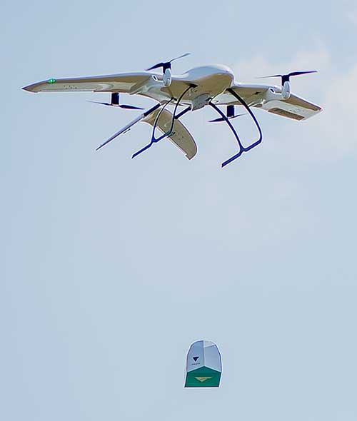
The package drop-off required no landing or human interaction, an attribute of Wingcopter’s innovative winch mechanism. Wingcopter had already successfully deployed a similar type of on-demand vaccine delivery to 19 remote villages in Vanuatu on behalf of the local Ministry of Health and supported by UNICEF.
The Wingcopter winch drop. (Photo: Wingcopter)
“We are very proud to be winners of the Lake Kivu Challenge, as this challenge and the African Drone Forum embody the innovative spirit of humanitarian aid and the African drone community as well as the great potential for sustainable drone deployments,” said Tom Plümmer, CEO and co-founder of Wingcopter. “We strongly believe that Wingcopter drones can leapfrog existing infrastructure by delivering significant social and economic value in Africa and beyond.”
“Wingcopter’s goal is to develop long-term partnerships with local governments, private sector and donor organizations throughout Africa,” added Selina Herzog, project manager at Wingcopter. “It is through these partnerships that we will accomplish the knowledge-sharing and training of the local workforce, ultimately empowering local stakeholders to take over and scale operations. We want our technology to give back to the communities where we operate and create new perspectives.”
The African Drone Forum created a unique platform to tell the Wingcopter story and exhibit its technology to more than 1,000 key players within the international drone and humanitarian ecosystem, allowing immense networking opportunities with the potential for future partnerships and business deals. An initial memorandum of understanding with a Rwandan startup has already been signed; others will likely follow.
Wingcopter recently announced a commercial partnership with UPS Flight Forward to jointly develop the next generation of package delivery drones. The combination of UPS’ experience in logistics and its global network with Wingcopter’s contactless drone delivery technology will put the two companies in a better position to contribute to the fight against the COVID-19 pandemic. Wingcopter is preparing multiple coronavirus-related projects.
Wingcopter on Bugarura Island. (Photo: Wingcopter)
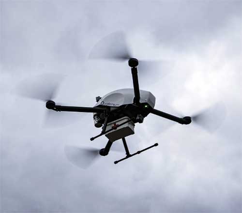
With more than 3 million people infected around the world, the coronavirus pandemic is pushing health authorities to research and develop new ways to react to critical situations, according to drone company Quaternium.
Public and private organizations are racing to develop experimental treatments and vaccines to fight COVID-19. At the same time, many local companies are trying to think outside the box to find ways to minimize the effects of the crisis. “Our current situation has opened up opportunities for innovative solutions, and we are best seeing them within the drone industry,” said Alicia Fuentes, CEO at Quaternium.
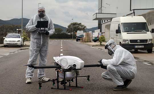
Photo: Quaternium
Drones have been deployed in the effort to contain the spread of the pandemic. “We’ve seen drones distributing public information, like voice messages, to those not following social distancing measures as well as delivering medical samples and spraying disinfectants to urban areas,” Fuentes said.
Unmanned solutions are easy to operate and can be quickly mobilized. “In addition to reducing the risk of health of sanitary workers, drones also get to unreachable places; they have become a versatile tool for managing this health catastrophe,” Fuentes said.
In Europe, several startups like Quaternium, Drone Tools and Manna Aero, and in the U.S. and Canada, companies such as Zipline and Draganfly are all exploring how they can help in their regions and neighboring countries to decrease the aftermaths of the pandemic and save more lives.
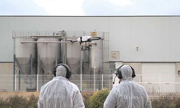
Quaternium demonstrates drone spraying
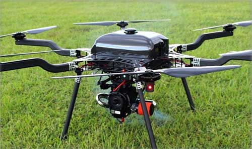
Quaternium has successfully been testing its hybrid drone, HYBRiX, to spray disinfectant products in Spain, showing how drone technology may serve in critical situations and how the company can support public authorities to help end the spread of the virus.
The company has also demonstrated aerial logistics solutions by delivering essential items to people in critical situations. Long-endurance drones can deliver supplies specifically for COVID-19 efforts, such as masks and gloves to first responders. HYBRiX can also deliver medicine to patients who can’t safely get to a pharmacy.
In the U.S., police departments are using drones from Impossible Aerospace to limit personal contact and share COVID-19 information, to reach out to homeless people (who are particularly at risk for coronavirus) and to monitor and enforce social distancing.
These are some of the areas where drones are being used to fight COVID-19.
Delivery drones
Due to COVID-19 being so contagious, it’s safer if human-to-human contact is minimized. UAVs are proving to be a valuable tool when delivering medical samples and essential items to health personnel. Several drone companies have made tests showing the crucial role that unmanned logistics can play against the spread of COVID-19.
Inform and prevent
“In the last weeks, we have seen speakers being mounted on drones to help inform people outdoors and prevent public gatherings. Drones can also be found flying with banners advising people on how to be more precautious when going outside,” Fuentes said. The mobility and flexible use of these UAVs make the mission of security agencies simpler, while avoiding close contact with the population, she said.
Aerial spraying and disinfection
First in China and now in Europe and the U.S., agriculture drones — originally designed to spray liquids on crops — are being adapted to spray disinfecting chemicals in public spaces and impacted areas. Experts have discovered that coronavirus is mainly transmitted by touching contaminated surfaces. This new virus has shown to be very contagious and resistant, staying on some surfaces up to 30 days, which makes disinfectant spray vital to helping reduce transmission mechanisms.
The battle with COVID-19 has just begun. Cases are continuing to rise in and outside of Europe. “Now more than ever, public authorities and private companies need to join forces in order to grow stronger and overcome this pandemic together,” Fuentes said.
Open space: the final frontier. These are the voyages of the professional surveyor and their crew. Their mission: to explore and survey strange new lands. To retrace old boundaries and to create new parcels and subdivisions. To boldly go where no one has gone before (unless it has been previously surveyed and platted…)!
With a nod to Star Trek fans (and apologies to Mr. Roddenberry), the surveyor has been the terrestrial version of the Captain Kirk and Science Officer Spock, exploring existing and uncharted territories. While most surveys completed in the modern day are retracements of previous parcels, there are still areas where surveyors are completing various tasks where no one has been before.
There are very few instances where a survey is performed near others. By this simple fact, one can argue that the surveyor is the original social distancer. The real question, however, lies within the determination of the value of the surveyor and if the work we perform is an “essential service.”
This article is not attempting to debate the value of the surveyor versus all the first responders, doctors, nurses, healthcare personnel and the hardworking employees doing their best to keep up with our basic needs. We are here to discuss the challenges faced by the surveyor and how technology has provided much-needed tools for crossing this abyss of doom and despair called COVID-19.
But first, let us talk about how we arrived at this extraordinary time for nearly everyone on the planet.
Photo: LeoPatrizi/E+/Getty Images
Worldwide upheaval or some close facsimile thereof
Every generation has a historical event, moment or era for which they remember exactly what they were doing:
“Greatest” generation (born before 1924): the Stock Market crash of 1929 and subsequent depression
“Silent” generation (born 1925-1945): Pearl Harbor and World War II
Baby Boomers (born 1946-1964): Korean War, the Kennedy assassination, the Moon landing and the Vietnam War
Generation X (born 1965-1980): Reagan assassination attempt, Challenger explosion, death of Princess Diana
Millennials (born 1981-1996): 9/11, Aurora and Sandy Hook shootings
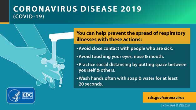
Unfortunately, the series of events leading up to the nationwide shutdown because of the COVID-19 pandemic will unseat most of those events and eras. While previous pandemics (for instance, the Spanish flu of 1918) struck and killed many more people, the mobility of today’s population coupled with instantaneous media coverage provides a much different environment for this situation.
Image: CDC.gov
Obviously, we are not alone, and this virus has spared few countries and races. Different cultures across the globe have adapted for the pandemic in a variety of ways, and the U.S. has faced the same challenges across our diverse environments.
Depending on where one is located, they face a different set of challenges due to the pandemic. Several heavily populated urban areas are subject to a strict lockdown while states with mostly rural areas are less restrictive. One size does not fit all when dealing with limiting public exposure to others, but let us leave the debate of how much restriction is needed to the scientists and public officials. Many today do not agree with the rules we have been dealt with in going about with our lives. That is a discussion for another time and different forum.
Instead, let us discuss what we face going forward with our “new reality” of some form of social distancing and how the need for surveying and geospatial information remains for a large portion of this world. We must simply adapt to this situation with the adoption of new technologies and a revamped workflow.
Everything changes, whether we like it or not
The surveying profession is not unlike many other service-oriented and public-serving occupations, even with most of the field work being performed in solitude. We still deal with clients, governmental agencies, other consultants and the public.
The COVID-19 pandemic has changed the way we are now interacting with those outside partners with technological advances and modified communication conduits. Many of these methods existed well before this situation, but the rapid advancement of the pandemic forced many companies and employees into adapting very quickly.
Surveyors are no different, so let us run through the changes we have seen within the industry.
Project communication
The biggest challenge facing most surveyors in dealing with the pandemic atmosphere has been communication. Whether it is with employees, clients, government agencies or other consultants, communication has been affected mostly because of the elimination of face-to-face opportunities.
Technology to allow remote communication has existed for many years, but not many of us have taken advantage of it because of the convenience of in-person interaction. Who does not want to leave the office to meet with a client, shake their hand and close the deal? Or have the client come to your office and go over the intricacies of a complex survey?
Regardless of whether one is introverted or extroverted, human contact has always helped establish and solidify relationships. For most of us, this is how business has always been done, be it your client or your employees.
Obviously, the biggest area affected has been daily interaction with employees. Controlling workflow, handling projects and troubleshooting any situation is more difficult when the team is not physically in the same location. If a team member is overwhelmed, another one can immediate meet with them and help. Work is easily passed between teammates with little effort.
But working remotely? That takes more effort, consideration and technology to accomplish. Yes, video conferencing has been in place for many years, but mostly in large companies and only implemented it in a dedicated conference room. Not many employees were previously afforded a webcam, microphone and speakers along with the necessary software; all of these components are now standard issue. For many, programs like Zoom, Skype and Microsoft Teams are now a critical communication tool for timely and efficient sharing of information.
What about communication with field crews? Many would say that even a pandemic would not change how we stay in touch with field crews, but even these relationships have been affected. While there are survey companies operating with limited physical contact as a norm (large firms with projects regionally or nationwide), most surveyors still have a substantial amount of direct communication between field and office. This situation has forced many firms to take precautions, with crew members only handling specific pieces of equipment or performing a thorough cleaning if sharing during a project.
Project documents and files have typically been been handled manually with some electronic data files being transferred via email or internet. Depending on the size of the original document, having a full-size paper copy of a previous survey or subdivision plat has advantages to looking at a PDF image on a tablet or computer screen while in the field. Many companies outfit their field crews with 11 x 17-inch printers to be able to print larger detailed areas of bigger documents. Additional care must be taken if these items will still be used for field operations.
Image: Tim Burch
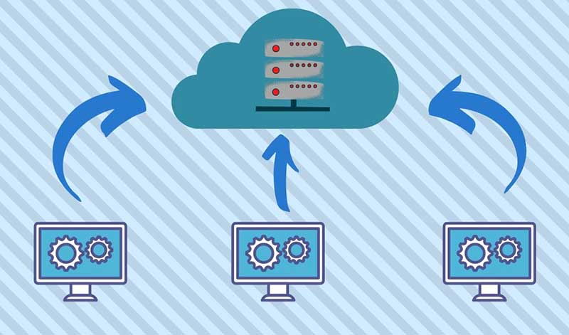
The transfer of data between office and field has become faster, more efficient and safer with technology. As data collectors have become more capable, direct connections via the internet to cloud storage is making transfer of project files and photos faster and more secure by providing immediate backup to guard against data loss. What used to take a trip to the office, connecting to a computer and downloading is now done in a matter of minutes without leaving the job site.
Field personnel are also benefiting from technology within our devices. Apps like FaceTime and programs like Microsoft Teams provide a gateway to video chatting so teammates can discuss projects in real time. Shared pictures, computer screens and face-to-face interaction provides an avenue to more effective communication and enhancing relationships between team members.
The pandemic has forced many surveyors to adapt and learn several new apps and programs to connect in new ways; however, this pandemic has also affected how we go about our field operations, too.
Enhanced data collection
Not many of the surveyor’s field activities are affected because of social distancing requirements, but the pandemic has forced our profession to be compliant with the new rules in case we are in proximity with others. Newer technology, using both terrestrial and aerial platforms, are now being utilized by more surveyors for their data collection needs.
Train employees now. As many companies have seen a slowdown in work due to pullbacks from projects moving forward, now is the time to get employees trained with the new technology and software to be better prepared for when the market comes back.
Using photogrammetry tools. Photogrammetry, lidar and laser-scanning systems are being purchased and implemented for everyday use and not just “special” projects with larger budgets. Not only are surveyors finding it keeps them further away from other people, it also allows for more efficient data collection and representation of existing conditions.
Flying unmanned aerial vehicles. UAVs continue to grow in popularity, and like the other technology discussed above, many firms are investing in becoming remote pilots and implementing aerial photography and lidar into their workflow. Previously, most surveyors (and the general public) would use Google Earth, Bing and other resources for aerial imagery to gain a better perspective on their project sites. Vendors are coming out with aerial products with more recent flights at a higher resolution, but do not offer the ability to extract reliable topographic data easily. In-house UAVs provide more flexibility and control over the information needed, and many are using their downtime to become familiar with aerial products.
Photo: GPS World
Dipping toes into remote sensing. Another sector of surveying equipment seeing increased use during this situation are new total stations with remote-sensing capability. Many surveyors may not have the need for a standalone laser or lidar scanner, so several manufacturers have introduced a total station that provides limited remote sensing for everyday use. While the built-in scanner is not nearly as robust as a traditional remote-sensing unit, it provides enough capability and accuracy for most users. This intermediate step of remote sensing helps a firm decide how much scanning they will produce and if an investment in a full function unit is right for them.
Upgrading GNSS receivers. We would be amiss if we did not mention that more surveyors are now upgrading their GNSS receivers to take advantage of more constellations, integration with IMUs and increased computing power of the latest data collectors. Some surveyors who are not as economically affected during this pandemic are taking advantage of great deals on new equipment and using this time to increase their capability and efficiency. As more satellite vehicles become available, the ability to gain accurate and precise locations is better than ever, so staying ahead of technology is still important in these times. We will continue to see more gains with L5 and L1C signals from the new GPS Block III satellites within the next few years, so staying current now is very important.
QA/QC — The electronic method
One trouble spot seen within the new paradigm is the ability to provide a thorough quality assurance/quality control (QA/QC) process on all surveying operations. Without the ability to print/plot original surveys at full scale, it becomes a more difficult procedure to review and analyze information on a computer screen.
The monitors used for drafting and calculations are getting bigger, but studies have shown the human eye will focus differently on an electronic screen compared to a survey on paper. There must be many other professions and occupations using similar technology who have yet to solve the QA/QC dilemma. Hopefully, our industry will find a way to help address this issue and provide guidance.
Image: Tim Burch
More connected than ever, yet still so alone
The COVID-19 pandemic of 2020 (let us hope that is all it encumbers) will be forever etched in our memories as frightening and unbelievable. More than 100 years has past since the last pandemic of this proportion has overwhelmed our population. We are much more advanced in our education of health, medicines and technology than the previous event, yet we were caught off-guard by the speed in which the virus spread throughout our lands. It taxed most of our health infrastructure beyond its limits and took its toll emotionally and financially to most of the population.
We were forced to adapt very quickly to a new norm of working remotely and independently of our co-workers and teammates. Did it hurt our productivity and profitability initially? Absolutely. Were our employees forced to learn new ways of doing their work and communicating by other means. Yes, they did. Was there a need for rapid troubleshooting of new procedures and task management? Of course. Has every transition of remote work been a success story? I doubt it, but it was not for lack of trying.
We are doing the best we can, and the surveying profession is rapidly trying to adapt. Like the rest of the world, the surveying profession will not be the same coming out of the restrictions placed upon us because of the pandemic. We have learned more about ourselves and how capable we are with tools we have. We also learned how we will transition with these skills into new technology not invented yet.
Surveyors are a tough bunch, so the social distancing and adaptation required to survive the COVID-19 pandemic of 2020 — while not easy by any stretch — has been handled with grace and professionalism. I would say to bring on the next one, but would rather this pandemic be in our rearview mirror quickly and not see anything like it ever again.
Xsens, manufacturer of motion-tracking modules, has launched real-time-kinematic (RTK)-compatible motion trackers. The development is designed to bring centimeter-accurate positioning within reach of a new generation of affordable commercial devices.
The RTK extension to conventional satellite positioning signals reduces the maximum positioning error from around ±1 meter in standard commercial GNSS receivers to typically ±2 centimeters. Companies developing innovative new products in non-military markets such as smart farming, autonomous vehicles and coastal maritime equipment have been keen to take advantage of high-precision RTK capability to enable new applications and more automated functions, according to an Xsens press release.
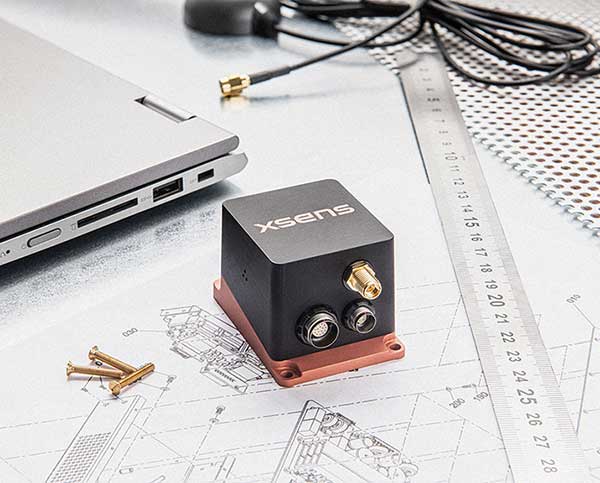
The MTi-680G is a new product in the Xsens MTi 600-series. The MTi-680G, an integrated GNSS/inertial navigation system (INS) module, features an integrated RTK GNSS receiver, as well as providing synchronized 3D attitude (tilt, inclination) and heading outputs.
The new MTi-680G also features upgraded firmware that substantially accelerates the module’s internal signal processing compared to non-RTK modules. Synchronizing the global position coordinates with the module’s attitude, heading and velocity outputs, the MTi-680G can provide a comprehensive positioning and navigation output for any carrier device, including of devices such as drones that move at high speed, at a maximum output data rate of 400 Hz.
The RTK-enabled module also offers these features:
Precise factory calibration of every production unit
High immunity to magnetic interference
Adaptive firmware operation to optimize performance in various types of scenario
Easy-to-use, free MT Software Suite developer tools to accelerate integration into end-product designs
Out-of-the-box operation with Xsens’ MTi development kits
“Centimeter-accurate positioning at an affordable price for commercial applications — this is the promise of the new RTK-compatible MTi-680G product,” said Boele de Bie, Xsens CEO. “From seed-sowing agricultural robots to autonomous cargo ships, a whole new generation of applications is now possible thanks to the centimeter-level accuracy of the MTi-680G’s position measurements.”
One-inch GNSS accuracy in under a minute, delivering seamless high-precision performance across the U.S. and southern Canada
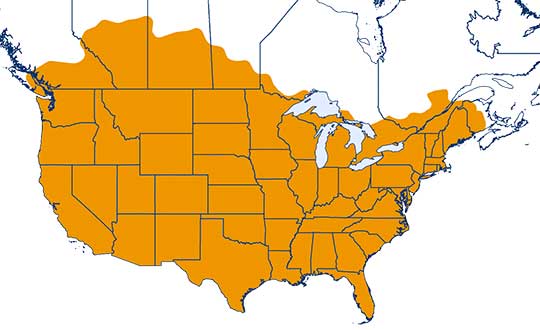
Trimble has completed expanding its CenterPoint RTX Fast correction service, with coverage now spanning the contiguous U.S. and southern Canada. This expansion is central to Trimble’s vision to transform how and where users can leverage precision and accuracy.
Coverage of Centerpoint RTX Fast. (Image: Trimble)
Designed for autonomous applications in both on-road and off-road markets, the coverage and performance of the service enables industry professionals to re-think what is possible when using augmented positioning for improving safety, performance, productivity and operational efficiency.
The CenterPoint RTX Fast subscription service delivers horizontal positioning accuracy of 1 inch (2 centimeters) or less in under a minute, with the versatility of satellite or cellular delivery. This expanded coverage makes it the largest, high-performance GNSS correction network in the world, according to Trimble.
Base stations not required. The service encompasses more than 5 million square miles across North America and Europe. By using the service, said Trimble, farmers, land surveyors and GIS professionals can untether from the cost and complexities of GNSS base stations.
In addition, Trimble RTX Fast offers a single, continuous correction technology platform for enabling a broad range of safety-critical autonomous applications in markets such as automotive, agriculture and construction.
“This achievement is a major milestone in the continuous evolution of our correction service and autonomy strategy. We are delivering unmatched access to fast, reliable, highly accurate positioning in more areas than ever before,” said Patricia Boothe, senior vice president of Trimble’s Autonomy Sector. “Whether enhancing performance in the autonomy ecosystem or simplifying traditional mapping and surveying workflows, RTX Fast users can gain greater accuracy to improve productivity and operate safely — ultimately transforming the way they work and drive.”
CenterPoint RTX Fast subscriptions for Trimble RTX-compatible GNSS receivers are available through Trimble’s Authorized Business Partners or Trimble’s online store.
The show was originally scheduled to take place May 4-7 in Boston. It was then postponed to tentatively take place Aug. 10-12 in Boston. Because AUVSI was unable to secure the original location for the new dates, the trade show has been moved to the Kay Bailey Hutchison Convention Center in Dallas.
“While we are disappointed to leave Boston, we are excited to confirm that we will be once again hosting Xponential in Dallas, Texas,” said Brian Wynne, president and CEO of AUVSI. “We anticipate great participation based on the attendance and engagement we experienced there in 2017, and our AUVSI Lone Star Chapter has already extended a warm welcome on behalf of the Texas unmanned systems community.”
According to AUVSI, it based its decision to reschedule to the fall on concerns for the health and safety of the attendees of the trade show because of the coronavirus pandemic.
“For 48 years we have witnessed how innovation and resolve meet challenges head-on to reshape critical missions and business operations for the better,” Wynne said. “Our commitment to supporting the unmanned systems community remains unwavering, so amidst the current global health crisis we, too, must adapt to fulfill that mission.”
AUVSI also will implement a health and safety plan to address social distancing and other measures to help keep participants safe, the association said.
The AUVSI Xponential trade show highlights advancement of businesses and technologies in the unmanned systems industry.
The warranty comes about as a result of very low observed failure rates over the company’s 10-year history and its ongoing quality initiatives.
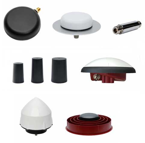
Tallysman Wireless is a leader in the GNSS antenna design and manufacturing industry. Tallysman offers a wide range of GNSS antenna elements, which includes accurate, low-profile ceramic patch (Accutenna), lightweight helical, high-efficiency Alfred loop (VeroStar) and precise cross dipole (VeraPhase and VeraChoke) technology antennas. All housed versions of these antennas are covered in the new standard three-year warranty.
Also included in the warranty period is the Tallysman line of radio-frequency accessories that includes low-noise inline amplifiers; compact, low-loss signal splitters; and power-regulated bias tees.
The standard warranty does not cover environmental hazards, such as lightning strikes, and abuse, such as physically damaged housings, ripped connectors and cables, normal corrosion, and wear and tear.
Qinertia, SBG Systems’ PPK software, now supports third-party IMUs and offers a GNSS post-processing license covering all major GNSS receivers
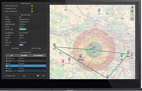
Screenshot: SBG Systems
SBG Systems’ INS/GNSS post-processing kinematic (PPK) software Qinertia now covers all surveyors’ projects by offering a license dedicated to GNSS post-processing. Open to the world, Qinertia supports all major GNSS receivers and is now open to third-party inertial measurement units (IMUs).
Qinertia has been designed to offer a comprehensive suite of post-processing software to geospatial professionals. It accepts all major GNSS manufacturers, and supports proprietary protocols from NovAtel, Septentrio, Trimble and u-blox for a straight-forward workflow.
The full-featured post-processing software offers native support for u-blox F9 real-time kinematic (RTK) receivers, reducing the workflow to a simple “drag and drop” to guarantee data integrity and accuracy.
Qinertia has been designed to help surveyors get the most of their surveys easily with a simple workflow, powerful quality control tools and tightly coupled algorithms. All of this is available to any surveyor with the new support of third-party IMUs or GNSS receivers. Several IMUs and inertial navigation systems (INS) have already been successfully integrated with Qinertia including Northrop Grumman’s LN-200 and LCI-100 and the Inertial Sense µIMU.
The new Qinertia GNSS license allows surveyors to post-process both static and kinematic GNSS data. In just a few clicks, surveyors can improve their trajectories, access RTK corrections worldwide, or even control a base-station’s precise location using precise point positioning (PPP) static computations.
GIS and Photogrammetry. Whether they fly a UAV or drive a car, professionals can improve their image location accuracy. Qinertia has been designed to help surveyors get their GIS or photogrammetry projects way more precise, by exporting a centimetric position for each picture at the exact shutter event.
A new high-performance compact GPS/GNSS receiver with an on-board IMU sensor, tailored to the needs of UAV applications
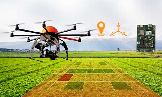
Septentrio has released a new GNSS/INS receiver, the AsteRx-i D UAS. This multi-frequency receiver combines reliable centimeter-level positioning with 3D orientation, enabling automated navigation of aerial drones and robots.
GNSS signals received include the American GPS, European Galileo, Russian GLONASS, Chinese BeiDou, Japan’s QZSS and India’s NavIC.
With a high-performance IMU (inertial measurement unit) from Analog Devices integrated directly into the receiver board, AsteRx-i D UAS is compact and lightweight. Aboard the drone, its small form-factor combined with exceptionally low power consumption results in extended battery life and longer flight times.
“With this product we introduce into our inertial-GNSS portfolio an IMU which allows us to reduce the weight and power consumption of our UAS boards while making them easier to integrate. These are all key elements for a successful UAV platform.”
AsteRx-i D UAS is the first commercial product resulting from Septentrio’s collaboration with Analog Devices, delivering robust positioning and attitude (heading, pitch and roll) in demanding industrial environments. Both single-antenna and dual-antenna versions are available.
The single-antenna version provides a lightweight solution optimizing the system SWaP (size, weight and power). The dual-antenna version is designed for machines that need reliable heading directly from the start.
AsteRx-i D UAS comes with Septentrio’s Advanced Interference Mitigation (AIM+) technology. In aerial drones, where many electronics are crammed into a small space, neighboring devices can emit electromagnetic radiation, interfering with GNSS signals. AIM+ offers protection against such interference resulting in faster set-up times and robust continuous operation.
The on-board IMU from Analog Devices is exceptionally robust against mechanical vibrations. This IMU combined with Septentrio’s anti-shock LOCK+ technology makes AsteRx-i D UAS resilient against impact during takeoff and landing.
The AsteRx-i D UAS evaluation kit is now available in Septentrio’s online shop, which offers direct access to the company’s latest GNSS technology. For more information, contact [email protected].
Next-generation phase noise instrument combines timing technologies in a smaller, higher performance measurement instrument
Photo: Microchip Technology
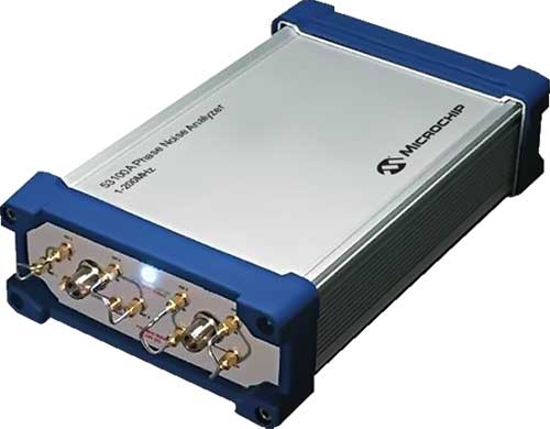
To help research and manufacturing engineers make precise and accurate measurement of frequency signals, including those generated by atomic clocks and other high-performance frequency reference modules and subsystems, Microchip Technology Inc. has announced the availability of the new 53100A Phase Noise Analyzer, a next-generation phase noise test instrument.
The 53100A Phase Noise Analyzer is designed for engineers and scientists who rely on precise and accurate measurement of frequency signals generated for 5G networks, data centers, commercial and military aircraft systems, space vehicles, communication satellites and metrology applications.
Capable of measuring radio frequency (RF) signals up to 200 MHz, the new test instrument rapidly acquires frequency signals and characterizes the phase noise, jitter, Allan deviation (ADEV) and time deviation (TDEV) quickly and precisely. All attributes of a frequency reference can be completely characterized with a single instrument within minutes.
The 53100A Phase Noise Analyzer enables a variety of configurations by allowing up to three separate devices to be tested simultaneously using a single reference, enabling higher capacity for stability measurements. At 344 x 215 x 91mm (13.5 x 8.5 x 3.6 inches), the phase noise test instrument is small enough for integration into manufacturing automated test equipment (ATE) systems, yet powerful enough for laboratory-grade metrology. Its interface provides backward compatibility with Microchip’s 51xxA test sets’ command and data stream, reducing the need to redesign existing ATE infrastructure.
The 53100A Phase Noise Analyzer provides flexibility by allowing an input reference device to be connected through the front panel at a different nominal frequency than the device under test — allowing a single reference to characterize a variety of oscillator products. Rubidium frequency standards such as Microchip’s 8040C-LN or a quartz oscillator such as Microchip’s 1000C Ovenized Crystal Oscillator (OCXO) could be used as a reference as well as other manufacturers’ precise oscillators.
The 53100A Phase Noise Analyzer is available now. Microchip supports the 53100A Phase Noise Analyzer with technical support services as well as an extended warranty.
According to the company, the week President Donald Trump declared a national state of emergency marked a major shift in human activity.
Garmin data pointed to a massive decline in the overall number of steps taken during the second two weeks of March in the U.S. This trend is consistent with the company’s global trend data in China, Italy and other countries where the coronavirus pandemic struck first.
“We’re observing a remarkable shift in the types of activities people are doing, reflecting an unprecedented about-face when it comes to typical springtime exercise and activity,” Garmin said in a blog post.
To paint a clear picture of the initial trends, Garmin engineers and data analysts looked at the percent change in activity levels in the United States for specific sports and exercises and compared the first half of March with the second half of March to determine increases and decreases. The results also are baselined against the same time period in 2019.
Here’s an overview of how activity has changed.
Skiing and snowboarding: These activities are down 96%. This aligns with resorts closing because of the pandemic.
Cycling: Virtual cycling activity was up 64% in the second half of the month, a shift that appears even more atypical when comparing it to the same time period last year. March 2019 saw a 20% decline in the activity as cyclists naturally began to take their rides outside to enjoy the warmer weather, Garmin said.
Indoor/treadmill running: Indoor/treadmill running is down 44%. According to Garmin, this doesn’t mean this activity has come to a halt. Because gyms across the country are closed, a number of treadmills aren’t being used. In fact, virtual running saw a steep increase in the second half of March, and despite gym closures, overall indoor cardio is holding strong over 2019 levels and showing an 18% week-over-week increase from March 16 to March 30. This suggests more people are exercising, and they’re finding ways to do it from home, with and without their own equipment, Garmin said.
Lap swimming: Lap swimming is down 88%.
Walking: Walking is up 36% when comparing the front half of March to the back half of March. This surge is double the 18% increase observed over the same time period last year, Garmin reported.
Yoga: Garmin wearable device data shows an 11% increase in yoga activity, when comparing the front and back halves of the month. This is an increase in 2019 data, as well.
Golf: Golf has seen a 20% decline in activity for the second half of March. When comparing the same two time periods last year, golfing activity increased by 53%.
According to the company, Trimble Dimensions is the signature event for Trimble’s global user community spanning agriculture, construction, geospatial, transportation, utilities and more. The show highlights technology and how it transforms the way professionals work to achieve success.
“Unfortunately, the overwhelming concerns and ongoing impact of COVID-19 inhibit our ability to deliver a conference that meets the high standards of safety and excellence our attendees expect and deserve,” Trimble said in a press release.
The event was scheduled to take place Nov. 2-4 at the Gaylord Opryland Resort and Convention Center in Nashville, Tennessee. Trimble Dimensions is a biennial event.