Blog

  • How ag machines use GNSS for greater harvesting efficiencies

    How ag machines use GNSS for greater harvesting efficiencies

    An early 1900s Italian folk song tells of a farmer walking into his fields at dawn to spread wheat seeds with his hand from a small bag.1 Farming has changed quite a bit since then. After remaining essentially unchanged for about 12 millennia, in the past century, it has been transformed by such innovations as tractors, electrification, chemical fertilizers and pesticides. In the 1990s, precision agriculture (PA) emerged. (This magazine produced a few supplements on the subject around 1999. If you still have any of them, please let me know.)

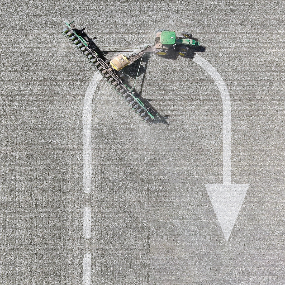
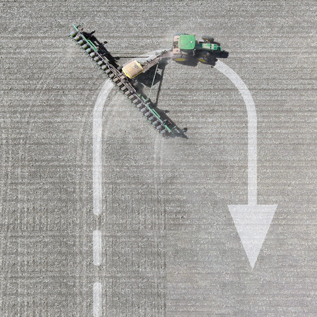
    PA reduces inputs of water, fertilizer, seeds, pesticides and fuel and increases harvests by mapping variations in soil characteristics and plant health and then using those maps to adjust the inputs using variable rate technology on sprayers. It also ensures that no part of a field is sprayed twice or missed and greatly reduces overlap in seeding and tilling. Double spraying is costly and wasteful; missing a row when spraying pesticide can cause pests to concentrate there and then spread, nullifying a whole spraying operation.

    The data for the maps are gathered from sensors on tractors and other farm machinery in the fields, as well as by aerial platforms — nowadays, mostly UAVs. GNSS receivers are essential in guiding the farm machinery. The required accuracy depends on the crop but is typically at the centimeter to decimeter level.

    Increasingly, farm machinery also incorporates a variety of other sensors, both to compensate for GNSS outages and to minimize the risk of collisions, such as when a cow crosses the path of a tractor. To maintain navigation during GNSS outages, inertial navigation is used. For obstacle avoidance lidar, radar and stereo vision cameras are used to measure the distance to the object. (Both challenges — navigation in GNSS-denied areas and obstacle avoidance — and their solutions are very similar to those encountered with autonomous vehicles on roads.)

    In-cab displays enable growers to monitor their progress in real time. They often also download the data and maps to a laptop to better identify missed spots or areas with special issues and to plan their next task.

    Manufacturers of PA equipment compete in a global market. Some challenges are the same everywhere, while some are specific — such as strong ionospheric scintillations in Brazil or antiquated agricultural practices in Japan’s Furano region. For this year’s cover story on PA, I discussed these challenges and the latest generation of farming hardware, software and services with
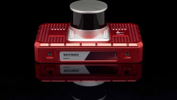
    Kirstin Schauble, director of systems engineering, ANELLO Photonics
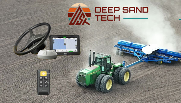
    Joey Koebelen, founder and CEO, Deep Sand Technology
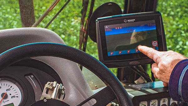
    Chad Huedepohl, PA portfolio manager, autonomy and positioning division, Hexagon

    Ken MacLeod, director of product management and Gordon Echlin, director of business development, Calian GNSS.

    This article contains a few excerpts from those interviews. I also received case studies from AgLeader Technology, ComNav Technology and Harxon Corporation.

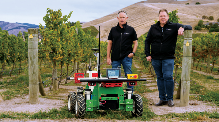
    ANELLO Photonics makes silicon photonics optical gyroscopes, which enable accurate dead reckoning without GNSS and are targeted mostly at the autonomy market. (Anello means ring in Italian, which reflects the nature of the company’s technology and the Italian-American background of its CEO, Mario Paniccia.) Because ANELLO specializes in high precision in situations with obstructed GNSS signals, orchard cultivation is one of the agricultural practices in which it specializes. “Orchards have high-value crops, such as almonds or walnuts, and you’re driving your tractor between very narrow rows with trees completely covering the sky above you,” Schauble said. “Our job is to replace that GNSS input with our inertial navigation system (INS) input.”

    Deep Sand Technology — in partnership with GEODNET, the largest real-time kinematic (RTK) network in the world — sells affordable RTK corrections to farmers. It also maintains and troubleshoots the system, compensated by the network’s cryptocurrency. “We handle the blockchain and use it for maintenance,” said Koebelen. “We have someone that checks every day and makes sure that the bases are up. We do the support on it. Instead of charging for that, we take the tokens; that’s just our part of the program, and they get free RTK.” Koebelen, who is also a peanut farmer, adds: “You can trust anything that we sell because it has been tested and used by a farmer and is supported by a farmer.”

    Hexagon, a very large company, makes a wide range of sensors that capture and display data about physical reality. Its latest contributions to PA include the TerraStar-C PRO and the TerraStar-X Corn Belt corrections services, which incorporate improvements in ionospheric resiliency. “Especially in the Brazil market, some growers were often experiencing hours of downtime due to ionospheric scintillation,” said Huedepohl. “With the ionospheric enhancements that we’ve added, that downtime now is down to just a few minutes here and there.” He also cites safety enhancements for the autonomy market, such as dual antenna solutions and geofencing.

    Calian GNSS is a global supplier of technical solutions, services and products to the space communications, defense, wired and terrestrial wireless, manufacturing, GNSS, agricultural technology and nuclear industries. The company’s recent entries in the PA market include GNSS antennas with lower elevation gain and extended filtering. “Our GNSS agriculture antennas support centimeter level precision, have best in class lower elevation angle gain enabling L-Band correction reception (at northern and southern latitudes), and have eXtended Filtering (XF), which creates very deep attenuation of nearby out of band radio frequency signals,” said Echlin. “Having a digital signal from the antenna to the smart ag controller simplifies and reduces the cost of the installation,” said MacLeod.

    Ag Leader, founded in 1992 and focused exclusively on precision farming technology, offers a complete line of systems that integrate with existing farm machinery. In February, it introduced the RightPath passive implement steering solution to alleviate the problem of trailed implements drifting off the guidance line by up to 10 inches or more, even when farmers utilize auto steer and on flat ground. RightPath keeps implements centered on the guidance line, ensuring precise input placement and increasing operational efficiency throughout the growing season while minimizing crop damage, yield loss and operator challenges, Ag Leader said. To utilize RightPath, both the vehicle and the implement require Ag Leader’s GPS 7500, but only the vehicle needs to be equipped with TerraStar-C, TerraStar-X, or RTK. RightPath will be available in late fall 2025 through a single purchase unlock and without any recurring subscription fee.

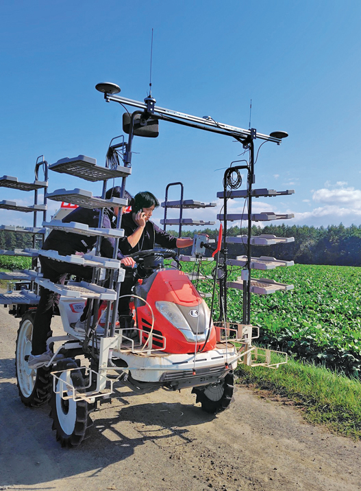
    ComNav Technology is an original equipment manufacturer (OEM) that develops and manufactures GNSS OEM boards, receivers and solutions for high-precision positioning applications worldwide. Japan’s Furano region is renowned for its vast farmland and abundant agricultural resources. Still, it is challenged by traditional manual driving methods that provide insufficient accuracy, low efficiency, and operator fatigue during prolonged tasks. To address these issues, ComNav introduced the AG502 autosteer system, which integrates satellite reception, positioning, navigation and autonomous driving. It is compatible with a variety of mainstream tractors on the market and is suitable for a wide range of agricultural tasks such as ridging, seeding, spraying and harvesting, ComNav said. In the Furano project, the AG502 demonstrated its versatility through its successful deployment on a transplanting machine.

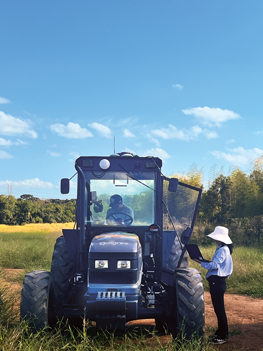
    Harxon Corporation makes GNSS positioning antenna solutions. The company has been collaborating with Brazilian agricultural navigation solutions and systems developer Agres to integrate Harxon’s Smart Antenna into the AgresAutopilot System. This secure and robust agricultural navigation solution has been widely adopted by Brazilian agribusinesses to provide automatic steering on straight or curved parallel lines to assist with such field operations as preparing the soil, planting seeds, cultivating the plantation and harvesting the crops. These systems are suitable for various brands and tractor/vehicle models such as Kuhn, John Deere, Valtra, Massey Ferguson, New Holland, LS, Landini, Jacto and others. 

    To maximize an operator’s turning accuracy and efficiency, Ag Leader introduced TurnPath, hands-free steering for automatic, repeatable end-of-row turns. (Photo: Ag Leader)
    To maximize an operator’s turning accuracy and efficiency, Ag Leader introduced TurnPath, hands-free steering for automatic, repeatable end-of-row turns. (Photo: Ag Leader)

    Challenges

    The key technical challenges faced by PA systems include minimizing multipath and RF interference and monitoring the positions of implements relative to the tractor. “Agriculture requires positional accuracy, so mounting an antenna on a farm machine is not a trivial matter,” said MacLeod. “On metallic machinery, radio frequency surface currents and reflections (multipath) will degrade the antenna radiation pattern, and RF noise coming from other electronics on the machine can interfere with GNSS.” Additionally, because most GNSS applications now are full band, “the challenge is designing antennas that are small and full band, and which also reduce local multipath on the machine.”

    Regarding the position of the implements, MacLeod said: “Many agricultural applications use the moving base technique to estimate a precise heading which can be used to monitor pass to pass overlap. Calian GNSS have smart antennas that support the moving base application.”

    Accuracy and Reliability

    Nearly all PA practices require RTK, which gives repeatable accuracy of 1 cm to 2 cm. “I have this conversation daily with farmers,” Koebelen said. “All crops or farm practices benefit from RTK, even if you’re just doing hay work — whether you’re planting or harvesting. We can’t control the weather, commodity prices, or fuel prices but we can reduce input costs. So even if you’re just tilling, GEODNET RTK will pay for itself and is better than using traditional autosteer, because you’re eliminating all overlap.”

    Additionally, farmers need reliable repeatability, even from one season to the next, to be able to return to the same spot to harvest what they planted. “Peanut farmers may plant with RTX or SF3, but satellite-based corrections, even higher precision ones, didn’t provide them enough repeatability to come back to harvest,” said Koebelen. “So, they still had to adjust their lines or hand-drive them. If the spacing between passes are off by even two to three inches, you’re going to lose peanuts. That’s why peanut farmers — as well as growers of potatoes, cucumbers, and other crops — need RTK.”

    Once they enter a GNSS-denied area, such as an orchard, farm machines will need a dead reckoning capability that can keep them within a 20 cm to 30 cm error, said Schauble. “This is typically posed as a cross-track error. Errors in the direction of the distance traveled are slightly less important, because you can tell based on visuals when you exit a row.”

    Growers think of reliability, accuracy and repeatability in terms of whether they can count on a system to do what they are asking it to do, Huedepohl explained. “They think about all those things. They do not necessarily focus on one thing versus another.”

    Retrofitting

    While many agricultural systems are proprietary, there is also a lot of mixing-and-matching and retrofitting going on. More than 90% of new tractors come with factory-installed guidance, but some growers want to retrofit new receivers on their machines, either because they did not have them or to upgrade. On some machines, it is possible to feed better positioning data — for example, integrating GNSS and inertial navigation — into the port that previously took in only GNSS data, using a standard NMEA format.

    “It’s a simple plug-and-play to exchange someone’s GNSS receiver with our INS solution. Obviously, they need to do some testing to optimize placement, installation and stuff like that,” said Schauble. “Many companies are retrofitting existing tractors with an autonomy stack. They take commercial off-the-shelf (COTS) systems, such as ours, or a lidar or a camera, and retrofit a tractor. That’s their business model.”

    The AG502 autosteer system being tested and calibrated on a transplanter in Japan’s Furano region, which is renowned for its vast farmland. (Photo: ComNav Technology)
    The AG502 autosteer system being tested and calibrated on a transplanter in Japan’s Furano region, which is renowned for its vast farmland. (Photo: ComNav Technology)

    Additional Sensors

    Among the additional sensors often used are wheel odometers. “Without the wheel speed, you’re relying heavily on accelerometers,” said Schauble. “Growers cannot afford to pay $100,000 for a reference-grade system. The navigation systems for these applications use MEMS accelerometers, as we do. So, wheel speed aiding is extremely important to maintain that distance traveled.”

    Integrating GNSS and inertial measurement units (IMUs) has long been standard. Increasingly, this integration is done inside an antenna, called a smart antenna. Calian, among others, does that. “We also have smart antennas that employ the L1-L5 observation pair rather than L1-L2, since the L5 signal is stronger and performs better under cover,” said MacLeod. “L5 uses an enhanced signal architecture with 10x faster chipping rate (10.23 MHz) offering more precise standard localization and improved multipath mitigation for reflections exceeding 29.3 m.”

    Corrections

    Corrections have also been key to the evolution of PA. A reference base station can provide 1-inch accuracy for up to 21 miles, degrading beyond that distance. It needs a WiFi network to communicate, so farmers often place the base station near their home and connect it to their home network. “We haven’t found an internet connection that isn’t quick enough to handle that,” said Koebelen. “From there, you can use your hotspot with a SIM card on your phone, and it’s like texting, so it will not drop like with voice calls. We haven’t run across rural areas where cell coverage is the limiting factor.”

    RTK adoption is growing among farmers. “In the past, many people did not want to use RTK, because it was not very affordable nor easy,” Koebelen said. “However, now that we have these networks [such as GEODNET], you’re going to see a lot more people rely on the precision of RTK and you’re going to see many new products come out. Right now, even John Deere, Trimble and other major brands that are more expensive are trying to make the tier below RTK more affordable or easier to get — for example, RTX, SF3, the satellite-based corrections.” GEODNET’s network is growing rapidly, he said, “because our price for RTK is lower than Trimble’s or John Deere’s basic entries, which use free satellite signals that drift throughout the day.”

    Huedepohl agrees that RTK has improved while prices have dropped significantly. “Earlier in my career,” he said, “RTK positioning was very expensive and satellite-based augmentation systems (SBAS) were not as stable. Also, RTK systems and such used a single constellation for the longest time. We started adding in GLONASS and then positioning network (Ntrip) corrections, which gave us a lot more robustness.”

    Precise point positioning (PPP) has also improved. It used to have convergence times of up to 45 minutes. “Then, you would drive underneath one tree on the edge of a field, and you had to start all over,” Huedepohl recalls. “That did not sit well with farmers, so PPP corrections struggled to take off. Because of those early experiences, it took a long time for the market to start to accept the newer PPP models that we’ve seen in the past seven or eight years. Now there are farmers who enjoy the reliability of those PPP corrections.” The convergence time for one of Hexagon’s PPP services, TerraStar-C PRO, is often less than five minutes, according to Huedepohl. “We have a fast startup time. So, if the tractor was shut down, already converged and you turn it back on, most people are going to be reconverged in just a minute or two.”

    Harxon enables autonomous agricultural applications with GNSS antennas, smart antennas and wireless data radios. (Photo: Harxon)
    Harxon enables autonomous agricultural applications with GNSS antennas, smart antennas and wireless data radios. (Photo: Harxon)

    Division of Labor

    The division of labor between manufacturers of PA equipment depends, in part, on whether a system is a retrofit or built from scratch. “If you are, let’s say, John Deere, and you own the entire autonomy stack within this tractor, then you can take our INS solution, add cameras, maybe add a lidar, and you can have your own fusion of those sensors,” said Schauble. “We have our own sensor fusion with IMUs and GPS. The tractor’s autonomy stack can do the sensor fusion with our output and other visual sensors, such as cameras and lidars.”

    “Dealerships want their tractors to be known as having the highest tech,” said Schauble. “For a dealership to offer our state of the art, autonomy-enabling technology would be a huge benefit to them.”

    Another differentiator is whether a factory-installed system is an OEM or branded. “We’ve been providing NovAtel branded receivers to AGCO for many years, through their channel, both factory-installed and aftermarket. Some of the others, such as CNH, are white labeled, so it would just say ‘Case-IH’ or ‘New Holland’ and have no Hexagon markings.”

    Whether OEM or aftermarket, most manufacturers have some type of proprietary integration. “There are products that are just NEMA; they are typically at the lower end and priced much lower,” said Huedepohl. “The higher performing flagship products out of everybody’s portfolio are usually doing a more customized integration.”

    Echlin has a similar perspective: “We provide products to OEMs who designed our products into their machinery. There are also system integrators and aftermarket system providers that use our smart antennas.”

    According to Harxon, one reason for the success of its smart antenna in the agriculture market, especially for autonomy users, has been its ease of integration and high performance. “GNSS positioning is just one part of an autonomous system, and the autonomous integrators don’t necessarily have resources or expertise to develop an OEM component portfolio. Therefore, it’s a timesaving and cost-effective choice to directly integrate a smart antenna into an autonomous system.” 


    1 “Di buon mattino il contadino va nei suoi campi a seminare il grano. Ha un sacchettino e ci tuffa la mano.”

  • A very short history of precision agriculture

    A very short history of precision agriculture

    ■ The term precision agriculture emerged when yield monitoring was first invented and brought to market.

    ■ GPS receivers were added to map the sources of the yields, which began to make it possible to manage farmland and zones based on productivity.

    ■ This very quickly evolved into also mapping soil sampling results and directly tying that type of information to point-specific yield information from a field.

    ■ After several years, variable rate application of fertilizer emerged.

    ■ In the mid-2000s, auto-swath technology came on the market, making it possible to turn on and off the different implement sections on application equipment — primarily, sprayers and spreaders. 

    ■ In the mid-2000s, autosteering systems started to become standard on newer equipment and soon became a key product in the aftermarket. This gave farmers better efficiency and helped provide them more hours of productivity per day. It also allowed them to pay better attention to the equipment and the application that they were set up to do.

    ■ The combination of swath control and auto guidance greatly accelerated the development of precision agriculture, eventually leading to the monitoring and control of planter equipment.

    ■ More recently, the trend toward autonomy began, with greater focus on live sensors, including camera imagery.

  • Precision agriculture with Deep Sand Technology

    Precision agriculture with Deep Sand Technology

    An exclusive interview with Joey Koebelen, Founder and CEO at Deep Sand Technology. Read the full story and additional exclusive interviews here.


    When and why did you found Deep Sand Technology?

    About five years ago. I was looking for an affordable RTK system. I was on a smaller farm and had older equipment. I did peanuts. I needed 7-inch accuracy. I looked around. It was $20,000 a system, plus yearly fees, and they didn’t always work on older tractors. So, I came across the FJDynamics system, and I was the first person in the United States to buy it. I was blown away, because it was a third of the cost of other RTK autosteering systems and great quality. John Deere, Trimble, Outback and Ag Leader asked me what I thought about it and, at the time, the only thing I lacked was some interface changes to make it more user friendly.

    They asked me if I wanted to be an engineer for them to make it happen quicker and work directly with the other engineers. So, I did that for about nine months, and then really saw the opportunity of an affordable high precision auto steering system that could really change the world for farmers. For once, the technology was simple enough to be sold remotely. So, I started selling systems across the United States. Once guys tried it, they were blown away. The also realized that I support everything. Who knows how to support a farmer better than a farmer? So, I built my team directly from that.

    Then, as we kept growing, we got in partnership with GEODNET because we had to use radio bases, which were nice but were limited and a little hard to troubleshoot remotely sometimes. Once I heard that they were trying to get RTK in rural areas, it was a no brainer, because that’s where our farmers are. It would help farmers. It got more guys into high precision RTK because there are many farmers out there using autosteer, but they never could afford to use true RTK precision. Now that we’re offering that affordable cost, we can help farmers save time and money.

    We’re also going to follow the guidelines on some of these environmental practices that are being pushed. Deep Sand Technology will always sell precision agriculture technology. Anything that we sell you can trust because it has been tested and used by a farmer and is supported by a farmer. We always offer a buyback guarantee.

    As a peanut farmer, what was your accuracy requirement?

    I needed repeatable 1-inch accuracy, which required RTK. Peanut farmers may plant with RTX or SF3, but satellite-based corrections, even higher precision ones, didn’t provide them enough repeatability to come back in to harvest. So, they still had to adjust their lines or hand-drive them. If the spacing between passes are off by even two to three inches, you’re going to lose peanuts. That’s why peanut farmers — as well as growers of potatoes, cucumbers, and other crops — need RTK.

    How dense does the network of base stations need to be?

    GEODNET is the largest RTK network in the world. They want to expand into rural areas. As we get customers in these rural areas, if they don’t have a base there, we’re able to offer them one. If they keep power and WiFi to it, they get free RTK. That’s going to strengthen our coverage across the United States and the world.

    One base can cover up to 21 miles. So, my base covers me and anyone in that area. That’s for 1-inch accuracy but you still have precision accuracy outside of 21 miles.

    There are many overlapping circles, each with a 21-mile radius?

    Yep. As I said, that is for 1-inch accuracy. There are many things that don’t always need that accuracy. I have guys that will use it up to 40 miles from the base station. There are 10,000 base stations across the world. We enter the location on a map and often, right now, if it’s a rural area and there aren’t a bunch of bases in there, we include one in their package. That way we can keep strengthening the RTK network.

    In the past, many people did not want to use RTK, because it was not very affordable nor easy. However, now that we have these networks, you’re going to see a lot more people rely on the precision of RTK and you’re going to see many new products come out.

    Besides peanuts, which crops need the highest accuracy? What are the next two or three levels in accuracy requirements?

    I have this conversation daily with farmers. All crops or farm practices benefit from RTK, even if you’re just doing hay work — no matter whether you’re planting or harvesting. We can’t control the weather, commodity prices, or fuel prices but we can reduce input costs. So even if you’re just tilling, tem, like RTK, will pay for itself and is better than using traditional autosteer, because you’re eliminating all overlap.

    USDA is spending hundreds of millions of dollars to promote farm practices that need RTK. I’m working with the USDA right now to release these programs that express why RTK plays such a factor, because it’s huge. For example, how do you reduce your chemical and fertilizer costs? The simplest way is to not overlap. Also, with accurate repeatability you can take soil samples and map them. So, now guys can adjust their fertilizer or the chemical rate off these samples, but to do that efficiently they need RTK.

    The need for WiFi puts farmers are at the mercy of the big telecom companies.

    You don’t need WiFi in the field. You need WiFi for the base station to communicate and we haven’t found an Internet connection that isn’t quick enough to handle that. From there, you can use your hotspot with a SIM card on your phone, and it’s like texting, so it will not drop like with voice calls. We haven’t run across rural areas where cell coverage is the limiting factor.

    So, there’s enough coverage everywhere for the base station to get online.

    A base station normally has a Starlink connection or whatever Internet connection you have at the house. Starlink is pretty popular nowadays.

    How is the adoption of RTK going? Is GEODNET the 800-pound gorilla right now?

    Yeah, that’s my opinion. Right now, RTK is getting more adopted, because even John Deere, Trimble and other major brands that are more expensive are trying to make the tier below RTK more affordable or easier to get — for example, RTX, SF3, the satellite-based corrections. We’re having a huge trend, because our price for RTK is lower than Trimble’s or John Deere’s basic entries, which use free satellite signals that drift throughout the day.

    Drones are becoming a big thing. I’m starting to see in-row cultivators. There are snowplows, a lot of autonomous options. Plus, I see a lot of construction surveying. We’re about to jump off into that. GEODNET is at the front because one their goals, to offer affordable RTK, aligns with farmers and nobody else really has that.

    What about the blockchain aspect of GEODNET?

    I think it’s a good program. Farmers would rather have the RTK. We handle the blockchain and use it for maintenance. We have someone that checks every day and makes sure that the bases are up. We log people in if they need another log in. We do the support on it. Instead of charging for that, we take the tokens; that’s just our part of the program, and they get free RTK. It’s a good program and it incentivizes other people. Farmers are skeptical when you start talking about blockchain or crypto. We want them to understand why the RTK data is important.

  • Precision agriculture with Calian GNSS

    Precision agriculture with Calian GNSS

    An exclusive interview with Ken MacLeod, Director of Product Management and Gordon Echlin, Director of Business Development at Calian GNSS. Read the full story and additional exclusive interviews here.


    What are the main challenges and issues for GNSS antennas in agriculture, as opposed to, say, surveying or construction? How do your products address them?

    KM: Many agricultural applications use L-band GNSS corrections, which are broadcast from a geostationary satellite (located above the equator). If you’re close to the equator, the geostationary satellite is roughly above you. However, as you move away from the equator, the look angle gets lower and lower. In Canada and northern Europe for example, the look angle is low, and the signal path is longer than at the equator. Therefore, you need an antenna that has low elevation angle gain.  Calian has several antenna products that have great low elevation angle gain.

    One of the other differences is antenna mounting. Agriculture requires positional accuracy, so mounting an antenna on a farm machine is not a trivial matter. On metallic machinery, radio frequency surface currents and reflections (multipath) will degrade the antenna radiation pattern, and RF noise coming from other electronics on the machine can interfere with GNSS.

    Most GNSS applications now are full band. The challenge is designing antennas that are small and full band, and which also reduce local multipath on the machine.

    You mentioned that these antennas are small, but on a tractor, size, weight and power (SWAP) is not a big concern. So, why is size an issue?

    KM: As you mentioned, for most large farm machinery, SWAP it’s not a problem. It is, however, for UAVs, which are being used to spray crops with herbicides and pesticides where a small light weight antenna is beneficial.

    Do most farm machines now use two antennas for their heading?

    KM: Many agricultural applications use the moving base technique to estimate a precise heading which can be used to monitor pass to pass overlap. Calian GNSS have smart antennas that support the moving base application.

    You also need to sense obstructions on the ground, but I guess that somebody else deals with integrating other sensors, such as inertial ones, with GNSS.

    GE: Calian GNSS smart antennas (GNSS receiver built-in to the antenna) have built in Inertial Measurement Units (IMU). We also have smart antennas that employ the L1-L5 observation pair rather than L1-L2, since the L5 signal is stronger and performs better under cover. L5 uses an enhanced signal architecture with 10x faster chipping rate (10.23MHz) offering more precise standard localization and improved multipath mitigation for reflections exceeding 29.3m

    [Shared a screen with eight antenna models.]

    What are the key characteristics of your antennas regarding precision agriculture?

    GE: Our GNSS agriculture antennas support centimeter level precision, have best in class lower elevation angle gain enabling L-Band correction reception (at northern and southern latitudes), and eXtended Filtering (XF), which creates very deep attenuation of nearby out of band radio frequency signals.

    KM: We have deep GNSS antenna knowledge and we know how to integrate receivers into antennas. So, out of the box, you can buy from Calian GNSS a fully functional smart GNSS antenna that outputs a digital signal. Having a digital signal from the antenna to the smart ag controller simplifies and reduces the cost of the installation.  Many customers, especially in the autonomy space, know software very well but are not hardware specialists. We remove the problem of integrating an antenna and a receiver into their product, and customers can start solving their PNT application.

    GE: There are many startups that don’t understand RF; there are not enough GNSS and RF guys around. Let us take care of the antenna rand receiver integration. Then customers just take the RS-422 or RS-232 signals and read the receiver’s messages or NMEA data and use our ROS2 driver.

    Does the installation take place at the factory or at the dealership, or do growers do it themselves?

    GE: We provide products to OEMs who designed our products into their machinery. There are also system integrators and aftermarket system providers that use our smart antennas. We offer advice and consulting services to customers who design the products and do the installs and ask us to recommend where they should place the antenna to get the best performance. Let’s say that you have a large metal roof with a patch antenna. The GNSS signal can bounce off the roof or run on top of a metal surface and reach the antenna and interfere with the direct signal. To mitigate these problems, we often provide installation advice.

    What are some of the GNSS receivers that you use?

    GE: Calian GNSS provides smart antenna products with Septentrio, uBlox or ST-Micro receivers built in. Our ceramic patch antennas typically use a ZED-F9P, which you can use as either a base or a rover. It can take in PPP-RTK corrections through L-band signals. We can also take commercial RTK services, such as those from Point One Navigation or from Swift Navigation. Or, if you have a big farm and many different pieces of equipment that need precise positioning, you could set up your own RTK base, which provide precise positioning for a radius of up to ~20 kilometers from the base station. The point is that we support correction services and are not bound to one service provider.

  • Precision agriculture with ANELLO Photonics

    Precision agriculture with ANELLO Photonics

    An exclusive interview with Kirstin Schauble, Director of Systems Engineering at ANELLO Photonics. Read the full story and additional exclusive interviews here.


    What crops are we talking about? What positional accuracy do they require? What accuracy can you achieve?

    Where ANELLO has been of use in agriculture, typically we’re talking about orchards or dairy farms, because these are the use cases where you have limited open sky view, or, in some cases, no open sky view. For the orchard case, you have high-value crops, such as almonds or walnuts, where you’re driving your tractor in between these very narrow rows with trees completely covering the sky above you. So, in this case, there’s hardly any GPS availability and certainly no RTK-level GPS, which poses a challenge for autonomy in these types of agriculture environments.

    Some of the stricter position requirements are on the order of 20 cm to 30 cm, which is approaching RTK-level accuracy. You can’t achieve this with just standard GPS, even under open sky. In those cases, you really need RTK-level GPS and open skies before you enter the orchard’s GNSS-denied area. As you know, RTK gives you 2 cm accuracy.

    Then you need to have a dead reckoning capability that can keep you within a 20 cm to 30 cm error. This is typically posed as a cross-track error. Errors in the direction of the distance traveled are slightly less important because you can tell based on visuals when you exit a row. However, while you’re in the row, you don’t want to run into a tree, so that cross-track error is important.

    Plus, you can use wheel odometry for the direction of travel.

    Yep, exactly. We also found a lot of success in those cases where you have our optical gyro technology plus the wheel speed odometry. Without the wheel speed, you’re relying heavily on accelerometers. Growers need small and cheap systems. They cannot afford to pay $100,000 for a reference-grade system. So, they are probably going to use MEMS accelerometers, which is what we use.

    So, wheel speed aiding is extremely important to maintain that distance traveled.

    So, the positional accuracy requirement is typically 20 cm to 30 cm and you can achieve that with your system.

    Correct.

    How much does your application cost? Is it installed at the factory, at the dealership, or by the grower? What’s the learning curve for the grower?

    Our main innovation has been in the gyroscope space. Early on in our development of silicon photonics optical gyros, we realized that the main use for them is in navigation for autonomous platforms — such as cars, UAVs, and autonomous boats. Our gyro isn’t something that we can just sell into a market like agriculture on its own. Tractors typically just have a GPS input, then the autosteering system takes care of the rest.

    So, our job is to replace that GPS input with our INS input. It uses GPS under perfect open sky. However, when you don’t have those conditions, it integrates the optical gyro and performs high-end dead reckoning, also using the wheel speed odometry, and our advanced sensor fusion engine. We have put years of pretty smart brains towards getting that engine fine-tuned, specifically for the high-end gyro that we have.

    It’s very difficult to be an algorithm engineer where you have just a MEMS gyro, MEMS accelerometers, and no real speed data. There’s not much you can do with that. But if you have the high performance of optical gyroscope technology, it enables you, as an algorithm engineer, to dead reckon very accurately without GPS. Then you integrate all that and feed it into the GNSS input on the auto steer system.

    Who does that integration?

    We do all the inertial measurements internal to our system. We read in the wheel speed. We do all the sensor fusion with GPS. Then, we output the tractor’s position, which is far more accurate than it would be just using GPS. So, we do everything that a typical GPS receiver would do, and we send out a position, velocity and attitude.

    Who does the integration depends on whether it is a retrofit or built from scratch. If you are, let’s say, John Deere, and you own the entire autonomy stack within this tractor, then you can take our input, add cameras, maybe add a lidar, and you can have your own fusion of those sensors. We have our own sensor fusion with inertial measurement units and GPS. The tractor’s autonomy stack can do the sensor fusion with our output and other visual sensors, such as cameras and lidars. That’s typically what a full autonomy stack might look like.

    However, some farmers just have standard, manually driven tractors but want to know where their workers are and want to document exactly which rows were sprayed, because if you skip a row pests can find their home in those trees and then spread from there. So, if you miss a row, it’s as if you had not sprayed the entire acre or the entire orchard. It’s pretty high stakes.

    Also, they often drive at night. It’s a difficult job. They might have to go refuel, then come back and start on the wrong row.

    The distance between rows is going to be a lot more than 30 cm, so you don’t need that accuracy to identify a row.

    Totally. I’m getting into the autonomy use case, for which you need that 20 cm to 30 cm accuracy.

    For the documentation use case — where you just retrofit a tractor with our technology — all this data is saved, then maybe they download the file to their laptop and see exactly which rows were sprayed. Maybe they see that a few rows were missed, so they can go back and spray them the next morning. We found that human error, such as missing a row or double-spraying one, is a big problem. It is true that, for that purpose, you don’t need 20 cm to 30 cm accuracy, but you’d really like to have at least 1 m to 2 m accuracy, which you would not get under heavy canopies without some sort of dead reckoning.

    So, you feed the position, speed, and attitude from your integration into the pre-existing input that was made to receive a signal from a GNSS receiver?

    Yeah, that’s exactly right.

    Is it standard NEMA messages?

    Many of these autonomy systems are basically hard coded to accept these messages straight from a GPS source. We put our inertial solution into these messages so that they can be easily ingested by pretty much any autonomy stack that would be using GPS. It’s a simple plug-and-play to exchange someone’s GPS receiver with our INS solution. Obviously, they need to do some testing to optimize placement, installation and stuff like that, but in terms of interfacing, it’s a plug-and-play switch.

    You just used the pronoun “they.” So, who is “they”? Do you have privileged relationships with some of the large manufacturers, such as John Deere? Do you sell your box to dealerships, who then sell it to farmers? Or can farmers order it directly from you and plug it in?

    Great question. Unfortunately, I can’t give names of customers, but typically the earliest entryway into this market is companies that can easily adopt new technology and who are innovating very heavily in the autonomy and ag space. There are several players in that arena and we’ve found a lot of success there. Many companies are retrofitting existing tractors with an autonomy stack. There are companies that do retrofitting. They take commercial-off-the-shelf (COTS) systems such as ours, or a lidar or a camera, and retrofit a tractor. That’s the business model for some companies.

    Others are building, completely from scratch, an autonomous robot that is performing certain tasks, such as spraying or harvesting inside an orchard.

    In both of those cases, those who buy your products are integrators who build and sell systems, not dealers or end users.

    Yes, they either build systems or retrofit tractors. The dealership is a very good option, because the manufacturers of these tractors have skin in the game for staying ahead on autonomy. They want their tractors to be known as having the highest tech. So, for a dealership to offer our state of the art, autonomy-enabling technology would be a huge benefit to the company.

    We have field applications engineers involved — either training dealerships to retrofit or with the integration. So, we might be involved in that integration. So far, however, the earliest market for that has been with companies that are integrators themselves.

    When you’re talking about autonomy, are you talking about totally autonomous machines that roam the fields without a driver in the seat or about steering tractors that still have drivers to monitor them and can intervene as needed?

    My understanding of how autonomy transforms an agricultural machine is that you start with manual drivers and then move toward autonomy. It is similar to the addition of advanced driver assistance systems (ADAS) to passenger vehicles. Eventually, you have no driver.

    I would imagine that farmers who own a tractor and are trying to retrofit — or, maybe, a company like John Deere that sells tractors — might start off with an autonomous tractor that still has a steering wheel and a seat but eventually could just drive itself, once that trust is gained. Trust is the key word. For many of these farmers, it’s hard to go from everything being completely manual and in their control to fully trusting autonomy.

    In some cases, that trust can be gained through full testing, over and over again, and continuous improvements. It’s possible for a farmer to go from fully manual to fully autonomous immediately, but I imagine that there’s a transition period during which tractor manufacturers are still adding steering wheels while also integrating more and more autonomy in their tractor systems.

    In the agricultural environment, besides INS, which sensors — such as radar, lidar, cameras, and odometers — are most useful? For example, for obstacle detection.

    Besides knowing where you are, the most important thing in autonomy is obstacle detection. If a dog runs into the orchard, you want to be able to stop. You can do this with either lidar or radar, which are both depth sensors.

    Cameras, plus AI, enable you to identify objects.

    You would want a stereo vision camera, so that you can tell the how far the object is. Every company has a different approach to this. Ideally, you have every sensor, but it’s a cost of computation tradeoff. Everyone takes that tradeoff differently, but it’s some combination of cameras, lidars, and radars.

    Do you integrate other sensors — such as lidar or cameras — with your inertial systems?

    We just do the inertial navigation part and the others integrate.

    Every time you acquire the GNSS signals after an occultation, such as under heavy canopy, you re-initialize the INS, correct?

    When you start up the system, to know where you are you need to have GPS signals. So, the best scenario would be to start up the system under open sky. However, we’ve found through working with our customers that this isn’t always the case. An autonomous tractor might just stop spraying for the night in the middle of a row and continue its mission the next day. So, they sometimes need to start up under heavy canopy, which means that they wouldn’t be able to acquire GPS signals, at least not accurate enough. In that scenario, we’ve added a functionality to boot up with your last position. What customers often do with this feature is to constantly save their last position and heading from our system; then, as soon as the system boots up, they can decide whether to start from their last known position.

    We leave that up to the customer, because there are some cases in which you might boot down the system and then boot it up and it’s somewhere else — for example, often an autonomous tractor will get towed to move it a long distance. If we just always booted it up with its last position that would cause issues in those scenarios.

    So, there are always these edge cases. That’s why we have this feature where the system itself will determine whether to boot up with its last known position or with GPS.

    Hopefully, that will become standard soon for car navigation, so that when you start driving from a parking space the system already knows which way you are facing and will guide you accordingly — rather than you having a 50/50 chance of starting out in the right direction!

    Yeah, exactly.

  • Precision agriculture with Hexagon

    Precision agriculture with Hexagon

    An exclusive interview with Chad Huedepohl, precision agriculture portfolio manager, Autonomy & Positioning division at Hexagon. Read the full story and additional exclusive interviews here.


    Precision agriculture has been around for more than 30 years. (GPS World published several issues of a supplement on the subject about 26 years ago.) What have been some of the key turning points? What options do farmers have now that they did not have, say, five years ago? Are the main improvements in accuracy, repeatability, reliability, or cost?

    The term precision agriculture started to come into play when yield monitoring was first invented and brought to market. One of the first successful ones was through Ag Leader Technology and their yield monitoring system, which then added positioning through GPS to start mapping where the yields were coming from. This then created the ability to start managing farmland and zones based on productivity. In turn, this very quickly evolved into also mapping soil sampling results and directly tying that type of information to point-specific yield information from a field. Auto-steering systems had been on the market prior, but really started becoming part of the precision agriculture portfolio in the late 90s.

    The industry took off in that direction for several years, then started to get into variable rate application of fertilizer, which was another way of more intimately managing the farmland. That then led, in the early 2000s, to the coming to market of auto-swath technology, which made it possible to turn on and off the different implement sections on application equipment — primarily, sprayers and spreaders. This enabled the operator to avoid putting a second application where you had already been, as well as making sure you had full coverage and no skips.

    In the mid-2000s, autosteering systems started to become standard on newer equipment and soon became a key product in the aftermarket. Auto-steering had a major impact on farmers because it gave them better efficiency, but also helped provide more hours of productivity per day. It enabled them to focus on other things and not be so physically and mentally drained by the end of the day because of constantly concentrating on where the machine had to go. It allowed them to pay better attention to the equipment and the application that they were set up to do.

    So, the combination of swath control and auto guidance is what sent the precision ag world into major acceleration, which eventually led to planter control. The company Precision Planting emerged into the precision ag space at about that time, drawing awareness of the need to utilize precision on row-crop planters. The industry soon started getting into much more finite monitoring and precision ag soon became an integrated featureset into planter equipment, rather than just an add-on.

    More recently, we’ve started the trend toward autonomy. It’s not mainstream yet, though. We started putting a lot more focus on live sensors, including camera imagery. There’s been some evolution toward sensors on the implements that make those decisions on the go. It’s catching on somewhat. It still does not have a whole lot of market penetration, yet that’s changing rapidly.

    When it comes to GNSS, I think the biggest part has been reliability — on a farmer’s terms. “Can I really count on this system to do what I’m asking it to do?” Farmers view that as reliable in the GNSS world. We then start asking, “What is reliable? Is it accuracy? Is it repeatability? Is it integrity with the actual position?” Growers think about all those things. They do not necessarily focus on one thing versus another.

    In terms of the integration, of how they use it in the cab, reliability has had the biggest impact on that, then cost has brought in more people. In the early days, just autosteering cost north of $20,000. Nowadays, a complete systems will cost somewhere around $20,000, so the out-of-pocket cost has not necessarily come down a lot, but what you’re getting for that value has advanced significantly. If you want to do just entry-level autosteering, that can be done relatively inexpensive compared to the early days.

    Most growers today are doing far more than just navigation.

    I was familiar with this history because I’ve written a dozen articles on precision ag over the past 20 years, but the way you summarized it was great. One thing you didn’t touch on, however, is the vast expansion in options for corrections data.

    I’m glad you brought that up. Corrections have been an important part of the evolution of precision agriculture as well. When farmers plant this field or spray that field, they want it to be done reliably. That is where accuracy comes in. Earlier in my career, real-time kinematic (RTK) positioning was very expensive and satellite-based augmentation systems (SBAS) were not as stable.

    Also, RTK systems and such used just single constellation for the longest time. We started adding in GLONASS and then positioning correction providers, which gave us a lot more robustness. Some of the early challenges with RTK were having enough common satellites with baselines. I think that really took off in about 2009. Prior to then, it was mostly just SBAS or RTK.

    There was also PPP, but the challenges that the industry was facing with PPP was the long convergence time. It used to be common for conversions to take 40 to 50 minutes. Then you would drive underneath one tree on the edge of a field and you had to start all over. When you’re talking about the actual cost of a farming operation, having to sit idle because of something like that did not sit well with farmers. So, PPP corrections struggled to take off. Because of those early experiences, it took a long time for the market to start to accept the newer PPP models that we’ve seen in the last, say, seven or eight years.

    Now there are farmers who enjoy the reliability of those PPP corrections, because the redundancy and resiliency between the different providers, such as Hexagon providing TerraStar services, through vegetation and being able to withstand some outages, definitely sits well with customers.

    The accuracy and convergence times have also improved significantly. At the end of the day, it’s one fewer thing that can go wrong for them or their dealer to have to deal with. I don’t have to worry about the state-sponsored continuously operating reference station (CORS) network going offline, about software updates or cellular issues, or, season to season, someone having to make sure that their system is all up and operational. A PPP solution is automatic. It either works or it doesn’t. That’s something that farmers like. They don’t like to have to deal with all this other integration technology.

    What’s PPP’s convergence time now?

    With TerraStar-C PRO, we’re often seeing a convergence time of less than five minutes. We have a fast startup time. So, if the tractor was shut down, already converged and you turn it back on, most people are going to be reconverged in just a minute or two.

    That’s a hot start.

    Yeah, right.

    Precision agriculture involves collecting data (on the ground and from the air), analyzing the data, creating maps, displaying the maps in the cabs of tractors and other machines, and using the maps to guide those machines as they water, spray, plant, and harvest crops. So, it involves hardware, software, data, analyses, and decisions. Besides making GNSS receivers and providing corrections via TerraStar, in which aspects of precision agriculture is Hexagon involved? For example, do you store and/or analyze any of the data that growers collect or create maps for them?

    We sell displays and controls that operators use that control equipment and collect the data for the farm. Many of our agriculture OEM and technology customers have their own software solutions that provide their crop growers with the tools they need to manage their farms, and Hexagon provides the hardware that feeds into them. However, Hexagon does have a software portfolio that provides tools for operation planning, monitoring and analysis to large enterprise farming customers like those in the sugarcane, bioenergy and forestry industries. In summary, we sell the control equipment — basically, the display interface — as well as rate control and implement control functionality. We sell the TerraStar PPP corrections as well as RTK corrections through Hexagon’s SmartNet.

    Do you have any unit that does a service for the growers of analyzing that data and creating the maps they use for planting, watering, and spraying?

    No, Hexagon does not provide any after-the-fact data analysis, certainly not for row crops.

    How is the adoption of precision agriculture proceeding in the United States? For example, roughly what percentage of growers currently use autosteer on their tractors?

    I don’t have any reports to reference other than those from USDA. Adoption rates across most row crops in the United States are going to typically be north of 70%. On machines built in the last five years, you’re talking about an adoption rate of more than 90%. Acres of crops grown using auto steer are probably 80% in North America. More than 50% of that is using a correction that is more accurate than just simple SBAS.

    What is the division of labor between Hexagon and the manufacturers of tractors, combines, sprayers, and other agricultural machines – such as John Deere, AGCO, Case IH, Kubota, Massey Ferguson, etc.? Do you have privileged relations with any of them? Are your guidance systems typically installed at the factory or by dealers?

    We go to market in a couple different ways, and we’re involved with most of the leaders in precision agriculture. We’re providing solutions t — whether OEMs, regional OEMs, or after-market solutions. So, we’re involved in most of the leading precision agriculture solutions in the global market.

    OEM solutions are factory-installed and the grower doesn’t even see the name Hexagon anywhere, correct?

    That is true in many or our partnerships. We are a factory option and some of the leading OEMs do both white label as well as branded. We’ve been providing NovAtel branded receivers to AGCO for many years, through their channel, both factory-installed and aftermarket. Some of the others, such as CNH, are white labeled, so it would just say “Case-IH” or “New Holland” and have no Hexagon markings.

    Is the aftermarket phasing out as it becomes standard for these solutions to be factory-installed on new machines?

    Yes and no. In some ways, there is more adoption of aftermarket products to pair with the mainline factory systems, but many of the shorter line OEMs and aftermarket solutions are accessing parts of the market that have machines that originally came with factory-installed solutions that are now antiquated, so they want to upgrade to get more out of it.

    You also have increasing consolidation — such as AGCO’s joint venture with Trimble and CNH’s acquisition of Hemisphere — so there are fewer GNSS providers for competing brands to utilize in the  market.

    Does the signal into the autosteer use the NEMA standard, so that you can just replace the old receiver with a new one?

    Most of the companies, whether they’re OEMs or aftermarket solutions, have some type of proprietary integration. There are products that are just NEMA; they are typically at the lower end and priced much lower. The higher performing flagship products are usually doing a more customized integration.

    Would you like to highlight any recent Hexagon products or services in the precision agriculture area?

    Probably the biggest one is bringing more awareness to the TerraStar-C PRO and the TerraStar-X Corn Belt products and a lot of the ionospheric resiliency that we’ve been able to improve with those products. They provide more robustness and reliability in challenging ionospheric scenarios. Especially in the Brazil market, some growers were often experiencing hours of downtime due to ionospheric scintillation. With the ionospheric enhancements that we’ve added that downtime now is down to just a few minutes here and there.

    Another one would be enhancements that we’ve been bringing to the autonomy market, such as dual antenna solutions and geofencing, for safety.

    Who integrates the other sensors used for safety, such as lidar or radar?

    That’s a key area we’re focusing on. We are currently working with specific integrators with our perception system. We have perception systems that primarily utilize cameras, but we can also utilize lidar and other sensors.

  • UN agencies denounce GNSS interference

    UN agencies denounce GNSS interference

    The International Telecommunications Union (ITU), International Maritime Organization (IMO) and International Civil Aviation Organization (ICAO) recently issued a joint statement urging “Protection of the Radio Navigation Satellite Service from Harmful Interference.

    All three organizations are United Nations agencies and have previously issued similar statements independently. This is the first time they have spoken on this in one voice.

    In 2020, ICAO issued a letter to all member states urging them to “strengthen CNS systems resilience and mitigate interference to GNSS.” It contained 13 recommendations resulting from three different work streams within the organization. The last of the recommendations was “… to support the multi-disciplinary development of alternative positioning, navigation and timing (APNT) strategy and solutions to complement the use of GNSS in aviation in coordination with ICAO and airspace users.”

    In 201, IMO issued a circular on deliberate GNSS interference.. It called on nations to prevent interfering transmissions coming from their territories, issue warnings about known interference, and consider taking actions to prevent unauthorized interfering transmissions.

    ITU issued a circular on “Prevention of harmful interference to Radio Navigation Satellite Service Receivers in the 1559 – 1610 MHz frequency band” in 2022. It emphasized that, according to ITU Radio Regulations, “All stations are forbidden to carry out unnecessary transmissions, or the transmission of superfluous signals, or the transmission of false or misleading signals…”

    This ITU circular urged nations to “address the critical issue” by: 

    • Reinforcing navigation systems’ resilience to interference.
    • Increasing collaboration between radio regulatory and enforcement authorities.
    • Reinforcing civil-military coordination to address interference risks associated with RNSS testing and conflict zones.
    •  Increase coordination between aviation, military and radio-regulatory authorities.
    • Retain essential conventional navigation infrastructure for contingency support in case of RNSS outages and develop mitigation techniques for service loss.

    A resolution by ITU’s 2023 World Radiocommunications Conference echoed similar themes. Still, it was criticized because its cautions and prohibitions came with the caveat, stating “…without prejudice to the right of administrations to deny access to the RNSS, for security or defense purposes.”

    Many observers opined that there are few reasons for nations to interfere with GNSS other than security or defense concerns, which allows malicious actors to have carte blanche. Furthermore, it was suggested that the resolution might have included language to ensure that security and defense-related disruptions do not extend beyond a nation’s borders or similar provisions.

    While no specific events are cited in the statement as motivating its publication, the death on Christmas Day of thirty-nine people aboard an Azerbaijan Airlines flight could have been the reason. The aircraft was approaching a Russian airport during an intentional interference event and was apparently misidentified by Russian forces. It was subsequently damaged by ground fire and crash-landed in Kazakhstan.

    The recent joint statement cites, among other international agreements and actions, the ITU Constitution, which says, “All stations, whatever their purpose, must be established and operated in such a manner as not to cause harmful interference to the radio services or communications of other Member States.”

    The joint statement concludes with:

    Therefore, ITU, ICAO and IMO jointly and urgently call on their respective Member States to:

    • Protect the RNSS from transmissions that can adversely cause harmful interference, degrading, interrupting, or misleading signals used for civilian and humanitarian purposes.
    • Reinforce the resilience of the systems that rely on RNSS for navigation, positioning, and timing in relation to this type of interference.
    • Retain sufficient conventional navigation infrastructure for contingency support in case of RNSS outages and misleading signals, and develop mitigation techniques for loss of services.
    • Increase collaboration between radio regulatory, civil aviation, maritime, defense and enforcement authorities.
    • Report cases of harmful interference affecting RNSS to the appropriate telecommunication, aeronautical, and maritime authorities and the ITU Radiocommunications Bureau to enable the monitoring of the situation.

    The United Nations and its agencies are collaborative bodies that operate by consensus and through the cooperation of members. As such, they have no ability to enforce standards or compel compliance with recommendations.

    Read the joint statement here.

  • JAXA selects Spirent’s PNT simulation solution for lunar navigation program

    JAXA selects Spirent’s PNT simulation solution for lunar navigation program

    The Japan Aerospace Exploration Agency (JAXA) has selected Spirent Communications to supply its lunar positioning, navigation and timing (PNT) simulation solution. The solution will support JAXA’s lunar exploration efforts and aid in developing essential navigation infrastructure for future moon missions.

    Spirent’s PNT X solution allows JAXA to simulate lunar PNT services in a controlled laboratory setting before their deployment on the moon. This capability is critical for testing and validating navigation equipment for lunar missions in accordance with the emerging LunaNet specifications, which include adaptable S-band frequency solutions. The system also ensures scalability for future space exploration.

    Using the PNT X system, JAXA can experiment with novel S-band signals and evaluate the performance of receivers that rely on standalone S-band Lunar PNT signals or a combination of Lunar PNT and Earth-based L-band GNSS infrastructure. The simulation of these signal combinations demands high levels of precision, which Spirent’s specialized architecture is designed to meet.

    This collaboration builds on a longstanding relationship between Spirent and JAXA. In 2011, JAXA utilized Spirent’s simulation technology to verify the performance of early Quasi-Zenith Satellite System (QZSS) receivers. Since then, Spirent simulators have supported multiple advancements in QZSS.

    Spirent’s lunar PNT simulation solution seeks to present new opportunities for space agencies developing lunar constellations, satellite and receiver developers and organizations planning lunar missions or seeking to establish additional PNT infrastructure on the moon.

  • ‘Gulf of America’ name change means decisions for map creators

    ‘Gulf of America’ name change means decisions for map creators

    With the United States now recognizing the Gulf waters as the “Gulf of America” and not the “Gulf of Mexico,” digital map creators are deciding how best to reflect the name change for their users.

    TomTom, for example, is introducing a U.S. geopolitical view for its users in the United States; they will see “Gulf of America.” Translations will be available in English, Spanish, French and German, and users searching for “Gulf of Mexico” will find the “Gulf of America.” Map users outside of the United States will see the default map view showing the “Gulf of Mexico.” Users searching for “Gulf of America” will find the existing “Gulf of Mexico” feature. All users will be able to change the view based on their preferences.

    The company also expects to update its APIs, such as Search API, Geocoding API and Map Display APIs.

    TomTom says its decisions are based on how the Geographic Names Information System and the International Hydrographic Organization view the name change.

  • SPH Engineering unveils UAV flight-planning software

    SPH Engineering unveils UAV flight-planning software

    SPH Engineering has introduced UgCS Open, a free version of its widely used UAV flight-planning software. This new offering retains the core features of the paid UgCS Expert version, including 3D flight planning, terrain-aware automation and mission control.

    The launch of UgCS Open is aimed at making advanced UAV flight planning more accessible while maintaining SPH Engineering’s focus on professional applications. This version is particularly beneficial for those starting with tasks such as lidar flights, UAV photogrammetry, automated inspections and terrain-aware mission planning.

    UgCS supports a wide range of popular UAV platforms, including DJI models such as the M350, M300, Mavic 3 Enterprise and Matrice 4 Series. Unlike cloud-based solutions, UgCS operates locally on PC or Mac systems, offering full offline capabilities and a fast, 3D flight-planning environment. This makes it suitable for complex missions such as lidar surveys, photogrammetry and corridor mapping.

    By introducing UgCS Open, SPH Engineering aims to lower the entry barrier for UAV operators while continuing to cater to the needs of experienced professionals requiring advanced mission planning tools.

  • OxTS launches GNSS-denied localization solution

    OxTS launches GNSS-denied localization solution

    OxTS has released WayFinder, a new localization solution designed for use in GNSS-denied environments. The system combines a GNSS/INS system, onboard processor, lidar scanner and two cameras to enable accurate positioning in areas with limited satellite coverage, such as urban canyons and underground tunnels.

    Precise localization data is crucial for various industries, including autonomous navigation, automotive testing and sensor data georeferencing. However, obtaining accurate positioning information in areas with weak or unavailable GNSS signals has been a persistent challenge. WayFinder is designed to operate with minimal setup, requiring only basic configuration before use. The system’s key feature is Lidar Boost, a new software technology that enhances GNSS/INS performance in environments with unreliable satellite signals.

    Lidar Boost employs advanced algorithms to process data from the integrated Lidar scanner, compensating for missing or erroneous GNSS updates in real time. This allows WayFinder to maintain high-accuracy localization in areas with limited satellite coverage and ensure smooth transitions between GNSS-supported and GNSS-denied environments.

    The system can be used across multiple sectors. In ports, it can provide precise localization for autonomous vehicles operating among stacked shipping containers. In mining, it can support navigation for both underground and surface vehicles. WayFinder also offers a solution for indoor automotive testing without the need for fixed infrastructure. Surveyors working in areas with intermittent GNSS coverage can also benefit from its positioning capabilities.

  • First fix: Our varied routes to GNSS/PNT

    First fix: Our varied routes to GNSS/PNT

    We each arrived at our current involvement with the GNSS/PNT industry by a different path. For many, it was through engineering, perhaps initially thinking of focusing on completely different challenges than those posed by extremely weak RF satellite signals, intentional interference, or ionospheric scintillation. For others, it was through surveying, which they might have entered to make a living traipsing through open fields — well, traversing them — while working independently and in nature.

    For others still, it was through one of the myriad applications of GNSS — from mapping the geographic distribution of the few remaining Amur leopards to guiding a tractor in the field, from commercial fishing in Alaska to conducting search and rescue missions, to training for military raids. Yet for others, it was through business, perhaps because they were tasked to route delivery trucks more efficiently or to track each vehicle in a rental fleet. Professor Richard Langley started out as an applied physicist and a radio tinkerer, building his first radio at the age of 14. My colleagues at North Coast Media got here via a career in journalism, with the steep subject-matter learning curve following their training in writing and editing.

    I got here mostly through my passion for maps, charts and navigation. I first became interested in maps as a child — after twice getting lost. The first time, I was 5 years old and lost track of my mother as she entered a store in Berkeley, California, and I kept walking down the street. The next time, I was 7 and had insisted on walking home alone from school in Milan, Italy. I was determined not to let it happen again. So, when I was 11, I was the only kid I knew who walked around Pisa studying a map and a compass.

    Next came the topographic maps I used for hiking. In my 20s, sailing around the Boston Harbor islands and off the coast of Maine, I learned to use nautical charts, sextants, radio direction-finders, sonar, radar, Loran C, and, finally, hand-held GPS receivers. I read my first technical article on GPS in 1985, when I was a graduate student in international security at MIT and Harvard, and the U.S. military was building the system. I studied its technical specifications and dreamt about its many possible future applications.

    In 2000, when looking for a career change and a job in journalism, I saw a posting for the position of managing editor of this magazine. I applied and 25 years later I am still in the business.

    Throughout, I always have been impressed by the deep expertise of the scientists and engineers who created this fantastic GNSS that billions of people use multiple times a day yet take for granted. Those who discount, belittle or even mock the expertise of people who have spent decades studying complex subjects — from climate change to economics, from foreign policy to epidemiology, from education to urban planning — are profoundly unaware and misguided, when not hypocritical. We need experts.