In August 2014, they were considered lost: Two Galileo satellites ended in the wrong orbit after their launch by a Soyuz from Kourou, French Guiana. Now the two satellites have been recovered and should be able to fulfill, at least partially, their mission, according to the ESA (the European Space Agency) — a situation made possible by the extended Galileo team, ESA and agency partners.
Blog
-
Esri Launches AppStudio for ArcGIS App Challenge
Esri launched the beta version of its AppStudio for ArcGIS and is requesting submissions for its App Challenge by May 1.
With AppStudio for ArcGIS, users can build their own ArcGIS native apps that will automatically run on Android, iOS, Windows, OS X and Linux platforms. Existing ArcGIS can be made into consumer-friendly apps for the Google Play and Apple app stores. There also are app templates to create map galleries and crowd-sourcing apps.
To enter the contest, email the video to Esri with a short write-up, company name and signed official rules. The builder of the best app will be announced by Esri on Twitter, Facebook and Instagram, and may be featured on the Esri website.
Since AppStudio for ArcGIS leverages the power of the ArcGIS Runtime, users can build their own native apps featuring advanced GIS capabilities such as offline visualization, editing, querying and analysis. It also includes a utility called AppStudio Player that will enables users to easily share their own apps within their organizations or companies.
AppStudio for ArcGIS Beta was introduced at Esri’s 2015 Developer Summit, held March 10-13 in Palm Springs, Calif.
-
Five Charged in GLONASS Embezzlement
Five people stand accused of embezzling 250 million rubles (more than $4 million) in federal funds earmarked for Russia’s GLONASS program, according to information shared by the Russian Legal Information Agency and reported in the Izvestia newspaper. The investigation began in 2013.
Charges have been brought against George Kovkov, deputy general director of the Central Research Institute of Machine Building, or TsNIImash; Alexander Chernov, chief of the company’s Capital Projects Department; Alexander Belov, general director of one of the Federal Special Construction Agency’s departments; Dmitry Belitsky, owner of the company Verny Consulting; and Roman Martynenko, general director of SpetsMonolit OOO.
Martynenko and Belitsky have also been charged with money laundering. None of the men pleaded guilty.
The GLONASS program has cost 140 billion rubles ($2.4 billion) to date, and its budget for 2012-2020 stands at a further 326 billion rubles ($5.5 billion). Construction of a GLONASS control center began in June 2010 on the site used by TsNIImash in Korolyov, a town outside Moscow. The construction was financed by a federal program, with 1.05 billion rubles (over $18 billion) allocated for the project.
By the end of 2010, it became clear by the end of 2010 that the construction cost estimates had been overstated, according to Izvestia. An expert appraisal also revealed that the contractor had rigged the costs. Construction was suspended in December 2011 when the Federal GLONASS Program for 2002-2011 ended. The construction of the building has not been completed.
The Federal Security Service (FSB) started looking into the unfinished building in 2013. In January, the FSB asked TsNIImash to provide the construction documents for an inspection, which ended in April. The results were then forwarded to the Investigative Committee and a criminal case opened.
In November 2012, the general designer of GLONASS, Yuri Urlichich, was dismissed from his post as a result of the scandal.
-
BeiDou Launch Expected Monday
News courtesy of the CANSPACE Listserv.
The launch of the next BeiDou satellite is predicted to occur at about 13:45 UTC on Monday, March 30.
The new BeiDou satellite would be the fifth GNSS satellite planned for launch by the end of the month, joining GPS Block IIF-9 (launched Wednesday), Galileo 7 and 8 (planned for launch Friday) and IRNSS-D (planned for launch Saturday, March 28).
-
Watch Friday’s Launch of Galileo 7 and 8
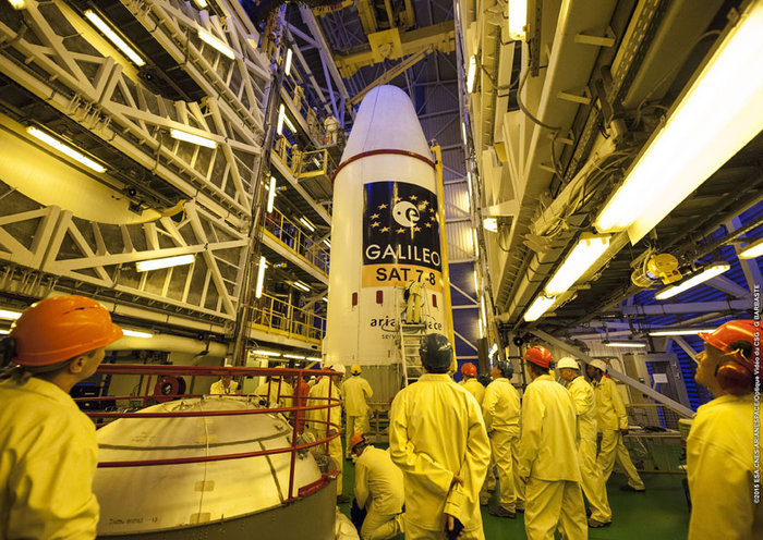
The upper composite containing the seventh and eighth Galileo satellites attached to their dispenser atop the Fregat upper stage inside the launcher fairing was hauled up the mobile launch tower then attached to the first three stages of its Soyuz ST-B launcher on March 24. (Photo courtesy of ESA) The seventh and eighth Galileo satellites are scheduled for launch Friday, March 27, at 21:46:18 GMT (22:46:18 CET) atop a Soyuz ST-B rocket from Europe’s Spaceport in French Guiana. Streaming starts at 21:24 GMT (22:24 CET) at the European Space Agency website.
The first three stages of the Soyuz rocket will take the Galileo satellites and their Fregat upper stage into low orbit. Then the reignitable Fregat, as much a spacecraft as a rocket stage, will take over the task of hauling the satellites higher through a pair of burns. The satellites will be released in opposite directions by their dispenser once they reach their set 22,522 kilometer-altitude orbit 3 hours, 47 minutes, 57 seconds after launch.
The webstream will cover the launch and orbital insertion in two parts. The first part begins at 21:24 GMT (22:24 CET) and ends at 22:19 GMT (23:24 CET). The second part begins at 01:22 GMT (02:22 CET) and ends at 02:17 GMT (03:17 CET).
-
Mobile World Congress Sees Rise in Indoor Location Companies

Kevin Dennehy This year’s Mobile World Congress in Barcelona was the biggest ever, with 95,000 attendees and thousands of booths, conferences and people with sore feet walking a cavernous exhibition hall. While the Geneva Auto Show ran close to the same dates, connected vehicle companies and technology were prominently featured. What was interesting, however, was the rise of indoor positioning companies and mobile advertising agencies with interest in location.
BARCELONA — Joining the 95,000 or so Mobile World Congress attendees were about three dozen companies who are offering indoor location and location advertising services. These companies have exhibited at previous conferences, but not in the numbers this year.
At the huge Fira convention center where MWC was held March 2-5, Los Altos, Calif.-based Pole Star installed more than 600 beacons for indoor location. Visitors were able to be guided to booths and other areas through an interactive map. “Business was good in 2014, we sold 10,000 beacons. We are making money,” said Christian Carle, Pole Star CEO.
One analyst said that the big change at MWC wasn’t the number of indoor positioning companies and demos, but the maturity and breadth of the technology. “Intel announced indoor positioning capabilities in their Wi-Fi chip, and had a demo that was very impressive. Many smaller companies that in past years were showing raw technology were showing polished solutions this year, such as Quuppa, MTI and Sensewhere, said Bruce Krulwich, Grizzly Analytics president, who has authored a report identifying 150 indoor positioning companies. “I definitely see a shake-out coming up, but it won’t be one technology prevailing over another. Different technologies meet different needs in the industry, and different technologies fit different sites. There are technologies that deliver universal indoor positioning, without any infrastructure or preparation, such as Wi-Fi multilateration and sensor fusion.”
Krulwich said that there is a shake-out that’s already started because there are too many companies working on similar technologies. “Start-ups in the area that don’t have differentiating innovation, don’t have integration into retail or other back-end systems, and don’t have market penetration, are already finding themselves in a challenge. But companies with clear innovations and commercial deployments will do fine,” he said.
United Kingdom-based Sensewhere is using crowdsourcing in its indoor positioning software. The software uses radios to scan for Wi-Fi and Bluetooth to allow an IP location to reference the sources and form a location database.
“It’s what we call the universal indoor positioning versus venue specific indoor positioning, which can work anywhere — we just need a crowd of people. Our target partners are handset manufacturers, network operators, social media, social network providers, and also chipset guys as well,” said Rob Palfreyman, Sensewhere CEO. “So, there are obviously a lot of companies like Google looking at venues; there is Micello and TomTom looking at add-ins in the indoor location, which is great news, but it just needs to have a technology that can drive the blue dot on their map, and we feel that Sensewhere is the right place to provide that blue dot because of the crowdsourcing global nature of our approach.”
One company, which has developed a popular mobile game, is using its network to attract advertisers for its location-based ad platform. “We already have the infrastructure in place because of our mobile game. With our platform, we can allow advertisers to launch campaigns using our beacon signals and geofencing,” said Pedro Jahara, CEO of Brazil-based RevMob.
New location technology like the ability to track SIM cards was rolled out at MWC. W-Locate, which is partnering with Morpho in Thailand, is tracking SIM cards with its XimLoc product, which the company said is more accurate indoors than other technology.
Even such companies as Geotab, which is a strong player in the fleet market, are leveraging MWC to continue a foothold in the European market. The company displayed its IOX-CAN system that can send data from a mobile device to the MyGeotab system, which can be viewed an analyzed by fleet managers, said Maria Sotra, Geotab marketing manager.
Geotab also partnered with Telefonica in November 2014 to focus efforts in Spain, Germany and the United Kingdom, Sotra said.
At MWC, location-based advertising market is gaining traction as advertisers are seeing the benefit of locating and attracting customers. New York-based xAd said it has doubled its revenue for the second year. “We have billions of mobile ads processed and billions of ad impressions. The company is profitable,” said Dipanshu Sharma, xAd founder and CEO.
He said the company has expanded into France and Germany and added China to its global ad network.
Another company that is using location technology as a differentiator is Airpush, which had another big presence at MWC. The company’s Abstract Banners was a big draw to attendees. Location, particularly geofenced areas, have created a call to action for consumers, which is attractive to advertisers, said Cameron Peeples, Airpush vice president of marketing.
Connected Car Still Big Opportunity at MWC
Although the Geneva Auto Show was starting as the MWC was ending, there were still several big announcements by connected car companies in Barcelona. Even the well-publicized Samsung S6 and S6 Edge and HTC One M9 handset rollouts included Mirrorlink, the connected vehicle standard from the Connected Car Consortium.
In another big announcement, Audi and AT&T said that all 2016 model vehicles equipped with Audi connect will come with the carrier’s 4G LTE or 3G coverage. This increase in services is big because the auto giant just rolled out 4G AT&T service in Audi A3s last year.
AT&T selected Airbiquity to provide end-user registration and device management connected vehicle services for select customer programs. “Airbiquity will deliver these services to AT&T using our Choreo cloud-based connected vehicle services delivery platform and project management, engineering, and operations teams,” said David Jumpa, Airbiquity chief revenue officer. “This is a ‘white label’ agreement whereby AT&T will integrate Airbiquity’s service delivery capability into AT&T’s connected vehicle customer solutions.”
Another location company is making huge inroads in connected vehicle markets with its Glympse for Autos product. Glympse will be installed in select Volkswagen and Peugeot models through MirrorLink, said Bryan Trussel, company co-founder and CEO.
The app allows users to share location from their vehicle by setting the recipient and timer, and hitting send. The company has a similar app for Gogo inflight aviation networks to allow a person on the ground to know where an airplane is for picking up passengers.
In other connected car news, Accenture is providing Fiat Chrysler Automobiles the capability of in-car, Internet-based services. Starting with the new Fiat 500X, Uconnect Live services, which was co-developed by Accenture, will power an infotainment system that offers music and news services, social network access, the ability to monitor driving style and a range of diagnostic services.
Accenture also partnered with Visa for an IoT-based connected car commerce test. At MWC, the company tested a scenario where drivers could order food from the car using cellular, Bluetooth and beacon connectivity. Accenture deployed a similar system with BMW’s ConnectedDrive, which allows customers to choose services in real time for a vehicle.
Health Market Even Has Location Potential
Niche location applications are growing as Internet of Things, or IoT, markets start to grow. One company taking advantage of the mobile market is Annapolis, Md.-based TCS, which featured its VirtuMedix platform in its MWC booth.
The platform is tailored to emergency physicians as part of the growing market for video telemedicine products and mobile health, said Jay Whitehurst, TCS commercial software group president. “It’s already saving lives,” he said of the platform, which combines encryption, navigation, mapping and messaging.
While the product, now being rolled out in a North Carolina emergency medicine group, provides patients with an alternative to urgent care centers and emergency rooms, it also can be used for longer term cases such as assisted living and rehab centers, the company said.
Whitehurst said TCS has made several company acquisitions that have played a part in new product rollouts, which include the company’s Trusted Location. The application allows financial firms, online gaming companies and others to identify and prevent credit-card fraud. The application identifies and validates a device’s location worldwide.
In other Mobile World Congress news:
- Spirent said its simulators have the capability to evaluate Wi-Fi Offload and Wi-Fi performance of mobile devices on its test framework. The new product allows companies to test multiple devices on a single unit to cover Wi-Fi/LTE mobility and interoperability. The testing is important in light of wireless carriers’ strategy to extend VoLTE in areas where cell coverage is limited, said Saul Einbinder, Spirent vice president, venture development.
- Google Waze said its Google Mobile Service (GMS) will be available as a preinstall option on mobile devices. OEMs and carriers can preinstall the app on their handsets so consumers can use the service immediately, the company said.
- Trimble’s ALK said its ALK Maps and route visualization software is now available in Europe. ALK Maps, launched in the United States in 2012, allows users to overlay routing, geocoding points, weather and other features, the company said.
- Although the announcement was not made at MWC, but has huge implications for mobile, Uber’s purchase of veteran location company deCarta was a big one. The deal’s financial terms were not disclosed, but the question legitimizes Uber’s desire to be a major autonomous vehicle player like Google.
-
iTrack Solutions Provides Web-Based Fleet Management Software
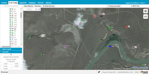
Photo: Integrated Tracking Solutions Integrated Tracking (iTrack) Solutions Loki Gen 6 is a web-based mapping software derived from a series of other Loki software products focused on asset tracking for large fleets of vehicles.
The maps are provided by Bing, but custom mapping can also be used with the support of Esri ArcGIS REST services and shapefiles.
iTrack Solutions is based in Calgary, Canada, and provides GPS tracking, mobile data communications and display software. The Loki Gen 6 features are listed below.
Home
Home is a configurable dashboard showing plans, schedules, calendars and other details.Live View
Live View shows the live BING map from anywhere in the world, which includes maps, satellite and aerial imagery as well as maps provided by the user. Video streams are supported, and a 3D viewing feature is provided from Cesium. A user can add or draw features on the map to share with other users.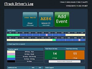
Photo: Integrated Tracking Solutions Communication
With this feature, users can communicate one-to-one or through a chat room, which includes video chat functionality.Management
An administrative user can assign tracking devices to vehicles, assign vehicles to subgroups, assign subgroups to larger groups or drivers to vehicles. An administrator also can set privileges for individual users.Access to data
Users can generate and view a replay on the fly as well as generate reports for vehicle tracking, hours in service, mileage, stop location and speed.Observations, Analysis
The forum feature provides a place group discussion, which becomes part of the Loki database, is searchable and can be linked to reports and replays. -
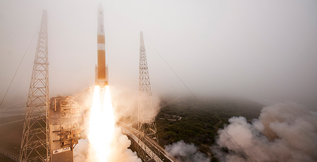
GPS IIF-9 Successfully Lifts Off from Cape Canaveral
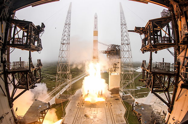
Photo credit: ULA. UPDATE: The GPS satellite has been deployed by the Delta IV rocket, completing today’s launch. The deployment occcurred as scheduled about 3 hours after launch.
The U.S. Air Force’s ninth GPS Block IIF satellite (GPS IIF-9) launched on time Wednesday at 2:36 p.m. EDT (1836 GMT) from Space Launch Complex 37 at Cape Canaveral Air Force Station, Fla.
The GPS IIF-9 rode aboard a United Launch Alliance (ULA) Delta IV rocket, which has been the workhorse of the GPS fleet for successful launches.
GPS IIF-9 is one of the next-generation GPS satellites, incorporating various improvements to provide greater accuracy, increased signals, and enhanced performance for users.
The Air Force and the 45th Space Wing supported the successful launch of the ULA rocket. This launch is the fourth ULA launch this year and the 95th launch since the company was formed in December 2006.
GPS IIF-9 launched aboard a Delta IV Medium-plus (4,2) Evolved Expendable Launch Vehicle, using a single ULA common booster core powered by an Aerojet Rocketdyne RS-68 main engine, along with two ATK GEM 60 solid rocket motors. The upper stage was powered by an Aerojet Rocketdyne RL10B-2 engine with the satellite encapsulated in a four-meter diameter composite payload fairing.
GPS Launch Workhorse. The launch marks the 29th Delta IV launch and the 57th operational GPS satellite to launch on a ULA or heritage launch vehicle. Delta IV has delivered numerous satellites for the National Reconnaissance Office (NRO), as well as GPS satellites for the Air Force and weather satellites for NASA, according to a ULA media release.
“Many thought the Delta IV and GPS days were long gone, but the recent questions concerning reliable and proven launch vehicles have brought them back online, so to speak, for GPS,” said GPS World Defense Editor Don Jewell. The upcoming (April 27) 20-year milestone for GPS space vehicles on orbit translates to approximately 500 orbital years just for the IIR and IIF constellations alone,” Jewell said. “The IIAs may account for that many orbital hours as well. Quite a record, and something of which the U.S. Air Force (USAF) and all the companies involved should be very proud.”
Yet Another USAF Success. Jewell points out that this is another successful government launch in a long string of successive launches, without a failure. “It is by far the most successful launch record ever put together by any nation or government. No other space-faring nation even comes close. The U.S. Air Force and all the players should be proud of all these records and more, plus we have one more GPS asset on orbit, providing GPS signals to the world and all they enable, courtesy of the USAF.”
“I’m elated with today’s successful launch, the GPS constellation remains healthy, strong and robust and in over 20 years since initial operational capability, GPS has never failed to deliver on its global positioning, navigation, and timing commitments,” said Brig. Gen. Cooley, director of Space and Missile Systems Center’s Global Positioning Systems Directorate.
“Each new generation of GPS satellites provides enhanced capability over the prior generations, and has delivered reliable performance demonstrating our commitment that GPS remain the Gold Standard space-based positioning, navigation, and timing service for the future,” Cooley said. “Thanks to the men and women of SMC, the 45th, 50th 310th Space Wings, Boeing, United Launch Alliance, the Aerospace Corporation, GPS IIF and Delta IV launch teams, the GPS IIF program continues to meet GPS enterprise needs.”
45th Space Wing. Once again, the 45th Space Wing team of military personnel, government civilians, and contractors provided support to the ULA launch of the Air Force Space Command mission, including weather forecasts, launch and range operations, security, safety, and public affairs.
The 45th Space Wing commander was both proud and pleased with the team she works with on the Eastern Range. “First, let me offer my heartiest congratulations to ULA, Boeing, Space and Missile Systems Center, the Launch Systems Directorate, the Global Positioning Systems Directorate, and all the mission partners who made this happen,” said Brig. Gen. Nina Armagno, 45th Space Wing commander, who also served as the Launch Decision Authority.
“What a treat — and an honor — it is to know that we have played such a significant part in something that we will celebrate two decades of helping people all around the world,” Armagno said. “Every GPS satellite since the program’s inception has been launched right here from Cape Canaveral Air Force Station safely and reliably by members of the 45th Space Wing.
“And that’s because we continue to take a ‘one launch at a time’ mentality and focus on our number one priority — 100 percent Mission Success. I am so very proud to be part of Team Patrick-Cape.”
Constellation Changes. The Air Force Second Space Operations Squadron (2 SOPS) indicates that IIF-9, SVN-71/PRN-26, will replace SVN-35 (currently being operated in Launch, Anomaly Resolution and Disposal Operations [LADO]) in the B plane slot 1F. SVN-35 is a GPS 2A-22 satellite originally launched aboard Delta 222 on August 30, 1993. It was decommissioned from active service in 2009, remained in orbit as a spare, then was set usable again in 2011. The satellite was declared unusable in 2013 and decommissioned a second time, reports Spaceflight Now. It was tested again in 2014.
SVN-38/PRN-08 will be taken out of the operational constellation prior to SVN-71 payload initialization and sent to LADO. PRN-08 will be assigned to SVN-49 in May and set to test, but is tentatively scheduled for assignment to IIF-10 to launch June 16.
SVN-35, launched on August 30, 1993, has been in a residual status since March 2013 in an expanded node slot in the B plane and successfully served 21.5 years, 14.0 years beyond its designed service life, due to the diligent efforts of the men and women of the U.S. Air Force.
SVN-51 is still in a re-phase journey from E1 (GLAN=146 °) to an auxiliary node at E7 (GLAN=60.7 °) scheduled to arrive sometime this summer.
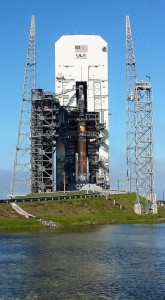
Courtesy photo/John Studwell, provided by 45th Space Wing Public Affairs. 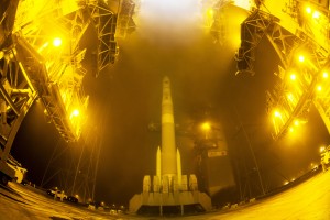
Photo credit: ULA. 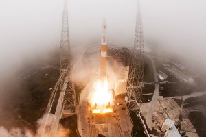
Photo credit: ULA. 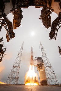
Photo credit: ULA. 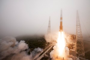
Photo credit: ULA. 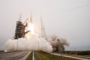
Photo credit: ULA. 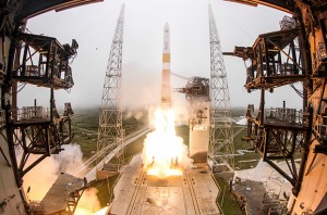
Photo credit: ULA. -

Uber and Decarta: Automated Taxi Tomorrow?
Janice Partyka The force of mapping was punctuated this month when Uber, the juggernaut taxi service, acquired long-time mapping and navigation company deCarta. Uber and its competitor, Lyft, redefined taxi service with a smartphone app that connects users and drivers. These services have exceled by offering reliable low-cost rides and quick pick-ups, functionality that is enabled by seamless mapping and navigation technologies. Acquisition of a mapping company serves Uber’s high ambitions.
Following introduction in San Francisco and New York, Uber just rolled out its ride sharing service, UberPool, in my city, Los Angeles. The service allows multiple individual customers going in the same direction to share a ride and lower their fare by as much as half. The potential for reducing traffic in congested cities is large, but how likely is it that UberPool can find matches and people willing to ride with strangers?
 Effective vehicle routing, navigation and traffic prediction is critical to making UberPool work. First, Uber must find pairs of trips that are similar enough in their timing and pathways to make a pairing attractive to the riders. Then, Uber needs to execute quickly and on time, given the unpredictability of whether the other rider is ready when expected. Coping with these uncertainties will be a huge challenge for Uber. Just 10 percent of work trips in America are by carpool. Can Uber develop the algorithm to make ride sharing attractive? Let’s wait and see.
It is no surprise that Uber has announced that it will be developing self-driving car technology with the goal of self-driving Uber taxis. This puts it in direct competition with Google, one of Uber’s largest investors. Uber has partnered with Carnegie Mellon University to create a research center for mapping, vehicle safety and autonomy technology. If Uber can someday build cars that drive themselves, they can eliminate the need for a driver. The question for 2015 may well be, who is not pursuing driverless cars? Maybe Macy’s and Martha Stewart will partner on a particularly tasteful automated vehicle? Do you think you’d still have to tip?
In other news, two former leading location competitors, LocationSmart and Locaid, have merged. Together they have the largest location-as-a-service platform for enterprise location for mission-critical applications in a number of industries including service assistance, proximity marketing, workforce management, emergency alerting, mobile gaming and transaction verification. As far as I know, they are not developing a self-driving vehicle.
-
Latin America Sanitation Company Goes with ProMark
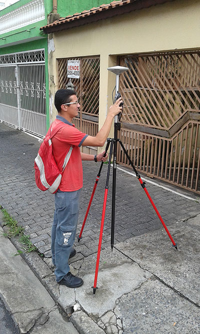
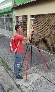 Saneamento Basico do Estado de São Paulo (SABESP), a Brazilian water and sewage collection utility owned by São Paulo state and Latin America’s largest water company by market capitalization, has selected Spectra Precision ProMark 120 and 220 GNSS receivers to assist in gathering the geographic location of all SABESP network assets and the location of all customers.
SABESP provides water to more than 28.7 million customers, or 67 percent of the population of São Paulo state. Water loss due to leakage in the SABESP network is a significant problem. The biggest reason behind water loss is leaks in the network; additional factors include sub-metering, caused by low water pressure; unauthorized consumption; and fraud.
Improving water management, recovering lost revenue and improving the quality of the customer experience is a priority for SABESP, Spectra Precision said. To help improve revenue generation and reduce water loss, SABESP developed two projects: LigGeo, to geo-reference the water meter location of approximately 4.8 million SABESP customers; and CadGeo, to geo-reference and register the location of the SABESP water and sewage network infrastructure.
According to Marcos Almir, sanitation systems analyst for the metropolitan department of development and management of SABESP, the twin projects of LigGeo and CadGeo were motivated by SABESP’s desire to improve productivity and competitiveness. “We created an innovative GIS effort to geo-reference and register SABESP distribution networks and buried assets. Tests showed the technical feasibility of using ProMark GNSS receivers and collectors with NTRIP technology to efficiently and effectively register all SABESP equipment in real time with geo-referenced attributes connected to the technical and commercial enterprise systems to optimize processes and reduce costs.”
To implement the LigGeo and CadGeo projects, SABESP purchased 50 ProMark 120 and 220 GNSS receivers from Hezolinem Equipamentos Topograficos, Spectra Precision’s Brazil dealer. Both SABESP technicians and outsourced service providers will use the receivers.
ProMark 120/220 GNSS receivers were chosen for their multiple advantages: They could be purchased as rovers only; they could run LigGeo and CadGeo proprietary software; they are compatible with local third-party networks, including CEGAT, Brazil’s largest private RTK geodetic base network, that delivers RTK network corrections enabling real-time accuracy of less that 20 cm; and they offered direct two-way 3G communication of information with the SABESP central cartographic base raster files.
-
IAIN World Congress Abstract Deadline Extended to March 31
 World Congress 2015, sponsored by the International Association of Institutes of Navigation (IAIN), has extended its deadline for abstract submissions to March 31.
The event will be held October 23-25 at the Clarion Congress Hotel in Prague, Czech Republic.
After abstracts are reviewed, authors will be notified of acceptance or rejection by April 15.
Speakers include Satoshi Kogure of the Japan Aerospace Exploration Agency, GPS World author Dorota Grejner-Brzezinska of the Institute of Navigation and The Ohio State University, Günter Hein of the European Space Agency, and more.
Topics of the event include:
- satellite navigation systems — GPS, GLONASS, Galileo, BeiDou/Compass, QZSS, etc.;
- augmentation systems — SBAS, GBAS, etc.;
- GNSS modernization;
- signal processing in navigation systems and systems integration;
- GNSS receivers and antenna technologies;
- interference and spectrum management, jamming and spoofing;
- autonomous navigation;
- MEMS, atomic clock and micro PNT;
- space and atmospheric weather effects on GNSS;
- aviation applications;
- marine applications;
- terrestrial applications;
- precision agriculture and machine control applications;
- healthcare applications;
- urban and indoors applications;
- automobile navigation;
- space applications and remote sensing;
- precise positioning, RTK;
- radar and alternative sensors;
- GNSS environmental monitoring;
- ionosphere monitoring with GNSS;
- algorithms and methods;
- collaborative methods;
- alternative signals for PNT;
- backups to GNSS;
- time and frequency distribution;
- and other PNT topics.
IAIN says it is a “non-governmental, nonprofit organization with the objective of uniting national and multinational institutes and organizations which aim to foster human activities at sea, in the air, in space and on land, and who may benefit from the development of the science and practice of navigation and related information techniques.”
Visitors from non-European countries must possess a valid passport for at least three months after the event date.
Learn more at the Congress website.