Editor’s Note: Alan Cameron is editor-in-chief and publisher of GPS World magazine. He also writes the monthly GNSS Design & Test newsletter. The views expressed are his own.
“It’s tough to make predictions, especially about the future.” This insight comes from the 20th-century American sage Yogi Berra. Yet predictions — hedged guesses, if you will — form the basis of nearly all new business ventures and decisions in ongoing business activities.
For surveyors in the year 2015, one of the key predictions — or guesses — to make concerns the next GNSS to come predictably and reliably online, to augment GPS where GPS alone does not fully function: under canopy, in dense urban environments, and so on. More satellites visible at more varied angles in the sky can help surmount these obstructions.
Staking the future of one’s business, in the form of new equipment acquisition, in such an environment is a bit like betting on a long-distance horse race. First one steed surges to the head of the pack, then it falls back as another charges forward. We have seen this pattern repeatedly in the growth of GLONASS, Galileo and BeiDou.
Some may say that GLONASS, the Russian system, has already won the race (the first heat, at least) and currently fills the role of GPS partner in precision surveying. It does, to some extent, but its future viability is cloudy — and its past record is patchy, to say the least. It rose to full operational capability around the turn of the century, then fell very, very low in numbers as short-lived satellites expired and were not replaced at sufficient rate. Recently, GLONASS has mounted a resurgence, but that has been marred by repeated launch failures and a disturbing anomaly. It cannot be counted or confirmed a winner, yet.
I spoke yesterday with an expert and veteran professional land surveyor who expressed the opinion that the manner in which surveying is conducted will change more in the next five years than it has in the last 25. Keep in mind that the last 25 years saw enormous changes themselves, as GPS significantly transformed, upgraded and made vastly more efficient most surveying activities.
Betting on a horse race in such a rapidly changing environment becomes even more chancy.
Here’s a tip from a racetrack tout: don’t count Galileo out.
GLONASS we recounted briefly above. BeiDou recently achieved a regional operations status over Eastern Asia, but further developments there have been puzzlingly quiet for some time.
The European system has come on with agonizing slowness since the year 2000, suffering many delays and most recently what could have been a debilitating failed dual launch. But the combined strength of the European Union continues to push determinedly forward, and the program has an ambitious schedule with an eye firmly fixed on operability. And some recent research results tend — perhaps — to substantiate the claim, long pooh-poohed by those in the United States, at least, that Galileo will eventually prove “better” than GPS. Details further on.
What might a prudent yet pragmatic, forward-looking surveying firm do in this uncertain environment, where the only certainty is change, and likely to be rapid change at that? Here’s another racetrack tip: don’t make any big bets just yet, but study the field closely and continuously. In particular, watch Galileo’s performance.
A further item to be checked in Galileo’s favor: its system operators have long been in close talks with the U.S. government on many matters involving co-operation and interoperability. As recounted in a recent story concerning the Federal Communications Commission’s surprising role in this matter, the Europeans are filling out the proper forms for full accreditation within the United States. This could turn out to be important in business operations.
Back to studying the field closely: also study leading manufacturers’ offerings in this regard. They also are making bets on the future; quite possibly they have better information, and/or have done more extensive analysis of what information is available, paired with in-depth, highly technical research and development of signal characteristics and how signals from disparate GNSS can be most productively combined.
A quick scan of GPS World’s2015 GNSS Receiver Survey shows the following key manufacturers (among others) have GPS receivers now commercially available that are Galileo-ready: Altus Positioning Systems, Ashtech, Geneq, iFEN, JAVAD GNSS, Leica Geosystems, NovAtel, NVS Technologies, Septentrio, Sprecta Precision, Spectrum, Topcon, and Trimble.
Better than GPS???
Supporters of Galileo have long raised hackles west of the Atlantic with claims that Galileo would provide better accuracy than GPS. Not! cried the faithful, and especially not when the modernized and improved, strengthened, more accurate GPS III signals are coming along just as fast if not faster than Galileo. Recently the pace of GPS III has come into question; can the Gold Standard and clear leader for 25+ years really be falling back into the pack?
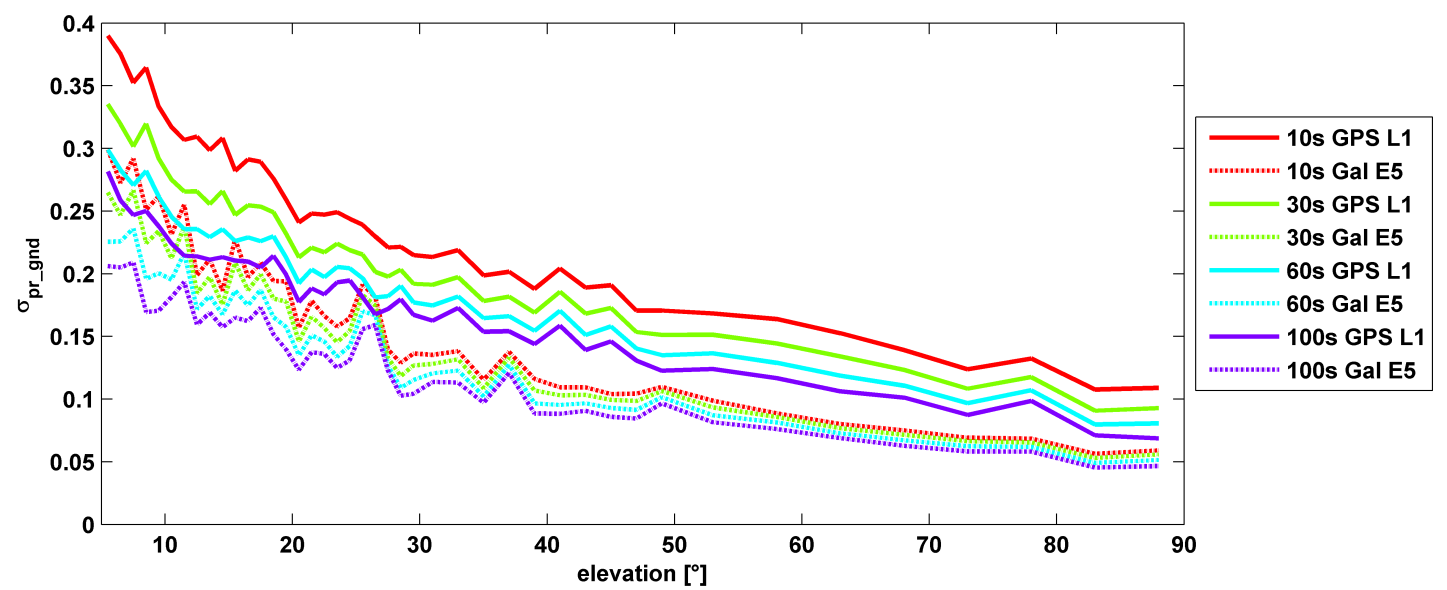
σ(pr_gnd) versus elevation for Galileo E1 (dotted lines) and GPS L1 (solid lines for different smoothing constants: red (10s), green (30s), cyan (60s), purple (100s).
Let’s disregard that question for the time being, and look at some recent research, to be reported in full in the cover story of GPS World magazine’s April issue, out soon. In it, the authors (two German and one American researcher) report:
“Analysis of new Galileo signals at an experimental ground-based augmentation system (GBAS) compares noise and multipath in their performance to GPS L1 and L5. Raw noise and multipath level of the Galileo signals is shown to be smaller than those of GPS. Even after smoothing, Galileo signals perform somewhat better than GPS and are less sensitive to the smoothing time constant.”
This is all pretty arcane and a bit removed from current field of operations, as far as surveyors are concerned. But it does signal something, and it provides food for thought.
The researchers obtained their results using four JAVAD Delta receivers, all connected to Leica AR 25 choke ring antennas.
GIS software provider Supergeo will release an NTRIP solution on SuperPad, its Windows Mobile GIS app, for high-accuracy field data collection and geospatial workflow enhancement.
SuperPad is a feature-rich mobile GIS application for field-based personnel to collect, edit, display and measure spatial data. The flexible development environment and customized extensions enable users to create a custom platform. SuperPad supports synchronizing data with an enterprise’s server to improve efficiency.
SuperPad version 3.3 will support an NTRIP solution with RTK technology. Real-time kinematic (RTK) satellite navigation, one of the latest and widely used technologies within the field of differential GNSS, significantly enhances the precision of the positioning data. RTK positioning can raise accuracy to the centimeter-level.
With the NTRIP solution, SuperPad is not only be capable of handling post-process DGNSS workflow, but also allows users to connect to network RTK service providers with NTRIP protocol, such as a virtual reference station RTK service provider or private station services. Its operations for turning on the module and quick-to-use settings will save surveyors time, while supporting GNSS receivers from makers such as u-blox, Hemisphere GNSS and NovAtel.
Progress of the SuperPad NTRIP Extension is also visualized as a condition monitoring informer on the map intuitively. Users looking for high accuracy or precision status with the RTK correction will find more details about the fixing mode and GNSS information presented clearly with the renewed GPS Status pages.
During the integrated electrical checks on March 3 of the launch vehicle and satellite following closure of the heat shield, an anomaly was observed in one of the telemetry transmitters of the satellite, according to a post on the Indian Space Research Organization (ISRO)’s Facebook page.
“In order to resolve the technical anomaly through further test, simulation and analysis, the launch of PSLV-C27 with IRNSS-1D has been postponed,” the post states. IRNSS-1D will be flown into space in the Indian Polar Satellite Launch Vehicle-XL (PSLV-C27) from Satish Dhawan Space Centre, Sriharikota.
IRNSS-1D is the fourth navigation satellite in the Indian Regional Navigational Satellite System, and will make the constellation operable.
Geomatics USA from Gainesville, Fla., has designed a precision surveying and mapping system that can be easily stowed in an overhead compartment for airline travel. Surveyors can fit everything needed for important mapping and surveying jobs into a baseball-style bag, including tripods. The compact, light-weight system offers differential sub-foot accuracy.
Components easily pack into a baseball-style case.
The G1-m1 receiver system has many advantages over conventional GNSS receivers, Geomatics said. The system is designed for precision surveying jobs that require travel to remote areas of the world, and for traveling to job sites by commercial airline. The complete base and rover kit, including the tripods, rods, and batteries, fits into a single baseball style bag and weigh less than 10 kg, making it easy to stow as carry-on luggage.
The Geomatics USA G1 system is scalable from a simple single-frequency semi-mobile receiver — ideal for control networks and some semi-kinematic mapping applications — to a dual-frequency network RTK solution. All of the Geomatics USA G1 solutions perform precision-quality tasks at a fraction of the cost of major-brand equipment.
The G1-m1 system comes with a free processing software license for the first 50 systems that supports carrier-phase relative positioning and CA-code differential correction. The software is designed with a simple user interface for easy selection of base and rover data or automatic data download of the closest Continuously Operating Reference Station (CORS) from the U.S. National Geodetic Survey database. It is compatible with other RINEX based post-process systems around the world.
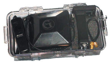
Complete survey set including GNSS receiver, antenna, battery and cables, fits in a small handheld plastic case.
According to Geomatics USA Chief Technology Officer Ahmed Mohamed, “The G1 product line fills the gap between survey applications, where cm-level precision is an absolute necessity, and mapping applications, where meter-level precision is acceptable. In fact, the G1-m1 product offers sub-foot precision in most cases and cm-level precision in ideal situations. Geomatics USA uses readily available components and open-source code to develop its end user product solutions. The objective is to make sure the software performs correctly with a very short learning curve for the user.”
For a limited time, Geomatics is offering a specially priced configuration for the first 50 systems through NavtechGPS, its worldwide distributor.
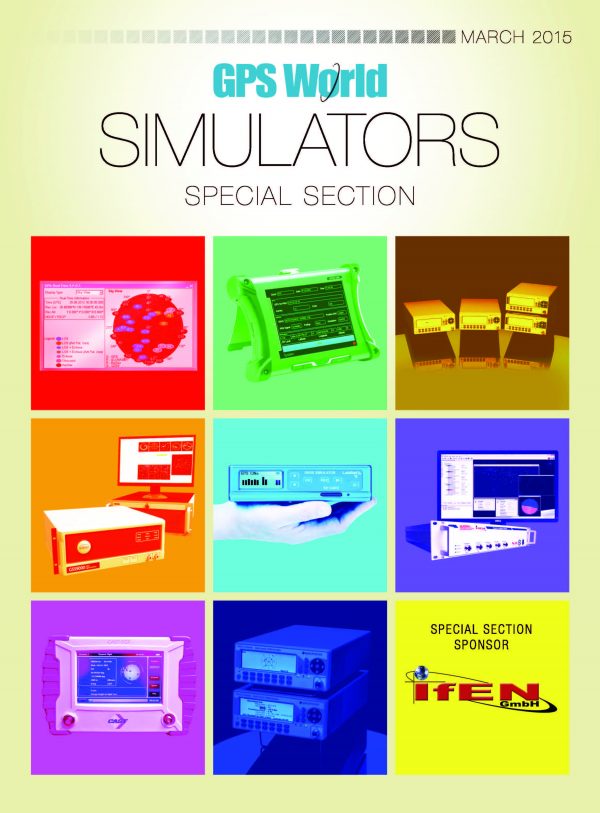
Special Section, March 2015. Download a PDF of this section, with the Simulator Product Showcase.
CAST Navigation
CAST-SGX GPS Satellite Simulator
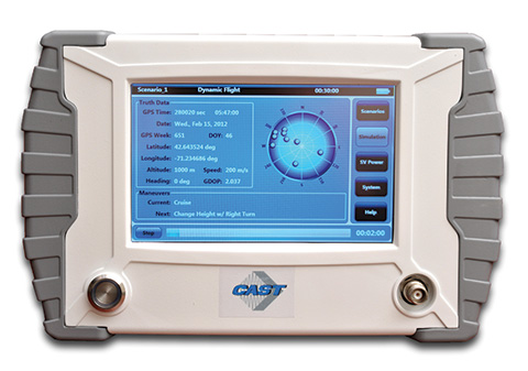
The SGX GPS satellite signal simulator from CAST Navigation. Photo: CAST Navigation
The SGX GPS satellite signal simulator from CAST Navigation provides the user with dynamic, repeatable GPS RF signals for use in the laboratory or in the field for a wide range of GPS applications. The SGX simulator is housed in a portable, lightweight, handheld enclosure measuring 7 x 11 x 3 inches and weighing just over 4 pounds.
The SGX is lightweight and portable, operates on AC or battery power, and features 16 channels of L1 C/A and P codes. Based on CAST’s technology that has been developed for use in the company’s larger military products, it is extremely accurate and repeatable.
The SGX is controlled via an intuitive touchscreen interface that allows the user to select, start, and stop scenarios, change screen views, and change satellite RF power levels while a scenario is running. Three test scenarios are delivered with the simulator.
XGEN Plus Scenario Generation Software. This software gives the user the ability to generate custom scenarios for use with the SGX. The software allows for complete control over GPS almanac, ephemeris, and all satellite error sources.
The user can select from a variety of vehicle types and simulate static or dynamic motion. The user can also employ antenna gain patterns and vehicle silhouettes if desired. The user can generate a customized high precision six-degree-of-freedom trajectory simply by defining a mission profile that is based on raw maneuvers, waypoints, Google Maps or a combination of these maneuver types.The new scenarios can be downloaded via USB port or SD card interfaces.
CAST has been in the GPS simulation and support business for more than 30 years, designing, developing, manufacturing, and integrating innovative GPS/INS simulators and associated test equipment for government, military, prime vendor, and consumer markets.
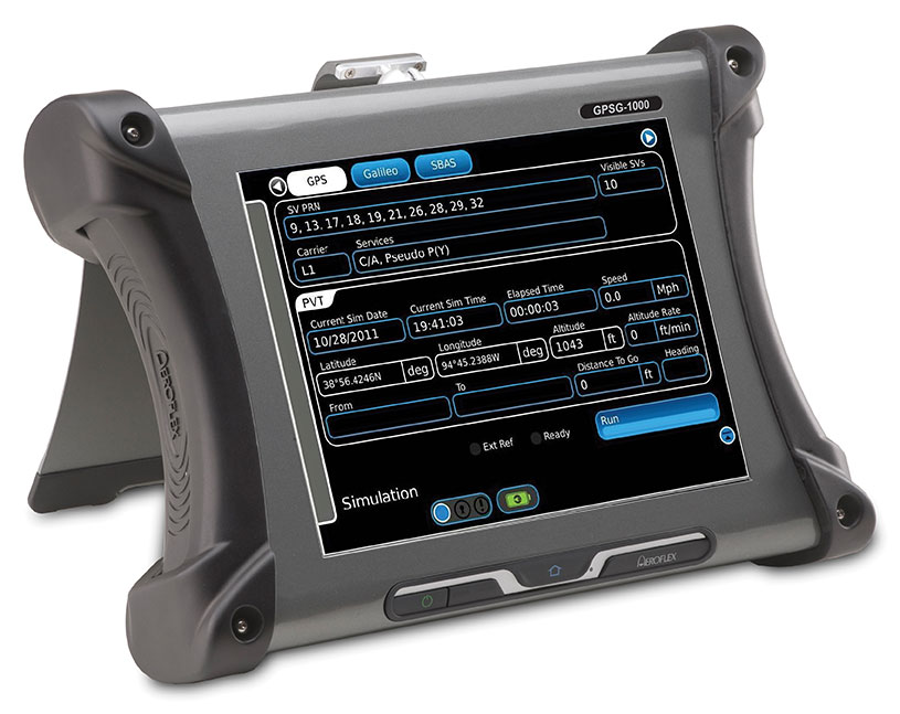
Designed to be a versatile yet affordable satellite simulator, the GPSG-1000 is proving to be a vital instrument used by those validating and testing GNSS receivers in a variety of applications within the transportation, consumer electronics, aerospace and military industry segments, to name a few.
The GPSG-1000 is a single carrier, multi-channel GPS/Galileo simulator that is portable and ruggedized so it can be safely and confidently deployed in a variety of outdoor and indoor environments. The unit is available in a 6- or 12-channel configuration, and supports the following GNSS signals: L1, L1C, L2C, L5, E1, E5, E5a, E5b and SBAS (WAAS and EGNOS).
The GPSG-1000 can be directly connected to a GNSS receiver under test. It can also simulate actual “open-sky” situations whereby the unit can generate its signals through the included antenna coupler system that isolates and transmits to the UUT’s antenna(s). Utilizing an integrated GPS receiver, the GPSG-1000 simulates actual time of day and date as well as the real constellation that would be available for navigation at that specific point in time. Multiple almanacs and route files can be saved to the GPSG’s memory, thereby enabling current and past history dynamic motion, constellation environment creation/recreation and other significant troubleshooting capabilities. During any given static or dynamic simulation, space vehicle parametrics and health can be user controlled.
The GPSG-1000 features a touchscreen user interface that can be remotely hosted via an integrated Ethernet port. The unit uses a rechargeable, Lithium Ion battery enabling hours of untethered use, and can also be used while the battery is recharging.
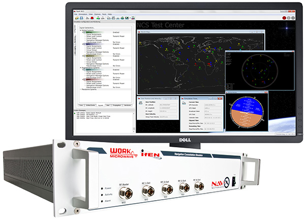
The NavX-NCS Professional GNSS Simulator by IFEN. Photo: IFEN
The absolute flexibility of the NavX-NCS Professional GNSS Simulator allows it to be configured with up to 108 channels and all of the following signals:
GPS L1/L2/L5 C/A & P code and L2C
GLONASS G1/G2 standard & high accuracy codes
Galileo E1/E5/E6 (BOC/CBOC/AltBOC)
BeiDou B1/B2/B3
SBAS L1/L5 (WAAS, EGNOS, MSAS, GAGAN)
QZSS L1 & L1-SAIF
IMES
The user is enabled to assign signals freely to any of the RF modules fitted to the simulator. This allows the same hardware to be used in a range of different configurations.
Signals may be added by software license with no need to return the hardware for upgrade.
Up to four independent RF outputs may be fitted, enabling the user to simulate multiple antenna locations simultaneously (allowing simulation of multiple antennas on one vehicle, multiple vehicles simultaneously, a mixture of static locations and mobile vehicles, and multiple antenna elements for Controlled Reception Pattern Antenna [CRPA] testing).
The comprehensive and easy-to-use Control Center operating software allows the operator to quickly create realistic test scenarios for effective testing of user equipment.
IFEN also offers the NavX-NCS Essential GNSS Simulator, which is available with 21 or 42 channels and is capable of simulating GPS L1 (including SBAS L1), GLONASS G1, Galileo E1, BeiDou B1, QZSS L1, and IMES. The simulator is also supplied with Control Center operating software for comprehensive scenario generation.
For USA and Canada: Mark Wilson; phone: 951-739-7331; email: [email protected]
Racelogic
LabSat 3 Triple Constellation Simulator
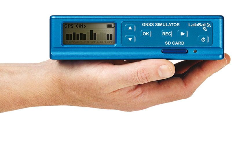
RaceLogic LabSat 3. Photo: RaceLogic
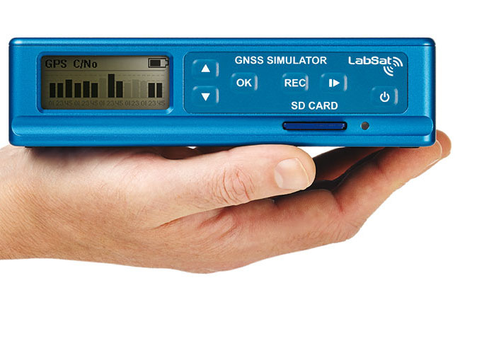
LabSat 3 from Racelogic is a low cost, stand-alone, battery powered, multi-constellation RF record-and-replay device, designed to assist GNSS engineers in the development and testing of their products.
With its small size and all-in-one design, LabSat 3 makes it easier than ever to collect raw satellite data in the same environment that end users experience in everyday use. This enables repeatable and realistic testing to be carried out under controlled conditions.
LabSat 3 doesn’t need to be connected to a PC in order to record live-sky GNSS signals. With one-touch recording to SD card and a two-hour battery life, it can be used in any outdoor location to create real-world scenarios, for eventual replay back in the lab. As well as being able to simultaneously record or replay GPS, GLONASS, BeiDou, QZSS, Galileo, and SBAS signals, it can log CAN Bus, serial, or digital data, embedded alongside the satellite information. This additional information can then be replayed alongside the GNSS output, with synchronization to within 60 ns. A 1PPS signal can also be generated using the internal GPS receiver.
LabSat 3 can be used as a replay system out of the box with a set of 60 pre-recorded scenarios supplied as part of the package, recorded from various locations around the globe. Additionally, SatGen software, a demo version of which is available from the LabSat website, allows for
scenario generation of user-defined trajectories, with precise control over velocity, heading, height, and constellation profiles. Routes are also easily created in Google Maps, and the software also supports NMEA and KML file import. SatGen gives test engineers the ability to develop their products using simulations that would be difficult or impossible to record due to geographic location or safety constraints.
LabSat 3 is available as a record and replay, or replay-only version; either one, two, or three constellation types generate a single, dual, or triple constellation file.
LabSat is currently used by many leading manufacturers of GPS chipsets, portable navigation devices, smartphones, and by major car companies in their test, development and production processes.
www.labsat.co.uk; phone: +44 (0)1280 823803
Rohde & Schwarz
R&S SMBV100A: GNSS Simulator in Vector Signal Generator
The R&S SMBV100A: GNSS Simulator in Vector Signal Generator. Photo: R&S
The GNSS simulator in the vector signal generator R&S SMBV100A is designed for development, verification and production of GNSS chipsets, modules and receivers. The simulator supports all possible scenarios, from simple setups with individual, static satellites all the way to flexible scenarios generated in real time with up to 24 dynamic GPS, GLONASS, Galileo, BeiDou and QZSS satellites.
GNSS simulator with support of GPS L1/L2 (C/A and P code), GLONASS L1/ L2, Galileo E1, BeiDou and QZSS L1, including hybrid constellations.
Real-time simulation of realistic constellations with up to 24 satellites and unlimited simulation time.
Flexible scenario generation including moving scenarios, dynamic power control and atmospheric modeling.
Configuration of realistic user environments, including obscuration and multipath, antenna characteristics and vehicle attitude.
Static mode for basic receiver testing using signals with zero or constant Doppler shift.
Support of Assisted GNSS (A-GNSS) test scenarios, including generation of assistance data for GPS, GLONASS, Galileo, BeiDou and QZSS.
Real-time external trajectory feed for hardware in the loop (HIL) applications.
High signal dynamics, simulation of spinning vehicles and precision code (P-code) simulations to support aerospace and defense applications.
Enhanced simulation capabilities for aerospace applications by supporting ground-based augmentation systems (GBAS).
Support of other digital communications and radio standards in the same instrument.
Afforable, Flexible and User-Friendly GNSS Simulators
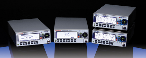
The Spectracom family of simulators. Photo: Spectracom
Spectracom GNSS Simulators support test and development programs from simple manufacturing tests to multi-output testing across the diverse ecosphere of industries relying on GNSS technology. Spectracom’s innovation allows users of any skill level full control over the GNSS constellation, vehicle motion/attitude and signal path complications such as atmospherics and multipath to develop complex scenarios. Typical test conditions include:
Clock errors
Data errors
“Real-world” motion from embedded Google Maps
In-band noise generation
Multipath
Signal obstructions calculated from 3D building models
“Current time” simulation
Real-time HIL testing
Easy synchronization for multi-output testing
Automative download of the current almanac
Antenna pattern effects
Inertial sensor testing
Assisted GNSS testing
No dedicated PC is required. Scenarios are run and managed from the front panel, SCPI commands, or any PC/tablet via a web interface. Users can select a flexible, field upgradeable Spectracom simulator, and then purchase the software options they need.
GSG-6 Series multi-frequency, advanced GNSS simulator is powerful enough for any cutting-edge test program. GPS, GLONASS, Galileo, Beidou, QZSS and IRNSS signals are available across multiple frequencies. The GSG-6 is designed for military, research or professional applications.
GSG-5 Series multi-constellation L1-band GNSS simulator is designed for commercial development/integration programs. If a user is developing commercial products with GNSS capability, the GSG-5 will shorten test programs with confidence.
GSG-51 single channel signal generator is designed for one purpose — fast, simple go/no-go manufacturing test and validation, ensuring the manufacturing line is operating at full capacity with confidence in quality.
Spirent provides simulators that cover all applications, including research and development, integration/verification and production testing.
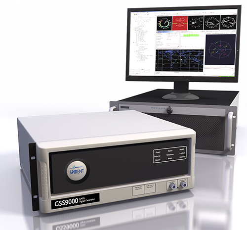
GSS9000. The newly released Spirent GSS9000 multi-frequency, multi-GNSS RF constellation simulator can simulate signals from all GNSS and regional navigation.The GSS9000 offers a four-fold increase in RF signal iteration rate (SIR) over Spirent’s GSS8000 simulator. The GSS9000 SIR is 1000 Hz (1 ms), enabling higher dynamic simulations with more accuracy and fidelity. It includes support for restricted and classified signals from the GPS and Galileo systems, as well as advanced capabilities for ultra-high dynamics. It can evaluate resilience of navigation systems to interference and spoofing attacks, and has the flexibility to reconfigure constellations, channels and frequencies between test runs or test cases.
Hardware changes can be done in the field, supported by the new on-board calibrator module. The GSS9000 is extensible and can support the widest range of carriers, ranging codes and data streams for the Galileo, GPS, GLONASS, and BeiDou systems, as well as regional/augmentation systems. Multi-antenna/multi-vehicle simulation, for differential-GNSS and attitude determination, and interference/jamming and spoofing testing are also supported.
CRPA Test System. Spirent’s Controlled Reception Pattern Antenna (CRPA) Test System generates both GNSS and interference signals. Users can control multiple antenna elements. Null-steering and space/time adaptive CRPA testing are both supported by this comprehensive approach.
GSS6425. The Spirent GSS6425 RPS quickly and simply records complex real-world RF environments, capturing both GNSS signals and atmospheric/interference effects. These environments can then be replayed repeatedly to the hardware software under test, reducing project, travel and engineering costs.
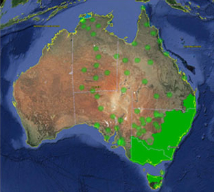
Trimble, together with its distribution partner Ultimate Positioning Group (UPG), announced the availability of Trimble VRS Now correction service in Queensland, New South Wales, South Australia, Tasmania and Victoria.
Trimble is also now offering the Trimble VRS Now correction service in Oregon’s Willamette Valley.
The commercial subscription service provides surveyors, civil engineers, geospatial professionals and other industry specialists in these areas with instant access to real-time kinematic (RTK) GNSS corrections without the need for a base station.
Using both GPS and GLONASS constellations, the Trimble service delivers centimeter-level RTK corrections customized for each GNSS receiver’s location anywhere in the network via cellular communications. The Trimble VRS Now service supplies accurate, reliable and easy-to-use GNSS positioning for a variety of applications including surveying, urban planning, urban and rural construction, environmental monitoring, resource and territory management, disaster prevention and relief and scientific research, Trimble said.
“The addition of VRS Now to Trimble’s current portfolio of corrections technologies and services in Australia highlights our ability to meet any accuracy, delivery, availability and financial consideration across a variety of applications and markets,” said John Sprivulis, business area director of Trimble’s Positioning Services Division in the Asia Pacific. “Trimble is effectively creating a national positioning infrastructure to meet Australia’s future needs.”
Trimble VRS Now in Australia is a continuation of Trimble’s focus on providing solutions that enable customers to increase productivity by simplifying access to high-precision accuracy around the world. Similar VRS Now services are operating in parts of the U.S. and Europe.
In addition, the Australian VRS Now service supports the Trimble Pivot Field Mobile App, which provides up-to-the-minute information on the VRS Now system status for users in the region.
Because OmniSTAR CORS service in the area is being phased out, existing Australian users will be automatically transitioned to the Trimble VRS Now service, which provides easy access to high accuracy and reliable positioning within the network coverage area.
Service in Australia and Oregon is a continuation of Trimble’s focus on providing solutions that enable customers to increase productivity by simplifying access to high-precision positioning around the world. Similar VRS Now services are operating in Illinois, Indiana, Iowa, Nebraska, Colorado, Florida, Alabama, Mississippi, Texas, and parts of Europe.
Trimble, together with its distribution partner Ultimate Positioning Group (UPG), announced the availability of Trimble VRS Now correction service in Queensland, New South Wales, South Australia, Tasmania and Victoria.
Trimble is also now offering the Trimble VRS Now correction service in Oregon’s Willamette Valley.
The commercial subscription service provides surveyors, civil engineers, geospatial professionals and other industry specialists in these areas with instant access to real-time kinematic (RTK) GNSS corrections without the need for a base station.
Using both GPS and GLONASS constellations, the Trimble service delivers centimeter-level RTK corrections customized for each GNSS receiver’s location anywhere in the network via cellular communications. The Trimble VRS Now service supplies accurate, reliable and easy-to-use GNSS positioning for a variety of applications including surveying, urban planning, urban and rural construction, environmental monitoring, resource and territory management, disaster prevention and relief and scientific research, Trimble said.
“The addition of VRS Now to Trimble’s current portfolio of corrections technologies and services in Australia highlights our ability to meet any accuracy, delivery, availability and financial consideration across a variety of applications and markets,” said John Sprivulis, business area director of Trimble’s Positioning Services Division in the Asia Pacific. “Trimble is effectively creating a national positioning infrastructure to meet Australia’s future needs.”
Trimble VRS Now in Australia is a continuation of Trimble’s focus on providing solutions that enable customers to increase productivity by simplifying access to high-precision accuracy around the world. Similar VRS Now services are operating in parts of the U.S. and Europe.
In addition, the Australian VRS Now service supports the Trimble Pivot Field Mobile App, which provides up-to-the-minute information on the VRS Now system status for users in the region.
Because OmniSTAR CORS service in the area is being phased out, existing Australian users will be automatically transitioned to the Trimble VRS Now service, which provides easy access to high accuracy and reliable positioning within the network coverage area.
Service in Australia and Oregon is a continuation of Trimble’s focus on providing solutions that enable customers to increase productivity by simplifying access to high-precision positioning around the world. Similar VRS Now services are operating in Illinois, Indiana, Iowa, Nebraska, Colorado, Florida, Alabama, Mississippi, Texas, and parts of Europe.
Trimble VRS Now coverage in Australia. Photo: Trimble
Trimble, together with its distribution partner Ultimate Positioning Group, announced the availability of Trimble VRS Now correction service in Queensland, New South Wales, South Australia, Tasmania and Victoria.
Trimble is also now offering the Trimble VRS Now correction service in Oregon’s Willamette Valley.
The commercial subscription service provides surveyors, civil engineers, geospatial professionals and other industry specialists in these areas with instant access to real-time kinematic (RTK) GNSS corrections without the need for a base station.
Using both GPS and GLONASS constellations, the Trimble service delivers centimeter-level RTK corrections customized for each GNSS receiver’s location anywhere in the network via cellular communications. The Trimble VRS Now service supplies accurate, reliable and easy-to-use GNSS positioning for a variety of applications including surveying, urban planning, urban and rural construction, environmental monitoring, resource and territory management, disaster prevention and relief and scientific research, Trimble said.
“The addition of VRS Now to Trimble’s current portfolio of corrections technologies and services in Australia highlights our ability to meet any accuracy, delivery, availability and financial consideration across a variety of applications and markets,” said John Sprivulis, business area director of Trimble’s Positioning Services Division in the Asia Pacific. “Trimble is effectively creating a national positioning infrastructure to meet Australia’s future needs.”
Trimble VRS Now in Australia is a continuation of Trimble’s focus on providing solutions that enable customers to increase productivity by simplifying access to high-precision accuracy around the world. Similar VRS Now services are operating in parts of the U.S. and Europe.
In addition, the Australian VRS Now service supports the Trimble Pivot Field Mobile App, which provides up-to-the-minute information on the VRS Now system status for users in the region.
Because OmniSTAR CORS service in the area is being phased out, existing Australian users will be automatically transitioned to the Trimble VRS Now service, which provides easy access to high accuracy and reliable positioning within the network coverage area.
Service in Australia and Oregon is a continuation of Trimble’s focus on providing solutions that enable customers to increase productivity by simplifying access to high-precision positioning around the world. Similar VRS Now services are operating in Illinois, Indiana, Iowa, Nebraska, Colorado, Florida, Alabama, Mississippi, Texas, and parts of Europe.
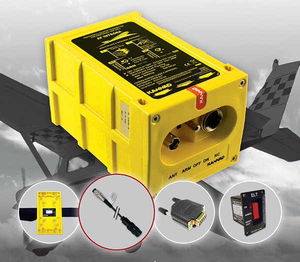
The The Kannad Integra Smart Pack by McMurdo Group could make it twice as easy to find missing aircraft. Photo: McMurdo Group
McMurdo Group, maker of end-to-end search and rescue solutions, has launched the Kannad Integra Smart Pack, an aviation emergency locator transmitter (ELT) bundle with both GPS and antenna redundancy. The product can result in Integra Smart Pack-equipped aircraft being twice as likely to be found in the event of an emergency compared to standard ELTs.
The Kannad Integra Smart Pack includes:
The Kannad Integra ELT – a small, light ELT with a built-in antenna and embedded GPS receiver.
The new Kannad Integra e-NAV NMEA – an NMEA-standard interface cable that connects the Integra ELT to the aircraft GPS. The latest known aircraft GPS position is continually updated and stored on the interface cable itself to provide an additional level of redundancy over the embedded Integra ELT GPS data.
Traditional ELTs rely on an aircraft’s external antenna and GPS equipment, which is subject to failure in the event of an emergency. The Integra ELT, however, can operate independently of the aircraft to provide key positioning data through its internal antenna and GPS receiver.
With the Integra Smart Pack bundle, in the event that the Integra ELT’s internal GPS antenna is unsuccessful for any reason, the positioning coordinates from the Integra e-NAV NMEA will be used. This additional GPS redundancy will result in better location positioning and higher chance of rescue.
“McMurdo is delighted to continue its long history of aviation search and rescue innovation with the introduction of the Kannad Integra Smart Pack,” said Christian Belleux, head of McMurdo’s Kannad Aviation Business Unit. “The Integra Smart Pack is a must-have SAR [search-and-rescue] solution to help ensure accelerated rescue response in the event of an emergency and to ultimately save more lives.”
The Integra ELT Smart Pack is suitable for all types of aircraft with specific versions to support helicopters, general aviation planes and large commercial jets. Once activated, the Integra ELT transmits a distress signal to alert international rescue services to the emergency location via the global Cospas-Sarsat Search and Rescue satellite system, which has helped to save more than 37,000 lives since 1982.
The McMurdo Group is exhibiting this week at Heli Expo 2015, Booth 5465, in Orlando, Fla.
LandWorks Inc., a developer of innovative land management solutions, has introduced Release 5.20 of its three primary software suites — LandWorks Property Management, LandWorks GIS, and WebMaps Enterprise GIS. All three have been re-written for easier use, enhanced industry-specific functionality, and tighter integration with Esri GIS solutions.
“In Release 5.20, we rebuilt the software from the ground up with a combination of C# [Sharp] .NET and a service-oriented architecture,” said LandWorks President Jerry Bramwell. “This modern architecture allows for integration of live Esri GIS maps and builds a foundation for hosting in the cloud.”
Deployed extensively for land asset management and mapping in the oil and gas, utility, mining, pipeline, renewable energy and government sectors, the upgraded LandWorks software suites are expected to appeal to an even wider audience. In addition, their applicability within organizations will expand beyond land management to project planning, acquisition and development.
The flagship LandWorks Property Management (LPM) suite is a complete solution for land asset management designed for easy storage and retrieval of data relating to any type of land right. In the new LPM version 5.20, clients may open an oil and gas lease or right-of-way agreement and instantly access a live GIS map displaying the relevant polygons. Direct integration with Esri’s ArcGIS Server gives the client full web-based GIS functionality from within the LPM interface and the ability to update the live map with new information on the fly.
“LPM is the only land asset management software with embedded live access to Esri GIS maps,” Bramwell said.
The LandWorks suites, used worldwide, also have been internationalized to support the language, date, currency and measurement formats preferred by individual end users based on their locations. A large mining company with operations in multiple countries, for example, may deploy the LandWorks suites across its enterprise. End users in Portugal, Spain and Canada are able to view the same information presented in Portuguese, Spanish or English.
In addition to a more intuitive interface with a modern look and feel, LandWorks has added new functionality to the software products designed for greater ease-of-use in specific industries. The ability to make land royalty payments for mining and wind energy operations has been expanded. LPM and LandWorks GIS have been enhanced to better manage and present linear-based land rights.
“The enhancement of our products to better manage land rights associated with linear assets will make the LandWorks suites more attractive to transportation and telecommunications industries,” said Bramwell.
LandWorks has built new modules to the LPM suite to extend its usability across the entire land management workflow. LPM now manages land-related projects of any type or size including acquisition, surveying and encroachment investigation.
The three LandWorks suites comprise a total of 18 individually licensed software products, many of which can function alone or interface with LPM. LandWorks GIS integrates the Esri GIS functionality into LPM. WebMaps Enterprise GIS Suite extends web-based mapping via ArcGIS Server across the enterprise to all departments, not just the land department.
“All LandWorks software products currently reside behind the client’s firewall, however, we will soon offer hosting in the cloud as an additional licensing optional for our clients,” said Bramwell.
During preparation of playback scenarios for the upcoming leap-second event taking place in June, engineers at Racelogic identified a potential pitfall for GNSS engineers. The difficulty arises from the fact that BeiDou uses a different “day number” for the date to apply the leap second, compared with GPS and Galileo. GPS and Galileo use 1-7 as week day numbers, and BeiDou uses 0-6.
If this fact has been missed during development, then the result is that the leap second may be implemented a day early on GNSS engines that are tracking the BeiDou constellation, said Mark Sampson, product manager for Racelogic.
“We tested four different Beidou enabled receivers, from four leading GNSS companies, and none of them appeared to handle the Beidou leap second correctly. This included an engine which originates from China!” Sampson said. “We have since been in contact with two of these companies, who have confirmed that their hardware does have a bug in the leap-second code due to the numbering of the days.”
The error presents itself when the receiver is running on the BeiDou constellation alone, and when the date is June 29 of this year. In some cases, the BeiDou leap second will be adjusted from 2 to 3 seconds from midnight on June 29, which should in fact occur on midnight of June 30. This will result in an error for the reported UTC time of 1 second for the period of this day. In other cases, the leap second was not implemented at all when running on BeiDou alone.
“We have also checked the output of a BeiDou signal generator from a different simulator company, and this too uses the 1-7 range for the BeiDou leap-second date instead of the correct 0-6 range,” Sampson said. “This may explain why a number of commercial receivers appear to have been caught out by this issue.”
Racelogic LabSat3 simulator.
In order to help companies test for this problem, Racelogic has generated simulated RF data for June 29 and 30, starting 15 minutes before midnight. “We have two sets of files. One set contains BeiDou only signals and the other contains a combination of BeiDou and GPS signals,” Sampson said. “Note that on some of the receivers we have tested, when GPS is being tracked as well, the GPS leap-second message overrides the one coming from BeiDou and applies the leap second correctly.”
The scenarios are compatible with Racelogic’s LabSat3 triple constellation simulator, which is available on a free 15-day loan or can be purchased from Racelogic.
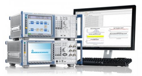
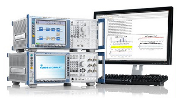
R&S CMW-PQA Test System for Performance Quality Analysis, by Rohde & Schwarz.
Rohde & Schwarz is presenting its new over-the-top (OTT) application analysis solution at Mobile World Congress, being held this week in Barcelona, Spain. The solution enables network operators and mobile device manufacturers to quickly and easily analyze and assess the behavior of OTT apps on mobile devices the data traffic they cause.
The additional software option is for the established R&S CMW-PQA performance quality analysis test system.
OTT apps are applications such as YouTube and WhatsApp that use mobile networks, but are not a service offered by the network operator. Such apps can cause uncontrolled data traffic on an operator’s network and excessively drain mobile phone batteries.
The R&S CMW-PQA OTT software now allows users to check which server the OTT app registers with, the number of connections it initiates and the network traffic volume it generates. The R&S CMW500 wideband radio communication tester, the core component of the R&S CMW-PQA, also offers a unique IP and protocol statistical analysis function that enables users to analyze how much the OTT app drains the mobile phone battery. The PACE software fromRohde & Schwarz subsidiary ipoque integrates this precise application identification function into the device.
The intuitive user interface enables users to quickly and easily configure tests as usual, Rohde & Schwarz said. Analysis results are available in a clearly structured graphical report. Users will have a clear overview of an app’s data throughput over time, its connected and idle state information, and when RRC messages were initiated.
The OTT solution for the R&S CMW-PQA test system is now available from Rohde & Schwarz. Customers who already have an R&S CMW-PQA do not need to purchase a hardware upgrade. A software upgrade is all that is required to add the OTT functionality to their system.
The test setup for OTT application behavior is on display at Hall 6, Booth C40, at Mobile World Congress.