China plans to build a BeiDou station in Antarctica this summer, according to a report in the Sydney Morning Herald. China’s official Xinhua news agency disclosed the plans.
The facility at Great Wall station in Antarctica will include receivers, auxiliary equipment and a reference station key to improving BieDou’s accuracy, according to the Chinese enews.com website.
Project leader Wu Xuefeng said the BeiDou facility would greatly improve China’s Antarctic mapping autonomy and improving the system’s precision.
The BeiDou facility will join others, including Norway’s Trollsat, strategically located in Antarctica to fit that country’s global networks, but which some claim breach the Antarctic Treaty. The treaty says “Antarctica shall be used for peaceful purposes only” and prohibits activities of a military nature.
Norwegian Bard Wormdal, author of The Satellite War, told Fairfax Media, “The Chinese military wants to use BeiDou for instance for guiding all sorts of missiles. A BeiDou base in Antarctica makes the system more reliable and precise.” He first raised alarm over the Norwegian satellite base at its Troll Antarctic station, which he found had been used by the U.S. National Geospatial Intelligence Agency.
Russia has three GLONASS ground stations on the continent.
Despite being an avowed Anglophile since my first visit to the United Kingdom, somewhere around 50+ years ago, I just could not help myself. Professor David Last, Professor Emeritus at the University of Wales (Bangor) and former president of the Royal Institute of Navigation (RIN) was holding forth, with that wonderful, attention-arresting public school accent, on weighty PNT (position, navigation and timing) matters before an awestruck audience.
Professor Emeritus David Last.
And what did I do? I just could not stop myself reminding him and everyone within earshot that the American Institute of Navigation (ION) predated the British Royal Institute of Navigation by more than two years. The point being, of course, that while two years actually makes little difference in the scheme of things, actuarially speaking we yanks rarely have the opportunity to make such a claim where our stiff upper-lipped Red Coat cousins are concerned. So, when the opportunity presents itself, as it typically does at ION GNSS+, then in my opinion, we former colonists just have to jump in with both feet — or one if by land and two if by sea, and all that.
An even more compelling argument for being first revolves around GPS versus Galileo operational satellites. The first GPS operational launch occurred in 1978, while Galileo has yet to launch a non-R&D operational PNT satellite, into a useable orbit that is. Now, before you accuse me of being smug, I am actually making a case for increased cooperation between the United States Air Force (USAF) and our European counterparts (ESA) where precision positioning, navigation and timing (PNT) schemes are concerned. For when it comes to satellite navigation and PNT, we yanks can definitely declare “been there, done that” mistakes and successes. What better place to “crow,” or rather, impart our considerable knowledge and network with fellow PNT aficionados, than at ION GNSS+.
ION GNSS+
All vocal eloquence jealousies and juvenile kidding aside, in many respects the ION GNSS+ event is actually the epitome of international cooperation in the PNT and GNSS (Global Navigation Satellite System) arena. This annual premiere event is described as “the world’s largest technical meeting and showcase of GNSS technology, products and services,” and I wholeheartedly agree. Indeed, the 2014 event, which took place from September 8-12 at the Tampa Convention Center in Tampa, Florida, had the stated goal of bringing together international leaders in GNSS and related positioning, navigation and timing fields to present new research, introduce new technologies, discuss current policy, demonstrate products and exchange ideas. It was a networking paradise in a wonderful, albeit somewhat steamy, venue, which you can review in two excellent videos concerning the event at the ION website.
This ION conference improves every year in content and attendance, and this year was no exception. Congratulations to Lisa Beaty and her whole team for a great conference, year after year. My favorite events are the annual GPS World Leadership Dinner and the prestigious annual ION Kepler award luncheon. Notice a trend?
GPS World Leadership Dinner
This much ballyhooed event becomes more and more of a draw each year. Tickets are coveted (as scare as hen’s teeth as Granny used to say) and competition is fierce. Every year we have about twice as many people wanting to attend as we have room to accommodate them. So the competition is never boring. This year was special in that one of our own GPS editors was nominated for an award and was overwhelmingly elected to receive it.
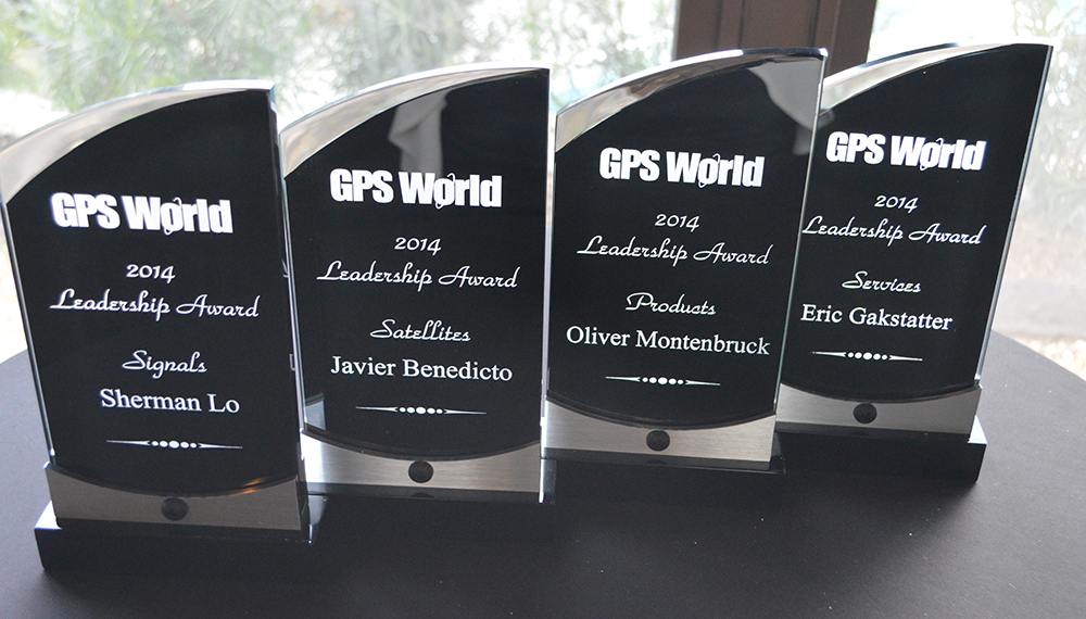
The Leadership Award winners this year were Javier Benedicto Ruiz, the Galileo Project Manager from the European Space Agency (ESA), who won in the Satellites category, while an old friend Sherman Lo, who is a senior research engineer and associate investigator (APNT) at Stanford University, won in the Signals category. Our own Eric Gakstatter, contributing editor for Survey and GIS from GPS World, won in the Services category; and finally Oliver Montenbruck, who is head of the GNSS Technology and Navigation Group, from DLR, the German Space Operations Center, won in the Products category.
GPS World 2014 Leadership Trophies.
The invited guests, and there was not an empty seat in the house, heard various perspectives from sponsors Lockheed Martin, Exelis, Raytheon, and Braxton Technologies, as well as visions of GNSS progress from our four award winners.
This event will be covered in much more depth in our December issue, but suffice it to say it was as usual a great event. I wonder from year to year how we will ever top the previous year’s entertainment, which always involves audience participation, but Alan Cameron just keeps coming up with outrageous ideas that seem to always pan out. Hope to see you there in Tampa next year.
The Kepler Award
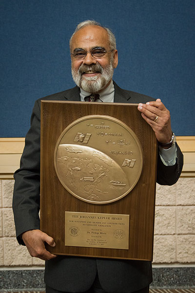
This year, the highly prestigious ION Kepler Award was won by Dr. Pratap Misra. Even though I am happy to say that through the years many of my friends and colleagues have won this coveted award, I can honestly say, in my opinion, there has never been a more deserving award winner than Professor Pratap Misra.
[Correction: The newsletter summary of this article misspells Pratap Misra’s name. We apologize for the error.—Editors]
Pratap Misra, 2014 Kepler Award recipient.
I have had the good fortune to know Professor Misra for many years, and frankly erroneously assumed, along with many others, that since he is so obviously deserving he had previously won the Kepler Award.
The Kepler Award is presented annually by ION in recognition of an individual’s unparalleled, sustained and significant contributions to the development of satellite navigation. It is the highest honor bestowed by ION’s Satellite Division. Professor Pratap from Tufts University meets and exceeds all of these qualifiers and more. He is simply self-effacing and polite as he quietly goes about being the best in all he endeavors.
Throughout the years, I have found Pratap to be extremely dedicated to his work, and more recently to his students. These are key attributes. Academically, I can honestly say that the authoritative tome Global Positioning System: Signals, Measurements and Performance that he coauthored with, another friend and colleague, Professor Per Enge of Stanford University, is among the most dog-eared in my PNT library. This widely praised volume is often described as a “comprehensive introduction to GPS: the system, signals, receivers, measurements, and algorithms for estimation of position, velocity, and time.” And while it was originally intended as a textbook for senior or graduate-level engineering courses, it also serves remarkably well as a self-study guide for practicing engineers and as a reference tool for writers and researchers. I consider it to be one of the three PNT bibles that are a must-have in every PNT subject-matter expert’s (SME) library. (The other two are Global Positioning System: Theory and Applications, Volumes 1 and 2, by Bradford W. Parkinson and James J. Spilker, and Understanding GPS: Principles and Applications, Second Edition, by Elliott Kaplan and Christopher Hegarty.)
Revised Second Edition by Pratap Misra and Per Enge.
In recent years, Pratap Misra has been honored as both an ION and IEEE Fellow and has served as a past chairman of the ION Satellite Division. He has held numerous volunteer positions within ION, but most recently he has focused on something near and dear to his heart, the support of student programs. This is where Professor Pratap Misra is without peer. Frankly it is obvious that his students adore him, and it is due in no small part to his single-minded dedication to and concern for them.
Every time we meet, the majority of his words and thoughts concerns his students. Their welfare is always uppermost in his priority list. Inevitably, while we are attempting to conduct a quiet and private conversation or interview, we are constantly being interrupted by well-meaning students, past and present, who just want to thank Pratap for his help and support. I could fill up several pages with the technical accomplishments of Professor Pratap Misra, but none of those accomplishments, recognitions or awards mean as much to him as the love, support and success of his students. It is so obvious to anyone who pays attention that he wholeheartedly thinks of his students as and treats them just like family.
I am sure, or at least hope, we all have past professors or teachers in our lives that we remember fondly, and then there are the few or perhaps only the one that changed the course of our lives for the better. Professor Pratap Misra is one of those rare latter individuals, so deserving of the appellation — a professor that made a difference in the lives of his students. I am so proud that he deservedly won the Kepler Award and am deeply honored that I can call him my friend.
GPS-IRT Update
The Global Positioning System Independent Review Team (GPS-IRT) is now officially part of the Independent Strategic Assessment Group (ISAG) under the auspices of the Institute for Defense Analyses (IDA). For 19+ years, the GPS-IRT was a separate team within IDA that researched GPS matters with the “goal of insuring both the military and civilian communities would benefit from new GPS/PNT capabilities and services.”
As a result of this organizational change, Air Force Space Command (AFSPC) chose to formally recognize the GPS-IRT’s 19+ years of effort in support of GPS modernization.
Last Thursday, General John Hyten (USAF), the commander of Air Force Space Command, presented a commemorative plaque to Mr. Kirk Lewis, the executive director at IDA, for both the GPS-IRT and the ISAG. The plaque will be displayed with the GPS satellite on permanent display at AFSPC headquarters, in the James V. Hartinger building on Peterson Air Force Base, Colorado. The plaque contains the names of the four prestigious chairmen who led the GPS-IRT over the last 19 years, as well as the names of the members of the IRT over that same time period. Sadly, two of the chairmen and five of the members are no longer with us, but we can only hope they are looking down upon us fondly and giving us guidance of a different sort.
Until next time, happy navigating, and remember: GPS is brought to you courtesy of the United States Air Force.
A new market research report by WhaTech examines the global and Chinese GNSS industry, covering the decade 2009-2019. The report “Discover latest trends in Global and Chinese GNSS system industry, 2009-2019” analyzes quantitatively the global and Chinese GNSS market of 2009-2014 by calculating the main economic parameters of each company. The data is broken down by company, country, and application. The report also estimates future market development in the coming period of 2014-2019.
In its first segment, the report reviews basic GNSS information including its classification, application and manufacturing technology. It then explores top global and Chinese manufacturers of GNSS systems, listing their product specification, capacity, production value, and market share. The report then analyzes the upstream raw materials, downstream clients, and current market dynamics of the GNSS industry.
The report concludes with proposals for a new GNSS industry project before evaluating its feasibility. Overall, the report provides an in-depth insight to the global and China GNSS industry covering important parameters, according to WhaTech.
Table Of Contents
Chapter One: Introduction of GNSS System Industry
Chapter Two: Manufacturing Technology of GNSS System
Chapter Three: Analysis of Global Key Manufacturers (Including Company Profile, Product Specification, 2009-2014 Production Information etc.)
Chapter Four: 2009-2014 Global and China Market of GNSS System
Chapter Five: Market Status of GNSS System Industry
Chapter Six: Market Forecast of 2014-2019 Global and China GNSS System Industry
Chapter Seven: Analysis of GNSS System Industry Chain
Chapter Eight: Global and China Economic Impact on GNSS System Industry
Chapter Nine: Market Dynamics and Policy of GNSS System Industry
The ongoing Syrian crisis, which broke out in April 2011, has been a severe humanitarian disaster, with more than 190,000 deaths since the start of the conflict. However, evaluating the ongoing crisis in Syria is challenging, because reliable and comprehensive witness reports are hard to gather in a warzone. Therefore, satellite images, as one of the few sources of objective information, are potentially of great importance.
In their recent study published in International Journal of Remote Sensing, Xi Li and Deren Li analyzed the effect of the Syrian crisis on levels of night-time light as a means of evaluating and monitoring the conflict. By comparing the levels of light in March 2011 and February 2014 (see Figure 1), they found that in all of the provinces, the levels of night-time light had declined sharply following the breakout of the conflict. Indeed, in most provinces, the level of night-time light decreased by more than 60 percent.
Notably, the authors also found that the number of internally displaced persons (IDPs) from each province showed a linear correlation with the level of night-light loss. This relationship between the number of displaced persons and the drop in night-time light levels may allow for the quantitative estimation of the number of IDPs from other areas of conflict, such as Iraq, where the activities of Islamic State are causing significant civil unrest.
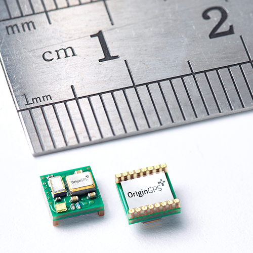
OriginGPS has launched the Nano Spider, a tiny yet fully integrated GPS receiver. The Nano Spider module is designed to support ultra-compact applications where size is at a premium, such as smart watches, wearable devices, trackers and digital cameras.
OriginGPS, which previously introduced the Micro Spider (5.6 x 5.6 mm) module, said the Nano Spider is 47 percent smaller than its previous solutions, measuring 4 x 4 x 2.1 mm. The Nano Spider’s proprietary structure is a multi-level circuit for surface mounting, built to reduce footprint size.
“The wearable technology trend requires components that balance a small size with high-performance and best-in-class power consumption,” said Gal Jacobi, CEO of OriginGPS. “OriginGPS aims to continue to shrink the size of components, while increasing features to make adding location functionality possible for every device.”
OriginGPS’ Nano Spider continuously tracks all GPS satellites in view and provides real-time positioning data in the standard industry format defined by the U.S. National Marine Electronics Association (NMEA). The Nano Spider offers a complete System in Package (SiP) that includes:
Fully integrated features – The Nano Spider includes a low noise amplifier (LNA), surface acoustic wave (SAW) filter, temperature controlled crystal oscillator (TCXO) and real-time clock (RTC) crystal, a power management unit, and radio frequency (RF) shielding.
Superior sensitivity and performance – The Nano Spider module offers accuracy of approximately one meter, and achieves a rapid time to first fix of less than one second and tracking sensitivity of -163 dBm.
Continuous connectivity with minimal power consumption – It achieves a state of near continuous availability by detecting changes in context, temperature and satellite signals by maintaining and opportunistically updating its internal fine time, frequency, and satellite data, while consuming microwatts of battery power.
Improving marginal signal conditions – It includes OriginGPS’ proprietary Noise Free Zone (NFZ) system to increase noise immunity even under marginal signal conditions, such as urban canyons, under dense foliage or a rapidly changing receiver position.
To see a demo of the Nano Spider and Nano Hornet modules, visit OriginGPS’ booth (Hall A4 Booth 271) at Electronica 2014 in Munich, Germany.
A GPS tracking device helped Philadelphia police rescue a woman who was kidnapped November 2 and apprehend the suspect who abducted her. A growing number of used car dealerships use the technology to protect their investments. This time it protected the life of an innocent victim of violent crime.
Surveillance video showed the crime being committed. The brazen attack was shocking to watch — an innocent woman named Carlesha Freeland-Gaither was grabbed by a man who then forced her into a car parked at the curb. The man then got in the car and drove away.
Police investigating the crime immediately checked the surveillance video and discovered they could read the license number of the vehicle used by the kidnapper. When they checked the license number, they discovered the vehicle had been purchased from a used car dealership specializing in helping people with bad credit get car loans.
“‘Buy Here, Pay Here’ refers to the fact that the dealership is also serving as the lender,” said Eddie Bermudez, product development manager with Position Plus of Lake Forest, California. “These lenders take a big risk lending money to people who other lenders won’t touch.”
The BHPH industry found GPS tracking systems to be a big help when a borrower is delinquent on their loan payments. The Position Plus system is used by almost 1,500 dealerships across the country.
“The lender places a small GPS tracking device in the vehicle,” Bermudez said. “As long as their loan payments are current, there’s no problem. But if they go delinquent, the lender has the option of using the GPS tracking device to locate the vehicle. This makes the process of repossessing the vehicle much easier.”
The lenders each have a policy as to how they handle these situations. In most cases borrowers receive emails or text messages warning them they’re behind before repossession efforts are initiated.
Fortunately, the kidnapping in Philadelphia ended well. The vehicle was located in the parking lot of a shopping center. The suspect attempted to start the car, but he was completely surrounded by police. According to Bermudez, the PositionPlus system could have stopped him cold.
“If it had been our system, he wouldn’t have been able to start the car,” added Bermudez. “We can’t shut down the engine while it’s driving, but we can keep the vehicle from starting the next time the ignition is turned on.”
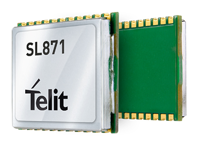
Telit Wireless Solutions has debuted the Jupiter SL871-S, designed for easy migration between a full-GNSS solution for top-ranked applications and a simple GPS-only solution for less demanding applications. The Jupiter SL871-S is designed to track and navigate GPS and QZSS constellations while ensuring pin-to-pin and protocol compatibility with its multi-constellation companion module, the SL871.
The module comes in a 9.7 x 10.1 millimeter LCC package with an ARM7 baseband processor, embedded ROM memory, and integrated LNA. It delivers geolocation data using NMEA protocol through a standard UART port. It supports ephemeris file injection (A-GPS) as well as Satellite Based Augmentation System (SBAS) for increased position accuracy.
In addition, its extremely low power consumption in all conditions is suited to applications requiring long battery life.
SL871-S has been designed to ensure hardware and software compatibility with SL871, allowing customers to design once and take advantage of the xL871 common form factor. Benefits include:
Pin-to-pin compatibility with SL871 family,
Same protocol used in SL871,
Straightforward migration between full-GNSS solutions and GPS-only solutions,
Satellite Based Augmentation System (SBAS) support for increased position accuracy, and
Assisted GPS.
The SL871-S can replace the SL871, allowing customers to design once and interchangeably mount the appropriate solution depending on the required features.
“The new SL871-S module designed to be easily swapped with other xL871 modules for enhanced simplicity and scalability,” said Taneli Tuurnala, CEO of Telit GNSS Solutions. “It is an ideal example of how buying a module from Telit enables our customers to avert the need to keep track of the latest chipset technology on their own. We keep them on top of the best available technology, pre-packaged in a module that is easy to replace as needed, without having to redesign their entire application to stay up to date.”
Farmers Edge, a precision agriculture and independent data management solutions company, has received an investment from Kleiner Perkins Caufield & Byers’ Green Growth Fund. With operations around the world, Farmers Edge provides a plug-and-play technology solution that helps farmers optimize crop inputs and maximize yield. The investment from Kleiner Perkins will fund expansion of Farmers Edge’s technology platform and support the company’s continued growth in international markets, Farmers Edge said.
“We see a huge market opportunity for Farmer’s Edge approach to precision agriculture. They uniquely integrate real-time satellite imagery and in-field telematics to maximize yield and minimize environmental footprint,”said Kleiner Perkins Partner, Brook Porter. “Farmer’s Edge is leading the current disruption around how crops are grown, and ultimately how crops are valued as traceability becomes an increasingly important factor in the food supply chain.”
On the heels of a recent acquisition, Farmers Edge has introduced FarmCommand, a comprehensive solution that provides farmers plug-and-play real-time equipment diagnostics and logistics telematics to any brand of equipment. FarmCommand will become part of the Precision Solutions product line that incorporates field-centric data such as drone and satellite imagery, soil testing, weather stations and precision agronomy. By coupling cloud-based software, Precision Solutions and FarmCommand, with an agnostic hardware solution, growers gain the ability to make comprehensive precision farm management decisions.
“We rely on Farmers Edge to function as an independent advisor, providing us with a no-hassle, turnkey solution to increase our profitability,” said Jerry Machacek, grower at Canora, SK. “They bring a level of hands-on service that is unique in the industry which is the reason we trust them with the management of our acres.”
“From seed selection to yield data analytics, we bring all the information together to make a meaningful impact on production and we stick by our customers to ensure the job gets done right,” said Wade Barnes, president and CEO of Farmers Edge. “We have an established history of partnering with both farmers and leading distributors to deliver products which will benefit the farmer and his trusted advisors.”
Under the theme “Taking the Pulse of the Planet,” 275 members of the GEO community from more than 45 countries will chart the next steps in creating and implementing a Global Earth Observation System of Systems (GEOSS) during the Group on Earth Observations (GEO) Eleventh Plenary Session. The session will be held November 12-14 in Geneva, Switzerland.
A highlight of the conference will be announcement of the winners of the GEO Appathon, a global app development competition built on the 80-million-plus resources available through GEOSS. The Appathon attracted 250 competitors from 50 countries, and will generate easy-to-use decision tools for mobile devices and computers.
GEO’s mandate is to harness the power of Earth observations from sources across the globe to provide more and better information to leaders in government, industry, and civil society confronting fundamental decisions affecting people and societies worldwide. One key GEO initiative that will be highlighted during the meeting is developing a comprehensive system to monitor the availability and quality of fresh water, in partnership with the World Health Organization, the UN Environmental Programme and other UN agencies as part of the UN Sustainable Development agenda.
GEO is leading the creation of an Africa-wide technological and human infrastructure so decision makers have the capacity to access and use Earth observations in making key decisions. To strengthen agricultural activity and reduce market volatility, GEO is coordinating the assessment of growing conditions of the world’s major crops through a combination of regional expertise, ground observations and analysis of meteorological and satellite data.
GEO is a voluntary partnership of governments and organizations that envisions “a future wherein decisions and actions for the benefit of humankind are informed by coordinated, comprehensive and sustained Earth observations and information.” Members include 94 nations and the European Commission and 77 participating organizations comprised of international bodies with a mandate in Earth observations.
GEO’s agenda spans nine Societal Benefit Areas, including agriculture, biodiversity, climate, disasters, ecosystems, energy, health, water and weather.
The new NEO-M8L Automotive Dead Reckoning (ADR) module by u-blox has integrated motion, direction and elevation sensors. The module integrates gyro and accelerometer with u‑blox’ GNSS platform u-blox M8 to achieve high indoor/outdoor positioning performance for road vehicle and high-accuracy navigation applications.
In addition to accessing the integrated module’s gyro and accelerometer data, accident reconstruction systems can provide the location of an accident to facilitate insurance claims even if a collision occurs in a tunnel or park house. High-end navigation devices are able to guide drivers through tunnels of several kilometers because of the accuracy of u-blox’ ADR system. Stolen vehicles can be located instantly due to continuous monitoring of sensor data and storage of location in non-volatile memory.
“Devices for usage-based insurance, stolen vehicle recovery, road pricing, fleet management, emergency services, and vehicle navigation depend on reliable, uninterrupted positioning including tunnels, park houses and stacked highways,” said Thomas Nigg, vice president of product strategy at u-blox. “The NEO-M8L is the ideal solution for all road vehicle based applications, able to calculate a position in all circumstances based on its own internal sensors, regardless of satellite visibility and end-device orientation.”
The NEO-M8L module will be demonstrated at the u-blox stand at electronica 2014 in Munich, November 11-14, Hall A4 Stand 219.
The compact module is 12.2 x 16.0 x 2.5 mm, requires minimum host integration resulting in no risk, is low cost, and provides fast time-to-market design, u-blox said. With uncritical orientation of the installed module, odometer function and autonomous data logging, it is an all-in-one solution for all road vehicle applications requiring reliable and uninterrupted position in challenging environments such as urban canyons, tunnels and underground parking.
The NEO-M8L embeds u-blox’ 3D Automotive Dead Reckoning (3D ADR) chip technology. Using the vehicle’s speed information and the module’s onboard sensors enables accurate positioning in three dimensions, even when satellite signals are completely lost and the end-device installation is not horizontal, u-blox said. An odometer function, based on the ADR technology, also provides accurate and continuous distance traveled.
The module is able to track all visible GNSS satellites including GPS, GLONASS, BeiDou, QZSS and all SBAS (European’s Galileo will be supported in a future firmware version). Concurrent reception of two GNSS systems is supported. The NEO-M8L module can output a position up to 20 times per second.
The module uses u‑blox’ M8 GNSS chip and is available in Professional Product grade. This grade includes qualification according to the ISO16750 standard “Road vehicles — Environmental conditions and testing for electrical and electronic equipment” and manufacturing in ISO/TS 16949 automotive-certified factories.
Samples and evaluation kits will be available in December 2014.
A hail suppression project dubbed RO-BERTA by the University of Applied Sciences, Rosenheim (Germany), has been selected the winner of the European Satellite Navigation Competition’s (ESNC) University Challenge. Judged by an international expert jury, the University Challenge is a special prize to reward innovative ideas emerging from Europe’s universities.
The Hail Navigator system is designed to reduce damage caused by hail. Based on the premise of suppressing the formation of hail by injecting silver iodide into clouds, Hail Navigator combines navigation with a precipitation reporting system that can guide pilots to optimal locations for hail suppression missions.
The system is complemented by weather observations (including precise times and locations) reported by local citizens via a smartphone app, which aids the validation of weather prediction models. These models constitute an important factor in deciding whether a hail suppression flight is necessary.
The project team was awarded the prize on October 23 in Berlin at the ESNC Awards Ceremony. More than 300 guests attended, representing the top European players in the navigation sector. In addition to cash, the prize includes support through the GNSS Research & Applications Centre of Excellence (GRACE) and a free ticket to the Munich Satellite Navigation Summit 2015.
“Winning this prize once again demonstrates that interdisciplinary cooperation is feasible and successful,” said Project Manager Peter Zentgraf. “The positive feedback the competition provides helps drive our many students to continue their dedicated work, which made it possible to reach our project goals.”
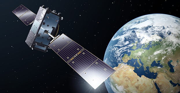
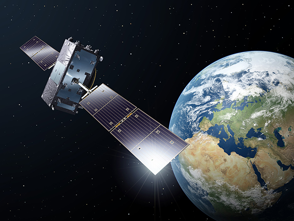
The fifth Galileo satellite is now pointing toward Earth. Photo: Galileo
The fifth Galileo navigation satellite, one of two left in the wrong orbit this summer, will make a series of maneuvers this month as a prelude to its health being confirmed. The aim is to raise the lowest point of its orbit — its perigee — to reduce the radiation exposure from the Van Allen radiation belts surrounding Earth, as well as to put it into a more useful orbit for navigation purposes.
Should the two-week operation prove successful, the sixth Galileo satellite will follow the same route, according to the European Space Agency (ESA).
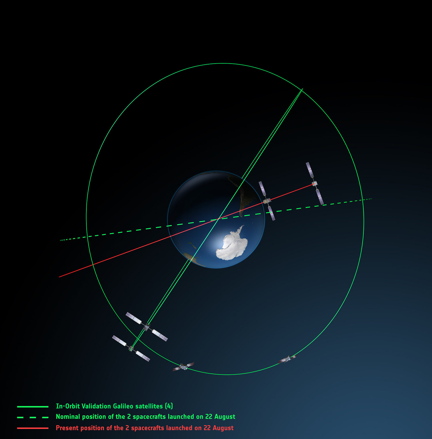
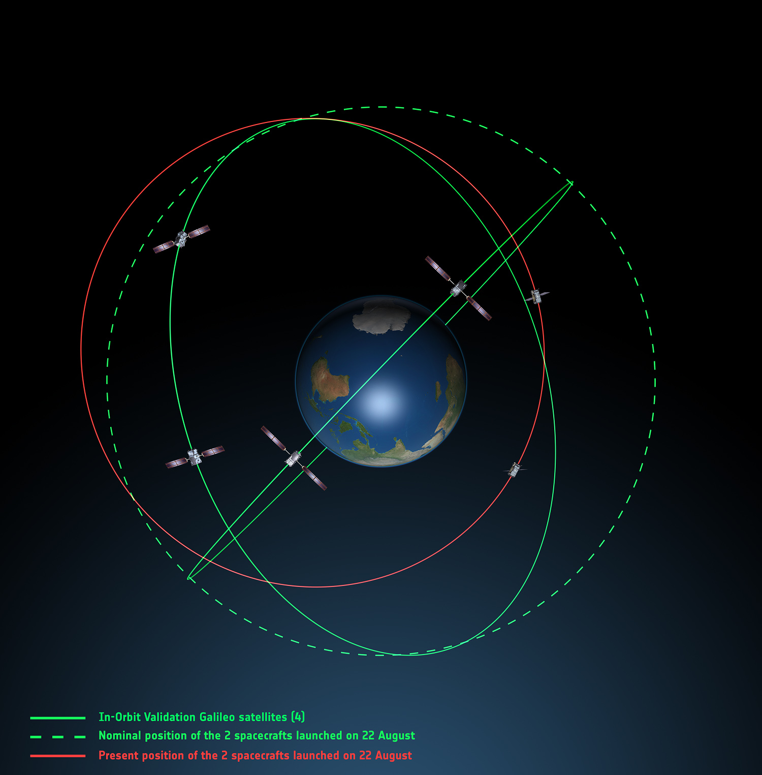
The Galileo pair, launched together on a Soyuz rocket on August 22, ended up in an elongated orbit traveling out to 25,900 km above Earth and back down to 13,713 km. The target orbit was a purely circular one at an altitude of 23,222 km. Also, the orbits are angled relative to the equator less than originally planned.
The two satellites have only enough fuel to lift their altitude by about 4,000 km — insufficient to correct their orbits entirely. But the move will take the fifth satellite into a more circular orbit than before, with a higher perigee of 17,339 km.
“The new orbit will fly over the same location every 20 days,” said Daniel Navarro-Reyes, ESA Galileo mission analyst. “The standard Galileo repeat pattern is every 10 days, so achieving this will synchronize the ground track with the rest of the Galileo satellites.”
“In addition, from a user receiver point of view, the revised orbit will reduce the variation in signal levels, reduce the Doppler shift of the signal, and increase the satellite’s visibility,” Navarro-Reyes said. “For the satellite, reducing its radiation exposure in the Van Allen radiation belts will protect it from further exposure to charged particles. The orbit will also allow Galileo’s Earth Sensor to hold a stable direction for the satellite’s main antenna to point at Earth. Right now, when the satellite dips to its lowest point, Earth appears so large that the sensor is unusable. The satellite relies on gyroscopes alone, degrading its attitude precision.”
The recovery is being overseen from the Galileo Control Centre in Oberpfaffenhofen, Germany, with the assistance of ESA’s Space Operations Centre, ESOC, in Darmstadt, Germany. France’s CNES space agency is providing additional ground stations so that contact can be maintained with the satellite as needed, ESA said.
The two satellites were previously Sun-pointing. “On 3 November that changed for the fifth satellite, as it transitioned to normal Earth-pointing mode,” added Daniel.
During November, some 15 maneuvers will take the satellite into its new orbit. Once there, it can formally begin in-orbit testing. The host satellite’s health is checked first, followed by more detailed navigation payload testing, ESA said.
Galileo orbits viewed from above: Orbits of the fifth and sixth satellites in red, compared to their intended position in dashed green, and the position of the four satellites launched in 2011 and 2012 in solid green. This view looks down over the South Pole to illustrate how the inclination relative to the equator is less than intended. The satellites are in an elliptical rather than circular orbit, with a maximum altitude of about 25,900 km and a minimum altitude of about 13,700 km, compared to a planned circular orbit of 23,222 km altitude. Photo: GalileoGalileo orbits viewed side-on: The fifth and sixth Galileo satellites in red, compared to their intended position in dashed green, and the position of the four satellites launched in 2011 and 2012, in solid green. This view looks side on to the two satellites’ orbital plane, which is off-center relative to Earth. The targeted orbit was circular, inclined at 55º to the equator at an altitude of 23,222 km.They are in a safe state, correctly pointing towards the Sun, properly powered and fully under control of an ESA–CNES team. Photo: Galileo