According to a new market research report published by MarketsandMarkets, the total Yield Monitoring Devices and Services Market is expected to reach $2.51 Billion by 2020, growing at a CAGR of 7.17% from 2014 to 2020.
The report, “Yield Monitoring Devices and Services Market by Technology (GPS/GNSS, GIS, Remote Sensing), Components (Sensors, GPS/GNSS, Display, Guidance & Steering, and Software & Services), Application (VRA, Field Mapping, Soil Monitoring, and Scouting), and Geography – Global Forecasts to 2020”, is available now. It includes 65 market data tables and 64 figures spread through 208 pages and an in-depth TOC.
Yield monitoring is considered by farmers to be essential as yield data is recorded automatically while harvesting crops. Yield monitoring and mapping offers many other on-farm and off-farm benefits such as real-time availability of information, creation of a spatial database, and evaluation of whole-field improvements. Yield monitoring devices and services are implemented for site-specific farming, which ensures better efficiency, high yield, and profitability with optimum usage of resources. Yield monitoring techniques have major applications in variable rate application (VRA), soil monitoring, field mapping, and crop scouting.
Despite the rapid growth of global commerce and the widespread availability of equipment for yield monitoring and VRA, adoption rates appear to differ sharply from one country to another. The increasing demand for food is propelling the growers to adopt yield monitoring techniques and optimize their resources efficiently with minimum wastages.
The report provides a detailed segmentation by technology, component, and application. The geographic analysis covers all existing and emerging technologies in the yield monitoring devices and services market. The market based on technology is segmented into guidance system and remote sensing. The market based on hardware components and software is segmented into hardware components such as sensors, GPS/GNSS devices, display devices, guidance, and steering; and software services such as yield data management software as well as consulting and training services. The report also covers major applications of yield monitoring techniques such as field mapping, VRA, soil monitoring, and crop scouting with qualitative and quantitative industry insights.
One of the objectives of the report is to analyze market trends for each of the Yield Monitoring Devices and Services Market segments and their respective growth rates. Apart from market segmentation, the report also covers an in-depth analysis such as Porter’s five force analysis, supply chain with a detailed process flow diagram, and market dynamics such as drivers, restraints, and opportunities for this market.
In the time since my first article on indoor location, I’ve learned that there is a whole lot to this indoor location technology and business. A number of companies are taking on the indoor challenge, but few have so far successfully cracked this nut.
Rx Networks in Vancouver, Canada, is one of those few who have not only found solutions that work and work reliably, but it has also found a way to commercialize their solutions and make money.
Its embedded software and services are used daily in more than 1 billion devices — mostly smartphones, some machine-to-machine (M2M) installations, tablets, laptops, and wearables. That is some claim!
Daily transactions are primarily requests for A-GNSS assistance data, but also include requests for location based on Wi-Fi and Cell-IDs. Devices are using various Rx software and/or services, which include any or all data from a four-constellation reference network (GPStream GRN), extended ephemeris (GPStream PGPS), and Wi-Fi/Cell-ID positioning (XYBRID RT).
Founded in 2006, and still privately held, Rx is currently profitable. The head office is in Vancouver, and the company has a remote office in Atlanta, Georgia. Rx Network provides GNSS assistance-data to nearly all North American mobile operators and to several international carriers, helping those customers comply with current E-911 requirements and also offer other location-based services (LBS). In anticipation of a potential FCC “indoor” E-911 mandate, Rx’s offerings have been expanded to provide the location of devices where GNSS is not available. Its patented IP is also licensed through major GNSS semiconductor vendors and, in several cases, directly to the smartphone manufacturers.
Rx’s global reference network (GPStream GRN) is the foundation of many Rx solutions, including real-time assistance data and predictions. The service supports GPS and GLONASS, and will soon incorporate BeiDou and Galileo — the data is used by mobile operators and service providers and as an input to other products like XYBRID Cloud, where assistance data is supplied to a cloud-based positioning engine. And GPStream PGPS supplies data from the reference network to create seed files that generate extended ephemeris on smartphones.
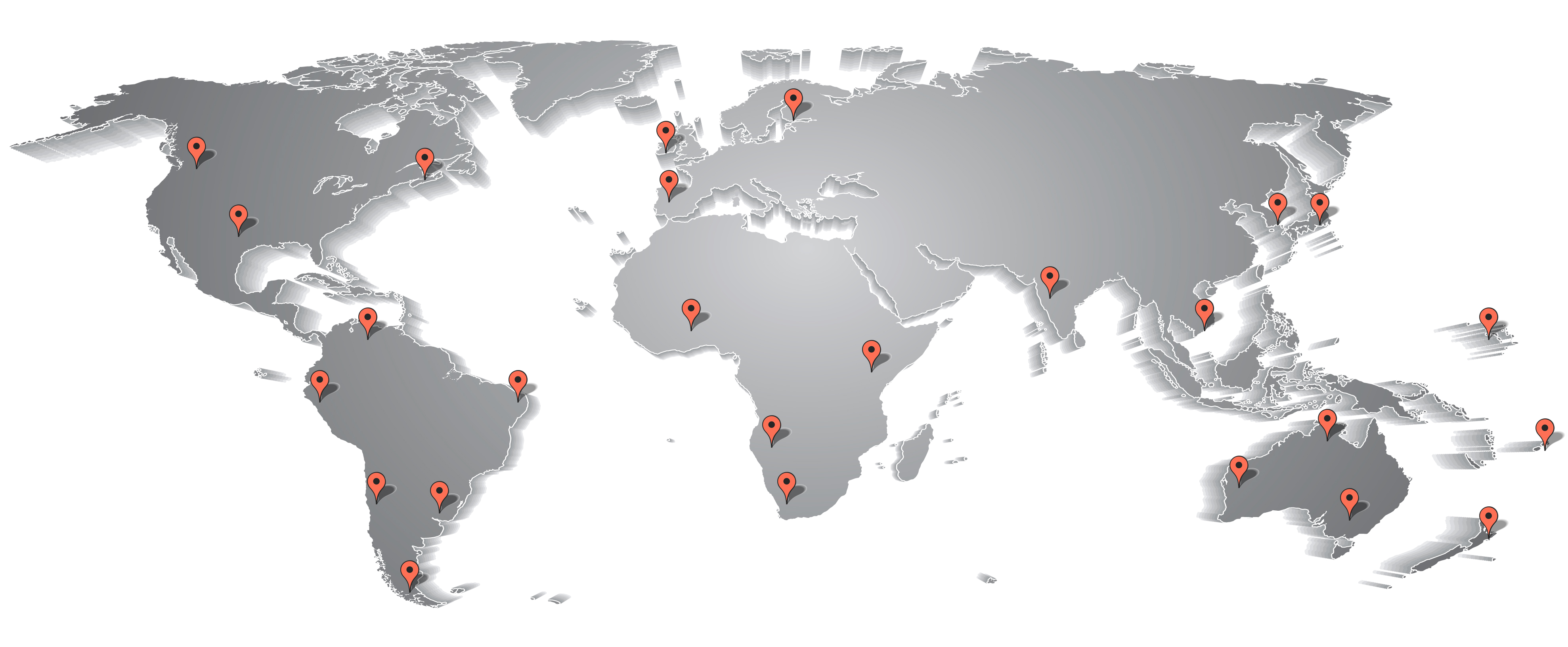
The Rx worldwide network of GNSS reference stations. Photo: Rx Networks
There may be growing concerns about the status of the nascent Galileo constellation, but back in May, there was good signal coverage at times in Vancouver, Naples, and Prague. This enabled Rx to conduct testing on behalf of the European GNSS Agency (GSA) in challenging signal environments. The tests confirmed that Galileo significantly improved the accuracy of location-based services in urban canyons and indoors. Galileo signals were incorporated in the positioning solution with various combinations of GPS and GLONASS.
A new product known as XYBRID Cloud — a “cloud-based software receiver” — is going to trial shortly with a major U.S. carrier interested in using Rx’s indoor GNSS capability to locate small cells, home phone units, and other assets that carriers have to manage. The latest release of Cloud is providing an acquisition sensitivity of –166 dBm, which is claimed to be the best in the industry.
The XYBRID Cloud system. Photo: Rx Networks
XYBRID Cloud captures I & Q data transmitted by satellites and sends it to a cloud-based positioning engine to determine location. This is in contrast to sending it to a receiver engine on a chip within the device. This is automatic, but is not really done for a “user” as much as for an asset such as a Wi-Fi access point, small cell, or other device that someone wants to locate.
Because these devices are often deep indoors, they may only see a few milliseconds of GNSS signals every now and then, so a real-time GNSS chip receiver would never get a fix. However, XYBRID Cloud assembles the captured data over time and is eventually able to record the location of the asset. This may take a few minutes or a few days, but a fix comes together eventually. Given that these assets are normally in fixed locations and seldom if ever move, such delays are not an issue, but knowing their location or if they’ve been moved can be quite valuable.
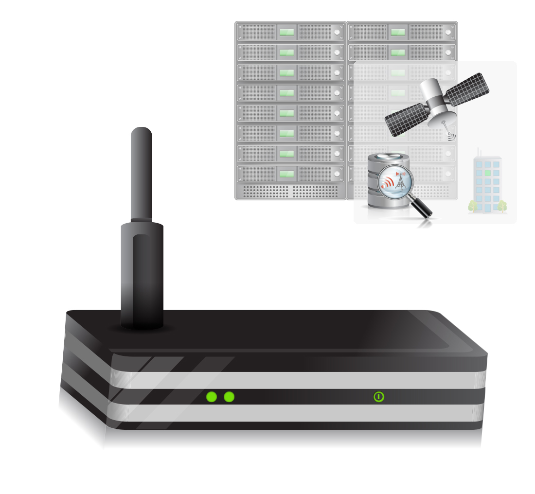
XYBRID RT/Synchro. Photo: Rx Networks
Another Rx product, XYBRID RT/Synchro,provides Wi-Fi and Cell-ID indoor and outdoor positioning using observed Wi-Fi and -tower signals, both with and without an active network connection. The systems works in real time (RT), and Synchro uses local datasets (regions) for Wi-Fi and other radio beacons that are downloaded into the user device whenever their signal is detected. Each “region” can be tailored to best suit a user’s general location, such as a metro area, city or other venue. The system is capable of a fast GNSS fix with improved sensitivity, or can fall back to basic Cell-ID/Wi-Fi positioning. Location is available indoors with an accuracy of 5-10 meters, depending on the quality of the regional datasets.
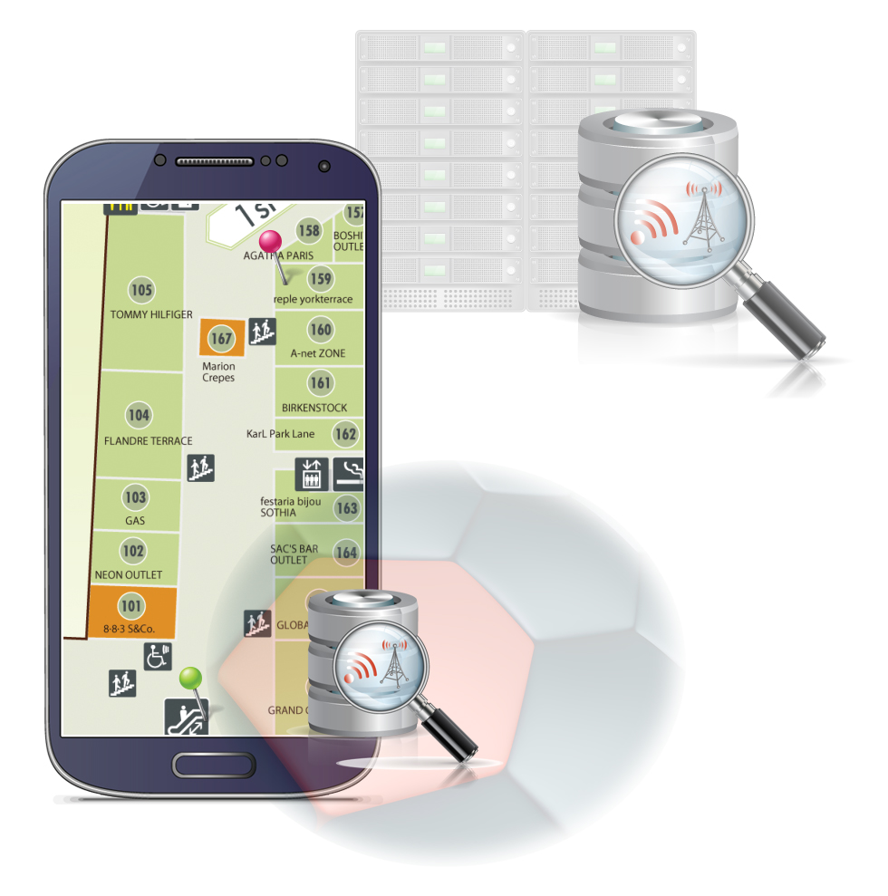
Zed provides floor-level detection based on barometric pressure data. Photo: Rx Networks
Zed is able to provide floor-level detection based on barometric pressure data to within a vertical accuracy of 1-3 meters. Zed combines a global pressure reference with crowd-sourced data for fine-grained performance. This improves Wi-Fi location accuracy and supports Wi-Fi crowd sourcing with altitude geo-tagging.
So, Rx indoor solutions can use various combinations of these three products depending on the capabilities of the user devices. XYBRID RT provides location indoors using Cell-IDs, but more often uses Wi-Fi for more accurate positioning. XYBRID Cloud provides location of assets by sending any observed satellite signals to Rx servers for processing. Zed provides a calibration and ground-level reference pressure for a device, typically a smartphone equipped with a barometric sensor. Applications include location determination for smartphones, tablets, and wearables, and XYBRID Cloud finds assets like access points, small cells, Bluetooth beacon gateways, and home phone systems. Three companies are currently using Rx technology in the wearables space — a sports watch, augmented reality glasses, and heads-up display cycling glasses.
Other services supplied by Rx include worldwide Assisted GNSS (A-GNSS):
GPStream GRN – Relies on data collected from the Rx worldwide grid of reference receivers for GPS, GLONASS, BeiDou and Galileo. Data is compatible with all popular positioning servers from leading vendors such as Ericsson, NEC, NSN, Qualcomm, and TCS.
GPStream PGPS – Predicted GPS is an efficient handset-based extended ephemeris A-GNSS solution which supports GPS and GLONASS, for both connected and autonomous operation. Galileo is slated to be demonstrated at the Naviteq conference in December and to be available in 2015 along with BeiDou.Each device equipped with the PGPS client accesses Rx servers at least once every 14 days and downloads a small seed file that is used to create extended ephemeris for each constellation for the following 14 days.
The GPStream PGPS software. Photo: Rx Networks
Rx claims that its A-GNSS services have “carrier-level reliability” — that is to say, 99.999% availability per year.
Rx semi-conductor customers use an IP package that is embedded in processor chips for cell phones. They typically go on to supply Rx software (GPStream PGPS) with their GNSS chips, which is then run on a phone’s host processor — designed in at the factory as part of the phone.
OEM customers buy Rx GPStream PGPS software either directly or from the GNSS chip manufacturer and design it into the smartphone at the factory.
Mobile operators and service providers buy A-GNSS data that is delivered to mobile phones using location-based services for 911 caller location and LBS. Rx also supplies these customers with data containing the locations of Cell-IDs and Wi-Fi access points.
It’s good to hear that someone is already making a living with indoor location. And with so many signals of opportunity, inertial and pressure sensors now being used to “help” or actually completely replace GNSS, the era of indoor testing seems to be giving way to everyday consumer use. The average consumer will likely not realize when they seamlessly transition from outdoors GNSS guidance to “indoor” signals driving their smartphone map inside the mall. Or how really difficult it is for GNSS guidance to work in downtown when they automatically get A-GNSS assistance data that keeps their car map guidance on the correct street. Good for consumers, good for the telecoms guys, and good for the GNSS industry.
“Networks of correlated atomic clocks, some of them already in existence, such as the Global Positioning System, can be used as a powerful tool to search for topological defect dark matter, thus providing another important fundamental physics application for the ever-improving accuracy of atomic clocks,” write physicists Andrei Derevianko and Maxim Pospelov in the current issue of Nature Physics journal.
Derevianko teaches at the University of Nevada, Reno, and Pospelov at the University of Victoria and the Perimeter Institute for Theoretical Physics in Canada. Derevianko and Geoff Blewitt, director of the Nevada Geodetic Laboratory at the University of Nevada, Reno are testing this dark-matter detection theory by analyzing clock data from atomic clocks aboard GPS satellites, searching for instances where initially synchronized clocks might have become desynchronized. They expect time discrepancies between spatially separated clocks to exhibit a distinct signature, one that may reveal the nature of spatial dark matter.
The Geodetic Lab developed and maintains the largest GPS data processing center in the world, according to a University of Nevada statement, able to process information from about 12,000 stations around the globe continuously, 24/7.
“We know the dark matter must be there,” explains Blewitt, “because it is seen to bend light around galaxies, but we have no evidence as to what it might be made of. If the dark matter were not there, the normal matter that we know about would not be sufficient to bend the light as much as it does. That’s just one of the ways scientists know there is a massive amount of dark matter somewhere out there in the galaxy. One possibility is that the dark matter in this gas might not be made out of particles like normal matter, but of macroscopic imperfections in the fabric of space-time.”
“Despite solid observational evidence for the existence of dark matter, its nature remains a mystery,” said Derevianko. “Some research programs in particle physics assume that dark matter is composed of heavy-particle-like matter. This assumption may not hold true, and significant interest exists for alternatives.
“Modern physics and cosmology fail dramatically in that they can only explain 5 percent of mass and energy in the universe in the form of ordinary matter, but the rest is a mystery.”
Scientific evidence reportedly shows that dark energy constitutes about 68 percent of the mystery mass and energy. The remaining 27 percent may be dark matter, though it has never been detected or measured.
“Our research pursues the idea that dark matter may be organized as a large gas-like collection of topological defects, or energy cracks,” Derevianko added. “We propose to detect the defects, the dark matter, as they sweep through us with a network of sensitive atomic clocks. The idea is, where the clocks go out of synchronization, we would know that dark matter, the topological defect, has passed by. In fact, we envision using the GPS constellation as the largest human-built dark-matter detector.”
Earlier this month, I attended the Trimble Dimensions conference in Las Vegas. More than 4,000 attendees made it the largest Dimensions conference to date. Since Trimble has been on a corporate acquisition binge for the last 10+ years, one has to pick an area of interest to focus on; otherwise, it’s easy to be overwhelmed with their wide offering of geospatial technology. In my Survey Scene newsletter earlier this month, I focused on Trimble’s satellite-based GNSS augmentation services. In this month’s GSS Monthly newsletter, I’d like to touch on Trimble’s activities in the geospatial software arena.
If you recall, Trimble bought SketchUp from Google a couple of years ago. SketchUp is software for 3D modeling used for a wide range of apps from interior/exterior architectural design to video game design. It’s not hard to understand why Google would want to sell SketchUp. Google products like Google Earth and Gmail are everyday consumer-friendly products that have mass appeal to a huge audience. SketchUp is a product that takes a higher level of geospatial user knowledge and time investment to use. It seems to be a perfect fit for a geospatial-oriented company like Trimble.
I used to be involved in a lot of 3D modeling projects in the landscape architecture area. I know how labor-intensive it is to generate high-quality 3D models and 3D video fly-throughs. I also understand the value that 3D models offer in bringing a proposed design to life. For example, look at the following photo taken of an unimproved site:
To visualize the golf course architect’s design, following is a 3D model of a proposed golf hole overlaid on an image of the unimproved land:
Imagine how much more effective it is to show a client this sort of visualization, rather than trying to explain this using a 2D set of architectural or engineering plans.
This is the kind of visualization that SketchUp is designed to address, but more structure (building) oriented. The impact on the the client is the same, bringing 3D and color to design ideas. In fact, SketchUp goes further than just helping designers visualize their ideas for their clients. In some cases, it can produce a list of materials to construct the building. At a short briefing I received at Dimensions, Trimble said that the following structure was designed, and a list of building materials was generated, using SketchUp.
OK, it’s not a high-rise building and SketchUp can handle more complex designs than this, but this illustrates where the technology is headed and that the fundamental workflow exists. Also, it shows that this type of technology is becoming available to a wider audience. I recall that 10 years ago, we needed a lot of computing horsepower, sophisticated software (such as 3D Studio Max), very specialized technicians, and a lot of time to generate 3D visualizations. SketchUp brings this capability to a wider audience.
For geospatial professionals, there’s obviously a lot of applications for SketchUp. A simple, yet powerful task is bringing Google Map imagery and topography data into SketchUp to give your buildings context. Following is a five-minute video describing how to import a Google Map into SketchUp:
To learn more about SketchUp (free and Pro versions), a number of YouTube videos are available, as well as videos of SketchUp’s annual conference called SketchUp 3D Basecamp.
Seven Best New Features of SketchUp 2014 (five-minute video):
Lastly, following is a collection of YouTube videos from SketchUp 3DBasecamp 2014 (60 minutes) for you to peruse if you’re interested:
Unmanned Aerial Systems (UAS)
Of course, UAS are still all the rage. While Trimble showed off its UAS product lineup (a la its 2012 acquisition of GateWing), last month in Reno, Nevada, there was a conference entitled UAS Mapping 2014 that was focused on UAS for mapping. More than 500 geospatial professionals attended to view the UAS technology demonstrations. We’ll have a report on this conference in next month’s GSS Monthly newsletter. UAS technology is still in the early stages of development (and, of course, still not legal to use commercially in the U.S., according to the Federal Aviation Administration) so a lot is happening.
There’s certainly a push toward using low-end UAS for GIS mapping. The UAVs themselves are becoming so inexpensive that the image-processing software ends up costing more than the UAV. For example, one image-processing company I hear about quite a bit is Pix4D. The company recently announced its Pix4Dmapping app that will turn a $900 DJI Phantom 2 Vision UAV into a 2D mapping and 3D modeling system. If you’re interested in the capabilities of this low-cost UAV mapping system, take a peek at the following 60-minute webinar from Pix4D.
Boris Skopliak, product manager for Trimble, gives an overview of the Trimble UX5 while at the 2014 Trimble Dimensions User Conference, held Nov. 3-5 in Las Vegas, Nevada. The UX5 unmanned aircraft system (UAS) for mapping and surveying captures imagery and can generate point clouds, digital terrain models and orthomosaics.
Location-based services company Telenav has announced new capabilities and updates to its free Scout mobile application that make the process of connecting and getting together easy and fun. Scout users can now manage the details of creating an event, contacting and inviting friends, choosing a location, communicating with the group and navigating, all within the updated Scout application. Scout is powered by OpenStreetMap.
For iOS devices, the new app experience will offer predictive, intuitive traffic push notifications for users’ everyday trips, eliminating the need to manually check for traffic delays. The newest version of Scout is now available from Google Play for Android and iTunes for iOS.
The results of a new survey from Telenav underscore the common pain points of planning events, meet-ups and meetings for consumers — especially Millennials — which Telenav is aiming to help alleviate with the updated Scout app. Nearly half (49 percent) of Millennials reported that they would find it useful to have a single solution that enables them to plan an event, communicate with attendees while they’re en route, and see each other’s estimated time of arrival.
“Mobile users have come to expect more out of their navigation devices and applications,” said Rohan Chandran, president and general manager of Telenav’s mobile division. “Navigation alone is critical, but it is a commoditized utility. We are looking to embrace the things that people really care about — the experiences in real life for which you navigate. Getting together should not be hard work, and we are trying to solve that. Scout is the new way people connect, get together, and go places in real life. It’s the only app that takes you all the way from chatting, to making event plans, to getting together in person, complete with voice-guided GPS along the way and everyone’s whereabouts and ETA pinpointed on the map.”
Scout’s new in-application features include:
Socialized Navigation Experience. In addition to offering invitees voice-guided, turn-by-turn directions to the event destination, Scout offers real-time location and ETA insights so guests are able to view the positioning of other guests on the navigation map. This prevents a barrage of “Where are you?” texts and calls while en route — and eliminates questions about where directionally challenged or perpetually tardy friends are.
Easier Meet-Up Invitations. Scout replaces what typically requires multiple applications by conveniently taking care of all the details of getting together, from inviting guests on their contact lists, to picking a day, time and location. “Did I get an invite?” and “what time is the event taking place?” are the last questions that organizers will be asked.
Group Chat. For the friend who is always left out, Scout users can now chat with all of the other event attendees directly within the app, allowing them to avoid juggling multiple text and phone conversations, and easily adjust and discuss the details of an event.
Predictive, Personalized Traffic Reports (iOS Devices Only). Users can schedule traffic report updates informing them of road conditions for their regular drives, and recommended alternate routes.
China North Industries Corporation (NORINCO) and the Russian GLONASS nonprofit partnership agreed to establish a joint venture to promote worldwide services based on GLONASS and BeiDou, according to a report in the Russian daily newspaper izvestia.
The two parties met November 11 in the Chinese city of Zhuhai. Under the agreement, the parties will identify existing technological competence that will be the foundation for the joint venture, and seek government support for joint initiatives to promote abroad.
Before the establishment of the joint venture, the parties agreed to establish a Russian-Chinese center for the implementation of satellite navigation technologies in the civil sphere. According to the agreement, “The center will be the controlling authority in determining the future direction of the joint venture and will deal with administrative issues related to the establishment of the future joint venture.”
Another topic at the meeting was the feasibility of establishing an international techno park dedicated navigation topics using GLONASS and BeiDou. China already has two specialized industrial park focused on developing technologies based on BeiDou.
NORINCOis a Chinese company that manufactures vehicles, machinery, optical-electronic products, oil-field equipment, chemicals, light industrial products, explosives and blast materials, and civil and military firearms and ammunition. NORINCO is also involved in domestic civil construction projects.
TomTom is making available MultiNet-R, a new map format for business customers. MultiNet-R offers TomTom customers accurate and up-to-date maps that can be quickly integrated into their products, the company said.
“With MultiNet-R, we leverage the strength of our new transactional mapmaking platform to bring customers the next generation in maps: real-time maps,” said Charles Cautley, managing director of TomTom Maps. “TomTom can now deliver high-quality map updates faster than any other mapmaker on the market. This combination of speed and quality ensures the best end user experience.”
MultiNet-R delivers rich content and coverage in a database model that features stable IDs and seamed content layers for easy compilation, according to TomTom. Additionally, MultiNet-R can power incremental map updates, enabling maps to be kept up-to-date without the need to install a full map update. The global, full-feature MultiNet-R will be released monthly in 2015 and weekly in 2016.
TomTom said it has perfected a highly efficient hybrid approach to mapmaking that optimizes professional methods with community input from hundreds of millions of users who actively share map changes, resulting in a map that is accurate and up-to-date.
Scene Sharp Technologies Inc. has launched Fuze Go MS Sharp Release 2.1, which can pansharpen up to 30 bands of satellite image data consistently and accurately without losing information, according to the company.
The multi-band, lossless pansharpening product makes Fuze Go MS Sharp the software of choice for processing advanced visible and non-visible image data from WorldView-2 and WorldView-3 satellites, the company said. A 15-day trial is available.
Fuze Go MS Sharp 2.1 was developed in response to extensive customer input regarding technical features as well as the functional experience for the user. It automates the image fusion process by adjusting to sensor and seasonal variations in each individual satellite image data set. This eliminates manual labor or the need to switch algorithms to find one that works for a given data set. The result is a faster workflow process that reduces production costs and provides more critical information for decision making.
Release 2.1 is a universal image processing tool in the sense that input files can include the most common data formats, such as TIFF (.tif), Erdas Imagine (.img) or ENVI (.hdr) (.dat). Output files can be converted to one of these alternate formats easily allowing the technologist to move between image-processing workflow systems.
The new MS Sharp release is available as an annual subscription for a single computer license or as a three- or six-person floating system license. Batch processing and integration into value added products are custom options that are also available. MS Sharp is available as a plug-in for ENVI 5.0, 5.1 and 5.2, or as a stand-alone product.
“Fuze Go MS Sharp Release 2.1 is ideal for organizations that have satellite image data and need software to automate their workflow,” said Ian Lucas, Scene Sharp Technologies CEO. “The ability to process any number of bands means adding more information for analytics so you can get more value out of the image data you are purchasing.”
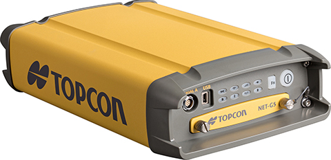
Topcon Positioning Group said that its latest GNSS reference receiver, the NET-G5, is capable of tracking a new signal from the GLONASS constellation.
The GLONASS-M 55 satellite was launched in June 2014 and is equipped with the experimental payload capable of transmitting signals in the L3 frequency band. Engineers successfully tracked the signal with the NET-G5 receiver during a series of recent tests at the Topcon Technology Center in Moscow. The use of signals in L3 band alongside L1 and L2 bands is expected to further enhance the competitiveness of the GLONASS system.
“Topcon is committed to continually investing in research and development to offer end-users and the industry the most up-to-date solutions,” said Ivan Di Federico, chief strategy officer for Topcon Positioning Systems. “Our premier engineers, scientists and designers bring world’s first products and technologies to market, and the ability of the NET-G5 to track the latest signal — a first for the industry — is an excellent example of that dedication.”
Using Vanguard and Universal Tracking technologies, the NET-G5 receiver incorporates 452-channels capable of tracking the full GNSS signal spectrum, including modernized GPS, GLONASS, Galileo, BeiDou, QZSS and SBAS signals.
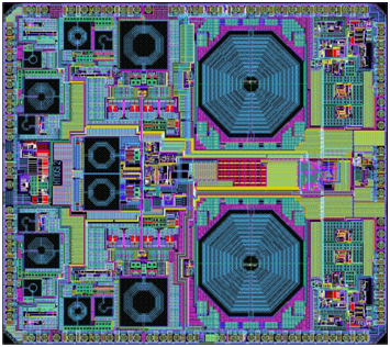
NTLab, a fabless microelectronic company based in Belarus, is offering the NT1051 dual-channel multi-frequency (L1/L2/L3/L5) mutli-system (GPS/GLONASS/Galileo/BeiDou) RF front end.
Manufactured in 0.18 um TSMC BiCMOS technology, it provides operability of the GNSS receiver even if interference power is 120-dB higher than the satellite signal.
The chip was designed to bring benefits of high-grade GNSS receivers to portable devices. To allow reliable navigation in the presence of interference, NT1051 has a 1-dB compression point (on RF input) of -40 dBm. This allows stable tracking, even if the interfering signal is 120-dB higher (compared to -160 dB of typical tracking sensitivity) than the satellite signal.
Simultaneously, portable devices require reduced power consumption. There is always a tradeoff between receiver linearity and consumed current, so the task of combining high dynamic range with low consumption was successfully solved in NT1051 architecture, NTLab said. The resulting power consumption is below 60 mW.
To allow dual-antenna receiver configurations, NT1051 has two separate channels with a common fractional frequency synthesizer.
The GPS Reflections Group of University of Colorado-Boulder has been awarded the prestigious Prince Sultan Bin Abdulaziz International Creativity Prize for Water. The prize is awarded biannually to acknowledge innovative work that contributes to the sustainable availability of water and the alleviation of the global problem of water scarcity.
The awards will be presented in a ceremony in Riyadh, Saudi Arabia, on December 16, concurrently with the 6th International Conference on Water Resources and Arid Environments (ICWRAE 6), December 16-18, 2014.
Professors Kristine Larson and Eric Small developed a new method to measure water at the Earth’s surface. The research team discovered that standard geodetic GPS instruments are sensitive to hydrological influences. They subsequently developed a cost-effective technique, GPS Interferometric Reflectometry (GPS-IR), to measure soil moisture, snow depth, and vegetation water content around GPS antennas. GPS-IR has the advantage of relying on an existing GPS infrastructure installed by surveyors and geoscientists that covers an increasingly large portion of the global surface.
Larson and Small collaborated with scientists at the University Corporation for Atmospheric Research and the National Atmospheric and Oceanic Administration, also in Boulder.
The team uses the GPS-IR technique to analyze data streams from existing GPS networks in near real-time. Data from hundreds of operational GPS sites are downloaded and processed, yielding estimates of hydrologic variables within 24 hours.
Scientists and government agencies can access this information at the team’s web portal and use the data to improve monitoring and forecasting of hydrologic variables.