Boatracs, Kannad, McMurdo and TSi have combined to form McMurdo Group, a single-vendor provider of end-to-end search and rescue, maritime domain awareness solutions.
McMurdo Group has announced a suite of Automatic Identification System (AIS) survival solutions for enhanced collision avoidance and man overboard (MOB) response in the U.S. recreational boating market. The offerings include AIS beacons, transponders, receivers and software.
AIS is an automatic tracking system used on boats and ships that identifies and tracks nearby AIS-equipped vessels and devices to help avoid collisions. AIS transponders send and receive critical navigation information – such as vessel identification numbers, vessel type, position, course and speed – and graphically display a map of the surrounding vessels and area. AIS receivers are often used in conjunction with AIS-capable computer software for similar tracking and monitoring purposes.
In the event a person with an AIS MOB beacon falls overboard, an AIS signal from the beacon is activated. This signal is then sent to AIS receiving devices where the location of the individual in the water can be pinpointed using GPS positioning and presented on graphical chart maps.
The Smartfind M5 has an on-screen beacon location indicator and audible alarm that is triggered to accelerate rescue efforts. It also has a “buddy list” feature that can identify the specific individual needing MOB assistance. For larger fleets, the McMurdo Group AIS Alarm Notification System extends graphical mapping, alarm notification and messaging capabilities to shoreside fleet management operators.
The McMurdo Group AIS product suite includes the following:
AIS Search and Rescue Transponders (SART) or Beacons
Smartfind S5 – a compact, lightweight, waterproof (to 10 meters) AIS SART with high-visibility buoyant carry-off bag ideal for use on life rafts or survival crafts.
Smartfind S10 – a personal, waterproof (to 60 meters) AIS Man Overboard (MOB) device with built-in flashing light and used by individuals or as an additional device to complement a yacht’s on-board flare pack.
Smartfind S20 – a compact AIS MOB device with integrated light for use in a lifejacket.
AIS Transponders and Receivers
Smartfind M5 AIS Class A Transponder – the industry’s first AIS Class A transponder with color display and AIS MOB and AIS SART alarm with crew list functionality to aid in MOB recovery.
Smartfind M10 AIS Class B Transponder – typically used for smaller vessels, charter boat operators or where the additional features of an AIS Class A transponder are not required (includes an a 30 day data logger).
Smartfind M15 AIS Receiver – economical AIS receiver for all recreational vessels.
AIS Software
PC Viewer – Graphical software package ideal for individual vessel operators (included with the Smartfind M5, M10 and Smartfind M15 products).
AIS Alarm Notification System – Vessel Monitoring System with integrated AIS MOB Alerts and Messaging typically used for ship-to-shore communications.
The Teseo II chip is ready for eCall, a European initiative intended to bring rapid assistance to motorists involved in a collision anywhere in the European Union.
STMicroelectronics, a global semiconductor company, has released its Teseo II single-chip satellite-tracking integrated circuit to the European Space Agency (ESA) and the European Commission Joint Research Center (JRC) for testing for eCall approval. The testing campaign is coordinated by the European GNSS Agency as part of its effort to accelerate Galileo adoption.
The Galileo tests will be conducted by the ESA and JRC over the next months to validate ST’s latest firmware release, according to the European GNSS Agency (GSA) test plan. The testing campaign supports the upcoming Galileo early operational services that are expected to go live at the end of 2014. In addition, the tests will evaluate Teseo II compatibility with the European Geostationary Navigation Overlay Service (EGNOS) and with Galileo for the eCall in-vehicle system that automatically sends notification messages from vehicles involved in an accident. Beside static and dynamic test conditions, the testing plan foresees three different use cases, in systems for single-, dual-, and up to triple-constellation (GPS/Galileo/GLONASS) systems.
Following the first position fix using Galileo in-orbit validation satellites conducted by ST and ESA in March 2013, STMicroelectronics has implemented the Galileo Golden-candidate production firmware as an additional constellation in its Teseo II chips. While the Teseo II ICs have always had the capability to be Galileo-ready, ST is enabling a firmware update from the Galileo navigation system. This update benefits consumers and doesn’t require any hardware modification.
The Teseo II chips can simultaneously use signals from multiple satellite navigation systems, including the currently available Galileo satellites, and progressively, as future satellites are launched, the full satellite constellation.
ST’s leadership in the multi-constellation reception delivers immediate use of the Galileo satellites already in orbit, and provides consumers with shorter time-to-first-fix, continuous tracking with enhanced accuracy, and effective operation under challenging circumstances, such as driving through urban canyons.
In January, GPS Worldpublished a cover story on the next-generation Teseo-3 chip, which also provides background on the development of the Teseo II.
Introduced in January 2011, ST’s Teseo II is a standalone satellite receiver able to use signals from multiple satellite navigation systems, including GPS, the European Galileo system, Russian GLONASS, and Japanese QZSS. This multi-constellation approach keeps many satellites in sight, delivering advantages such as shorter time-to-first-fix and continuous tracking with enhanced accuracy, even under challenging circumstances such as driving through urban canyons.
Our esteemed editor-in-chief and publisher at GPS World, Alan Cameron, penned an editorial in January concerning claims made by the People’s Republic of China regarding the Gold Standard for PNT (position, navigation and timing). The Chinese recently claimed that its BeiDou system averaged a user range error (URE) of 2.5 meters using zero age of data (ZAOD), 95% of the time.
Alan correctly made the point that today BeiDou is strictly a regional system, and that while the published and arcane (30-year-old) standard for GPS is 6 meters under the same conditions, this is merely a standard, a never-to-exceed boundary, and not an actual URE measurement. GPS has always provided significantly better than 6 meters accuracy, with a reasonable age of data, while the GPS numbers for URE have significantly improved on a consistent basis since 1978 and today are the best in the world for any global PNT system.
Dr. Bradford Parkinson, the father of GPS, after reviewing the Chinese data pointed out that, “ If a GNNS has full view and an immediate update (such as Compass [BeiDou]) they can drive the AOD down, effectively becoming a WAAS system. This result would not represent a global capability. Plus, there are other errors for a single-frequency receiver in addition to the ionosphere (that is calibrated by WAAS and EGNOS), including troposphere modeling errors, and multipath that drive the ranging error up for a civil user depending on the situation.”
This data is very useful for GDOP (Geometric Dilution of Precision) statistics, which are quite surprising – and come about because of the 30+ GPS satellites in view and the resulting excellent geometry available.
The public data clearly shows that the GPS system is every bit as accurate, and indeed comparatively nominally much more accurate, than BeiDou, and GPS covers the entire globe, not just an area over China and portions of Australia.
It All Starts Here — GPS SIS URE
The GPS accuracy equation begins with the signal in space (SIS). Since 1978, the SIS figures for GPS satellites have continuously improved, as I said primarily due to more accurate orbit determination and more stable atomic reference systems, while the GPS URE numbers have continued to decline. Which is a good thing – smaller URE numbers are better.
Indeed, this clearly explains, in my opinion, why SVN49, which is a perfectly healthy GPS satellite, has never been set to healthy status. While the SVN49 GPS signals are all well within the published 6 meter URE – a never exceed threshold – they are significantly greater than 2 meters. Accuracy matters with GPS, so until corrections can be made, the satellite will remain in test status. Today, it serves as a very useful orbiting GPS test bed but does not enter into the SIS or URE equation.
GPS SIS URE is best explained as the pseudo-range inaccuracy due to ephemeris (orbit) and clock (atomic reference system) errors, which are common to all modern space PNT systems. The SIS root-mean-square (RMS) URE for GPS has been steadily declining over time (smaller numbers are better) and, consequently, so have the user range errors for users on the Earth. However, for my technical readers and space physics buffs, SIS errors are not determined by simple equations and therefore are sometimes difficult to describe accurately because they are neither purely stochastic nor deterministic. Indeed, Ph.D.-level subject matter experts such as Liang Heng, Grace Xingxin Gao, Todd Walter, Sherman Lo and Per Enge, from Stanford University, have clearly shown that SIS errors do not necessarily have a normal distribution Also, the traditional statistics such as sample mean and sample standard deviation may be affected by extreme excursions or outliers. However, these deviations do not significantly affect URE for most users, as they are effectively smoothed by long-term trend analyses and an active Kalman filter.
Better Clocks
Certainly, better atomic reference systems with frequency stabilities on the order of 1×10-E13 or better are partially responsible for these improvements, since one nanometer of clock stability typically equals one foot of position accuracy on the Earth’s surface. That number is important because I clearly remember the day in 1990 at the 1CACS (1st Command and Control Squadron) in Cheyenne Mountain (the 1 CACS is now located at Vandenberg AFB in California), when it was explained that the nominal ephemeris tracking error via optical systems for GPS satellites was on the order of two kilometers. The 1 CACS was responsible for providing collision-avoidance support during NASA shuttle missions and is still responsible for maintaining an extensive space satellite and space object catalog. Today, that error, using different tracking methods — including a global network of dual-frequency GPS tracking and monitoring sites — for GPS SVs approaches two centimeters or better. Consequently, better (more stable) clocks and more precise orbit determinations have greatly reduced the signal-in-space errors and significantly improved the position accuracy for all GPS users on a global scale. And for me that is the crux of the issue for GPS versus any other space-borne PNT system in existence today, or for any system in the near future.
A Global System
GPS is and has always been a global system, since its inception (1973) 41 years ago this year and since President Reagan decreed on September 16, 1983, just 15 days after Korean Air Flight 007 was tragically shot down by fighter aircraft from the Soviet Union (there were four other similar tragedies involving the Soviet Union on record) for being off course, that the Global Positioning System would be a gift from the United States to the world for precise navigation, so that this type of disaster need never happen again. Since that time GPS has been a truly global system for all users, friend or foe, without distinction. Of course longevity and dependability are merely two of the important factors that makes GPS the PNT Gold Standard.
GPS Stands Alone
I do not intend nor do I need to defend GPS as the global Gold Standard for PNT, the figures speak for themselves, however I do feel that the words Gold Standard, as I and many other subject matter experts, interpret them, may need a bit of an explanation.
One of my professional colleagues and a dear friend, for more years than I care to count, and I have long disagreed on this terminology. He feels the term Gold Standard is easily misinterpreted and should not be applied to GPS simply because it is not always well understood; instead he prefers the term system of first choice. However, that just does not have the same ring or historical significance as the Gold Standard.
What is a Gold Standard?
Leaving aside the monetary or financial implications for our PNT purposes, a Gold Standard is defined as the best one or the very best example of its kind — with synonyms such as: a system benchmark, a yardstick, a touchstone, the criterion, a paradigm and the epitome. Add to these descriptors the sense of longevity, endurance, dependability, and quality the GPS engenders among users — and you may be approaching the true sense of the phrase “Global PNT Gold Standard.” I can say unequivocally that the GPS is the only space-based PNT system in existence today that meets all these exacting and more fluid definitions simultaneously.
Historical Perspective
The Global Positioning System has had a continuous on-orbit presence since the second NRL Test and Development satellite was launched in 1977. GPS achieved IOC or Initial Operating Capability with 24 SVs (satellite vehicles) on December 8, 1993 (2SOPS celebrated the 20th anniversary of GPS IOC in December 2013). GPS FOC or Full Operational Capability was achieved on April 27, 1995, just 16 months later. Since that date, the GPS has never been less than fully operational, providing both the military Precise Positioning Service (PPS) and the civil Standard Positioning Service (SPS) to global users. As the staff writers at GPS Daily stated in a recent anniversary article:
Amazingly, though many Navstar satellites have been launched and been decommissioned over the past 20 years, four of the original Block IIA satellites which made up the IOC constellation (SVN-23,SVN-26, SVN-34, and SVN-39) are still operating and providing reliable PNT services as of this 20th Anniversary of IOC.
GPS has grown to become a vital worldwide utility serving billions of users around the globe. GPS multi-use PNT services are integral to the United States global security, economy, and transportation safety, and are a critical part of our national infrastructure. GPS contributes vital capabilities to our nation’s military operations, emergency response, agriculture, aviation, maritime, roads and highways, surveying and mapping, and telecommunications industries, as well as recreational activities.
It is not an overstatement to say GPS is fundamental to today’s technical infrastructure and culture. GPS provides the ‘winning edge’ to our warfighters and allies by delivering premier space-based PNT services to the nation and the world.
This indeed supports the definition, as I see it, of a Gold Standard for global PNT. A system that is long-lived, dependable, and just keeps improving every day. A ubiquitous utility that has changed the world we live in and the way we live our lives for the better, a system that now defines not only the critical national infrastructure of the United States but of many nations around the globe.
As for GLONASS, Galileo and BeiDou, we can have this discussion again in 20 years or so when they have been IOC and FOC for a credible period of time and have proven their accuracy, longevity and utility. For now, there is only one Gold Standard and that is the Global Positioning System.
What Is Don Reading?
This month, my reading preferences centered around mythical and real life figures in the CIA or Central Intelligence Agency. And frankly, sometimes it was hard to tell the difference.
screenshot: “Command Authority”
Command Authority, by Tom Clancy with Mark Greaney Putnam and Sons, ISBN: 978-0-399-16047-9
I devoured this 740-page tome in one weekend and was looking for more when I finally finished. This is one of those books you don’t want to end. It describes the life of the young Jack Ryan as a CIA operative during the Cold War, and of his son, Jack Jr., today. The authors manage the timeline to and fro adroitly so that it is never an issue. As usual, the action spans the globe and as far as I can determine the historical facts are accurate and the scenarios are riveting but believable.
Tom Clancy passed way just about two months before this final book was published. He managed to write 28 books in 30 years, a prodigious feat considering most of them were on the order of 700 pages or more (Threat Vector runs 840 pages). But to my mind, they were all too short, and Tom managed to exit, as any writer would desire, leaving his avid readers yearning for more.
Until next time, happy navigating, and think about what a difference GPS, the PNT Gold Standard, has made in your life. You might be surprised. And then grab a good Tom Clancy book. You have 28 excellent volumes from which to choose.
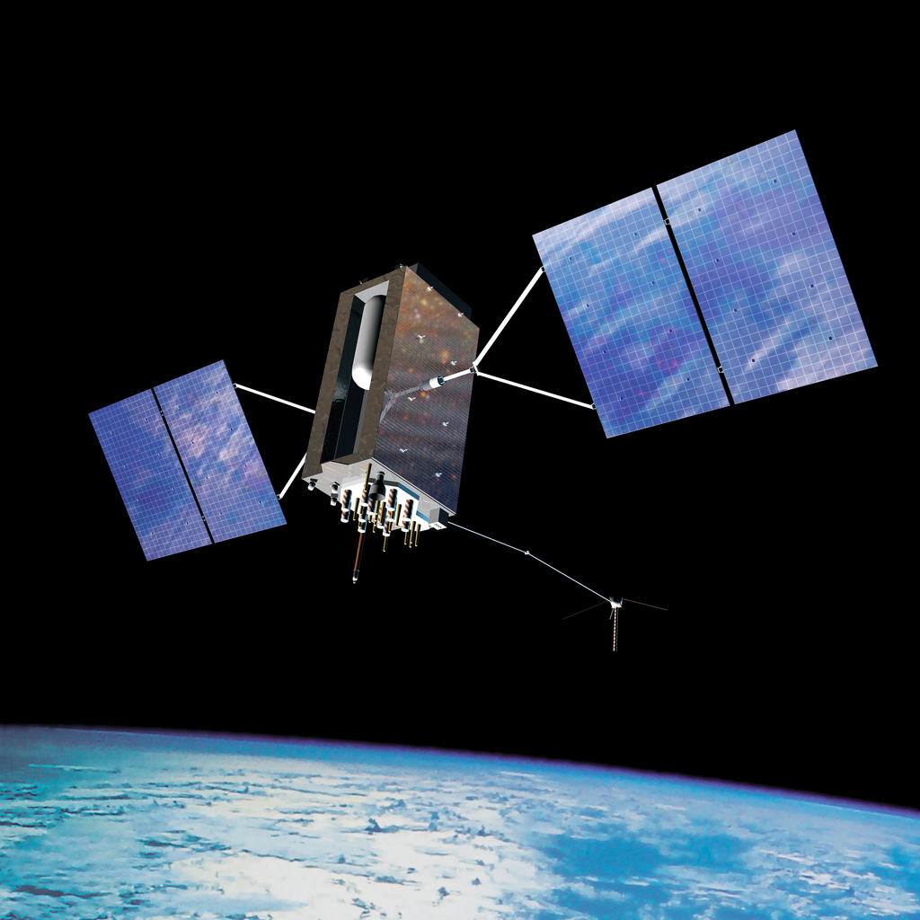
Gen. William Shelton, chief of Air Force Space Command, said the date when prime contractor Lockheed Martin and payload manufacturer Exelis are expected to have the first GPS satellite ready for launch will slip from its original target at the end of this fiscal year, according to National Defense Magazine. Technical difficulties are slowing the development process, he said.
“We’re not happy at all. Is my patience wearing thin? Yes. Has it gotten to the place where I am going to step off the cliff? No,” he said at a breakfast sponsored by the Air Force Association’s Mitchell Institute.
Gen. Shelton said the Air Force is working closely with the contractors.
Shelton said the issue highlights the problem inherent in relying on one contractor for a critical technology, reports Space News. Exelis Geospatial Systems has supplied the payloads for all previous generations of GPS satellites.
“The payload hardware is built and is currently in test,” said Jared B. Adams, director of communications for Exelis geospatial systems, in an email to National Defense Magazine. “Last year, Exelis identified some development issues with the navigation payload for the first GPS III satellite that needed further work. Significant testing with flight-like engineering units and the first GPS III satellite’s flight hardware indicates that the known technical issues have been resolved, and GPS III will meet all mission and quality requirements.”
The payload delay is not expected to push back the first launch of the Lockheed Martin-built GPS III satellites in 2015. Lockheed Martin Space Systems is under contract to build eight GPS III satellites.
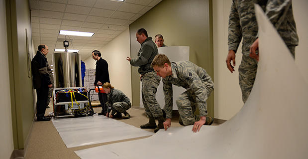
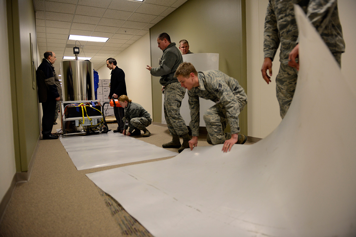
Personnel with the U.S. Naval Observatory-Detachment Colorado and 2nd Space Operations Squadron move the rubidium fountain clock into its new home Tuesday at Schriever Air Force Base. The USNO monitors the GPS constellation and provides time offsets to the 2nd Space Operations Squadron for their daily navigation uploads to each individual GPS satellite. (U.S. Air Force photo/Christopher DeWitt).
The U.S. Naval Observatory’s Alternate Master Clock on Schriever Air Force Base received its second rubidium fountain clock February 4 to ensure it has the most precise time in the world.
Both the USNO’s Washington D.C.-based primary and its local Alternate Master Clock facility serve as the Department of Defense’s common time reference. Additionally, the USNO monitors the GPS constellation and provides time offsets to the 2nd Space Operations Squadron for its daily navigation uploads to each individual GPS satellite.
“With the new rubidium fountain clock, we are going from the time standard of 1 to 2 nanoseconds down to 300 picoseconds,” said Bill Bollwerk, Head of USNO Detachment Colorado.
One nanosecond is equivalent to one billionth of a second, while a picosecond is equal to one trillionth of a second. Though these small slices of time may not sound important, every nth of a second is significant, especially in GPS operations.
“A nanosecond matters because it is equivalent to a 1-foot of error for GPS,” Bollwerk said. “If the GPS satellite clocks were off by 3 nanoseconds, you have 1-meter of error introduced into GPS.”
Designed and produced by physicists at the USNO laboratory in Washington D.C., the powered rubidium fountain clock traveled by dedicated truck to Schriever. Once the fountain clock arrived at Colorado base, with the help of members of the 2nd Space Operations Squadron, the 50th Security Forces Squadron and 50th Civil Engineering Squadron, the USNO team moved it to a climate controlled chamber in the USNO’s laboratory via an airsled hover lifter.
“The 2 SOPS men and women are able to operate and provide accurate instantaneous reliable support to U.S. military forces around the world, thanks to our partnership with the U.S. Naval Observatory,” said Lt. Col. Thomas Ste. Marie, 2 SOPS commander. “We are happy to be able to work together to support their upgrade. Our relationship allows 2 SOPS to continually reach our goal of record breaking time-transfer performance and navigation accuracies.”
Although 2 SOPS was happy to support the move, it’s not as easy as one might think.
“The process of moving the rubidium fountain was very complicated,” said Ken Dreiling, USNO Detachment Colorado. “We had to ensure the fountain clock was not actually in contact with the floor or the walls as we moved it from the loading dock through the hallways and elevator into our facility.”
The careful transport of the fountain was essential to prevent damage that could affect the clock’s performance.
“The fountain clock collects billions of rubidium atoms, encased in a spherical vacuum chamber and laser-cooled to a millionth of a degree above absolute zero degrees Kelvin, approaching the coldest temperature anything can be,” Bollwerk said. “The reason we do that is because we want to observe and measure the atoms for long time in an environment that minimizes unwanted noise like the Doppler Shift.”
Though the Alternate Master Clock provides precise timing for several communication and space systems, Missile Defense Agency, DOD facilities and several civilian infrastructures around the world, the new system was installed primarily to support GPS operations.
“It is great to have the most precise time standard in the world but it is useless unless you can get it to the user, not everyone can come to the facility and set their watch,” said Bollwerk. “GPS is USNO’s primary means of providing global precise time to the warfighter. It is a great partnership between the Navy and the Air Force.”
Dreiling said the new fountain clock will help improve GPS operations.
“The new rubidium fountain clock is the next-generation new frequency standard,” Dreiling said. “This will boost the GPS’s timing by 10-fold.”
The Russian GLONASS/GNSS Forum is conducting a survey on the future of GLONASS.
When translated, the page provides the following background:
“One of the priorities of the GLONASS system is determined to ensure its competitiveness in the global market for satellite navigation services.”Currently, public customers of the federal target program “Maintenance , development and use of GLONASS for 2012-2020 ” prepared proposals on bringing the main characteristics of the system to a level that ensures its competitiveness in the medium term ( 2020 onwards ).
“It seems appropriate that in the preparation of these proposals, the opinion of the main consumers of navigation service providers and manufacturers are taken into account.”
The survey asks the following questions (translation provided by Innovation editor Richard Langley):
What characteristics of the GLONASS system in your view are the most critical for competitiveness relative to GPS, Galileo, and Compass considering plans for their deployment and development (accuracy of the “Space Segment,” access, stability characteristics, compliance with international standards on the time scale UTC and coordinate system, others …)?
Is it important for the competitiveness of the presence of GLONASS that there be additional services such as transferring information on one of the new navigation signals to provide a highly accurate global positioning mode PPP (Precise Point Positioning) by analogy with the E6 Galileo and B6 Compass signals? What extra services could you offer for implementing in the system GLONASS for civilian users to increase its attractiveness?
Is it critical for civil GLONASS to have a complete set of new code signals (L1, L2, L3)?
Is it important in terms of competitiveness, for the GLONASS satellites, in addition to the planned new code signals in the traditional GLONASS bands (L1, L2, L3) to add another signal in the range L5? Why? If yes, for which consumers is this important?
What are the characteristics, in your opinion, that should be achieved to ensure the competitiveness of the system in 2014-2015, 2020, after 2020?
What do you see as the most effective ways to achieve the desired values of the main characteristics of the GLONASS system, including measures of state support?
Is it critical to the competitiveness of GLONASS availability to have a document of the type “Standard GLONASS civil service,” which would give the key performance characteristics of GLONASS and these characteristics would be guaranteed by the “provider” of the GLONASS system (similar to the standards issued by GPS and Compass)?
Responses are being accepted until February 14. Send responses to [email protected] with Questionnaire TTX in the subject line. Responses will be compiled and prepared for appropriate treatment to public customers of the federal target program “Maintenance, development and use of GLONASS for 2012-2020 years. “
Spirent Communications, a testing navigation and positioning systems company, today announced the introduction of Spirent SimSAFE, a software solution that concurrently simulates legitimate Global Navigation Satellite System (GNSS) constellations and spoofed or hoax signals to evaluate receiver resilience and help develop counter measures. SimSAFE was developed in conjunction with Qascom, GNSS signal security and authentication experts.
As GNSS become increasingly embedded in modern infrastructure for application timing and device positioning, the opportunities for interference and spoofing attacks become greater, Spirent said. Hoax or spoofing attacks work by mimicking genuine GNSS signals, which mislead GNSS receivers. From mobile telephony to Internet banking, GNSS timing signals are used in many key systems, and yet there is no requirement on GNSS equipment to demonstrate any degree of robustness to block or even detect malicious attacks that disrupt performance. Often, affected receivers do not recognize when they are receiving fake signals and continue to operate normally, but provide false time or position information.
“GNSS signal vulnerability is becoming a significant issue,” said John Pottle, marketing director of Spirent’s Positioning Division. “SimSAFE is the first tool to help develop systems that will detect and counter spoofing attacks. This solution is unique in being able to provide a means of both emulating a spoof attack and monitoring a receiver under attack to evaluate mitigation strategies and countermeasures.”
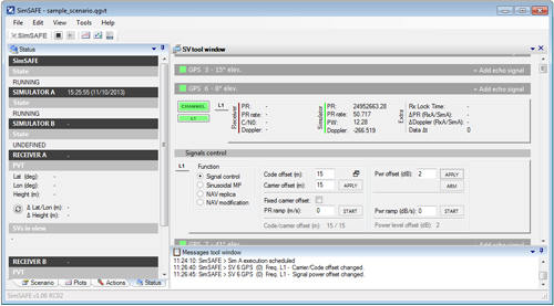
SimSAFE is a fully controllable laboratory-based, non-radiated test solution to evaluate a receiver’s response to a wide range of spoofing attacks. The test tool generates simulated spoofing attacks that can be aligned with genuine signals from an antenna or locally generated “genuine” signals using a Spirent GNSS simulator. This allows users to simulate a wide range of sophisticated attacks, monitor the response of the receiver under attack and evaluate the effectiveness of proposed countermeasures to then improve resilience against such attacks.
screenshot: Spirent’s SimSAFE
In essence Spirent’s SimSAFE spoofing test bed does two things:
Generates simulated spoofing attacks where a Spirent RFCS is controlled to represent a hoax signal synchronized with a “genuine” signal which can be ambient GNSS or itself generated by simulation.
Monitors a GNSS receiver subject to simulated spoofing attack in order to evaluate and refine mitigation strategies or countermeasures.
The two principal applications of SimSAFE are:
The evaluation of the vulnerability of a user’s receiver when exposed to a wide range of simulated spoofing attacks.
The evaluation and refinement of spoofing mitigation techniques, signal authentication strategies or countermeasures. This work can be conducted using any receiver of the user’s choice; however, a range of receiver monitoring tools supplied with SimSAFE are enabled if the receiver supports Septentrio Binary File (SBF). A suitable Septentrio receiver is supplied in the standard configurations for this purpose.
The Federal Aviation Administration has ruled that a beer delivery drone service of Lakemaid Beer to ice fishermen cannot go forward. Lakemaid, brewed in Stevens Point, Wisconsin, had hoped to use drones to deliver its beer from bait shops to anglers in ice shacks. But the government says the brewer’s next test — which Lakemaid managing partner Jack Supple says was tentatively set for Minnesota’s Lake Mille Lacs and the Twin Pines resort — cannot proceed.
“We were a little surprised at the FAA interest in this since we thought we were operating under the 400-foot limit,” Supple told NPR via email. He adds that the beer-makers “figured a vast frozen lake was a lot safer place than [what] Amazon was showing on 60 Minutes.”
FAA rules don’t currently allow drones to be used for commercial delivery. The agency has scheduled reviews of its rules on drones.
The FAA told Lakemaid that its plan broke at least four regulations, ranging from the operator’s rating to the use of airspace. The FAA told Lakemaid that it “recognizes that people and companies other than modelers might be flying UAS with the mistaken understanding” that their actions are legal. But the rules and guidelines used in such cases apply only to people flying model airplanes, the FAA added.
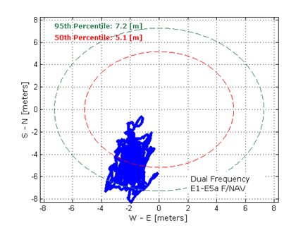
Dual-frequency Galileo positioning performance during the In-Orbit Validation phase: positioning accuracy is an average 8 m horizontal and 9 m vertical (95% of the time). Its average timing accuracy is 10 nanoseconds on average. Plot courtesy of ESA.
The in-orbit validation of Galileo has been achieved, according to the European Space Agency (ESA). Europe now has the operational nucleus of its own satellite navigation constellation in place — the world’s first civil-owned and operated satnav system.
Four is the minimum number of satellites needed to perform navigation fixes. In 2011 and 2012, the first four satellites were launched into orbit. In 2013, these satellites were combined with a growing global ground infrastructure to allow the project to undergo its crucial in-orbit validation phase: IOV.
“IOV was required to demonstrate that the future performance that we want to meet when the system is deployed is effectively reachable,” said Sylvain Loddo, ESA’s Galileo Ground Segment manager. “It was an intermediate step with a reduced part of the system to effectively give evidence that we are on track.”
Galileo Validated Video
On March 12, 2013, Galileo’s space and ground infrastructure came together for the first time to perform the historic first determination of a ground location, taking place at ESA’s Navigation Laboratory in the ESTEC technical centre, in Noordwijk, the Netherlands. From that point, generation of navigation messages enabled full testing of the entire Galileo system. A wide variety of tests followed, carried out all across Europe.
“ESA and our industrial partners had teams deployed in the field continuously for test operations,” said Marco Falcone, ESA’s Galileo System Manager. “More than 10,000 km were driven by test vehicles in the process of picking up signals, along with pedestrian and fixed receiver testing. Many terabytes of IOV data were gathered in all.”
The single most important finding from the test results? Galileo works, and it works well. The entire self-sufficient system has been shown as capable of performing positioning fixes across the planet.
Galileo’s observed dual-frequency positioning accuracy is an average of 8 meters horizontal and 9 meters vertical, 95 percent of the time. Its average timing accuracy is 10 billionths of a second. Its performance is expected to improve as more satellites are launched and ground stations come on line.
For Galileo’s search and rescue function — operating as part of the existing international Cospas–Sarsat programme — 77 percent of simulated distress locations can be pinpointed within 2 kilometers, and 95 percent within 5 kilometers. All alerts are detected and forwarded to the Mission Control Centre within a minute and a half, compared to a design requirement of 10 minutes.
“Europe has proven with IOV that in terms of performance we are at a par with the best international systems of navigation in the world,” said Didier Faivre, ESA director of Galileo and Navigation-related Activities.
In an article for The System section of the February 2013 GPS World, Peter Steigenberger, Urs Hugentobler, and Oliver Montenbruck discuss Galileo-only positioning. “Using an ionosphere-free dual-frequency linear combination of pseudorange measurements on the Galileo E1 and E5a frequencies, the position of the TUME reference station [at the Technische Universität München (TUM) in Munich, Germany] could be determined with a 3D position error of less than 1.5 meters,’” the authors said. Read more here.
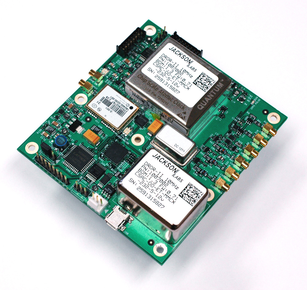
Jackson Labs Technologies, Inc., a designer and manufacturer of GPS, timing and frequency equipment, is offering the DROR-II, a 10-MHz/5-MHz/1-PPS GPS-Disciplined Atomic Frequency and Timing Reference (GPSDO).
The DROR-II is a ruggedized frequency and timing reference with a Cesium Vapor Atomic Oscillator followed by a precision SC-cut Crystal Double-Oven Oscillator and an actively vibration-compensated VCXO oscillator, with specific emphasis on ultra low phase noise performance under extreme vibration and acceleration such as could be encountered in aircraft, tracked vehicles, and wheeled vehicles.
The DROR-II unit is optimized for operation in high-vibration and high-acceleration environments that require ultra-low phase noise performance and high frequency stability under extreme conditions. The DROR-II combines the strengths of three different on-board oscillators to provide an overall performance that has not been achievable with legacy products, at a steady-state power consumption of less than 3.85W, the company said.
The DROR-II uses a GPS receiver to provide long-term phase and frequency accuracy of the built-in CSAC atomic oscillator which is followed by an SC-cut, Double Oven OCXO (DOCXO) for very high short-term stability and low phase noise, which is itself followed by a three-axis electronically vibration-compensated crystal oscillator for ultra-low-noise under high vibration. Using these four signal sources cascaded to each other allows unmatched Phase Noise and Short Term Stability (ADEV) while also providing long-term atomic holdover, very fast warmup, and long-term phase-lock to UTC. Short term stability of 1E-012 (1ppt), and phase noise floors of -162dBc/Hz are achieved. Frequency stability over 24 hours is better than 5E-013 (0.5ppt) typically when locked to GPS.
The DROR-II supplies three isolated 10-MHz Sine Wave outputs, two CMOS 1PPS, and one 5-MHz output that is phase-synchronized to UTC via the internal GPS receiver. DROR-II contains a 50-channel WAAS/EGNOS/MSAS-enabled GPS receiver that provides support for avionics systems through integrated three-axis gyro-accelerometers and a -160-dBm GPS tracking capability. DROR-II power requirements are less than 3.85W steady-state, and only a single supply of between 11.0V to 32V is required. Support for an external LCD display is standard.
The unit can be monitored and controlled by an RS-232 port or a USB port via industry standard SCPI-99 Commands (GPIB commands), and is capable of generating numerous NMEA-0183 output sentences for easy integration into existing infrastructure. The DROR-II can be ordered with various OCXO options and with different temperature ranges.
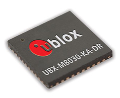
Chip maker u-blox has introduced the UBX-M8030-Kx-DR, a chip that integrates 3D Automotive Dead Reckoning technology to calculate a vehicle’s position, speed, and elevation in areas of poor or no satellite visibility. u-blox also provided a two-minute video demonstration.
u-blox has introduced its next-generation semiconductor technology dedicated to advanced in-dash navigation, emergency call (including eCall, a European rapid response initiative, and ERA-GLONASS, Russia’s Government Accident Emergency Response System), usage-based insurance, road-pricing, and stolen-vehicle recovery systems.
The UBX-M8030-Kx-DR chip integrates 3D Automotive Dead Reckoning (3D ADR) technology, which enables it to calculate a vehicle’s position, speed, and elevation in areas of poor or no satellite visibility, a common scenario in high-density urban environments, stacked highways, or parking garages.
Here is a two-minute YouTube video demonstration.
“Drivers expect car navigation systems to be fast, accurate, and work everywhere, regardless of satellite visibility. As cities expand, construction of more tunnels, multi-level overpasses and park garages is increasing,” said Thomas Nigg, VP Product Marketing at u‑blox. “Our solution meets this challenge head-on; regardless of satellite visibility, our 3D ADR chip shows movement in three dimensions to maintain continuous and accurate positioning in tunnels, stacked highways, multi-level or underground parking facilities.”
The technology aids traditional GNSS navigation systems such as GPS, GLONASS and BeiDou by blending them with individual wheel speed, gyroscope and accelerometer information to maintain accurate 3D positioning even when satellite signals are completely lost.
The UBX-M8030-Kx-DR chip is self-calibrating to compensate for sensor aging and temperature effects. It is compatible with virtually all vehicles and drive trains (i.e. front-, rear-, all-wheel drive), and supports a variety of sensor combinations. Sensor information can be derived from the vehicle’s sensors for the most cost-efficient implementation, or from external sensors for after-market solutions. The chip is AEC-Q100 qualified and is produced in ISO/TS Automotive certified production sites.
The chip requires minimum host integration or customization resulting in no risk, low cost, and fast time-to-market, u-blox said. Installation is uncritical thanks to automated software calibration. 3D ADR is accurate even at low speeds.
The chip allows for easy testing, simple and modular production set-up, and minimal BOM. The chip comes in a 40-pin QFN package measuring only 5 x 5 mm and includes I2C, SPI, UART and USB interfaces.