Detect and Locate GPS Jamming: Provide Actionable Intelligence
Sponsored by: Exelis Original Broadcast Date: Thursday, December 5, 2013 Moderator: Don Jewell, Editor, Defense PNT Newsletter Speakers: Jeff Coffed, Product Marketing Manager, Exelis Inc.; Carl Slutsky, Product Manager for Signal Sentry 1000, Exelis Panelists: Joseph Rolli, Signal Sentry Business Manager, Exelis; Jon Schnabel, Chief Scientist, Geospatial Systems, Exelis Summary: The Global Positioning System—GPS—is an essential element of the global information infrastructure and supports nearly every facet of modern life. However, the availability and usage of low-cost GPS jamming devices has resulted in the increased threat of intentional and unintentional disruption to commercial and industrial systems that rely on precise GPS data. That is why Exelis developed Signal Sentry 1000, a solution that enables authorities to locate with pin-point accuracy the sources of interference thereby assuring safety, efficiency, and revenue. This webinar will discuss the threat and Signal Sentry. This webcast will be of interest to anyone whose organization relies on GPS for information or commerce.
Sponsored by: Hemisphere GNSS Original Broadcast Date: Thursday, November 21, 2013
Moderator: Tony Murfin, Editor, Professional OEM newsletter
Speakers: Olivier Casabianca, Business Area Manager, Trimble GNSS OEM; Hal Adams, Co-founder/Chief Operating Officer, Accord Technology; Neil Gerein, Defense Product Manager, NovAtel; Eric Brewer, Senior Systems Engineer, Rockwell Collins; and Howard William Loewen, President, MicroPilot Inc.
Summary: In recent years, there has been explosive growth in the Unmanned Aerial Vehicle (UAV) market segment, with most on-board navigation systems relying on GNSS or GNSS with inertial aiding. As military budgets decline, interest in civilian commercial applications is growing rapidly. The FAA recently awarded special type certification to two UAVs for commercial Arctic operations, and the industry is now poised for the opening of the regulation floodgates to address a growing commercial demand. In this webcast, we will hear from some of the industry leaders in GNSS-based navigation for UAVs, in both the military and civilian sectors: they will tell us what they are doing in UAV navigation and where they see this exciting market going.
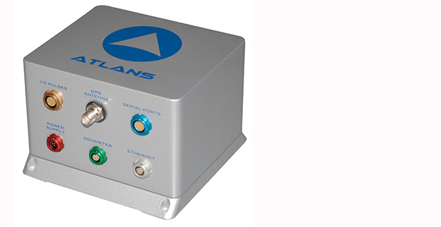
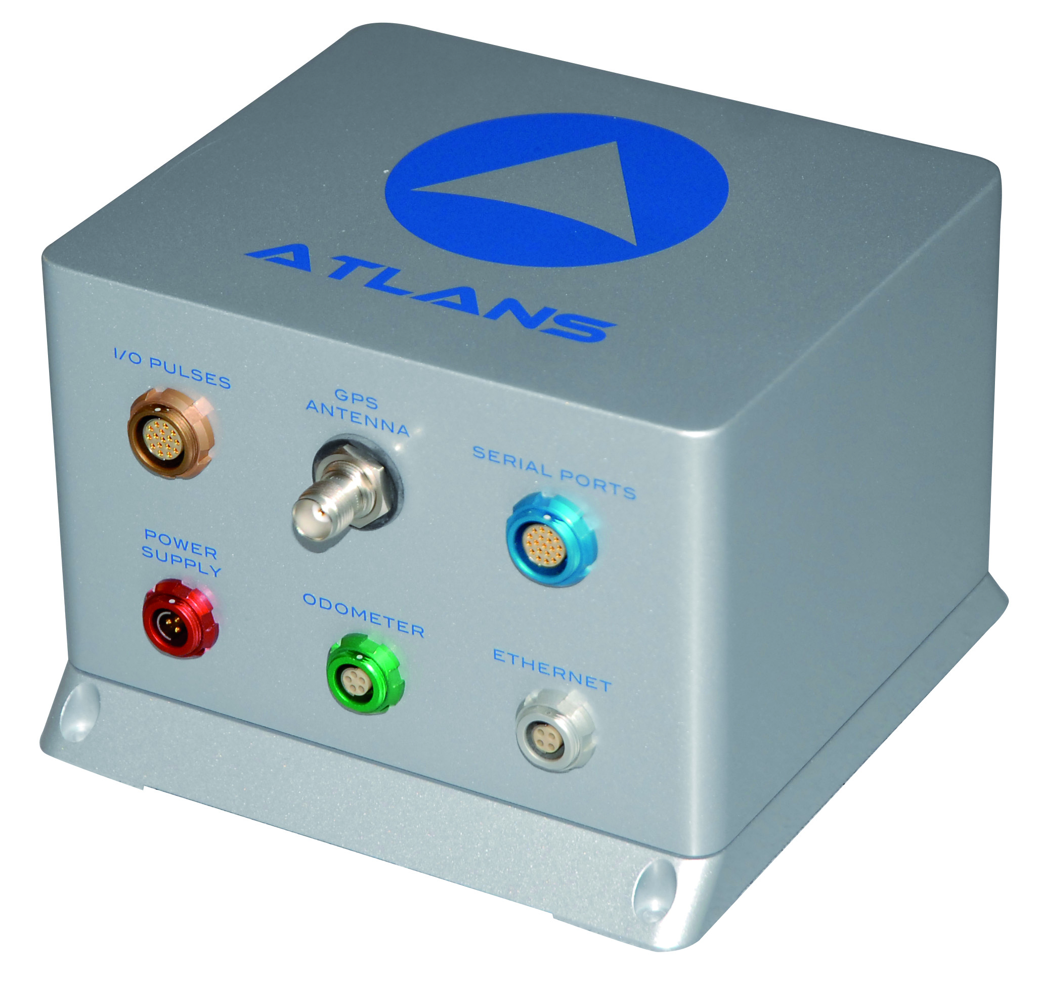
iXBlue, a provider of navigation, positioning, and mapping solutions, has launched its new ATLANS-C position and orientation system, developed in close cooperation with Septentrio Satellite Navigation. The system is designed to provide continuous and accurate positioning in urban environments, where GNSS signals are obscured, intermittent, or possibly distorted by reflective surfaces.
ATLANS-C benefits from the optimized integration of iXBlue’s fiber-optic gyroscope (FOG) based inertial navigation system (INS) and Septentrio’s multi-constellation GNSS receiver technologies. Experts from iXBlue and Septentrio worked closely to develop a “smart” coupling method that combines the advantages of the two companies’ technologies. The result is an easy-to-use, easy-to-integrate, and highly reliable INS-GNSS mobile mapping solution, the companies said.
“The ATLANS-C development was a real team effort,” said Jan Van Hees, head of sales and business development at Septentrio. “Technical trials with leading customers have already demonstrated superior accuracy, continuity, and reliability of positioning and attitude data, even in the most challenging urban environment.”
“The new system’s robustness, compact size, and improved urban-area performance uniquely address more complex mobile mapping market requirements. The ease of use, quick integration, and zero maintenance features are excellent values recognized by original equipment manufacturers (OEM) or mobile mapping system integrators,” explained Xavier Montazel, head of iXBlue inertial products division. “One of ATLANS-C’s many other advantages is its versatility, allowing the same equipment to be used for land and air applications. Configuration of the system is achieved through the use of iXBlue’s innovative web interface, utilized across the complete range of products.”
ATLANS-C has no ITAR components inside, allowing fast and easy global export. Customers will benefit from the industry exclusive five-year warranty and a 24/7 support line. ATLANS-C is available today with a six-week lead time.
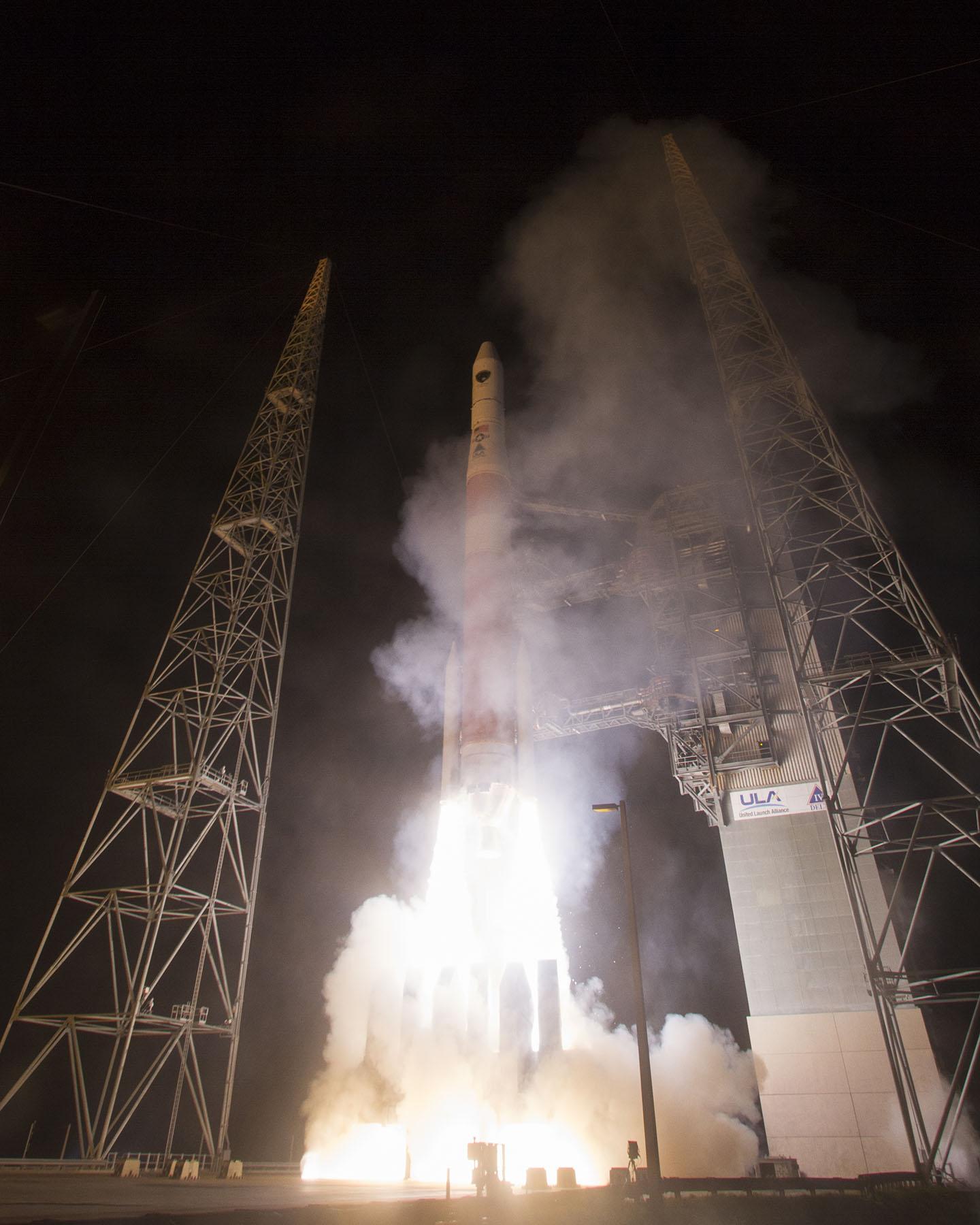
The U. S. Air Force successfully launched the fifth GPS IIF satellite carried aboard a United Launch Alliance Delta IV launch vehicle at 8:59 p.m. EST from Cape Canaveral Air Force Station, Florida, February 20. Watch the launch here.
Racelogic’s latest update to the LabSat 3 simulator allows the use of 128-Gbyte SD cards, giving up to nine hours of high-quality RF recording. Also included in the update is the ability to use external USB hard drives and the addition of a serial/USB NMEA output, generated by the internal GPS engine during a replay.
The multi-constellation, stand-alone, battery-powered GPS/GLONASS/Beidou simulator is affordable and convenient, Racelogic said.
Along with SD card recording, LabSat 3 features inbuilt battery power, dual-channel recording of GPS/Galileo/QZSS/SBAS, BeiDou, or GLONASS, and logging of other external signals such as CAN and RS2232 — in a small, rugged, and light enclosure.
A United Launch Alliance Delta IV lifts off from Space Launch Complex-37 with the Air Force’s Global Positioning System (GPS) IIF-5 satellite. This launch marked the 25th Delta IV flight since the first flight in 2002. Credit: Ben Cooper/ULA
News compiled with the assistance of CANSPACE listserv.
After a brief delay due to concerns over solar radiation trends, the GPS IIF-5 satellite was successfully launched at the end of the designated launch window at 01:59 UTC on February 21. The satellite, attached to the launch rocket’s upper stage, was initially placed in a highly elliptical orbit. Following a third burn of the rocket, the satellite was released into its assigned orbit at about 05:37 UTC today.
Here is a video showing highlights of the launch:
GPS IIF-5 will replace the aging spacecraft known as GPS IIA-28 in Plane A, Slot 3 of the constellation.The GPS IIA-28 satellite was launched aboard Delta 249 on November 5, 1997, as the final member of the Block IIA series. It will go into a reserve role in the network for the remainder of its useful life.
This is the first of three GPS launches planned through July to replace aging craft in the constellation. GPS IIF-5 incrementally upgrades the constellation with improved accuracy, enhanced internal atomic clocks, better anti-jam resistance, a civil signal for commercial aviation, and a longer design life, all features of the Boeing-build Block IIF series. This will be the fifth of 12 Block IIF spacecraft being built to form the backbone of the GPS fleet for the next 15 years.
Launch logo. The nickname of the IIF-5 satellite is Canopus, the brightest star in the modern constellation Carina and the second brightest star in the night-time sky, after Sirius.
According to the Air Force, the new capabilities of the IIF satellites will provide greater navigational accuracy through improvements in atomic clock technology, a more robust signal for commercial aviation and safety-of-life applications, known as the new third civil signal (L5), a second civil signal (L2C) available for the dual-frequency GPS receivers and a 12-year design life providing long-term service. These upgrades improve anti-jam capabilities for the warfighter and improve security for military and civil users around the world.
“I am pleased with the outcome of today’s launch. The new capabilities provided by the IIF satellites will improve operations, sustainment and overall GPS service for the warfighter, international, commercial and civil communities,” said Col. Bill Cooley, director of the Space and Missile Systems Center’s Global Positioning Systems Directorate.
“The modernized capabilities that are coming on board with the successful launch of GPS IIF-5 will support the worldwide GPS community for years to come. I would like to recognize the outstanding commitment and the superb dedication to mission success from the 45th and 50th Space Wings, our industry partners: Boeing and United Launch Alliance, and the GPS IIF and Delta IV program teams at the Space and Missile Systems Center,” said he said.
The GPS Block IIF satellites are built by Boeing, and are operated by the United States Air Force following their launch by United Launch Alliance, using Evolved Expendable Launch Vehicles.
The first GPS IIF satellite was launched on May 27, 2010, and entered service on Aug. 26, 2010.
The second satellite, which launched on July 16, 2011, entered service on Aug. 22, 2011.
The third satellite launched on Oct. 4, 2012, and entered service 22 days later.
The fourth IIF was launched May 15, 2013, and entered service on June 21, 2013.
Every modern GPS satellite was launched from Cape Canaveral Air Force Station.
Each GPS IIF satellite delivers:
Greater navigational accuracy through improvements in atomic clock technology,
A new civilian L5 signal to aid commercial aviation and search and rescue operations,
Improved military signal and variable power for better resistance to jamming in hostile environments,
A 12-year design life providing long-term service and reduced operating costs,
An on-orbit, reprogrammable processor that can receive software uploads for improved system operation.
“Once again, a group of talented mission partners rose to the challenge of launching another successful mission from the Cape,” said Col. Douglas Schiess, commander, 45th Operations Group, who served as the Launch Decision Authority. “Those mission partners include the 45th Space Wing, the Space and Missile Systems Center, the 50th Space Wing, United Launch Alliance, Boeing, and our other industry partners with the Delta IV and GPS IIF launch teams.”
A United Launch Alliance Delta IV lifts off from Space Launch Complex-37 with the Air Force’s Global Positioning System (GPS) IIF-5 satellite. This launch marked the 25th Delta IV flight since the first flight in 2002.A United Launch Alliance Delta IV lifts off from Space Launch Complex-37 with the Air Force’s Global Positioning System (GPS) IIF-5 satellite. This launch marked the 25th Delta IV flight since the first flight in 2002.
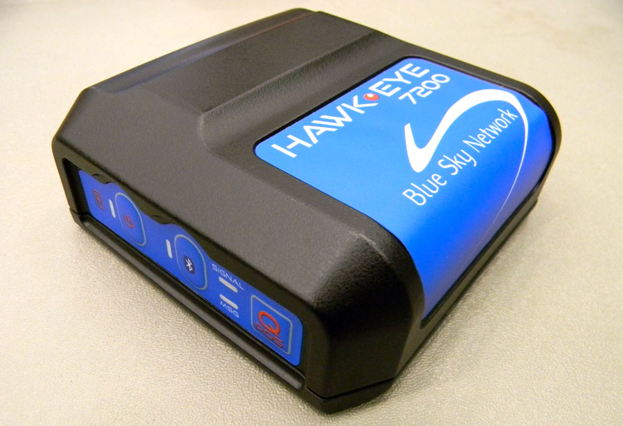
Blue Sky Network’s HawkEye 7200 Portable Tracking Solution.
Blue Sky Network has released the portable HawkEye 7200 with geofencing. The Hawkeye 7200, released in September 2013, is a small mobile device designed specifically for Iridium and GNSS satellite tracking of aviation, land/mobile or marine assets. The company will demonstrate its new AVR (advanced variable response) geofencing capabilities at the upcoming HAI Heli-Expo tradeshow in Anaheim, California, February 25-26.
“Advanced variable response or AVR delivers functionality and utility one level beyond traditional geofencing alarms or alerts. It allows the asset manager or geofence designer to set a conditional response for what happens or does not happen when an aircraft, vehicle, or vessel is in, or out of a geofenced area,” explains John Peterson, Blue Sky Network’s vice president of Business Development. “For example, position reporting frequencies could be turned off when an asset is at its home base, resume normal reporting after leaving the base, and increase reporting frequency when entering regions considered more dangerous. AVR gives asset managers more control, ultimately making fleet management easier, safer, and less expensive.”
In addition to AVR, the HawkEye 7200 offers three significant advantages over traditional satcom asset tracking devices
An all-in-one design including internal long-lasting lithium ion battery and dual Iridium and GNSS antenna;
true concurrent multi-national GNSS for faster, more accurate positioning; and
Bluetooth connectivity using Blue Sky Network’s custom APP for iPhone and iPad, facilitating easy messaging and custom form transmission from Apple devices.
The HawkEye 7200 portable satcom solution works directly with Blue Sky Network’s cloud-based web portal SkyRouter. Skyrouter is a secure online website that provides tracking and management of globally dispersed assets.
Broadcom Corporation today introduced a GNSS system-on-chip (SoC) that will enable wearable location devices to operate with less power and more accuracy, Broadcom said. The Broadcom BCM4771 GNSS SoC is designed for low-power, mass-market wearable devices such as fitness trackers and smart watches. Broadcom will showcase its mobile innovations at Mobile World Congress in Barcelona, February 24-27.
The Broadcom BCM4771 GNSS SoC with on-chip sensor hub enables consumers to more accurately track and manage their health and well-being by delivering precision activity tracking and location data while consuming less power than traditional architectures. This enables location intelligence and the extended battery life needed by the growing wearable market.
Wearable wireless device revenues are projected to exceed $6 billion in 2018 with sports, fitness and wellness as the largest segment with 50 percent share of all device shipments1.
“Today’s wearables like fitness trackers have surged in popularity, but often miscalculate speed and distance,” said Mohamed Awad, Broadcom director of the Marketing, Mobile and Wireless Group. “As the largest supplier of discrete GNSS solutions, Broadcom brings its location expertise to deliver more precise fitness and health measurements to the accelerating wearable market.”
Broadcom’s new chip constantly monitors user activity levels and location history to improve accuracy while adding advanced features such as location batching. In addition, Broadcom’s BCM4771 significantly reduces power consumption and board area by combining its location capabilities with an integrated sensor hub, contextual awareness, and GNSS. The SoC is complimented by Broadcom’s Wireless Internet Connectivity for Embedded Devices (WICED) Smart and WICED Direct software development kits (SDKs) to provide additional wireless connectivity to the platform.
Key Features. Designed in 40 nanometer (nm) process technology, the BCM4771 GNSS SoC includes a sensor hub that integrates sensor inputs for its on-chip algorithms to detect the user’s context, accurately compute speed and distance traveled, and provide fitness applications with the GNSS track. Power savings and advanced accuracy are achieved by intelligently leveraging context detection through the tight coupling of sensor inputs and GNSS on a single SoC. Broadcom’s BCM4771 also realizes a lower overall bill of materials (BOM) cost through the integration of a multipurpose sensor hub, the company said.
The BCM4771 will be sampling by the end of Q1 2014.
WASHINGTON, D.C. – The Federal Communications Commission today proposed rules to help emergency responders better locate wireless callers to 911. The proposed updates to the FCC’s Enhanced 911 (E911) rules respond to Americans’ increasing use of wireless phones to call 911, especially from indoors, and take advantage of technological developments that allow for more accurate location information to be transmitted with 911 calls.
The FCC’s current E911 rules require wireless providers to automatically transmit information to 911 call centers on the location of wireless 911 callers within certain parameters for accuracy. These rules, which were adopted in 1996 and underwent their last major revision in 2010, enable wireless providers to meet this accuracy standard based solely on the performance of outdoor wireless 911 calls.
However, many Americans are replacing landlines with wireless phones, and calling patterns are changing. For example, reports indicate that nearly 73 percent of 911 calls in California are made from wireless phones, and approximately 80 percent of all smartphone use occurs indoors.
In light of these trends, the FCC today proposed changes to its E911 rules to include indoor location accuracy — particularly location accuracy in challenging indoor environments such as large multi-story buildings, where first responders are often unable to determine the floor or even the building where the 911 call originated. Determining the location of indoor wireless callers is more challenging than determining an outdoor location, but innovation and technological developments in this area are making it easier to locate mobile devices wherever they are, the FCC said.
The FCC proposes in the near term that wireless providers meet interim location accuracy metrics that would be sufficient to identify the building for most indoor calls. The FCC also proposes that wireless providers deliver vertical location information that would enable first responders to identify the floor level for most calls from multi-story buildings.
In the long term, the FCC seeks to develop more granular indoor location accuracy standards that would require identification of the specific room, office, or apartment where a wireless 911 call is made, according to the statement by the FCC. These standards would rely on the advancing capabilities of indoor location technology and increasing deployment of in-building communications infrastructure.
The FCC also proposed additional steps to strengthen its existing E911 rules to ensure delivery of more timely, accurate, and actionable location information for all wireless 911 calls. In addition, the FCC is seeking comment on whether to revisit its timeframe for replacing its current handset- and network-based location accuracy standards with a single standard in light of technological developments.
While seeking comment on its proposals, the FCC also encouraged industry, the public safety community, and other stakeholders to work collaboratively to develop alternate proposals for its consideration. The FCC emphasized that its ultimate objective is that all Americans – whether they are calling from urban or rural areas, from indoors or outdoors – receive the support they need in times of emergency.
u‑blox has introduced the CAM-M8Q GPS/GLONASS/BeiDou/QZSS antenna module. The module integrates a u-blox M8 satellite receiver IC plus SAW filter, LNA, TCXO, RTC, passives and a pre-tuned GNSS chip antenna in an ultra-small 9.6 x 14.0 x 1.95 mm package. The new module requires only a power source for reliable and accurate satellite positioning anywhere in the world.
Combining low power consumption with high-sensitivity, high jamming immunity and concurrent GNSS operation (GPS/GLONASS, GPS/BeiDou, or GLONASS/BeiDou) the surface-mount CAM-M8Q provides a drop-in solution for satellite positioning in an ultra-small form factor, u-blox said.
“Our u-blox CAM-M8Q is perfect for customers designing highly compact products who want to speed up product development while freeing resources for core activities,” explains Thomas Nigg, vice president of product marketing at u-blox. “The CAM-M8Q is a pre-tuned, performance and cost optimized module providing satellite positioning on an extremely small footprint. It is literally an ‘instant’ positioning solution.”
The u-blox CAM-M8Q module is designed for a wide range of applications such as personal locators, handheld navigators, and wearable electronics as well as vehicle telematics systems used for emergency call, anti-theft, insurance and road pricing. Consistent omni-directional antenna performance helps ensure excellent performance regardless of module orientation.
In addition, the CAM-M8Q allows the internal chip antenna to be used as a backup antenna if the design incorporates an external antenna. This benefits companies where there is a risk that the primary external antenna may malfunction or suffer damage, for example in vehicle tracking systems where damage is possible to the external antenna.
The CAM-M8Q module uses the latest u-blox M8 GNSS receiver chip qualified according to AEC-Q100 and is manufactured in ISO/TS 16949 certified sites. Qualification tests are performed as stipulated in the ISO16750 standard: “Road vehicles – Environmental conditions and testing for electrical and electronic equipment.”
The CAM‑M8Q is form-factor compatible to predecessor modules UC530 and UC530M, allowing the upgrade of existing designs with minimal effort.
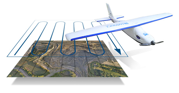
Topcon Positioning Group has released and made available in Europe the Topcon SIRIUS PRO powered by MAVinci, an Unmanned Aerial System (UAS) designed to produce the most accurate solutions for automated mapping of construction sites, pipelines, disaster areas, mines, quarries and myriad sites without regard to terrain.
During October 2013, Topcon Europe Positioning (TEP) entered into a strategic partnership with UAS provider MAVinci GmbH. The result of that partnership is the release of the fixed-wing UAS Topcon SIRIUS PRO powered by MAVinci.
“We are excited to announce our distribution agreement with Topcon. This partnership is the ideal expansion of our global distribution network,” Johanna Claussen, CEO at MAVinci GmbH said. “The simple operation of our UAS from flight planning to the final orthophoto and DEM (Digital Elevation Model), allows flexible use in highly demanding environments. Its flexible assisted auto-pilot landing mode enables navigation around any unforeseen obstacles.”
Based in St. Leon Rot, Germany, MAVinci is a aerial surveying company specializing in the development of UAS technology.
“By adding Topcon’s RTK solutions to the UAS and ground control station, the SIRIUS PRO is the first commercially available UAS that can reach 5-cm accuracy without the need for ground control points,” said Sander Jongeleen, mobile mapping product manager for Topcon Positioning Group. “This leads to an enormous reduction of operational cost and allows mapping of areas that are not easily accessible with high accuracy.”
The SIRIUS PRO is a fixed-wing UAS capable of producing high quality and pre-positioned aerial photography without the need of extensive ground control that is required by competitive products. Key features include:
Work in mountain areas — Flight plan adapts to elevation model
Cover areas that require multiple flights — Flight plan automatically splits and rejoins for post processing
Simple hand launch
Land in areas where automatic landing is impossible with assisted auto-pilot mode
Fly in all weather conditions — wind up to 50 km/h, temperature range of -20º C to 45º C and rain.
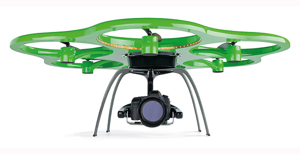
The Aibotix X6 unmanned aerial vehicle is designed to deliver up-to-date geospatial information from hard-to-reach areas.
Hexagon, a global provider of design, measurement and visualization solutions, has acquired Aibotix, a manufacturer of intelligent multicopter systems for high-efficiency aerial applications.
Headquartered in Kassel, Germany, Aibotix is the maker of Aibot X6, a new generation of vertical takeoff and landing unmanned aerial vehicle (UAV). Intelligent, autonomous and safe, the multi-rotor platform is designed to suit the needs of customers in the industrial inspection, aerial mapping, surveying, utility and security markets, Hexagon said.
UAV-based solutions are ideal for delivering up-to-date geospatial information and aiding in hard to reach areas – such as difficult infrastructure inspections of power lines, bridges and dams to locally focused mapping tasks of buildings or any vertical structure. They are quickly becoming a viable tool for key market segments that require application-specific solutions; where the UAV becomes an integral part of the workflow process, delivering essential pieces of information that drive actionable intelligence.
“The Aibotix acquisition is an important addition to Hexagon’s photogrammetric and mapping technologies portfolio,” said Hexagon President and CEO Ola Rollén. “The growing number of applications for UAV-based solutions offers huge growth potential, especially in areas that require frequent and local updates such as smart city applications, dynamic GIS, and emergency response.”