GeoSpatial Experts’ GeoJot+ field data collection system now runs on Windows Mobile devices. According to GeoSpatial Experts, companies can seamlessly transfer GeoJot’s app component across Apple, Android, and now Windows Mobile 6.x devices such as Trimble and Juniper handheld GPS units.
GeoJot+ enables users to capture geotagged photos on mobile devices along with descriptive attribute information for each photo. The data is then automatically uploaded to the cloud and processed back in the office.
Using GeoJot+, organizations create reports and ArcGIS or Google Earth maps for managers and clients. GeoJot+ data is fed into a company’s backend database for further analysis and archiving. The system provides functionality from field data collection to final reports.
One subscription can now cover all Android, Apple, and Windows Mobile devices. Licenses can easily be transferred across operating systems using the GeoJot Administrator’s Dashboard, as they are not tied to specific devices.
“While smartphones and tablets are opening GIS mobile data collection to a larger audience, there are still many circumstances where people need higher GPS accuracy,” said John Clark, GeoSpatial Experts’ Director of Business Development. “With an intuitive interface and minimal training requirements, GeoJot+ now makes high-end GPS equipment more accessible to people outside of the GIS department.”
GeoJot+ meets a need for any organization requiring field asset inventory, proof of performance, compliance documentation, site assessments, situational awareness, or damage assessment. GeoJot+ captures location, condition and other data about real world conditions at a specific place and time.
This information helps companies solve business problems, gain competitive advantage, speed cash flow, and reduce expenses.
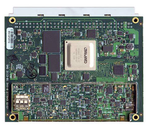
The 864-channel TRE-3 receiver, just announced by JAVAD GNSS, can simultaneously access all current GNSS signals, with room to spare for multiple-channel tracking of select signals, according to the company. The new product offers many features, including:
Three ultra wide-band (100 MHz) fast sampling and processing, programmable digital filters and superior dynamic range. After 12-bit digital conversion, nine separate digital filters are shaped for each of the nine GPS L1/Galileo E1, GPS L2, GPS L5/Galileo E5A, GLONASS L1, GLONASS L2, Galileo E5B/BeiDou B2/GLONASS L3, Galileo altBoc, Galilee E6/BeiDouB3/QZSS LEX, and BeiDou B1 bands.
Each band consists of a combination of a digital cascaded integrator-comb (CIC) filter and a digital finite impulse response (FIR) filter (up to 60-th order) where signal selection is performed.
Two types of digital in-band anti-jamming filters (automatic 80-th order and “user selectable” 256-th order).
Multiple channels to acquire and track each satellite signal. For example, 20 channels can be assigned to acquire the GPS L1 signal, each spaced one millisecond apart. Up to 5 channels can be assigned to track each signal, each with different filter parameters and tracking strategies. This supports acquiring and tracking weaker signals in difficult conditions, especially under trees and canopy — potentially using up to the 864 channels available in the receiver! Several patents are pending.
80 dB out-of-band interference rejections: high dynamic range of wide RF bands and highly rectangular digital filters make the receiver much more resistant to out-of-band jamming.
High-speed high-dynamic automatic gain control (AGC) to respond to interferences and signal variations.
Programmable filter width (by commands).
Highly stable digital filters (band characteristics do not change with age, input voltages, or temperature).
Improved GLONASS inter-channel bias performance (due to a flat digital filter shape).
New multipath rejection technique.
60-MHZ-wide Galileo altBoc band takes advantage of the full benefit of this signal. Its multipath resistance is improved even beyond that of the company’s new multipath reduction technique, it asserts.
864 GNSS channels allow tracking all current and future satellite signals.
Three wide-band RF sections enable monitoring spectrums and interferences in three 100-MHz-wide bands.
TRE-3 can track and decode the QZSS LEX signal messages, making it a unique product on the market in this regard, according to the company.
Features for time -transfer applications: In time sources where the zero crossing of the input frequency defines the exact moment of the time second, the receiver monitors zero crossings and accurately defines the moment of the time second. An external time interval measurement unit is not required to measure zero crossing and 1-PPS offset.
Embedded calibrator measures phase and code delays of each of the nine bands in timing applications. External calibration is not required.
TRE-3 is form, pin-out, and command compatible with the company’s earlier TRE-G3T receiver. It uses 8-Watts of power, compared to 4-Watts of the TRE-G3T
JAVAD GNSS has published an invitation to professional land surveyors in the United States to submit resumés for consideration. The company says it seeks “talented” surveyors to advise on its customer support and to participate in evaluating product features and ideas.
Singapore-based Miclyn Express Offshore (MEO), a provider of offshore support vessels across South East Asia, Australia and the Middle East, has awarded Veripos a five-year contract for provision of high-precision GNSS positioning services in support of its fleet of 27 ships.
Under the terms of the contract, Veripos will provide MEO’s fleet with Veripos Ultra Precise Point Positioning (PPP) service designed to deliver decimeter-level accuracies globally along with associated integrated mobile receivers. Among the first vessels assigned to utilize the service and equipment are MEO’s new 2,000 dwt platform supply vessels, MEO Ranger and MEO Resolution, both of which have been equipped with LD5-GG2 receivers. Meanwhile, four older MEO vessels have been similarly configured to receive Veripos Ultra service.
Commenting on the latest contract award, Walter Steedman, Veripos chief executive officer, said it further consolidated the company’s continuing leadership for provision of precise GNSS positioning services for offshore applications throughout the region and beyond.
Miclyn Express Offshore employs more than 1,400 shore-based personnel and seafarers.
Arcturus T-20 unmanned aerial vehicle with 3D imaging pods on a recent test flight at a Southern California test range. (PRNewsFoto/Arcturus UAV)
The GeoDragon sensor system by Urban Robotics has been integrated and flown on an Arcturus UAV T-20 Tier II unmanned aerial vehicle. The sensor system is enclosed in a wing-mounted pod and is capable of high-resolution 2D and 3D image capture.
GeoDragon adds significant 3D imaging and mapping capabilities to the T-20 UAV. The GeoDragon system can create 3D reconstructions in near-real time and output high-resolution digital elevation models, LIDAR-like datasets, and wide area maps. The system will be released in mid-2014.
The sensor was designed by Urban Robotics in Portland, Oregon. The aircraft was built by Arcturus UAV in Rohnert Park, California.
According to Arcturus, the unique aspects of the system are low weight (equating to longer endurance and loiter time,) small operational footprint on the ground (1 or 2 full size pick-up trucks,) a quick mount/dismount pod, quiet operation (the T-20 utilizes a modified four-stroke engine), and the ability to fly simultaneously with other payloads on the T-20, such as EO/IR.
GeoDragon imagery is post-processed using automated 3D algorithms to rapidly generate large mapping and modeling datasets. Urban Robotics develops software and hardware solutions for 3D ISR, remote sensing and geospatial applications, including collection, post-processing, and data management.
The T-20 is a runway independent, Tier II class, small tactical unmanned aerial vehicle with a technical readiness level (TRL) 9. The primary mission of the Arcturus UAV is intelligence, surveillance and reconnaissance. Typical missions include aerial mapping, drug interdiction, fire-fighting, border patrol, force protection, search and rescue, as well as military ISR. Payloads include full motion video from daylight and infrared cameras. Video is then transmitted by secure data link to mission commanders on the ground. An onboard GPS autopilot with waypoint navigation accepts multiple flight plans from the Ground Control Station, allowing the T-20 to return to a specified location autonomously after up to 16 hours of flight.
The T-20 is powered by a 190cc an air-cooled, four-stroke, fuel injected engine. Carbon fiber composite construction used in the T-20 airframe allows for payloads up to 65 lbs.
Trimble has added its Trimble UX5 unmanned aircraft system (UAS) to its agriculture product portfolio for aerial imaging and mapping. The Trimble UX5 system can enable ag service providers to capture aerial images for scouting and monitoring crop health such as detecting pests, weeds and nitrogen deficiencies.
The system also can locate cattle and their available forage over large areas, measure crop height, and generate topographic maps and models for land leveling and drainage applications.
As a result, the system provides farmers’ advisors — agronomists, Trimble resellers, and other ag service providers — with a powerful data collection tool that can aid with recommendations to improve farming operations.
The UX5 system flies at 80 kilometers/hour (50 mph) and is stable in significant crosswinds and light rain. In a single 50-minute flight, the system can cover a two square kilometer (0.8 square mile) area at five centimeter (two-inch) image resolution. It comes with a camera modified to capture the near-infrared spectrum, which helps in deducing vegetation indexes for crop health assessment. The UX5 system can capture a variety of images to be processed post flight. The output of a single flight provides geo-referenced precision images, a digital surface model (DSM) showing elevations as a color image, and a dense 3D point cloud that includes elevations.
“The addition of the Trimble UX5 system strengthens our agriculture product portfolio and enables us to provide a solution that benefits a broad range of customers including growers, ranchers, water management contractors, agronomists and other ag service providers,” said Joe Denniston, vice president of Trimble’s Agriculture Division. “High-speed aerial imaging is a powerful tool that can quickly and easily locate problem areas to be addressed. The faster a problem area is discovered, the better the chance it can be evaluated and resolved before crop yield is impacted.”
Trimble provides training for system operators and their observers, which focuses on safety precautions and the application of the Trimble UX5 system for maximum success. The Trimble UX5 system is available from authorized agriculture distribution partners and is subject to regulations and restrictions defined by local civil aviation authorities. Unmanned aircraft systems are not allowed to be flown in some regions or for certain applications.
The U.S. Geological Survey (USGS), in cooperation with other federal agencies, has posted new Idaho U.S. Topo quadrangles (1,193) and New Mexico quads (1,980 maps), which include the Public Land Survey System (PLSS). These are added to the growing list of states west of the Mississippi River to have PLSS data added to U.S. Topo maps.
The PLSS is a way of subdividing and describing land in the United States. All lands in the public domain are subject to subdivision by this rectangular system of surveys, which is regulated by the U.S. Department of the Interior. Other selected states will begin getting PLSS map data during the next respective revision cycle.
The new design for U.S. Topo maps improves readability of maps for online and printed use, while retaining the look and feel of the traditional USGS topo map. Map symbols are easy to read when the digital aerial photograph layer imagery is turned on.
Santa Fe, New Mexico 2013 U.S. Topo quadrangle, showing PLSS data with contour, orthoimage and woodland layers off. Note: “US Topo maps are not legal documents. The PLSS information shown on these maps is for general reference purposes only, and should not be used to determine legal boundaries or land ownership. The Bureau of Land Management (BLM) is the authoritative source for PLSS information at the federal level, and the US Topo representation is derived from BLM GIS data files. The management of these data is not completely uniform throughout the country.
“It is a privilege to support production of the U.S. Topo maps, as I am an extensive user of these products,” said Kristin Fishburn, a geographer with the USGS. “The capability to turn layers on and off combined with the continuous enhancements in content makes the maps particularly useful for a recreational user. I’m excited to peruse the new Idaho and New Mexico maps.”
Other re-design enhancements and new features include:
New shaded relief layer for enhanced view of the terrain
Military installation boundaries, post offices and cemeteries
New road classification
A slight screening (transparency) has been applied to some features to enhance visibility of multiple competing layers
New PDF legend attachment
Metadata formatted to support multiple browsers
U.S. Topo maps are created from geographic datasets in The National Map, and deliver visible content such as high-resolution aerial photography, which was not available on older paper-based topographic maps. The new maps provide modern technical advantages that support wider and faster public distribution and on-screen geographic analysis tools for users.
The digital topographic maps are PDF documents with geospatial extensions (GeoPDF) image software format and may be viewed using Adobe Reader, available as a no-cost download.
These new quads replace the first-edition U.S. Topo maps for Idaho and New Mexico. The replaced maps will be added to the USGS Historical Topographic Map Collection, which are also available for free download from The National Map and the USGS Map Locator & Downloader website.
US Topo maps are updated every three years. The initial round of the 48 conterminous state coverage was completed in September of 2012. Hawaii and Puerto Rico maps have recently been added. More than 400 new US Topo maps for Alaska have been added to the USGS Map Locator & Downloader, but will take several years to complete.
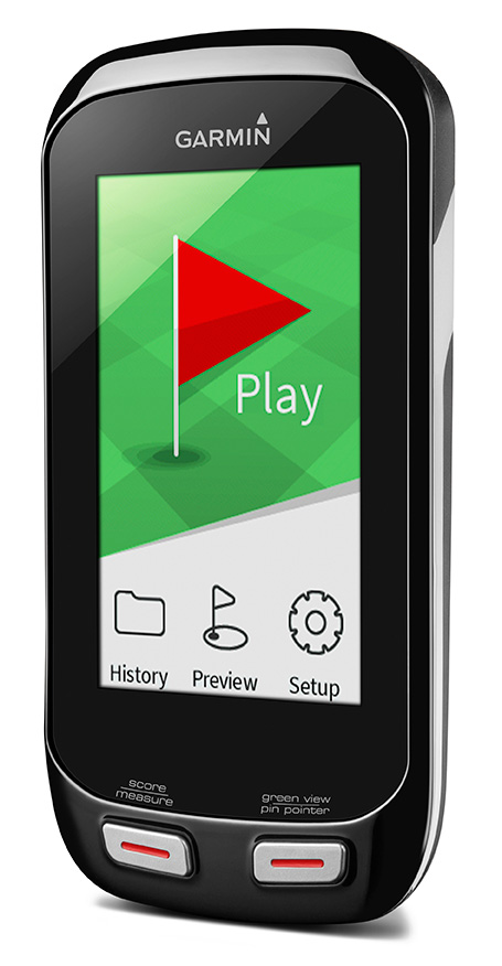
Garmin International has introduced two new handhelds geared for the golf aficionado, including a new top-of-the-line model, the Approach G8.
The Approach G7 and G8 golf handhelds have color touchscreens, more than 30,000 preloaded international courses, a rechargeable battery capable of multiple rounds, and new measurement features such as PlaysLike Distance, which shows adjusted range for uphill and downhill shots.
For golfers who prefer to leave their smartphones in their bags, the new Approach handhelds offer Smart Notification technology, which lets the user pair a compatible iPhone 4S or later to receive emails, texts, and call alerts on the device (Android compatibility is expected in the second quarter of this year). The devices are also compatible with Garmin Connect, so users can upload their scores and track their progress over time.
Both the Approach G7 and G8 incorporate the new measurement feature PlaysLike Distance, which adjusts distances for uphill and downhill shots, so players get the most accurate yardage measurements. Both devices also offer Club Advice, which remembers how far users hit each club and makes recommendations based on shot distances.
Another new feature in the G7 and G8 golf handhelds is the Big Numbers mode, so users can easily see the vital information they need without squinting or reading glasses.
The Approach G7 and G8 handhelds come preloaded with more than 30,000 international courses, with no extra subscriptions or fees. Both devices give precise distance to the front, back and center of the green, as well as layup and dogleg distances. Both devices have a rechargeable battery that plays an entire weekend of golf (15 hours) on a single charge.
The Approach G7 and G8 double as digital scorecards with scoring options for Stroke Play, Stableford, Skins and Match Play with adjustable handicaps. Users can save, review, share and print scores for up to four players. With the vibrant screen, the G7 and G8 offer colorful layup arcs at 100, 150, 200 and even 250 yards, so users know exactly how far to hit when laying up.
The Touch Targeting feature lets users touch any point on the display, and will give the precise distance to that exact spot, no matter if it is on the fairway, a hazard, a landing area, or even the front, middle or back of the green.
Like other Approach devices, the G7 and G8 have Green View, which allows users to zero in on a map of the green and manually position the pin in order to get the most accurate yardages. There is also an advanced Stat Tracking feature in the G7 and G8, which keeps track of fairways hit, greens in regulation and putts per round. These stats can be viewed during the round, or can be downloaded afterwards.
The premium Approach G8 also provides blind shot assistance with the new PinPointer feature, which shows the user the exact center of the green even if it’s not visible, and points them in the right direction for more accurate blind shots. Additionally, it adds Wi-Fi, so the G8 will automatically update courses when connected to Wi-Fi at no additional cost. The G8 rounds out the Approach family as the top-of-the-line golf handheld from Garmin.
New to the Garmin golf lineup, the Approach G7 and G8 will now be compatible with Garmin Connect. With the recent revamp of the online community, owners with Approach G7 and G8 will be able to upload, analyze and share their scorecards, as well as other data like fairways hit, greens in regulation, shot distance and number of putts. Users can keep track of whom they’ve played against, and who won each round. They can analyze course data, and see hole-by-hole details to understand their own trends and tendencies to improve their game. This is great to track users’ progress and improvements over time for every course they play.
Rugged, and with a water rating of IPX7, the Approach G7 and G8 are durable enough to withstand a rainstorm, or users’ golf bags without fear of damage. The Approach G7 and G8 will be available in Q1 2014. The Approach G7 will retail for $299.99 and the Approach G8 will retail for $399.99, and will be available at specialty golf retailers, golf course pro-shops and on garmin.com.
GNSS simulation expert Spirent Federal is inviting users to “a rigorous and thorough” one-and-a-half-day training conference, including a half-day of For Official Use Only (FOUO) sessions, set for March 26-27 in Salt Lake City.
The 2014 Spirent Federal GNSS Training Conference features hands-on training led by Spirent engineers on its latest GNSS simulation equipment. FOUO sessions will be held on Thursday, March 27, for U.S. citizens only.
Topics covered include:
SVN49 anomaly simulation
Utilizing remote control and motion
Advanced modeling and simulation techniques
Differential GPS and augmentation systems
Multi-GNSS constellation testing
Integrated GPS/inertial testing (FOUO Session)
M-code simulation (FOUO Session)
CRPA testing (FOUO Session)
General sessions will be held Wednesday and Thursday, March 26-27. FOUO sessions will be held Thursday, March 27.
For information and to register, visit the event website.
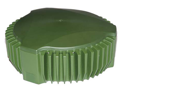
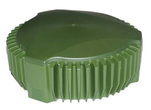
Public Works and Government Services Canada (PWGSC) has selected NovAtel’s GAJT-700ML antenna for testing on Canadian Army armored vehicles. The GAJT-700ML, developed in Calgary at NovAtel’s global headquarters, is a single-unit GPS anti-jam antenna system for land vehicles.
The testing is being conducted through PWGSC’s Build in Canada Innovation Program (BCIP).
NovAtel was selected to participate under the BCIP’s “safety and security” priority area. PWGSC will procure a number of GAJT-700MLs on behalf of the Department of National Defense (DND). The Directorate of Land Requirements (DLR) — with the assistance of the Quality Engineering Test Establishment (QETE) and the Land Force Trials and Evaluation Unit (LFTEU) — will oversee all testing on DND’s behalf.
Field testing, centered on battlefield days, is expected to take place in early March of 2014 at 4th Canadian Division Support Garrison Petawawa. The battlefield days will analyze the performance of GAJT on the Artillery Observation Post Variants (OPV) of the Light Armored Vehicle III (LAV III) in operational conditions to confirm the suitability and robustness of GAJT-700ML for this role. The process is expected to be completed by the end of March.
“NovAtel has worked closely with Canadian and Allied defence agencies to test the resilience of the GAJT-700ML in challenging jamming environments,” said Jason Hamilton, vice president, Marketing and Product Management. “The BCIP program provides an opportunity to expand this testing to incorporate end user soldier feedback on the installation and operational effectiveness of GAJT during battlefield usage of the LAV OPV. This invaluable feedback will be used by NovAtel to further drive product innovation in support of Canada and its Allied partners.”
“The Canadian Army requires accurate, secure and reliable access to Global Positioning Systems to conduct operations throughout the full spectrum of conflict in all potential theatres of operation,” said Colonel Andrew Jayne, Director Land Requirements. “With the ever-increasing demands on the electromagnetic spectrum and threat of harmful interference, technologies which contribute to the assurance of position and timing information are a critical enabler of Army and Canadian Armed Forces operations in today and tomorrow’s operating environment.”
GAJT is a null-forming technology that negates jammers, ensuring the satellite signals necessary to compute position and time are always available. Three categories of GAJT are manufactured by NovAtel:
GAJT-700ML: for use with military land vehicles, networks and timing infrastructure
GAJT-700MS: for marine vessels, from small boats to capital ships
GAJT-AE: for use with an external antenna in size and weight constrained applications
The BCIP was created by the Government of Canada to strengthen Canadian innovation. The program offers procurement and testing of pre-commercialized products and services, at a late stage of development. The BCIP:
Bridges the “pre-commercialization gap”
Supports Canadian suppliers by connecting innovators and government users and by testing innovations
Provides real-world evaluation of pre-commercial goods and services
Improves the efficiency and effectiveness of government operations
Nokia has released its financial results for the fourth quarter and the full year 2013, which show growth for its HERE division, formerly known as Navteq.
In the fourth quarter 2013, HERE had sales of new vehicle licenses of 3.2 million units, compared to 2.4 million units in the fourth quarter 2012 and 2.6 million units in the third quarter 2013. On a year-on-year basis, unit sales to vehicle customers increased primarily due to higher vehicle sales and higher consumer uptake of in-vehicle navigation.
Sales to vehicle customers represented well over 50% of external HERE net sales in the fourth quarter of 2013, as well as in the fourth quarter of 2012 and the third quarter of 2013.
The automotive success was partially offset by lower sales to personal navigation device (PND) customers. External sales for PNDs went up 10 percent, from €204 million in the fourth quarter of 2012 to €225 in the fourth quarter of 2013.
HERE total sales decreased from €278 million to €254 million (10 percent), which Nokia said is because of the fast decline of internal sales (such as navigation and maps found in Nokia devices). Sales were €74 million at the end of 2012, compared to only €29 million for the end of 2013.
The regulatory announcement explains that Hexagon, Topcon Europe B.V. and Topcon Corporation have entered into a memorandum of understanding (MoU) related to Veripos, Inc. Hexagon Acquisition Ltd., an indirectly wholly owned subsidiary of Hexagon, has made an unconditional cash offer for all outstanding shares in Veripos not already owned by Hexagon Acquisition Ltd. Hexagon Acquisition Ltd. owns and has received acceptances and pre-acceptances for a total of 9,980,630 shares, representing 30.1 per cent of the outstanding shares in Veripos.
Under the MoU, Hexagon would establish a customer agreement between Topcon and Veripos, under which Topcon will act as a reseller of the satellite broadcast correction signal offered by Veripos. This “TerraStar Agreement” between Veripos and Topcon is intended to be an agreement with TerraStar GNSS Ltd., a wholly-owned subsidiary of Veripos and the contractual partner for all resellers and customers of the on-shore services. Under the TerraStar Agreement, Topcon will be entitled to offer the signal to its customers and to make its products compatible with the signal.
Also under the MoU, Hexagon and Topcon will establish a separate joint venture company on an equal partner basis for the purposes of pursuing joint efforts and cooperation in relation to the future development and direction of the services provided under the TerraStar Agreement.
GNSS receiver manufacturers who are partners with TerraStar include NovAtel, Altus Positioning Systems, and Septentrio Satellite Navigation.
The acceptance period for the unconditional cash offer expires on January 29, subject to further extensions but not beyond February 7.