Blog

  • App Divides up Tree Stem for Loggers

    Corvallis Microtechnology, Inc., has released its Virtual Tree Bucking application software for use on an iPAD, iPhone or iPod touch device.

    When segmenting a tree stem into log products, the important question to ask is how to maximize the income from the stem, the company explained. In some cases, it will be more profitable to divide the tree into a saw log segment and a pulpwood segment. In other cases, it may make more sense to sell the entire stem as pulpwood and not bother cutting it up. The logger will usually rely on past experience and also do some calculations to figure out the best way to utilize the tree stem for the current market. When there is the possibility of getting three different log products out of the same stem, the decision can be difficult to make.

    The Virtual Tree Bucking app will help remove some of the guesswork. It will let the user set up the log merchandise grades, conversion factors and prices by volume or by weight. Before actually cutting up the stem, the user can divide up the stem on the screen of this app and try various scenarios to view the yield of wood quantity and potential revenue for each case. The user may enter up to three products per stem and the app will report the volume/weight and value for each log as well as the sum total for the stem.

    The app provides the option to save the reported results to a PDF file for later review. It will work with both Metric and English units.

    Also included are functions for precisely adding points, lines and areas to the screen, the ability to measure distances and areas as well as the ability to locate a point by address or by coordinates.

    The app comes with a detailed built-in help document. It is available at the Apple App Store.

    Photos: Corvallis Microtechnology, Inc.

  • TerraGo Unveils New Version of Geospatial Collaboration Software

    TerraGo, a provider of location intelligence solutions, has released v.6.0.4 of its geospatial collaboration software, including TerraGo Publisher, TerraGo Composer and TerraGo Toolbar. It is hosting a webinar on January 30 to demonstrate key capabilities.

    The latest release includes features that improve the user experience, introduce new field data collection capabilities, and provide enhanced support for Esri ArcGIS v.10.1 and v.10.2.

    According to Chief Technology Officer George Demmy, “Our software enhancements are designed to simplify the way ArcGIS users share products derived from their work and analysis with the people who consume them, anywhere they might be, and to make it simple and intuitive for those end users to analyze and update those products and even contribute their own observations without specialized software or training.”

    With a strategic group of partners, including systems integrators and software providers, and more than 1,000 global customers, including those in defense and intelligence, crisis response, transportation and natural resources, TerraGo solutions enable organizations to discover, integrate and deliver location intelligence to the edge of the enterprise and back, the company said.

  • Eight Inches or Less: On the Road to High Accuracy for Automated Driving

    Eight Inches or Less: On the Road to High Accuracy for Automated Driving

    Janice Partyka
    Janice Partyka

    From CES to the Detroit Auto Show, it has been a big month for in-car connectivity that enables vehicle diagnostics, streaming entertainment, telematics and navigation. Ford, GM, Google and Audi unveiled new connected vehicle platforms and features, and AT&T stole the carrier limelight with LTE Connected Services.

    Plus, two industry giants announced that they are working to enable vehicles to continuously record road position at accuracies of eight inches or less. Shoppers are becoming more open to sharing their personal location with retailers. And the U.S. GAO issued a report on location privacy related to vehicle technology and applications. It has been a busy month.

    The first mass-marketed connected vehicle system was Ford Sync, which now boasts one million users and seems poised to grow rapidly with the release of an updated version. The Mustang will be the first of the company’s models with the new Ford Sync, which lets drivers use voice to activate iPhone and Android apps. New voice activated apps include Parkmobile, a parking space finder, and the Domino app, which lets me command my car to order a pizza, just the way I like it. GM announced its first LTE-enabled vehicles for about 10 of its models. Fast connectivity in vehicles will transform in-car experiences and hopefully not kill us.

    Carrier Ringmaster. AT&T wrangled itself into the center ring of car connectivity announcements. The carrier has won a multi-year exclusive agreement to enable Telsa with high speed connectivity. Despite Audi’s collaborative relationship with T-Mobile, AT&T was able to steal some work away from T-Mobile by getting a deal to supply connectivity for some Audi models. AT&T has also teamed up with Ericsson, Amdocs, Jasper Wireless and others to create AT&T Drive, a mobile platform for developing LTE connected vehicle services.

    Pathway to a Jetson Car. Two industry biggies, Continental and Here, are working together to create an end-to-end connected high-precision mapping and vehicle system offering for OEMs. The system will serve as the basis of highly automated driving functionality with the first objective of continuously determining road position to within three to eight inches. That’s quite a task. The maps will include road information that will feed vehicles with information to allow them to react to changing road conditions or speed limit changes, automatically. Continental was the first automotive supplier to be granted a test license for automated driving on public roads in Nevada.

    See Me Now. The percentage of consumers willing to share their current location via GPS with retailers nearly doubled year-over-year to 36 percent, according to a new IBM study of more than 300,000 global consumers. The study distinguished four distinct groups of consumers, differentiated by their interest in and use of social, location and mobile technologies while shopping. The largest group, 40 percent of shoppers, use social, location and mobile technologies, but don’t utilize them for buying products. The second largest group, almost 30 percent of shoppers, will use these technologies for making purchases. The rest of the shoppers sit on either pole of being tech laggards or hyper technology users.

    In-Car Privacy under the Microscope.  The U.S. Government Accountability Office (GAO) has looked into privacy issues for in-car location-based services. The GAO examined how 10 companies are using location data and if they share it, and how the policies and practices of these companies align with industry recommended privacy practices. Each of the companies stated that they do not share personally identifiable location data with marketing companies or data brokers. The GAO found that not all of the companies were following industry recommended privacy policies. The report was prepared for the Senate Subcommittee on Privacy, Technology and the Law of the Judiciary Committee. The companies that the GAO chose to examine included TeleNav (ScoutGPS Navigation), Google Maps (Navigation), TomTom (LIVE Services), Garmin Traffic, Ford Sync, Chrysler UConnect, Honda AcuraLink, GM OnStar, Toyota (Lexus Enform and Toyota Entune), and Nissan Infiniti Connection and CARWINGS.

    Retailers are Getting Closer. Qualcomm has made its Gimbal proximity beacons commercially available, which are reportedly accurate to one foot and work indoors and outdoors. Gimbal is a proximity platform for brands to engage customers’ mobile devices with contextual communication, using a combination of physical location, activity, time and personal interests. The intent is to increase the relevance of content delivered to end users’ devices to allow retailers, content providers and developers to send personalized high-value content to mobile devices.

  • NNG Provides Connected Navigation Software to Mazda3

    NNG Provides Connected Navigation Software to Mazda3

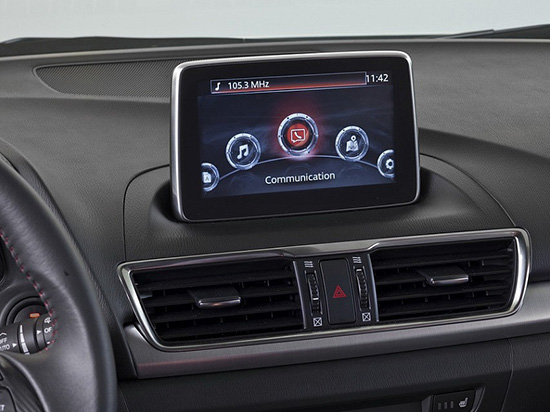
    Mazda3's infotainment system.
    Mazda3’s infotainment system.

    The new Mazda3 infotainment system, which appears in Mazda3’s Active Driving Display, is now running on NNG’s iGO navigation engine, and includes TTS, voice recognition and full 3D navigation.

    This solution, supported by Mazda’s MZD Connect, is also reportedly the first on the market to offer an embedded connected-service package with Internet connection provided through the driver’s smartphone. Drivers will be able to access dynamic local search, fuel prices, real-time traffic and weather information free of charge in the first 60 days, and benefit from three years of free map updates.

    “Mazda’s new design, KODO, has really inspired us to develop an integrated infotainment system, with knowledge and refined features matching the look and performance of the car,” said Péter Balogh, NNG. “We succeeded in offering cutting-edge solutions in the head unit, enhanced safety, usability and comfort to the driver.”

  • Hyundai Selects Verizon for Next-Generation Connected Cars

    Hyundai Motor America has selected Verizon Enterprise Solutions to provide a range of connected services including safety, security, diagnostics and infotainment to Hyundai vehicles starting in 2014.

    “We selected Verizon to provide the wireless network service for ‘Next-generation Blue Link’ because both customer opinion and various data sources indicate that Verizon provides the best solution to our customers for both coverage and quality,” said Woo-Young Kwak of Hyundai Motor Group.

    Hyundai vehicles are distributed throughout the United States by Hyundai Motor America and are sold and serviced through more than 820 dealerships nationwide. According to Forrester Research, the number of vehicles shipped worldwide with embedded connectivity is expected to grow from 5.4 million in 2012 to 36 million in 2018.

    “Our agreement with Hyundai expands our long-standing collaboration with a wide range of auto manufacturers throughout the industry to support network engineering, security, cloud solutions, telematics platform, and program management for millions of vehicles in the U.S. and around the world,” said Mark Bartolomeo of Verizon Enterprise Solutions. “We are thrilled to be working with Hyundai to help enhance the driving experience for their customers. It’s the breadth of our expertise combined with the depth of our technology that allows our clients to launch new services and initiatives faster.”

  • AT&T, Sabre to Explore How Location Can Personalize Travel

    AT&T, Sabre to Explore How Location Can Personalize Travel

    sabreAT&T and Sabre, a global travel technology company, announced they will jointly explore solutions that could usher in a more personalized experience for travelers. The two companies are developing and testing solutions that will utilize AT&T’s newly enhanced Location Information Services (LIS) – Hybrid, which allows developers to build geo-aware mobile applications. The companies are exploring how device-based location information services can help airlines, airport retailers, and other travel-related companies deliver intelligent, predictive and personalized services throughout a traveler’s journey.

    AT&T LIS Hybrid has the ability to define custom geofences (a virtual perimeter within a geographic area) in any shape or size, both indoors and out, using cellular, GPS and Wi-Fi information shared by the user from their devices. Knowing when a traveler enters or leaves a pre-defined geofence would allow travel suppliers to provide personalized services and relevant offers based on the traveler’s real-time location.

    “By applying cutting-edge technologies, coupled with data analytics and better intelligence, we can give travelers the personalized experience they have come to expect in today’s connected world,” said Sarah Kennedy of Sabre Labs, the technology incubator and research lab at Sabre. “Together with AT&T, we will explore the role advanced location-based services can have in helping travel suppliers provide better, more personal service to their customers.”

    The app might alert airline staff when a high-status passenger is still clearing security when her flight is due to depart; or notifies travelers of special promotions as they approach an airport bookstore; or warns a passenger if he is in the wrong terminal for his connecting flight. The two companies are exploring technology that could underpin these types of apps across almost all types of smartphones, tablets and operating systems. Any services developed as part of the trial will meet location services best practices guidelines when it comes to customer privacy including customer opt-in.

    “Our application programming interface, or API, and software development kit allows companies like Sabre to build multi-carrier geo-aware mobile applications,” said Laura Merling, of AT&T. “AT&T LIS Hybrid works with Wi-Fi as well as existing cellular device-based information location services such as GPS, to deliver near-precise device location information indoors and outdoors.”

    Phase one of the pilot project between Sabre and AT&T is expected to be completed during the first half of 2014.

  • Record Number of Automakers at International CES

    It’s a daunting task — trying to find the big location story in a maze of 150,000 attendees and thousands of exhibitors at the International Consumer Electronics Show in Las Vegas. Aside from every automaker touting their connected vehicle efforts, the big deal this year at CES is wearable technology (last year it was 3D printing? Yawn). Despite sore feet from walking football-field lengths of booths, CES is still a cool show, blaring stereos, walls of TV screens, robots…and connected cars. 

    LAS VEGAS — Although the largest number of worldwide auto manufacturers attended this year’s International CES here, many industry experts believe that technology giants Google and Apple will swoop in and grab not only the market, but will control what will go into the connected automobile in the future.

    “Leading IT, consumer electronics and Internet companies will marginalize specialist vendors. I’m worried that Internet companies will take over the [connected car] market — away from the auto manufacturers,” said Thilo Koslowski, Gartner vice president at the Consumer Telematics Show, held the day before CES

    Koslowski’s fears have been partially validated as Google launched a partnership, called the Open Automotive Alliance, with automakers to bring the Android operating system into cars. The Google move comes after a similar announcement by Apple, which was launched to get its iOS platform into connected cars.

    Initial Open Automotive Alliance members include Audi, General Motors, Honda, Hyundai and Nvidia. Apple, in its group, has Jaguar Land Rover, Volvo, Mercedes-Benz, Honda, Ferrari, Nissan, Chevrolet, Infinity, Kia, Hyundai, Opel and Acura.

    “We think [Google] is a strong content partner — the deal gives [you] perspective on where we as a company are heading. Same on the Apple side,” said Charles Koch, Honda manager, new business development, at the Consumer Telematics Show.

    Despite standing room-only crowds at CES during most of the connected and automated car session, Koslowski said companies need to keep the right focus on the future. “[Connected vehicles] still are not a definite market, but we will see if it is in the next 3-4 years,” he said. “HMI and user interface will be biggest differentiators. Personalization will be important, but it will also be an expected feature.”

    Koslowski said the Holy Grail for connected vehicles in the future is the transition to autonomous capability. “It’s progressing very quickly. Automakers have to avoid the gold rush mentality as it may not be the treasure trove,” he said.  “They have to meet expectations [about the the technology] and avoid the creepiness factor that you know too much about the consumer.”

    Regardless of the future, Koslowski believes the connected vehicle is a disruptive opportunity.  “I can see carriers offering a car for free in exchange for lifetime data. Less dramatic would be with an eight-year data plan,” he said. “This would probably be a smaller, less expensive vehicle than a Ferrari or Audi.”

    Overall, the telematics market has gone through several market changes in the past 10 years, said Kevin Link, senior vice president and general manager, China, for Verizon Telematics.  Link said that Telematics 1.0 included door unlock, navigation, automatic collision notification, call centers and navigation. “It all began with GM and Mercedes becoming springboards for the industry. Initially, there was low consumer awareness; now, it is something like 88 percent in the United States,” he said.

    Outside the U.S., however, the consumer awareness for telematics drops into the single digits. “The business model, especially in the U.S., is a burden on the consumer. In China, it’s a business-to-business play, which is not a burden on the consumer, which also explains the high usage rate,” Link said.

    At CES, a record nine automakers attended and exhibited:  Audi, BMW, Chrysler, Ford, General Motors, Kia, Mazda, Mercedes and Toyota.

    AT&T Mobility Makes Big Announcements at CES

    In a pre-CES press conference, General Motors announced its first LTE-enabled vehicles — in which AT&T Mobility is powering the LTE network for GM’s OnStar service. The first LTE-enabled vehicles, which will be available this summer, are Impala, Spark, Volt, Orlando, Spark RV, Silverado, Silverado HD, Malibu, Equinox and Corvette Stingray.

    AT&T also announced it will provide connectivity for Ericsson Connected Vehicle Cloud which connects to the AT&T Drive platform for automakers

    “We expect about 50 million cars to be connected by 2020. The car will be another device in your life,” said Glenn Lurie, AT&T president, emerging enterprises and partnerships. “LTE in a car will get another set of application developers involved — how will they differentiate the car?  It’s a global opportunity.”

    Magellan and Navigation Solutions’ Nav System Features Proximity Capability

    Navigation Solutions, owned by Hertz, said it is working with Magellan to offer the NeverLost 6 navigation device that features connected services — many of which offer a consumer choices based on businesses and attractions near their current location.

    A number of new systems, including Magellan’s new models and Pioneer’s five NEX models, which consist of four navigation and an A/V receiver, feature connected services that allow access to navigation — even when the phone isn’t connected to a data source. This has been a sore subject for users of the free Google Maps on a phone — no Internet, no navigation.

    Magellan also announced a new line of RoadMate Personal Navigation Device (PND) units featuring Easy Touch screens and an underlying Android OS to improve navigation capabilities and features.

    In other CES news:

    • Broadcom continues to make strides in indoor and Wi-Fi position with several new product rollouts. The company also is rolling out its BCM47531 GNSS chip that can grab signals from five satellite constellations at the same time (GPS, GLONASS, QZSS, SBAS and BeiDou), said Mohamed Awad, Broadcom director, product marketing.
    • Alpine rolled out the aftermarket’s first 9-inch navigation system, which will cost $2,600 and be available in June.  The company is targeting used trucks and other vehicles as they are staying on the road longer, said Melvin Diaz, Alpine product planning manager.
    • In its press conference at CES, Kenwood said its navigation units are selling well.  Its flagship, a $1,500, 7-inch system, features INRIX traffic and Garmin navigation.
    • In the LBS Insider February blog, several industry experts will be interviewed about the future of the autonomous vehicle.

  • Esri Publishes Interactive Map of World University Rankings 2013-2014

    In association with Times Higher Education, Esri published an interactive map of world university rankings for the school year 2013-2014. Click on the image below to view the map.

    WorldUniversity

  • Topcon Unveils 2D, 3D Excavator Control Systems

    Topcon Unveils 2D, 3D Excavator Control Systems

    X-32_studio_Topcon-W

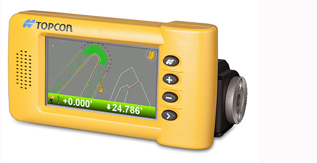
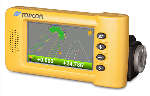
    Topcon Positioning Group announces the addition of two new indicate control systems to its excavator control system lineup — the X-32 and X-33. The systems feature Topcon’s new GX-30 control box and TS-i3 sensors.

    The GX-30 features a full-color touchscreen display. The TS-i3 sensors have no moving components, offer single and dual-axis measurement modes, and include convenient LED status indicators.

    “The X-32 is a versatile and easy-to-use 2D excavator system that includes technology not available on other, more expensive systems,” said Kris Maas, manager for machine control product marketing.

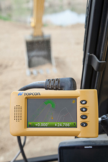
    X-32_cab_Topcon-W“The X-32 is an excavator grade indication system to fit any budget. With this new system, you have the flexibility to use a wide array of references from which to work: Existing surface, a hub, previous cut, single slopes and dual slopes with the use of a compass or rotating laser. It’s as easy as choosing your reference and entering a cut and/or slope depth,” Maas said.

    “The X-32 allows an operator to work faster, with consistency and greater degree of accuracy, and promotes a safer work site by keeping a grade checker out of the trench.”

    Additionally, Maas said, “The X-32 grows as your needs expand because it’s easily upgradeable to a 3D system.”

    “The X-33 adds Topcon’s industry-leading GNSS satellite technology to create a highly productive 3D indicate excavator grade control system,” Maas said. The system’s MC-i3 GNSS receiver with Vanguard technology provides “maximum flexibility in satellite signal tracking.  Additionally, the MC-i3 is Sitelink3D ‘ready’ for integration into Topcon’s real-time 3D management solution,” he said.

    The new 3D system is designed to establish grade faster and ensure the operator stays on grade. “The system eliminates over excavation and controls material usage, allowing the user to ‘see’ the exact position of the machine on site and the bucket position at all times,” Maas said. When detailed information is required, the operator can select to visualize the plan, profile, or sectional view and use the dual grade indicators for elevation control.

  • Will the Next Industrial Revolution Be Bigger than the First? Will Geospatial Technology be Part of It?

    The waves of innovation.
    The waves of innovation.

    It’s truly mind-boggling when I think of how early we are in the technology adoption curve — not just for geospatial technology, but technology in general. On the one hand, it’s scary to think about how much technology might penetrate and be further integrated into our lives, on the verge of threatening our privacy if we let it. On the other hand, it’s frustrating to think about how crashes, crimes and catastrophes can be avoided or minimized if today’s technology was deployed.

    Crashes. There is no reason that something like the Asiana Airlines crash at the San Francisco International Airport or the Southwest Airlines Boeing 737 landing at the wrong airport in Branson, Missouri, earlier this month should have ever happened. Technology exists today that can prevent these sorts of incidents and tragedies caused by human error, and prevent some that are not caused by human error.

    eyewitness-animations

    Simply put, if my automotive GPS receiver can steer me to the correct McDonald’s (one of many) within a city, there’s no reason a GPS receiver (with a current airport database) can’t guide a pilot to the correct airport. If I can load a CAD model into a bulldozer machine-control system and have it grade the surface material to within a few centimeters, a similar GPS system can certainly assist in landing an airliner at the San Francisco airport without hitting the sea wall.

    Thinking on a broader scale, there is no reason that the vast majority of vehicle crashes should occur. That’s right, something that occurs every day and in every city in the world, causing billions of dollars of economic loss each year, should never happen. At a minimum, high-speed laser rangefinders on each side of a vehicle could monitor the distance from other vehicles/obstacles and automatically brake or warn the vehicle operator of an impending collision if preventive action is not taken. The advancement of Intelligent Transportation Systems (ITS) will change our daily lives, and that technology revolution is just beginning.

    Crimes. Stolen vehicles should become nearly extinct. Just like nearly every rental car today has a GPS tracking system in it to track its location if stolen, there’s no reason that every personal and commercial vehicle should not have the same technology. In fact, every valuable (as deemed by you) possession such as your bicycle, your pets, your lawnmower, and even your kids, can be outfitted with some sort of inexpensive location technology.

    How about monitoring convicted felons? Imagine the massive cost savings if prison populations could be significantly reduced because convicted felons could be “electronically incarcerated”?

    Catastrophes. We can’t control Mother Nature’s power to wreak havoc with her weather phenomena, but people can be forewarned and bettered prepared to take timely action. Television has the Emergency Alert System, which is designed to enable the president of the United States to speak on television to the American population within 10 minutes. However, with services such as Netflix, Chromecast, and DVR recording devices, television viewing habits are changing. The mobile device is the new television. A tremendous amount of work still needs to be done to catch up with the rapid adoption of mobile devices.

    SARSAT
    SARSAT U.S. Rescues – 2013. Source: NOAA

    The U.S. National Oceanic and Atmospheric Administration (NOAA) reported that it helped save 253 lives in 2013 using sensors on satellites to forewarn people of severe weather. According to NOAA, its satellites detected distress signals from emergency beacons carried by downed pilots, shipwrecked boaters and stranded hikers, and relayed information about their locations to first responders on the ground. It’s a powerful statement of what the combination of sensors and communications can accomplish.

    “Each life we save underscores the undeniable value of NOAA satellites,” said Mary Kicza, assistant administrator for NOAA’s Satellite and Information Service.

    The Common Denominator

    The common technology denominator for eliminating or mitigating the effects of crashes, crimes, and catastrophes is sensors and communications. Those two technologies are the driving forces behind the next industrial revolution, and it’s going to be huge, perhaps a bigger economic impact on the world than the first industrial revolution, according to an article in the San Jose Mercury News.

    The Mercury News article quotes a study published by General Electric (GE) concluding that sensors and communications (referred to as the Internet of Things in the article) could “add as much as $15 trillion to the global GDP, which it noted is roughly the size of today’s U.S. economy.” That’s a staggering number.

    After I read the Mercury News article, I thought about many of the geospatial consulting projects I’m working on. The biggest challenges my clients face are related to one of three technologies: lack of inexpensive sensors, lack of communications, and lack of software to deal with the increasing volumes of data (for example, Big Data).

    I’ve written about the value of sensors (GNSS, RFID, analog, etc.) quite a bit. I believe they will be the foundation of the next industrial revolution because they will provide a high level of granularity  — in other words, very detailed data from which better decisions can be made. A great example is the Snapshot program that insurance company Progressive uses to dial in automobile insurance rates. Part of the Snapshot program is a device that you plug into your car’s OBD (On-Board Diagnostic) port. It monitors your driving habits for 30 days. It records how often and how hard you apply your brakes, how many miles you drive and times during the day that you drive. After 30 days, Progressive statisticians evaluate your driving habits and assign an insurance premium. If you’re a safe driver (by their definition), you’ll likely save money on your insurance premium.

    snapshot

    According to Progressive, drivers respond to real-time feedback.

    The industry publication Insurance & Technology reports that the newer version of Snapshot provides real-time feedback such as a “beep” when driver brakes too hard. Progressive General Manager Dave Pratt claims, “You do see the driving score change — we have data that says people who get that kind of feedback have fewer accidents. But I see that as real-time feedback 1.0. You want to do more, but you do not want to distract people while they’re driving either. There’s a balance to be struck.”

    Progressive’s Snapshot program is a great example of using an inexpensive sensor to collect highly granular data in order to make better decisions. Think about how having access to granular data like this in your job may enhance your decision-making. If a farmer precisely knew the characteristics of the soil in all of his fields and within each field, wouldn’t he make better decisions about soil treatment and planting? If a municipal engineer precisely knew the condition of a water distribution system, wouldn’t she be able to make better decisions about maintenance and upgrade requirements?

    Inexpensive sensors are only one piece of the puzzle. Without a method of real-time communication and software to process it, the value of the data suffers. Therefore, inexpensive sensors will drive the demand for both communications and data processing software.

    Lastly, I’ll leave you with an image of a slide presented by Dr. James Canton, CEO at the Institute for Global Futures. The slide is part of a presentation of his entitled “Global Tech Trends 2014”. It is a concise illustration of the confluence of sensors, communications,  and data.

    Emergentapps
    Global Tech Trends 2014. Source: Dr. James Canton


    Thanks, and see you next time.

    Follow me on Twitter at https://twitter.com/GPSGIS_Eric

  • Epson Teams with Geodetics for Inertial Navigation Systems

    Epson Teams with Geodetics for Inertial Navigation Systems

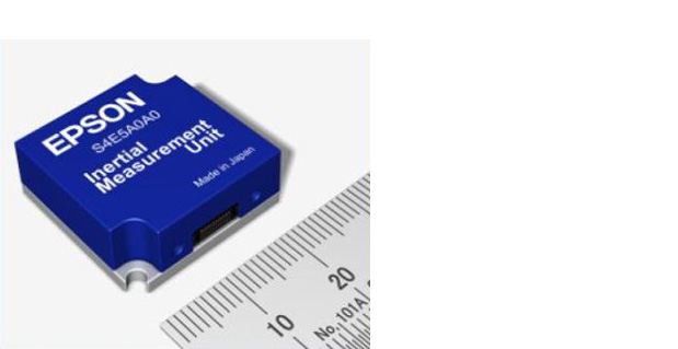
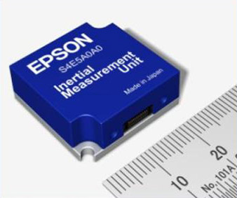
    EpsonIMUEpson Electronics America has announced a strategic partnership with Geodetics Incorporated of San Diego, California, for production of a new variant of its Geo-iNAV product.

    According to the announcement, Geo-iNAV is a fully-integrated GPS-aided inertial navigation system that provides real-time, high-precision positioning and navigation for manned and unmanned air, sea and ground vehicles. It combines GPS and proprietary sensor fusion technologies to achieve centimeter-level real-time positioning and navigation for dynamic platforms. Geodetics will offer Geo-iNAV integrated with Epson’s new G362 and G352 IMU modules. The G362 and G352 are the world’s highest performance IMUs on the market in their size, weight and power class, the company said.

    “Geodetics has the high-precision navigation expertise necessary to integrate IMU and GPS technologies, producing Inertial Navigation Systems (INS) that meet the performance requirements of very demanding applications,” said David Gaber, EEA’s IMU product line manager. “The combined solution, called Geo-iNAV Tactical, is a cost-effective, tactical-grade INS in a compact package with no EAR or ITAR export control restrictions.”

    Geodetics President and CEO Lydia Bock added, “Epson has established a new benchmark for MEMS IMU performance, enabling Geodetics’ products to reach new applications and customers by delivering high performance for a significantly lower cost than competing devices.”

    Epson says that with recent advances in unmanned vehicle technologies, the GNSS ecosystem has expanded to support mission-critical applications, which require more accurate navigation. Geo-iNAV Tactical delivers this capability with  features to support reliable and precise navigation with a low SWaP (size, weight and power) profile for autonomous vehicles and payloads on manned vehicles. Geo-iNAV Tactical is offered in several configurations designed to meet a wide range of requirements and is available in commercial as well as SAASM configurations.

  • Supergeo Releases SuperGIS Desktop 3.2

    SuperGIS32

    Supergeo has released SuperGIS Desktop 3.2.

    According to a company announcement, SuperGIS Desktop 3.2  integrates abundant GIS tools to offer GIS users from various domains a professional platform for geoprocessing and analyzing, displaying, editing, managing, and querying spatial data faster and easier. With 3.2, SuperGIS Desktop supports Multiple Map Frames and Feature Guided Pages to print and display regional and detailed data of each feature on the map for facilitating outputting of designed map.

    A Land Parcel Editor has been added into SuperGIS Desktop 3.2; hence, cadastral map administrators can easily edit and manage cadastral data in special formats.

    SuperGIS Desktop 3.2 focuses on improving map analysis, editing and management functions, and supports Multiple Map Frames to help users effectively and simultaneously process and analyze spatial data in different extents.

    For add-ons, Georeferencing Tool and OGC add-on, built in to SuperGIS Desktop 3.2, are also improved so that users can manipulate the functions more intuitively and easily.

    For more product information and to download the newest trial, visit the Supergeo website.