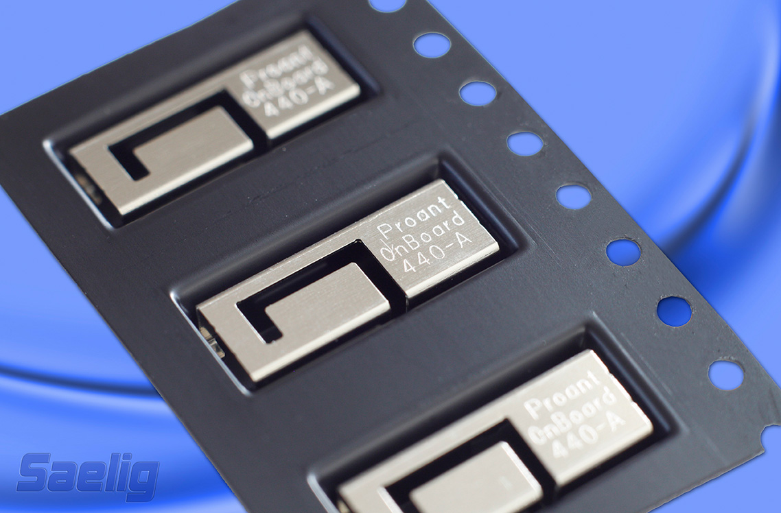
Saelig Company, Inc., announces the availability of the Proant OnBoard SMD 2400 (2.4GHz band) and SMD GPS (GPS and GLONASS) miniature surface-mount (SMD) antennas for mobile wireless products. The OnBoard series moves embedded antenna integration one step ahead by combining high performance and low cost in this new OnBoard SMD family, the company said.
Traditionally, small low-cost antennas for printed circuit board assembly have been manufactured with a dielectric substrate as the base for the radiating structure. With this approach, the antenna is normally a rectangular block, which means that the PCB area below the antenna is unavailable for mounting other components. Another drawback is that the substrate itself introduces dielectric losses to the antenna, reducing its total efficiency.
Proant has taken the concept of small SMD antennas one step ahead by increasing both the antenna performance and design flexibility, and combining this with low cost and manufacturability. The result is the new OnBoard SMD antenna family, which builds on previous OnBoard antennas, but in a surface mounted sheet-metal solution, packaged in tape-on-reel and suitable for high volume manufacturing. One of OnBoard’s key features, which eliminates the need of the dielectric substrate used in other SMD antennas, is the patent-pending capacitively-loaded footprint of the antenna’s supporting pins, which significantly reduces losses and increases the performance.
The first two products to be launched in this 50 ohm RoHS-compliant family are OnBoard SMD 2400 (2.4GHz band) and SMD GPS (GPS and GLONASS). Future variants will include WLAN dual-band, 868/915 MHz, and GSM versions.
“We wanted to simplify antenna integration for our customers,” said Tomas Rutfors, CEO of Proant. “The solution was to make a simple product that satisfies both engineering and sourcing needs. With the OnBoard SMD family, we have defined a new product segment, which didn’t exist before.”
Made in Sweden by Proant AB, a widely respected specialist antenna company in the M2M and wireless market, providing a wide range of embedded and external antennas, OnBoard SMD 2400 (2.4GHz band) and SMD GPS (GPS and Glonass) are available now at under $1 (1000 pcs) from Saelig Company, Inc., the USA technical distributor. A demonstration board is also available at $35.
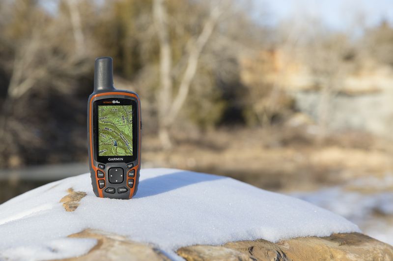
Garmin International Inc., a unit of Garmin Ltd., today announced the GPSMAP 64 series of rugged outdoor handhelds. The GPSMAP 64 series brings a dual GPS and GLONASS receiver, preloaded geocaches and smartphone connectivity for LiveTrack and Smart Notification to its product line for hikers, hunters, and geocachers.
“Building on the popularity of the GPSMAP series, the new GPSMAP 64 series improves functionality to make a top-notch device even better,” said Dan Bartel, Garmin vice president of worldwide sales. “The GPSMAP 64 is ideal for anyone, no matter if it’s their first handheld, or if they’ve used Garmin for years. It combines trusted Garmin technology with the comfort of a device people know and love.”
The GPSMAP 64 series has a 2.6-inch sunlight-readable transflective color display and a high-sensitivity GPS and GLONASS receiver with a quad helix antenna for superior reception. With the addition of GLONASS satellites, the time it takes for the receiver to lock on to a position is (on average) approximately 20 percent faster than using GPS alone. This allows users to get their position quickly and precisely even in heavy cover and deep canyon.
The GPSMAP 64 series features three distinct water-resistant (IPX7) models to suit various activities and interests. The basic GPSMAP 64 includes a built-in worldwide basemap with shaded relief, and supports BirdsEye Satellite imagery and TOPO U.S. 24K maps. The GPSMAP 64s adds a 3-axis electronic compass and barometric altimeter. Additionally, the 64s adds wireless connectivity for data transfer between other compatible Garmin handhelds and mobile apps, and for Smart Notification technology. With this, users can receive emails, texts and alerts on the device (when paired with an iPhone 4S and later). This allows users’ smartphones to be safely protected from the elements. The 64s also comes with a one-year subscription of BirdsEye Satellite Imagery. The GPSMAP 64st includes preloaded U.S. 100K topographic maps. With this, users will be able to search for points of interest by name or proximity to their location and view descriptive details for terrain contours, topo elevations, summits and geographical points.
For outdoor adventurers, the rugged GPSMAP 64 devices are compatible with BaseCamp, a free software download that allows users to view and organize maps, waypoints, routes and tracks. The 64s and 64st models are compatible with the BaseCamp mobile app for data transfer, and the Garmin Connect mobile app, for features such as LiveTrack. With LiveTrack, users can pair their device with the app, and invite friends and family to follow their activity in real time. This provides peace of mind, especially if users are alone. Through ANT+, the 64s and 64st models are also compatible with external sensors such as an external temperature sensor and heart rate monitor. With ANT+, the 64s and 64st models can act as a remote for the new VIRB and VIRB Elite action cameras.
Each device comes preloaded with the locations of 250,000 geocaches from Geocaching.com. Devices store and display key information to find the hidden containers including the geocache coordinates, terrain rating, its difficulty, hints and descriptions, so users no longer have to manually enter coordinates or print out geocache info. By going paperless, users are helping the environment, and improving their efficiency. If users would like to continue geocaching beyond the preloaded geocaches, when they register their device they can sign up for the free premium membership trial through Geocaching.com, and download more geocaches. The GPSMAP 64 devices can store millions more, so users will no longer have to pick and choose which geocaches they want to load on their device.
All of the devices in the GPSMAP 64 series have a dual-battery system, where both standard AA batteries and a rechargeable NiMH battery pack (sold separately) can be used. The devices have internal memory (4GB for 64/64s and 8GB for 64st), and a microSD card slot to store additional data and maps.
The new GPSMAP 64 series will be available this month. The GPSMAP 64 will retail for $299.99, the GPSMAP 64s will retail for $399.99, and the GPSMAP 64st will retail for $499.99.
Loctronix Corporation, a provider of unified positioning solutions for GNSS-challenged environments, has announced the availability of the ASR Workbench, a development toolset for the company’s recently released ASR-2300 software-defined radio (SDR) module. The ASR-2300 is a function-rich SDR for high-performance positioning, navigation and timing (PNT), and communication applications, the company said.
“The ASR-2300 delivers advanced SDR capabilities in a small, mobile form-factor enabling developers to readily create and field complex SDR-based solutions. The new ASR Workbench tool makes it easy for developers to take full advantage of the ASR-2300’s capabilities,” said Michael Mathews, Loctronix’ CEO and founder.
The new ASR Workbench is a Windows-based Integrated Development Environment (IDE) for SDR applications development and testing. It comes with a drag-and-drop, real-time DSP modeling tool with integrated support for the ASR-2300. With ASR Workbench developers will be able to:
Process multiple ASR-2300 baseband I/Q sample streams.
Access a variety of DSP processing and visualization blocks for use in custom models.
Record/playback signals, analyze received signals using a variety of demonstration models.
Optimize the performance and configuration of the ASR-2300 module with a suite of diagnostic tools.
Export data into formats supporting additional analysis using a variety of standard tools including Matlab/Simulink, Excel, etc.
Loctronix’ ASR-2300 SDR module provides multiple, fully-integrated RF paths supporting reception of GNSS, cellular, ISM band, and UHF signals of opportunity, making it suitable for demanding scientific, military, aerospace and commercial/industrial applications, such as UAV/UAS navigation, GPS-challenged or -denied tracking and navigation, combined communications and navigation radios, and GPS integrity monitoring and validation, according to Mathews.
“Using an SDR effectively is challenging due to the steep learning curve required to take advantage of its many programmability benefits. At Loctronix, one of our highest priorities is to provide tools that simplify complex application development. It is not enough to provide just an API and hardware for the user community and hope that they will learn how to use the platform effectively,” Mathews said.
“Developers looking to create solutions for these demanding applications will realize greater functionality with the ASR-2300, thanks to its multiple sensor and multiple frequency capabilities,” he added. “The new ASR Workbench will result in shorter development times and lower development costs for such high-performance PNT applications.”
The ASR Workbench will be freely downloadable for customers purchasing the ASR-2300. The ASR-2300 SDR is available directly from Loctronix.
As GPS vulnerabilities to intentional jamming and unintentional interference become key factors for high-reliability navigation, inertial aiding to coast through outages becomes an important consideration for OEM integrators. Micro-electro-mechnical systems (MEMS) have been seen as offering the most promising, economical way forward for cost-effective, compact inertial and gyro solutions for almost every application going.
However, in the past, MEMS gyro and accelerometer components from which inertial and gyro systems are built have not provided performance anywhere near as good as laser gyros (ring laser gyros, or RLG) used in the majority of high-performance inertial systems. Now, as new MEMS inertial systems have begun to hit the market in recent months, the envelope appears to be opening up on achieving pretty high performance.
Gladiator Technologies, based in Snoqualmie near Seattle, Washington, is one of several companies currently supplying MEMS-based inertial/gyro systems for a wide range of applications. I came across Gladiator at the Association for Unmanned Vehicle Systems International (AUVSI) convention in Washington, D.C., last August and decided to take a closer look at them as a typical supplier of new, compact, cost-effective MEMS navigation devices, which are becoming essential compliments to GNSS.
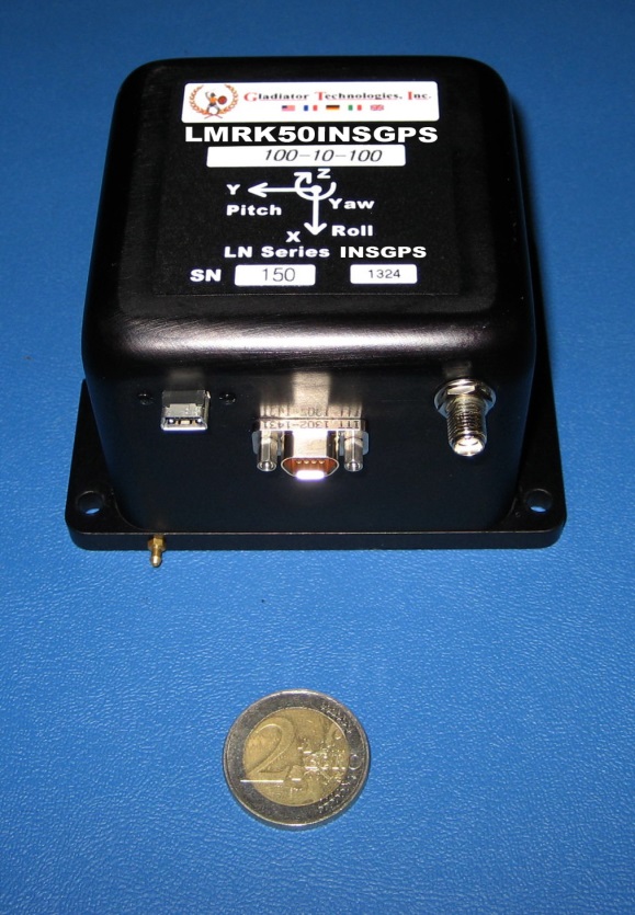
Gladiator has been around since 2005 and has continued to innovate each year, growing its product line and gradually improving performance. Right or wrong, as an “inertial layman” I’ve always used drift rates (bias) to assess inertial accuracy, and this is apparently directly related to the noise floor of the sensor device. Now Gladiator has released its latest Landmark 50 INS/GPS with low noise MEMS gyros and accelerometers and it claims 1 degree/hour drift rate in-run — as good as an 8-cm path length ring-laser gyro — something of an achievement for a MEMS-based device. (That’s a 2 Euro coin used in the photo for size reference.)
Landmark 50 INS/GPS, shown with a 2 Euro coin.
The product line goes all the way from automotive gyros up to the latest high-performance GPS/INS, and includes basic angular rate sensors and accelerometer packages. Applications include automotive testing, agricultural motion sensing, motorsport racing, instrumentation (including robotics and flight testing), rail, marine and energy motion detection, military land-vehicle and marine platform stabilization and navigation, electro-optical/infra-red targeting and stabilization, launcher and missile stabilization/navigation, and unmanned vehicles.
Gladiator integrates u-blox GPS receivers in its GPS/INS systems because of good environmental and test performance and good accuracy and navigation update rates. It’s possible in the future that airborne-qualified GPS or higher performance DGPS will find their way into new inertial variants, but for now Gladiator is very satisfied with u-blox receivers.
Applications may use a single/dual axis gyro or inertial measurement unit (IMU) where angular attitude outputs are required, such as image, attitude or weapons stabilization, or even packaged accelerometers.
And, of course, unmanned aerial vehicles (UAVs) are one of the target markets for these MEMS products — Gladiator has already had a lot of success in this segment. Its equipment is used on a number of unmanned vehicles, including fixed-wing and vertical take-off and landing (VTOL) vehicles, as well as ground and underwater unmanned vehicles. These applications range from primary navigation/backup navigation to primary flight control/backup flight control, and include a large number of stabilization applications including electro-optical/infrared, LIDAR (light detection and ranging) and platform stabilization. Gladiator supplies these UAV applications with various inertial sensors (gyros) and inertial systems, including IMUs, vertical gyros (VGs), attitude heading reference systems (AHRS) and GPS-aided inertial systems. Customers in this market segment include Schiebel, U.S. Army, U.S. Naval Research Laboratory, ST Aerospace, and others.
Gladiator is closely monitoring progress towards UAVs gaining certified access to civil aerospace, and the prospect of expanding civilian applications and markets that that will bring. The company feels that its skills are in and around inertial sensor technology and products, and its efforts towards civil qualification should focus on these elements. Therefore, Gladiator is are looking for a partner who would take on GNSS civil qualification for civil airborne GNSS/INS applications.
Gladiator is still a small outfit with around 30 people, with most of its engineering done in-house by a team of nine engineering staff supported by some external consultants. Senior management has more than 100 years’ experience in this field, and Rand Hulsing, the chief scientist, holds 68 patents in MEMS inertial sensors. New patents are currently pending on inertial-grade gyro and accelerometer designs. People on staff have gained significant experience working for companies such as Allied Signal, Sundstrand, Honeywell, L3, Systron Donner and Hughes.
I pressed Mark Chamberlain, Gladiator CEO, for details of which (bought out) OEM MEMS devices his company integrates into its systems, and I was quite surprised by his response — Gladiator designs its own high-performance MEMS gyros and accelerometers and uses a fabless model to produce them. Clearly, it is having great success with this approach as its product performance has improved to almost within reach of existing technology high-performance inertial systems. Some of Gladiator’s lower end systems do still use OEM MEMS sensors. Their manufacturing facility in Washington focuses on product assembly and test, including calibration and environmental test.
The systems Gladiator supplies are non-ITAR — which is short for saying that they can be exported to most friendly countries, and are not subject to special/restricted U.S. State-Department trade regulations.
Gladiator does around $10 million/year currently, and anticipate its growth to continue. It has a number of sales representatives in North America, South America, Europe, Asia and Australia, so it is well known around the world, with more than 200 customers in 30 countries. I asked Mark about the possibility of an Initial Public Offering (IPO), but he is currently quite happy with the existing private ownership for the time being. The Gladiator board includes investor-directors from France and Germany, and the external directors also have impressive experience, so presumably board guidance has also helped Gladiator get where it is today.
So, we have almost-inertial high-performance products with integrated GPS, attitude-only products and accelerometer packages for almost any application you could imagine, and are quietly inching towards 1 deg/hour total within the next few years — MEMS devices really have come a long way in the last few years.
Honda Motor Co. is joining an alliance of companies that will work with Google Inc. on technological innovations for inboard automotive information networks, such as GPS, according to The Asahi Shimbun. Honda will be joining Audi AG, General Motors, and Hyundai Motor Group in the Open Automotive Alliance. The alliance plans to incorporate Google’s Android operating system into automotive communications systems.
Google has also indicated interest in the development of driverless cars.
Toyota Motor Corp., meanwhile, established a joint venture with Microsoft Corp. three years ago to develop information technology for Toyota’s next-generation vehicles. The technology allows for updating map data and other services for the GPS in Toyota vehicles, as well as track stolen vehicles.
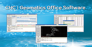
CHC announced today the availability of CHC Geomatics Office (CGO), a software solution dedicated to post processing static and kinematic GNSS raw data. CGO supports GPS+GLONASS+BeiDou data in various raw data formats and is compatible with major brands, allowing a seamless integration with an existing pool of equipment, the company said.
“CGO is undoubtedly the most affordable yet powerful GNSS post processing software available in the market.” says George Zhao, CEO of CHC. “In addition, this new product launch reinforces our commitment to provide full GNSS solutions to our customers including post-processing applications.”
A 90-day fully functional demonstration license is available to enable users to evaluate the CGO’s features before purchasing.
CHC designs, manufactures and markets a wide range of professional GPS/GNSS solutions in more than 50 countries. Headquartered in Shanghai (China), CHC is a GPS/GNSS manufacturer with a strong international presence and employs more than 500 professionals worldwide.
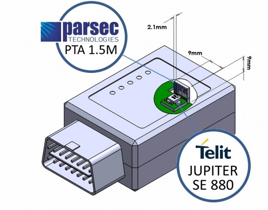
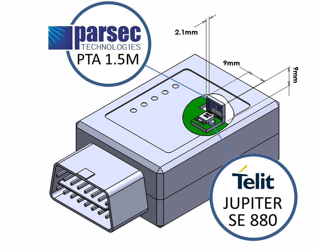
Telit Wireless Solutions and Parsec Technologies today announced that a combination of the companies’ technologies results in a low profile companion solution for GPS receiver and antenna. For host devices able to accommodate higher volumetric symmetry, assembly of the components can be made to fit a 6 x 16 x 8 millimeter volume. A flat component arrangement can yield an ultra-low-profile volume of 6 x 16 x 2.4 millimeters.
“Receivers combining the Parsec PTA/PT Family and Telit’s Jupiter SE880 modules deliver good user experience in finished LBS (location-based services) critical products without sacrificing design flexibility, ease of implementation or cost,” said Michael A. Neenan, CEO and founder of Parsec Technologies, Inc. “The combination is ‘bullet-proof’ in providing a rewarding design experience making RF work reliably, passing end-product regulatory compliance testing without re-test.”
“Miniaturization is a major enabler of new application areas for positioning and M2M,” said Taneli Tuurnala, Vice President and Head of GNSS Division of Telit Wireless Solutions. “With the Parsec antennas, the complete receiver features the industry’s ‘smallest landed footprint,’ making it suitable for use in wearable electronics, UBI devices or adapters for the mobile computing industry.”
Along with miniaturization, the receiver outperforms top traditional designs, handling a loss of 10 dB or greater in GPS signal reaching, for example, the typical OBD port under a vehicle’s dashboard where many usage-based insurance (UBI) dataloggers are installed. The PTA1.5M active antenna delivers the ultra-sensitive Jupiter SE880 micro receiver over 15 dB of additional gain in the operating frequency range. Both companies are making available complete application notes to simplify the engineering effort for system integrators.
The miniature 4.7 x 4.7 millimeter LGA (Land Grid Array), SiRFstarIV-based Jupiter SE880 receiver module employs heterogeneous 3D integrated technology to achieve best-in-class performance in all dimensions critical for regular or size-constrained GPS applications. Its RF front-end employs spatially calibrated waveguide-quality radio paths inside the three-dimensional space of its architecture, reducing parasitic impedances characteristic of traditional 2-D RF designs. Inside, a multi-filter system includes not only the traditional SAW filters typical in GPS receiver designs but also a 2.4-GHz notch-filter capable of nullifying the jamming effects of high-energy radio devices such as Wi-Fi hot-spots, Bluetooth systems, cordless phones, and others, which greatly affect a GPS receiver’s ability to resolve timid satellite signals in the hostile radio environment where they need to operate.
The PTA1.5M, with a gain of 15dB, and PTA1.5x2M, with a gain of 30dB, are tiny GNSS active antenna modules capable of receiving signals down to -192 dBm with frequency centered at 1575.42 (±1.023) MHz. Either model delivers a radiated efficiency greater than 60% when mated to the Jupiter SE880 receiver. Parsec’s PT1233D LNA also has the highest available IP3 at low voltage, helping eliminate interference. Both PTA1.5M and PTA1.5x2M can incorporate the antenna element, an optional SAW filter, the cascadable PT1233D LNA, matching and passives components, on a low cost, easy to integrate 10×16 mm single sided PCBA with “back side” copper clad ground plane. The height of the PTA1.5M and PTA1.5x2M modules vary according to application, allowing their use in even the smallest form factors including Intel’s M.2 Next Generation Form Factor (NGFF) module (23x30x2.4 mm, LxWxH).
Samsung Electronics Co., Ltd. unveiled the Samsung Galaxy NotePRO and TabPRO line of tablets. The devices include the Galaxy NotePRO (12.2-inch) and TabPRO (12.2, 10.1, 8.4-inch).
“We created the Galaxy NotePRO and TabPRO series to kick-off a year in which Samsung truly establishes its leadership in the tablet market,” said JK Shin, CEO and President of IT & Mobile Division, Samsung Electronics. “This new line offers the best-in-class content consumption and productivity, combining a stunning viewing experience with Samsung’s design legacy. The Samsung Galaxy NotePRO and TabPRO truly demonstrate our commitment to providing our customers with extraordinarily versatile product offerings, tailored to tablet users of every description.”
According to the announcement, the new lineup provides users with an extraordinary display and a matching feature set. The Samsung Galaxy NotePRO and TabPRO combine a crystal-clear, WQXGA display, powerful productivity tools, and unique features with preloaded and free downloadable content.
The Samsung Galaxy NotePRO and TabPRO present the world’s first 12.2-inch WQXGA Widescreen (16:10) display, offering crystal clear resolution (2560×1600) with more than 4 million pixels. With a larger viewing area, the defined screen allows users to enjoy stunning full HD video play and more information at a glance.
A personalized Magazine UX, specifically optimized for a large screen, allows users to tailor their Galaxy tablet experience for their own needs. The UX enables them to organize their favorite content in an easy-to-use dashboard with automatic feed or news updates and then quickly access the most frequently used apps for a more comfortable reading experience. By utilizing a screen size comparable to traditional magazine-sized material, content is easier to view in its original format when reading digital magazines or e-books.
The Samsung Galaxy NotePRO and TabPRO (12.2) come equipped with a variety of productivity tools to help users to manage both their personal and professional lives.
Multi Window enables users to split the screen up into four different windows. An Virtual Keyboardprovides them with enough space to type comfortably, leveraging haptic feedback to produce a more realistic typing experience.
The Samsung S Penincluded with the Galaxy NotePRO delivers a responsive tablet experience with access to features such as Action Memo, Scrapbook, Screen Write and S Finder. In addition, Pen Window enables users to draw a window of any size on the screen, and instantly access unique in-application features such as YouTube or a calculator.
Users can easily access and control their home or office PC directly through their Galaxy NotePRO or TabPRO with Remote PC in order to seamlessly edit and save files remotely.
The Galaxy NotePRO and TabPRO come pre-loaded with Cisco WebEx Meetings platform, a web conferencing solution. Users can share anything on their screen as well as starting a WebEx meeting from contact list. Samsung e-Meeting provides collaboration capabilities by giving users the ability to share content during a meeting without having to access a central server or network.
The Samsung Galaxy NotePRO and TabPRO line will come in various connectivity options: WiFi Only, WiFi and 3G, or WiFi and LTE. Users can choose between the 12.2-inch Galaxy NotePRO that comes with an included S Pen, and the 12.2-inch Galaxy TabPRO, Galaxy TabPRO 10.1-inch and 8.4-inch without the S Pen.
The following optional accessories are also available for purchase with the Galaxy NotePRO and TabPRO: Various Book Covers, USB LAN HUB, Universal BT Keyboard and S Action Mouse (accessories may vary by product model).
The Samsung Galaxy NotePRO and TabPRO tablet line will be offered globally and will be available starting from Q1, 2014.
Samsung Electronics Co., Ltd. unveiled the Samsung Galaxy NotePRO and TabPRO line of tablets. The devices include the Galaxy NotePRO (12.2-inch) and TabPRO (12.2, 10.1, 8.4-inch).
“We created the Galaxy NotePRO and TabPRO series to kick-off a year in which Samsung truly establishes its leadership in the tablet market,” said JK Shin, CEO and President of IT & Mobile Division, Samsung Electronics. “This new line offers the best-in-class content consumption and productivity, combining a stunning viewing experience with Samsung’s design legacy. The Samsung Galaxy NotePRO and TabPRO truly demonstrate our commitment to providing our customers with extraordinarily versatile product offerings, tailored to tablet users of every description.”
According to the announcement, the new lineup provides users with an extraordinary display and a matching feature set. The Samsung Galaxy NotePRO and TabPRO combine a crystal-clear, WQXGA display, powerful productivity tools, and unique features with preloaded and free downloadable content.
The Samsung Galaxy NotePRO and TabPRO present the world’s first 12.2-inch WQXGA Widescreen (16:10) display, offering crystal clear resolution (2560×1600) with more than 4 million pixels. With a larger viewing area, the defined screen allows users to enjoy stunning full HD video play and more information at a glance.
A personalized Magazine UX, specifically optimized for a large screen, allows users to tailor their Galaxy tablet experience for their own needs. The UX enables them to organize their favorite content in an easy-to-use dashboard with automatic feed or news updates and then quickly access the most frequently used apps for a more comfortable reading experience. By utilizing a screen size comparable to traditional magazine-sized material, content is easier to view in its original format when reading digital magazines or e-books.
The Samsung Galaxy NotePRO and TabPRO (12.2) come equipped with a variety of productivity tools to help users to manage both their personal and professional lives.
Multi Window enables users to split the screen up into four different windows. An Virtual Keyboardprovides them with enough space to type comfortably, leveraging haptic feedback to produce a more realistic typing experience.
The Samsung S Penincluded with the Galaxy NotePRO delivers a responsive tablet experience with access to features such as Action Memo, Scrapbook, Screen Write and S Finder. In addition, Pen Window enables users to draw a window of any size on the screen, and instantly access unique in-application features such as YouTube or a calculator.
Users can easily access and control their home or office PC directly through their Galaxy NotePRO or TabPRO with Remote PC in order to seamlessly edit and save files remotely.
The Galaxy NotePRO and TabPRO come pre-loaded with Cisco WebEx Meetings platform, a web conferencing solution. Users can share anything on their screen as well as starting a WebEx meeting from contact list. Samsung e-Meeting provides collaboration capabilities by giving users the ability to share content during a meeting without having to access a central server or network.
The Samsung Galaxy NotePRO and TabPRO line will come in various connectivity options: WiFi Only, WiFi and 3G, or WiFi and LTE. Users can choose between the 12.2-inch Galaxy NotePRO that comes with an included S Pen, and the 12.2-inch Galaxy TabPRO, Galaxy TabPRO 10.1-inch and 8.4-inch without the S Pen.
The following optional accessories are also available for purchase with the Galaxy NotePRO and TabPRO: Various Book Covers, USB LAN HUB, Universal BT Keyboard and S Action Mouse (accessories may vary by product model).
The Samsung Galaxy NotePRO and TabPRO tablet line will be offered globally and will be available starting from Q1, 2014.
Image of the sun on Tuesday, Jan. 7, 2014, from the Solar X-Ray Imager on NOAA’s GOES satellite, taken just after the maximum emission of a solar flare. The eruption came from the middle of the sun and is directed toward Earth. This is the largest solar flare so far this year.
Forecasters at NOAA’s Space Weather Prediction Center said the sun’s coronal mass ejection (CME) that reached Earth on Jan. 9, unsettled the geomagnetic field but did not cause storm conditions to be reached due to the weak magnetic field. While there is still a chance we could see some geomagnetic storming, that threat is greatly diminished. The Space Weather Prediction Center is a division of the U.S. National Oceanic and Atmospheric Administration.
The sunspot in Region 1944 that produced the eruption at 1:32 p.m. EST Tuesday, January 7, has had no significant additional flaring and shows signs of decay.
How space weather affects real-time technology
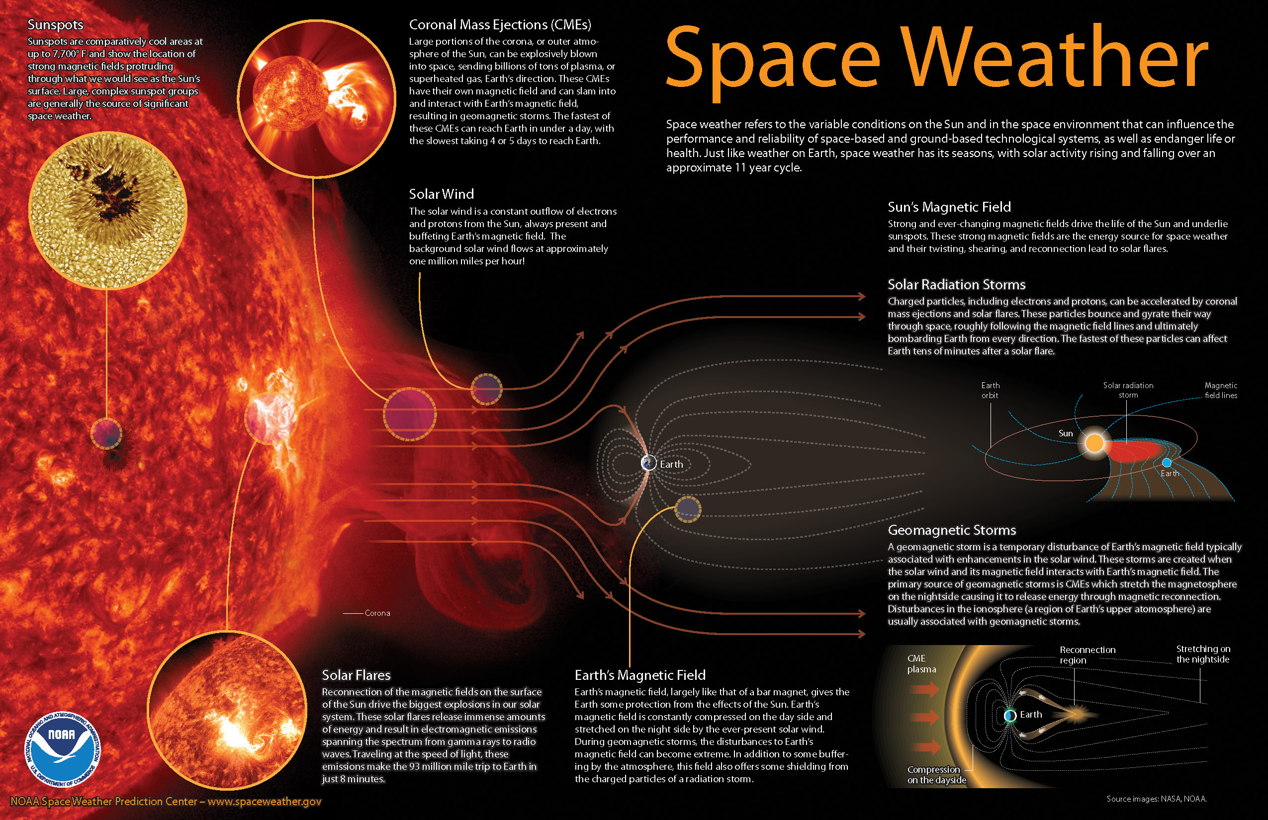
Economies around the world have become increasingly vulnerable to the ever-changing nature of the sun. Solar flares can disrupt power grids, interfere with high-frequency airline and military communications, disrupt GPS signals, interrupt civilian communications, and blanket the Earth’s upper atmosphere with hazardous radiation.
Monitoring and forecasting solar outbursts in time to reduce their effect on space-based technologies have become new national priorities. And NOAA’s Space Weather Prediction Center (SWPC), part of NOAA’s National Weather Service, is the nation’s official source of space weather forecasts, alerts, and warnings.
Space weather explained (source: NOAA).
Monitoring the Sun
To monitor events on the sun, SWPC staff utilize a variety of ground- and space-based sensors and imaging systems to view activity at various depths in the solar atmosphere. A worldwide network of USAF-sponsored optical observatories also provides space weather forecasters with detailed, plain-language information about activity in and around sunspot groups, as well as other areas of interest on the sun.
Space weather forecasters also analyze the 27-day recurrent pattern of solar activity. Based on a thorough analysis of current conditions, comparing these conditions to past situations, and using numerical models similar to weather models, forecasters are able to predict space weather on times scales of hours to weeks.
With effective alerts and warnings, NOAA is helping to minimize the hazards of space weather on technology. For example, satellite operations can be adjusted, power grids can be modified, and polar flights can be rerouted.
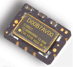
COSPAS-SARSAT beacons are battery operated emergency distress transmitters for locating ships or persons when time is critical for survival. The new Connor-Winfield series CSBxx Series are Surface Mount, 5x7mm, 3.3V, LVCMOS or Clipped Sinewave Temperature Compensated Crystal Oscillators (TCXO) designed to be emergency beacon frequency references requiring tight ± 0.2 ppm frequency stability and frequency slope control of only ±0.7 ppb/min.
The low power dissipation of 6mW allows it to power-up immediately with an accurate frequency. Class 1 devices operate over –40°C to 55°C and Class 2 devices operate–20°C to 55°C. Standard frequencies are 10.0, 12.688375, 12.688575, 12.688656, 12.68875, 16.367, and 20.0 MHz. To save time during the beacon certification process, temperature test data is available from a special on-line URL for each serialized TCXO.
Features:
3.3 Vdc Operation
Frequency Stability: ± 0.20 ppm
Mean Slope = ±0.7 ppb/min
Temperature Ranges Available:
Class I -40 to 55°C , Class II -20 to 55°C
LVCMOS or Clipped Sinewave Output
Ceramic Surface Mount Package
Tape and Reel Packaging
RoHS Compliant / Pb Free
Each unit is serialized and data is available on-line
The Director General of Civil Aviation (DGCA) of India certified on December 30 the GAGAN system to RNP0.1 (Required Navigation Performance 0.1 Nautical Mile) service level, according to The Hindu.
Now aircraft equipped with Satellite Based Augmentation System (SBAS) receivers will be able to use GPS-Aided Geo Augmented Navigation (GAGAN) signals in Indian airspace for en route navigation and non-precision approaches without vertical guidance.
Mission control centers, along with associated uplink stations, have been set up at Kundalahalli in Bangalore. Another control center and uplink station are in Delhi. A top official of the AAI said one of the Reference Stations has been housed outside the premises of the Thiruvananthapuram airport. The reference stations pick up signals from the orbiting GPS satellites. The measurements are immediately passed on to the mission control centers that then work out the necessary corrections that must be made. Messages carrying those corrections are sent via the uplink stations to the satellites in geostationary orbit that have the GAGAN payload.
The availability of the GAGAN signal in the country’s air space will bridge the gap between European Union’s European Geostationary Navigation Overlay Service (EGNOS) and Japan’s Multi-functional Satellite Augmentation System (MSAS) coverage areas.
The SBAS consists of 15 Indian Reference Stations, three Indian Navigation Land Uplink Stations, three Mission Control Centers, three Geo-Stationary Navigation Payload in C and L bands and with all the associated software and communication links.
GAGAN will provide augmentation service for GPS over India, the Bay of Bengal, South East Asia and the Middle East expanding up to Africa.