A Constellation of 18 by 2015, Rising to 26 by the End of That Year
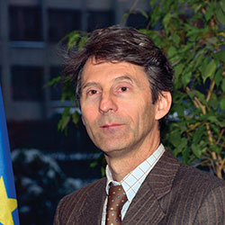
An Interview with Paul Flament
Paul Flament is the European Commission Programme Manager and Head of the EU Satellite Navigation Programme Unit.
A Belgian civil engineer specialized in telecommunications, he previously worked for 11 years in the European Space Agency, for space missions control centers and for the design and development of telecommunication satellites. After obtaining a master’s degree in European Studies, he joined the European Commission in 1998.
On the occasion of this special Europe/Galileo issue of the magazine, he speaks to GPS World readers regarding the present and promising future of the European GNSS.
Alan Cameron (AC): Can you recap for us briefly the upcoming satellite launch schedule that will take Galileo to Initial and then to Full Operating Capability?
Paul Flament (PF): It’s very simple. The first two in-orbit validation satellites were launched in October 2011, the next two on October 12, 2012. Satellites 5 and 6 will be launched in September of this year, aboard a Soyuz launcher from Kourou, and numbers 7 and 8 will follow in December.
Then, in 2013 we will see three Soyuz launches of two satellites each. We do not have the precise launch dates yet, but they are likely to be in April, June, and September. In December 2014, we expect to have the first launch using the Ariane 5 launcher, which is capable of deploying four satellites in one go. This means that by the end of 2014 Galileo will have deployed 18 satellites in orbit.
In 2015, there will be two Ariane 5 launches, one in the middle of the year, one at the end, each carrying four satellites. This will bring the total number of satellites to 26 by the end of 2015.
I am doubly confident of this constellation deployment schedule. First, at the technical level: The European Commission (EC) together with the European Space Agency (ESA) is following very closely all the industrial activities. The satellites in production now are with OHB. We have people in Bremen, where the OHB facilities are located, following this very closely. If there are technical issues, we take them up straight away with those concerned, the moment they appear. We also have monthly meetings with Jean-Jacques Dordain, the director general of ESA, and we make a careful tour of all the dates and conditions.
Secondly, there are no unknowns from the budget point of view. Except for the cost of the Ariane 5 launchers, the costs of deployment are already covered. And the EU’s member states have agreed on a budget of €6.3 billion for the next seven years. Budget should not be an issue.
Just recently, on March 12 of this year, we were for the first time able to calculate positions with the four Galileo satellites already in the sky. They pass overhead every so often, depending on geometry of orbit. This is an important technical milestone, even if this does not provide you a service as such. It demonstrates that the capability is there and that the mission part of the system works.
In terms of services, we want to be able at a certain point in time to start offering a guaranteed service. Our objective is October 2014. We will then have a constellation of 14 satellites. On the basis of that constellation, taking some margins, we will guarantee a minimum service of eight operational satellites. That service, in combination with GPS and other systems like GLONASS, will be something that users can start counting on. We will guarantee that at least eight satellites will be in operation from that moment onward.
We will probably translate this number of satellites into a performance-level guarantee. But for the moment it will be based on the number of satellites.
The fact is that we are populating the constellation, and very quickly we will have 26 satellites in orbit. That leads us to the Initial Operational Capability (IOC) phase: With those 26 in the sky we will guarantee a service based on 22 operational satellites.
The target constellation is one of 30 satellites. We don’t know yet for sure when this will be achieved. That will depend on when the last batch of satellites are ordered, and we are still discussing that. But we have an obligation to have deployed 30 satellites by the end of 2020. Then we will guarantee a service based on 24 satellites, with two spares per orbital plane.
AC: What is foreseen as the market readiness to adopt and use Galileo at that time? What companies are taking the lead in designing, manufacturing, and selling combined GNSS receivers?
PF: We believe that market trends go towards multi-constellation receivers. We already see that in some iPhones with GLONASS capability. We already see in the professional market segment that there are some companies providing Galileo capabilities, taking advantage of E1 and E5 for GPS and Galileo.
In the mass market, we also believe many companies will start to build up the multi-signal capability. Companies like STMicroelectronics are working on that. I have asked the European GNSS Agency (GSA) to provide figures. Out of a list more than 60 receiver manufacturers, at least 50 percent of them have at least one product that incorporates European Geosationary Navigation Overlay Service (EGNOS) capabilities. Of those same 60 companies, 30 percent already also have products incorporating Galileo capabilities: STMicro, Septentrio, NovAtel, Leica Geosystems, IFEN, Japan Radio, and others.
We believe that it is important to have continuous interaction with receiver manufacturers so that they understand the benefits of Galileo. EC Vice President Antonio Tajani is devoting a lot of attention to that. We build Galileo, but we do it for users. We have to make sure manufacturers understand the benefits. Discussions with them started in December in London when Mr. Tajani met with a set of CEOs of receivers manufacturers. He promised to meet with them every six months. We are also meeting with them on March 19 to provide information on calendars.
AC: What other European Commission programs will rely on initial or full Galileo capability to fulfill their mission?
PF: As of today, there is no obligation to use Galileo, no mandatory regulation imposing the use of it. There are some initiatives, like the Intelligent Transport Directive, which recommend but do not impose making use of EGNOS and Galileo. Or eCall, which in case of a car accident automatically contacts the rescue services. This will be required in all new cars starting 2015. These systems rely on satellite navigation for positioning. We also have digital tachography to measure the times of driving and rest of truck drivers. This will become a requirement as from 2018, and also relies on satellite navigation.
We also see initiatives by member states to put in place GNSS-based road-pricing systems. Germany has taken a lead in this. The European Union (EU) is trying to harmonize these road-pricing systems across national borders, with programs like Eurovignette and the Interoperability Directive.
In other modes, like aviation, you already have EGNOS. With landing procedures in place based on EGNOS, the system has become a reality.
In Europe we have the common agricultural policy, providing subsidies to farmers. As these are based on field sizes and crops, they need to be controlled, and using EGNOS and Galileo will help achieve more precise measurements.
AC: The Galileo Open Service Signal In Space Interface Control Document (OS SIS ICD) Issue 1 is described as being “subject to evolution.” Can you predict when a further iteration (Issue 2) will appear, and what changes it may contain?
PF: The present version of the ICD is still applicable. It correctly reflects the structure of the messages broadcast by Galileo. The statement you quote refers to the evolution of the document because as you remember there has been a debate about a safety-of-life (SOL) service that is multi-constellation and multi-regional. Since the initial concept of SOL on Galileo was changed in the last two years, some capacity onboard the satellites has been freed. We would like to use that for something else, keeping the backward compatibility for receivers. This will allow us to put in place, for example, a mechanism to improve the tracking performance and availability. Also authentication and higher accuracy for professional markets could be implemented, while maintaining the options for future advanced receiver-autonomous integrity monitoring (RAIM). That explains why we are still working on the evolution of the document. The next version of the ICD will be published in due time.
AC: Can you talk about progress towards increasing the EU share of the GNSS global market — currently 20 percent, but with the objective to reach 33 percent, as in other high-tech sectors? How might this be done?
PF: It is important for us in building Galileo that users benefit in having a second constellation. Satisfying users is the key. It also gives us some sort of independence from GPS, which would otherwise be the sole-source GNSS in the world. We would like our European companies to be more proactive and not to be limited to 20 percent share of the market. Everyone would.
We have our traditional research programs, like the Seventh Framework Programme (FP7). The next installment of the EU’s research programs will be called Horizon 2020, and it will make available budget devoted to the development of applications, receivers, and so on. Whether that will allow European companies to gain market share will depend on their proactivity, their innovation, and market-oriented strategies. That is their responsibility.
We are also active in things like the Galileo Masters, which tries to help small-to-medium enterprises (SMEs) who have good business ideas, young entrepreneurs or scientists with good GNSS-related innovations.
On top of that, we are starting studies to see how we can secure the market uptake of Galileo, not simply to help European industries, but to see that manufacturers and downstream applications developers understand the benefits of Galileo. By the end of the year, we should have created a better understanding by manufacturers and users of the full potential of using Galileo.
AC: Are there any other issues or concerns that you would like to bring to the attention of GPS World readers and the global GNSS community?
PF: I would like to briefly focus on EGNOS. For us it is important that this service will stay for a long time. We promised this to the aviation sector. The EU is finalizing its budget for the period 2014 to 2020, and this will allow us to continue to operate and improve EGNOS. Our objective is that it will augment Galileo as well as GPS, using the dual-frequency approach. That’s a real plus at the regional level for Europe. Its main customer will remain the aviation sector, although it is also widely used in precision farming, tracking and tracing, and so on.
Secondly, we are working on the continuous evolution of the system. We all know that satnav is an evolving domain. It takes time to build satellites and to improve technology. The Mission Evolution Road map that has been developed by experts will be presented to member states later this year.
Finally, we will be organizing the annual European Space Solution conference in Munich in November this year, and in mid-2014 in Prague. We are also hosting the International Committee on GNSS (ICG), which will take place in Prague in November 2014. For us, the location in Prague is symbolic since the European GNSS Agency (GSA), which will be our exploitation entity, is also located there.