Planet’s Deven Desai explains how Planet uses satellite imagery to uncover data for the oil and gas industry, as well as for road detection, at the 2019 Esri User Conference in San Diego.
Author: Allison Kral
-
NASA Disasters Program offers satellite imagery, maps for disaster response
Jeremy Kirkendall, senior GIS administrator for the NASA Disasters Program, gives GPS World an overview of the program at the 2019 Esri User Conference in San Diego. Watch this video to find out how satellite imagery produced by the program helps with disaster response efforts.
-
Trimble launches Catalyst On Demand at Esri UC 2019
Trimble’s Rachel Blair Winkler offers an overview of Trimble’s Catalyst On Demand, a usage-based service plan for Android phones and tablets for the company’s Catalyst GNSS receiver, at the 2019 Esri User Conference in San Diego.
-
Trimble showcases SiteVision augmented reality system at Esri UC 2019
Trimble’s Stephanie Michaud discusses the company’s SiteVision augmented reality system at the 2019 Esri User Conference in San Diego. According to the company, SiteVision uses Trimble’s Catalyst softGNSS receiver, combined with Google ARCore technology, to produce a handheld high accuracy outdoor augmented reality system.
-
Nearmap unveils 3D imagery streaming technology
At the 2019 Esri User Conference in San Diego, Nearmap’s Tony Agresta discusses Nearmap 3D, which allows customers to stream and export 3D imagery on demand at massive scale, through its proprietary MapBrowser web application.
-
Geneq introduces battery pack, GPS data collector, Net20 Pro CORS/GNSS reference station receiver
Geneq’s Richard Desrochers gives GPS World an overview of the company’s latest products — the battery pack, GPS data collector, Net20 Pro CORS/GNSS reference station receiver — at the 2019 Esri User Conference in San Diego.
-
Live from the 2019 ION Joint Navigation Conference and Esri User Conference
The GPS World staff reported live from the Institute of Navigation’s (ION) 2019 Joint Navigation Conference, which took place July 8-11 in Long Beach, California, and the Esri 2019 User Conference, which took place July 8-12 in San Diego. Check out news, photos and videos from the shows.
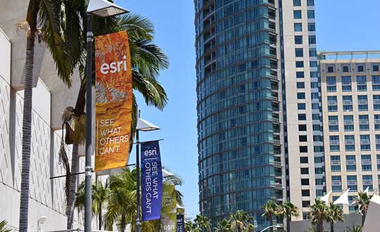
Esri User Conference
July 8-12 // San Diego
NEWS
• Jane Goodall Institute releases StoryMap highlighting chimp habitat conservation (7/24/19)
• NASA Disasters Program aids with disaster relief efforts (7/24/19)
• Trimble launches usage-based service plan for Catalyst GNSS receiver (7/11/19)
• Esri, Jane Goodall Institute partner to protect ecosystems (7/9/19)VIDEOS
ION Joint Navigation Conference
July 8-12 // Long Beach, California
NEWS
• KVH launches TACNAV 3D inertial navigation system (7/10/19)
VIDEOS
-
Talen-X displays Broadsim Wavefront simulator, Threatblocker and BroadSense Nano at ION JNC 2019
Talen-X Chief Operating Officer Tyler Hohman discusses the company’s Broadsim Wavefront simulator, ThreatBlocker version 2 and BroadSense Nano at the Institute of Navigation’s 2019 Joint Navigation Conference in Long Beach, California.
-

Trimble launches usage-based service plan for Catalyst GNSS receiver

Trimble Catalyst On Demand enables automated domain-level email address access, which streamlines license allocation for organizations with a large number of users. (Photo: Allison Barwacz) Trimble’s Catalyst software-defined Global Navigation Satellite System (GNSS) receiver for Android phones and tablets is now available with a usage-based service plan: Trimble Catalyst On Demand.
According to the company, the new service plan is focused on satisfying the requirements of a growing number of industries and organizations who recognize the benefits of using high-accuracy GNSS technology in the field, but need a more flexible payment model.
Trimble Catalyst On Demand provides scalable access to RTK-quality GNSS positioning using an affordable pay-per-use hourly pricing model in addition to the current Catalyst monthly plans, the company added. The service also enables automated domain-level email address access, which streamlines license allocation for organizations with a large number of users.
“Catalyst On Demand is Trimble’s response to the growing number of individuals and organizations needing flexible access to high-accuracy GNSS technology,” said Rachel Blair Winkler, business area manager, mapping and GIS, for Trimble. “By providing a usage-based payment model for Catalyst, we are empowering more users inside and outside the geospatial profession to record positions, navigate to points, measure relative distance and create digital maps. This results in better work and better decisions.”
Trimble Catalyst service subscriptions and the Catalyst DA1 antenna are available through Trimble’s Authorized GIS Distribution Network.
-
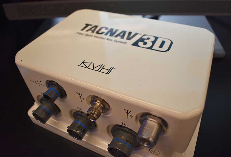
KVH launches TACNAV 3D inertial navigation system
Photo: Allison Barwacz KVH Industries released its TACNAV 3D inertial navigation system, which includes an embedded GNSS and optional chip-scale atomic clock.
According to the company, the TACNAV 3D’s modular tactical design and flexible architecture allow it to function as either a standalone navigation solution or as the core of a multi-functional Battlefield Management System.
TACNAV 3D can integrate with a number of military GNSS systems and features one pulse per second timing assurance during GNSS signal loss, the company added. It also includes an iridium transceiver option that transmits and receives vehicle position, waypoint, and target location to and from a command center or other vehicles. It can receive and transmit data over ethernet, CANbus or RS-422 serial data bus.
“It incorporates a chip-scale atomic clock,” said Bill Houtz, business development — military and government for KVH Industries’ Inertial Navigation Group. “It has an embedded GPS, or we can work with other GPS external systems. It’s extremely flexible. It is an excellent SWAP-C alternative to the ring-laser gyros or other solutions on the market right now.”
-
Esri, Jane Goodall Institute partner to protect ecosystems
Esri is partnering with the Jane Goodall Institute to develop a set of tools that will help communities map and manage the ecosystems around them through a collaborative design and planning approach, aided by GIS software.
According to the partners, these tools will help communities map, monitor, and better manage their natural resources from community forests and wildlife reserves, to water catchment and flood control areas, as well as human settlement, agriculture and agroforestry spaces.
The Jane Goodall Institute’s community-centered conservation approach — Tacare — partners local communities and governments to create sustainable livelihoods while planning for and advancing environmental protection. The Tacare approach also achieves conservation results and addresses environmental threats — including incompatible expansion of agriculture, human settlements, harvesting forest products, disease, wildlife trafficking and illegal bushmeat trade — by consulting communities about their needs and priorities, and working together to collaboratively plan for and implement land use practices that enable their own development.
“A key component of our success is that we work to help villagers find ways to make livelihoods that do not destroy the environment, and help them understand that protecting the environment not only conserves wildlife, but their own future,” said Dr. Jane Goodall, DBE, founder of the Jane Goodall Institute and United Nations Messenger of Peace.
The Jane Goodall Institute uses Esri’s ArcGIS platform and Survey123 mobile app to help communities and governments in western Tanzania, Uganda and other countries in Africa to plan, monitor and protect chimpanzee populations in local protected forests outside designated national parks.
“Conservation at the community level is essential to sustaining our natural world,” said Jack Dangermond, Esri founder and president. “Protecting global ecosystems cannot work on a global scale unless it starts locally, which is why we are honored to work with our friend and partner, the Jane Goodall Institute, on this collaboration, leveraging their years of experience working at the local scale in pursuit of conservation, balanced with the needs of human communities.”
