Author: Jesse Khalil

  • U-blox partners with GMV

    U-blox partners with GMV

    Logo: u-blox

    U-blox has signed an agreement with GMV to combine GNSS receiver hardware from u-blox with GMV’s safe correction service and sensor fusion and positioning engine. This solution is suitable for automotive applications because it provides a holistic safety approach that maximizes performance and minimizes timetomarket costs.

    Starting in April 2023, u-blox will directly commercialize the solution. This includes integration services and certification support provided jointly by u-blox and GMV for applications such as ADAS Level 2+ and vehicle autonomy.

    The collaboration was forged at the recent Mobile World Congress (MWC), Barcelona 2023. The two companies will work hand in hand to integrate their technologies and provide a solution for the needs of future automotive application

  • VOTIX and Iris Automation partner on safe BVLOS operations

    VOTIX and Iris Automation partner on safe BVLOS operations

    Image: VOTIX
    Image: VOTIX

    VOTIX has partnered with Iris Automation to enable safe beyond visual line of sight (BVLOS) flights by integrating Iris Automation’s Casia G ground-based detect and alert system into the VOTIX cloud-based UAV operating system.

    This integration makes remote operations a reality for enterprises that need effective and flexible UAV BVLOS deployments, from routine automated inspections of critical infrastructure to rapid mobilization seen in UAV as first responder programs.

    This hardware-software solution will feed data from the Casia G system into the VOTIX platform to provide a complete picture of the operational airspace in real-time.

    The Casia G system can detect non-cooperative or intruder aircraft at a distance by monitoring the airspace and providing their precise location and classification data. This enabes automated conflict resolution via the VOTIX platform.

    “Our mission is to make BVLOS easy,” said Ed Boucas, VOTIX CEO. “We have integrated every aspect of drone operation in a single pane of glass so that pilots can easily perform safe and secure BVLOS flights.”

  • M3 Systems aids in CPS4EU project

    M3 Systems aids in CPS4EU project


    Image: M3 Systems
    Image: M3 Systems

    M3 Systems has played an important role in the CPS4EU European project by providing use cases and solutions centered around the company’s GNSS simulator, StellaNGC.

    The project aims to develop new Cyber-Physical Systems (CPS) technologies that will improve the efficiency and reliability of critical infrastructures, such as transportation systems, energy networks and communication systems.

    The CPS4EU project involves 36 partners from various European countries, including M3 Systems, working to develop new standards and guidelines for the design, deployment and operation of CPS.

    The M3 Systems’ flagship product was integrated into a new test bench, to be used by position systems, to assess reliability for autonomous driving and intelligent mobility applications.

  • Great funding opportunity to support geodesy: March 22 deadline!

    Great funding opportunity to support geodesy: March 22 deadline!

    In July 2020, my First Fix article discussed the Geodesy Crisis in the United States. In January 2022, Mike Bevis, collaborating with others, prepared a white paper titled “The Geodesy Crisis,” documenting the concern about the lack of trained geodesists in the United States. Since then, my November 2022 survey scene column highlighted that without investment in geodesy, the United States will not have the available skills and knowledge to develop new geodetic technologies and improve models to address challenges to society. In December 2022, Matteo Luccio discussed the urgent need for U.S. geodesists with Everett Hinkley, who works for the federal government, serves as a subject-matter expert on several high-level boards, and dubs himself a “concerned citizen geodesist.”

    Well, things are starting to happen. NGS is soliciting grant proposals from eligible organizations to implement activities that modernize and improve the National Spatial Reference System (NSRS) and advance the science of geodesy in the United States. See the image below.

    I realize that this is very short notice, but all Letters of Intent (LOIs) must be received no later than Wednesday, March 22, 2023. Full proposals do not have to be completed until April 24, 2023. The grant information and related material can be found here.

    This is a great opportunity for institutions of higher education, state, local and Indian tribal governments to partner with industry and private consultants to advance the science of geodesy.

    (Image: NGS Website)
    Image: NGS Website

    NGS Geospatial Grant Opportunity: https://content.govdelivery.com.

  • Furuno presents, exhibits at WSTS 2023

    Furuno presents, exhibits at WSTS 2023

    Furuno logo 2023Furuno will participate in the Workshop on Synchronization and Timing Systems (WSTS) 2023, on March 13-16 in Vancouver, Canada.

    The exhibition brings together the leading corporate and government experts to shed light on the diverse innovation taking place in the field of synchronization and timing.

    Furuno’s Takahiko Ikeda, general manager of research and development, Systems Products Division, will speak on time synchronization in his presentation, “The Contribution on the Accuracy and Robustness of Time Synchronization in Multi-Constellation and Multi-Band GNSS Receivers.”

    In this presentation, Ikeda will explain how L5 receivers are effective in time synchronization applications and how they contribute to the safe and secure operation of critical infrastructure, showing specific test results.

    Furuno will also introduce and exhibit its latest GNSS receivers and antennas for timing. The featured products include:
    • Timing multi-GNSS receiver module GT-100
    • Multi-GNSS disciplined oscillator GF-8801/8802/8803 and GF-8804/8805
    • Field time sync generator TB-1
    • Dual-band GNSS antenna

  • Winners announced from myEUspace competition

    Winners announced from myEUspace competition

    Image: EUSPA website
    Image: EUSPA website

    The European Union Agency for the Space Programme (EUSPA) has announced the winners of the first myEUspace track “Submission of an Idea.” This track consists of promising theoretical ideas that leverage EU space data and have high market potential. Winners received a cash prize of €10,000 each.

    The myEUspace competition is open to teams from all EU Member States plus Switzerland, Norway and Iceland. The competition offers a total prize of nearly €1 million and provides support to entrepreneurs throughout the entire innovation cycle, from early-stage start-ups to scale-ups.

    While the evaluation of the prototypes track is ongoing, the competition remains open for the last track, “Submission of Products.” Applications for the final track are due April 25.

    Depending on the maturity of the solution at the time of submission, entrepreneurs can compete and win in three different innovation areas: “Space My Life,” “Our Green Planet” and “Dive in Deep Tech.”

    See the full list of winners by area of innovation:

    “Our Green Planet”
    • Spillalert: Intuitive web interface for oil spills and blackwater tank detection
    • BugBit: Risk analysis platform for predicting and alerting of bark beetle outbreaks
    • Push4CleanAir: SaaS pollution monitoring platform
    • Detritus: Online platform and mobile app for waste-crime detection
    • Orioos: Autonomous robotic solution for monitoring woody perennial crops
    • Vantu: Van-lifers companion app to discover “off the beaten track” sites to camp for the night

    “Dive in Deep Tech”
    • DeGenS: Decentralized space-to-ground data availability for artificial intelligence (AI) using blockchain
    • Climate AI for Web3: Real-world portable climate API for virtual worlds powered by AI and satellite data
    • Latitudo Supersar: AI analysis, classification and interpretation of multi-sensor and multi-mission images
    • WhisperCash: Person to person payments via satellite for isolated regions
    • Kyck: Geospatial metaverse platform for exploring and sharing AR experiences in the physical world

    “Space My Life”
    • Foremca: Cryptographic methodology providing forensic digital proof
    • MicroPURA: Microbial Purity to detect levels of microbial contamination in the air
    • Space4CC: Monitoring actions to safeguard cultural heritage in conflict areas
    • Oasis City Lab: AI tool to track urban threats

  • Northrup Grumman provides Marines with next-gen targeting devices

    Northrup Grumman provides Marines with next-gen targeting devices

    Photo: KaninRoman/iStock / Getty Images Plus/Getty Images
    Photo: KaninRoman/iStock / Getty Images Plus/Getty Images

    The U.S. Marine Corps has selected Northrop Grumman to provide the Next-Generation Handheld Targeting System (NGHTS), a compact targeting system that provides advanced precision targeting and can operate in GPS-denied environments.

    NGHTS will provide Marines an enhanced capability to identify and designate targets from extended ranges.

    “NGHTS’ advanced technology will significantly enhance warfighters’ ability to safely complete their missions,” said Bob Gough, vice president of navigation, targeting and survivability, Northrop Grumman. “NGHTS is lightweight and combines four systems into one portable device with state-of-the-art imaging, targeting, ranging, designating and networking. This compact, multi-sensor electro-optical/infrared device lightens Marines’ loads and keeps them connected while adding precision and safety to their missions.”

    This laser-based device can perform rapid target acquisition, laser terminal guidance operation and laser spot imaging. Its high-definition infrared sensors provide accuracy and grid capability over extended ranges.

    Additional features include a high-definition color display and day/night celestial compasses.

  • Geospatial and location intelligence capabilities highlight GCA 2023

    Geospatial and location intelligence capabilities highlight GCA 2023

    Geo Connect Asia (GCA) 2023, Asia’s leading international geospatial industry event, will take place March 15-16 at Marina Bay Sands Expo and Convention Centre, Singapore.

    GCA 2023 will be held alongside Digital Construction Asia (DCA) 2023, and co-located with the launch of Drones Asia 2023. The three-in-one event, held fully in person, is expected to bring together more than 2,500 delegates and attendees from around the world.

    With the theme “Advancing sustainable and resilient geospatial solutions for an interconnected world”, a key focus of GCA 2023 will be the use of advancements in geospatial technology and data interoperability to address regional challenges.

    Supported by the Singapore Land Authority (SLA), the event will feature more than 70 exhibiting companies and demonstrate the role played by the mix of geospatial, location intelligence, remote sensing and drone-based solutions.

    The two-day in-person conference comprises ten main sessions featuring more than 50 prominent industry speakers, panelists and moderators.

    Shining light on opportunities for enhancing productivity in the construction world, DCA 2023 will focus on showcasing digitalized processes and improved workflows. By enhancing ground-based equipment with aerial capabilities and implementing technology — such as artificial intelligence (AI), building information modeling and internet of things — current challenges in construction can now be targeted via novel and more efficient approaches.
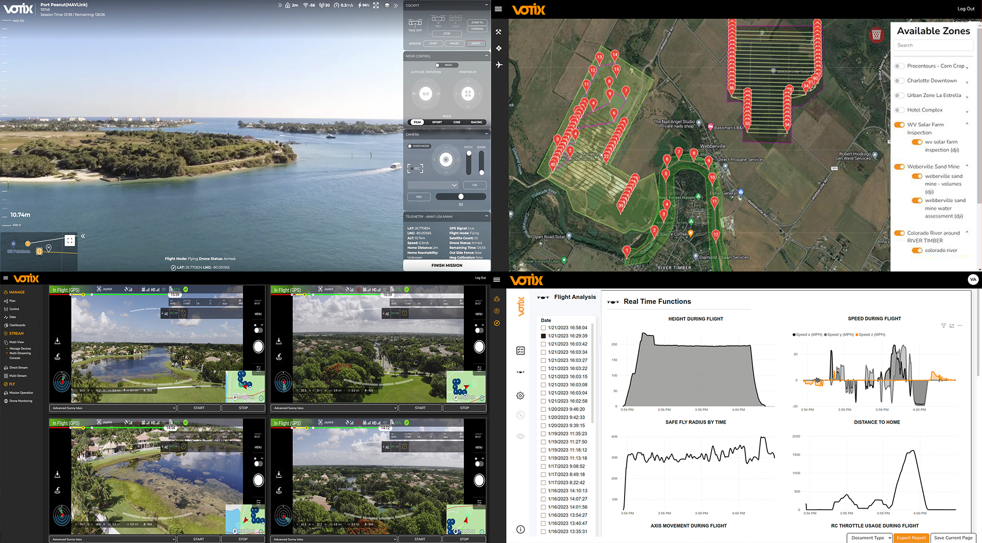
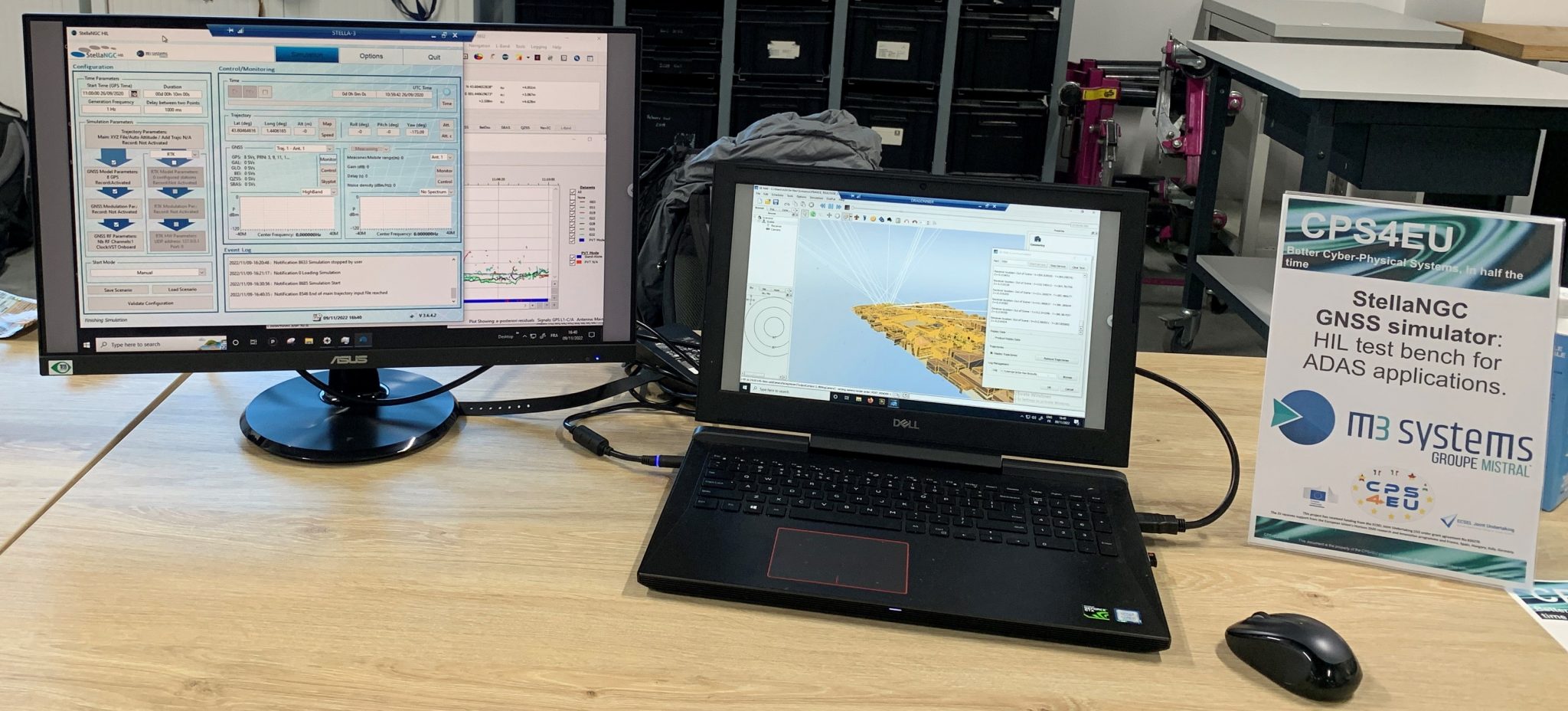
    Drones Asia 2023 will address the commercial UAV industry. The newly launched and co-located show aims to create a focused platform for the complete drone ecosystem.

    Drones Asia 2023 plays a critical role in enabling AI in today’s geospatial marketplace, broadening the conversation as industry experts investigate the application of UAVs in the commercial and industrial world, exploring industrial adoption to improve productivity and efficiency.

    For the full programme and registration, visit the GCA 2023 website.

  • Hoptroff livestreams GNSS vulnerabilities roundtable

    Hoptroff livestreams GNSS vulnerabilities roundtable

    Hoptroff will host its thought leadership industry roundtable, “GNSS, the time is up,” on March 21. The virtual roundtable will explore the impact of escalating GNSS vulnerabilities to business continuity and how organizations can best protect business-critical operations.

    “Businesses and financial institutions need to accept and start planning how they are going to mitigate the risks associated with GNSS,” said Tim Richards, CEO at Hoptroff. “This livestream roundtable will allow business and financial institutional decision-makers to better understand the impact and disruption GNSS vulnerabilities can have on their bottom line, and why they need to act now.”

    The roundtable is an opportunity for those in the financial and business sector to learn more about the status of GPS, the growing potential risks from increased jamming, spoofing and cyberattacks, what disruption looks like, and the new technologies available to provide complementary positioning, navigation and timing (PNT) technologies to help mitigate risk.

    “GNSS vulnerabilities create serious consequences for critical infrastructure,” said Richard Hoptroff, founder and chief time officer at Hoptroff. “To effectively mitigate these threats, complementary PNT solutions need to be deployed.”

    The event will be moderated by Robert Hampshire, deputy assistant secretary for Research and Technology, U.S. Department of Transportation.

    Speakers at the roundtable event include:

    • Robert Hampshire – Deputy Assistant Secretary for Research and Technology, U.S. Department of Transportation
    • Diana Furchtgott-Roth – Heritage Foundation and George Washington University
    • Judah Levine – Fellow, National Institute of Standards and Technology (NIST)
    • Karen Van Dyke – Director for PNT, U.S. Department of Transportation
    • Steve Suarez – Global Head of Innovation, Financial Services
    • Kathryn Condello – Senior Director, National Security/ Emergency Preparedness, Lumen Technologies
    • Richard Hoptroff – Founder and Chief Time Officer, Hoptroff

    Areas of discussion at the roundtable include:

    • The rising GNSS vulnerabilities and the potential consequences of GNSS disruption such as service outages, errors, or inaccuracies.
    • Example use cases where GNSS vulnerabilities can have a significant impact on your business continuity.
    • How to enable new resilient complementary technologies for your disaster recovery plans.
    • How to start utilizing these technologies today in your real-life applications such as precision timing for global financial services.
    • Practical advice for businesses on reducing GNSS risk in financial transactions, fraud detection, compliance and data integrity.

    Those interested in attending the livestream roundtable can sign up on the Hoptroff website.

  • ION hosts webinar on SQM

    ION hosts webinar on SQM

    On March 9, the Institute of Navigation (ION) is hosting a complimentary webinar on “Signal Quality Monitoring Based on Chip Domain Observables: Theory, Design, and Implementation.”

    The webinar is presented by Xiaowei Cui and Mingquan Lu, professors at Tsinghua University, China.

    Signal quality monitoring (SQM) is a technique utilized by satellite- and ground-based augmentation systems (SBAS/GBAS) to detect potential hazardous deformations in signals and better protect integrity for safety-critical users.

    The next generation of SBASs will incorporate dual-frequency multi-constellation (DFMC) techniques, for which SQM is important since signal deformations might be the largest source of uncertainty in ranging error after first-order ionospheric delays are eliminated.

    However, the performance bounds of the traditional multi-correlator-based SQM technique face some challenges because of the raised requirement on detection sensitivity by dual-frequency ionosphere-free measurements and multiple modulation modes of civilian signals from multi-constellation techniques.

    To mitigate the challenges and improve overall performance, SQM based on chip domain observables (CDOs) is emerging but has not yet been systematically studied.

    Presenters will propose a design methodology for CDO-based SQM, consisting of derivations and corresponding massive simulations. Correctness and effectiveness are assessed to confirm the methodology, and a simplification process by checking the sensitivity of CDOs is demonstrated in terms of implementation.

    Space is limited; register at ion.org to secure a spot.

  • ION GNSS+ 2023 abstract deadline is tomorrow

    ION GNSS+ 2023 abstract deadline is tomorrow

    ION GNSS+ 2023


    Abstracts for the ION GNSS+ 2023 show, “GNSS + Other Sensors in Today’s Marketplace,” are due March 3.

    ION GNSS+ will take place Sept. 11-15 at the Hyatt Regency Denver at Colorado Convention Center in Denver.

    ION GNSS+ 2023 is the world’s largest international technical meeting and showcase of GNSS technology, products and services. The show aims to bring together leaders in GNSS and related positioning, navigation and timing to present advances, introduce new technologies, update current policy, demonstrate products and exchange ideas.

    The two tracks covered during the show will be commercial and policy tracks and research tracks.

    The commercial and policy tracks will include navigation for mass market, autonomous and safety critical applications and future trends in navigation. The research track will cover multisensor and autonomous navigation, algorithms and methods and advanced GNSS technologies.

    Interested parties may submit their abstracts on the ION GNSS+ 2023 website.

  • BeiDou and GNSS headline ISSN 2023

    BeiDou and GNSS headline ISSN 2023

    The International Symposium on Satellite Navigation 2023: Advances, Opportunities and Challenges (ISSN 2023) will take place Nov. 20-22 in Jiaozuo, Henan, China.

    ISSN 2023 will provide a platform for GNSS scientists and engineers to communicate and exchange theories, methods, technologies, applications and future challenges.

    The event is open to all scientists who may have the latest results and developments in BeiDou (BDS) and GNSS+, including constellations, signals, orbits, receiver design and multi-sensor fusion, as well as positioning, navigation and timing theory, algorithms, models and applications in engineering and Earth science.

    Manuscripts on new advances in multi-GNSS and other regional systems, compatibility, interoperability and new applications are also welcome.

    ISSN 2023 is jointly sponsored by Henan Polytechnic University and the Editorial Office of Satellite Navigation. Main topics and sessions include:

    • Session 1: “Navigation System and Signals”
    • Session 2: “Space and Ground Augmentation”
    • Session 3: “GNSS Receiver and Anti-Spoofing”
    • Session 4: “GNSS Orbiting Determination& Modeling”
    • Session 5: “Integrated PNT and Location-Based Services”
    • Session 6: “GNSS Positioning Algorithms and Models”
    • Session 7: “Integrated Navigation and Smart Applications”
    • Session 8: “GNSS PPP and Applications”
    • Session 9: “Time and Coordinate Reference System”
    • Session 10: “GNSS Atmospheric Sensing & Meteorology”
    • Session 11: “GNSS Ionosphere and Space Weather”
    • Session 12: “GNSS/InSAR Surveying and Geodesy”

    Those interested can learn more about the event and register on the ISSN 2023 website.