Author: Jesse Khalil

  • GPS Innovation Alliance urges Trump administration to address GPS interference

    GPS Innovation Alliance urges Trump administration to address GPS interference

    A coalition of 14 major industry associations has called on the departments of Defense and Transportation to address increasing threats from GPS signal jamming and spoofing that are affecting civilian operations beyond traditional conflict zones.

    The letter, signed by organizations including the GPS Innovation Alliance (GPSIA), Aircraft Electronics Association, Airlines for America and the U.S. Chamber of Commerce, was sent to Defense Secretary Pete Hegseth and Transportation Secretary Sean Duffy, outlining concerns about GPS signal interference. The letter warns that such interference is expanding beyond military conflict zones to affect civilian transportation and commerce operations in international airspace and waters.

    The coalition represents industries that collectively contribute significant portions to the U.S. economy. The aviation system accounted for 5% of U.S. GDP in 2024, totaling $1.45 trillion, while ports and maritime operations contributed $2.9 trillion, nearly 10% of GDP. GPS technology has generated more than $1.4 trillion for the U.S. economy since its introduction, with more than 6 billion GPS-enabled devices in use worldwide.

    The organizations are seeking coordinated action from the Trump administration to modernize GPS infrastructure and enhance its resilience against interference. The coalition has indicated its willingness to work with federal agencies on addressing what it describes as challenges to national security, public safety and economic prosperity.

    System Vulnerabilities

    Despite GPS maintaining a 99.99% availability rate with no recorded outages since 1993, the system faces several challenges. On-orbit satellites operate years beyond their intended design life, ground system upgrades have been delayed, and the system lacks counter-spoofing capabilities.

    The coalition emphasizes that GPS serves as a foundation for modern defense, aviation, maritime operations and commercial activities. Transportation industry officials note their sector’s role as a key partner in U.S. military logistics operations.

    “GPS is one of the most important innovations of the modern era, underpinning national security, critical infrastructure such as transportation, and commerce,” said Lisa Dyer, Executive Director of the GPS Innovation Alliance. “The Trump administration’s approach to “getting stuff done” is what this nation needs to finally achieve a modern GPS that is resilient to jamming and spoofing. The President’s leadership can also deter further harmful interference – actions that will benefit most critical industries that are delivering goods and services around the world and transporting passengers safely to their destinations.”

    The GPSIA recommendations call for executive branch agencies to:

    • Accelerate the procurement and launch of modern GPS satellites and include anti-jamming and anti-spoofing technology upgrades in GPS ground systems.  Prepare a program plan that ensures GPS is technologically more advanced than China’s BeiDou and Europe’s Galileo GPS-like systems.
    • Strengthen enforcement and coordination across the U.S. government to rapidly identify and respond to interference events and crack down on illegal sales and use of jamming devices.
    • Streamline regulatory and certification processes to accelerate adoption of advanced technologies such as jam- and spoof-resistant antennas, modern GPS signals, and anti-spoofing signal authentication in airframes, receivers and devices.
    • Deter interference through public statements and diplomatic engagement, making clear the United States will not tolerate harmful jamming and spoofing outside conflict zones that risks public safety and impedes commerce.

    Read morof GPSIA’s reccomendations here.

    “These are concrete, achievable actions that, if pursued, will ensure the integrity, continuity, availability, and resiliency of GPS. This approach also offers the commercial position, navigation, and timing industry time to mature and deploy their technologies so that they can meet the high regulatory bar that is appropriately set for public safety applications,” Dyer said.

  • Simulating signal threats with Safran Electronics & Defense

    Simulating signal threats with Safran Electronics & Defense

    In universities across the world, theory lays the foundation, but in the field, realism builds true expertise.  

    For students studying GNSS engineering, textbooks and simulations alone are no longer enough. Tomorrow’s engineers need to use the same applications and work with the same complex environments that professionals face in the real world. This means using tools that generate actual RF signals, not just software abstractions — tools that recreate urban canyons, interference, jamming, spoofing and satellite dynamics with precision. 

    Safran has established the Minerva Academic Partnership Program, an initiative that brings its Skydel GNSS Simulation Engine to qualified educational institutions worldwide. 

    A Modern, Software-Defined Approach to GNSS Simulation

    At the heart of this initiative is the Skydel simulation engine, a software-defined GNSS simulator. Built to leverage commercially available off-the-shelf (COTS) hardware, Skydel eliminates the need for proprietary hardware. It delivers the full spectrum of satellite constellations — as well as LEO ones — and frequency bands. By integrating Skydel in their projects, researchers now have the tools to pursue ambitious ideas with confidence, such as:

    ■ Designing and testing custom signals or constellations not yet in existence

    ■ Simulating real-world scenarios that can include both environmental and man-made interference

    ■ Integrating and testing additional sensors and platforms through open-source plug-ins and hardware-in-the-loop setups

    ■ Conducting rigorous resiliency testing against jamming and spoofing in a controlled, repeatable environment without real-world risk

    ■ Building their own simulator with existing hardware components around Skydel

    Empowering the Next Generation of PNT Innovators

    Through the Minerva program, Safran provides full-feature Skydel licenses for faculty and student use, creating an environment where learning and innovation thrive. This initiative not only eliminates the barrier to entry but also fosters collaboration between academia and industry –— fueling a new wave of GNSS advancements.

    A Global Initiative

    Today, Minerva includes more than 80 member institutions and boasts a growing portfolio of peer-reviewed publications and conference presentations.

    “This momentum highlights the real-world impact of the program and its role in driving local research excellence and fostering a vibrant, collaborative international GNSS community,” said Pierre-Marie Leveel, program director of PNT simulation at Safran Electronics & Defense. “Safran Electronics & Defense’s Minerva program is more than just a software — it’s a mission to democratize GNSS simulation and nurture the next generation of PNT researchers. As innovation becomes more critical to national sovereignty, transportation, and space exploration, empowering students and researchers has never been more vital.” 

    Elevating GNSS Simulation

    The evolution of Safran Electronics & Defense’s GNSS simulators — across both software and hardware — has been shaped by the growing demands of users and the broader market.

    “The demand for multi-vehicle and multi-antenna scenarios has never been higher, and the same can be said for interference simulation,” said Pierre-Marie Le Veel, program director of PNT Simulation at Safran Electronics & Defense.

    To address these challenges, Safran’s GSG-7 and GSG-8 Gen2 simulators are engineered to handle a range of applications, from basic to advanced GNSS jamming and spoofing resiliency testing.

    The GSG-7 simulator is designed for location-aware applications and systems that depend on navigation or timing. With high-end performance — featuring a 1,000 Hz simulation iteration rate, high dynamics, real-time synchronization, and all-in-view satellite signal simulation — the GSG-7 is well-suited for development and integration projects that demand high performance and extensive constellation licensing. It supports multi-constellation and multi-frequency GNSS simulations and can be configured to operate with all current and upcoming GNSS signals.

    Meanwhile, the GSG-8 Gen2 is the latest iteration of Safran’s GSG-8 model, offering flexible simulation capabilities for any device that relies on GNSS signals. Built on Safran’s Skydel-based simulation platform, the GSG-8 Gen2 helps users model scenarios.

    Powered by high-end GPUs, the GSG-8 Gen2 offers reliable and precise GNSS signal testing. It can simulate thousands of signals, run multiple instances at once, and introduce jamming and spoofing to evaluate system resilience. The turnkey system features a redesigned chassis for greater connectivity, including six front-facing, high-quality RF outputs, a combined output covering the full GNSS bandwidth, and the same high-end simulation iteration rate as the GSG-7. This allows users to quickly get up and running with complex simulation requirements.

    “The market is also demanding realism,” Le Veel said.

    All Safran simulators are powered by the Skydel Simulation Engine, which is updated quarterly. Each release introduces new features, signals, and enhancements, enabling more authentic simulations and offering the flexibility to create virtually any GNSS testing scenario.

    Staying Ahead of Market Changes and Signal Threats

    The recent increase in signal interference threats has driven the demand for enhanced positioning, navigation and timing (PNT) resilience, leading to the broader use of both conducted and over-the-air (OTA) testing. The anticipated deregulation of controlled reception pattern antenna (CRPA) technology also is expected to open the door for civilian markets to perform testing.

    “Throughout the past few years, Safran Electronics & Defense has massively revamped our approach to the Wavefront platform and now offers the GSG-Wavefront for those testing CRPA antennas against jamming and spoofing threats,” Veel said.

    The ability to safeguard GNSS networks from jamming and spoofing attacks has never been more vital. Achieving this level of resilience calls for a GNSS simulator that can generate dedicated RF signals for evaluating the effectiveness of CRPA architectures.

    Safran’s GSG-Wavefront, featuring a shared local oscillator (LO) design, stands out as a field-proven, off-the-shelf solution for CRPA receiver testing. It has a customizable platform that offers upgradable options powered by Skydel — the company’s GNSS simulation engine.

    Le Veel added, “We are working hard to keep up with demand in both the defense and civilian markets.”
    In addition, Le Veel noted that Safran’s GSG-Anechoic is attracting attention from users who work with anechoic chambers, thanks to its multiple, independent RF outputs, automatic antenna mapping, and built-in calibration features for delay and power loss.

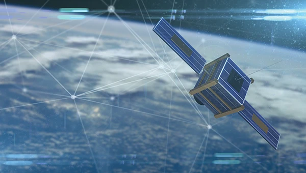
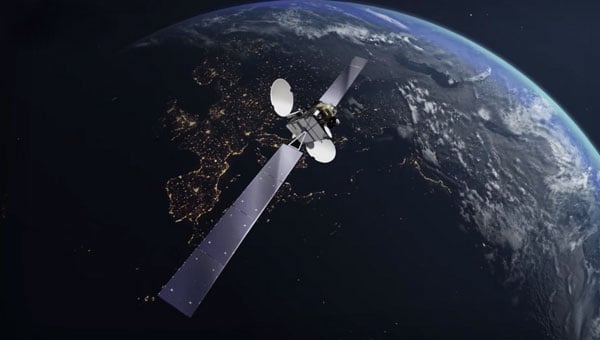
    Safran Electronics & Defense supports a wide array of users in both the civilian and defense sectors, spanning aerospace, critical infrastructure and transportation. In recent years, however, the company has seen its fastest growth in the New Space market. Safran’s simulators are used in a range of cutting-edge applications, including satellite navigation, low-Earth orbit (LEO) constellations, and rocket launch and landing systems.

    “We are proud that the flexible tools and features we have included in Skydel are being used in these incredibly robust applications,” La Veel said.

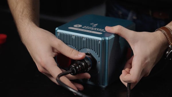
    A challenge for most GNSS simulation suppliers is ensuring compatibility and coherence with a wide range of GNSS receivers. La Veel shared that Safran Electronics & Defense is in a unique position, as it also designs and manufactures its own receivers, such as the newly released Skylight.

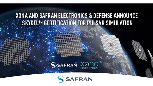
    “Additional challenges can arise when developing new signals or constellations, such as the newest LEO ones, said La Veel. “Our close partnerships with both Xona Space Systems and TrustPoint have allowed us to overcome these challenges.”

    A single GSG-8 Gen2 simulator from Safran Electronics & Defense can generate more than 2,000 signals without the need for additional hardware. This capability is essential when modeling legacy signals, multipath effects, jamming and spoofing scenarios, or even LEO-constellations.

    Safran simulators support all legacy signals, including GPS, Galileo, BeiDou, GLONASS, NavIC, QZSS and SBAS, across all bands and security features such as M-code, PRS and Galileo OSNMA. The systems also offer compatibility with emerging LEO constellations, including Xona’s PULSAR X1 and X5, as well as TrustPoint. Custom Signals and Custom Constellation features offer users the flexibility to create entirely new signals and satellite constellations, or to modify existing configurations.

    “It is de rigueur these days for companies to claim or incorporate AI into their solutions. In addition to using AI for tropospheric modeling based on real-world data, Safran Electronics & Defense has also taken a different approach to using AI in GNSS simulation,” Le Veel said.

    He added that the company’s upcoming demonstration at ION GNSS+ 2025 will reveal Skydel AI, a new tool designed to make scenario creation and parameter setting as simple as writing an email. “The amount of people who can easily now test their prototypes, products or systems will dramatically increase as the steep curve to learn GNSS simulation is flattened.”

  • Safran unveils upgraded VersaSync GNSS master clock

    Safran unveils upgraded VersaSync GNSS master clock

    Safran Electronics & Defense has released an enhanced version of VersaSync, its ruggedized GNSS master clock and network time server designed for defense applications.

    The updated VersaSync platform includes several technical improvements over previous versions. The system now offers improved frequency stability in harsh environmental conditions, including extreme temperatures, shock and vibration. Engineers have enhanced holdover performance for GNSS-denied missions and increased resistance to power supply transients to maintain timing continuity during platform power disruptions.

    The new version maintains form-fit-function compatibility with earlier VersaSync models, allowing for straightforward upgrades without major redesigns.

    The system has been deployed in more than 16,000 operational cases across various platforms, including high-altitude intelligence, surveillance and reconnaissance aircraft, armored vehicles, naval combat systems and offshore platforms. VersaSync incorporates anti-jamming and anti-spoofing algorithms and features a conduction-cooled design for size, weight and power (SWAP)-constrained environments.

    The device provides secure Network Time Protocol and Precision Time Protocol synchronization over Ethernet and offers configurable input/output options. Applications include mobile command, control, communications and intelligence platforms, airborne ISR, Satellite On The Move systems and naval communications.

    Safran Electronics & Defense will display the enhanced VersaSync at DSEI 2025.

  • Leankon launches multi-band GNSS antenna

    Leankon launches multi-band GNSS antenna

    Leankon, a global leader in innovative IoT antenna solutions, has introduced the LK1850301 Dipole FPC (Flexible PCB) GNSS antenna, engineered for seamless integration and high-performance positioning across various applications.

    Leveraging innovative technology, the LK1850301 achieves an ultra-compact size of just 49 × 10 × 0.1 mm while supporting global multi-band GNSS. It is fit for GNSS modules and offers flexible cable length configurations to meet diverse design requirements.

    Key Features and Benefits

    • Balanced dipole design: Optimized for superior return loss and stable radiation patterns, the antenna delivers consistent performance while minimizing interference from cable length or connector variations.
    • Multi-band GNSS support: Supporting GPS L1/L2/L5, Galileo E1/E5, GLONASS L1/L5, and BeiDou B1/B2, this compact antenna is ideal for precision applications such as smart agriculture, industrial tracking, navigation, and asset monitoring.
    • Customizable integration: Leankon offers multiple cable lengths and connector options, with custom configurations available for seamless system integration and optimized performance.
    • Designed for compatibility across a wide range of devices, the antenna includes a peel-and-stick adhesive backing for quick, hassle-free assembly.

    As industries increasingly adopt global multi-band GNSS navigation, the need for reliable, adaptable antenna solutions is greater than ever. The LK1850301 empowers engineers and product designers with high-performance satellite signal reception in a compact, integration-friendly form factor.

    To accelerate project development, Leankon provides free samples of the LK1850301 for early-stage testing and performance validation.

  • Tennessee leverages GIS technology to streamline septic permits amid rapid population growth

    Tennessee leverages GIS technology to streamline septic permits amid rapid population growth

    Throw a dart at a map of Tennessee. You will probably hit somewhere that is growing. Nashville’s outskirts are projected to add a quarter to their population in the next 15 years. The Ford Motor Company has begun construction on the BlueOval City manufacturing plant outside of Memphis. A multibillion-dollar uranium enrichment facility has broken ground in the Knoxville exurbs.

    Tennessee growing at double the rate of the rest of the U.S. does not surprise anyone who issues residential building permits in the state. Inspectors at the Tennessee Department of Environment and Conservation (TDEC) saw requests for subsurface sewage disposal system services jump 18% in one year. “It’s a monumental, staggering rate to grow,” said Steve Owens, the TDEC environmental consultant tasked with expediting service delivery across the state.

    Owens, a meteorologist by training, hydrologist by virtue, and self-taught geographic information system (GIS) engineer by practice, streamlined the work of TDEC inspectors with enterprise GIS technology. With it, a team of fewer than 100 inspectors processed over 23,000 requests last year in Tennessee’s rural fringe communities.

    Designing a System Around How Inspectors Work

    About one in five Americans lives in a home that relies on a septic system. They are built in remote areas too far to connect to municipal sewage systems, which happen to be the places where Tennessee is growing the fastest. High demand for housing created a sense of urgency to issue permits as swiftly — and as safely — as possible.

    Owens spent his early career in a truck as a septic permit inspector. “It’s hard work,” he said from his Memphis office. “You’re dealing with outdoor conditions all day and you’re never working fast enough.”

    Inspectors often eat lunch in their trucks while driving to their next site. The septic systems that they design, permit and inspect treat wastewater from homes and businesses. These systems must be well suited to the specific soil conditions of the land to work properly. When evaluating proposed subdivisions, inspectors conduct a range of fieldwork assessments — such as soil profiles, percolation data, and absorption rates — all while answering calls from the public.

    Inspectors assess whether a new septic drain field meets state regulations before the property can be occupied.
    Inspectors assess whether a new septic drain field meets state regulations before the property can be occupied.

    A malfunctioning or ill-fitted septic system can pollute wells of drinking water and springs. Foul-smelling sewage can pool on the surface, creating a breeding ground for parasites, mosquitoes and other vectors that can spread pathogens to neighbors and pets.

    June 2024 TDEC audit of drip dispersal systems documented more than 400 site visits in a short time frame. Inspectors used an ArcGIS enterprise program to compare standard observations and record site-specific notes and photographs at each site. Results are filtered and displayed on an interactive map.

    The audit represents a fraction of the work that TDEC permit inspectors do. Complaint investigations, repair designs, and expansion assessments are among the 13 different types of services inspectors deliver each day. To modernize, Owens configured an enterprise GIS to manage the full scope of operational data for those services—from how residents make requests, to how inspectors execute the work and get documentation to the customer, to how management reports progress.

    “It’s different from the typical mapping and analysis you might associate with GIS,” Owens said. “We’re utilizing ArcGIS Survey123 and ArcGIS Dashboards to create an efficient ecosystem for what we do with our work and how to get that work out to the public.”

    The drip dispersal system audit documented all results from more than 400 site visits.
    The drip dispersal system audit documented all results from more than 400 site visits.

    A “Flintstones to Jetsons” Digital Transformation

    As recently as seven years ago, Tennessee septic permit data existed entirely on paper. Pulling a permit meant driving to a state office in the county seat and making photocopies. Digitization came with an announcement from the governor that made headlines across the state. Trucks hauled away filing cabinets full of septic records, and technicians scanned their contents to create a FileNet public document system of record. “We have gone from Flintstones to Jetsons in the last decade,” Owens said.

    In the past, permit requests came to TDEC inspectors as a list of addresses and contact information. Inspectors started each day punching addresses into online mapping sites, guessing at an efficient route. Their days ended back at the office to log their time, update templates, and input data into various spreadsheets.

    In high-growth counties, where multiple inspectors collaborate to tackle a significant workload, they often duplicated efforts. “It would not be uncommon for someone to go out to a site on Wednesday, and the next guy would go out there on Friday and not know the work had already been done,” Owens said.

    Owens considered the extensive manual processes involved in permit inspections. Having used GIS technology for environmental impact assessments for other TDEC projects, he knew the work could be automated. “We had already been using mobile GIS tools for some time at that point, so staff were used to it,” Owens explained. “I thought we could utilize a lot of the tools that Esri already has built in and customize it a little bit to meet our needs.”

    Conversations with TDEC managers confirmed the hunch. Inspectors were spending up to two hours each day planning their routes and logging what they had done. “It ended up being somewhere about 34,000 hours a calendar year just figuring out where we’re going and tracking what we do,” Owens said.

    The project to upgrade the workflow with GIS would pay for itself in eight months if they could cut the tracking and logging time in half.

    Automating Data Editing and Management Workflows

    Owens envisioned a system that would link service requests to jobsite workflows. He designed configurable applications for inspectors to use for data collection. Permit and inspection data would integrate into an enterprise geodatabase that serves as a source of truth for TDEC septic service requests. The database would sync to the public document viewer.

    In the new GIS-based system, residents and developers make permit service requests by filling out an online application. The system then locates the request, assigns an inspector, and sends the appropriate form that guides the inspection work. Inspectors check the boxes, record the test results, upload photos and drawings, and issue letters and certificates—all from tablets in the field.

    Inspections in the queue now appear on a shared map.
    Inspections in the queue now appear on a shared map.

    Submitting the completed permit or inspection through ArcGIS Survey123 generates PDFs that automatically go to the applicant, TDEC staff, and the database that syncs to the public site.

    “The real gem is for staff to be able to plan their day by using a map instead of entering all that data into online map tools and seeing what they come up with for their route,” Owens said. The map is part of a real-time operations dashboard with hundreds of requests dotted across Tennessee.

    Points colored with darker hues alert inspectors to older requests—fees are waived if they are not completed within 45 days. All the related information—requester contact, location data, violations, resolutions, test results, and historical records—is organized by location. “This used to be done in spreadsheets and file cabinets so it’s a huge time-saver,” Owens said.

    TDEC staff now have a completed inspection report that details their work across the state and allows managers to keep an eye on the completion rate.
    TDEC staff now have a completed inspection report that details their work across the state and allows managers to keep an eye on the completion rate.

    When management sees clusters of requests on the map, they know it is time to reallocate resources. “They can pull in inspectors from other counties to get the work done, and then go back to normal workload,” Owens added.

    Management watches a splash page that tabulates completed work to keep a pulse on field staff and avoid backlogs. They can drill down on how long specific tasks are taking, and view performance metrics for individual staff members. They pay close attention to the average number of days it takes to issue permits. If the times go up, they have the data to bring to the budget office to justify hiring more inspectors.

    Amid Tennessee’s building boom, officials face intense pressure to keep pace and deliver high-quality results. Modernizing their permitting and inspection system has provided TDEC with tangible efficiency gains to present to legislators and the public.

    “This was a major investment in our division, and we want to let them know that, ‘we hear you,’” Owens said. “We can show how much work that we have done to address those concerns, and the output speaks for itself.”

    This year, TDEC was awarded honorable mention by the Environmental Council of the States (ECOS) in the State Innovation category for their septic permitting modernization project.

    Learn more about how state and local governments use GIS to empower environmental compliance.


    This article originally appeared at Esri Blog.

  • Safran’s Skydel simulator now supports Xona’s Pulsar LEO navigation signals

    Safran’s Skydel simulator now supports Xona’s Pulsar LEO navigation signals

    Safran Electronics & Defense‘s Skydel GNSS simulation platform is now fully certified to support simulation of Xona Space Systems’ low-Earth orbit positioning, navigation and timing (LEO-PNT) signal, Pulsar.

    According to the companies, this certification is the culmination of a rigorous multi-phase validation program jointly led by Safran and Xona engineering teams. It underscores Safran’s commitment to advancing robust, high-fidelity testing for next-generation LEO-PNT services. With this milestone, engineers can now use Skydel to evaluate Pulsar’s performance in environments that reflect real-world complexity, interference and operational demands.

    Skydel now simulates Xona’s Pulsar X1 signals, delivering centimeter-level precision, 100x signal strength and enhanced resilience — capabilities that Pulsar will soon bring to orbit.

    “With Skydel-powered simulators certified for Pulsar X1, our customers have more possibilities than ever,” said Pierre-Marie Le Veel, program director of PNT simulation at Safran Electronics & Defense. “They can test LEO and legacy constellations side by side, introduce complex interference, and explore entirely new scenario combinations — all from a single, flexible platform. This is a major step forward in enabling engineers to push the boundaries of GNSS testing.”

    Beyond accuracy, Skydel enables advanced resilience testing, including jamming, spoofing and other NAVWAR threats. Its modular, future-ready architecture ensures seamless integration of new Pulsar signal types and constellation updates, offering the agility needed to keep pace with the evolving LEO PNT landscape and demands for trusted, high-integrity PNT.

    “Validation is the bridge between innovation and trust,” said Tyler Reid, CTO of Xona. “By replicating Pulsar at full fidelity, Skydel empowers engineers to design and validate solutions for the most demanding navigation and timing challenges — without waiting for on-orbit availability.”

    Skydel’s certified Pulsar simulation capability is available now to partners and customers worldwide.

  • Safran launches AI tool for GNSS simulation automation

    Safran launches AI tool for GNSS simulation automation

    Safran Electronics & Defense has unveiled Skydel AI, a breakthrough in GNSS simulation technology that uses artificial intelligence (AI) to automate and simplify simulation scenario setups.

    Skydel AI streamlines GNSS simulation scenario creation through intelligent automation and an intuitive interface. Using natural language commands, Skydel AI allows users to query GNSS/Skydel topics, request assistance and dynamically configure simulation parameters by creating Python code for use by Skydel. The technology eliminates complexity and significantly reduces setup time.

    “Soon available as part of Safran’s Support offerings, Skydel AI can help customers drastically improve their development cycles by accelerating manual scenario tuning and reducing long test cycles within Skydel,” said Pierre-Marie Leveel, program director for PNT at Safran. “Already established as the most flexible, robust, and accurate GNSS simulation engine, Skydel never stops innovating and delivering what the market requires – whether it is more realism, higher accuracy, more environment complexity, or ease of use.”

    The company also introduced an AI-powered tropospheric model that enhances Skydel’s tropospheric simulation using real-time weather data and AI predictions to improve wet delay accuracy. Integrated with the Open-Meteo API and Skydel’s system, it relies on a neural network trained on 14 million samples from 221 GNSS stations, delivering up to 88% more accuracy. This model will be available in a future Skydel release.

    The technical breakthrough reflects Safran Electronics & Defense’s commitment to redefining GNSS simulation with intelligent, adaptable and high-performance solutions for mission-critical applications.

  • EGNOS satellite upgrade strengthens European navigation services

    EGNOS satellite upgrade strengthens European navigation services

    The GEO-3 satellite Eutelsat 5 West B (PRN 121) is now part of the European Geostationary Navigation Overlay Service (EGNOS) operational platform and broadcasts the Operational Signal-in-Space.

    PRN 121 began broadcasting operational signals Aug. 25 as part of EGNOS System Release 2.4.3. The upgrade seeks to strengthen service continuity and prepare the system for future enhancements.

    The transition involved swapping satellite roles within the EGNOS constellation. On Sept. 5, the GEO-2 satellite ASTRA 5-B shifted from operational to test status, creating a new configuration with GEO-1 and GEO-3 handling operational duties while GEO-2 serves as the test platform.

    The changes will not disrupt service or affect coverage areas, officials said.

    “Eutelsat is proud of its long-standing collaboration with EUSPA,” said Arlen Kassighian, chief engineering officer of Eutelsat. “We are delighted to host this payload, which will continue to significantly enhance the performance of global navigation satellite systems across Europe in the coming years.”

    The system release represents preparation for EGNOS V3, the next-generation platform that will offer enhanced performance, improved robustness and dual-frequency multi-constellation capabilities for European satellite navigation services, according to Jean-Marc Pieplu, head of EGNOS Exploitation Department.

    The European Union Agency for the Space Programme manages the EGNOS space segment, system upgrades and service provision. The agency’s integration of the GEO-3 satellite ensures EGNOS continues providing reliable augmentation services for safety-critical and professional applications throughout Europe.

    Additional information is available in the EGNOS Service Notice.

  • Advanced Navigation expands across US and Europe with centers of excellence

    Advanced Navigation expands across US and Europe with centers of excellence

    Advanced Navigation is moving forward with plans to establish international positioning, navigation and timing (PNT) Centers of Excellence, with the UK location selection process currently underway.

    The company is evaluating potential sites based on access to technical talent, logistics capabilities and proximity to major international airports. The final UK center location will be announced in late 2025, with additional global centers confirmed in early 2026.

    Over the past year, Advanced Navigation has doubled its workforce and significantly expanded manufacturing capacity to address surging defense sector demand. The international COE network represents the next phase of the company’s growth strategy, positioning it to double its team again within 12 months.

    “In an era of increasing complexity and contested environments, the ability to navigate with absolute certainty is becoming the world’s most critical strategic asset,” the company stated.

    Building Supply Chain Resilience

    To complement its Australian operations and establish robust onshore supply chains meeting local standards and security requirements, Advanced Navigation plans to partner with regional specialists in critical PNT sensing technologies, including:

    • Inertial sensing (optical gyroscopes and MEMS)
    • Vision-based sensing
    • Lidar and radar sensing
    • Acoustic Doppler velocity log sensing

    The company emphasizes that navigation’s future depends on integrating diverse, adaptable sensor suites rather than relying on single technologies. Through its multi-sensor approach centered on inertial systems, the company aims to deliver resilience even in severe GPS-contested environments.

    The expansion will accelerate innovation cycles, strengthen quality assurance and create opportunities for partners and research institutions across America and Europe to collaborate on breakthrough technologies.

    Strengthening NATO Capabilities

    The strategic expansion directly addresses NATO forces’ evolving operational needs. By establishing presence within U.S. and European industrial landscapes, Advanced Navigation aims to bolster critical infrastructure resilience while creating collaboration opportunities and jobs.

    Beyond scaling production, the centers will focus on enabling seamless interoperability across NATO’s land, sea and air platforms, reducing integration time and costs for member nations. The COE network positions the company to power the next generation of autonomous systems and alternative PNT solutions worldwide.

    Advanced Navigation said the Boreas D90 FOG INS represents the type of technology that will be developed and manufactured at these new facilities.

  • TomTom unveils next-gen automotive navigation application

    TomTom unveils next-gen automotive navigation application

    TomTom has launched its Automotive Navigation Application, a navigation solution designed for automakers that combines TomTom Orbis Maps with an enhanced user interface layer built on the company’s Navigation SDK. The company said the integrated solution allows car manufacturers to deploy navigation systems more quickly while reducing development costs and timelines.

    The application addresses growing demand in the automotive industry for software-defined vehicles (SDVs), where rapid integration capabilities have become essential for meeting market expectations. TomTom designed the system to help automakers focus on delivering innovative solutions rather than spending extensive resources on navigation development.

    The company conducted comprehensive testing of the application on automotive-grade hardware, including end-to-end evaluations performed directly in vehicles. This testing process ensures automakers receive a production-ready application that meets industry quality standards.

    The solution provides automakers with three key components: an off-the-shelf navigation application, a user experience library for customizing driver interfaces, and a vehicle integration library with documentation that enables independent connection between vehicles and the application. This structure seeks to streamline the integration process for manufacturers and their partners.

    Built on TomTom Orbis Maps, the application uses updated map data designed to provide accurate and reliable navigation information. The system includes dynamic caching functionality that delivers continuous updates, ensuring drivers receive current route information. Automakers can customize the navigation experience to align with their brand identities through the Mapmaker tool, which simplifies the customization process without requiring extensive development time or costs.

    The application incorporates 3D visualization and electric vehicle-optimized navigation features. For electric vehicles, the system integrates with the vehicle’s battery status to provide charging stop recommendations. The charging finder feature helps drivers locate charging stations based on their subscriptions and preferences, while advanced filters allow trip planning that includes access to desired amenities along routes.

    TomTom continues to offer its standalone Navigation SDK alongside the new application. The SDK has customizable features for in-house developers who prefer to build their own navigation systems, giving manufacturers options based on their specific requirements and development capabilities.

  • Microchip Technology unveils GNSS disciplined oscillator modules

    Microchip Technology unveils GNSS disciplined oscillator modules

    Aerospace and defense applications depend on position, navigation and timing (PNT) technology for mission-critical accuracy and reliability. But integrating PNT into designs requires extensive specialized knowledge.

    To accelerate development, Microchip Technology has introduced a portfolio of GNSS Disciplined Oscillator (GNSSDO) modules that integrate the company’s atomic clock and oscillator technologies, including the Chip-Scale Atomic Clock, Miniature Atomic Clock and Oven-Controlled Quartz Crystal Oscillators.

    The GNSSDO modules process reference signals from GNSS or alternative clock sources and discipline onboard oscillators to reference signals, enabling precise timing, stability and holdover performance based on application requirements. The modules serve military and defense applications including radar, satellite communications, mounted and dismounted radios, vehicle platforms and other critical PNT applications, including GNSS-denied environments.

    A GNSSDO module functions as a PNT subsystem within larger system designs or as a standalone system, providing precise timing critical to high-performance systems. Microchip engineers and manufactures the local oscillators used in the modules. Other Microchip components include 32-bit microcontrollers and SmartFusion 2 field-programmable gate arrays.

    MD-013 ULTRA CLEAN: Microchip’s highest-performance standard GNSSDO module supports multiple GNSS constellations or external reference input. The module uses a high-performance OCXO that enables outputs with ultra-low phase noise and short-term frequency stability. Phase noise performance specifications are minus 119 dBc/Hz at 1 Hz offset and noise floor of minus 165 dBc/Hz. Short-term frequency stability, measured by Allan Deviation, is 3E-13 at 1-second tau, 6E-13 at 10-second tau and 9E-13 at 100-second tau. The module generates 1 PPS TTL, 10 MHz sine wave and 10 MHz square wave outputs disciplined to an embedded 72-channel single-band GNSS receiver, with optional upgrade to configurable L1/L2 or L1/L5 dual-band, multi-GNSS receiver.

    MD-300: Designed for harsh environments in a 1.5 in-by-2.5-in footprint, the MD-300 features an embedded MEMS OCXO or TCXO as the local oscillator, enabling low g-sensitivity, high shock and vibration tolerance and low thermal transient response. Its size, weight, and power performance make it suitable for applicationssuch as drones and manpacks. The module disciplines to embedded GNSS receivers or external references and outputs high-performance 10 MHz and 1 PPS signals.

    LM-010: A PPS disciplined module providing precise timing for Low Earth Orbit applications requiring radiation tolerance with stability and holdover capability. The standard platform module provides 1 PPS TTL and 10 MHz sine wave outputs disciplined to an external reference input. The module contains Microchip’s digitally corrected OCXO or low-power CSAC SA.45.

    The GNSSDO modules use common serial communication protocols and graphical user interfaces for command and control. Software can configure various parameters, including inputs, outputs, auto switching, holdover parameters, GNSS tracking and observables, and reporting messages from the serial interface.

  • GPS World set to attend ION GNSS+ 2025

    GPS World set to attend ION GNSS+ 2025

    The future of positioning, navigation and timing (PNT) technology takes center stage this month at ION GNSS+ 2025, running Sept. 8-12 at the Hilton Baltimore Inner Harbor.

    The Institute of Navigation’s flagship conference has evolved beyond its original focus to embrace all PNT technologies that complement satellite navigation — a shift GPS World readers will recognize, as we expanded our coverage in the same direction years ago.

    This year’s program tackles evolving topics including low-Earth orbit (LEO) satellites for PNT, resilient navigation in satellite-denied environments, autonomous systems and lunar navigation. International researchers will present hundreds of technical papers while exhibitors demonstrate breakthrough technologies and services.

    GPS World staff will be on-site throughout the event, connecting with readers, contributors and industry partners while gathering insights on emerging developments. Click here to follow along with our coverage.

    The complete technical program is available here.