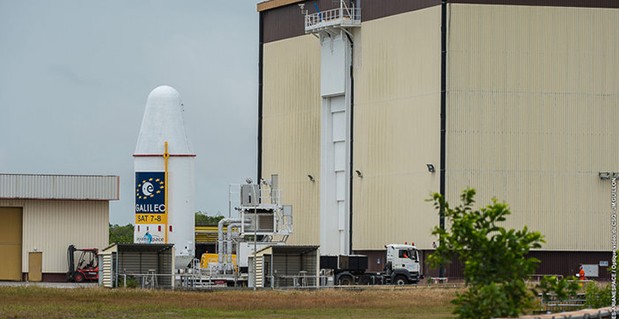
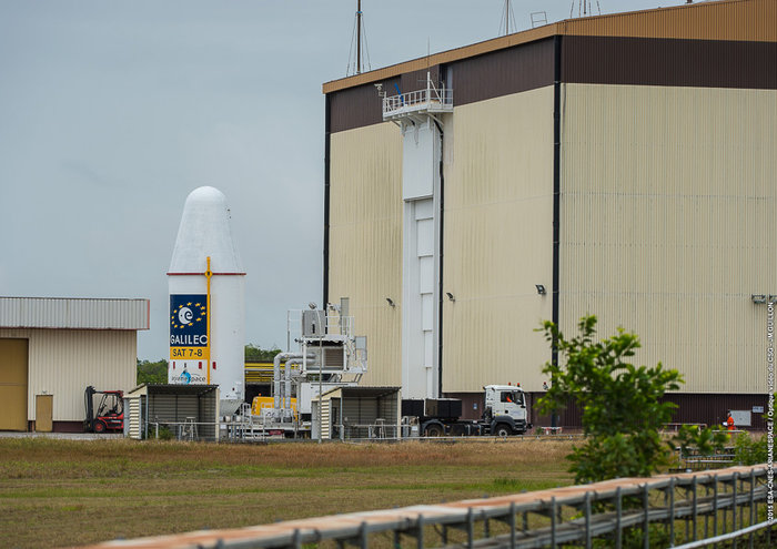
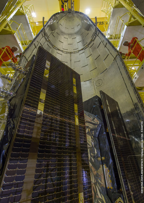
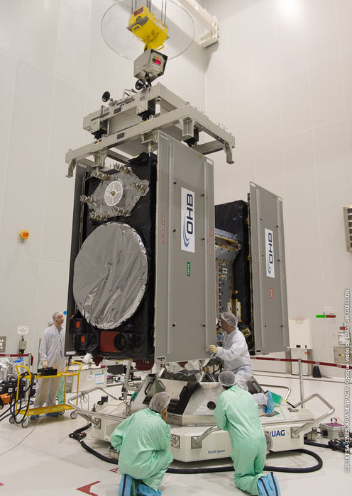
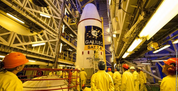
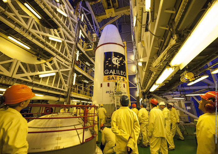
The upper composite containing the seventh and eighth Galileo satellites attached to their dispenser atop the Fregat upper stage inside the launcher fairing was hauled up the mobile launch tower then attached to the first three stages of its Soyuz ST-B launcher on March 24. (Photo courtesy of ESA)
The first three stages of the Soyuz rocket will take the Galileo satellites and their Fregat upper stage into low orbit. Then the reignitable Fregat, as much a spacecraft as a rocket stage, will take over the task of hauling the satellites higher through a pair of burns. The satellites will be released in opposite directions by their dispenser once they reach their set 22,522 kilometer-altitude orbit 3 hours, 47 minutes, 57 seconds after launch.
The webstream will cover the launch and orbital insertion in two parts. The first part begins at 21:24 GMT (22:24 CET) and ends at 22:19 GMT (23:24 CET). The second part begins at 01:22 GMT (02:22 CET) and ends at 02:17 GMT (03:17 CET).
Integrated Tracking (iTrack) Solutions Loki Gen 6 is a web-based mapping software derived from a series of other Loki software products focused on asset tracking for large fleets of vehicles.
The maps are provided by Bing, but custom mapping can also be used with the support of Esri ArcGIS REST services and shapefiles.
iTrack Solutions is based in Calgary, Canada, and provides GPS tracking, mobile data communications and display software. The Loki Gen 6 features are listed below.
Home Home is a configurable dashboard showing plans, schedules, calendars and other details.
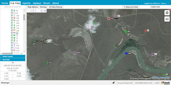
Live View Live View shows the live BING map from anywhere in the world, which includes maps, satellite and aerial imagery as well as maps provided by the user. Video streams are supported, and a 3D viewing feature is provided from Cesium. A user can add or draw features on the map to share with other users.
Photo: Integrated Tracking Solutions
Communication With this feature, users can communicate one-to-one or through a chat room, which includes video chat functionality.
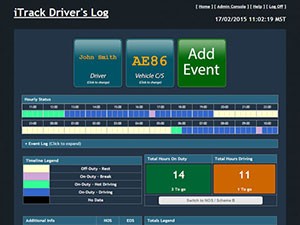
Management An administrative user can assign tracking devices to vehicles, assign vehicles to subgroups, assign subgroups to larger groups or drivers to vehicles. An administrator also can set privileges for individual users.
Access to data Users can generate and view a replay on the fly as well as generate reports for vehicle tracking, hours in service, mileage, stop location and speed.
Observations, Analysis The forum feature provides a place group discussion, which becomes part of the Loki database, is searchable and can be linked to reports and replays.
UPDATE: The GPS satellite has been deployed by the Delta IV rocket, completing today’s launch. The deployment occcurred as scheduled about 3 hours after launch.
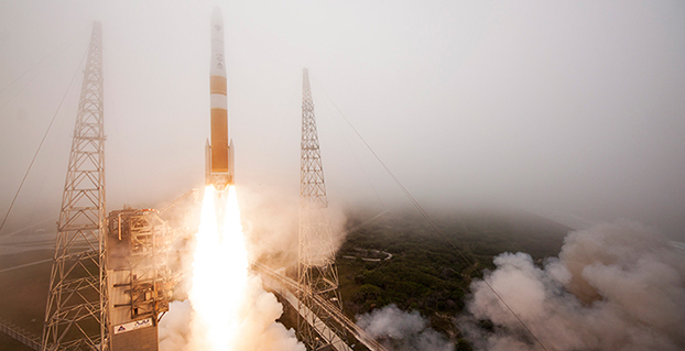
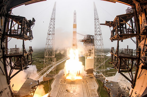
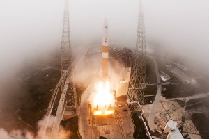
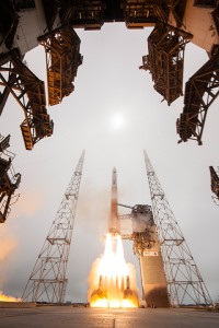
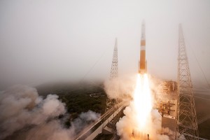
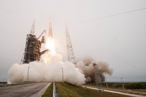
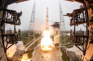
The U.S. Air Force’s ninth GPS Block IIF satellite (GPS IIF-9) launched on time Wednesday at 2:36 p.m. EDT (1836 GMT) from Space Launch Complex 37 at Cape Canaveral Air Force Station, Fla.
The GPS IIF-9 rode aboard a United Launch Alliance (ULA) Delta IV rocket, which has been the workhorse of the GPS fleet for successful launches.
GPS IIF-9 is one of the next-generation GPS satellites, incorporating various improvements to provide greater accuracy, increased signals, and enhanced performance for users.
The Air Force and the 45th Space Wing supported the successful launch of the ULA rocket. This launch is the fourth ULA launch this year and the 95th launch since the company was formed in December 2006.
GPS IIF-9 launched aboard a Delta IV Medium-plus (4,2) Evolved Expendable Launch Vehicle, using a single ULA common booster core powered by an Aerojet Rocketdyne RS-68 main engine, along with two ATK GEM 60 solid rocket motors. The upper stage was powered by an Aerojet Rocketdyne RL10B-2 engine with the satellite encapsulated in a four-meter diameter composite payload fairing.
GPS Launch Workhorse. The launch marks the 29th Delta IV launch and the 57th operational GPS satellite to launch on a ULA or heritage launch vehicle. Delta IV has delivered numerous satellites for the National Reconnaissance Office (NRO), as well as GPS satellites for the Air Force and weather satellites for NASA, according to a ULA media release.
“Many thought the Delta IV and GPS days were long gone, but the recent questions concerning reliable and proven launch vehicles have brought them back online, so to speak, for GPS,” said GPS World Defense Editor Don Jewell. The upcoming (April 27) 20-year milestone for GPS space vehicles on orbit translates to approximately 500 orbital years just for the IIR and IIF constellations alone,” Jewell said. “The IIAs may account for that many orbital hours as well. Quite a record, and something of which the U.S. Air Force (USAF) and all the companies involved should be very proud.”
Yet Another USAF Success. Jewell points out that this is another successful government launch in a long string of successive launches, without a failure. “It is by far the most successful launch record ever put together by any nation or government. No other space-faring nation even comes close. The U.S. Air Force and all the players should be proud of all these records and more, plus we have one more GPS asset on orbit, providing GPS signals to the world and all they enable, courtesy of the USAF.”
“I’m elated with today’s successful launch, the GPS constellation remains healthy, strong and robust and in over 20 years since initial operational capability, GPS has never failed to deliver on its global positioning, navigation, and timing commitments,” said Brig. Gen. Cooley, director of Space and Missile Systems Center’s Global Positioning Systems Directorate.
“Each new generation of GPS satellites provides enhanced capability over the prior generations, and has delivered reliable performance demonstrating our commitment that GPS remain the Gold Standard space-based positioning, navigation, and timing service for the future,” Cooley said. “Thanks to the men and women of SMC, the 45th, 50th 310th Space Wings, Boeing, United Launch Alliance, the Aerospace Corporation, GPS IIF and Delta IV launch teams, the GPS IIF program continues to meet GPS enterprise needs.”
45th Space Wing. Once again, the 45th Space Wing team of military personnel, government civilians, and contractors provided support to the ULA launch of the Air Force Space Command mission, including weather forecasts, launch and range operations, security, safety, and public affairs.
The 45th Space Wing commander was both proud and pleased with the team she works with on the Eastern Range. “First, let me offer my heartiest congratulations to ULA, Boeing, Space and Missile Systems Center, the Launch Systems Directorate, the Global Positioning Systems Directorate, and all the mission partners who made this happen,” said Brig. Gen. Nina Armagno, 45th Space Wing commander, who also served as the Launch Decision Authority.
“What a treat — and an honor — it is to know that we have played such a significant part in something that we will celebrate two decades of helping people all around the world,” Armagno said. “Every GPS satellite since the program’s inception has been launched right here from Cape Canaveral Air Force Station safely and reliably by members of the 45th Space Wing.
“And that’s because we continue to take a ‘one launch at a time’ mentality and focus on our number one priority — 100 percent Mission Success. I am so very proud to be part of Team Patrick-Cape.”
Constellation Changes. The Air Force Second Space Operations Squadron (2 SOPS) indicates that IIF-9, SVN-71/PRN-26, will replace SVN-35 (currently being operated in Launch, Anomaly Resolution and Disposal Operations [LADO]) in the B plane slot 1F. SVN-35 is a GPS 2A-22 satellite originally launched aboard Delta 222 on August 30, 1993. It was decommissioned from active service in 2009, remained in orbit as a spare, then was set usable again in 2011. The satellite was declared unusable in 2013 and decommissioned a second time, reports Spaceflight Now. It was tested again in 2014.
SVN-38/PRN-08 will be taken out of the operational constellation prior to SVN-71 payload initialization and sent to LADO. PRN-08 will be assigned to SVN-49 in May and set to test, but is tentatively scheduled for assignment to IIF-10 to launch June 16.
SVN-35, launched on August 30, 1993, has been in a residual status since March 2013 in an expanded node slot in the B plane and successfully served 21.5 years, 14.0 years beyond its designed service life, due to the diligent efforts of the men and women of the U.S. Air Force.
SVN-51 is still in a re-phase journey from E1 (GLAN=146 °) to an auxiliary node at E7 (GLAN=60.7 °) scheduled to arrive sometime this summer.
Courtesy photo/John Studwell, provided by 45th Space Wing Public Affairs.
Saneamento Basico do Estado de São Paulo (SABESP), a Brazilian water and sewage collection utility owned by São Paulo state and Latin America’s largest water company by market capitalization, has selected Spectra Precision ProMark 120 and 220 GNSS receivers to assist in gathering the geographic location of all SABESP network assets and the location of all customers.
SABESP provides water to more than 28.7 million customers, or 67 percent of the population of São Paulo state. Water loss due to leakage in the SABESP network is a significant problem. The biggest reason behind water loss is leaks in the network; additional factors include sub-metering, caused by low water pressure; unauthorized consumption; and fraud.
Improving water management, recovering lost revenue and improving the quality of the customer experience is a priority for SABESP, Spectra Precision said. To help improve revenue generation and reduce water loss, SABESP developed two projects: LigGeo, to geo-reference the water meter location of approximately 4.8 million SABESP customers; and CadGeo, to geo-reference and register the location of the SABESP water and sewage network infrastructure.
According to Marcos Almir, sanitation systems analyst for the metropolitan department of development and management of SABESP, the twin projects of LigGeo and CadGeo were motivated by SABESP’s desire to improve productivity and competitiveness. “We created an innovative GIS effort to geo-reference and register SABESP distribution networks and buried assets. Tests showed the technical feasibility of using ProMark GNSS receivers and collectors with NTRIP technology to efficiently and effectively register all SABESP equipment in real time with geo-referenced attributes connected to the technical and commercial enterprise systems to optimize processes and reduce costs.”
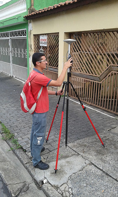
To implement the LigGeo and CadGeo projects, SABESP purchased 50 ProMark 120 and 220 GNSS receivers from Hezolinem Equipamentos Topograficos, Spectra Precision’s Brazil dealer. Both SABESP technicians and outsourced service providers will use the receivers.
ProMark 120/220 GNSS receivers were chosen for their multiple advantages: They could be purchased as rovers only; they could run LigGeo and CadGeo proprietary software; they are compatible with local third-party networks, including CEGAT, Brazil’s largest private RTK geodetic base network, that delivers RTK network corrections enabling real-time accuracy of less that 20 cm; and they offered direct two-way 3G communication of information with the SABESP central cartographic base raster files.
The event will be held October 23-25 at the Clarion Congress Hotel in Prague, Czech Republic.
After abstracts are reviewed, authors will be notified of acceptance or rejection by April 15.
Speakers include Satoshi Kogure of the Japan Aerospace Exploration Agency, GPS World author Dorota Grejner-Brzezinska of the Institute of Navigation and The Ohio State University, Günter Hein of the European Space Agency, and more.
Topics of the event include:
satellite navigation systems — GPS, GLONASS, Galileo, BeiDou/Compass, QZSS, etc.;
augmentation systems — SBAS, GBAS, etc.;
GNSS modernization;
signal processing in navigation systems and systems integration;
GNSS receivers and antenna technologies;
interference and spectrum management, jamming and spoofing;
autonomous navigation;
MEMS, atomic clock and micro PNT;
space and atmospheric weather effects on GNSS;
aviation applications;
marine applications;
terrestrial applications;
precision agriculture and machine control applications;
healthcare applications;
urban and indoors applications;
automobile navigation;
space applications and remote sensing;
precise positioning, RTK;
radar and alternative sensors;
GNSS environmental monitoring;
ionosphere monitoring with GNSS;
algorithms and methods;
collaborative methods;
alternative signals for PNT;
backups to GNSS;
time and frequency distribution;
and other PNT topics.
IAIN says it is a “non-governmental, nonprofit organization with the objective of uniting national and multinational institutes and organizations which aim to foster human activities at sea, in the air, in space and on land, and who may benefit from the development of the science and practice of navigation and related information techniques.”
Visitors from non-European countries must possess a valid passport for at least three months after the event date.
The upper composite, containing the seventh and eighth Galileo satellites attached to their dispenser atop the Fregat upper stage inside the launcher fairing, being moved from the S3B building to the Soyuz launch site of Europe’s Spaceport on March 24. Photo: European Space Agency
By the European Space Agency
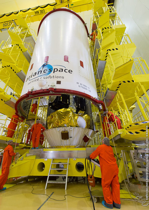
The seventh and eighth Galileo satellites attached to their dispenser atop the Fregat upper stage being enclosed within their Soyuz launcher fairing on March 20. Photo: European Space Agency
Thousands of engineers have worked on the seventh and eighth navigation satellites of Europe’s Galileo constellation in recent years, but last Friday marked the very last time the spacecraft were glimpsed by human eyes.
The team from ESA and builders OHB in the S3B building of Europe’s Spaceport in French Guiana looked on as the focus of their work disappeared from view.
The pair of satellites — already resting atop their Fregat upper stage and attached to their dispenser — was enclosed within the halves of the Soyuz rocket’s protective fairing.
This unit was moved yesterday to the launch site, where it will be lifted atop the first three stages of the Soyuz ST-B to complete the vehicle for Friday’s launch.
Last week saw the two satellites being fuelled in the Spaceport’s S5A preparation hall and then brought together atop the dispenser that will support them during the rigours of ascent.
The dispenser’s final task is to release them in opposite directions once their 22 522 km-altitude orbit is reached. The satellites themselves will then gradually lower themselves to their working 22 322 km orbit.
After fueling, the satellites plus dispenser were moved to the S3B processing building, where their Fregat was already fueled and waiting.
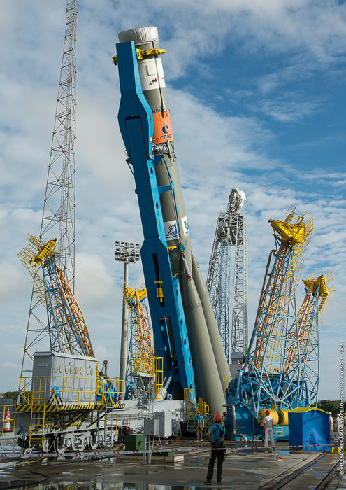
The first three stages of the seventh and eighth Galileo satellites’ Soyuz ST-B rocket being raised to the vertical on the launch pad at Europe’s Spaceport in French Guiana, awaiting the addition of the ‘upper composite’ containing the Galileo satellites plus the Fregat upper stage enclosed within the Soyuz fairing. Photo: European Space Agency
The reignitable Fregat is as much a spacecraft as a rocket stage. Once the Soyuz reaches low orbit, Fregat will take over the task of hauling the satellites higher through a pair of burns.
The two Galileos and their dispenser altogether weigh more than one and a half tonnes, so the attachment operation took place with great care and precision.
Then the fairing halves were slowly slid into place around them and closed. Enclosed in this way, the satellites will be protected from the harsh slipstream and vibration of the first few moments of launch, when the Soyuz is still travelling through the thickest layers of atmosphere.
The fairing is due to be ejected 3 min 29 sec after liftoff. Until liftoff, the satellites remain connected to the outside world via power and data links, allowing ESA’s Galileo team keep a check on their battery charging and the health of their atomic clocks.
The satellites stay switched off during launch, and will be activated automatically on separation from the dispenser.
Launch is due at 21:46:18 GMT (22:46:18 CET, 18:46:18 local time) on 27 March. The satellites are scheduled for release upon reaching their set orbit 3 h 47 min 57 sec after launch.
The seventh and eighth Galileo satellites were enclosed within their protective Soyuz fairing on Friday, 20 March 2015, ahead of their launch a week later. Photo: European Space Agency
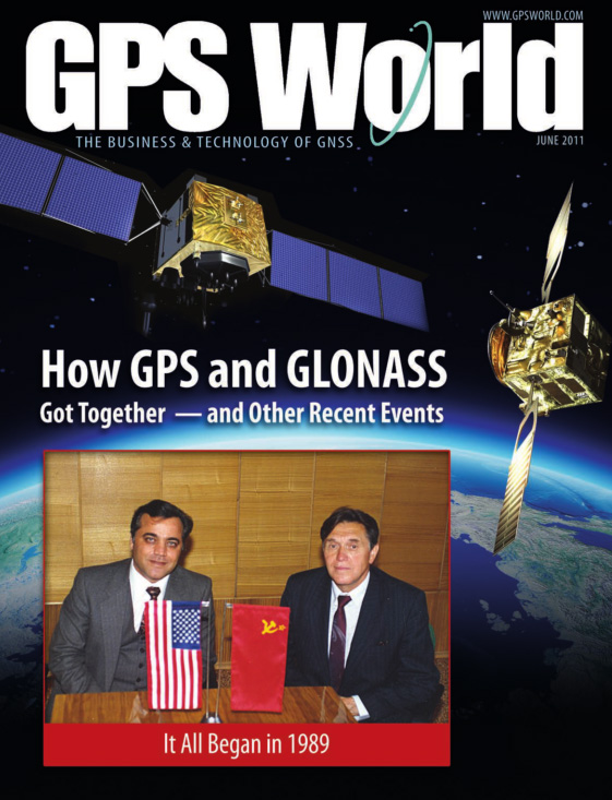
25 years ago, while the Soviet Union still existed, I began efforts that led me to become the first to combine United States’ GPS and Russia’s GLONASS satellites. Later I hosted many GPS and GLONASS authorities, fostered friendships among them, and promoted concepts such as “compatibility” and “interoperability” of satellite systems. See the details in the GPS World article, “How GPS and GLONASS Got Together.” The whole world now benefits from the combined GPS and GLONASS system.
As with GPS and GLONASS, we need to get together again. Just because I am passionate about technical issues does not mean that I ignore human issues. This time it is not about technology. This time it is about We the People.
For citizens of the United States, founded on this concept, it is inconceivable that we might one day wake up and learn that one of our States had been “gifted” to a neighboring country. But this is exactly what happened to the people of Crimea. Since 1784, Crimea was part of Russia and its people lived peacefully and happily as part of Russian culture and heritage. In 1954, approximately 75 % of the Crimea population were ethnic Russians. One day they woke up and learned that Nikita Khrushchev, the successor to Stalin, had “gifted” their land to Ukraine (reportedly for his own political gain).
Anyone familiar with the history of the Soviet Union knows that the people of Crimea were not able to raise objections. They were ruled under the dictatorship of Khrushchev who is known in the West for pounding his shoes on the table in the United Nations and threatening the United States. Those who claim Crimea does not belong as part of Russia give credence to the action of Khrushchev.
Should people have a ‘say’ or ‘voice’ in their future? Contrast the actions of Khrushchev in 1954 with that of Scotland and Quebec in more recent years. Crimeans had no choice about their fate, it was decided by the unilateral action of one man. Whereas, when some people in Scotland and Quebec wanted to secede, all people were allowed to vote to determine their fate.
After the collapse of the Soviet Union and the establishment of better relations between Russia and the Western world, East and West Germany rightfully reunified after an imposed ‘wrong’ of separation, but at no time did anyone come to the aid of the Crimean people to correct their ‘wrong’. Even worse, when the current issue surfaced, the US and Europe stood opposed to them.
It is not only my personal observation that Crimeans love their motherland of Russia. Forbes magazine contributor, Kenneth Rapoza, in his March 20, 2015 article writes that: “[…] poll after poll shows that the locals […] are all in agreement: life with Russia is better than life with Ukraine.”
The position of the West regarding Crimea has exacerbated the problem of Ukraine, and despite financial hardship in Russia, Putin’s popularity has skyrocketed while the United States’ standing has plummeted among the Russian people.
One can argue that President Putin and Russia could have used a better approach to help the people of Crimea achieve their goals and aspirations, but many believe that the West did not leave him a better choice. I don’t agree with many of President Putin decisions, but on this issue Vladimir Vladimirovich is exactly right.
I once worked to bring together GPS and GLONASS; I wish I had the opportunity to invite Presidents Obama and Putin to my California or my Moscow facilities to see if we could put an end to this situation.
Dr. Javad Ashjaee
JAVAD GNSS
March 21, 2015, San Jose, California
For the story of how Ashjaee “hosted many GPS and GLONASS authorities, fostered friendships among them, and promoted concepts such as compatibility and interoperability of satellite systems,” see the cover story of GPS World’s June 2011 issue, “How GPS and GLONASS Got Together.”
The seventh and eighth Galileo satellites being fitted together onto the dispenser, March 16-17. (Photo courtesy of ESA)
The Soyuz for Arianespace’s next medium-lift mission is in the launch zone at French Guiana, where it stands ready to receive the two spacecraft passengers that will join Europe’s Galileo global navigation satellite system.
Applying procedures that have been followed since the workhorse Soyuz launcher inaugurated the Space Age, the basic three-stage vehicle for Arianespace’s March 27 flight emerged today from its MIK integration building in the Spaceport’s northwestern sector.
Riding horizontally on a transporter/erector rail car, Soyuz was transferred to the ELS launch zone — which was followed by its erection to the vertical orientation and positioning over the launch pad, suspended in place by four large support arms.
With this step completed, all was ready for the purpose-built 53-meter-tall mobile gantry to be moved into position around the launcher — a phase of the processing in French Guiana that differs from Soyuz operations at Baikonur Cosmodrome in Kazakhstan and Plesetsk Cosmodrome in Russia. The gantry provides a protected environment for installation of the “upper composite,” which consists of the two Galileo spacecraft, the Soyuz’ Fregat upper stage and a two-piece protective payload fairing.
The March 27 launch — designed VS11 in Arianespace’s numbering system — is scheduled to lift off at precisely 6:46:18 p.m. local time in French Guiana, with its Galileo satellite passengers to be deployed during a flight lasting approximately 3 hrs., 47 min. Total payload lift performance is estimated at 1,597 kg., which includes a combined mass of some 1,428 kg. for the two spacecraft.
Flight VS11’s passengers — built by OHB System, with Surrey Satellite Technology Ltd. supplying their navigation payloads — are the third and fourth Full Operational Capability (FOC) satellites in the Galileo program, which is creating a European-operated space-based navigation system.
The European Commission is managing and funding Galileo’s FOC phase, during which the network’s complete operational and ground infrastructure will be deployed. The European Space Agency has been delegated as the design and procurement agent on the Commission’s behalf.
The Federal Aviation Administration has established an interim policy to speed up airspace authorizations for certain commercial unmanned aircraft operators who obtain Section 333 exemptions. The new policy helps bridge the gap between the past process, which evaluated every UAS operation individually, and future operations after the FAA publishes a final version of the proposed small UAS rule.
Under the new policy, the FAA will grant a Certificate of Waiver or Authorization (COA) for flights at or below 200 feet to any UAS operator with a Section 333 exemption for aircraft that weigh less than 55 pounds, operate during daytime Visual Flight Rules (VFR) conditions, operate within visual line of sight (VLOS) of the pilots, and stay certain distances away from airports or heliports:
5 nautical miles (NM) from an airport having an operational control tower; or
3 NM from an airport with a published instrument flight procedure, but not an operational tower; or
2 NM from an airport without a published instrument flight procedure or an operational tower; or
2 NM from a heliport with a published instrument flight procedure
The blanket 200-foot COA allows flights anywhere in the country except restricted airspace and other areas, such as major cities, where the FAA prohibits UAS operations. Previously, an operator had to apply for and receive a COA for a particular block of airspace, a process that can take 60 days. The agency expects the new policy will allow companies and individuals who want to use UAS within these limitations to start flying much more quickly than before.
Section 333 exemption holders will automatically receive a blanket 200-foot COA. For new exemption holders, the FAA will issue a COA at the time the exemption is approved. Anyone who wants to fly outside the blanket parameters must obtain a separate COA specific to the airspace required for that operation.
More information on the UAS exemption process is available on the FAA’s UAS page.
The launch of India’s fourth Navigation Satellite, IRNSS-1D, is now scheduled for 17:19 IST (11:49 UTC) on Saturday, March 28, from Satish Dhawan Space Centre, Sriharikota.
The launch was previously scheduled for March 9, then postponed until March 29 to replace a faulty telemetry transmitter on the satellite, according to the Indian Space Research Organization.
IRNSS-1D will be fourth in the seven-spacecraft Indian Regional Navigation Satellite System constellation. It will be flown into space in the Indian Polar Satellite Launch Vehicle-XL.
The space segment of the IRNSS consists of seven satellites: three in geostationary orbit and four in inclined geosynchronous orbit. The ground segment consists of infrastructure for controlling, tracking and other facilities. The entire IRNSS constellation of seven satellites is planned to be completed by 2015.
Both IRNSS-1A and 1B are functioning satisfactorily from their designated geosynchronous orbital positions. The first three satellites in the IRNSS series were launched from Sriharikota on July 1, 2013, April 4, 2014, and October 16, 2014. IRNSS-1E and IRNSS-1F satellites are expected to be launched before year end.
IRNSS is an independent regional navigation satellite system designed to provide position information in the Indian region and 1,500 kilometers around the Indian mainland. IRNSS will provide two types of service: Standard Positioning Services (SPS) — provided to all users — and Restricted Services (RS), provided to authorized users.
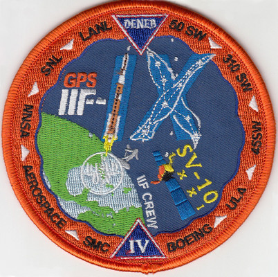
A patch for the upcoming GPS satellite launch shows a stylized GPS IIF-IX formed by the Delta 4 rocket and the constellation Cygnus (Latinized Greek word for swan). The satellite is nicknamed Deneb, the brightest star in the constellation and one of the 57 stars used in celestial navigation. The patch also indicates that the satellite is SV-10 and 71. The SV-10 identifier may indicate that it is the 10th satellite off the IIF assembly line. Photo: US Air Force
The U.S. Air Force’s ninth GPS Block IIF satellite (GPS IIF-9) is set to launch Wednesday at 2:36 p.m. EDT (1836 GMT) from Space Launch Complex 37 at Cape Canaveral Air Force Station, Fla.
The GPS IIF-9 will ride aboard a United Launch Alliance (ULA) Delta IV rocket, marking the 29th Delta IV launch and the 57th operational GPS satellite to launch on a ULA or heritage launch vehicle.
GPS IIF-9 is one of the next-generation GPS satellites, incorporating various improvements to provide greater accuracy, increased signals, and enhanced performance for users.
UPDATE (April 17, 2015): The USCG Navigation Center has confirmed that SV-10 was launched instead of SV-9. The Air Force discovered a problem with SV-9, so it was pulled from the launch and SV-10 was sent into orbit in its place. SV-9 will be used in a future launch.
Constellation Changes. The Air Force Second Space Operations Squadron (2 SOPS) indicates that IIF-9, SVN-71/PRN-26, will replace SVN-35 (currently being operated in Launch, Anomaly Resolution and Disposal Operations [LADO]) in the B plane slot 1F. SVN-38/PRN-08 will be taken out of the operational constellation prior to SVN-71 payload initialization and sent to LADO. PRN-08 will be assigned to SVN-49 in May and set to test, but is tentatively scheduled for assignment to IIF-10 to launch June 16. SVN-35, launched on August 30, 1993, has been in a residual status since March 2013 in an expanded node slot in the B plane and successfully served 21.5 years, 14.0 years beyond its designed service life, due to the diligent efforts of the men and women of the U.S. Air Force. SVN-51 is still in a re-phase journey from E1 (GLAN=146 °) to an auxiliary node at E7 (GLAN=60.7 °) scheduled to arrive sometime this summer.
Topcon Positioning Group has acquired Digi-Star, an international provider of agricultural solutions involving weight sensors and control systems for feeding, planting, fertilizer and harvest equipment manufacturers.
“After several years of working on development projects together, we are delighted with this acquisition,” said Ray O’Connor, president and CEO of Topcon Positioning Group. “Digi-Star and Topcon Precision Agriculture are a perfect fit, bringing complementary technologies and distribution channels to our rapidly growing precision agricultural division. At a time when many companies are decreasing their investment in agricultural markets, we are increasingly optimistic about their growth based upon our strong commitment to developing management systems and solutions that bring the power of the Internet of Things (IoT) to every farm.”
Based in Fort Atkinson, Wis., Digi-Star supplies electronic equipment, precision sensors, optical yield and feed management sensors, displays, position verification and software used by farmers and other equipment operators to precisely measure and analyze valuable data from critical farming processes. Digi-Star has expertise in the livestock and grain equipment markets, according to a news release from Topcon.
Mac Moore, president and CEO of Digi-Star, said, “Topcon and Digi-Star have numerous synergies with electronics, sensors, and integration of specific user interfaces for the agriculture and industrial markets that will complement each other’s customers. Both companies will benefit from the expanded product lines and solutions that progressive customers depend upon for maximum profitability.”
In 2012 Digi-Star purchased RDS Technology, a United Kingdom-based company, which possesses similar technology for agricultural and construction applications, adding engineering, development and manufacturing facilities in Europe.
“We are very enthusiastic about the opportunity of combining these companies. In addition to expanding our reach into the farm market segment, this will further extend our scope of field solutions to help us continue strong growth while serving an expanded customer base for Topcon Precision Agriculture, for the aftermarket and original equipment manufacturer (OEM) clients,” said Albert Zahalka, president of Topcon Precision Agriculture. “We are also excited to add the skilled employees and world-class facilities located in the Midwestern United States, the United Kingdom and the Netherlands to our global agricultural family.
Digi-Star currently employs more than 220 employees in its three locations, with approximately half located in the United States or Europe.
 World Congress 2015, sponsored by the