MicroSurvey Software, part of Hexagon, has released its new field data-collection software platform for Android users.
FieldGenius for Android, version 1.0, is first release of the company’s new multi-platform field software built on the Android platform. It supports most popular GNSS sensors on the market today.
FieldGenius is third-party, brand-neutral data-collection software used by many surveyors. The new release builds on decades of innovation MicroSurvey has invested into the original FieldGenius software, providing users with an easy-to-use and intuitive mobile data-collection software package for the next generation.
New features include dynamic data panels synchronized with the map views. A fresh user interface provides familiarity for existing FieldGenius users while offering new tools, simplified workflows and readily available data that surveyors require at the point of work to make informed decisions in the field.
“Surveyors, dealers, and distributors from every corner of the world have been demanding an Android based version of MicroSurvey FieldGenius for years,” said Marc Veinotte, global sales and OEM manager at MicroSurvey. “This is the first release of our new multi-platform field data collection software that will provide a consistent user experience across a wide cross section of data collection devices. MicroSurvey continues its hardware neutrality strategy offering support for almost every brand of popular and upcoming GNSS receiver on the market today.”
Early adopters of FieldGenius for Android will receive additional benefits and participate in the newly created MicroSurvey Technology Innovation Group (MTIG).
Ensuring the freedom to continue innovating is vital to our global economy, job creation and ultimately to empowering the next generation of GPS-enabled applications.
GPS — it’s a household name and has come to benefit so many aspects of our day-to-day lives. Today across the globe, it is estimated that there are more than 3 billion GPS receivers in the marketplace. Included in this total are GPS receivers found in mobile phones, automobiles, airplanes, tractors, boats and high-precision surveying equipment, to name just a few examples. In the past decade alone, GPS applications like these have helped generate more than $1.2 trillion for the U.S. economy and millions of jobs.
So how did GPS become so ubiquitous? Thanks to the leadership of the United States Air Force, which maintains and operates the GPS constellation, and long-standing U.S. policy, which makes GPS available as a vital public resource, any private sector company can design and build a receiver capable of listening for these GPS signals, without seeking the government’s approval or paying user fees. This freedom to innovate is at the heart of why GPS has been so successful and continues to drive innovation across our economy.
With the freedom to innovate, GPS receiver manufacturers have developed a range of advanced technologies to address market needs from the simple to the highly complex. These technologies reflect the inherent functional and technical differences between radio communications services and a navigation service like GPS.
Huge range of technologies. GPS receiver innovations enable a receiver to listen for a GPS signal that is less than a millionth of a billionth of a watt, while simultaneously resisting interference that is 10,000 times greater. Whether the GPS receiver is found in a tiny smartwatch or a 20-ton tractor, what they have in common is the ability to convert a faint radio signal into what we most commonly recognize as our current location displayed as a blue dot. They do this remarkably well.
Today’s regulatory landscape also correctly recognizes that every GPS-enabled application has unique requirements driven by intended function, environment and design factors. For example, a GPS receiver used for synchronizing financial transactions has different demands from a GPS receiver found in an autonomous vehicle. The former focuses on timing while the latter needs precise positioning to help maintain lane-level guidance.
Similarly, high-precision surveying equipment capable of delivering centimeter-level accuracy will no doubt have different receiver and antenna requirements than those found in a typical smartphone. The freedom to innovate enables GPS receiver manufacturers to support this market differentiation.
GPS resiliency. With many of our nation’s key critical infrastructure sectors dependent on GPS, there has been increasing discussion in Washington about the resiliency of GPS. Some have specifically expressed concern that a GPS jamming or spoofing attack could disrupt these key services and have advocated for new requirements on GPS receivers.
To be clear, GPS jammers and spoofers are illegal devices, designed specifically to interfere with GPS signals, either blocking the signal outright or emitting a fake signal in order to falsify one’s location. In either scenario, this interference occurs within a localized area from a detectable source. So, the reality is that mandates won’t stop a malicious actor intent on illegally interfering with GPS or another wireless technology, but vigorous enforcement of U.S. federal law can.
It is also important to remember that the GPS satellites are a multi-use U.S. military-civilian asset, supporting the mission of our armed forces, and have therefore been built with the highest levels of security and redundancy. Any attempts to attack the GPS constellation risks impacting not just civil services but the military signal as well.
Mission-critical applications. When it comes to resiliency, open innovation enables GPS receiver manufacturers to work with mission-critical application providers to develop products designed to meet their specific requirements. Different categories of users can and should define and specify performance and resiliency requirements appropriate for their applications.
For example, the requirements for a military GPS receiver are much more demanding than those for the receiver in an IoT device that reports its position hourly or daily. A military GPS receiver will, therefore, be significantly more expensive than an IoT receiver. Conversely, those who deploy internet of things (IoT) receivers will require low price points to support ubiquitous applications.
GPS manufacturers and applications developers have responded to market requirements by providing new and innovative techniques for increasing resilience, including designing receivers capable of receiving signals from multiple GNSS systems. This is the best way to ensure resilience — via application-specific requirements that are driven by customers who are most knowledgeable about their needs, not by general regulations or government fiat.
Preserving signal access. At the same time, the government does have a responsibility to investigate and take the necessary enforcement action to preserve unhindered reception of GPS signals. Vigorous enforcement of federal law by the Federal Communications Commission (FCC) and other government agencies — which already prohibits the manufacture, importation, marketing, sale and operation of GPS jammers — can keep these illegal devices out of the hands of those seeking to disrupt GPS operations. Such enforcement is critical to protecting our military operations, aviation and other safety-of-life applications.
Over the past three decades, worldwide adoption of robust, innovative GPS receivers attests to the trust users have placed in GPS as the gold standard for availability, accuracy, reliability and resiliency. Ensuring the freedom to continue innovating is vital to our global economy, job creation and ultimately to empowering the next generation of GPS-enabled applications.
About the GPS Innovation Alliance
The GPS Innovation Alliance was founded by Deere & Company, Garmin International Inc. and Trimble Inc. The Alliance recognizes the ever-increasing importance of GPS and other GNSS technologies to the global economy and infrastructure and is firmly committed to furthering GPS innovation, creativity and entrepreneurship. The GPS Innovation Alliance seeks to protect, promote and enhance the use of GPS. For more information, visit www.gpsalliance.org or follow @GPS4Life.
J. David Grossman serves as executive director of the GPS Innovation Alliance (GPSIA), an organization dedicated to protecting, promoting and enhancing the use of GPS. Prior to joining GPSIA, Grossman spent nearly a decade in public service, including as chief of staff to FCC Commissioner Mignon Clyburn; legislative director and senior advisor for technology policy to Rep. Anna Eshoo of Silicon Valley; and as technology counsel to the U.S. House Small Business Committee under the leadership of Rep. Nydia Velázquez.
Grossman holds a Master’s Degree in Public Policy from George Mason University and a B.A. in Political Communication from George Washington University’s School of Media and Public Affairs.
Government agencies are increasingly turning to high-precision aerial imagery to solve city-planning conundrums. Three recent case studies show how emergency 9-1-1 services gather data to provide updated maps to emergency services to get to the right locations as soon as possible; reveal how a city’s public works department streamlines data collection for more efficient infrastructure management; and how to give GIS professionals instant access to the most current information available — all in the cloud.
Photo: Nearmap
It’s said a picture is worth a thousand words. In the case of aerial imagery, where location data is packed into every pixel, a picture could save lives.
Emergency dispatch is just one type of government agency now relying on high-quality aerial imagery. With up-to-date georeferenced imagery of their own towns and counties, agencies are not only improving response to emergency calls, but also streamlining public works and enhancing city planning.
A company providing that imagery is Nearmap, which serves more than 8,200 organizations and businesses globally using small aircraft for image capture. The aerial mapping company provides high-quality imagery as a subscription service delivered through the cloud. Its photo maps are taken at least twice a year, with leaves both on and off the trees, to provide different views of locations in different seasons.
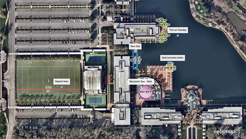
Nearmap’s patented camera system and software pipeline enables it to capture aerial photos, stitch them together into seamless digital maps, and publish the content online within days of capture. Above, Nike’s headquarters in Portland. (Photo: Nearmap)
Aircraft offers a huge advantage over unmanned aerial vehicle (UAV) or satellite imagery. Airplanes can cover much greater distances than UAVs, and pilots pay heed to the weather and fly below cloud layers to deliver the clearest visuals possible. Unlike space-based platforms, airplanes operate at lower altitudes, also increasing the resolution, and can fly on demand, unlike satellites that have set orbits dictating their periodicity for returning to a target area.
Nearmap’s powerful, patented technology allows it to deliver high-resolution aerial imagery as a service: orthographic (straight down) maps, multi-perspective panoramas and oblique aerial views — all at resolutions four times clearer than free satellite imagery.
Once photographed, the images are stitched together in the cloud in a matter of days, where they are available for viewing and analysis on desktop, tablet and mobile devices via a subscription service.
Nearmap’s proactive capture model is based on population — the larger the population, the more captures it takes per year. Nearmap images 88% of Australia’s population, 70% of the U.S. population, and 75% of the New Zealand population.
Nearmap captures many areas multiple times throughout the year; for many locations this gives customers a leaf-off and leaf-on view. Providing spring leaf-off captures allows customers a view of the ground that is typically obstructed by foliage the rest of the year.
The flight plans cover approximately 430 urban areas that are flown, captured and processed, and then served up via the MapBrowser in-browser tool, or supplied via application programming interface (API) for use in various design platforms. When a user subscribes to Nearmap, the capture is immediately available with any and all historical captures, without the need to pay for a dedicated flight.
“To capture imagery for a map, a plane has to crisscross over its own flightpath. Each sweep has to overlap the previous by approximately 70%,” explained William Tewelow, GPS World’s contributing editor for geointelligence. “Vertical (or nadir) is straight overhead. Oblique is everything else, but usually not exceeding 30% to either side because it distorts the structures and vertical features (parallax), makes mosaicking difficult, and shadows structures behind other structures.”
That said, oblique imagery is important for building 3D meshes for imagery point clouds, Tewelow said, as well as seeing various angles of a structure.
Following are examples of the creative — and surprising — ways government agencies are using Nearmap imagery to improve their services today, and prepare for future changes in their communities.
Better 9-1-1 address mapping
Shelby County is the largest county in Tennessee in both population (927,644) and geographic area (785 square miles). Memphis is the county seat, home to the county’s Emergency Communications District, for the operations of the local 9-1-1 emergency system.
The district provides Shelby County residents with an efficient emergency telephone number service using the latest technology, equipment and training for the various emergency service providers and dispatch centers.
For each dispatch center, the district provides county address location mapping. A secure database known as an ALI (Automatic Location Identification) contains the exact 9-1-1 address for any given associated phone numbers.
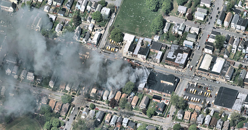
Albany, N.Y.: A house fire in progress. (Photo: Nearmap)
When a 9-1-1 call comes in, the database is queried by the Public Safety Answering Point to obtain the caller’s location. This data is then placed in the computer-aided dispatch software and 9-1-1 mapping software used by the district to help fire and rescue, emergency medical services and law enforcement gain instant access to updated maps containing GIS data needed to get to the right locations as soon as possible.
The 9-1-1 mapping system uses geodetic coordinates to plot wireless calls on the map. The system also reverse geocodes the coordinates to provide the 9-1-1 telecommunicator with a calculated civic address based on proximity of other features in the map, such as address points or streets.
Out-of-Date Imagery. For years, Shelby County’s aerial image process required a contracted flight to photograph the county areas. Because of the high cost of capturing those images, the county purchased images once every two years, after pooling resources from various county entities.
“We had gaps where we wouldn’t have updated imagery,” said Timothy Zimmer, the district’s GIS administrator. “While the images were high resolution, there were issues with mosaicking the separate images together, and since the imagery was taken every two years, many rural and unincorporated areas were out of date.”
With out-of-date images, the county had to develop alternate methods to locate addresses for the 9-1-1 systems.
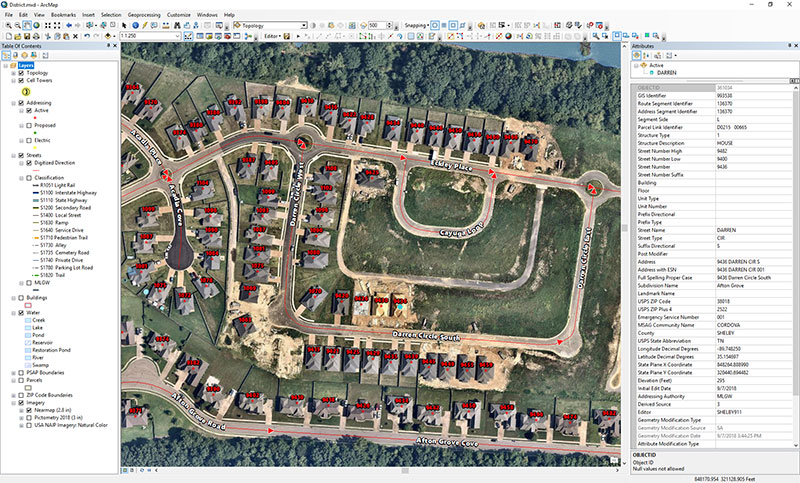
Moving into the Cloud. In the summer of 2018, Zimmer began to work with Nearmap. With Nearmap, Zimmer and his team can access current imagery to geocode new addresses and developments as well as plot new roads into the 9-1-1 mapping systems (Figure 1).
For Zimmer, the biggest advantage is that Nearmap’s imagery integrates directly into Esri’s ArcMap, ArcPro and ArcGIS Online applications, so he can overlay GIS information directly over the high-resolution imagery.
“I really like how Nearmap is integrated into the GIS stack,” Zimmer said. “We’re able to stay on top of new developments, roads, and addresses. Being able to have Nearmap imagery integrated into our GIS systems helps us be much more accurate.”
The combined impact of data services, base maps, Nearmap imagery and third-party data are improving all aspects of public safety, including law enforcement, fire and emergency medical services.
Other Shelby County agencies also are using the district’s imagery and GIS data. “The county clerk and the utility company are using our address mapping data because Nearmap has helped enable us to be much more current,” Zimmer said.
Public works in a fast-growing city
Durham is one of the points in North Carolina’s high-tech Research Triangle and home to Duke University.
An economic and cultural renaissance is happening in the city. With a revitalization of its downtown district, the redevelopment and repurposing of former tobacco districts into tech hubs, and chic loft-style apartment complexes, Durham is rapidly growing beyond its most recently reported 250,000 population numbers.
Impervious Challenge. In early 2018, the city’s growth explosion prompted Edward Cherry, GIS administrator for the City of Durham Public Works Department, and his staff of 14 GIS professionals to seek ways to streamline their data collection.
The department manages all infrastructure data for the city, including mapping the impervious area. As defined by the U.S. Geological Survey, impervious surfaces include highways, streets, pavement, driveways and even house roofs — any surface that won’t absorb rainwater. Rather, the rain runs off into storm sewers and then into local creeks; localized flooding is often the result.
Durham Public Works manages half a billion square feet of impervious area. The city’s $16 million-a-year Stormwater Utility Fee income was a driver for Cherry’s team to explore satellite imagery options. Imagery from satellites, however, were infrequent and too low-resolution to meet their needs. The satellites captured images only once-a-year, and that might be on a cloudy or rainy day. Clouds cast shadows, and rain makes pavement appear newer than it is.
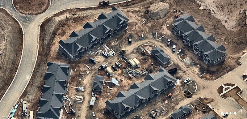
Nearmap’s aerial imagery, captured in Durham three times a year at a 2.8-inch ground sample distance (GSD), solved the problem (the GSD of each individual pixel in the imagery represents 2.8 inches on the ground. See Figure 2).
Figure 2: Rapid growth requires frequent imagery. Above is a new Durham neighborhood under construction. (Photo: Nearmap)
Dozens of projects in the Public Works Department — from road maintenance and pothole patching to water sampling and degradation — are using the improved imagery, which has saved the city money, reduced time spent in the field, and allowed crews to use real-time imagery when they are working in the field.
Monitoring Pavement Conditions. The City of Durham is responsible for maintaining most of its roads, and conducts a road-condition survey that samples different sites, evaluating the level of degradation.
Since 2014, Nearmap has regularly captured Durham streets at the same resolution and accuracy, and both the historical and current data are available to the department. With multiple high-quality image captures at high resolution, surveyors can see sections that have been recently paved. “We don’t need to send crews out to an area where a stretch has already been paved,” Cherry explained.
Road Repair Documentation. As in any city, the patching of potholes is an ongoing project for Durham’s public works department. With imagery, the city has been able to streamline the process.
Traditionally, the streets department sent out inspectors to spray paint and circle areas that required repairs. “Then we would produce maps and hard copies to direct [road repair contractors] ahead of time on a scheduled event,” Cherry said.
Now the city uses an application integrated with Nearmap imagery by which contractors can view the job on their smartphone or tablet while in the field. The surveyors can edit and draw the areas that need patching instead of physically going out and spray-painting them. “Then, in real time, the people doing the patching can see a very high-resolution image of where they need to do the work,” he said.
The pothole image captures are recorded, so the city knows where and how many potholes were patched. “We can see where work has been done when we are billed for it,” Cherry said. “We can visualize the work, which is an added bonus.”
Mapping Riparian Zones. With imagery previously taken only when the leaves had fallen (known as leaf-off), surveys of riparian zones in Durham proved limiting.
With imagery captured during both leaf-off and leaf-on seasons, riparian buffers around streams can be properly monitored for expansion. The buffers can be altered if there are issues with a stream’s path, such as sediment clogging the flow, repeated flooding or people intruding on a buffer.
Change Detection. High-resolution imagery has improved Durham’s billing process by producing web service maps that capture individual storylines. Stormwater billing customers, for instance, can visualize their properties with the impervious areas mapped out and tied to their billing records.
With up-to-date imagery providing data for change detection software, records also show when a customer has added a driveway or an extension to their house.
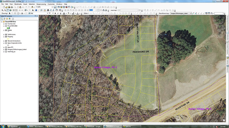
Figure 3: Aerial Imagery of an Apex neighborhood displayed in ArcGIS from Esri. (Image: Nearmap)
“Having access to imagery back to 2014, we’re able to go back in time during the thrust of development and monitor it forward,” Cherry said.
Nearmaps’ library of historical imagery allows for change detection algorithms to run in Esri’s ArcGIS imagery analysis software suite.
More efficient government
GIS data combined with aerial imagery is tailor-made for city planning and managing urban growth.
For instance, the population of Apex, N.C., has more than doubled since 2000. Situated near Raleigh and the state’s Research Triangle Park, Apex was rated number one in Money magazine’s 2015 “Best Places to Live,” which cited Apex’s charming downtown, highly rated schools and high-paying technology jobs.
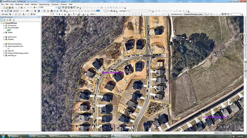
Figure 4: The post-construction image of the same neighborhood is much more accurate. (Image: Nearmap)
To manage the explosion in development, Apex’s GIS professionals needed instant access to current information. The old-school method required planners to drive the streets, inspect roadways, and roll out the measurement wheel. Now, the combination of Esri ArcGIS for mapping and Nearmap high-resolution aerial imagery allows them to visualize and measure within six inches of accuracy.
“Our ability to leverage our GIS operation improved dramatically with Nearmap. The flexibility of its cloud solution and ability to integrate with ArcGIS has redefined how we rapidly respond to staff and citizen requests,” said Steve Nelson, a GIS professional with Apex.
The use cases for these solutions are diverse. Law enforcement calls on GIS professionals from Apex to quickly provide current, clear, aerial photography for active or ongoing investigations. Planners focused on development are charged with meeting state regulatory reporting guidelines when it comes to building and maintaining roads. Environmentalists want to know if anyone is digging on protected land.
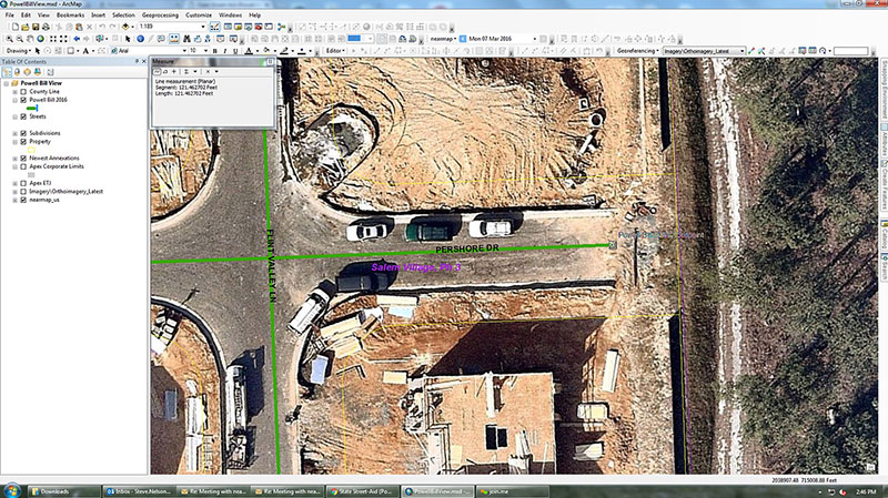
Figure 5: Measuring for reimbursement in Apex. (Image: Nearmap)
For the State Street-Aid Program, financial allocations are made to incorporated municipalities eligible under North Carolina law. State routes that pass through incorporated cities are maintained by the cities. Cities are responsible for paving new roads, but the state has the power and economic means to reimburse them.
To qualify for reimbursement for new roads developed and maintained, Apex needs to submit a report to state engineers for review. The report documents the distance for all newly paved roads.
Before the new system was in place, GIS professionals had access to imagery from 2013, but the actual development took place after this. In (Figure 3), the 2013 imagery simply outlines the parcels and rights of way. It has no detail with respect to where the roads start and end, so a lot of field work was needed to take measurements, drive roads scattered across the county, and collect data.
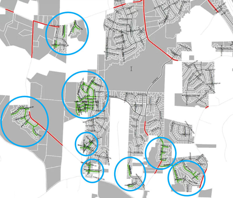
Figure 6: Green lines indicate new streets in Apex in a single year (2013). (Image: Nearmap)
With the new system, workers have instant access from their desktop to the same location as it currently is. They can see exactly where the edge of the road starts and stops (Figures 4 and 5), which is different from the yellow-lined “right of way” depicted in Figure 3. While in the office, GIS professionals can measure distances precisely, creating an accurate representation of ground truth.
Figure 6 highlights a small portion of new roads built in Apex in one year. The green lines highlighted are scattered across the city. As Apex continues to grow and annex adjacent territory, the dynamic nature of the growth will be captured and uploaded to the cloud.
Unlocking Potential
As cities grow in complexity, mapping becomes integral to planning. With the advances aerial imagery provides, cities are starting to unlock the full potential of location data and visualizing a better future.
A roundup of recent products in the GNSS and inertial positioning industry from the August 2019 issue of GPS World magazine.
OEM
GNSS module
Ultra-low-power for wearables
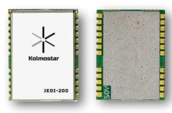
Photo: Kolmostar
The JEDI-200 reduces the energy for one position fix by up to 150x compared to traditional GNSS sensors, providing a positioning solution for location-based internet-of-things applications.JEDI-200 specification highlights include 10-mW ultra-low-power consumption (measured) at 1-Hz navigation rate; 1-second ultra-fast time-to-first-fix from cold start, and 2-meter CEP high positioning accuracy. It supports GPS and BeiDou. It offers 100-byte compressed ephemeris (EPH) to enable A-GPS with speedy download via low-power wide-area network (LPWAN) technologies such as LoRaWAN and narrowband internet of things (NB-IoT). Kolmostar, www.kolmostar.com
Inertial navigation
For GPS-denied environments
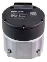
Photo: Emcore
The EMCORE EN-300 precision fiber-optic inertial measurement/navigation unit is a high-accuracy inertial system designed to be form, fit and function compatible with a legacy equivalent, but with better performance needed for GPS-denied navigation, precise targeting and line-of-sight stabilization. The EN-300 incorporates EMCORE’s proprietary integrated optics devices to enhance performance. The internal signal processing provides full stand-alone or aided navigation, and as an option can provide standard IMU delta velocity and delta theta. With the option of full navigation capability including coning and skulling compensation and sophisticated Kalman filtering, the unit also is able to statically find north to less than one degree through gyrocompassing. Emcore, www.emcore.com
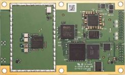
GNSS board
For positioning and heading
Phantom 40. (Photo: Hemisphere GNSS)
The Phantom 40 positioning board is the first Lyra-based offering in a line of low-power, high-precision boards. Its multi-frequency, multi-GNSS receiver processes 700 channels with access to Hemisphere’s Atlas GNSS global corrections network. The 60 x 100 mm module with 24-pin and 16-pin headers is a significant upgrade for existing designs using this industry-standard form factor. The new Lyra II digital ASIC and Aquila wideband RF ASIC designs will be available with the new board, as well as Cygnus interference mitigation technology. Hemisphere GNSS, www.hemispheregnss.com
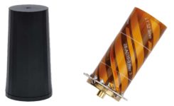
Helical antennas
Available in housed and embedded OEM versions
The new helical antenna in both housed (left) and unhoused form. (Photo: Tallysman)
The first three products of a new range of helical antennas include the HC871, HC872 and HC600. The active GNSS helical antennas feature a low-current, low-noise amplifier (LNA), and include integrated low-loss pre-filters, to protect against harmonic interference from high amplitude interfering signals, such as 700-MHz band LTE and other near in-band cellular signals. The HC871 is a housed, dual-band, active GNSS antenna supporting GPS L1/L2, GLONASS G1/G2, Galileo E1, and BeiDou B1 (25 grams). The HC872 is a housed, dual-band, active GNSS antenna supporting GPS L1/L2, GLONASS G1/G2, Galileo E1, BeiDou B1, and L-Band services (36 grams). The HC600 is a housed, passive Iridium antenna (18 grams). Tallysman, www.tallysman.com
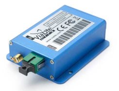
Fiber extension KIT
Carries signals up to 10 kilometers
ViaLiteHD Blue OEM module, one of the available formats for the GPS RF over fiber link. (Photo: VitaLink)
ViaLite’s new GNSS/GPS Fiber Extension Kit has been qualified for use with Microsemi’s timing and synchronization products, and carries timing signals over optical fiber links to 10+ kilometers. The kit includes the ViaLiteHD GPS Link, designed to provide a remote GNSS/GPS signal or derived timing reference to equipment located where there is no reception, such as inside buildings, tunnels and mines. The kit is suitable for GPS, Galileo, GLONASS and BeiDou bands, and the links provide a wide dynamic range with negligible signal degradation from noise or interference. ViaLite, www.vialite.com
SURVEY & MAPPING
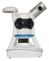
Lidar scanner
3D mobile scanner for urban areas, roads
Photo: Viametris
The second generation of the vMS3D lidar scanner is now more compact and simplified in both electronic and ergonomic terms to make it more robust and stable in adverse conditions and challenging environments. Despite being lighter, the second generation offers the same technological capacities as its predecessor, but is simpler to use and can be mounted on a vehicle in minutes. The system component (including the sensors) and the element to affix the device to the vehicle (the frame) previously formed one unit, but are now separated in a design that limits vibrations and prevents any strain on the mechanics during acquisition. The scanner’s receiver is a Septentrio AsteRx-m2a and its inertial measurement unit is an SBG Systems Ellipse2-D. Viametris, www.viametris.com
Job-site monitoring
Real-time 3D construction management gets remote support
Sitelink 2.0. (Photo: Topcon)
Sitelink 2.0 is the latest edition of Topcon’s real-time 3D job-site monitoring and management system. The update includes a new pay-as-you-go point-based service model, new features to Sitelink Support Desk, and a new Haul Truck application. Remote configuration via the support desk allows Topcon personnel to directly access and configure receiver components on connected machines, while simultaneously retaining an active remote session of Topcon’s 3D-MC grade-control software for machine control. Topcon, www.topconpositioning.com
Data collector
Connected smartphone for the field
Photo: Trimble
The TDC600 handheld is an ultra-rugged, all-in-one smartphone and GNSS data collector for geographic information system (GIS) and field inspection applications. The rugged handheld runs on Android 8.0 and has a bright sunlight-readable 6-inch display, 2.2-GHz processor, 4-GB memory and an enhanced-capacity all-day battery. It supports the Trimble Catalyst GNSS positioning service that delivers subscription-based accuracy on demand for Android devices. Its built-in receiver supports GPS, GLONASS and BeiDou plus satellite-based augmentation system (SBAS) capabilities for real-time positioning. It is rugged for GIS users in organizations such as environmental management, utilities and government agencies. Wi-Fi, Bluetooth 4.1 and 4G LTE cellular connectivity support data and voice calls, so field workers can use the TDC600 as they would any consumer smartphone, communicating between the field and office, sending emails and texting. Trimble, www.trimble.com
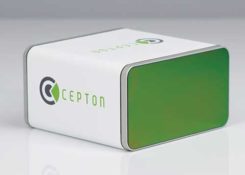
Vehicle scanner
1,200 scan lines per second
Photo: Cepton
The SORA-P60 is designed to provide accurate 3D scans and to enable automated classification of objects and volumetric scanning, including high-velocity vehicle scanning and classification. Cepton’s Micro-Motion Technology (MMT) lidar in combination with its edge-compute hardware SORA-Edge makes it a powerful, mobile object classification and volumetric measurement device that can send its data over Ethernet, Wi-Fi or LTE to a central processing server. The SORA-P60’s three scan lines, each scanning at 400 Hz, enable accurate scanning for classification of objects traveling at highway speeds — 400 Hz translates to a scan line every 5 centimeters for an object traveling at 50 miles per hour. For example, users can measure the size of a tow hitch and trailer on a vehicle traveling on a highway in real time. The SORA-P60 sensor is free of rotational or frictional components, making it impervious to mechanical wear and tear. In addition, the new SORA-P60 features rugged housing designed to withstand harsh environments, cold climates and salt spray. Cepton Technologies, www.cepton.com
UAV
Long-flight demonstrator
Completed maiden flight
Photo: U.S. Defense Department
The XQ-58A Valkyrie from National Security Solutions provider Kratos completed its maiden flight on March 5 at Yuma Proving Grounds in Arizona. Kratos Unmanned Aerial Systems (KUAS) and the Air Force Research Laboratory (AFRL) partnered on the development of the XQ-58A Valkyrie. During its 76-minute maiden flight, the UAV completed its test objectives. The runway-independent UAV is capable of long-range flights at high-subsonic speeds. Its development falls within AFRL’s Low Cost Attritable Aircraft Technology (LCAAT) portfolio, which has the objective to break the escalating cost trajectory of tactically relevant aircraft. Kratos Defense & Security Solutions, www.kratosdefense.com
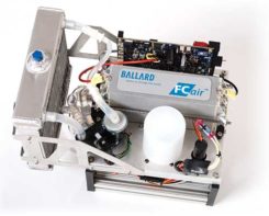
Fuel cells
Long-duration power solution for commercial UAVs
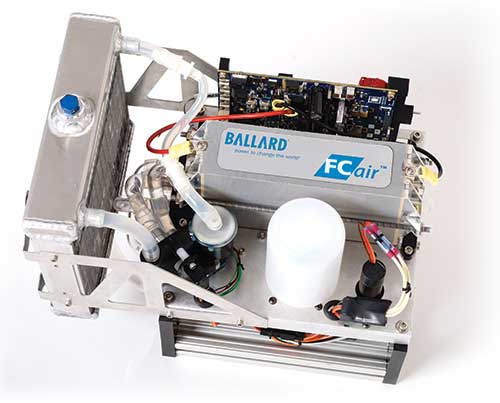
Photo: Ballard
The FCair hydrogen fuel cell can extend UAV flight time to up to 90 minutes, almost three times that of lithium-ion battery-powered drones. The product line includes FCair-600 and FCair-1200 liquid-cooled fuel-cell power systems, with built-in hybrid battery control and charging and delivering 600 and 1200 watts of power, respectively. These systems are in ongoing field trials, having previously been proven in harsh environments and at high altitudes. FCair includes a hydrogen fuel-cell power system, hydrogen storage vessels, pressure regulators, refueling solutions and hydrogen gas supply. The product line supports commercial UAV manufacturers and operators in the delivery of fuel-cell-powered UAV benefits, including: three times the flight duration of batteries; five times the reliability and a fraction of the noise of small internal combustion engines; and significantly reduced operational expenses. Ballard, www.ballard.com
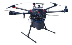
Lidar platform
Compact for uav deployment
Photo: Teledyne
The CL-90 is a lightweight compact lidar platform for UAV deployment. It features exceptional canopy penetration, offering low-noise, high-quality survey-grade data to deliver high-quality performance in data accuracy and point precision. The CL-90 provides full lidar performance across the entire operating altitude range of the UAV, and offers a variable field-of-view capability that eliminates the need for multiple passes over a target. Teledyne, www.teledyne.com
Drone countermeasure
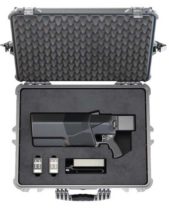
Lightweight, compact handheld gun
Photo: DroneShield
DroneGun MKIII is a portable pistol-shape drone jammer weighing under 2 kg. DroneGun MKIII is designed to be an alternate product rather than a replacement for the previously released DroneGun Tactical unit. It has a shorter effective range of 500 meters versus 1–2 kilometers for DroneGun Tactical. DroneGun MKIII can be used in combination with other DroneShield products, including the RfPatrol body-worn detection device and the DroneSentinel stationary multi-sensor detection system. DroneShield Ltd., www.droneshield.com
The 28th edition of the European Navigation Conference (ENC 2020) will be held May 11-14 at the International Congress Center in Dresden, Germany.
The conference is hosted by the German Institute of Navigation (DGON). Because of the rapid development of analog and digital technologies, there is increasing progress in performance of GNSS.
The conference brings together scientists, engineers and international experts to discuss new ideas, latest research results, future developments and new applications. High-level presentations will allow each participant to receive an in-depth view on the current status of satellite navigation technology. Topics include:
GNSS Updates & Policies
GNSS Algorithms & Techniques
Resilience and Autonomy
Multi-Sensor & Data Fusion
Aviation & Marine Navigation
Space & Science Applications
Mobility and Transportation
Speakers. Keynote speakers will be Julia Klöckner, Federal Minister of Food and Agriculture, and Dr. Pascale Ehrenfreund, German Aerospace Center, chair of the Executive Board.
Expo. A technical exhibition provides an opportunity for companies, agencies and research institutions to display their offerings; it will be directly placed in the conference area.
Abstracts. The European Navigation Conference aims to provide a forum for both academic and industrial professionals in navigation topics from all over the world and to bring together academicians, researchers, engineers, system analysts, graduate and undergraduate students with government and non-government organizations to share and discuss both theoretical and practical knowledge. Experts are invited to submit outstanding and valuable original research papers and participate in the technical exhibition during the conference. The deadline for abstracts is Nov. 1, 2019.
About Dresden. The city of Dresden is located at the river Elbe and has a long and colorful history. Although Dresden is a relatively recent city of Slavic origin, it is well-known as the capital and royal residence for the Electors and Kings of Saxony, who for centuries furnished the city with cultural and artistic splendor. After the reunification process in 1989, Dresden has regained importance as one of the cultural, educational, political and economic centers of Germany and Europe.
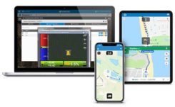
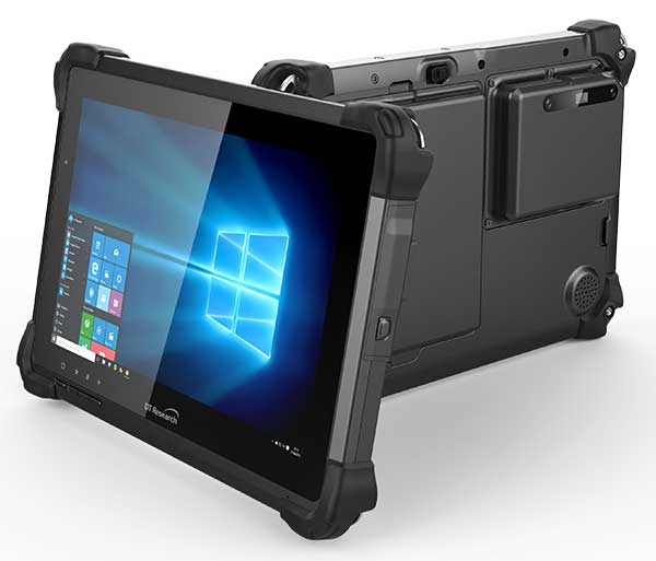
DT Research has designed a new rugged tablet with 3D imaging that is purpose-built for 3D mapping with a built-in GNSS module.
The DT301X has an Intel RealSense Depth camera that provides real-time 3D imaging combined with dual-frequency GNSS module for real-time mapping and positioning. The digital images are better than high-definition standard, and are suitable for construction building information management (BIM) graphics.
The DT301X rugged tablet is compatible with existing applications with Microsoft Windows 10 IoT Enterprise operating systems for flexible integration, and it brings together the advanced workflow for data capture, accurate positioning and data transmitting.
Key features of the DT301X
Highly durable. IP65 and MIL-STD-810G rated tablet in a slim case offers the versatility to be used in the field, office and vehicles.
Indoor/outdoor display. A high brightness 10.1-inch touchscreen offers flexible viewing in a wide range of lighting.
Wi-Fi and Bluetooth. Long-range Bluetooth for 1000-foot range and 4G LTE mobile broadband for the latest in high-speed communications.
High performance. Intel 8th-generation Core i5 or i7 processor offers high-performance while still being energy efficient.
Hot-swappable batteries. With high-capacity 60- or 90-watt hot-swappable batteries, the DT301X keeps working continuously.
In July, Volkswagen AG and Ford Motor Co. provided updates on their development alliance announced in January.
The automakers plan to collaborate on autonomous vehicles, among other programs. Together, they are investing $2.6 billion in Pittsburgh startup Argo AI, which is developing a self-driving technology platform. Ford first invested in Argo two years ago.
The investment includes the resources of VW’s Autonomous Intelligent Driving Group (AID), valued at $1.6 billion. AID will become Argo AI’s European operation.
Volkswagen and Ford hope to achieve a self-driving platform that can be scaled comparatively quickly. Argo AI’s objectives are to
build for scale.
architect the software to be production quality.
have automotive-grade sensors and computers.
fully integrate their product with OEMs and automakers.
A benefit to having the Argo AI system on more vehicles means the AI will obtain data through daily operation, enabling it to grow smarter and better.
Argo AI has successfully tested its driverless vehicles in five U.S. cities: Pittsburgh, Palo Alto, Detroit, Miami and Washington, D.C.
“Seen & Heard” is a monthly feature of GPS World magazine, traveling the world to capture interesting and unusual news stories involving the GNSS/PNT industry.
Photo: Nuro
Hey, R2, Where’s my pizza?
Domino’s pizza will start using Nuro’s R2 unmanned vehicles for delivery in Houston, Texas, later this year. Once customers have opted in, they can track the R2 vehicle via the Domino’s app and will be provided with a unique PIN code to unlock a compartment to get their pizza. Nuro is already at work in Houston delivering goods from dinner to dry cleaning.
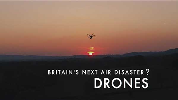
Screenshot: BBC
Drone Attack
A BBC documentary has sent the drone industry into a tizzy. “Britain’s Next Air Disaster? Drones” begins with the December 2018 Gatwick Airport incident when two drones entering airport airspace led to a disruption of operations for three days. Dronemakers dislike the documentary’s thrust that drones are a threat to public safety and a tool for terrorists, while barely mentioning their positive contributions in fields such as search and rescue, plant inspections and agriculture.
Photo: Rawpixel.com/Shutterstock.com
NavIC Rising
The Indian Space Research Organisation is in talks with chipmakers Qualcomm and Broadcom to substitute GPS in Indian mobile phones with its own satellite system (NavIC). The Times of India noted that cellphones hold the biggest commercial potential for NavIC, with more than 650 million mobile users in India. ISRO and the Indian Air Force are also working to equip fighter jets with the navigation system, and commercial vehicles registered after April 1 are mandated to have NavIC trackers.
Photo: Monitum Pty Ltd.
Infrastructure sensors are Mthing
Internet of things (IoT) project Mthing is researching GNSS monitoring sensors to record near-real-time measurements of infrastructure construction. The 18-month project in Brisbane, Australia, aims to develop GNSS IoT sensors that will provide cost-efficient, constant and high-precision monitoring that will connect to cloud services and provide instant alerts. Mthing aims to produce low-cost sensors with broad market potential. The research team includes Queensland University of Technology, survey company Monitum, and the Innovative Manufacturing Cooperative Research Centre.
Image-based positioning has not yet been certified in aviation applications. To cover numerous environmental conditions, the authors installed various optical sensors. They present an approach for fusing image data of two complementary cameras with different spectral ranges.
The use of two image sensors working in the visible light spectrum and infrared spectrum increases availability and accuracy, meeting requirements to be used as an augmentation for state-of-the art GNSS-based landing systems.
This investigation presents real flight data processed by means of the proposed method. This work constitutes a new approach for robust runway detection, since position calculation was only carried out once in one time epoch on a single blended image.
The proposed method was applied to data from two flight campaigns in post-process. A determined set of parameters lead to a sufficient level of availability and a valid runway detection throughout the final approach.
Citation
M. Angermann, S. Wolkow, A. Dekiert, U. Bestmann, P. Hecker (2018), “Linear blend: Data fusion in the image domain for image-based aircraft positioning during landing.” Pacific PNT Conference,www.ion.org/publications/browse.cfm
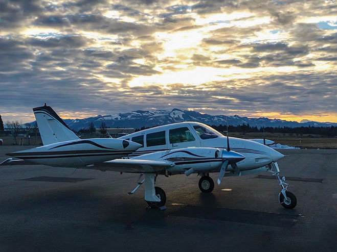
Aircraft navigation during landing approach is mostly supported by ground-based landing systems in commercial aviation, which cause high installation and maintenance costs.
Nevertheless, the final sequence of the flight before touchdown is mostly performed by the pilot manually, because of the high requirements for accuracy and integrity. Only a few landing systems can fulfill these requirements during the last 200 feet above ground.
The current work presents a further development of an optical positioning system to be deployed below 200 feet and on ground after touchdown in order to be used as an additional source for positioning information. The system is capable of visual 3D positioning of the aircraft relative to the runway.
Algorithms for threshold marking (see image below) and centerline detection, as well as lateral position calculation during rollout are presented. The system is evaluated during flight trials performed with the research aircraft Dornier Do 128-6.
Citation
S. Wolkow, M. Angermann, A. Dekiert, U. Bestmann (2018), “Model-based threshold and centerline detection for aircraft positioning during landing approach.” Pacific PNT Conference,www.ion.org/publications/browse.cfm
I was inspired by the 50th anniversary of the Moon landing on July 16 and our focus on mapping this month to look into imagery of the Moon.
Only recently have we learned that the lunar orbiters that photographed the Moon in the 1960s sent back images that were stunningly high resolution (HR), even by today’s standards. The actual resolution was presumably kept secret because the imaging technology was also used in our Cold War spy satellites.
Under the Lunar Orbiter Program, satellites took photographs of the Moon’s surface to identify suitable landing sites for the Apollo Program. Managed by the Langley Research Center, five Lunar Orbiters were successfully flown in 1966 and 1967, mapping 99% of the Moon’s surface with a resolution of 60 meters or better.
The first three missions were dedicated to imaging 20 potential landing sites, and were flown at low-inclination orbits.
The fourth and fifth missions were devoted to broader scientific objectives and were flown in high-altitude polar orbits. Lunar Orbiter 4 photographed the entire nearside and 95% of the farside, and Lunar Orbiter 5 completed the farside coverage and acquired medium (20-meter) and high (2-meter) resolution images of 36 pre-selected areas.
In that pre-digital era, the Lunar Orbiters had an ingenious imaging system, which consisted of a dual-lens camera, a film processing unit, a readout scanner and film-handling apparatus. Both lenses, a 610-mm narrow angle HR lens and an 80-mm wide-angle medium resolution (MR) lens, placed their frame exposures on a single roll of 70-mm film.
The axes of the two cameras were coincident so the area imaged in the HR frames were centered within the MR frame areas.
The film was moved during exposure to compensate for spacecraft velocity, which was estimated by an electric-optical sensor. The film was then processed, scanned, and the images transmitted back to Earth. Based on these images, the NASA Apollo Site Selection Board would name five candidate landing sites in February 1968.
China’s National Reference Station Network. (Image: BeiDou)
A Russian law was approved July 26 that sets forth cooperation between Russia and China on using GLONASS and BeiDou for peaceful purposes.
According to the RosCosmos website, the law was approved at a meeting of the Council of Federation of the Federal Assembly of the Russian Federation. The law is officially named, “On ratification of the agreement between the Government of the Russian Federation and the Government of the People’s Republic of China on cooperation in the use of GLONASS and Beidou global navigation satellite systems for peaceful purposes.”
An intergovernmental agreement was signed on Nov. 7, 2018, in Beijing during the 23rd regular meeting of the heads of government of Russia and China. The agreement creates an institutional and legal framework for cooperation in the development and manufacture of civil navigation equipment using GLONASS and Beidou systems.
It also establishes cooperation in the development of Russian-Chinese standards for the application of navigation technologies using both systems — in particular, standards for the control and management of traffic flows across the Russian-Chinese border. The border is 4,200 kilometers (2,615.5 miles) long — world’s sixth-longest international border.
Under the agreement, the two countries plan to place in their own countries measuring stations for the other country’s GNSS, on a reciprocal basis.
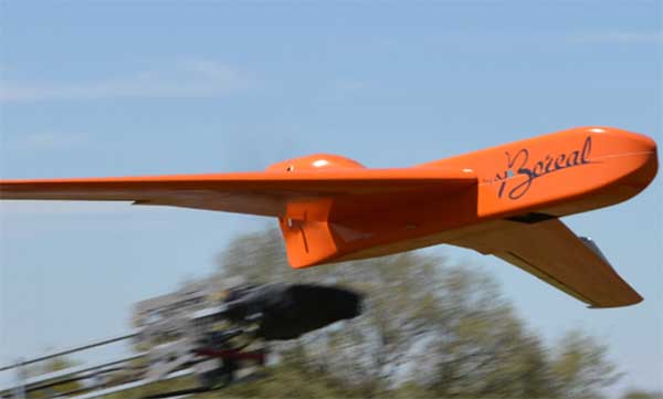
EGNSS improves positioning integrity and accuracy for the Boreal drone. (Photo: GSA)
News from the European GNSS Agency
The Skyopener project, co-financed by the European GNSS Agency (GSA), aims to pave the way toward increased use of remotely piloted aircraft system (RPAS) in civil applications.
The project has tested the benefits of multi-frequency GNSS and EGNOS in RPAS, revealing gains in availability, accuracy and robustness.
There is increasing demand to operate RPAS over long distances because of their potential for a wide range of civil applications. However, regulation regarding RPAS use in civil airspace does not yet allow beyond-visual-line-of-sight (BVLOS) operations, and remotely piloted aircraft are not allowed to fly in non-segregated civil airspace and are not yet widely used for civil and commercial applications.
This is something that Skyopener aims to change.
RPAS for civil applications. The project is developing operational processes that will reduce all categories of risks associated with RPAS and allow an air navigation service provider (ANSP) to manage very-low-level RPAS operations. Thanks to the benefits it offers in terms of improved integrity and positioning accuracy, EGNSS (Galileo and EGNOS) will play a central role in these processes.
Through these operational processes, Skyopener will contribute to the roadmap for the integration of civil RPAS into non-segregated airspace, which will have a huge impact on the service applications that can be offered by these aircraft.
“Systems that enable RPAS to fly safely, in compliance with regulations, will enable market access and significantly reduce the cost of insurance premiums for RPAS operators, making a wide range of RPAS applications more commercially attractive and widely used,” said Marc Pollina, CEO of Skyopener consortium member M3 Systems.
Excellent results. A test conducted by the project into the benefits of multi-frequency GNSS and EGNOS has delivered excellent results. The test found that the use of GPS and Galileo in L1/E1 and L5/E5 multi-frequency combinations provides improved availability, better accuracy and greater robustness against interference, as interference with one frequency band has no effect on the second.
What’s more, EGNOS helps meet increasingly stringent requirements for robust navigation, continuity, accuracy and availability — further complemented by Galileo’s multi-constellation capacity and integration with other sensors such as inertial or vision sensors.
The Boreal drone used in the project is a fixed-wing system that operates over a long range (more than 100 kilometers) in BVLOS, with EGNOS and Galileo enhancing navigation by improving positioning integrity and accuracy. In addition, the RPAS is equipped with a newly developed communication and navigation surveillance (CNS) system that combines use of GNSS, satcom and special security measures.
Essential GNSS. GNSS technologies are essential for RPAS. The primary need is obviously for navigation — the RPAS uses GNSS waypoints to follow the trajectory defined in its mission. However, GNSS also addresses other key needs, such as geofencing to ensure that the RPAS keeps within the mission parameters and surveillance to enable adequate tracking by the operator and civil aviation authority.
GNSS also enables high accuracy and, ultimately, automated landing and the geo-referencing of collected data. These benefits will increase in the future, with the Galileo authentication service reducing the risk of threats, and PPP data correction on E6 providing better geo-referencing.