Author: Tracy Cozzens

  • IdeaForge provides specialized UAVs to Indian market

    IdeaForge provides specialized UAVs to Indian market

    The Ninja UAV. (Photo:: ideaForge)
    The Ninja UAV. (Photo: ideaForge)

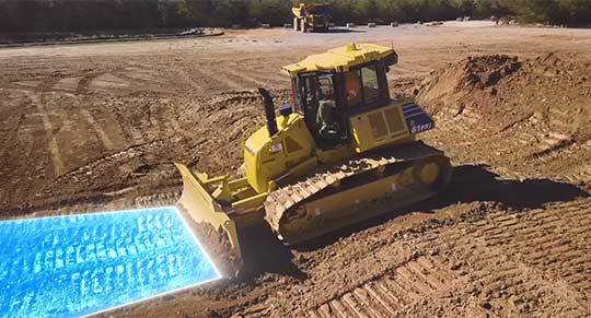
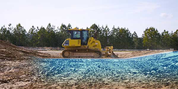
    Lynx–Lawrence & Mayo, an Indian engineering equipment providers, has expanded its portfolio to include specialized drones, through its partnership with ideaForge, India’s largest UAV manufacturer.

    As part of the agreement, ideaForge’s drones equipped with more than a decade of UAV design expertise, will be accessible to Lynx – Lawrence and Mayo for applications across urban development, weather monitoring and testing, agro-technology and other sectors.

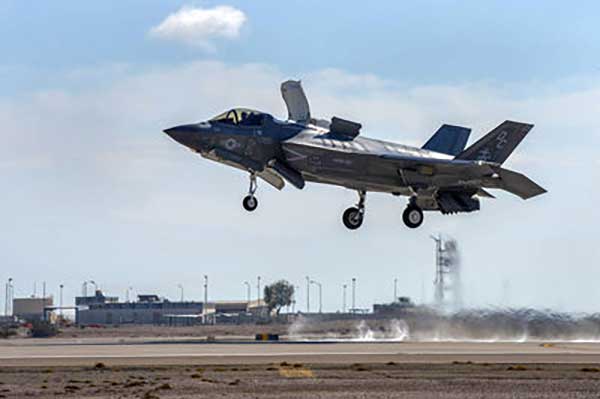
    Developed by a team of Indian Institute of Technology Bombay graduates, ideaForge has been celebrated for its innovations in the unmanned aerial vehicle (UAV) domain. It built a small, light autopilot in 2009 and India’s first autonomous quadcopter UAV. Their designs have led the development of world class, indigenous UAVs for security and surveillance, reconnaissance, mapping, photogrammetry and other industrial applications. Now, their UAVs even come with the capability to meet the DGCA regulations, to ensure NPNT compliance.

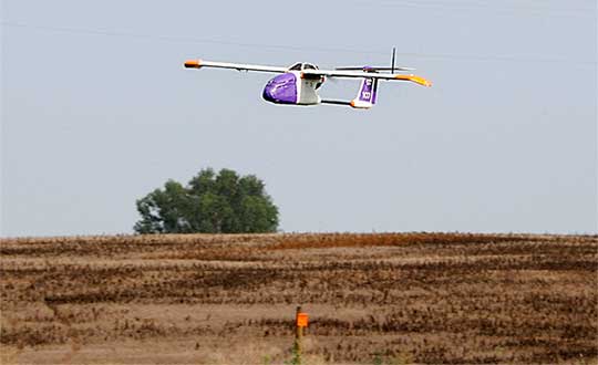
    Through this partnership, Lynx–Lawrence & Mayo will have access to ideaForge’s fleet of UAVs for inspection, surveillance, traffic and crowd management, and disaster management. The fleet includes:

    • Switch UAV – A fixed-wing vertical take-off and landing (VTOL) hybrid for terrain-independent deployment with long range, high endurance and high altitude capabilities.
    • Q-Series UAV – Enterprise specialist VTOL quadcopter built with military design philosophies.
    • Ninja UAV – Lightweight and economical micro UAV built specifically for mapping and advanced surveillance.
    • Netra Pro – Rugged quadcopter for maximum redundancy in extreme conditions.
    • Netra V-Series – Field-proven UAVs for mission-critical applications, integrated with high zoom HD real-time video transmission.

    “We at Lynx have been driving innovation and excellence in advanced precision equipment for engineering and industry. With the addition of innovative UAVs from ideaForge, we are delighted to add a range of advanced and futuristic drones to our portfolio,” said Glenford D’souza , Lynx senior general manager. “We will be strategically deploying these products to create an integrated and specialised service/solution offering to our existing and potential clients. We look forward to a long term and fruitful partnership.”

    IdeaForge has deployed more than 700 systems and has trained more than 1,200 pilots in services including the Indian Army, Navy and Air Force; state police forces; Indian railways; and many more agencies.

    IdeaForge drones have been used in defense and homeland security for border monitoring, anti-terror operations, counter insurgency operations, disaster management, traffic monitoring, campus surveillance, crowd management and more.

    With the flexibility to customize their drones for an array of requirements, ideaForge also provides end-to-end UAV solutions and services to the industrial and commercial sectors.

  • Laser scan data improves response in active shooter simulation

    A security technology firm reduced the time needed for public-safety personnel to engage a simulated active shooter by providing the team with site floorplans created from 3D laser scan data.

    Before the exercise, the firm scanned the entire 112,000-square-foot building interior in just 2.5 hours with the GeoSLAM ZEB-HORIZON 3D mobile scanner.

    “In the role-playing scenario staged at a mega-church, the off-duty police officers reached the shooter in up to 21 percent less time using a 2D floorplan generated from the laser scans,” said Robert W. Myers, CEO of Entropy Group LLC. “However, we expect engagement times to drop considerably by leveraging the 3D scan data to create virtual reality training simulations.”

    Based in San Ramon, Calif., Entropy Group was established to save lives during active shooting incidents at schools and churches by providing law enforcement with the situational awareness information they need to reach perpetrators more quickly inside complex building spaces.

    Handheld mapping. The firm uses the GeoSLAM ZEB-HORIZON handheld mapping device to capture 3D scans of school and church interiors, including small offices, classrooms and closets. The GeoSLAM software generates highly accurate 2D floorplans for use by responders, either hardcopy or digital, to navigate the interior of the building.

    The same data set can also be used to create virtual environments where multiple officers train on computers to respond to attack scenarios in realistic, immersive 3D simulations of actual schools and churches in their jurisdictions.

    “Eventually, we plan to utilize machine learning technology that will allow individual officers of first responder teams to be dispatched to specific locations within the facility in real time to quickly reach shooter engagement locations within the buildings,” Myers said.

    The handheld ZEB-HORIZON laser scanner allows users to map interior and exterior spaces in 3D at walking speed. The lightweight device captures up to 300,000 points per second with an accuracy of 1-3 centimeters up to 100 meters from the user.

    SLAM technology ensures points are tied to local coordinate systems even in interior spaces where GPS/GNSS coverage is poor. Large multi-room buildings that might take days to scan with a stationary scanner can be mapped in a few hours with the ZEB-HORIZON.

    “Mobile laser scanning technology is the fastest and most cost-effective way to create the 2D and 3D building information tools public safety personnel need to prepare for a variety of emergency scenarios,” said Shelley Copsey, GeoSLAM CEO.

    The GeoSLAM Hub software creates a fully integrated data collection and mapping workflow, enabling ZEB-HORIZON users to process, view, merge, edit and output 2D and 3D deliverables within minutes of data capture. Outputs include 2D floorplans, CAD, as well as an integrated workflow for the creation 3D building information models (BIMs).

    Entropy Group is working directly with school districts and places of worship to provide scanning services and develop standardized procedures for the capture of 3D data inside their buildings. These reality capture data sets and derived 2D and 3D products will be provided to local public safety organizations for use in generating hardcopy and digital representations.

  • NavTechGPS offers GNSS and INS courses in New Orleans

    NavtechGPS is offering the following multi-day training sessions on GNSS/GPS technology in New Orleans this December. Both courses will take place at the InterContinental New Orleans Hotel.


    Photo: InterContinental New Orleans Hotel
    Photo: InterContinental New Orleans Hotel

    Dec. 9-12 (4 days)
    Course 346: GPS/GNSS Operations for Engineers and Technical Professionals
    Instructor: Dr. Chris Hegarty, MITRE

    Take this 4-day course to gain a comprehensive understanding of GPS/GNSS system concepts, design and operation, including information on GPS signal processing by the receiver; techniques by which GPS obtains position, velocity and time and a brief introduction to differential GPS (DGPS) and Kalman filtering.


    Dec. 9-13 (5 days)
    Course 557: Inertial Systems, Kalman Filtering and GPS/INS Integration
    Instructors: Dr. Alan Pue, Johns Hopkins, APL; Mr. Michael Vaujin, Aerospace, Navigation & Defense Consultant.

    Expanded to a full five full days based on attendee requests, this course on GPS-aided navigation will thoroughly immerse you in the fundamental concepts and practical implementations of the various types of Kalman filters that optimally fuse GPS receiver measurements with a strapdown inertial navigation solution. The course includes the fundamentals of inertial navigation, inertial instrument technologies, technology surveys and trends, integration architectures, practical Kalman filter design techniques, case studies, and illustrative demonstrations using MATLAB.
    Five fulls days allow for a fuller and detailed development of the design of an aided navigation system, combined with a detailed discussion of the use of lower quality IMUs, and advanced filtering techniques.

    For more information, visit the NavtechGPS website.

  • Komatsu dozing control logic combines GNSS/INS for machine control

    Komatsu dozing control logic combines GNSS/INS for machine control

    Photo: Komatsu
    Photo: Komatsu

    Komatsu America Corp. has introduced Proactive Dozing Control logic, a fully-integrated dozing control system that allows operators to perform auto-stripping, auto-spreading, high production dozing and finish grading.

    Built on the company’s intelligent machine control, the system uses GNSS positioning in conjunction with an inertial measurement unit (IMU) to calculate precise position. The two sensors work together to calculate exactly where the tracks are on the ground.

    The machine control system communicates with the dozer’s hydraulic controllers, engine controllers and the machine controller. Through cylinder sensor technology, the position of the blade is calculated in relationship to the machine body.

    The Proactive Dozing Control logic measures the surrounding ground and determines what has been done on the area being graded, then stores that data and information. When the dozer prepares to go back over that area to cut or work it more, the system understands what it was like from its previous track and, therefore, follows the existing terrain — the very terrain that was just created.

    Proactive Dozing Control logic provides real-time position of the machine on the job site to create a highly accurate elevation for the system to drive the blade to the precise grade needed. Using real-time conditions, the system understands what the terrain around the machine looks like and makes calculated decisions — whether it should cut and carry material, whether it should spread or fill that material, or whether it should be finish grading.

    The new system is available on the Komatsu D51EXi-24, D51PXi-24, D61EXi-24 and D61PXi-24 dozers.

    Photo: Komatsu
    Photo: Komatsu

    “Proactive Dozing Control logic opens up a world of application possibilities for machine control technology,” said Derek Morris, Product Marketing Manager, Intelligent Machine Control and Smart Construction for Komatsu. “Traditionally, GPS machine control focused on finish grade, which meant operators only used the technology approximately 10 to 20% of the time. Proactive Dozing Control logic is a game-changer because the integrated system now lets operators use automation any time, whether for general site clean-up, backfilling trenches and more.”

    “A key differentiator is that our system collects data at the tracks, while aftermarket solutions collect data at the blade,” Morris noted. “Because data is collected at the track, the system provides a real-time picture of the ground around the machine, allowing the system to make calculated decisions based on the current terrain. By collecting data at the track level, we’ve created machine control that is far more advanced, offering an entirely new level of efficiency, whether you’re an operator who has 20 years’ experience or someone new to the job, our Proactive Dozing Control logic provides precision work every time, making operation easier and more productive.”

    With Komatsu’s Proactive Dozing Control logic, operators can use the dozer to its full capacity, leading to increased utilization, better ROI and better production. Owning and operating costs are also lowered because wear and tear on the machine is reduced by automating operation, Komatsu stated in a press release.

    By significantly minimizing track slip during operation, undercarriage wear is reduced, thereby lowering O&O costs, since 50% of the ownership cost of a dozer is the undercarriage.

  • Kansas to fly BVLOS drone with onboard systems only

    Kansas to fly BVLOS drone with onboard systems only

    Kansas receives approval for first beyond-visual-line-of-sight drone flight in the nation using only onboard detect and avoid.

    The Kansas Department of Transportation (KDOT) has received permission to conduct the first beyond-visual-line-of-sight (BVLOS) drone operation in the nation leveraging only onboard detect-and-avoid systems.

    This is the first U.S. Federal Aviation Administration (FAA) authorized operation to fly without a requirement for visual observers or ground-based radar. It is the result of the 31-member Kansas UAS Integration Pilot Program (IPP) team efforts to advance drone technologies.

    In a collaborative effort among Kansas State University Polytechnic Campus (K-State Polytechnic), Westar Energy, Iris Automation and KDOT, the Kansas IPP team will fly a nine-mile track to evaluate technologies to inspect power lines in rural Kansas. This approval is the first of its kind for long line linear infrastructure and is the first step to enable routine commercial infrastructure inspection across the state.

    This is the first unmanned aerial vehicle (UAV) flight to leverage onboard sense and avoid systems alone for collision avoidance. It also marks the first required automated avoidance action.

    Historically, all FAA-issued Part 107 BVLOS waivers have required visual observers or ground-based radar. These mitigations limit the possibility of true BVLOS flights, as they are typically prohibitively expensive and limit operations to pre-defined corridor areas with radar coverage.

    This important milestone is facilitated by Kansas UAS IPP partner Iris Automation’s Casia onboard collision-avoidance system.

    “The UAS industry has worked over 10 years to demonstrate the most significant commercial benefit of drone operations within the United States,” said Bob Brock, KDOT director of aviation. “We are proThe Applied Aviation Research Center on the K-State Polytechnic Campus, which assisted in development of the safety case that ultimately led to FAA approval, will be responsible for the training and flight operations with a cross-functional team from the KDOT IPP. Flights will take place over the next few months, providing the FAA with much-needed data on true BVLOS activity.d of the joint state, university and industry team that made this landmark decision possible.”

    “The ability to fly BVLOS missions without ground-based radar or visual observers is a significant advancement, and Westar Energy views this as an opportunity to play a key role in shaping the future of UAS operations within the utility industry,” said Mike Kelly, Westar Energy Senior UAS coordinator. “Being able to operate under this waiver allows the Kansas IPP team the ability to research and develop truly scalable BVLOS UAS operations for the automated inspection of linear infrastructure.”

    “We look forward to leveraging this waiver to integrate UAS technology into the transmission line inspection process,” said Kurt Carraway, UAS Executive Director of the K-State Polytechnic Applied Aviation Research Center. “We are certain that utilities will be able to quickly realize a return on investment while mitigating safety to their maintenance personnel and increasing the reliability of their infrastructure to the general public.”

    “Flying rural missions like these without a human pilot onboard or costly radar on the ground is exponentially safer and more cost effective,” said Iris Automation CEO and Co-Founder Alexander Harmsen. “The FAA is trusting us to pave the way for a safer, scalable future together with this precedent-setting second approval of our system.”

    The U.S. Department of Transportation selected Kansas Department of Transportation as one of nine participants in the FAA UAS IPP. This program allows state, local and tribal governments to conduct advanced UAS operations to gather data to assist the rulemaking process that will set the boundaries for UAS operations in the United States.


    Feature photo: Kansas UAS IPP

  • Second GPS III satellite tops rocket at launchpad

    Second GPS III satellite tops rocket at launchpad

    The second GPS III satellite — nicknamed Magellan — is now at the launchpad at Cape Canaveral Air Force Station, Florida, in preparation for liftoff on Aug. 22.

    United Launch Alliance tweeted out an image of the encapsulated satellite on its way to the rocket.

    The Lockheed Martin-built satellite was originally scheduled for launch on July 25, but the launch was pushed to Aug. 22 because of “an anomaly during component testing at a supplier that created a cross-over concern. Upon further evaluation, additional time is needed to replace and retest the component on the launch vehicle,” ULA said.


    Launch Updates

    The launch window on Aug. 22 will open at 9 a.m. EDT (1300 UTC) and extend to 9:27 a.m. EDT (1327 UTC), a 27-minute duration. ULA’s live countdown blog begins at 11:45 p.m. EDT (0345 UTC) on Aug. 21. The launch webcast starts at 8:40 a.m. EDT (1240 UTC).

    Those interested can dial the ULA launch hotline at 1-877-852-4321 or join the conversation at www.facebook.com/ulalaunch, twitter.com/ulalaunch and instagram.com/ulalaunch; hashtags #DeltaIV #GPSIIISV02.


    GPS III SV02 will be the 29th and final flight of the Delta IV Medium rocket, the 73rd GPS launch by a ULA or heritage vehicle and marks ULA’s 135th mission.

    GPS III SV02 is named Magellan in honor of the Portuguese explorer who led the first expedition to circumnavigate the Earth.

    The satellite, encapsulated in the 4-meter-diameter composite payload fairing, was moved overnight last week from its processing facility to the seaside launchpad at a top speed never exceeding 5 mph.

    The satellite was hauled by a motorized KAMAG Elevating Platform Transporter (EPT) that provided hydraulic leveling and precision positioning capabilities along the route. The EPT also towed a Portable Environmental Control System (PECS) trailer to supply conditioned air to the payload fairing during the trip.

    Once parked in the hoistway on the backside of the Mobile Service Tower (MST), technicians used the crane system in the gantry the next morning to carefully lift the satellite onto the Delta IV rocket’s second stage to complete a successful vertical integration of the launch vehicle and payload. The fully assembled rocket now stands 207 feet tall.

    A tip-to-tail electrical test of the combined payload and launch vehicle will occur next, an operation known as the Integrated Systems Test (IST). Once that is completed, the comprehensive process to verify flight readiness will begin in parallel to final vehicle closeouts for the launch targeted for Aug. 22 at 9 a.m. EDT (1300 UTC).

    ULA rockets have successfully launched 70 GPS satellites since 1978.

    ULA technicians transport the GPS III satellite to the Delta IV launchpad.( Photo: United Launch Alliance)
    ULA technicians transport the GPS III satellite to the Delta IV launchpad. (Photo: United Launch Alliance)
    The Delta IV rocket leaves the the Horizontal Integration Facility (HIF) aboard a 36-wheel, diesel-powered transporter on May 28 and traveled to Space Launch Complex-37. The trip took 40 minutes. (Photo: ULA)
    The Delta IV rocket leaves the the Horizontal Integration Facility (HIF) aboard a 36-wheel, diesel-powered transporter on May 28 and traveled to Space Launch Complex-37. The trip took 40 minutes. (Photo: ULA)


  • GNSS experts: The GSA wants you for Fundamental Elements

    GNSS experts: The GSA wants you for Fundamental Elements

    Screenshot: EU Science & Innovation video
    Screenshot: EU Science & Innovation video

    The European GNSS Agency (GSA) is looking for experts with a high level of expertise in navigation satellite systems to assist it with tasks related to the implementation of the Fundamental Elements funding mechanism.

    The GSA is interested in experts with professional experience in specific market segments such as aviation, location-based services, agriculture, surveying, rail, road, maritime, and timing and synchronisation and/or with hi-tech business building skills.

    Specifically, the GSA would like to involve business and technical experts with proven experience in one or more of the following areas:

    • E-GNSS signal processing;
    • Development (hardware, software/firmware algorithms etc.) of E-GNSS receivers and antennas;
    • Applications, services and products in the area of E-GNSS;
    • E-GNSS technologies state of the art boosting, particularly E-GNSS differentiators.

    Experts assist in:

    • Evaluation of proposals, prize applications and tenders
    • Monitoring of actions, grant agreements, public procurement contracts

    Experts also provide opinion and advise on preparation, implementation and evaluation of EU programmes and design of policies.

    No deadline, but apply early

    To select experts, the European Union Institutions regularly publish calls for expression of interest detailing the selection criteria, the required expertise, the description of the tasks, their duration and the conditions of remuneration.

    The call for expression of interest is permanently open, so there is no application deadline. However, early application is encouraged because the first experts should be appointed in the third quarter of 2019. Anyone interested can register here.

    Experts who have already registered in the Participant Portal expert database are invited to log-on here to declare their interest in Fundamental Elements assignments and to update their area(s) of expertise.

    For more information and to download the call, click here.

    Fundamental Elements

    Fundamental Elements is an EU R&D funding mechanism supporting the development of EGNSS-enabled chipsets, receivers and antennas. Fundamental Elements projects are part of the overall European GNSS strategy for market uptake, led by the GSA. The objectives of the programme can be summarised as follows:

    • Facilitate the adoption of EGNSS, building on innovative services and differentiators;
    • Improve the competitiveness of EU industry ;
    • Address user needs in priority market segments ;
    • Maximise benefits to European citizens.

    The total budget for projects to be carried out in 2015-2020 is EUR 111.5 million.

  • Garmin launches GNC 355 GPS/comm radio with LPV approaches

    Garmin launches GNC 355 GPS/comm radio with LPV approaches

    The GNC 355 is a GPS navigator with localizer performance with vertical (LPV) approach guidance and a built-in communications radio. (Photo: Garmin)
    The GNC 355 is a GPS navigator with localizer performance with vertical (LPV) approach guidance and a built-in communications radio. (Photo: Garmin)

    Garmin International Inc. has launched the GNC 355 — a GPS navigator with Localizer Performance with Vertical (LPV) approach guidance and built-in communications radio.

    With the GNC 355, pilots can take advantage of the benefits of WAAS/SBAS GPS guidance, while also incorporating a modern comm radio into their existing avionics stack.

    Intended for Class I/II aircraft that weigh 6,000 lbs./2,721 kg. or less, as well as experimental/amateur-built (EAB) aircraft, the GNC 355 Supplemental Type Certification (STC) is imminent and will be available in August for more than 700 aircraft makes/models.

    “Based on the popularity of legacy products like the GX 60 and the GNC 250/300XL, as well as customer excitement for our new GPS 175 and GNX 375, we’re pleased to bring the GNC 355 to market,” said Carl Wolf, Garmin vice president of aviation sales and marketing. “The GNC 355 gives value-minded customers a simple upgrade path to a GPS navigator with a number of capabilities including WAAS/LPV approach guidance, wireless connectivity, a modern Comm radio, and with its standard mark-width form factor, pilots can easily add the GNC 355 without overhauling the panel of their aircraft.”

    Aircraft owners can incorporate the GNC 355 into an existing avionics stack because of its standard 6.25-inch wide by 2-inch tall design. A vibrant, colorful and responsive touchscreen display boasts a familiar Garmin user experience, while a dual concentric knob and home button offer added versatility when interfacing with the touchscreen.

    The user interface has been optimized for the screen size of the display, while also retaining a familiar menu structure similar to other Garmin products. Pilots can quickly access direct-to functionality, moving map, flight plan, nearest, procedures, waypoint and terrain pages, as well as frequency information using the touchscreen, and create customizable data fields and shortcuts for quick, one-touch access to important information.

    Fully WAAS/SBAS IFR-approach-capable, the GNC 355 gives pilots the benefit of flying LPV, as well as Area Navigation (RNAV) approaches. Many approaches offer vertical approach guidance as low as 200-feet above ground level (AGL).

    Pilots can also leverage the touchscreen and moving map to generate customized holding patterns over an existing fix in the navigation database or over a user-defined waypoint and easily insert it into a flight plan. Visual approaches are also available within the GNC 355 and provide lateral and vertical approach guidance in visual flight conditions.

    Two versions, the GNC 355 and GNC 355A, are available with 25 kHz and 8.33 kHz frequency channel spacing respectively. Using the internal frequency database, airport, weather, Air Route Traffic Control Center (ARTCC) and Flight Service Station (FSS) frequencies are easy to find and can be loaded to the standby position by selecting the frequency from the airport information page. Recent, nearby and saved frequencies also offer easy access to frequency information. For example, with built-in standby frequency monitoring, pilots can listen to ATIS while monitoring tower frequency simultaneously. The airport identifier and frequency type are also displayed below the frequency so pilots can communicate with confidence.

    An array of interface options includes the G3X Touch flight display for experimental and certificated aircraft, the G5 electronic flight instrument, the GFC 500 and GFC 600 autopilots, as well as select third-party autopilots. Course deviation and roll steering outputs can also be coupled to the GFC 500/GFC 600 autopilots and select third-party autopilots so procedures such as holds, radius-to-fix (RF) legs and missed approaches may be flown using the autopilot. Aircraft owners can also retain many of their existing flight instruments, audio panels and many legacy CDI/EHSI indicators such as the KI 208/209 products.

    Additional interface options include pairing the GNC 355 with a dual-link Garmin Automatic Dependent Surveillance-Broadcast (ADS-B) solution, such as the GTX 345 or GDL 88. When paired with these products, the GNC 355 is capable of displaying subscription-free Flight Information Service-Broadcast (FIS-B) weather and ADS-B traffic targets, which includes patented TargetTrend and TerminalTraffic.

    Wireless Connext devices running the Garmin Pilot and FltPlan Go applications. Pilots can also use the Flight Stream 510 to access the wireless benefits of Garmin’s Database Concierge, which uploads aviation database information from the Garmin Pilot app to the GNC 355 in minutes.

    The GNC 355 provides a number of additional benefits, including graphical flight plan editing, allowing pilots to more easily edit their flight plan based on an ATC amendment or weather. Features such as FastFind simplify flight plan entry by applying predictive logic to suggest airports and waypoints using current GPS location, while Smart Airspace makes it easier to identify pertinent airspace on the moving map.

    The addition of SafeTaxi airport diagrams displays runways, taxiways, Fixed Based Operators (FBOs), hangars and more relative to the aircraft’s location on the airport surface.

    The GNC 355 and GNC 355A can be purchased through the Garmin Authorized Dealer network at that time starting at a list price of $6,9951 and $7,6951 respectively.

    European Union Aviation Safety Agency (EASA) validation is expected at a later date.

    A free GNC 355 trainer app is also available for download on Apple mobile devices, which allows customers to explore the feature set.

  • Editorial Advisory Board PNT Q&A: How mapping improves PNT tech

    Editorial Advisory Board PNT Q&A: How mapping improves PNT tech

    How have improvements in mapping data-collection advanced other PNT technologies?

    Photo: Nearmap
    Tony Agresta

    “Real-time positioning, navigation and timing (PNT) benefit from high-resolution aerial maps captured and published on a consistent basis. With sub 3-inch aerial photographs streamed through custom applications or instantly accessible solutions, governments and commercial use cases apply these maps for emergency 9-1-1 dispatch, routing guidance, and new information applications to inform citizens.”
    Tony Agresta
    Nearmap


    Ismael Colomina
    Ismael Colomina

    “In principle, PNT shall be based on linear/angular motion sensors. However, since the origins of aerial triangulation down to contemporaneous hybrid multi-sensor systems, mapping and motion sensors have cooperated in PNT tasks. Current visual- and lidar-odometry are brilliant examples thereof.”
    Ismael Colomina
    GeoNumerics


    Members of the EAB

    Tony Agresta
    Nearmap

    Miguel Amor
    Hexagon Positioning Intelligence

    Thibault Bonnevie
    SBG Systems

    Alison Brown
    NAVSYS Corporation

    Ismael Colomina
    GeoNumerics

    Clem Driscoll
    C.J. Driscoll & Associates

    John Fischer
    Orolia

    Ellen Hall
    Spirent Federal Systems

    Jules McNeff
    Overlook Systems Technologies, Inc.

    Terry Moore
    University of Nottingham

    Bradford W. Parkinson
    Stanford Center for Position, Navigation and Time

    Jean-Marie Sleewaegen
    Septentrio

    Michael Swiek
    GPS Alliance

    Julian Thomas
    Racelogic Ltd.

    Greg Turetzky
    Consultant

  • Raytheon M-code receivers certified by U.S. Air Force

    Raytheon M-code receivers certified by U.S. Air Force

    Photo: Raytheon
    Photo: Raytheon

    New technology makes GPS more secure and reliable for military systems.

    Raytheon has received security certification for new GPS modules and receivers from the GPS Directorate at the U.S. Air Force Space and Missile Systems Center.

    The new modules and receivers will give military aircraft, ships, ground vehicles and weapon systems secure and reliable access to modernized GPS.

    “Because GPS is under constant attack, we worked with our government partners to create new M-code modules and receivers that give the military secure and resilient navigation systems,” said Eric Ditmars, vice president of Raytheon’s Secure Sensor Solutions. “And since the tech is platform agnostic, it will work on a wide-range of platforms in the air, on the ground or at sea.”

    Raytheon’s military code common GPS module was certified, along with its ground-based GPS receiver, or GB-GRAM, and the avionics GPS receiver, or GRAM-S/M. GB-GRAM and GRAM S/M are jointly developed with Trimble, while General Dynamics provides cryptographic capabilities for the modules.

    “Operators need a system that is flexible and fast,” said Chad Pillsbury, director of Resilient Navigation at Raytheon Space and Airborne Systems. “We’ve designed these GPS systems with a common security architecture — meaning we can get this capability in the hands of operators faster and eliminate the need for additional security certifications.”

  • Europe chooses Airbus for SMILE space weather satellite

    Europe chooses Airbus for SMILE space weather satellite

    Image: European Space Agency
    Image: European Space Agency

    The European Space Agency has chosen Airbus to build the European component of the SMILE (Solar wind Magnetosphere Ionosphere Link Explorer) satellite.

    SMILE will be the first joint satellite mission between the European Space Agency (ESA) and the Chinese Academy of Sciences (CAS), following on from the success of the Double Star/Tan Ce mission which flew between 2003 and 2008.

    The objective of SMILE is to study and understand space weather. Specifically, it will look at the physics behind continuous interaction between particles in the solar wind and Earth’s magnetosphere, the magnetic shield that protects the existence of life in our planet.

    Space weather can interfere with GNSS signals.

    The mission is now entering a four-year period of manufacturing, testing and integration of the payload module and the platform. In launch configuration, these two components will form a 3.15-meter-high stack.

    The spacecraft will have a mass of 2,200 kg and will travel in a highly elliptical orbit around the Earth. Its perigee will be at a distance of 5,000 km (from where it will download data to the Troll ground station in Antarctica and the CAS ground station in Sanya, China), while the apogee will be as far as 121,000 km (almost one third the distance to the Moon). At this vantage point the satellite will have a prolonged view of the Earth’s northern polar regions, to enable the boundary of the Earth’s magnetic field and the Northern Lights, or aurora borealis, to be imaged.

    Payload in Madrid, platform in Shanghai. The payload module will be built at the Airbus site in Madrid, where the instruments will be integrated. The platform will be built in Shanghai. Both, the payload module and the platform will be integrated and tested at ESA’s European Space Research and Technology Centre facilities by a multinational team.

    The science payload consists of four instruments:

    • The Soft X-ray Imager will obtain unique measurements of the regions where the solar wind impacts the magnetosphere.
    • The Ultra-Violet Imager will study the global distribution of the auroras.
    • The Light Ion Analyser will measure the energetic particles in the solar wind.
    • The Magnetometer will assess changes in the local magnetic field.

    “Today, we are able to predict the weather on Earth; now it’s SMILE’s turn to help us understand space weather around the Earth and who knows? Probably one day, we will have enough data to be able to forecast dangerous solar storms that could disrupt our systems in space and on the ground,” said Fernando Varela, head of Airbus Space Systems in Spain. “We thank the Spanish Administration for their decisive and continued support to scientific missions.”

    Other ESA missions, built by Airbus, such as Cluster that studied the Earth’s magnetosphere, and SOHO that studied the Sun, have already improved understanding of space weather.

    Under the current plans, the spacecraft will be launched by a European Vega-C or Ariane 62 rocket in 2023.

  • Iran jams GPS on ships in Strait of Hormuz

    Iran jams GPS on ships in Strait of Hormuz

    Ships sailing through the Strait of Hormuz and the Persian Gulf have been experiencing GPS interference that U.S. officials suspect is the work of the Iranians, according to CNN.

    The U.S. Department of Transportation’s Maritime Administration issued an advisory on Aug. 7 to ships traveling in the Persian Gulf, Strait of Hormuz, Gulf of Oman, Arabian Sea and Red Sea. Ships have reported GPS interference, bridge-to-bridge communications spoofing and jamming, and other problems.

    Iran’s goal is for ships and aircraft to wander into Iranian waters or airspace, justifying a seizure, a U.S. defense official told CNN. He said Iran has placed GPS jammers on Iran-controlled Abu Musa Island, which lies in the Persian Gulf close to the entrance of the Strait of Hormuz.

    “Heightened military activity and increased political tensions in this region continue to pose serious threats to commercial vessels,” reads the advisory. “Associated with these threats is a potential for miscalculation or misidentification that could lead to aggressive actions. Vessels operating in the Persian Gulf, Strait of Hormuz, and Gulf of Oman may also encounter GPS interference, bridge-to-bridge communications spoofing, and/or other communications jamming with little to no warning.”

    In at least two incidents, vessels reported GPS interference. One vessel reportedly shut off its Automatic Identification System (AIS) before it was seized, complicating response efforts.

    Vessels have also reported spoofed bridge-to-bridge communications from unknown entities falsely claiming to be U.S. or coalition warships.

    Since May 2019, the following maritime incidents have occurred in this region:

    • Six attacks against commercial vessels.
    • Shoot-down of U.S. Navy remotely piloted aircraft over international waters
    • Attempted at-sea interdiction of Isle of Man-flagged M/V British Heritage (oil tanker)
    • Seizure of ex-Panama-flagged M/V Riah (oil tanker)
    • Seizure of U.K.-flagged M/V Stena Impero (oil/chemical tanker)
    • Detention and subsequent release of Liberian-flagged M/V Mesdar (oil tanker).
    Photo: Igor Grochev/Shutterstock.com
    Photo: Igor Grochev/Shutterstock.com