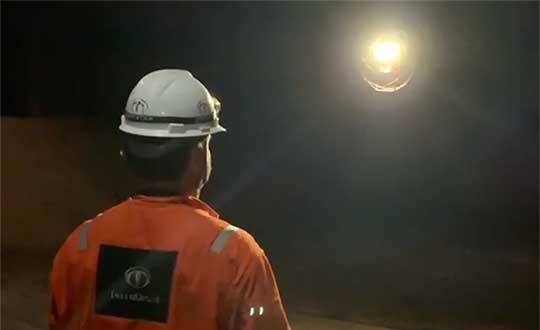
Terra Drone Brazil, a group company of Japan-based Terra Drone Corp., has successfully completed Brazil’s first drone inspection of an offshore FPSO tank. The unmanned FPSO tank inspection was undertaken for Brazil’s state-owned oil company Petrobras.
The ballast tank inspection using drones was conducted aboard P-66, a floating production, storage and offloading (FPSO) unit from Petrobras that is operating in the Pre Salt Area at Santos Basin. An FPSO is a floating vessel used by the offshore oil and gas industry for the production and processing of hydrocarbons, and for the storage of oil.
Petrobras needs its cargo and ballast tanks inspected regularly for maintenance. Any kind of corrosion, cracks, fractures or welding anomalies must be identified quickly before they can damage the structural integrity of the ship.
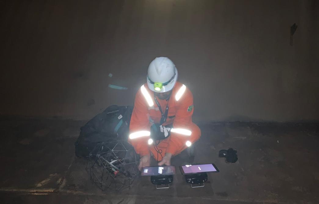
The drones are prepped for the tank inspection. The UAV inspection just over an hour. (Photo: Terra Drone)
Traditionally, this inspection is done by sending a team of up to four men inside the confined tank space using scaffolds or rope access. This kind of close-up visual inspection of one tank alone can take from half a day to a full day, and pose a safety threat to the workers inside the tank.
Using drones reduces the need for workers to enter the tank. “Not only is unmanned FPSO tank inspection safer, but it is also much quicker and more precise than manual inspection,” said Marcelo Belleti, executive director at Terra Drone Brazil. “Further, drone inspections for cargo tanks can lead to potential cost-savings as well.”
Terra Drone Brazil completed the inspection of a ballast tank for Petrobras in little over an hour with a team of only two men. The high-definition pictures and videos captured by the drone ensured a quality deliverable report for all 40 points pre-defined for the close-up inspection.
Terra Drone Brazil is certified by ABS (American Bureau of Shipping), DNV GL (Det Norske Veritas and Germanisher Lloyds) and Loyd’s Register as a service supplier approved for surveying using Remote Inspection Techniques (drones) as an alternative means for a close-up survey of the structure of ships and mobile offshore units. The Petrobras P-66 is ABS-certified.
Data from Earth Monitor reveals the number of cars and trucks in an area of Amsterdam. (Image: Airbus)
The new Earth Monitor tool draws from the Airbus imagery archive and satellite tasking capabilities to provide advanced geospatial analysis, trends and detection maps.
Available as part of Airbus’s OneAtlas suite of geospatial tools, Earth Monitor enables customers to draw precise, timely and meaningful conclusions. It uses Orbital Insight’s machine learning and computer vision expertise through algorithms that detect changes in infrastructure and land use in near-real time. It can identify and count objects such as cars, trucks, roads, homes, buildings and construction sites and, soon, aircraft.
Earth Monitor can identify trends, spot patterns and track economic activity, delivering advanced geospatial analysis and change-detection maps on customized areas of interest to users in defense, intelligence and law enforcement.
Earth Monitor comes from a collaboration between Airbus Defense and Space, a French aerospace company, and Orbital Insight, a Silicon Valley startup. The OneAtlas platform combines Airbus’ constellation and tasking services with Orbital Insights’ analytic capabilities.
Orbital Insight’s algorithms draw on petabytes of data from multiple sources, such as satellite and synthetic aperture radar imagery, geolocation intelligence and vessel traffic data.
The tool’s interface enables users to create and manage projects, customize analyses and define period and measurement frequencies.
A roundup of recent products in the GNSS and inertial positioning industry from the July 2019 issue of GPS World magazine.
OEM
Inertial sensors
Sensor fusion with GNSS receiver
Photo: xsens
The MTi 600-series of inertial sensors comes in a 31.5 x 28.0 x 13.0 millimeter IP51-rated case. It produces roll and pitch readings accurate to ±0.2 degrees. GNSS-assisted heading (yaw) measurements are accurate to ±1.0°. Xsens’ sensor fusion algorithms optimize output from new accelerometer, gyroscope and magnetometer components. It also has a CAN bus interface. The MTi 600-series modules are the first from Xsens to include an NMEA-compatible interface for GNSS receivers. Users can choose any GNSS receiver chip, module or system to work alongside the MTi-670, a GNSS/INS device that supplements the pitch, roll and yaw outputs available from other MTi 600-series products with global positioning information. Xsens, www.xsens.com
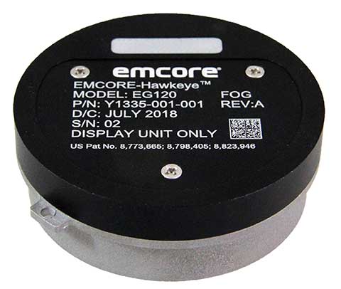
Fiber-optic gyroscope
For medium accuracy platforms
Photo: Emcore
The Emcore-Hawkeye series EG-120 FOG module is an ultra-compact, state-of-the-art design that is a small, affordable closed-loop FOG. The EG-120 delivers advantageous size, weight and power (SWaP) and is 35% smaller than Emcore’s previous generation FOGs. The Emcore-Hawkeye EG-120 incorporates advanced, next-generation field programmable gate array (FPGA) electronics that deliver increased performance and reliability combined with low cost. The Emcore-Hawkeye series features performance specifications for medium accuracy platform stabilization applications such as camera systems used in aircraft, unmanned aerial vehicles (UAVs) and gun stabilization systems. A wide variety of other guidance, navigation and aeronautics applications are supported. Emcore, www.emcore.com
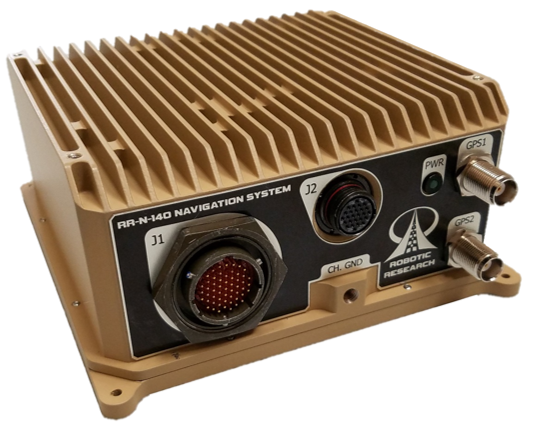
Navigation system
Customizable for ground vehicles of all sizes
Photo: Robotic Research
The RR-N-140 navigation system provides accurate, absolute and relative 3D localization information for ground vehicles of all sizes. It features dual-antenna GNSS for zero-speed heading detection and redundancy. The device delivers exceptional localization performance in GPS-denied or compromised areas. It is designed specifically for use on unmanned ground vehicles and is customizable to incorporate a wide variety of sensor inputs into the navigation solution. Robotic Research, www.roboticresearch.com
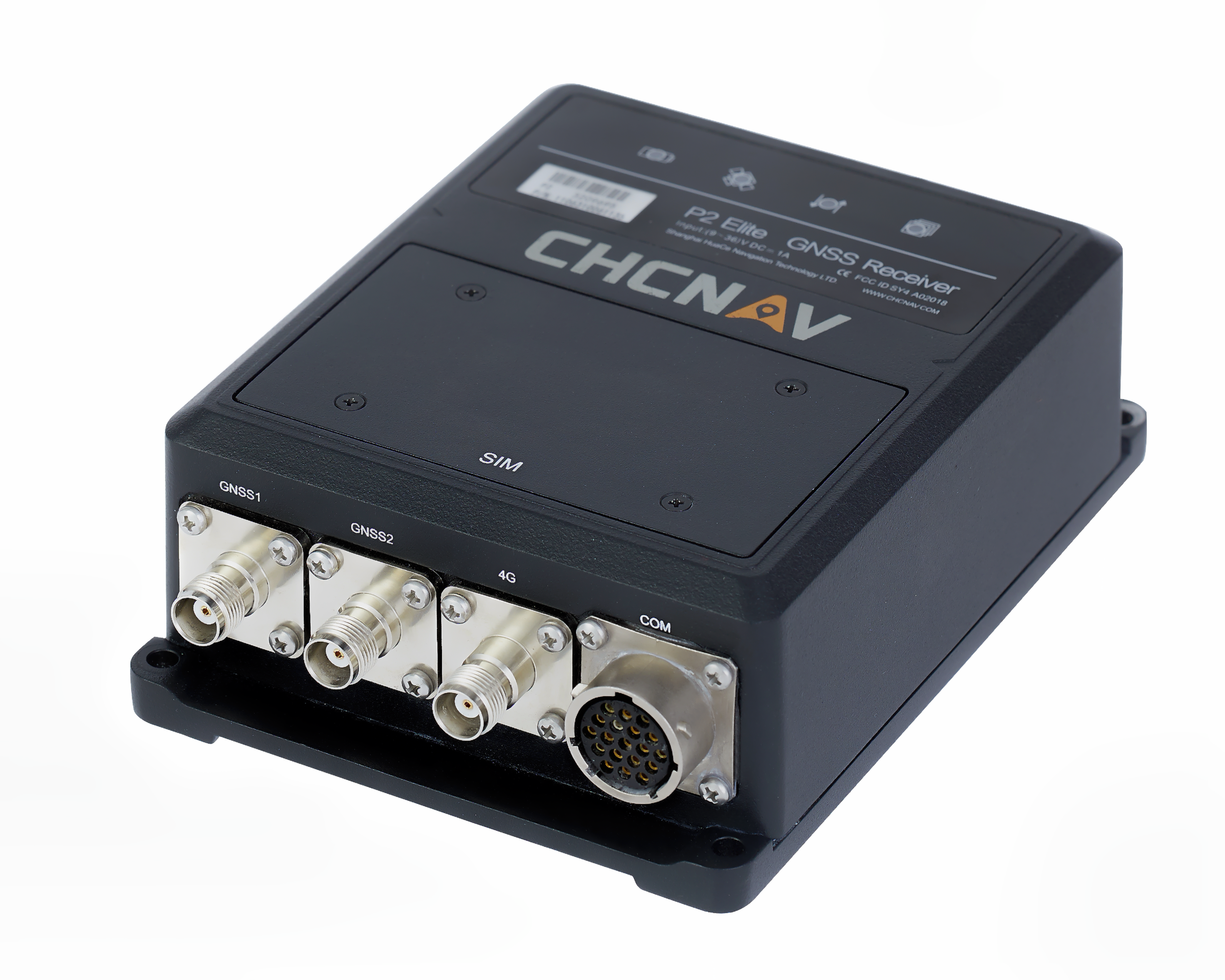
GNSS sensors
Combines numerous interfaces to speed system integration
The P2 Elite GNSS sensor. (Photo: CHC Navigation)
CHC Navigation’s new P2 GNSS sensor series provides high-accuracy positioning and heading in a compact, rugged enclosure. The series is suitable for a wide variety of applications such as reference stations, marine systems, unmanned navigation, industrial automation, robotics and machine control. The P2 GNSS series is designed to significantly reduce system integration efforts by combining numerous connectivity interfaces including RS232, low-latency PPS output, Ethernet, CAN bus protocol and a comprehensive web interface for configuration set-up. The series integrates the latest GNSS technology in a rugged IP67 and lightweight enclosure. It delivers reliable, uninterrupted, high-accuracy, real-time positioning and heading measurements. The P2 GNSS sensor offers cost-effective and powerful real-time kinematic (RTK) positioning. The P2 Pro GNSS adds a dual-antenna input for precise heading data. The P2 Elite integrates additional 4G and UHF modems to provide a powerful, all-in-one GNSS sensor. CHC Navigation, www.chcnav.com
TRANSPORTATION
Correction stream
Data enables precision positioning
RTX Auto is a GNSS software library for use in safety-critical automotive applications. The RTX Auto library can be integrated with any GNSS device and enables the decoding of Trimble’s RTX correction stream for centimeter-level absolute positioning accuracy. It works with other on-vehicle sensors to deliver a certified positioning solution that satisfies advanced driver assistance systems (ADAS) and autonomous driving requirements. It provides RTX-based absolute positioning for General Motors’ Super Cruise, a hands-free driving system for the freeway. After 2020, Super Cruise will will be available on all General Motors brands. Trimble, trimble.com
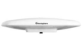
Smart antenna
Atlas-capable for marine markets
Photo: Hemisphere GNSS
The Vector V200 single-frequency, multi-GNSS smart antenna with integrated Atlas L-band is designed for general marine applications and markets. Powered by Hemisphere’s Crescent Vector technology, the V200 multi-GNSS compass system utilizes GPS, GLONASS, BeiDou, Galileo and QZSS (with future firmware upgrade and activation) for simultaneous satellite tracking to offer heading, position, heave, pitch and roll output. With support for NMEA 0183 and NMEA 2000, the V200 provides accurate position and heading information to autopilots, chart plotters and other general marine navigation applications. Hemisphere GNSS, www.hemispheregnss.com
Driver safety solution
Security for intelligent driving
The Proactive Security Solution for Intelligent Driving will enhance safety by supporting ADAS and driver monitoring systems (DMS). It integrates Quectel multi-mode LTE Cat 6 smart modules SC600Y/SC600T and an artificial intelligence (AI) algorithm from a third party to realize ADAS and DMS capabilities including monitoring irregular driving behaviors, conducting precise detection of vehicles and traffic signs, sending warnings of potential risks and more. For ADAS, it can precisely identify and locate vehicles, pedestrians, lanes and traffic signs and will send alerts to drivers if an imminent collision or an unintended lane departure is detected. The DMS supports facial recognition and detection, and is able to monitor driver attentiveness and measure eye blinks as well as head movements so that drivers will receive warnings of distractions, smoking, yawning or looking around. Quectel Wireless Solutions, www.quectel.com
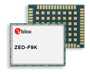
Automotive module
Aimed at urban lane accuracy
The ZED-F9K module is designed to keep cars in their lanes. (Photo: u-blox)
The ZED-F9K GNSS and dead-reckoning module brings continuous lane-accurate positioning to challenging urban environments. Building on the F9 platform, the module offers both high-precision multi-band GNSS and inertial sensors. It combines the latest generation of GNSS receiver technology, signal processing algorithms and correction services to deliver down to decimeter-level accuracy within seconds. The real-time kinematic (RTK) receiver module receives GNSS signals from all orbiting constellations. The inertial sensors constantly monitor changes in the moving vehicle’s trajectory and continue to deliver lane-accurate positioning when satellite signals are obstructed, such as in parking garages, tunnels, urban canyons or forested areas. The module’s accuracy and low latency make it suitable for automotive OEMs and Tier 1 automakers developing V2X (vehicle-to-everything) communication systems. By continuously sharing their location, V2X systems help increase overall road safety and reduce congestion. u-blox, www.u-blox.com
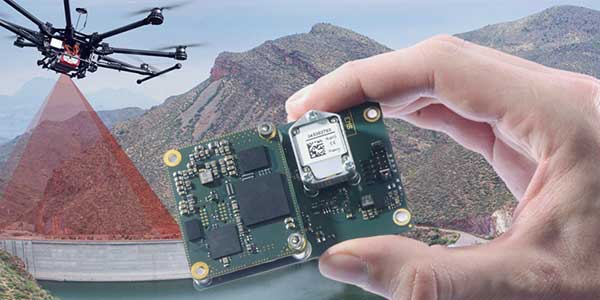
The Quanta UAV series is a line of inertial navigation systems (INS) dedicated to UAV-based surveying integrators. The small, lightweight and low-power INS is offered with two levels of accuracy. Quanta UAV and Quanta UAV Extra have been developed for compact lidar to high-end beyond-visual-line-of-site (BVLOS) mapping solutions. They provide precise orientation and centimeter-level position data both in real time and in post processing, eliminating the need for ground control points and reducing the need for overlaps. SBG’s post-processing software Qinertia gives access to offline real-time kinematic (RTK) corrections from more than 7,000 base stations in 164 countries. SBG Systems, www.sbg-systems.com
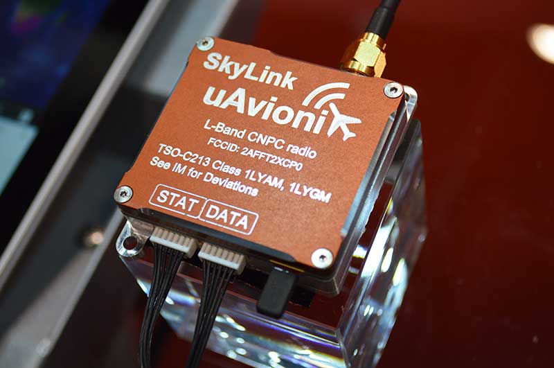
CNPC radio prototype
Being tested as command and non-payload control UAS radio
Photo: Allison Barwacz
SkyLink is an L-band frequency-modulated CNPC radio intended for point-to-point or networked BVLOS UAS operations. uAvionix has focused on minimizing size, weight, and power consumption (SWaP) while maximizing range and spectrum efficiency. The current 50-gram 10-Watt prototype is testing successfully at ranges exceeding 40 miles at low altitude. uAvionix is testing under an experimental transmit license and approval from the Federal Communications Commission and Federal Aviation Administration, respectively. uAvionix, uavionix.com
Thermal drone
Designed for solar farm inspections
The senseFly Solar 360 UAV is designed to enable the automated and efficient inspection of solar farms. Created in collaboration with software company Raptor Maps, the efficient thermal drone solution enables the automatic assessment of solar plant performance at a sub-module level. Created by combining eBee X fixed-wing drone technology, senseFly’s Duet T thermal mapping camera and Raptor Maps software, senseFly Solar 360 is a fast and fully automated drone. It can be integrated into solar management workflows without requiring either drone piloting skills or the manual analysis of aerial solar-farm data. Solar-farm inspection can be reduced from days to hours, with inspection of utility-scale solar farms completed more quickly, easily and accurately. SenseFly, www.sensefly.com Raptor Maps, raptormaps.com
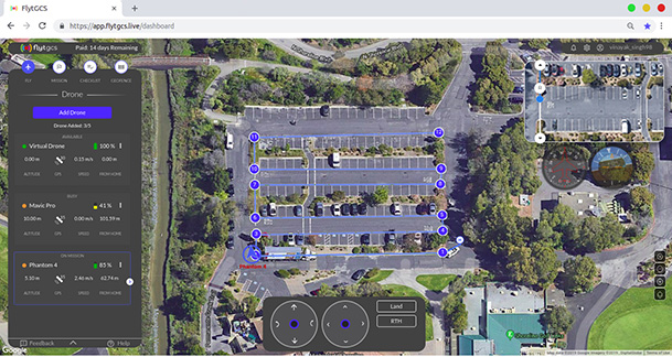
Remote operations
Cloud-based, enables BVLOS
Photo: FlytBase
FlytGCS is built for subject-matter experts, drone operations managers and UAV operators who wish to automate, simplify and scale their missions. To support automated BVLOS missions, FlytGCS offers features such as connectivity and control over 4G/LTE/5G, live high-definition video feed, fleet management, unlimited missions, remote gimbal control, pre-flight checklist and geofence, mission planner and cockpit view from a web dashboard. FlytGCS is a hardware-agnostic solution that helps securely deploy drones using a mobile app (for DJI drones) or onboard single-board computers (for Ardupilot and PX4 drones). FlytBase, flytgcs.live
Inspection drone
Collects data in dangerous areas
The Elios 2 is a collision-tolerant drone for indoor inspections. (Photo: Flyability)
The Elios 2 UAS is designed for inspection tasks. Routine inspection jobs indoors, underground and around complex pipework become quicker, safer and are fully documented by high-resolution video and stills. The Elios 2 includes a rotatable thermal and high-definition visual camera payload, 10,000-lumen oblique lighting system, and reversible rotors that enable the UAV to back out of tricky situations. The drone’s geodesic-like cage makes it collision-tolerant and enables flight in restricted areas such as refinery enclosures, mines, vats, cargo holds and nuclear containment vessels. Flyability, www.flyability.com
SURVEY
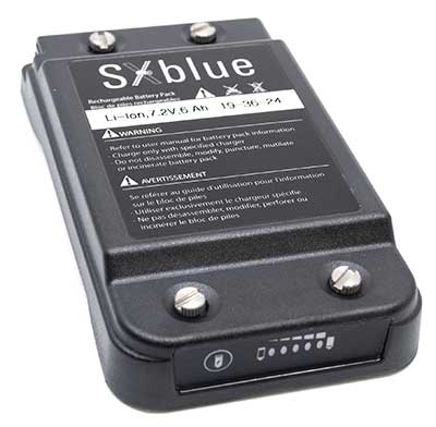
Battery upgrade
Long-life battery for extended fieldwork
Photo: Geneq
SXblue receivers now have an extended-life battery equipped with 4 Li-ion rechargeable cells that boost its capacity from 3900 mAh to 6000 mAh. When fully charged, the battery can last up to 16 hours depending on the SXblue model and Bluetooth connectivity — an up to 50% increase. The colored LEDs for the battery charge indicator have been enhanced for a better contrast. With only a 6-mm increase in thickness and the same weight as previous models, the user will not notice any change in handiness and ergonomics. The new battery is compatible with all past SXblue II and III models and current iSXblue II+ GPS, SXblue II+ GPS, iSXblue II+ GNSS, SXblue II+ GNSS and SXblue Platinum. Geneq, geneq.com
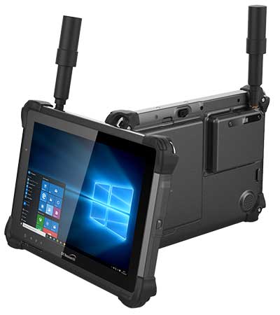
Fieldwork tablet
Captures detailed images
DT301X-TR rugged tablet. (Photo: DT Research)
The DT301X-TR rugged tablet includes an Intel RealSense 3D camera. The lightweight military-grade tablet is built to enhance precision for bridge and construction inspections, 3D surveying and mapping of underground utilities. It provides multi-frequency GNSS real-time kinematic (RTK) with carrier phase for mapping and positioning, and supports GPS, GLONASS, BeiDou, Galileo and QZSS. An optional foldable antenna supports high-accuracy field work, which can be measured with RTK GNSS positioning directly or used to connect to an external antenna for higher precision. DT Research, www.dtresearch.com
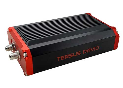
GNSS Receiver
Dual-antenna receiver with heading
Photo: Tersus GNSS
The David Plus dual-antenna GNSS receiver offers centimeter-accurate positioning and heading for intelligent transportation, construction, machine control, precision agriculture and navigation. Designed for efficient and rapid integration, the compact, lightweight receiver tracks GPS, GLONASS and BeiDou signals: GPS L1/L2, GLONASS L1/L2, BeiDou B1/B2 from the primary antenna, and GPS L1/GLONASS L1 or GPS L1/BeiDou B1 from the secondary antenna. The modular and flexible design can provide robust positioning and heading accuracy in a compact footprint for UAVs and other smaller autonomous projects. Tersus GNSS, www.tersus-gnss.com
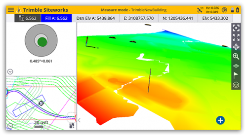
Tilt compensation
Android and Windows compatible
Screenshot: Trimble
Siteworks Software version 1.1 features GNSS tilt-compensation functionality and support for the Android operating system, meaning field workers can use smartphones or tablets. Contractors can run Siteworks on either Windows 10 or Android. Using Trimble Siteworks and a Trimble SPS986 GNSS smart antenna, construction surveyors can take measurements faster and perform more efficient stakeouts. It is designed to shield magnetic interference and can be used effectively anywhere on a construction site. Construction surveyors can capture accurate points without leveling the pole. Three modes support tilt compensation, so contractors can record accurate points while standing, walking or driving the site in a vehicle. Trimble, www.trimble.com
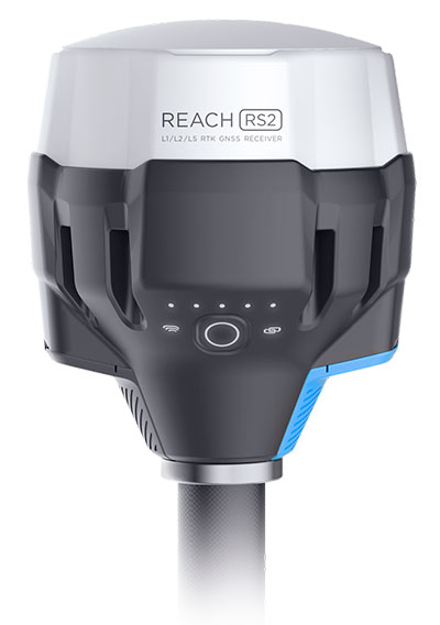
RTK receiver
Multi-band centimeter-accuracy
Photo: Emlid
The Reach RS2 is a multi-band GNSS receiver that features a built-in LoRa radio, a 3.5G modem, and a survey app for iOS and Android. The receiver determines a fixed solution in seconds and provides positional accuracy down to several millimeters. It tracks GPS/QZSS (L1, L2), GLONASS (L1, L2), BeiDou (B1, B2), Galileo (E1, E5) and SBAS (L1C/A), and reliably works in RTK mode on distances up to 60 kilometers and 100 kilometers in PPK mode. A multi-feed antenna with multipath rejection offers robust performance even in challenging conditions. RINEX raw data logs are compatible with OPUS, CSRS-PPP, AUSPOS and other PPP services so users can now get centimeter-precise results. Emlid, emlid.com
Mapping
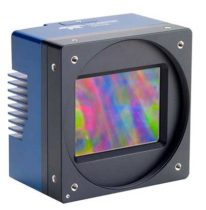
High-speed camera
High resolution for aerial imaging
Photo: Teledyne
The Falcon 4 is a 86-megapixel ultra-high resolution and high-speed complementary metal oxide semiconductor (CMOS) camera. It offers capabilities for large-area, high-resolution, high-speed imaging. With 86 megapixels at 16 frames per second and a global shutter, the camera offers capabilities for large-area, high-resolution, high-speed imaging. Available in both color and monochrome models, the camera is sensitive into the near-infrared spectrum. The Falcon4’s high resolution and throughput serve a
variety of challenging applications including aerial imaging, reconnaissance, security and surveillance, 3D metrology and flat panel display inspection.
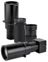
Three new high-performance lenses are designed for high-altitude aerial photography and long-range aerial and ground inspection applications. The 300mm AF, 180mm, and 150mm MK II lenses are designed to enhance the performance and flexibility of Phase One Industrial’s iXM-RS and iXM aerial camera series. Each offers precision imagery, taking advantage of the cameras’ ultra-high resolution backside-illuminated CMOS sensors, to maintain a smaller ground sample distance while flying at higher altitudes.
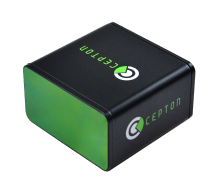
The SORA-P60L, part of Cepton’s SORA family of lidar scanners, is purpose-built to deliver long-range, high-resolution imaging for UAVs. It offers a 400-Hz frame rate, enabling drones to fly faster while maintaining high point-cloud density. With a 550-gram payload, the SORA-P60L prolongs UAV flight time allowing more ground to be covered in a single trip. Cepton’s Micro-Motion Technology faces all lasers downward at all times, providing a dense, uniform point cloud that, in combination with the high scan rate, makes it suitable for fixed-wing and fast-moving rotary-wing UAVs.
The WASP-200 LRF rangefinder is designed to measure ranges with accuracy and precision. It can be used for precision agriculture applications and as a proximity-to-ground sensor on board small or large unmanned aerial vehicles. It has 1-centimeter resolution and 10-centimeter accuracy, and is compatible with the Collins Aerospace Piccolo (CAN Bus and RS-232) and Pixhawk drivers. The WASP series of rangefinders also feature single-shot laser ranging for fast scanning and moving platforms; programmable burst mode averaging; and an IP-67 option. The rangefinders are suitable for robotics and UAVs, sense and avoid, industrial automation, height and distance measurements, and maritime operations.
The Leica BLK2GO is a small, portable, integrated handheld imaging scanner that offers mobility for scanning complex indoor environments. It combines visualization, lidar and edge-computing technologies to scan in 3D while in motion, allowing users to be more agile and efficient in capturing objects and spaces. Its dual-axis lidar scans up to 700,000 points per second. The handle contains WLAN connectivity, a rechargeable 45-minute battery, data storage for six hours of scans, a USB-C port for fast data transfer, and edge computing. The BLK2GO has a wide range of applications from adaptive reuse projects in the architecture and design industries to location scouting, pre-visualization, and VFX workflows for media and entertainment.
By Daniel S. Maier, Thomas Kraus, Daniela E. Sánchez, Ronny Blum and Thomas Pany, Universität der Bundeswehr München
This research paper presents an update of the authors’ real-time real-world testbed for new GNSS signals. It includes experience gained in setting up an airborne pseudolite, UAVlite, to analyze the code- and phase-ranging performance and to test navigation message authentication schemes.
UAVlites transmit GNSS-like signals free from any local transmitter multipath, in contrast to ground-based transmitters. A software-defined radio allows easy broadcast of new navigation signals, which can be tested in real environments.
Purpose. To improve GNSS signals, it is important to test and analyze signal performance under various conditions and harsh environments. This is done mainly with computer simulation. However, a simulation always relies on assumptions and simplifications of a real-world problem.
Therefore, the authors are developing a flexible, cost-efficient and highly adjustable test system, usable for real test scenarios. With this system, researchers can investigate GNSS signal structures, range performance, authentication methods, channel coding and signal behavior under foliage, blockage, jamming, spoofing and other interferences.
Testbed Setup. Key elements include a UAVlite, two ground stations and a composite binary offset carrier signal. The system has demonstrated decimeter code-range accuracy and millimeter phase-range accuracy. Performance of a Galileo Open Service Navigation Message Authentication implementation was also analyzed.
The testbed has potential in the field of signal analysis and optimization, especially in multipath, channel coding, authentication or robustness against jamming, spoofing or other interference for existing GNSS signals, and for developing potential new GNSS signals.
“Seen & Heard” is a monthly feature of GPS World magazine, traveling the world to capture interesting and unusual news stories involving the GNSS/PNT industry.
Tethered drone
Spanish police used a tethered drone system for traffic monitoring, crowd control and surveillance of the UEFA Champions League Final, played June 1 at the Wanda Metropolitano stadium in Madrid. An Elistair tethered U06 Plus drone oversaw 67,000 fans in the stadium and 200,000 in nearby streets. Use of the drone was in response to a heightened terrorist threat level in Spain, making it part of the largest security operation for any sporting event in the Spanish capital. Continuously supplied with power, the drone maintained its position at 50 meters high for 8 hours.
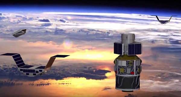
CYGNSS satellite launch. (Artist’s concept/NASA)
Tricky Signals
NASA’s eight CYGNSS (Cyclone Global Navigation Satellite System) microsatellites collect radio signals from GPS beacons to characterize hurricanes. A month after launch in December 2016, the CYGNSS team noticed the signals were wavering when the U.S. began to boost the radio power on 10 GPS satellites as they passed over northern Syria. The swings don’t interfere with other scientific uses of GPS, but for CYGNSS the measurements of high winds varied by 5 meters a second or more — the difference between a category-2 and category-3 hurricane. After two years of work, the CYGNSS team has compensated by repurposing a secondary antenna on the satellites to measure GPS signal strength.
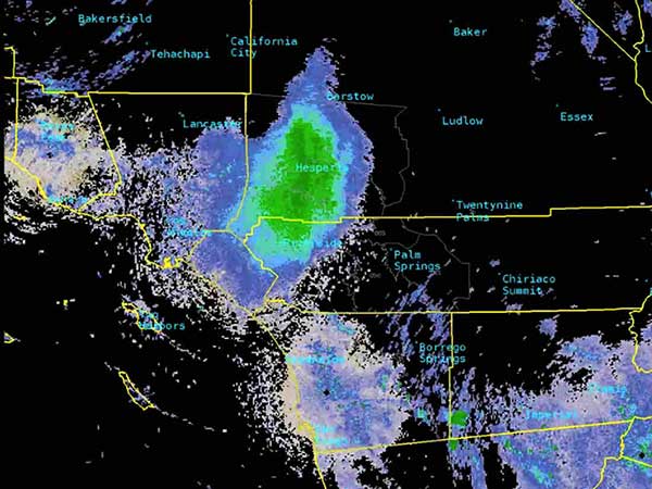
The ladybug blob tracked by Doppler radar. (Image: National Weather Service)
Ladybug, ladybug, fly away home
In this case, California. In June, a millions-strong swarm of ladybugs showed up on radar as a weather event when the insects took to the sky to hunt for aphids. One explanation for the unusual swarm is that a large population of ladybugs had been spread out in a mountainous area, and rising temperatures triggered their mass migration to valleys where they might find an abundance of aphids to eat.
New Zealand joins Aussies on SBAS
Land Information New Zealand (LINZ) will work with Australian counterpart Geoscience Australia to investigate ways to deliver a regional satellite-based augmentation system (SBAS) to significantly improve GPS accuracy. The proposed SBAS will support emergency helicopter crews, providing pilots with accurate vertical guidance for landing, enabling them to reach people faster in difficult terrain and bad weather. The SBAS will also improve the safety of self-driving cars. The new system will improve accuracy to less than a meter, and in some devices to 10 centimeters.
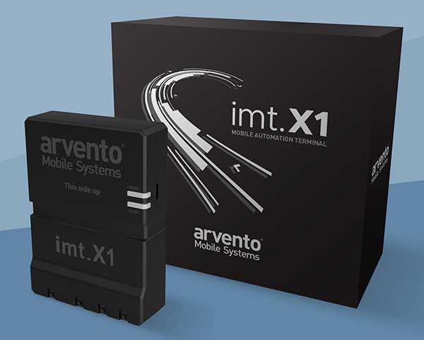
Arvento’s imt.x1 has a six-axis gyro sensor that can sense three-dimensional movement caused by emergency acceleration, panic braking and directional yaw and drift.
With connectivity options including dual CANBus and Bluetooth, the system is also eCall compatible and captures and provides data for accident analysis and other vehicle tracking functions. The system also uses the next-generation powerful Arm-based microcontroller.
This latest launch is yet another product of a successful, eight-year strategic partnership between Arvento and u-blox. “U-blox is more than a supplier,” said Özer Hıncal, Arvento’s general manager. “As a global leader in the IoT [internet of things] industry providing high-performance IoT modules, platforms and support services, u-blox is our trusted solutions partner, working closely with us to address customer demands and issues.”
As for previous Arvento products, collaboration with u-blox was a key factor in the imt.x1 product development process. The system’s high position sensitivity and accuracy are based on integration of u-blox’s 2G, 4G and 5G-ready cellular modules as well as GNSS modules.
The development of the imt.x1 aligns with Arvento’s vision and mission as a developer of advanced fleet telematics and vehicle tracking devices and will be available from August 2019.
SiTime Corp. has unveiled its Endura micro-electro-mechanical system (MEMS) timing solutions for aerospace and defense applications including precision GNSS, as well as field and satellite communications, avionics and space.
The Endura products are engineered to provide high performance in harsh conditions — severe shock, vibration and extreme temperature — that are routinely experienced in these applications.
SiTime offers customers 5 million possible part numbers that can be created from 17 programmable products.
“When exposed to high levels of shock, vibration, and extreme temperatures, legacy timing components have been prone to failure, degrading system performance and reliability,” said Piyush Sevalia, executive vice president of marketing. “To solve these problems, SiTime created an oscillator system of silicon MEMS, analog circuits, compensation algorithms, and advanced packaging, which is designed to outperform any other available timing solution in harsh environments.
“For example, Endura precision TCXOs deliver 4 parts per trillion per g (ppt/g) of acceleration sensitivity, which is 50 times better than legacy quartz-based solutions. With such performance, we believe that Endura will transform the oscillator landscape in aerospace and defense.”
Highlights of the company’s solutions include:
4 parts per trillion per g force of acceleration (50 times better than quartz)
Supports –55 degreesCelsius and +125 degrees Celsius operation
Key timing specifications conform to MIL-PRF-55310
Five million possible part numbers
Endura Super-TCXOs (temperature compensated oscillators) for use in high-speed communications and GNSS applications include:
SiT5146/SiT5147 – 1 to 220 MHz, ±0.5 to ±2.5 ppm, -40 degrees Celsius to +105 degrees Celsius
SiT5346/SiT5347 – 1 to 220 MHz, precision ±0.1 to ±0.25 ppm, -40 degrees Celsius to +105 degrees Celsius
SiT5348/SiT5349 – 1 to 220 MHz, ultra-precision ±0.05 ppm
SiTime’s portfolio of commercial off-the-shelf (COTS) Endura products spans six oscillator types and 17 products. All devices offer programmable options such as frequency, operating voltage and stability.
In addition, some devices offer specialized programmable features such as spread spectrum, pull-range, and differential output type.
Endura products are available with up to two grades of acceleration sensitivity, as low as 4 ppt/g (typical). This breadth of products provides customers with a large selection and the ability to configure each device for their application requirements.
Endura products are also designed for continuity of supply for long-life programs.
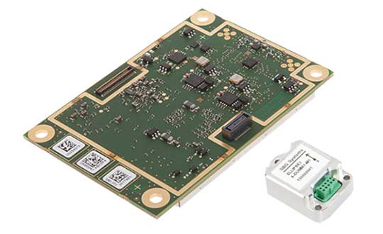
High-precision GPS/INS receiver is now available with a single-antenna option for faster integration, lighter weight and lower power consumption.
Photo: Septentrio
Septentrio’s GPS/INS receiver is now available with a single-antenna option. The single-antenna receiver brings the possibility of robust centimeter positioning and 3D attitude (heading, roll, pitch), while keeping weight and power consumption to a minimum. For Septentrio customers, this means simplified integration as well as increased operation time and productivity.
Septentrio centimeter-level positioning is based on multi-frequency, multi-constellation GNSS (GPS, GLONASS, Galileo, BeiDou, QZSS) technology. AsteRx-i S combines GNSS and an industry-grade inertial measurement unit (IMU) to deliver precise positioning together with 3D attitude and coasting functionality.
Septentrio’s unique GNSS/IMU integration algorithm enables continuous positioning in difficult environments such as near high structures, under foliage or during short GNSS outages (this is referred to as coasting or dead reckoning).
This makes AsteRx-i S a suitable positioning solution for robotics, autonomous vehicles and logistics. Previously available only as a dual-antenna product, AsteRx-i S is now available with either a single- or a dual-antenna option.
“By strengthening our GPS/INS integration portfolio we continue building upon our strategy of bringing reliable precise positioning together with 3D attitude to challenging industrial environments such as container parks or tree plantations,” said Danilo Sabbatini, product manager at Septentrio.
“AsteRx-i S has now become even more versatile with the support of both single and dual antenna operations on the same hardware platform,” Sabbatini said. “With the single-antenna AsteRx-i S delivers accurate 3D attitude in small-size applications where weight and power consumption are critical, while the dual antenna option is still the best solution for applications requiring short initialization time.”
Small, light, low power. The single-antenna AsteRx-i S requires minimal space which makes it suitable for robotic devices looking for small and light precise positioning solutions. Since only one antenna is required, there is less weight and lower power consumption, resulting in extended battery life. The dual antenna AsteRx-i S, on the other hand, is the best solution for devices requiring quick heading initialization and devices with prolonged static operation.
Advanced Interference Mitigation. AsteRx-i S comes with built-in Advanced Interference Mitigation (AIM+) technology. In robotic devices neighboring electronics can emit electromagnetic radiation which interfere with GNSS signals. AIM+ offers protection against such interference resulting in faster set-up times and robust continuous operation. A built-in power spectrum plot allows users to analyze interference, helping locate its source and mitigating it.
By offering both single and dual antenna options, Septentrio is now able to better accommodate specific needs of their customers interested in a GNSS/INS solution.
What is the biggest safety challenge for autonomous vehicles?
John Fisher. (Photo: Orolia)
“Sharing the road with human drivers. Optimized safe driving algorithms are compromised to mesh with the human’s natural level of risk taking. But this reduces safety, delaying acceptance — a real conundrum. Now, if we could just eliminate the humans…” John Fischer
Orolia
Julian Thomas
“When AI systems can deal with 99.9% of situations, the challenge will be keeping the passenger engaged to take over quickly when the 0.1% happens. Imagine a truck in front with a load coming loose. Which one would you trust?” Julian Thomas
Racelogic
Members of the EAB
Tony Agresta Nearmap
Miguel Amor Hexagon Positioning Intelligence
Thibault Bonnevie SBG Systems
Alison Brown NAVSYS Corporation
Ismael Colomina GeoNumerics
Clem Driscoll C.J. Driscoll & Associates
John Fischer Orolia
Ellen Hall Spirent Federal Systems
Jules McNeff Overlook Systems Technologies, Inc.
Terry Moore University of Nottingham
Bradford W. Parkinson Stanford Center for Position, Navigation and Time
Our cover story this issue is all about autonomous vehicles. Retirees — not usually considered early adopters of technology — are trusting autonomous vehicles to ferry them from point to point using the technology our industry can offer.
We have also used a lot of magazine space to discuss unmanned aerial vehicles, or drones, and shown how they are taking on a lot of tasks formerly done by manned pilots or workers, such as aerial mapping or factory inspections.
So is the idea of an autonomous plane such a stretch?
At June’s Paris Air Show, Christian Scherer, chief commercial officer for Airbus, told the Associated Press that his company already has the technology to fly passenger planes without pilots.
Scherer also said in the AP interview that Airbus hopes to be selling hybrid or electric passenger jets by around 2035.
Airbus already has “the technology for autonomous flying.”
But having the tech is one thing. Winning over regulators and potential travelers is quite another.
“When can we introduce it in large commercial aircraft? That is a matter we are discussing with regulators and customers, but technology-wise, we don’t see a hurdle,” Scherer said.
In fact, in a new study, seven out of 10 people say they would be willing to travel in an unpiloted plane at some point in their lifetime. The survey was conducted by U.S. software firm Ansys, which is working to provide digital replicas of how planes and cars react in different situations.
Passengers would be more willing to embrace automation if firms could show that a computer would react in the best and quickest way if anything unexpected happens.
But are we there yet? Michael Wiggins, the chairman of the aeronautical science department at Embry-Riddle Aeronautical University in Florida, addressed the autonomous-flight adoption question for the New York Times.
“From what I see, could it happen in the distant future? I think it probably could. Will it happen in the near future? I don’t think so,” Wiggins said. “Right now, any progress toward that area should be done very slowly, very measured and only after a bunch of research with results that suggest we should do that.”
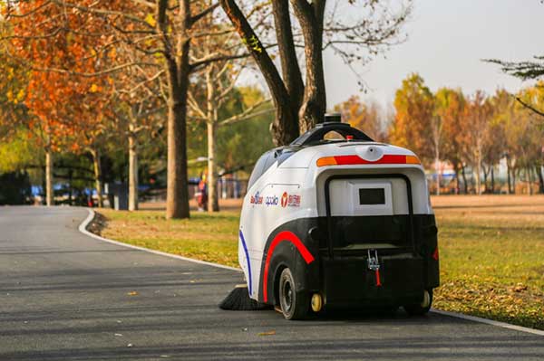
The sweeper Woxiaobai has been in service for a year. (Photo: Unicore)
Fall is a beautiful time of year. But when the leaves drop, it means a lot of sweeping for most of us. Not so for the 200 campuses and parks in China using IdriverPlus’ WO series of unmanned sweepers.
High-precision GNSS positioning plays an important role in making the autonomous units possible, providing real-time high-precision position, speed and time information.
The sweeper in Beijing’s Haidian Park. (Photo: Unicore)
Unicore’s high-precision GNSS technology and their products’ high reliability have enabled IdriverPlus’ unmanned sweepers and logistics vehicles — China’s first mass-produced products in intelligent driving. In January, IdriverPlus received the green light to test self-driving cars in Beijing.
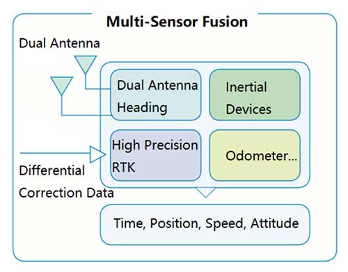
Diagram: Unicore
Sweepers and logistics vehicles are not only used in open-sky areas, but also in complex environments shadowed by buildings or trees or experience multipath. These areas include school campuses, factory and science parks, and community squares.
Complex environments result in different GNSS availability, reliability and convergence. In autonomous driving, the inputs the vehicle receives from GNSS and other sensors must be accurate and reliable.
A customer removes her express package from the Wobida logistics vehicle. (Photo: Unicore)
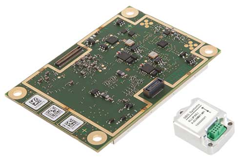
The UM482 module used by the IdriverPlus is characterized by dual antennas, compact dimensions, high performance and low cost, providing anti-jamming performance.
Integrated with on-board MEMS and Unicore’s U-Fusion combination technology, the UM482 can effectively solve the disruption of positioning results caused by the loss of satellite signal, and further optimize the continuity and reliability of positioning and heading outputs in complex environments such as city canyons, buildings and tunnels.
Lidar USA is integrating its UAV scanning systems with the Harris Aerial H4/H6 Hybrid multicopters.
As surveyors and mappers experience growth, they assume larger and larger projects, making longer flight times increasingly important. The Harris Hybrid can provide such flights with lidar and industrial-grade cameras, allowing for far greater coverage in a single flight.
“The beauty of the Harris Hybrid, is that the pilot continues to enjoy the flexibility of a multicopter, availability of fuel, and relatively compact packaging at an affordable price,” said Jeff Fagerman, CEO of Lidar USA. “While it is louder than an all-electric system, for particularly large, rural projects it is a very nice solution.”
Harris Aerial, a drone manufacturer near Orlando, Florida, builds and sells heavy-lift hybrid multicopters. These copters use a small generator running on 95 (or higher) octane fuel to power the UAV for up to 5 hours. The H6 can carry an A-series HD lidar system of 3 kg for 2.5 hours and a V-series of 5 kg up to 1.5 hours.
For the lidar operator, most projects require only one or two flights. On projects that are relatively flat with a clear line of sight to the horizon in all directions, these systems can cover everything legally possible in a single flight.
Lidar USA offers the Harris Aerial H4/H6 Hybrid an integrated package with any Lidar USA scanning system.