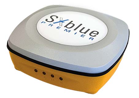
Geneq Inc., a manufacturer and provider of GNSS receivers and positioning solutions to GIS professionals and surveyors, has launched its newly designed website. The website features new functionalities, better product viewing options, and improved product support options.
The completely redesigned website to support the company’s product and service improvement program, the company said. The new website will be regularly updated with news on SXblue products, product support, software updates, events and social media feeds. The company welcomes feedback from clients, distributors and partners.
Geneq Inc. has been developing and manufacturing professional GNSS receivers and software products for 15 years. Its SXblue brand has been sold around the world.
AgJunction Inc. is partnering with Swift Navigation to develop near-autonomous small tractor solutions for agricultural applications with high accuracy.
The Duro enclosure. (Photo: Swift Navigation)
The partnership will combine autosteering technology pioneered by AgJunction and the Duro RTK GNSS receiver from Swift Navigation. The research resulting from this partnership will ultimately lead to lower cost autosteering products with high accuracy, the company said.
“Duro, and the robust RTK GNSS positioning it delivers, is a source of pride for Swift,” shared Tim Harris, CEO of Swift Navigation. “With a mission to enable a future of autonomous vehicles, we strive to bring that autonomy to farm equipment — such as small tractors — at an affordable price for farmers and partnering with the renowned autosteering expert AgJunction helps make that a reality.”
“AgJunction and Swift have been groundbreaking in their respective fields,” said Dave Vaughn, president and CEO of AgJunction. “I’m eager for what the future holds and how we can further deliver low-cost autosteering and navigation while delivering high accuracy down to a centimeter.”
On April 10, the world looked in awe at the first image of a black hole. The image was captured by a world-spanning network of radio telescopes that together, using Orolia atomic-clock technology, create the Event Horizon Telescope.
It zeroed in on the supermassive monster — 6.5 billion times the mass of the sun — in Galaxy M87 to create the image.
As Innovation Editor Richard Langley explains, the technique used to capture the image — very long baseline interferometry (VLBI) — relies on GPS. (VLBI was the topic of Langley’s Ph.D. thesis.)
VLBI links two or more radio telescopes that can be many kilometers apart, or even on different continents. VLBI is used in both geodesy and astronomy. There is also a practical GPS link to the Event Horizon Telescope. From the second of six simultaneously published open-access papers on the result: “All timing is locked to a 10-MHz [hydrogen] maser reference and synchronized with a pulse-per-second (PPS) Global Positioning System (GPS) signal…”
“[T]he long-term drift of the maser [is] compared to GPS, measured by differencing [and plotting] the 1 PPS ticks from the maser and local GPS receiver. The vertical width of the trace is due to variable ionospheric and tropospheric delays of the GPS signal, while the long-term trend represents the frequency error of the maser. The drift measured from this plot, and its effects on the fringe visibility, are removed during VLBI correlation.”
Image: Event Horizon Telescope Collaboration
From the third paper: “In order to reconstruct the brightness distribution of an observed source, VLBI requires cross-correlation between the individual signals recorded independently at each station, brought to a common time reference using local atomic clocks paired with the Global Positioning System (GPS) for coarse synchronization.”
Guided projectiles can provide sailors with precision fires
Raytheon Company and the U.S. Navy completed a new round of successful Excalibur N5 munition test firings at Yuma Proving Ground in Arizona.
Raytheon’s sea-based Excalibur N5 projectile will more than double the maximum range of conventional 5-inch munitions and provide the same accuracy as the land-based version. (Photo: U.S. Department of Defense)
The precision-guided projectiles demonstrated various short-, mid- and long-range capabilities.
Besides satellite navigation, Raytheon’s precision weapon systems incorporate laser guidance, high-definition radars, advanced seekers and other technologies.
Designed to be fired from the Navy’s five-inch guns, Excalibur N5 is the sea-based variant of the extended-range, precision munition used by ground forces around the globe. The Excalibur weapon provides accurate, first-round effects at all ranges in all weather conditions.
“Excalibur N5 answers the Navy’s need for a sea-launched, precision-guided projectile,” said Sam Deneke, Raytheon Land Warfare Systems vice president. “N5 doubles the range of the Navy’s big guns and delivers the same accuracy as the land-based version.”
Excalibur is a true precision weapon, impacting at a radial miss distance of less than two meters from the target. Widely used by U.S. and international artillery forces, Excalibur has been fired more than 1,400 times in combat.
The precision-guided projectile was co-developed by Raytheon Company and BAE Systems Bofors.
Besides N5, Raytheon has developed other variants such as the laser-guided Excalibur S, Excalibur HTK and Excalibur Shaped Charged Trajectory.
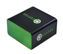
Cepton Technologies Inc., a provider of 3D lidar solutions for automotive, industrial, security and mapping applications, has unveiled its newest lidar scanner, the SORA-P60L.
Part of Cepton’s SORA family of lidar scanners, the new scanner is purpose-built to deliver long-range, high-resolution imaging for unmanned aerial vehicles (UAVs).
The SORA-P60L offers a 400-Hz frame rate, enabling drones to fly faster while maintaining high point-cloud density. With a 550-gram payload, the SORA-P60L prolongs UAV flight time allowing more ground to be covered in a single trip, the company said.
Cepton’s unique Micro-Motion Technology faces all lasers downward at all times, providing a dense, uniform point cloud that, in combination with the high scan rate, makes it suitable for fixed-wing and fast-moving rotary-wing UAVs.
“Cepton’s SORA-P60L leads the lidar industry with its best-in-class point cloud density that provides superior imaging for UAVs,” said Neil Huntingdon, Cepton’s VP of business development. “With the affordable price point, long-range capabilities and high frame rate of SORA-P60L, UAVs can capture data faster and build more accurate maps. SORA-P60L is our first product from the SORA family that we have unveiled this year. We see a lot of opportunities for this unique sensor in other markets and have a number of products in development that will be revealed later this year.”
Protective radome housing for the Galileo ground station on desolate Jan Mayen Island in the Norwegian Arctic. The site is housing a Galileo Sensor Station plus satellite link to pass data back to the Galileo ground system. (Photo: ESA/Fermin Alvarez Lopez)
CGI has signed an agreement with Thales Alenia Space France to enhance and maintain security software for the Galileo satellite navigation system.
Valued at approximately 14 million euros, the contract will last until the end of 2020. CGI experts are working on this strategic project from Rotterdam and Toulouse.
CGI will improve the functionality, robustness and reliability of Galileo’s ground infrastructure, as well as enhance and maintain software for its Public Regulated Service Key Management Facility (PKMF).
The Public Regulated Service (PRS) is one of the key features that distinguishes Galileo from other satellite navigation systems. It ensures that only government-authorized entities have access to Galileo’s secure PRS signal that meets strict security standards in areas such as defense, law enforcement and customs.
“We look forward to working with CGI to ensure the highest level of security for Galileo, along with an efficient, high performance infrastructure,” said Guillermo Salgado, Galileo ground mission and EGNOS programs director, Thales Alenia Space France. “CGI’s significant space and security experience, combined with its local presence and global resources, gives us access to the experts we need to launch and operate one of the world’s most advanced satellite navigation systems.”
“CGI has strong legacy in space, and we continue to support space clients across the globe, actively managing their business and national interests while positioning CGI as a trusted space leader,” said Dirk de Groot, who leads CGI’s business unit in the Netherlands.
CGI has more than 40 years of experience in the space domain and delivers complex, mission-critical space software systems across Europe, Asia and North America, supporting programs from satellite navigation, communications and operations, to space-enabled applications.
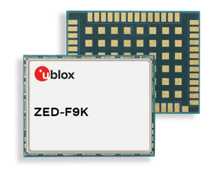
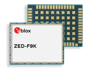
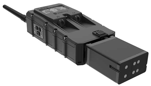
The ZED-F9K module is designed to keep cars in their lanes. (Photo: u-blox)
The new u‑blox ZED-F9K GNSS and dead-reckoning module is designed to bring continuous lane accurate positioning to challenging urban environments.
The module offers both high-precision multi-band GNSS and inertial sensors. It combines the latest generation of GNSS receiver technology, signal processing algorithms and correction services to deliver down to decimeter-level accuracy within seconds, addressing the evolving needs of advanced driver-assistance systems (ADAS) and automated driving markets.
The ZED-F9K builds on the u‑blox F9 technology platform. Compatibility with GNSS correction services further improves positioning accuracy by compensating ionospheric and other errors.
The real-time kinematic (RTK) receiver module receives GNSS signals from all orbiting GNSS constellations. The greater number of visible satellites improves positioning performance in partially obstructed conditions, while increased satellite signals delivers faster convergence times when signals are interrupted.
Inertial sensors integrated into the module constantly monitor changes in the moving vehicle’s trajectory and continue to deliver lane accurate positioning when satellite signals are partially or completely obstructed, as is the case when the vehicle is in parking garages, tunnels, urban canyons or forested areas.
When satellite signals become available again, the module combines inertial sensor data with GNSS signals to deliver fast convergence times and high availability of the decimeter-level solution.
The result of this combination of the latest developments in GNSS technology, correction services and inertial sensing is a tenfold increase in positioning performance over standard precision solutions, according to u-blox.
By robustly providing lane accurate position information, the ZED‑F9K meets the needs of ADAS and autonomous driving applications, as well as head units and advanced navigation systems. The module’s accuracy and low latency also makes it suitable for automotive OEMs and Tier 1 automakers developing V2X (vehicle-to-everything) communication systems. By continuously sharing their location with other traffic participants, V2X systems contribute to increasing overall road safety and reducing traffic congestion.
“We designed the ZED-F9K to be a turnkey high-precision GNSS solution that caters to the needs of today’s and tomorrow’s connected cars,” said Alex Ngi, product manager, product strategy for dead reckoning, u‑blox. “The ZED-F9K is unique in that it integrates a multitude of technologies, from the GNSS receiver to the inertial measurement unit and relevant dead reckoning algorithms into a single device for which we can ensure performance throughout the customer product development cycle.”
DroneShield Ltd. has released a body-worn drone detection product, RfPatrol. Weighing under 1 kilogram, the mobile unit is expected to be of significant interest to a range of DroneShield’s customer base globally, across military, law enforcement, security and VIP markets.
DroneShield made the announcement at AUVSI Exponential 2019, being held this week in Chicago.
RfPatrol is a passive (non-emitting) product, which substantially broadens the range of customers to whom the product is lawfully available. It was developed in response to customer interest.
Already, a small quantity of the RfPatrol units has been ordered by a western country’s defense department, for evaluation with a potential larger order in the future.
“We are excited to launch RfPatrol,” said DroneShield CEO Oleg Vornik. “Due to its miniaturized/body-worn nature, substantially larger customer universe due to its non-emitting nature, and a relatively lower price point compared to fixed-site products, we expect it to have substantial appeal. In addition to being able to be used as a stand-alone, it is a perfect companion to our DroneGun product.”
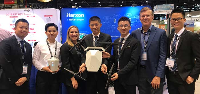
The Harxon team at AUVSI Xponential. (Photo: Harxon)
Harxon showcased its full range of UAV antennas and technologies for various UAV applications — especially for UAV base stations — at AUVSI Xponential, which took place April 30-May 2 in Chicago.
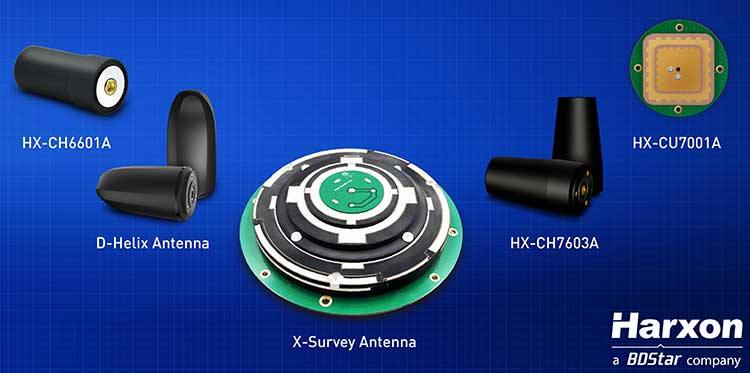
Harxon’s newly launched X-Survey antenna offers a 4-in-1 design for multi-constellation GNSS signal reception. It integrates Wi-Fi, Bluetooth and 4G modules for easy integration into real-time kinematic (RTK) systems.
It also ensures centimeter accuracy for precision positioning of UAVs, and stability of signal transmission, which provides the navigation and communication performance required by UAV base stations.
Additional UAV antenna products and technologies on display at booth #2218 include the HX-CH7011A and HX-CU7001A, new OEM antennas with small size and low weight, but with high gain and a stable phase center. Other available antennas include HX-CH7603A, HX-CH6601A, HX-CH7603A and HX-CSX601A for UAV and surveying applications.
Image: Harxon
Skycatch collaboration. Harxon has established strategic relationships with many industrial enterprises, such as Skycatch. Skycatch is an industrial data-collection and analytics company that focuses on indexing and extracting critical information. It provides combination GNSS base station and drone data-processing solutions that deliver high accuracy maps and point clouds in the 30 minutes or less.
Harxon — which specializes in GNSS positioning and navigation — is collaborating with Skycatch to give customers the opportunity to improve their UAV base station mapping solutions, and to maximize UAV operation efficiency and reliability.
High-precision GNSS solutions. The UAV industry, driven by new technologies, is one of the most dynamic growth sectors in the construction industry. The next phase of the drone revolution is flying towards standardization with precision solutions.
Harxon’s high-precision GNSS positioning technologies have been widely used in UAV-related applications, including UAV base stations, UAV power patrols, plant protection and machine control.
Qulsar announces precision time protocol (PTP) software availability for Qualcomm FSM platform.
The QNgine-S precision time protocol (PTP) software by Qulsar is now available on the Qualcomm FSM9xxx platform, which is used in small-cell designs worldwide.
With QNgine-S, products based on the FSM9xxx platform have access to a precision timing solution that will enable indoor and urban canyon deployments of small cells, where GNSS signals are rather weak.
As operators continue to upgrade and modernize their networks, there is an increasing demand for a packet-based timing solution (such as 1588 PTP) to support LTE-TDD and LTE-A deployments.
The QNgine–S made available by Qulsar to use with the FSM9xxx platform is designed to enable operators to deploy small cells cost effectively and without a hardware upgrade to existing networks (such as on an existing timing unaware network), especially in locations where GNSS signals are unavailable or impeded.
Qulsar’s 1588 PTP slave technology already powers many eNodeBs and mobile backhaul infrastructure.
QNgine-S is a software-only solution that integrates with the baseband software of the FSM9xxx platform to provide an IEEE 1588-2008 PTP solution capable of recovering both time and frequency from a remote PTP grandmaster.
According to Minoo Mehta, Qulsar’s VP of Sales and Strategic Partnerships, “QNgine-S is optimized to operate in networks that haven’t implemented full on path PTP support. Qulsar’s advanced time recovery servo uses adaptive algorithms to allow time recovery to better than the required 1.1 μs for TDD applications, coupled with frequency alignment better than 15 ppb to meet the air interface requirements — a level of performance that typically cannot be achieved with unsophisticated servos and/or open source PTP solutions.”
“QNgine-S provides an increasingly important solution for synchronization of small cells and remote radio heads,” said Puneet Sethi, senior director, product management, Qualcomm Atheros, Inc. “We applaud Qulsar’s approach to delivering precise timing performance to customers using the FSM9xxx platform without new specialized hardware requirements, as this will help accelerate the global adoption of these platforms.”
Qulsar also provides design engineering services to tailor QNgine-S to variant architectures and platforms as needed and offers lab testing services to validate PTP performance.
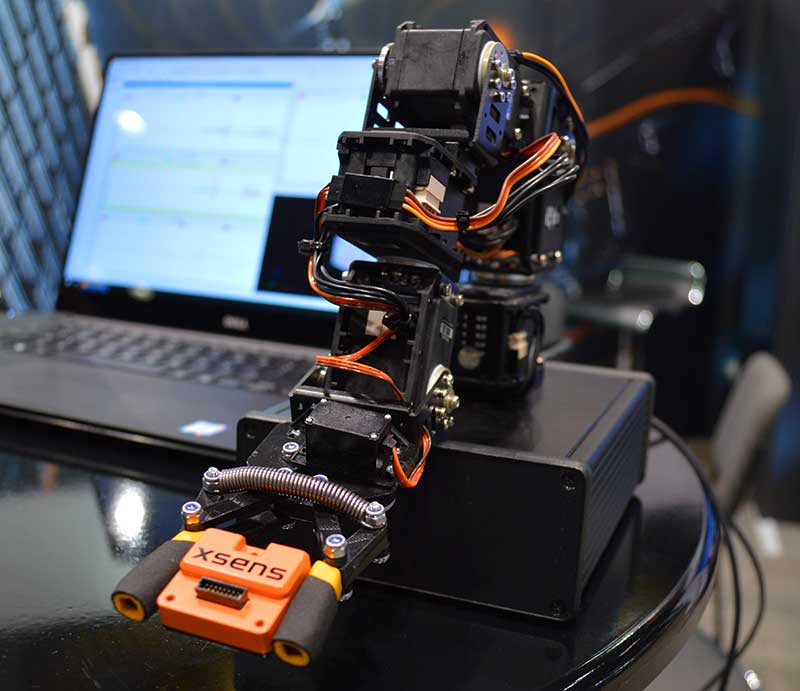
New MTi 600-series with flexible interfacing options is backed by software development suite for easy integration into space-restricted host systems such as drones, Xsens said.
The MTi 600-series is a generation of inertial motion sensors which set a new standard in the market for their small size, industrial-grade performance and competitive pricing, Xsens added.
The new MTi 600-series of inertial sensors, supplied in a 31.5mm x 28.0mm x 13.0mm IP51-rated case, produce roll and pitch readings accurate to ±0.2 degrees. GNSS-assisted heading (yaw) measurements are accurate to ±1.0°. Among the products’ new features are a CAN bus interface and NMEA compatibility.
To achieve this performance, Xsens has applied numerous innovations in its latest sensor fusion algorithms, which optimize the output from new accelerometer, gyroscope and magnetometer components.
Photo: Xsens
The MTi 600-series modules are the first from Xsens to include an NMEA-compatible interface for GNSS receivers. This means that users can choose any GNSS receiver chip, module or system to work alongside the MTi-670, a GNSS/INS device that supplements the pitch, roll and yaw outputs available from other MTi 600-series products with global positioning information.
Xsens is demonstrating the high performance of the new modules at its stand 2627 at AUVSI Xponential, taking place in Chicago this week.
The MTi 600-series modules are available for sampling on request to Xsens. Volume production is expected to begin in July.
Wingtra and 3DR, producer of the Site Scan drone data platform, have signed a partnership agreement to benefit the mining and surveying industries.
Wingtra’s VTOL drone WingtraOne and Site Scan form a complete aerial surveying solution, including highly efficient aerial data collection, post-processing and analysis. Through the partnership, 3DR now endorses the WingtraOne as the preferred fixed-wing drone for its Site Scan platform.
Wingtra and 3DR will distribute the complementary solution across a range of industries, focusing particularly on mining and surveying teams. 3DR will sell Wingtra products through its existing distribution partnerships across North America, Europe and Australia, and Wingtra will sell Site Scan worldwide.
“We’re thrilled to officially partner with Wingtra and make a fixed-wing VTOL drone available to our customer base,” said Chris Anderson, 3DR CEO. “We’re looking forward to deepening this partnership and continue making Site Scan and Wingtra the go-to drone solutions for mining teams across the world.”
Mining and surveying professionals are turning to fixed-wing vertical take-off and landing (VTOL) drones because of their ability to take off and land vertically as a multicopter but fly as fast a fixed-wing craft.
The WingtraOne VTOL drone offers safe launch and land, as well as high resolution and broad coverage in a single flight with absolute accuracy down to 1 centimeter (0.4 inches).
Users can upload photos collected with the WingtraOne into the Site Scan cloud-based web application to process them into high-resolution maps and 3D models.
Site Scan users include mining firms such as Newmont, Newcrest and Gerdau. Site Scan offers an all-in-one software program for analyzing drone-captured data with a suite of measurement tools, securely sharing them with teammates and stakeholders, and exporting them for use in CAD, mine planning and geological software.
“Our partnership with 3DR lets our customers analyze high-precision aerial data directly in Site Scan — in a lot of cases without any additional tools,” said Basil Weibel, founder of Wingtra. “Together, WingtraOne and Site Scan make up a complete solution and we are very excited to offer this bundle to the industry.”