Abom, a company that designs sophisticated commercial goggles, has launched new augmented reality (AR) goggles.
Designed for safety, industrial and military markets, Abom’s P3 augmented reality goggles feature accurate tracking of orientation, velocity and positioning using IMU/GPS-GNSS/INS receiver capability.
Other features include 3D spatial mapping and tracking, integrated VX Inc. CNED display technology, and an array of integrated image sensors and advanced embedded electronics. The goggles’ stereoscopic dual displays have an ultra-high-brightness output with adjustable control and 1080p output.
The goggles are optimized with a military-ballistics-rated lens (MIL-PRF 32432A) that complies with the Military Compliance Eye Protection (MCEP) program, meeting many challenging elements of the U.S. Army’s IVAS specification (HUD 3.0).
For industrial applications, the P3 also meets ANSI Z87.1+ high-mass impact rating and IP-55 ingress protection against water and dust, which opens the door for supporting National Safety Council technology initiatives and requirements for meeting extreme IP-67 rating compliance.
The P3 goggles are field-use ready and designed for extreme environmental durability and cold-weather climate conditions where demanding ruggedized performance is critical. It has advanced thermal image sensors, and embedded within the Goggle Chassis is an ultra-high-performance depth camera supported by two infrared cameras optimized for low-light conditions up to 10 meters.
The goggles incorporate Abom’s patented ultra-low power thin-film technology, making it impossible for fog to survive on the inner surface of the eyewear, according to the company.
“Abom’s award-winning heated goggle technology, now military approved, has made integration and optimization with immersive, augmented reality display technology the perfect solution for highly ruggedized extreme use-cases that exceed industry standards for both quality and performance,” said Jack Cornelius, Abom CEO.
“Abom’s development partner for the P3 Goggle, VX Inc., has pushed the limits of mechanical and electrical engineering design performance,” Cornelius said.
Autotalks, a vehicle-to-everything (V2X) communications company, has teamed up with Marben for a live V2X demo based on Marben V2X software running on Autotalks’ chipset.
The first live end-to-end global V2X demo will take place at the Autotalks booth (C198) at TU-Automotive Detroit, being held June 5-6 in Novi, Michigan.
Autotalks has been cooperating for several years with Marben, a global leader in embedded software solutions for the telecommunication and automotive industries. The joint effort led to the successful integration of Marben’s stack and software application on Autotalks chipset using the C-V2X standard.
The Autotalks solution minimizes development, testing and certification efforts for a V2X system to be deployed anywhere, using a software toggle between V2X technologies. This translates into a huge advantage for OEMs and Tier 1 automakers who benefit from the shortest time to market for a global V2X platform.
The chipset isolates V2X from the non-safety domains, thus providing domain separation and security, scalability and ability to optimize the cost structure of telematic control units (TCUs). The isolation of V2X combined with Autotalks’ recognized cyber security technology enables a secure platform.
“Our agility in maturing the C-V2X solution simultaneously with leveraging our V2X ecosystem partners for this purpose has yielded fast results and offers a clear deployment path for OEMs and Tier 1s alike. We appreciate Marben’s long-standing cooperation and are pleased to demonstrate the first end-to-end dual-mode V2X demo with them,” said Yaniv Sulkes, Autotalks’ VP of business development and marketing in North America and Europe.
Global software communications company Marben has developed a complete ready-to-use V2X software solution including security and several applications that are deployed worldwide. The company’s solution significantly increases road safety, optimizes traffic and contributes to greener mobility.
“We are glad to partner with Autotalks, and showcase this first of a kind demonstration, after our straightforward and quick C-V2X integration,” said Devang Naik, director of software engineering.
The live demo can be seen at the Autotalks booth C198 at TU-Automotive Detroit.
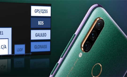
The latest Lenovo smartphone offers dual-frequency GNSS capable of tracking the latest BDS phase III signal, the Z6 SE, using an Allystar chipset.
The company says this is the first time a smartphone supports the new BeiDou signal.
HD8040 series SoC. (Photo: Allystar)
Fitted with a Allystar HD8040 series chipset, the Lenovo Z6 youth edition provides position accuracy up to sub-meter, according to Allystar.
The HD8040 series chipset supports all civil signals on the L5 band. Besides GPS/QZS L5 and GAL E5a, the latest BDS phase III signal B2a has already been implemented to maximize the visible satellites in L5 band.
Dual-frequency GNSS means that the receiver tracks more than one radio signal from each satellite on different frequencies — GPS L1 and L5, Galileo E1 and E5a, and Beidou B1 and B2a.
B2a will replace B2I and broadcast on MEO and IGSO satellites. The code lengths are 10230, which have better anti-cross-correlation performance and are designed separated pilot component and data component to improve tracking sensitivity.
In general navigation scenarios, multipath error lead to positioning inaccuracy of up to several meters, caused by to signals bouncing off of higher buildings. The error caused by multipath can be nullified and mitigated by using two frequencies instead of one in urban areas. Under a relatively open-sky environment, measurement error caused by the ionosphere is usually eliminated by a linear combination of dual frequencies to easily achieve sub-meter accuracy.
“Allystar is glad to boost the smartphones and Internet of Things (IoT) applications with the latest multi-frequency GNSS SoC (system on chip) technology,” said Shi Xian Yang, the product and marketing manager in Allystar.
Lenovo smartphone Z6 SE has Allystar inside. (Photo: Lenovo/Allystar)
Toyota Research Institute-Advanced Development Inc. (TRI-AD) and Carmera Inc. have joined forces to conduct a proof of concept about developing camera-based automation of high-definition (HD) maps for urban and surface roads.
This is the first step towards realizing TRI-AD’s open software platform concept known as automated mapping platform (AMP) to support the scalability of highly automated driving, by combining data gathered from vehicles of participating companies to generate HD maps.
Automated driving requires highly reliable road information based on HD map data. While the creation of highway HD maps is underway, this coverage represents less than 1% of the worldwide road network.
The next challenge is to create and maintain maps for urban areas and local roads that go beyond the highway road network.
TRI-AD/Carmera mapmaking from vehicle cameras in downtown Tokyo. (Image: Toyota/Carmera)
In this proof of concept, the two companies will place cameras in Toyota test vehicles to collect data over several months from areas of downtown Tokyo. The cameras installed in the test vehicles use Toyota Safety Sense components that Toyota installs on its vehicles globally.
Images and other data gathered from TSS will be processed on Carmera’s real-time platform to automatically generate HD map data.
In addition, by placing commercially available dashcam drive recorders in Toyota test vehicles, the project will demonstrate automated map generation from a broader range of sources that do not have TSS.
This draws upon Carmera’s millions of miles of driving video collected, structured and enriched through safety monitoring partnerships with professional fleets in other complex environments like New York City.
Carmera feature detection image in downtown Tokyo. (Image: Toyota/Carmera)
By combining maps automatically generated via the techniques employed in this project with digital maps available today, it will be possible to provide even more reliable road information to automated vehicles in the future. And by generating HD maps based on data acquired from commercially available vehicles around the world, automated driving can be enabled on all roads.
“Currently automated driving map development relies on highly expensive specialized mapping vehicles deployed in limited numbers, and a lengthy manual process for reliable HD map creation,” said Mandali Khalesi, vice president of automated driving at TRI-AD. “We’re excited to partner with Carmera to automate HD map generation and help enable automated driving mobility for all.”
“Carmera was founded to deploy next-generation street intelligence at low cost, high speed and automotive-grade reliability, in order to democratize autonomous mobility at global scale,” Ro Gupta, CEO at Carmera, said. “We’re excited to collaborate with TRI-AD in putting the flexibility and modularity of our platform to work to build HD maps, beginning with one of the largest and most dynamic urban environments in the world.”
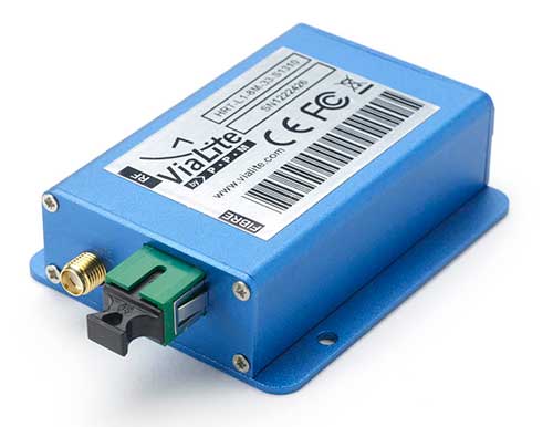
ViaLiteHD Blue OEM module, one of the available formats for the GPS RF over fiber link. (Photo: ViaLink)
Carrying timing signals over optical fiber links to 10+ km, ViaLite’s new GNSS/GPS Fiber Extension Kit has been successfully qualified for use with Microsemi’s timing and synchronization products.
Included in the kit is the ViaLiteHD GPS Link, which is designed for providing a remote GNSS/GPS signal or derived timing reference to equipment located where there is no reception, such as inside buildings, tunnels and mines.
ViaLite designs and manufactures RF over fiber links/systems, support modules, rack chassis and outdoor enclosures. It is a division of Pulse Power & Measurement.
The kit is suitable for GPS, Galileo, GLONASS and BeiDou bands, and the links provide a wide dynamic range with negligible signal degradation from noise or interference.
ViaLite worked closely with Microsemi engineering and product management teams to create the optimized extension kit. Simple single-link extensions are available from both Microsemi and ViaLite, and more complex distributed systems can be defined and supplied by ViaLite.
“We are honored to have been selected by Microsemi as a global supplier for GNSS fiber-optic link equipment,” said ViaLite director of sales Craig Somach.
Microsemi provides synchronization services that assist customers with the planning, deployment and maintenance of synchronization infrastructure.
Their systems need to meet various levels of redundancy, provide multiple timing and frequency outputs, and apply the most accurate GNSS and satcom techniques for measuring offsets between geographically dispersed clocks.
The systems are employed across a wide range of industries, including communications, data centers, aerospace, defense, industrial, financial services, government, oil and gas, power and transportation.
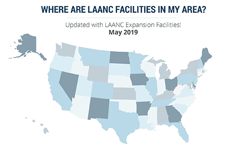
More than 100 control towers and airports have been added to the hundreds of Federal Aviation Administration (FAA) air traffic facilities and airports that currently use the Low Altitude Authorization and Capability (LAANC) system.
LAANC is a collaboration between the FAA and industry that directly supports the safe integration of unmanned aircraft systems (UAS) into the nation’s airspace.
LAANC expedites the time it takes for a drone pilot to receive authorization to fly under 400 feet in controlled airspace. By adding contract towers to the number of LAANC-enabled facilities, drone pilots will have access to more than 400 towers covering nearly 600 airports.
In less than two years, LAANC has provided fast access to controlled airspace for more than 100,000 flights, according to Matt Fanelli, director of strategy at Skyward.
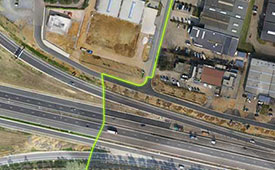
Image: Skyward
“People have been asking the FAA to add more airports and today, 109 contract towers have now been added to LAANC.” Skyward has updated its 2019 LAANC Facilities Guide so that UAV pilots can easily reference airports near them that will be adding this service.
Contract towers are air traffic control towers that are staffed by employees of private companies rather than by FAA employees. LAANC provides air traffic professionals with visibility into where and when authorized drones are flying near airports and helps ensure that everyone can safely operate within the airspace.
The expansion to more than 100 contract towers means the FAA has further increased drone pilots’ access to controlled airspace safely and efficiently.
LAANC is used by commercial pilots who operate under the FAA’s small drone rule (PDF) (Part 107). The FAA is upgrading LAANC to allow recreational flyers to use the system and in the future, recreational flyers will be able to obtain authorization from the FAA to fly in controlled airspace.
For now, recreational flyers who want to operate in controlled airspace may only do so at fixed sites.
Seen & Heard is a monthly feature of GPS World magazine, traveling the world to capture interesting and unusual news stories involving the GPS/GNSS industry.
Photo: Mount Everest/Daniel Prudek/Shutterstock.com
Surveying the highest height
The precise height of Mount Everest — now listed as 29,029 feet, or 8,848 meters — has been contested since the first survey by British officers in 1849.
On January 2020, Nepal plans to end the controversy and declare both snow and rock height of the world’s tallest mountain. This spring a two-member Nepali survey team will summit the mountain with a Trimble R10 GNSS receiver, gifted by New Zealand.
Besides a GNSS survey at the summit, teams will conduct precise leveling, trigonometric leveling and gravity surveys. The GNSS survey will cover 285 points with 12 different observation stations, nine of which are in hills of Sankhuwasava, Bhojpur and Solukhumbu districts.
Photo: e-Golf cars/Volkswagen
Takin’ it to the (Hamburg) streets
Five electric Volkswagen Golfs are now on the streets of Hamburg, Germany, being tested with Level 4 automation.
The cars are designed to handle complex urban traffic patterns without help from drivers, although they must be ready to intervene.
Level 5, the highest category, requires the vehicle to perform all tasks, turning every rider into a passenger.
The cars are driving 1.9 miles (3 km) of urban roads where new signals and traffic management systems have been installed for autonomous driving.
Boeing 787 Dreamliner Hainan airlines/aapsky/Shutterstock.com
GPS Rollover gone wrong
The April 6 GPS Week Number Rollover was supposed to pass without a hitch, with plenty of notice that updates might be required for legacy receivers. Instead, several systems crashed.
In China, as many as 15 Boeing 777s and 787s were grounded pending a GPS update (the receivers gave the date as August 22, 1999.)
In New York City, part of the wireless grid faulted, cutting information feeds to the NYPD (license plate cameras) and remote worksite communications.
In Australia, weather balloons were grounded. In the United States, NOAA autonomous monitoring stations went offline. Fixes for all these systems are underway.
A roundup of recent products in the GNSS and inertial positioning industry from the May 2019 issue of GPS World magazine.
OEM
Signal Analyzer
Tests gnss-disciplined oscillators
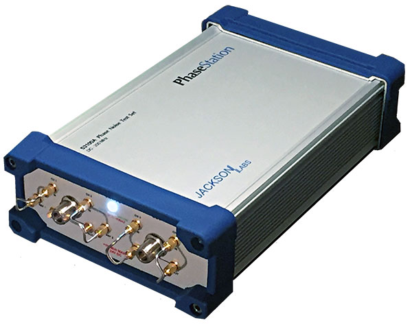
Photo: Jackson Labs
The PhaseStation ADEV Frequency Stability phase noise test system is a new signal source analyzer. It tests signal performance in a host of products such as GPS- or GNSS-disciplined oscillators. It can also be used to qualify and evaluate local oscillator performance for GNSS receiver design, including GPS TCXO evaluation and parametrization, or to take stability measurements of 1PPS and arbitrary frequency outputs from GNSS receivers. It is also useful in optimization of GNSS receiver Kalman filter design via the GNSS receiver 1PPS output signals. It automatically synchronizes and syntonizes (calibrates) the internal dual oscillator DOCXO option to external GNSS receivers via 1PPS input. Jackson Labs, jackson-labs.com
‘Vested’ Tracker
Line for LTE, IoT, child safety
Photo: WTS Positioning Solutions
The Trax G+ personal GPS tracker has real-time tracking capability with update rates up to every 10 seconds. For customised industrial applications, the new Trax G+ can support up to two updates per second. It also comes with wireless charging and IP68 water resistance. The Trax G+ 4G LTE-M supports 4G LTE-M and NB-IoT standards, with both European and U.S. models available. The Trax G+ app offers unlimited geofences, augmented reality tracking, speed alerts, location history, the possibility to track multiple devices and device sharing. A special collaboration with POC sports brand resulted in the POCito VPD Air Vest + TRAX. The vest provides a child with back protection for winter sports and is designed to store a TRAX POC Edition device. WTS Positioning Solutions, trax.business
Multi-GNSS module
Supports civil signals on the L5 band
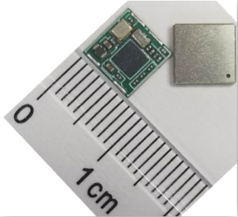
Photo: Allystar
The TAU-0707 is a multi-band, multi-GNSS module series. Within its 7.6 x 7.6 millimeter size, the TAU-0707 supports GPS, Galileo, GLONASS, BeiDou, QZSS, IRNSS and all civil bands (L1, L2, L5, L6). The module is a concurrent multi-band receiver embedded with a Cynosure III single-die standalone positioning chipset, which offers multi-frequency measurements and simplifies integration for third-party applications. The TAU1206-0707 and TAU1205-1010 models are better in multipath mitigation due to the higher chipping rate of L5 signals relative to L1 C/A code. For professional applications, module TAU1303-0707 comes with built-in support for standard RTCM protocol (MSM), supporting multi-band multi-system high-precision raw data output, including pseudorange, phase range, Doppler, SNR for any kind of third-party integration and application. Allystar Technology, www.allystar.com
Open-source receiver
Offers GNSS for the enthusiast
Photo: Amungo Navigation
NUT2NT+ is an open source, multi-frequency, multi-signal, front-end GNSS receiver board built around the NT1065 chip. The receiver has been specifically created for satellite navigation enthusiasts. The NUT2NT+ hardware and software solution offers user the ability to set a receiver’s modes and frequencies, to capture all signals continuously, and to have complete control over primary processing features. The receiver is available via the Crowd Supply website. Amungo Navigation, www.amungo-navigation.com
5G GNSS receivers
For UTC time synchronization
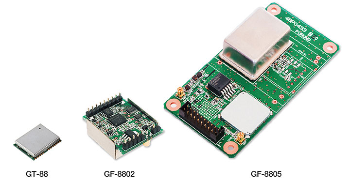
Photo: Furuno
The GT-88 timing module and GF-8801/02/03/04/05 disciplined oscillator are for users who require UTC time-synchronized signals (1 PPS/10 MHz) to meet the new 5G requirements. Achieved stability is better than that of an atomic clock, including rubidium. The GT/GF-88 series includes an algorithm, Dynamic Satellite Selection, that provides outstanding multipath mitigation in urban canyon environments. It support GPS, GLONASS, QZSS and Galileo. Furuno Electric Co. Ltd., furuno.com
SURVEY & MAPPING
Machine control
System improves safety, speed for drilling and piling contractors
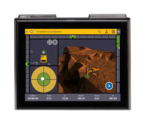
Photo: Trimble
The Groundworks Machine Control System enables contractors to perform drilling and piling operations with centimeter-level accuracy. Using a touchscreen display, operators can personalize the interface with configurable views. The software aligns with other solutions in the Trimble Civil Engineering and Construction portfolio. Stakeless navigation reduces rework and decreases the need for personnel working near the machine during operation. Contractors can drill to the specified location, depth, orientation and inclination angle. Better rock fragmentation and lower hauling costs can be achieved by optimizing drill-hole spacing, angles and the location of the machine for a more even blasting pattern. Auto stop reduces overdrilling. Automated quality assurance and quality control reporting includes capture of start and end positions, time, elevation and actual embedment depth. Trimble, www.trimble.com
Survey software
Improved for UAV use
Photo: Virtual Surveyor
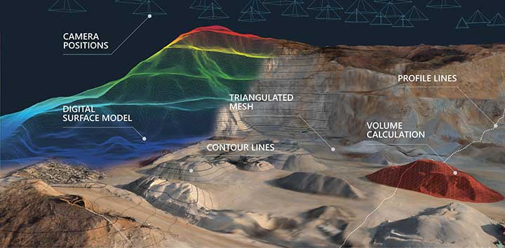
Virtual Surveyor now enables users to process larger projects without buying more powerful computers or cloud services. Version 6.2 solves the problem of large files by offering enhanced clipping and mosaicking functionality. Users can merge multiple processed pieces of orthophotos and digital surface models into a single project, and create smooth edges with the new clipping tool. The mosaic can then be exported to a new TIFF file or serve as the basis for a full area virtual survey. A 3D Fly Through capability allows users to select spatial bookmarks and waypoints and create a movie that allows the viewer to fly through the terrain. Virtual Surveyor, virtual-surveyor.com
GNSS Receiver
Tilt compensates for out-of-plumb measurements
A surveyor checks an urban construction project. (Photo: Topcon)
The compact HiPer VR features advanced GNSS in a rugged IP67 design. Its GNSS chipset has Universal Tracking Channels Technology that automatically tracks every satellite signal (GPS, GLONASS, Galileo, Beidou, IRNSS, QZSS, SBAS). It also has an integrated 9-axis IMU and 3-axis eCompass. TILT (Topcon Integrated Leveling Technology) is designed to compensate for mis-leveled field measurements out of plumb by as much as 15 degrees.The HiPer VR can be used for static or kinematic GNSS post-processed surveys, as a network RTK rover with the FC-5000’s internal 4G/LTE cellular modem, as a UHF/FH/Longlink jobsite RTK rover, and also in Topcon’s patented Hybrid Positioning workflow. Topcon Positioning Group, topconpositioning.com
Mobile laser scanner
With NovAtel and Velodyne
Photo: Lidaretto
Lidaretto is a flexible mobile laser scanner for aircraft, land vehicles or on foot. Combining high-end technology by Velodyne and NovAtel, Lidaretto produces highly accurate point clouds for professional applications such as mapping, surveying, GIS and inspection. The NovAtel OEM7 receiver provides 555 channels, and is SPAN-enabled and optionally dual GNSS. Signals received include GPS+GLONASS L1 and L2; the receiver is upgradable to Galileo and BeiDou. Accuracy is achieved to 1–2 centimeters. Lidaretto, www.lidaretto.com
Processing software
For land surveying
Photo: 3Dsurvey
3Dsurvey version 2.0 is a software ecosystem for land surveying data processing. Users can take photos with any standard digital camera, import images into 3Dsurvey, and produce their own orthophoto maps and digital surface models, as well as calculate volumes faster. Data is processed automatically based on matching algorithms. Smart tools in the software increase efficiency. Also available is the flight planning app 3Dsurvey Pilot and the viewing app 3Dsurvey Viewer. 3Dsurvey, www.3dsurvey.si
TRANSPORTATION
Hangar repeater
Enables indoor avionics testing
Photo: Foxcom
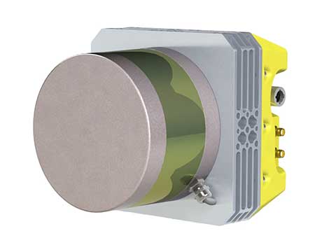
The Hangar Repeater Solution enables aircraft ground engineers to undertake 24/7 avionics testing of GPS, Inmarsat and Iridium satellite signals indoors. Aircraft engineers can undertake testing of aircraft regardless of weather, without having to move aircraft in and out of a hangar. The dedicated repeater reduces on-ground time, work hours and overall maintenance costs, and provides communication inside buildings or underground without the need for direct line of sight to the sky. Foxcom, www.foxcom.com
Avionics sensor
Supports GPS guidance
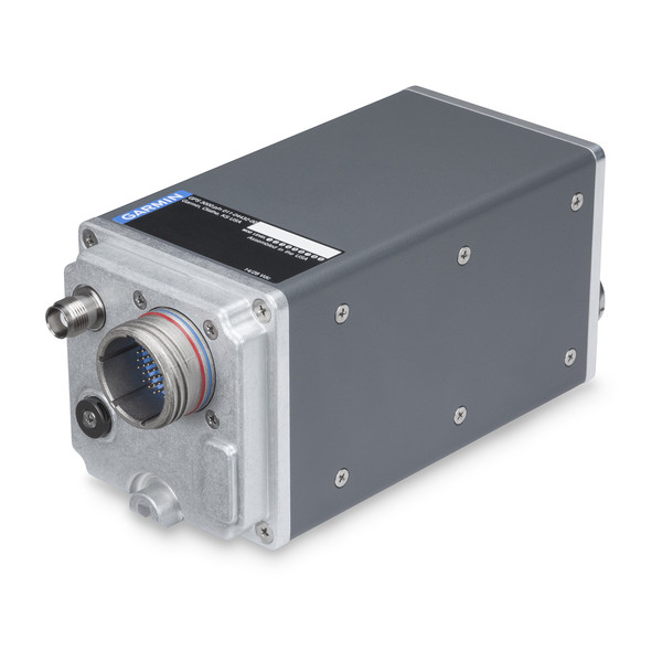
Photo: Garmin
The GPS 3000 is a compact, remote-mount 15-channel GPS receiver capable of five position updates per second. It uses enhanced WAAS/SBAS signals to provide ultra-precise, DO-260B-compliant position data. It provides an ARINC 743A-5 GNSS interface over an industry-standard ARINC 429 data bus for those who wish to integrate GPS 3000 with existing avionics systems. When so configured, the GPS 3000 sensor can provide position source information to the FMS, meeting requirements for required navigation performance (RNP) and supporting GPS-based vertical approach capability for coupled LPV approaches and other next-generation flight applications. Garmin, www.garmin.com
Positioning devices
Auto motion sensors for GNSS-denied environments
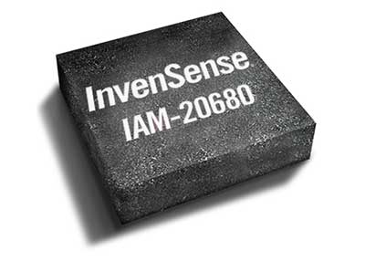
Photo: Invensense
A new line of automotive high-accuracy devices is designed to enhance the absolute position of a vehicle in GNSS- and GPS-denied environments: IAM-20680, IAM-20680HP, IAM-20380 and IAM-20381. The IAM-20680 is a 6-axis qualified sensor that features 16-bit accelerometers and 16-bit gyroscopes. The IAM-20680HP is a high-performance version of the IAM-20680 that features high gyroscope and offset thermal stability. The IAM-20380 gyroscope is compatible with a 3-axis automotive accelerometer and an automotive-qualified 6-axis device. The IAM-20381 is a 3-axis accelerometer compatible with a 3-axis automotive gyroscope and an automotive-qualified 6-axis device. The IAM-20680HP and IAM-20680 can be used to improve estimates of position, direction and speed when GNSS is denied, as well as improve quality of the position estimation when the satellite signal is strong. InvenSense, www.invensense.com
UAV
Analysis platform
For precision agriculture
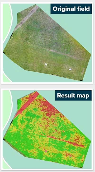
Screenshot: Agremo
Agremo is a cloud-based data-processing solution designed to turn drone-collected images of agricultural sites into actionable and accurate data. It is used to collect aerial footage and create an analysis report that reveals how a crop is progressing. The agricultural sensing and analysis platform is designed for drone operators, farmers, growers and agronomists. Using Agremo, drone operators can help farmers monitor and manage their crops per field throughout the season. A visualized, user-friendly, geo-referenced map of a field can provide statistics such as plant counting, plant health tools and stress detectors that enable precise yield increase and increase of overall profit. Agremo, www.agremo.com
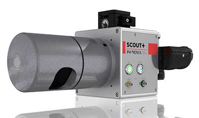
UAV lidar
For light vegetation and medium-range scanning
Photo: Phoenix Lidar Systems
The Phoenix Scout-32 is a powerful, compact, mid-range lidar. The lightweight system collects survey-grade data with an AGL range up to 65 meters, and features multi-target capacity with up to two target echoes per laser shot. It can build high-density point clouds of smaller scan areas, and has options for photogrammetry, hyperspectral, thermal imaging and more. Phoenix Lidar Systems, www.phoenixlidar.com
The meeting will be open to the public up to the seating capacity of the room. Visitors will be requested to sign a visitor’s register.
The agenda for the meeting includes the following topics:
Examine methods to protect, toughen and augment (PTA) access to GPS/GNSS services in key domains for multiple user sectors.
Examine emerging trends and requirements for PNT services in U.S. and international fora through PNT Advisory Board technical assessments, including backup services for terrestrial, maritime, aviation and space users.
Update on U.S. Space-Based PNT Policy and GPS modernization.
Explore opportunities for enhancing the interoperability of GPS with other emerging international GNSS.
Prioritize current and planned GPS capabilities and services while assessing future PNT architecture alternatives with a focus on affordability.
Assess economic impacts of GPS/GNSS on the United States and in select international regions, with a consideration towards effects of potential PNT service disruptions if radio spectrum interference is introduced.
Review the potential benefits, perceived vulnerabilities, and any proposed regulatory constraints to accessing foreign Radio Navigation Satellite Service (RNSS) signals in the United States and subsequent impacts on multi-GNSS receiver markets.
Meeting times are 8:30 a.m. to 5:30 p.m. Eastern Time on Thursday, June 6; and 9 a.m. to 1 p.m. ET on Friday, June 7.
Meeting address:
Westin Hotel Alexandria Old Town
400 Courthouse Square
Alexandria, VA 22314
Full details on the meeting can be found in the Federal Register Notice. For more information, contact James J. Miller, designated federal officer, Human Exploration and Operations Mission Directorate, NASA Headquarters, Washington, DC 20546, (202) 358-4417, fax (202) 358-4297, or [email protected].
Quectel Wireless Solutions has launched its Proactive Security Solution for Intelligent Driving to enhance driving safety.
The solution supports advanced driver assistance systems (ADAS) and driver monitoring systems (DMS).
The Proactive Security Solution integrates Quectel multi-mode LTE Cat 6 smart modules SC600Y/SC600T and AI algorithm from a third party to realize ADAS and DMS capabilities including monitoring irregular driving behaviors, conducting precise detection of vehicles and traffic signs, sending warnings of potential risks and more.
For ADAS, it can precisely identify and locate vehicles, pedestrians, lanes and traffic signs on the road and will send alerts to drivers if an imminent collision or an unintended lane departure is detected.
Drivers will receive four types of warnings including lane departure warnings (LDW), forward collision warnings (FCW), headway monitoring and warning (HMW) and forward start warning (FSW).
The DMS supports facial recognition and detection, and is able to monitor driver attentiveness and measure eye blinks as well as head movements. Drivers will receive warnings on any distraction such as making or receiving a call, smoking, yawning or looking around. For buses, taxi-hailing services or long-distance passenger vehicles, this solution also allows administrators to know more about their drivers’ states and improve management accordingly.
The driver monitoring system supports facial recognition and detection. (Image: Quectel)
Quectel Proactive Security Solution for Intelligent Driving features a rich set of interfaces and multiple hardware development platforms, designed to cut design-in time and facilitate integration for customers and OEMs.
SC600T/SC600Y is Quectel’s new generation of multi-mode Smart LTE Cat 6 module with built-in Android 9.0 OS. Based on a Qualcomm octa-core and 64-bit high-performance processors with built-in Adreno 506 GPU, SC600T/SC600Y are designed to support high performance, various multimedia features and Quick Charge 3.0 technology. They are designed for both industrial and consumer applications with high data-rate and multimedia functions. Features include:
LTE Cat 6 modem supporting 2x20MHz carrier aggregation, with maximum download speed up to 300 Mbps
Worldwide LTE, UMTS/HSPA+ and GSM/GPRS/EDGE coverage
Dual-band Wi-Fi and Bluetooth
Dual LCDs and dual touch panels for independent display and operation: 1920×1200 @60fps for primary display and 1920×1080 @60fps for secondary display, Wi-Fi display
Support up to four cameras, with two of them working simultaneously
Multi-constellation GNSS receiver available for applications requiring fast and accurate fixes in any environment
Support recording and playback of 4k videos at 30fps@SC600T/ 1080P videos at 60fps@SC600Y
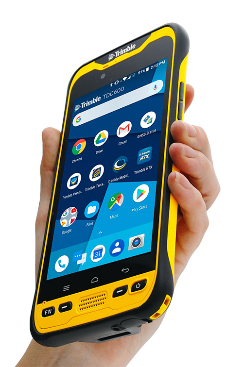
Trimble has introduced the TDC600 handheld, an ultra-rugged, all-in-one smartphone and GNSS data collector for geographic information system (GIS) and field inspection applications.
The next-generation smartphone data collector runs on an Android 8.0 operating system. It has a bright sunlight-readable 6-inch display, 2.2-GHz processor, 4-GB memory and an enhanced capacity all-day battery.
More powerful and with a longer lasting battery than its predecessor, the TDC600 handheld supports the Trimble Catalyst GNSS positioning service that delivers subscription-based accuracy on demand for Android devices.
In addition, the TDC600 can be used with external receivers such as the Trimble R2 and R1 GNSS receivers, and also features a built-in GNSS receiver that supports GPS, GLONASS and BeiDou constellations plus satellite-based augmentation system (SBAS) capabilities for real-time positioning.
The TDC600 is built for GIS users in organizations across a variety of industries —environmental management, utilities and government agencies. With Wi-Fi, Bluetooth 4.1 and 4G LTE cellular connectivity that supports data and voice calls, field workers are able to use the TDC600 as they would any consumer smartphone, communicating between the field and office, sending emails and texting.
Featuring a slim, lightweight and ergonomic pocket-size form factor, the TDC600 fits in a user’s hand with a fitted strap providing extra security. Constructed to meet military (MIL-STD-810G) specifications, the durable design absorbs drops and shocks, and works in harsh weather conditions, without the need for a protective case.
The TDC600 integrates seamlessly with Trimble’s data collection applications —Trimble TerraFlex] software and Trimble Penmap for Android software — as well as third-party apps such as Esri Collector for ArcGIS.
With its Google Mobile Services certification, users can run Google core applications and access apps on the Google Play Store to personalize their device.
“The global mobile workforce is growing, and field personnel are constantly tasked with capturing and computing large amounts of data in more places with greater accuracy, requiring powerful and reliable data collection methods,” said Rachel Blair-Winkler, business area manager for Trimble Mapping & GIS.
“A professional turnkey solution such as the TDC600 handheld running Trimble data collection apps paired with the Trimble Catalyst service fulfills this requirement,” Blair-Winkler said. “Our customers now have a powerful, comprehensive and cost-effective entry-level system to collect and retrieve highly accurate GIS data virtually anywhere in the world.”
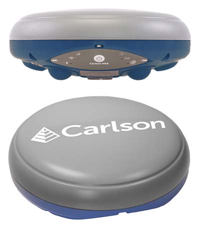
Carlson Software has introduced a new four-constellation, three-frequency surveying receiver. The Carlson NR3 network rover weighs just under two pounds, but delivers highly reliable GNSS real-time kinematic (RTK) for land surveying, geospatial information systems (GIS) and other data-collection uses.
Carlson Software President and Founder Bruce Carlson introduced the Carlson NR3 network rover at the company’s Grow With Us User Conference 2019.
Able to be used as a base or rover, the NR3 uses all four constellations — GPS, GLONASS, BeiDou and Galileo — and provides triple-frequency tracking on GPS, GlONASS and Galileo, the company said.
Incorporating multipath and ionospheric detection, the NR3 maintains accuracy and continued operation despite shocks, vibration or other interference.
According to the company, the NR3 is easy to mount and balance as it utilizes the optional Hybrid+ in Carlson SurvCE/PC that enables simultaneous interaction with GNSS and a robotic total station, the company said.
”The NR3 is Carlson’s answer for a lightweight – just 1.8 lbs. – network rover that can also be used in a base rover setup with Carlson’s Listen-Listen service,” said Butch Herter, Carlson’s director of Hardware Development. The Listen-Listen service allows base/rover operations via cellular modem for better correction transmission ranges compared to traditional terrestrial UHF radios.
“It has hot swappable batteries and four come with the system that give it over a 20-hour runtime,” Herter added. “With the dual internal cell modem antennas, it maintains cell signal where others may not. When paired up with the Carlson CR2+ robot, it is the ideal companion receiver to use with the new SurvCE hybrid surveying system.”
Produced by Septentrio with Carlson specifications, the Carlson NR3 has an integrated 4G LTE cellular modem, plus Wi-Fi and Bluetooth for modern wireless capabilities and is made to perform exceptionally in locations with bad visibility or interference.