Author: Tracy Cozzens

  • Hemisphere GNSS adds features for machine-control applications

    Hemisphere GNSS adds features for machine-control applications

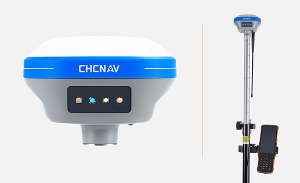
    New GradeMetrix features include knuckle boom and swing boom support

    Hemisphere GNSS has expanded the features of its GradeMetrix excavator solutions, adding support for knuckle boom and swing boom excavators as part of its GradeMetrix 3D Excavator solution.

    The additional feature sets unlock enormous potential for GradeMetrix excavators, especially in the compact excavator market, according to Hemisphere. “Hemisphere recognizes that machine control technology for compact excavators has been an underserved audience globally,” said Miles Ware, vice president of marketing. “Based on direct feedback from our global machine control partners, and endless hours of testing, we are excited to introduce these options that will further enhance the available ROI [return on investment] for our customers.”

    Hemisphere's receivers are frequently used in construction applications. (Photo: Hemisphere GNSS)
    Photo: Hemisphere GNSS

    “Hemisphere’s commitment to globally expand the access to machine-control technology continues to be a key component of our growth strategy,” said Farlin Halsey, president and CEO of Hemisphere GNSS. “Our strategy to combine best-in-class GNSS technology, with modern, efficient and intuitive features, further advances our efforts to make machine-control technology available to the global construction community, including such key customers as Iwasaki.”

    “The opportunity to introduce a solution that supports excavators equipped with knuckle boom is a very important achievement for our organization,” said Satoshi Furuguchi, CEO of Iwasaki Co. Ltd. “Iwasaki and Hemisphere have a great partnership, and we look forward to empowering additional productivity solutions together.”

    Hemisphere will make knuckle boom and swing boom options available in several of its new GradeMetrix excavator kits. Existing GradeMetrix excavator customers will have an option to add this feature to their current systems via an additional cable and sensor package available from an authorized GradeMetrix dealer.

    Hemisphere GNSS is exhibiting at the Construction & Survey Productivity Improvement Expo in Chiba, Japan, at booth E-11.

  • Mayflower receives FAA approval for GPS anti-jam antennas

    Mayflower receives FAA approval for GPS anti-jam antennas

    FAA TSO-C190 authorization makes multi-platform anti-jam GPS navigation antenna (MAGNA) systems available for both military and commercial aviation use

    MAGNA-F anti-jam system. (Photo: Mayflower)
    MAGNA-F anti-jam system. (Photo: Mayflower)

    Mayflower Communications Company Inc. has received technical standard order Mayflower Communications (TSO-C190) authorization from the U.S. Federal Aviation Administration (FAA) for both models of its MAGNA GPS anti-jam product.

    Mayflower’s MAGNA GPS anti-jam products — MAGNA-Federated (MAGNA-F) and the MAGNA-Integrated (MAGNA-I)— can be installed on both military and civilian aircraft. Both MAGNA products offer simultaneous L1/L2 protection and can protect commercial and military GPS receivers.

    Mayflower’s MAGNA products build on Mayflower’s SWaP-optimized GPS anti-jam antenna technologies, which are optimized for small size, weight and power (SWaP), including small antenna systems. The MAGNA products were developed with sponsorship by the U.S. Navy SPAWAR and further improved under the U.S. Army PEO AVN to support GPS protection requirements for SWaP-constrained air, sea and ground platforms, such as fixed-wing/rotary aircraft, ships, UAVs and tactical vehicles.

    MAGNA-I anti-jam system. (Photo: Mayflower)
    MAGNA-I anti-jam system. (Photo: Mayflower)

    The MAGNA-F (NavGuard 710) has been extensively integrated, tested and flown in navigation warfare (NAVWAR) operational environments by the U.S. government on multiple aircraft platforms. MAGNA-F is the highest performance and smallest federated GPS anti-jam solution on the market in its class, utilizing a 3.5-inch diameter controlled reception pattern antenna (CRPA) compatible with existing fixed radiation pattern antenna (FRPA) footprints.

     The MAGNA-I (NavGuard 730) is a high-performance yet small GPS anti-jam integrated solution on the market, with a 4.5-inch diameter FRPA-compatible footprint. MAGNA-I simplifies platform integration and reduces lifecycle costs.  The MAGNA-I integrated anti-jam solution (antenna array integrated with antenna electronics in a single module) is designed for platforms with difficult integration challenges.   

    “The MAGNA GPS protection system provides pilots with improved GPS availability in a global environment with disrupted GPS signals,” said Triveni Upadhyay, Mayflower’s founder and president. 

    Mayflower Communications management team will be participating in the upcoming Joint Navigation Conference (JNC).

    Mayflower Communications is exhibiting its MAGNA suite of products at booth #216 at ION’s 2022 Joint Navigation Conference, which takes place June 6-9 in San Diego, California. Also at the conference, Naresh Jarmale, Mayflower vice president of engineering, will present a paper during Session B4: Military PNT User Equipment 2 – EGI and Platform Integrated PNT.

  • Topcon supplies GNSS boards for Atmos drones

    Topcon supplies GNSS boards for Atmos drones

    The Marlyn Cobalt drone. (Photo: Atmos)
    The Marlyn Cobalt drone. (Photo: Atmos)

    Topcon Positioning Group is supplying high-end GNSS boards for the Atmos Marlyn Cobalt drone.

    Topcon’s ultra-compact B111A GNSS receiver board can provide scalable positioning from sub-meter differential GPS to sub-centimeter real-time kinematic (RTK) positioning. The board’s flexible design — low power consumption, comprehensive communication interfaces and peripheral support — make it easy to integrate the B111A into any precise positioning application, Topcon said.

    Topcon';s B111A GNSS receiver board. (Photo: Topcon)
    Topcon’s B111A GNSS receiver board. (Photo: Topcon)

    Besides in surveying and mapping, survey drones are now used in a broad spectrum of applications ranging from construction and mining to agriculture and environmental monitoring.

    The Atmos Marlyn Cobalt is a vertical-takeoff-and-landing (VTOL) fixed-wing mapping drone developed by Atmos with the goal of allowing users to effortlessly collect accurate geospatial information and turn it into actionable insights. “Our mission is to provide professionals with the tool with which they can plan a better future with precision,” said Ruud Knoops, Atmos CEO.

    To provide precise positioning accuracy, a GNSS board needs to compensate for inaccuracies caused by satellite constellations, receiver hardware and atmospheric conditions.

    The use of Topnet Live — Topcon’s GNSS real-time correction service — provides high-accuracy positioning and survey-grade results to professionals through a 24/7 cross-border, consistent and reliable access. The combination removes the need for base stations, increasing efficiency leading to higher productivity and decreased costs.

  • Geoscience Australia conducts economic impact survey of NPIC program

    Geoscience Australia conducts economic impact survey of NPIC program

    NPIC is key to a location-enabled Australia. (Image: Geoscience Australia)
    NPIC is key to a location-enabled Australia. (Image: Geoscience Australia)

    Geoscience Australia is undertaking an assessment of the economic impact of the National Positioning Infrastructure Capability (NPIC) program.

    The program provides free and open access to multi-GNSS observation streams from Australia’s network of continuously operating reference stations (CORS).

    Users can connect to these data and product streams directly from Geoscience Australia or via a commercial positioning-service provider. The CORS network has been designed to support a national positioning capability that provides better than 5-cm accurate positioning solutions in areas with access to mobile-phone coverage (delivery via the internet).

    Geoscience Australia has engaged ACIL Allen to conduct a web-based survey for stakeholders with interest in this program to assist with data gathering for the economic assessment.

    The survey takes 15 to 20 minutes to complete. There is an additional optional component for service providers that may take an additional 15 minutes.

    It can be completed in stages, if necessary, with a facility to save responses. It will remain open until June 28 (extended from May 25).

    Questions can be directed to Alan Smart (project director) at 0404 822 312 or Nanumi Starke (ACIL Allen) at 0466 636 345.

  • Septentrio adds RxLeverArm to RxTools for ease of GNSS/INS installation

    Septentrio adds RxLeverArm to RxTools for ease of GNSS/INS installation

    Septentrio has taken a step toward simplifying the integration process of its GNSS receivers that include inertial navigation systems (GNSS/INS). Its new RxLeverArm software tool aids GNSS/INS installation and improves accuracy, with automatic optimization of lever-arm settings.

    RxLeverArm is now part of Septentrio’s RxTools software package included with every Septentrio GNSS/INS receiver. This new tool visualizes, validates and automatically calibrates the exact distance between the INS sensor and the antenna, removing the need for accurate distance measurements with complex instruments.

    Inertial receiver setup is significantly simplified with RxLeverArm functionality, which enables users to start testing minutes after receiver installation. (Im age: Septentrio)
    GNSS/INS receiver setup is significantly simplified with RxLeverArm functionality, which enables users to start testing minutes after receiver installation. (Image: Septentrio)

    “We are focusing our design around easy, efficient and effective INS installations ensuring short time-to-market and accurate deployment for our customers,” said Danilo Sabbatini, product manager at Septentrio.

    “The RxLeverArm tool in combination with the intuitive web user interface, as well as the support material available in our knowledge base, enables customers to start testing within minutes after the physical installation of their receiver,” Sabbatini said.

    For lever-arm compensation, users now only need to measure the rough distance between the inertial measurement unit (IMU) and the main GNSS antenna reference points on the vehicle. Data is then logged under open-sky conditions, which allows the RxLeverArm tool to optimize the initial rough distance measurement and prevent common errors such as sign inversion.

    The result is simplification of the installation process and better accuracy of the lever-arm measurement.

  • OneNav completes pureL5 field test using customer evaluation system

    OneNav completes pureL5 field test using customer evaluation system

    The commercially available L5-only GNSS solution includes machine-learning algorithms to leverage increased L5 signal-ranging precision in challenging signal conditions.

    oneNav logoOneNav has announced performance results from field testing its latest pureL5 customer evaluation system (CES) software in both open-sky and challenging signal environments.

    The patent-pending oneNav GNSS system, including a custom array processor and a library of machine-learning algorithms, demonstrated consistent sub-meter accuracy and rapid time-to-first-fix (<2 sec) in open-sky testing.

    In very challenging urban and deep urban canyon environments, the pureL5 CES field-test equipment outperformed the commercial precision L1 GNSS unit against which it was compared, demonstrating tracking of satellite signals as weak as –160 dBm.

    The oneNav system was able to acquire directly and track L5 signals in all environments with no L1 receiver present, greatly simplifying the RF front end and antenna subsystem and making the pureL5 solution suitable for space- and power-constrained mobile and internet of things (IoT) devices requiring reliable high performance.

    Results of a representative urban drive test route are shown below (the map describes the route driven). During this test, the CES and the commercial precision L1 receiver were both connected to a common antenna, fixes were taken once/second, and the results were compared to a common ground truth position. On average, the oneNav system demonstrated a 55% improvement in accuracy over the precision.

    Image: oneNav
    Image: oneNav

    OneNav’s family of  algorithms improves pureL5 system performance by predicting whether the received signal is line of sight (LOS) and correcting non-line-of-sight (NLOS) signals to increase the number of measurements available for accurate positioning.

    The pureL5 algorithms characterize signal and multipath environments. Accordingly, algorithms developed in one deep urban area can be used to mitigate multipath in areas geographically different, but that present similar multipath signatures. This obviates the need for field-test teams to collect data in thousands of urban areas around the globe.

  • Microchip provides time-scale system without GNSS

    Microchip provides time-scale system without GNSS

    Microchip LogoMicrochip Technology has launched its Precise Time Scale System (PTSS), which is not dependent on GNSS.

    The PTSS is designed to give nations, institutions, critical infrastructure operators and scientific labs control over the time source for their critical infrastructure systems. It provides a high-quality back-up or alternative to GNSS as a source of time, which can be distributed through eLoran, IEEE 1588 over fiber, two-way time transfer, and other methods.

    Core products integrated into the PTSS:

    • SyncSystem 4380A Time Scale Edition generates an autonomous time scale derived from combining sever­al highly accurate independent clocks with a multi-channel instrument for measuring and comparing clock performance.
    • Time Scale Orchestrator is a software platform providing a unified view with a built-in database that integrates the management, monitoring, alarming and reporting functions of the individual prod­ucts that form the time scale system.
    • 5071A Cesium Clock Primary Frequency Standard and MHM 2020 Active Hydrogen Maser are Microchip’s atomic clocks that provide accurate and stable frequencies continuously measured against each other to compute and generate the ensemble time-scale frequency.

    The PTSS integrates the new portfolio of time scale products into a turnkey solution, available in a single rack and guaranteed by a complete factory acceptance test (FAT) that exceeds the most stringent requirements.

  • Amateurs with smartphones help monitor GNSS signals in space

    Amateurs with smartphones help monitor GNSS signals in space

    This graphic represents measurements uploaded via the CAMALIOT app by thousands of volunteers. (Image: ESA)
    This graphic represents measurements uploaded via the CAMALIOT app by thousands of volunteers. (Image: ESA)

    More than 11,000 people around Europe and the world have turned their smartphones into GNSS monitoring tools by downloading the CAMALIOT app, so far delivering more than 53 billion measurements of meteorology and space weather patterns to researchers, according to the European Space Agency (ESA).

    ESA asks CAMALIOT volunteers to leave their smartphones by a window each night with GNSS on. The phones record small variations in satellite signals, gathering data for machine-learning analysis. More than 50 smartphone models with dual-frequency receivers can use the app.

    CAMALIOT was developed through ESA’s Navigation Innovation and Support Programme (NAVISP) with the support of the agency’s Navigation Science Office through its GNSS Science Support Centre. The combination of GNSS data, smartphone access and machine learning in support of science is a priority research line of ESA’s Navigation Science Office.

    GNSS signals undergo scintillation as they pass through irregular plasma patches in the ionosphere. This electrically charged upper atmospheric layer is continuously changing, influenced by solar activity, geomagnetic conditions and the local time of day. Dual-frequency GNSS receivers can compensate for this effect by comparing their two frequencies.

    As these signals head to Earth, they are also modified by the amount of water vapor in the lower atmosphere, helping to forecast rainfall in particular.

    “Fixed satnav stations already monitor these effects, but these smartphone-based measurements are boosting our coverage hugely. We’re very gratified by all the support we’ve received,” said Vicente Navarro, ESA navigation engineer. ”These results will then undergo a Big Data machine-learning analysis, seeking out previously unseen patterns in both Earth and space weather.”

    Formally known as the Application of Machine Learning Technology for GNSS IoT Data Fusion project, CAMALIOT is run by a consortium led by ETH Zurich in collaboration with the International Institute for Applied Systems Analysis.

  • Orolia supports White Rabbit integration with Arista MetaWatch

    Orolia supports White Rabbit integration with Arista MetaWatch

    Leveraging Orolia’s HATI core in combination with Arista MetaWatch, the integration provides sub-nanosecond timestamping with accurate, precise and reliable timing

    Orolia has successfully supported the integration of its White Rabbit High Accuracy Timing IP (HATI) core within Arista 7130 network devices.

    The HATI IP core. (Photo: Orolia)
    The HATI IP core. (Photo: Orolia)

    The collaboration between Orolia and Arista sets a new standard in time synchronization for FPGA-based network devices with the support of native White Rabbit capabilities to achieve sub-nanosecond time synchronization using optical fibers across multiple points in the network.

    This integration is factory-supported in combination with the MetaWatch application in the Arista 7130LB platform, enabling distributed traffic capture with high-resolution timestamping, buffering and de-duplication, to provide advanced network monitoring and detailed network analytics. Deep buffering, time-ordered aggregation and de-duplication reduce the load on downstream packet capture and analysis devices.

    “One key feature of this important collaboration is the simplification of the overall network architecture by eliminating coaxial cabling and PPS distribution equipment,” said Francisco Girela, White Rabbit application engineer with Orolia. “This integrated solution eases the adoption of White Rabbit, leading to cost savings, reduced footprint and better scalability.”

    White Rabbit is an ultra-accurate IEEE 1588 Precision Time Protocol (PTP) implementation that achieves sub-nanosecond accuracy over optical fiber links. Designed for use in avionics, telecommunications, space, defense and scientific applications, White Rabbit has become the gold standard for time distribution within electronic trading networks.

    Arista’s MetaWatch is a powerful FPGA-based network application designed for Arista’s 7130 platform and combines several components of a traditional network monitoring solution into one device, which simplifies network data capture, monitoring and analytics.

    “Moving from analog time synchronization to fiber-based White Rabbit will allow our customers to improve their network analytics while improving the overall synchronization accuracy across a large estate,” said David Snowdon, engineering director, Arista. “The combination of MetaWatch and White Rabbit allows for less than a nanosecond of error on any timestamp taken in a wide-area network — a crucial feature for trading firms optimizing their latency, or for exchanges guaranteeing fairness.”

    The Orolia White Rabbit Z16. (Photo: Orolia)
    The Orolia White Rabbit Z16. (Photo: Orolia)

    Orolia’s WR Z16, a reliable and precise time fan-out solution for White Rabbit distribution on 1G Ethernet-based networks, is a standalone device with 16 SFP connectors that provide sub-nanosecond accuracy over the plug-and-play optical fiber links. The HATI core requires an activation license generated by Orolia to be loaded in the reference WR-Z16 device paired with it to be functional.

  • CHC Navigation introduces i73+ pocket-sized GNSS receiver

    CHC Navigation introduces i73+ pocket-sized GNSS receiver

    CHC Navigation (CHCNAV) has launched the i73+ pocket-sized GNSS receiver. The i73+ is a compact, powerful and versatile receiver with an integrated UHF modem that can be used either as a base station or rover. Powered by 624 GNSS channels and the latest iStar technology, the i73+ delivers survey-grade accuracy in all jobsite configurations.

    “Building on the legacy of the i73 GNSS receiver, the new i73+ receiver is designed to maintain its proven compact and lightweight concept, but adds the ability to be operated as either an RTK base station or a rover,” said Rachel Wang, product manager, Surveying and Engineering Division, CHCNAV. “To enable this extra feature, we have built in the latest UHF modem technology, allowing the reception and transmission of RTK corrections without sacrificing receiver size and power consumption.”

    Integrated Tx/Rx UHF modem extends capacity

    The i73+ has a built-in transceiver radio module compatible with major radio protocols, making it a suitable portable built-in UHF base and rover kit with fewer accessories. The i73+ is a highly productive NTRIP rover when used with a handheld controller or tablet and connected to a GNSS RTK network via CHCNAV LandStar field software. 

    The integrated, advanced 624-channel GNSS technology takes advantage of GPS, GLONASS, Galileo and BeiDou, in particular the latest BeiDou 3 signal, and provides robust data quality at all times. The i73+ extends GNSS surveying capabilities while maintaining centimeter-level survey-grade accuracy. 

    The i73+ GNSS receiver. (Photo: CHCNAV)
    The i73+ GNSS receiver. (Photo: CHCNAV)

    Built-in IMU technology

    With its inertial measurement unit (IMU) compensation ready in 3 seconds, the i73+ delivers 3-cm accuracy at up to 30º pole tilt, increasing point measurement efficiency by 20% and stakeout by 30%. Surveyors are able to extend their working boundary near trees, walls and buildings without the use of a total station or offset measurement tools. 

    The i73+ is the lightest and smallest receiver in its class, weighing only 0.73 kg including battery. It is almost 40% lighter than traditional GNSS receivers and easy to carry, use and operate without fatigue. The i73+ is packed with advanced technology, fits in hands and offers high productivity for GNSS surveys.

    The i73+ includes a built-in UHF modem. (Photo: CHCNAV)
    The i73+ includes a built-in UHF modem. (Photo: CHCNAV)
  • AT&T first carrier to route 9-1-1 calls with geolocation

    AT&T first carrier to route 9-1-1 calls with geolocation

    U.S. cellular carrier AT&T is rolling out location-based routing to automatically transmit wireless 9-1-1 calls to the appropriate call centers.

    Traditionally, wireless 9-1-1 calls were routed based on the location of cell towers, which can cover up to a 10-mile radius. This can cause delays in emergency response, especially when a call is made where state, county or city boundaries overlap.

    With location-based routing, a device can be located and routed within 50 meters of the device location. Through a new “Locate Before Route” feature from Intrado, AT&T can quickly and more accurately identify where a wireless 9-1-1 call is coming from using device GNSS and hybrid information to route the call to the correct 9-1-1 call center.

    Graphic: 911
    Graphic: 911

    The nationwide rollout has started and is available in Alaska, Colorado, Hawaii, Idaho, Montana, Oregon, Washington, Wyoming, Kansas, Illinois, Iowa, Minnesota, North Dakota, Missouri, Nebraska, South Dakota and Guam. Additional regions will be rolled out over the next several weeks. The nationwide rollout is scheduled to be completed by the end of June.

  • Raytheon to continue supporting US Air Force geospatial intelligence

    Raytheon to continue supporting US Air Force geospatial intelligence

    An MQ-9 Reaper on patrol. (Photo: Lt. Col. Leslie Pratt)
    An MQ-9 Reaper on patrol. (Photo: Lt. Col. Leslie Pratt)

    Contract to provide geospatial intelligence, infrastructure support and training for the Air Force Distributed Common Ground System

    Raytheon Intelligence & Space (RI&S), a Raytheon Technologies business, has been awarded a five-year indefinite delivery, indefinite quantity contract to continue geospatial intelligence (GEOINT) system mission support and training for the U.S. Air Force’s Distributed Common Ground System (DCGS).

    Under the DCGS GEOINT Field Support contract, RI&S will provide mission support and engineering services for the current DCGS weapon-system baseline as well as partnering with the Air Force to facilitate the transition to an open architecture.

    Open architecture will enable DCGS to more readily integrate data from the intelligence community and commercial providers, with the goal of using artificial intelligence to create multi-intelligence analysis.

    DCGS draws in data from airborne sensors aboard the RQ-4 Global Hawk, Mq-1 Predator, MQ-9 Reaper and other intelligence, surveillance and reconnaissance platforms all over the globe.

    Under the contract, RI&S will leverage its mission domain knowledge to ensure high mission availability to support end-to-end operations, from mission planning for an airborne sensor to data collection, processing and data discoverability for the DCGS Analysis Exploitation Teams in support of theater and National Command Authority.