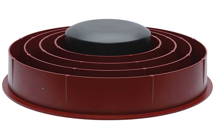
Case New Holland (CNH) has selected the Tallysman Wireless VeraChoke antenna for modernization of its high-precision European GNSS real-time kinematic (RTK) network.
“The objective of the GNSS antenna update is to enable the tracking of all GNSS constellations and signals, thus improving the robustness, convergence time, and accuracy of positioning within CNH’s European RTK network,” said Michiel Jochims, CNH Industrial RTK manager EMEA. “At this stage, with only 25 stations updated, we are delighted to observe a significant performance improvement. We look forward to continuing the network update and bringing enhanced positioning to all of our European customers.”
The VeraChoke antenna provides excellent multipath suppression and repeatability of PCV and group delay variation (GDV), making it suitable for GNSS reference networks, explained Temo Wubbena, CEO of Geo++. “After detailed analysis, we have recommended Tallysman’s VeraChoke antenna to CNH Industrial.” Geo++ is supporting the upgrade of CNH Industrial’s European RTK network.
The patented VeraChoke has a very tight phase center variation (PCV), strong multipath mitigation and excellent performance across the full GNSS spectrum. Its PCV and phase center offsets (PCOs) are repeatable from unit to unit, making suitable for network RTK applications.
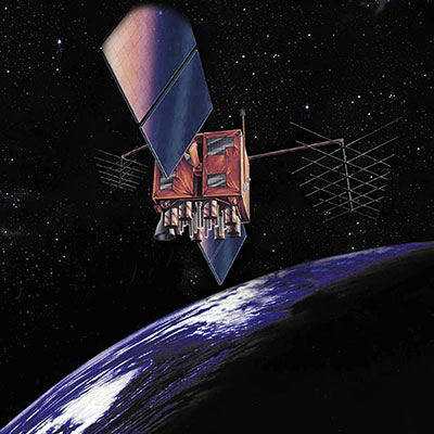
Artist’s rendition of a GPS-IIR satellite in orbit. (Image: GPS.gov)
The U.S. Space Force has announced the decommissioning of GPS satellite SVN-47 (PRN-22), which officially took place Jan. 18. The satellite has been unusable since Dec. 2.
SVN-47 was a replacement satellite in the second generation of GPS satellites (GPS-IIR), launched Dec. 21, 2003.
The announcement was made in a Notice Advisory to NavStar Users (NANU 2022001) issued by NAVCEN, U.S. Coast Guard.
The designation PRN-22 will be used to bring SVN-41 back in to the active constellation. After 2200 Zulu on Jan. 2o, GPS will transition SVN-41 (PRN-22) into the broadcast almanac for all satellites, and SVN-41 will resume transmitting L-band signals. The almanac transition, accomplished one satellite at a time, will require approximately 24 hours to complete.
A second NANU emphasized that “Before, during, and after transition SVN-41 (PRN22) will remain unusable until further notice.”
SVN-41, the sixth of the GPS-IIR satellites, was launched on Nov. 10, 2000, and set to active service a month later on Dec. 10. It was decommissioned in July 2021.
RINEX 4.00 (2021) is a major revision of the format document to modernize the navigation message files to be able to accommodate the new navigation messages from all the GNSS constellations, as well as system data messages such as ionospheric corrections, Earth orientation parameters and system time offsets.
The RINEX Working Group Chair Ignacio Romero provided an explanation to the GNSS community about the new RINEX 4.00 format that explains changes from previous RINEX versions.
The new format is also described in detail on the IGS Format and Standards page. For more information on the RINEX updates and activities, visit the RINEX WG Page.
The IGS adopted RINEX 4.00 during its 59th Governing Board Meeting on Dec. 7, 2021.
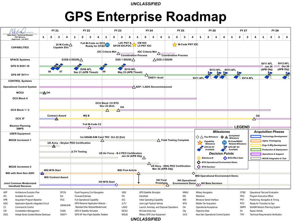
The U.S. Space Force has released a graph illustrating the GPS Enterprise Roadmap. The roadmap provides timelines for all the different elements of the GPS enterprise through the end of fiscal year 2028.
The link includes proposed changes for IS-GPS-200, IS-GPS-705 and IS-GPS-800 related to RFC-467 (2021 Proposed Changes to the Public Documents), as well as updated briefing charts for the 2021 GPS Public Interface Control Working Group (ICWG).
The updated documents reflect changes discussed at the 2021 Public ICWG on Sept. 29, 2021.
John Deere has revealed a fully autonomous tractor ready for large-scale production. The machine combines Deere’s existing 8R tractor, a TruSet-enabled chisel plow, a GPS-based guidance system, and new advanced technologies.
The autonomous tractor has six pairs of stereo cameras, which enable 360-degree obstacle detection and the calculation of distance. Images captured by the cameras are passed through a deep neural network that classifies each pixel in 100 milliseconds and determines whether the machine continues to move or stops, depending on whether an obstacle is detected. The autonomous tractor continuously checks its position relative to a geofence, ensuring it operates where it is supposed to, and is within less than an inch of accuracy.
John Deere Operations Center Mobile provides access to live video, images, data and metrics on a mobile device. Using the app, farmers can swipe from left to start the machine. While the tractor is working, the farmer can leave the field to focus on other tasks, while monitoring the machine’s status.
The app allows a farmer to adjust speed, depth and more. In the event of any job quality anomalies or machine health issues, farmers will be notified remotely and can make adjustments to optimize the performance of the machine.
Unveiled at the 2022 Consumer Electronics Show in Las Vegas on Jan. 4, the autonomous tractor will be available to farmers later this year.
NextNav’s Pinnacle 911 will deliver Z-axis capabilities with floor-level accuracy for wireless 911 calls in more than 4,400 cities and towns across the United States.
NextNav has entered into an agreement with one of the nation’s largest wireless carriers, not yet named, to deliver vertical location for Enhanced 911 (E911), using NextNav’s Pinnacle 911.
Pinnacle 911 leverages the barometric sensors already available in phones, tablets and other devices to deliver “floor-level” altitude measurements that exceed the FCC mandate for 3-meter accuracy. The Pinnacle service compares device data to local conditions, subtracting the weather and other factors to leave behind a highly accurate altitude measurement.
NextNav altitude stations create a hyperlocal model of environmental conditions. The precisely surveyed, high-density network delivers “floor level” real-time altitude data nationwide.
NextNav’s dedicated, managed network makes Pinnacle available throughout metropolitan areas, providing comprehensive coverage that scales to meet a variety of use cases.
The delivery of vertical location to public safety answering points (PSAPs) nationwide will improve emergency response in the United States. It enables first responders to accurately locate wireless 911 callers in multi-story buildings, enhancing both safety and response times, and helping to save lives.
With NextNav’s Pinnacle 911 reaching more than 4,400 cities and towns in the United States, including 90% of buildings above three stories, implementation of the service will exceed the Federal Communication Commission’s (FCC) Z-axis requirement for nationwide E911.
“For over two decades, one of public safety’s key needs has been 3D geolocation information — especially floor-level vertical location,” said Ganesh Pattabiraman, CEO of NextNav. “Partnering with one of the nation’s largest wireless carriers to deliver precise, Z-axis information will not only improve geolocation information for PSAPs, but save lives by reducing emergency response times by more than 80%. This adoption of our Pinnacle technology for 911 marks a historic step forward for communities around the nation, and public safety as a whole.”
In an independent evaluation by the Cellular Telecommunications and Internet Association commissioned by the FCC, Pinnacle was able to deliver floor-level accuracy (defined as ±3 m) 94% of the time, consistently exceeding the 80% benchmark set by the FCC.
NextNav’s Pinnacle service enables applications and technologies that rely on precise altitude data across industries, including public safety, mobile apps and gaming, lone worker tracking as well as out-of-home retail experiences.
NextNav’s extensive list of existing partners and customers includes AT&T FirstNet, Intrepid Networks, 3am, TRX Systems, Qualcomm, Bosch, Unity and Unreal Engine.
Hemisphere GNSS has announced another Vega heading and positioning OEM board using the Lyra II and Aquila chipsets.
The Vega 60 GNSS board fits industry-standard 46 x 71 mm form factors with a 60-pin connector. It can be used to replace more expensive and lesser abled 60-pin boards with either single- or dual-antenna capabilities.
Hemisphere’s Lyra II and Aquila application-specific integrated circuit (ASIC) designs provide the ability to simultaneously track and process more than 1,100 channels from all GNSS constellations and signals including GPS, GLONASS, Galileo, BeiDou, QZSS, NavIC, SBAS and L-band. The ASIC technology offers Vega 60 scalable access to every modern GNSS signal available.
Cygnus interference mitigation technology is also a standard feature, providing built-in digital filtering capabilities and spectrum analysis. This provides enhanced anti-jamming as well as interference detection and mitigation.
“We are excited for the opportunity to introduce our Vega 60 board,” said Miles Ware, director of marketing at Hemisphere. “Vega 60 brings our industry-leading heading and position solutions to an OEM board footprint with very few affordable upgrade paths.”
Spirent Communications plc has chosen Navmatix s.r.o., a Czech-based company that provides cloud infrastructure for real-time data delivery, to provide cloud infrastructure for its GNSS Foresight service.
Spirent GNSS Foresight is a cloud-based service delivering real-time data on the availability and quality of GNSS signals. The solution accurately forecasts when and where GNSS positioning and navigation will be most reliable through a combination of high-definition maps and precise orbital modelling. This makes it possible to obtain a clear picture of the operating environment at a moment’s notice.
GNSS Foresight will ultimately allow unmanned vehicles, air taxis and drones to operate beyond-visual-line-of-sight (BVLOS) safely.
The GNSS Foresight service enables flight in challenging environments by calculating GNSS availability for every meter, every second, from 1-100 meters altitude, for up to three days into the future. (Image: Spirent Communications)
Navmatix will provide the cloud infrastructure required to deliver GNSS forecast data as real-time data via an API. Navmatix will be deploying full operational and developmental support, including hosting for collection and processing the GNSS forecast data through its content delivery network (CDN). The CDN allows the end user to efficiently query, comprehend and interact with the data. Navmatix will handle the foundational infrastructure of the project, a significant phase in expansion of the company as a whole.
“Spirent Communications are pioneers in GNSS test and assurance solutions, and the Spirent GNSS Foresight service expands our solutions to help autonomous systems reliably use GNSS,” said Jeremy Bennington, vic president of PNT Assurance. “Navmatix has built a framework that can deliver mission-critical services, which is also reliable and scalable. We’re excited to be partnering with Navmatix and look forward to growing Navmatix’s CDN to support the growth of Spirent GNSS Foresight solution throughout its complete lifecycle.”
Because of the amount of data generated, the architecture delivers a robust and sophisticated solution, according to Navmatix. Being entirely cloud based, it allows for continual updates and remote access. The cloud infrastructure will provide the tools necessary to deliver Spirent GNSS Foresight services to Spirent customers worldwide.
Navmatix offers managed infrastructure solutions for the operation, development and ongoing maintenance of GNSS services worldwide.
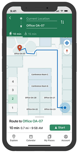
Esri has released ArcGIS IPS, an indoor positioning system. ArcGIS IPS adds a blue dot to indoor maps, enabling users to locate their current position inside a building in the same way GPS enables outdoor location indicators.
ArcGIS IPS is designed to enable new use cases to improve on-site experiences, workplace operations and efficiencies. It uses an alternative technology to enable real-time positioning inside buildings that unlocks a variety of use cases, the company said.
Use cases inside buildings include:
real-time localization and positioning
real-time navigation and wayfinding
live location sharing and tracking
live location tracking
location data capture and analytical insights
real-time localization and positioning.
ArcGIS IPS is available for users of ArcGIS Indoors, an indoor mapping system for smart building management, and ArcGIS Runtime SDKs, which enables the indoor positioning capability in custom-built apps.
Image: Esri
ArcGIS IPS comes with the mobile ArcGIS IPS Setup app, which allows collection of radio signals from Bluetooth Low Energy (BLE) beacons inside buildings to enable an indoor positioning system. It can make use of an existing or new beacon infrastructure and is vendor agnostic.
ArcGIS IPS geoprocessing tools are also included to set up and author an IPS environment in ArcGIS Pro.
Users can navigate to specific points of interest — places, assets or people — in real time. This requires an existing app based on ArcGIS Runtime to support routable networks. ArcGIS Indoors can also display the route to a destination.
“Seen & Heard” is a monthly feature of GPS World magazine, traveling the world to capture interesting and unusual news stories involving the GNSS/PNT industry.
Photo: lindsay_imagery/E+/Getty Images
Where Sea Turtles Nest
Florida’s Sea Turtle Grants Program — funded with proceeds from special license-plate sales — were used to purchase Trimble TDC100 and TDC600 handheld GNSS receivers for state park staff to gather data about turtle nesting activity. The staff also uses Esri’s ArcGIS Survey123 field-capture software to report on turtles using the 108 miles of beach in 40 of Florida’s state parks. Negative impacts from commercial fishing, plastic waste and climate change have become a threat to sea turtles, which are now classified as an endangered species.
Concept of vertiport at airport. (Groupe ADP)
Paris up in the Air
Paris has begun testing electric air taxis at a new site outside the French capital, with an eye toward creating at least two demonstration flight paths during the 2024 Olympics to ferry passengers from nearby airports. Inaugurated in November, the test site is dedicated to new sustainable urban air mobility, and will study the use of electric vertical take-off and landing (eVTOL) aircraft. Choose Paris Region, Groupe ADP and RATP Group are managing the effort with VoloCity taxis by Volocopter onboard.
Photo: Stanislav Ostranitsa/iStock/Getty Images Plus/Getty Images
Russia Threatens GPS
The Kremlin warned it could blow up 32 GPS satellites with its new anti-satellite technology (ASAT), which it tested Nov. 15 on a retired Soviet Tselina-D satellite, according to numerous news reports. Russia then claimed on state television that its new ASAT missiles could obliterate NATO satellites and “blind all their missiles, planes and ships, not to mention the ground forces,” said Russian Channel One TV host Dmitry Kiselyov, rendering the West’s GPS-guided missiles useless. “It means that if NATO crosses our red line, it risks losing all 32 of its GPS satellites at once.”
Bali toll gate. (Photo: dwart/iStock/Getty Images Plus/Getty Images)
Indonesia Goes Cashless
Indonesia’s GNSS-based cashless toll system will take effect by the end of 2022, reports Indonesia Expat. The country’s Public Works and Public Housing Ministry plans to have its multi-lane, free-flow-based non-cash toll transaction system implemented on 40 toll roads on the islands of Java and Bali. MLFF uses GNSS plus a map-matching process and special toll road apps on smartphones to determine fees. The system is expected to increase efficiency, effectiveness, security and convenience in conducting toll road payment transactions.
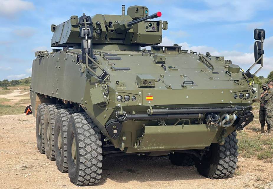
GMV will supply its advanced navigation and timing solution to the Spanish Army, providing positioning information on armored vehicles with or without GNSS signals.
The 8×8 Dragón wheeled combat vehicle (WCV, or VCR in Spanish) will use GMV’s ISNAV system. GMV signed a contract with TESS Defence in August 2020 for €2.1 billion. The contract will equip 240 Dragóns with ISNAVs. GMV plans to produce the ISNAV units at its manufacturing facilities in Tres Cantos, which opened in 2019. The first units will be delivered in the fourth quarter of 2023.
The ISNAV system was developed by GMV as part of the VCR 8×8 Technology Program. It meets the demanding requirements of the program and has successfully passed both the mission system integration tests, and the functional tests installed on several demonstration units.
The ISNAV was designed to be modular equipment that can be adapted to various vehicle configurations, sensors and receivers. It includes the option of including Galileo PRS to provide advanced PNT (positioning, navigation and timing) capabilities, making it possible to determine the position of the vehicle in all kinds of scenarios, including scenarios without a GNSS signal.
By J. David Grossman Vice President of Regulatory Affairs Consumer Technology Association
This January, the annual Consumer Electronics Show (CES) — owned and produced by the Consumer Technology Association (CTA) — returned to Las Vegas. As the premier global platform for innovation, each year CES showcases the latest and greatest consumer technologies, from smartphones and wearables to self-driving trucks and electric cars.
GPS continues to play a central role in the technology we use daily. At CES, GPS-enabled technologies are found in nearly every product category, including 5G, internet of things (IoT), smart cities, vehicle tech and fitness wearables.
They are also among the CES 2022 Innovation Awards honorees, such as a connected bracelet that can alert emergency contacts and a robot that can identify the difference between crops and weeds.
How did GPS come to play such a critical role in devices as diverse as drones and smartphones?
Over the past 40 years, GPS has transformed from its origins as a military technology to one that no consumer or business can live without. During the 1990s, CTA members such as Panasonic and Sony pioneered commercially available GPS receivers.
At CES 1998, Garmin introduced StreetPilot, described as “one of the first practical and affordable GPS-based road navigation devices” and paved the way for huge growth in the consumer GPS market.
By the 2000s, GPS was no longer just a stand-alone technology. Following new Federal Communications Commission requirements, GPS-enabled smartphones opened the door for all-in-one devices. These products could deliver turn-by-turn navigation or identify the location of a lost or stolen device. In more recent applications, GPS technology provides the foundation for ever-more-complex mobile applications.
Opening of the 2022 Consumer Electronic Show. (Photo: Consumer Technology Association)
Foundational Technology
The evolution of GPS reflects a broader industry trend: innovators integrate foundational technology into successive generations of products, spurring development of new products and services. We’ve seen the same pattern play out for Wi-Fi, Bluetooth and Near Field Communication (NFC), which enables the latest tap-to-pay technologies. Hundreds of companies simply would not exist without free, global access to GPS signals!
With GPS, ridesharing companies such as Lyft match drivers and passengers, lead drivers to a precise pick-up location, and chart out a safe and efficient driving route. GPS-integrated smartwatches allow runners and cyclists to easily track pace and distance, a huge boon for many of us in the pandemic era. Closer to home, GPS-enabled pet collars help families keep tabs on their furry friends.
Revolutionary
Beyond the technology we use daily, GPS technology is also revolutionizing such industries as agriculture. Thanks largely to GPS, centuries-old businesses are now technology companies. For instance, John Deere leveraged its 185-year history of building tractors and combines GPS with other location technologies to steer semi-autonomous tractors with centimeter accuracy. In addition to the time and efficiency benefits for farmers, technologies like these support sustainable agriculture by reducing the use of pesticides, water, seed and fertilizer.
John Deere held a Media Days press conference at Mandalay Bay during CES 2022. (Photo: Consumer Technology Association)
The success of GPS is important for our industry’s success, and I am proud of the role GPS plays in everyday life. Modernization of GPS, supported by the U.S. government and industry, will enhance the accuracy, reliability and resiliency of the technology, which in turn will ensure GPS remains central to the innovation economy.