Category: Autonomous

  • Swift integrates high-integrity GNSS with Nvidia Drive AGX platform

    Swift integrates high-integrity GNSS with Nvidia Drive AGX platform

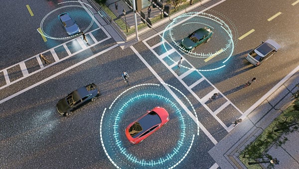
    Swift Navigation is collaborating with Nvidia to enable a more scalable, cost-effective approach to autonomous driving by integrating the Nvidia Drive AGX platform with Swift’s globally referenced, centimeter-accurate GNSS positioning.

    Swift Navigation offloads absolute localization to the GNSS sensor stack using its Swift Automotive Suite. The suite is a complete, modular software solution for safe, high-integrity precise vehicle localization that combines the centimeter-level Skylark Precise Positioning Service with the Starling positioning engine, software that fuses raw GNSS data and corrections with inertial sensors (IMU) and wheel odometry to deliver high-integrity, centimeter-accurate positioning (PVT).

      By entrusting lane-level positioning to Swift’s high-precision stack, the vehicle’s optical sensors are relieved of the absolute positioning burden. This allows the perception stack to be optimized for obstacle detection and immediate safety, significantly reducing overall system cost and complexity.

      Integration with Nvidia Drive AG

      The integration is delivered through the Starling SAL Plugin for Nvidia DriveWorks. The Nvidia Drive AGX platform is the industry-standard, end-to-end platform for software-defined vehicles, scaling from assisted to fully autonomous operation. DriveWorks, its comprehensive SDK, provides a unified sensor abstraction layer (SAL) for seamless ingestion of data from all sensor types.

      Swift’s new plugin acts as a drop-in component within this architecture. Sitting between the vehicle’s raw GNSS sensors and higher-layer software, such as that for localization, the plugin invisibly handles the complex mathematics of GNSS corrections and sensor fusion, outputting a clean, corrected position stream directly into the standard DriveWorks interface.

      “We are removing the single biggest hurdle to widespread autonomy: the complexity and cost of localization,” said Holger Ippach, EVP of Product and Marketing at Swift Navigation. “By delivering Starling’s natively integrated, high-integrity GNSS to Nvidia DriveWorks, we are giving OEMs a direct path to globally referenced, lane-level positioning that is simple, scalable, and affordable.”

      The collaboration and the Starling SAL Plugin unlock several advantages for automotive OEMs leveraging the Nvidia Drive platform:

      • Cloud-native ASIL safety. Skylark is an ASIL-certified positioning service built entirely in the cloud, offering scalability and reliability at a lower cost than solutions reliant on physical data centers.
      • Comprehensive sensor fusion. The Starling Positioning Engine delivers robust, high-integrity positioning by fusing precise GNSS with IMU and wheel odometry, ensuring continuous, lane-level accuracy even in signal-challenged environments.
      • Plug-and-play precision. Developers no longer need to build localization stacks from scratch. High precision is toggled on simply by adding the Starling plugin to the DriveWorks configuration.
      • Hardware independence. Because Starling is software-defined, Nvidia customers can achieve high performance using a wide variety of mass-market GNSS receivers, rather than being locked into expensive, proprietary navigation units.
      • Pre-validated integration. The Starling plugin has been rigorously tested and validated within the DriveWorks environment. This eliminates the complex, months-long burden of validating custom sensor drivers and fusion algorithms, allowing engineering teams to focus immediately on high-level path planning and control.

      The Starling SAL Plugin for Nvidia DriveWorks is available now.

    1. MatrixSpace wins C-UAS Low-Cost Sensing Challenge

      MatrixSpace wins C-UAS Low-Cost Sensing Challenge

      Winners of the U.S. defense Counter-small Unmanned Aircraft System (C-sUAS) Low-Cost Sensing (LCS) challenge have been announced.

      MatrixSpace Inc. was selected as the overall winner and will receive the top award of $500,000. Following the overall winner, the top three performers — Guardian RF, Hidden Level and Teledyne FLIR Defense — will each receive award amounts of $100,000.

      The selected systems secured a place among the 10 finalists who advanced to live testing during USNORTHCOM’s Falcon Peak 25.2 exercise, outperforming 115 submissions. The system demonstrated capability in detection, classification, localization, scalability, cost and integration readiness.

      Sponsors of the award include Defense Innovation Unit (DIU), U.S. Northern Command (USNORTHCOM), Joint Interagency Task Force 401 (JIATF-401), U.S. Army, U.S. Navy, U.S. Marine Corps and U.S. Indo-Pacific Command.

      “Small UAS threats are evolving faster than traditional acquisition cycles, and meeting that challenge requires capabilities that can be deployed at speed and scale,” said David Payne, acting director of DIU’s Autonomy Portfolio. “The selected solutions show how commercial innovation can strengthen our layered defense — delivering affordable sensing that we can field widely, adapt quickly, and keep the warfighter ahead of the threat.”

      The MatrixSpace platform combines ultra-low SWaP-C radar, AI-driven edge intelligence, and distributed networked CUAS powered by AiCloud. During the evaluation, it successfully detected, tracked and classified every sortie flown —including RF-dark fiber FPVs, commercial drones, and custom-built UAVs.

      A scalable, distributed approach to counter-UAS sensing

      The LCS challenge, launched in May 2025, was designed to complement existing sensor systems by identifying emerging technologies that enable broad, distributed, and resilient sensing architectures. During FP 25.2, the 10 selected finalists demonstrated solutions spanning radio frequency passive detection, active radar, acoustic sensing, optical and infrared modalities, and hybrid systems.

      These technologies collectively showed potential cost savings of 50–80 percent in total cost of ownership, while still meeting key coverage and performance requirements for C-sUAS defense.

      During live testing, vendors were evaluated against a variety of small UAS flown both individually and in coordinated multiples, employing diverse communication protocols. Finalists were not informed which platforms or profiles they would be tested against, ensuring performance was measured under realistic, un-scripted, and operationally relevant conditions.

      Evaluated by experts and end-users, against a rigorous selection criteria,challenge winners differentiated themselves by demonstrating tailored technical strengthshigh performance against threat-representative UAS targets and demonstrating a cost-effective architecture enabling deployment at scale across fixed, mobile, and austere environments.

      About the LCS Challenge

      The Counter-sUAS Low-Cost Sensing (LCS) challenge sought to identify emerging sensor solutions that could:

      • expand detection coverage
      • reduce total lifecycle cost
      • integrate seamlessly into joint C2 architectures
      • provide the resilience and redundancy required to counter small UAS threats.

      Launched in May 2025, the challenge drew participation from traditional and nontraditional vendors across the country, representing the full spectrum of sensing modalities. The Falcon Peak 25.2 exercise provided a realistic environment to evaluate these capabilities under operationally relevant conditions.

      For more information about DIU’s work accelerating commercial technology into the Department of Defense, visit www.diu.mil.

    2. Safe Pro unveils new algorithms for GPS-denied drone operations for U.S. Army

      Safe Pro unveils new algorithms for GPS-denied drone operations for U.S. Army

      The latest generation of Safe Pro’s AI technology will be presented at U.S. Army exercise at Fort Hood, Texas

      Safe Pro Group, a developer of artificial intelligence (AI)-enabled defense and security solutions,  has deployed upgraded AI algorithms to its patented Safe Pro Object Threat Detection (SPOTD) technology for drone operations in GPS-denied environments.

      The newly enhanced SPOTD capabilities will be prominently featured at the upcoming U.S. Army 2026 Concept Focused Warfighter Experiment (CFWE) technology demonstration taking place at Fort Hood, Texas.

      Operating on the Amazon Web Services (AWS) Cloud or at the Edge, SPOTD is Safe Pro’s patented rapid battlefield image analysis platform designed to identify and map small explosive threats such as landmines and ambush drones detected in videos collected from virtually any drone.

      The ability for SPOTD to rapidly detect threats and create 2D/3D models from drones flying in GPS-denied environments was developed after real-world exercises in Ukraine at the request of end users. The integration of these new algorithms further enhances the value of SPOTD as a situational awareness tool for use in a wide array of military reconnaissance and planning operations.

      SPOTD enhancements include:

      • Ability to process any drone video data: Turning video clips into 2D and 3D models with AI-trained explosive threat detections
      • Enhanced operational robustness: Operating capability in GPS and GPS/GNSS denied environments
      • Terrain modeling: Threat and terrain mapping in support of unmanned ground vehicles (UGVs) route planning
      • Rapid mapping-only mode: Mapping for intelligence, surveillance and reconnaissance (ISR) and missions that do not require AI-powered threat detections
      • Accelerated processing: Up to 10x reduction in processing time powered by Safe Pro’s proprietary geospatial AI algorithms.

      Powering the company’s SPOTD technology is Safe Pro’s unique real-world datasets, which include high-resolution drone imagery and GPS-tagged geospatial data encompassing more than 2.2 million drone images analyzed to date, and 41,400+ threats identified across 11,400 hectares (28,000+ acres).

    3. Genesys launches high-definition ADAS maps for India

      Genesys launches high-definition ADAS maps for India

      Genesys has developed India’s first large-scale high-definition maps engineered specifically for vehicles enabled with advanced driver assistance systems (ADAS).

      Covering more than 1 lakh km of India’s national highways, expressways and strategic corridors, this initiative marks one of India’s most ambitious road intelligence programs and establishes a new benchmark for automotive-grade precision.

      India’s highways account for a disproportionately high share of road fatalities, driven by fast-moving traffic, inconsistent lane discipline, and limited real-time awareness for drivers and vehicles. HD maps narrow this gap by adding the centimeter-level context that traditional maps cannot provide — lane geometry, curves, slopes, signage, barriers and localization cues that help ADAS systems anticipate danger instead of merely reacting to it. This is a big leap forward from current sensor-based ADAS systems, Genesys said.

      The HD maps include ADAS-critical features such as lane geometry, road markings, barriers, signage, medians, elevation and curvature profiles, and localization objects like poles and gantries — all processed to achieve centimeter-grade precision.

      CORS network plays a key role

      To achieve the centimeter-level accuracy required for ADAS Level 2 functionality, Genesys relies on the Survey of India’s Continuously Operating Reference Stations (CORS) network. Real-time GNSS correction signals along major corridors dramatically strengthen field operations, allowing survey teams to capture lane-level and asset-level detail that meets global automotive standards.

      This work builds on the existing memorandum of understanding between Genesys and Survey of India, enabling collaboration on digital twin projects, national mapping programs, and high-accuracy geospatial missions.

      These datasets are owned by Genesys and can be licensed across industries, creating opportunities in commercial fleet navigation, logistics optimization, mobility platforms, safety analytics and automotive R&D.

    4. NASA preps Mars helicopter as war shapes defense tech future

      NASA preps Mars helicopter as war shapes defense tech future

      It’s always good news when we hear about NASA’s “out-of-this-world” next steps toward building a replacement for Ingenuity, the small Mars helicopter-drone. With 72 flights over 1,004 days, Ingenuity outlived NASA’s expectation of just 30 operational days on Mars. It ended up serving as a trailblazer for the SUV-sized Perseverance rover as it worked its way around Jezero Crater. Built with a large number of smartphone components, it’s actually amazing that this thing survived for so long, given the radiation environment on the surface of Mars, along with the harsh temperature extremes of daytime 32°F to nighttime minus 130°F. How a Samsung S5 phone battery survived, operating so far outside its design temperature range, is hard to fathom.

      NASA’s 20-year plan for future Mars exploration now looks to take advantage of the huge expansion of the envelope for exploration that the small 30-day Mars helicopter brought to the Perseverance mission: “Enhanced mobility systems will enable exploration of challenging terrains and increased operational range. Aerial mobility technologies will facilitate access to previously unreachable areas on Mars.”

      NASA drone flies over ‘Mars Hill’ in Death Valley during recent navigation tests (Photo: NASA/JPL)
      NASA drone flies over Mars Hill in Death Valley during recent navigation tests. (Photo: NASA/JPL)

      So now NASA is working on the next Mars rover mission and on improvements for its accompanying airborne support. A team recently took three commercial drones into Death Valley to work on overcoming navigation problems that Ingenuity encountered on Mars flying over “bland” terrain with few visual features for its optical navigation system. Sand dunes without features on Mars messed with Ingenuity’s navigation solution, including on its 72nd flight.

      Death Valley and Mesquite Flats Sand Dunes were two places the NASA team visited to test improved navigation algorithms installed on existing commercial drones, and they found some improvements by adding camera filters. The new software helped find landing spots in cluttered terrain.

      But now new initiatives are seeking ways to get crewed flights to Mars in the next couple of years, well ahead of NASA’s timetable, which doesn’t move to anything crewed until around 2030. NASA still seems to prefer to pursue landers to gather much more data on Mars before risking crewed flights. Robotic dogs are also being investigated that can traverse rugged uphill areas that landers cannot access, as well as a winged glider the size of a small school bus.


      Meanwhile, the never-ending Russia-Ukraine war rages on, dominated by drone attacks from both sides. Russia is increasingly using Iranian Shahed or the equivalent Russian-produced Geran-2 one-way drones, while Ukraine intercepts them with low-end modified commercial drones. This stalemate has $20,000 Geran-2 drones being brought down by high-speed interceptor drones built for $2,000 to $6,000 — in other words, the cost of attrition might determine the victor.

      Russian Geran-3 jet-powered drone downed by Ukraine. (Photo: DIU)
      Russian Geran-3 jet-powered drone downed by Ukraine. (Photo: DIU)

      However, Russia has now introduced a jet-powered Geran-3 model that flies at up to 230 mph, which Ukraine has apparently been able to bring down.

      As we well know, Ukraine not only regularly receives Western military equipment but also civilian drones in large numbers. But an industrial capability has also been created in Ukraine to design, develop and build high volumes of drones. So it’s not surprising that Ukraine has revealed its own interceptor drone known as Sting.

      STING interceptor drone and imagery striking a Shahed drone. (Photo: Wild Hornets Group)
      STING interceptor drone and imagery striking a Shahed drone. (Photo: Wild Hornets Group)

      Nevertheless, Sting has four rotor props and should be no match for a Geran-3 flying at top speed, even though Sting is claimed to be capable of 215 mph. The Russian jet-powered drone also apparently comes with anti-jam capabilities and a satellite navigation system, but Russia has yet to field these new drones in large numbers. Of course, Ukraine says it has already developed jet-powered interceptor drones — so the step up to the next level of technology should happen for both sides, but of course, costs increase for both sides, which neither can really afford.


      Defense has always affected the speed of development for any technology — government funding and oversight are major incentives for new companies to emerge and for new technologies to be developed. Anduril Industries has recently emerged as a new entrant to the U.S. industrial defense complex, specializing in autonomous systems. Anduril’s products include unmanned aircraft systems and counter-UAS, and they have made big strides in both areas.

      Anduril is a relatively new company, initially founded in 2017, so its products are fresh off the drawing board and its product improvement experience is at best eight years. The big U.S. defense contractors have fielded and corrected decades of problems in their high-tech systems, so new generations come with hard-learned design and build understanding. The advantage for Anduril is that they are not bound by the restrictions of a long-established industrial heritage, but this can also mean they may still have a way to go in learned experience.

      Nevertheless, in high technology, much is new technology and new software and new approaches to build. So it takes effort to not only make this stuff work but also to make it work reliably.

      Altius — 33lb warhead attack drone. (Photo: Anduril)
      Altius — 33lb warhead attack drone. (Photo: Anduril)

      Anduril builds lots of test articles and rapidly evolves the design through rigorous internal and real-world testing. So it’s not uncommon to see test failures — this is how improvements are developed.

      Recent U.S. defense tests that saw crashes at Eglin Air Force Base in Florida drew a lot of bad press, given that the Altius drone had already been battle-tested in Ukraine. However, if the approach of lower cost, high volume and attritable drones is the one we have chosen, it may take a little more time to get maturity into the beast.


      Navigation testing for NASA’s next Mars drone, jet-powered attack drones, and evolving interceptor defenses and drones from a new player on the U.S. defense scene — a pretty wide range of unmanned aircraft applications.

    5. Robosat partners seek improved localization of autonomous machines

      Robosat partners seek improved localization of autonomous machines

      Researchers from Finland, Switzerland, Spain and Romania gathered at Tampere University in Finland for a workshop this month within the Robosat project focusing on localization of autonomous machines.

      Workshop participants discussed and demonstrated novel technical solutions to improve localization, particularly of autonomous machines operating in challenging and unconstrained environments, such as forests and mountainous regions.

      The Robosat project aims to change how autonomous robots navigate in the wild by integrating multi-sensor and multi-GIS data. During the Tampere workshop, partners from Tampere University (Finland), ETH Zürich (Switzerland), Universitat de València (Spain) and CITST (Romania) discussed strategies for sharing data, identifying relevant GIS and GNSS datasets, and leveraging AI for autonomous labeling of large-scale data. 

      Key topics included the integration of multi-sensor and multi-GIS data to enhance positioning accuracy, planning piloting tests with ETH’s ANYmal robot and TAU’s new I/Q GNSS grabber device, and discussing methods for AI-driven data labeling for massive datasets collected during field trials.

      The Tampere University project team includes Elena Simona Lohan and Jari Nurmi as supervisors and Ph.D. students Yelyzaveta Pervysheva and Muhammad Safi.   

      The Robosat efforts supports applications in robotics, environmental monitoring, and industrial automation. By combining expertise across Europe, Robosat intends to pave the way for smarter, safer and more efficient autonomous systems.

      It also aims to provide new open-access rich datasets to the research community. A first dataset enabling multimodal classification studies has already been published on Zenodo as a collaborative work between Tampere University and CITST teams.

      The Robosat project

      Autonomous robot navigation in the wild using satellite-based 3D geographical information (ROBOSAT) aims to provide a scalable MultiGIS high-quality data collection platform through the use of a quadrupedal robot that can autonomously perform long-distance missions in challenging environments, such as Alpes mountains or Finnish forests.

      Consortium organizations are comprised of three universities and one SME:

      • Tampere University, Finland. Expertise: GNSS, wireless positioning, sensing, and communications, RF Fingerprinting and interference mitigation. Coordinator: Elena Simona Lohan
      • ETH, Switzerland. Expertise: automation, mapping, control theory, and legged-robot research. PI: Marco Hutter
      • Universitat de Valencia, Spain. Expertise: computer science, database management, machine learning. PI: Joaquin Torres Sospedra
      • CITST, Romania. Expertise: machine learning/artificial intelligence, robotics, exploitation. PI: Irina Mocanu.
    6. EUROCAE seeks input on use of GNSS in UAS

      EUROCAE seeks input on use of GNSS in UAS

      The draft EUROCAE document ED-348: Guidelines for the use of multi-GNSS solutions for UAS – Medium Risk is now open for comments.

      Between 2019 and 2022, EUROCAE group SG-6 developed guidelines for low risk operations Sail I and Sail II (ED-301) to support the use of GNSS and show compliance with previously established safety objectives (SORA OSO#13).

      SORA OSO#13 is also applicable to higher SAIL operations with a different level of assurance, which may take the form of a service level agreement (SLA) with external GNSS service providers. This changes the approach with respect to low-risk operations, so a new standard will be defined instead of evolving ED-301.

      “When discussing the use of GNSS in UAS operations, the assessment cannot be limited to GNSS as an external service only, but should consider other critical aspects such as system architecture, vulnerabilities, performance analysis, receiver design or integration, among other elements,” SG-6 posted on the EUROCAE website.

      Because the requirements for medium-risk operations are more demanding than for low-risk operations, the scope of the ED-348 document not only covers compliance with OSO#13 requirements — where GNSS is considered an external service to support UAS operations — but also considers other relevant SORA OSOs where GNSS plays a relevant role.

      Based on this information, the guidelines cover the following OSOs in regard to GNSS support SAIL III operations:

      • OSO#05: UAS is designed considering system safety and reliability.
      • OSO#08: Operational procedures are defined, validated and adhered to.
      • OSO#13: External services supporting UAS operations are adequate to the operation.
      • OSO#23: Environmental conditions for safe operations are defined, measurable and adhered to.
      • OSO#24: UAS is designed and qualified to operate under adverse environmental conditions.

      Interested parties are invited to review the proposed draft on the EUROCAE Workspace and complete the comment form. Non-members of EUROCAE can register and click on “Access only to Open Consultation”). Early replies are encouraged; the deadline for comments is Feb. 2, 2026.

      The non-profit European Organisation for Civil Aviation Equipment (EUROCAE) is based in Lucerne, Switzerland, and serves as a European forum focusing on electronic equipment for air transport.

    7. AeroVironment expands Puma visual navigation system kit to Puma LE

      AeroVironment expands Puma visual navigation system kit to Puma LE

      AeroVironment has integrated its visual navigation system (VNS) kit with the Puma Long Endurance (LE) small unmanned aircraft system, delivering GNSS-denied navigation capability to ensure mission success.

      First introduced in 2022 for the Puma 2 AE and Puma 3 AE, the VNS kit uses advanced computer vision and onboard processing to deliver precise, GNSS-independent navigation. Its integration into Puma LE now extends this capability across the full Puma family for greater flexibility and resilience in degraded or denied environments.

      “Assured navigation is critical to the mission, especially as GNSS becomes an increasingly vulnerable resource,” said Jason Hendrix, Vice President of Small Uncrewed Systems for AV. “By fusing visual and inertial data in real time, the system enables uninterrupted flight paths, accurate geolocation, and mission continuity in unreliable GNSS regions.”

      Using a suite of downward-facing sensors, cameras and onboard computing, the VNS kit performs visual inertial odometry (VIO) to capture and analyze terrain imagery, estimating true aircraft position in real time. The system fuses continuous visual data from the cameras with motion inputs from onboard inertial sensors to calculate precise position, velocity, and orientation — allowing the aircraft to know where it is and where it is going when GNSS is not available. It automatically transitions between GNSS-enabled and GNSS-denied modes with zero pilot input, ensuring uninterrupted mission continuity in contested environments.

      In September, AV announced several upgrades to the Puma LE platform that include the integration of a Laser Target Designator and the release of the Universal Gimbal Kit, enhancements that evolve Puma LE beyond ISR into a cutting-edge precision-engagement system.

      “Every upgrade to Puma LE, including the addition of the VNS kit and our new laser designator and gimbal capabilities, is driven by one goal: giving the warfighter greater confidence, flexibility, and capability,” said Trace Stevenson, president of Autonomous Systems at AV. “These recent releases are a great example of AV constantly evolving our platforms to ensure they are at the forefront of technology and providing best in class capability to the warfighter.”

      The VNS Kit is designed as an add-on option for new Puma 3 AE or Puma LE system orders and as a retrofit kit allowing existing Puma 2 AE, Puma 3 AE, and Puma LE customers to upgrade fielded systems. The compact two-piece add-on installs into existing Pumas with minimal impact on performance and fits within the standard Puma cases for efficient mission packout. The standard Puma LE system weighs 23.8 pounds and offers 6.5 hours of endurance, a 60-kilometer range, is inaudible at 500 feet and features tool-free payload swaps for seamless transitions between intelligence, surveillance and reconnaissance (ISR), targeting, and other mission sets.

    8. MatrixSpace launches portable counter-drone radar

      MatrixSpace launches portable counter-drone radar

       MatrixSpace has released the Portable 360 Radar, a rugged, easily transportable radar kit.

      The Portable 360 Radar delivers reliable close-airspace awareness with panoramic coverage for rapid-response counter-drone operations, from safe-guarding stadiums and large public gatherings, to border security and battlespaces.

      Traditional radar systems are cumbersome, slow to set up and limited in effectiveness for mobile C-UAS deployments, with high-power requirements. Instead, MatrixSpace Portable 360 Radar is low power, portable and affordable.

      The MatrixSpace platform unifies threat awareness across multiple networked Portable 360 Radar systems and other sensors, without compromising local operation. By combining AI edge processing with MatrixSpace AiCloud Enterprise software, central command centers get an enhanced common operating picture and deep airspace activity analytics to assure public safety.

      Major corporations and government agencies have adopted MatrixSpace Portable 360 Radar, which has excelled in rigorous C-UAS field testing including the U.S. Army’s recent xTechCounter Strike competition where it won best active sensor.

      Key Features and Benefits

      • Low power, small footprint — a portable radar system easily transported by car that assembles in minutes.
      • Breakthrough affordability, enabling operators to catch hard-to-detect drones in challenging environments like dense cities and variable terrain.
      • Resilient AI edge-first architecture powered by sophisticated AI edge processing that continuously improves, assuring decisive operations even in congested environments.
      • Easy extensibility to MatrixSpace AiCloud — users can deploy one system or one hundred, all working together for enterprise command and control.

    9. Voyant Photonics expands FMWC lidar platform

      Voyant Photonics expands FMWC lidar platform

      Voyant Photonics has released new versions of its Carbon lidar platform, adding 32-line and 64-line variants designed for compact, cost-sensitive and compute-limited systems.

      The new models, which will be displayed at CES 2026 (booth 4875, Las Vegas Convention Center West Hall), complement existing 128-line configurations and are optimized for industrial autonomy, robotics, drones and smart infrastructure applications.

      Building on the same semiconductor foundation as Voyant’s flagship Carbon platform, the new versions offer lower data rates and simplified integration while maintaining core FMCW advantages including velocity measurement, interference immunity and high dynamic range.

      “With these additions, we’re extending our FMCW lidar to applications where cost and compute budgets are essential and where historically the only available options were over-engineered sensors built for automotive and not designed with industrial needs in mind,” said Clément Kong, vice president of sales at Voyant Photonics. “Carbon 32 and Carbon 64 make it possible for developers to embed true 4D perception in the smallest and most constrained devices, accelerating the shift from autonomous vehicles to autonomous everything.”

      Platform capabilities

      The Carbon family uses Voyant’s proprietary silicon-photonics architecture that integrates beam steering and coherent detection on a single photonic chip, enabling mass-production economics, reduced calibration drift and unit-to-unit consistency.

      The new variants include high-precision depth sensing and real-time velocity measurement, exceptional ambient light immunity and compact design for industrial and mobile environments.

      With line resolutions spanning 32, 64 and 128, original equipment manufacturers and system integrators can tailor performance, bandwidth and compute load to specific use cases, from robotics and automated guided vehicles to drones and embedded edge platforms.

      According to the company, Voyant’s commercialization strategy focuses on transforming lidar from a niche automotive sensor into a core component of machine perception across industries. Its chip-scale FMCW technology delivers both motion and depth per pixel, enabling spatial reasoning capabilities for industrial automation, robotics, smart infrastructure, logistics and defense.

      By partnering with semiconductor foundries and leveraging the global photonics supply chain, Voyant aims to achieve scalability and cost efficiency, opening markets previously closed to traditional time-of-flight lidar solutions.

      “We’re entering a new era of physical AI, where devices and machines interpret and interact with the world around them,” said Clément Nouvel, CEO of Voyant Photonics. “Voyant’s vision is to make high-performance 4D sensing as ubiquitous and affordable as any other embedded component, bringing real-world autonomy to every sector.”

    10. First Fix: Taking a deeper dive in 2026

      First Fix: Taking a deeper dive in 2026

      Rapid innovation is reshaping GNSS/PNT and positioning, navigation and timing (PNT) landscapes. The same can be said for the channels through which we provide this content to you. 

      GPS World is making strategic refinements to its magazine publishing schedule and digital solutions portfolio to better serve our subscribers. Our transition from a monthly print and digital edition cadence to a six-times-per-year magazine frequency will better align with buying cycles and industry events.

      That’s why the issue you are reading now will be the last of 2025. We will have plenty of new content online daily at GPSWorld.com to keep you informed on trends and new developments in the GPS, GNSS and PNT sectors.

      Going forward, GPS World will publish our print issue six times. In 2026, look for issues in February, March, May, June, September and October. We will continue to bring you the same exclusive content, including our Simulator Buyers Guide and our GNSS/PNT Buyers Guide. We’ll have our guest columns, such as Inside the Box. Plus, our popular departments PNT Corner, Evolution, Mapping Marvel, LaunchPad, MarketWatch, System of Systems and Seen & Heard will round out our print editions.

      In 2026, our cover stories will tackle transportation, defense, simulators, autonomous systems, precision agriculture and complementary PNT, as well as surveying and mapping. Every GPS World issue will continue to deliver exclusive technical content and market insights — only now, each edition will delve deeper into today’s hottest trends in GNSS/PNT.

      In tandem with our magazine content and publishing evolution, GPS World is significantly expanding its digital offerings. New and enhanced digital platforms include:

      GPSWorld.com. Watch for more exclusive content focused on the market segments that matter most.

      Weekly e-newsletters. Navigate! Weekly, Survey Scene, Defense PNT and Autonomous Arena deliver insightful columns and the latest news straight to your inbox each month.

      Custom, sole-sponsored e-newsletters, webinars and digital events. Keep an eye out for turnkey opportunities to showcase thought leadership and new technologies.

      These changes reaffirm GPS World’s commitment to being the most authoritative and effective media brand for reaching professionals in the GNSS, PNT and GPS markets. For the past 35 years, GPS World has served readers in print and online, and we have no intention of changing that now. Technology may have evolved over that time, but our dedication to providing you with the latest news and in-depth coverage will continue. 

      —GPS World Staff

    11. New mini UAV designed for border patrol

      New mini UAV designed for border patrol

      CopterPIX, an Israeli developer and manufacturer of autonomous multi-rotor UAV solutions, has unveiled its newest platform: the ERE95 Mini.

      CopterPIX made the announement at UVID Dronetech 2025, which took place Nov. 26 at Expo Tel Aviv.

      The ERE95 Mini is designed as an operational platform for border protection, long-range surveillance, and ISR missions. It is fully capable of GNSS-denied missions and integrates a long-range, anti-jamming communication system supporting distances of over 20 km.

      According to the company, the ERE95 Mini has an endurance of 2 hours and can carry up to 5 kg of payload for up to 1 hour. It also has integrated daylight and thermal imaging for advanced surveillance. With a fully foldable frame, the platform collapses into a compact backpack-sized kit, making it suitable for rapid mobility and field operations.

      Its modular “puzzle” architecture allows quick adaptation of SDR modules, optical payloads, and navigation solutions, enabling mission-specific configurations with unprecedented flexibility. To support rapid field deployment, the ERE95 Mini features a mechanical and electrical quick-connect interface, allowing operators to switch payloads in seconds and maintain continuous operational readiness across all missions.