“Seen & Heard” is a monthly feature of GPS World magazine, traveling the world to capture interesting and unusual news stories involving the GNSS/PNT industry.
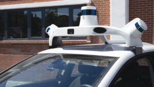
Waymo opens autonomous rides in LA
Photo: Waymo
Waymo has launched its fully autonomous ride-hailing service in Los Angeles, available 24/7, following a waitlist of nearly 300,000 users before its rollout. The service covers nearly 80 square miles of Los Angeles County, including Santa Monica, Hollywood Boulevard and the University of Southern California. Waymo plans to expand its coverage as it scales its operations.
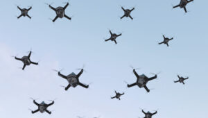
A large UAV show in Quanzhou, Fujian Province, China, ended in disaster when hundreds of UAVs crashed due to GNSS jamming. The event, intended to celebrate the city’s history with 2,000 UAVs equipped with low-altitude fireworks, faced significant disruptions when a camera drone entered the area without notifying authorities, leading them to mistakenly jam the signal. This incident resulted in an estimated loss of more than 10 million yuan ($1.4 million)
ISPRA project unveils coastal habitats of Italy
Photo: ISPRA
The PNRR MER A16-A18 project, led by the Italian Institute for Environmental Protection and Research (ISPRA), has released its first preliminary data for mapping Italian coastal habitats through the WebGIS Virgeo cartographic platform. The project focuses on mapping the growth of the Posidonia oceanica and Cymodocea nodosa meadows, which are crucial for biodiversity. Using high-resolution satellite imagery, lidar sensors and autonomous unmanned vehicles, the project is creating a comprehensive database for marine coastal ecosystem management and protection.
Celestial navigation system for UAVs
Photo: Cpl. Harrison Rakhshani
Researchers at the University of South Australia have developed a celestial navigation system for UAVs. The new system combines visual observations of the stars with standard autopilot technologies. In tests of the system using a fixed-wing UAV, researchers could pinpoint its position within 2.5 miles. This technology can be deployed by UAVs in GPS-compromised or denied areas by eliminating the need for GPS.
Propeller Drones has secured a $7 million contract with the Israel Electric Corporation (IEC) to conduct fully autonomous UAV operations for electrical infrastructure inspection. This project marks an advancement in beyond visual line of sight (BVLOS) drone operations in Israel, as it represents the first government approval for pre-approved BVLOS flights using an unmanned traffic management (UTM) system.
Under the collaboration, Propeller Drones and FlightOps will partner to enhance AI flight capabilities that meet IEC requirements and regulatory standards. Airwayz, a company specializing in low-altitude UTM solutions, has been selected to provide the UTM system for managing drone operations.
Airwayz’s UTM system, developed by experienced air traffic controllers, integrates real-time weather and location data to optimize airspace usage and manage multiple drone fleets simultaneously. This technology allows for efficient rerouting of unmanned vehicles in case of unexpected incidents.
The collaboration seeks to address long-standing regulatory challenges in the UAV industry by demonstrating the ability to conduct large-scale autonomous operations safely and efficiently. According to Propeller, this project has the potential to open up new opportunities for drone applications across various industries, particularly for inspections in hazardous or hard-to-reach areas.
As the system accumulates flight hours and data, it is expected to contribute to the advancement of autonomous BVLOS UAV operations, potentially influencing future regulatory approvals and industry standards. Propeller shared that the success of this project could pave the way for broader adoption of autonomous drone technologies in Israel and potentially serve as a model for other countries.
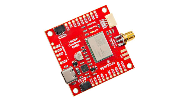
SparkFun Electronics has introduced the SparkFun Quadband GNSS RTK Breakout (Qwiic), which is designed to improve positioning accuracy using the Quectel GNSS module. This module has a compact design and compatibility with the Qwiic connector, making it easy to integrate into various projects. Additionally, it shares the same dimensions, pin layout and connectors as the SparkFun GPS-RTK-SMA Breakout – ZED-F9P, offering a seamless upgrade path for users.
The LG290P module is a quad-band, multi-constellation, high-precision real-time kinematics (RTK) GNSS receiver capable of receiving signals from multiple frequency bands: L1, L2, L5 and L6/E6. It supports all GNSS constellations and offers support for Satellite Based Augmentation Systems (SBAS) — such as Wide Area Augmentation System (WASS) and European Geostationary Navigation Overlay Service (EGNOS) — as well as precise point positioning (PPP) services, including BDS PPP-B2b and MADOCA-PPP. The module is designed to provide precise navigation with fast convergence times and reliable performance through RTCM and RTK corrections.
The module features a built-in NIC anti-jamming unit, which uses advanced algorithms to detect and eliminate interference signals. This can significantly enhance signal reception in challenging electromagnetic environments. The device can be used in complex scenarios, such as urban settings or areas with dense tree cover. Due to its high precision and low power consumption, the SparkFun Quadband GNSS RTK Breakout – LG290P is ideal for applications in intelligent robotics, UAVs, precision agriculture, mining, surveying and autonomous navigation.
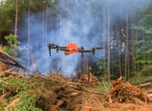
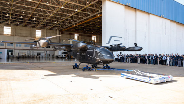
Sikorsky, a Lockheed Martin company, and Rain, a provider of autonomous aerial wildfire containment technology, successfully demonstrated how an autonomous Black Hawk helicopter can be commanded to take off, identify the location and size of a small fire and then accurately drop water to suppress the flames.
At Sikorsky headquarters in Stratford, Connecticut, the Rapid Wildfire Response Demonstration showcased the integration of Sikorsky’s MATRIX flight autonomy with Rain’s wildfire mission autonomy system to suppress a fire in its early stages.
Representatives from NASA, the Federal Emergency Management Agency (FEMA), the Defense Advanced Research Projects Agency (DARPA), the Los Angeles County Fire Department, the Orange County Fire Authority and the philanthropic and impact investment community witnessed the demonstration as part of a two-day wildlands firefighting meeting to discuss autonomy.
During the 30-minute flight demonstration, guests used a tablet to command the Black Hawk aircraft to take off, search for and find the fire and then drop water from a Bambi Bucket slung 60 ft beneath the aircraft. Each of three successive water drops extinguished a 12-inch-diameter propane-fueled fire ring emitting a 3-to-6-inch-tall flame, demonstrating the precision of the Rain fire perception and targeting capability. The Rain system also rapidly adjusted the flight path to account for an 8-to-10-knot crosswind during each water drop. Sikorsky safety pilots in the Black Hawk cockpit monitored the flight controls but were hands-off until the aircraft landed.
“Seen & Heard” is a monthly feature of GPS World magazine, traveling the world to capture interesting and unusual news stories involving the GNSS/PNT industry.
The Northern Plains UAS Test Site (NPUASTS) has assisted the Grand Forks, North Dakota, Fire Department in obtaining a Tactical Beyond Visual Line of Sight waiver from the Federal Aviation Administration, allowing first responders to operate unmanned aircraft systems (UAS) beyond visual line of sight (BVLOS) in extreme emergencies. This capability can be used to assess large fires, conduct aerial searches and locate missing persons. The NPUASTS team trained 11 first responders in UAS operations and flight protocols.
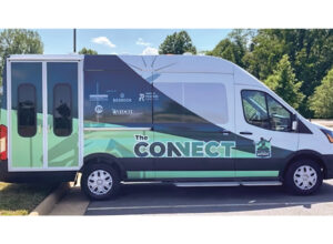
Free Autonomous Shuttle Service Launches in Detroit
Photo: Detroit
A free autonomous shuttle program has launched in Detroit, Michigan. The four electric, wheelchair-accessible “Connect” shuttles will operate every 10 to 15 minutes during peak hours along a 10.8-mile route from Michigan Central to Bedrock’s 200 Walker Street on the East Jefferson Riverfront. Initially, the shuttles will be manually operated to allow for route adjustments and ensure smooth operation of autonomous features. Full autonomous driving is expected later this year.
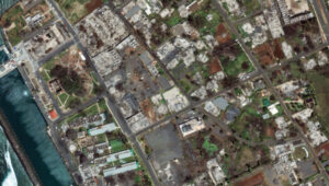
Maui Recovers One Year After Deadly Wildfires
Photo: Maxar Technologies
New satellite images from Maxar Technologies reveal the extent of damage in Lahaina, Maui, nearly a year after the catastrophic wildfires on Aug. 8, 2023, which resulted in more than 3,900 properties being destroyed and 100 fatalities. Despite the devastation, the satellite image shows signs of recovery, with debris removal progressing and new temporary housing being constructed for displaced residents. The images show cleared lots and returning greenery.
Sea Lions on a Mission
Photo: Nathan Angelakis
Researchers have attached lightweight video cameras to sea lions to explore previously uncharted areas of the ocean off the south coast of Australia. The footage, combined with a machine learning model, produced detailed maps of the ocean floor, revealing the distribution of different habitats and species. This method allows scientists to access deep and remote habitats that are unreachable by traditional hydrographic surveys. The study, published in Frontiers in Marine Science, highlights the potential of using animal-borne cameras for marine exploration and conservation efforts.
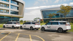
SBG Systems’ INS Ellipse-D powers Leo Drive’s autonomous car.
The evolution of autonomous vehicles has been a fascinating journey, transforming from science fiction to reality over the past few decades. Most modern cars on roadways worldwide have varying levels of autonomy, ranging from Level 1 features, such as cruise control, to Level 5 fully autonomous features, including the ability to monitor roadway conditions and perform safety-critical tasks without human intervention.
In recent years, several technology and automotive companies have recognized the benefits of autonomous vehicles and their potential impact on communities and industries worldwide. In response, industry leaders have supported autonomous vehicle innovation and adoption by offering new products and working closely with educators, nonprofit organizations and other groups that aim to use autonomous solutions to connect the world.
New solutions combining GNSS technology with inertial navigation systems (INS) have emerged to increase autonomous operation efficiency and development. GNSS/INS serves as the foundation for various autonomous operations, ranging from self-driving vehicles on public roads to sophisticated port machinery. In urban public transportation, the accuracy of GNSS signals can be compromised by tall buildings and signal interference, leading to potential errors in navigation. Meanwhile, in the specialized vehicle sector, the lack of extensive experience in complex environments poses challenges, with unpredictable issues potentially arising.
As we enter a new era of advanced autonomy, companies such as SBG Systems and Septentrio, along with their partners, are pushing the boundaries of what is possible in self-driving technology. SBG Systems and autonomous vehicle developer Leo Drive are integrating GNSS/INS systems, multiple cameras and lidar sensors into Leo Drive’s autonomous platforms for precise navigation and accurate positioning data for safe and efficient operations in urban applications.
Septentrio and Smart yoUr Mobility Inc. (SUM) also are making significant strides in advancing autonomous operations. The companies have formed a strategic partnership to develop and implement a multi-sensor fusion system for autonomous driving. This collaboration aims to enhance self-driving vehicles’ accuracy, reliability and safety by integrating data from various sensors, including lidar, cameras and radar.
Additionally, recognizing the need for precise positioning in complex environments — such as ports packed with equipment and steel containers — SUM and Septentrio are working together on a solution that ensures accurate positioning and reliable autonomous operations in challenging port operations.
Enhancing precision and performance
Leo Drive offers scalable software and hardware solutions, providing a comprehensive, end-to-end service for integration into autonomous systems. The company’s mission is to enhance the accessibility and adoption of autonomous technology across various sectors, including UAVs, unmanned ground vehicles (UGVs) and autonomous driving systems.
To operate its autonomous vehicles effectively, Leo Drive was in search of an INS compatible with its existing platforms and robust enough to meet real-time processing demands in dynamic environments. The company also wanted an INS with dual-antenna RTK capability to offer consistently high precision in positioning and orientation, leading the company to SBG Systems’ Ellipse-D, a dual-antenna RTK INS.
Leo Drive integrated the Ellipse-D INS into its autonomous test vehicle, a passenger car converted for autonomous operations. Equipped with GNSS/INS systems, multiple cameras and lidar sensors, the vehicle requires precise navigation and accurate positioning data for safe and efficient operation. This vehicle serves as a critical platform for research and development (R&D) and technology demonstrations.
The test vehicle is powered by Autoware software, hosted by the Autoware Foundation, a nonprofit organization committed to developing open-source, collaborative software for autonomous vehicles.
Leo Drive mounted Ellipse-D INS onto its test vehicles using non-ferromagnetic materials to prevent interference and ensure optimal sensor performance. The electrical connections were made via RS-232/422 and CAN interfaces, and custom drivers were used within the ROS2 environment to integrate the Ellipse-D’s real-time data into their sensor fusion algorithms.
During the integration phase, the SBG Systems’ support team provided ongoing assistance to quickly address any challenges. The SBG Systems Support portal also was valuable, providing comprehensive guidance and troubleshooting assistance.
Leo Drive’s autonomous car is equipped with GNSS/INS systems, multiple cameras and lidar sensors for precise navigation as well as accurate positioning.
Ellipse-D played a key role in Leo Drive’s Autonomous Vehicle by providing accurate real-time navigation data. Its dual-antenna RTK capabilities ensure orientation data is reliable and supports the vehicle’s complex navigation algorithms. The sensor’s RS-232/422 and CAN connections allowed for easy integration with Leo Drive’s onboard computers. Custom drivers and nodes in the ROS2 environment facilitated smooth communication between the Ellipse-D and other vehicle sensors, enhancing overall system robustness.
Advanced features for better navigation
Since integrating Ellipse-D INS into its autonomous vehicle, Leo Drive said it has experienced several significant improvements, including:
Improved accuracy: Ellipse-D’s high positioning and orientation accuracy has been instrumental in refining the performance and reliability of Leo Drive’s autonomous systems.
Increased efficiency: Ellipse-D’s advanced algorithm enables smoother development processes and more accurate test results, streamlining R&D efforts.
Timely support: The comprehensive customer support, including detailed documentation and a responsive technical support team, ensured a seamless integration process.
Leo Drive identified three standout qualities of SBG Systems that have been critical to its success: exceptional customer support, high-quality products and a user-friendly support portal.
“Collaborating with SBG Systems and integrating the Ellipse-D into our vehicle has been essential in achieving the precision and reliability critical to our R&D efforts and autonomous operations,” said Oğuzhan Sağlam, Leo Drive’s sales manager.
Self-driving shuttles in South Korea
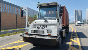
In 2022, Septentrio and SUM partnered for the joint development and technical application of a multi-sensor fusion system for autonomous driving. This led to the integration of Septentrio’s AsteRx-SBi3 Pro+ into SUM SMOBI platform vehicles.
Septentrio’s AsteRx-SBi3 Pro+ integrated into SUM’s autonomous vehicles.
The AsteRx-SBi3 Pro+ features Septentrio’s FUSE+ inertial sensor-fusion technology, which offers a comprehensive solution for these challenges. This includes centimeter-level positioning accuracy (horizontal: 0.6 cm + 0.5 ppm, vertical: 1 cm + 1 ppm) and integrated attitude accuracy (heading: 0.15°, pitch, and roll: 0.02° using a dual antenna set-up) to maintain precise vehicle operation. Additionally, the INS provides reliable speed data (0.02 m/s) for smooth and stable motion control.
In Gangneung, South Korea, a shuttle drives fully autonomously on the city’s roads. While a human driver is still required by law as a safety precaution, this is the first step to a more autonomous transport future.
SUM is collaborating with local governments to allocate bus routes for autonomous vehicles. The company operates autonomous buses on routes in Seoul, South Korea, including the Sangam Dong A2 autonomous vehicle for the Cheongwadae shuttle bus and late-night bus services. SUM also operates autonomous vehicles in Gangneung City.
According to members of the SUM team, this technology ensures accurate stops, optimal route planning, and improved passenger safety by minimizing the risk of collisions and ensuring timely arrivals. SUM’s autonomous shuttles and on-demand transit services benefit from precise positioning, allowing them to adjust routes dynamically based on real-time passenger requests and traffic conditions.
The benefits
According to SUM, coupling Septentrio’s AsteRx SBi3 Pro with SUM’s software and hardware solutions has unlocked many benefits, including:
Enhanced safety: Precise positioning and reliable navigation are paramount for the safety of all autonomous vehicles. Septentrio’s technology ensures accurate lane positioning and collision avoidance capabilities, safeguarding people and property across multiple sectors.
Greater reliability: Septentrio’s antennas ensure consistent and reliable performance for autonomous vehicles, even in challenging conditions. This minimizes downtime and disruptions.
Sustainable transportation: Autonomous vehicles can potentially reduce traffic congestion and emissions across the board. SUM’s technology, which is integrated into various autonomous vehicles, contributes to a more sustainable transportation future for cities and industries.
Additional application: Autonomous port operations
In ports around the world, many aging yard trucks are still being used. However, the industry has been gradually adopting automated port operations to move away from outdated positioning methods and toward autonomous solutions that can redefine operational standards.
Early attempts at using GNSS for positioning autonomous machines in ports faced significant challenges. The chaotic environment of large moving metal machines and constantly changing container stacks created blockage and multipath position errors, making it hard to achieve reliable centimeter-level GNSS positioning.
Modern GNSS technology has revolutionized port automation with its ability to achieve centimeter-level accuracy for autonomous trucks, forklifts and container carriers to navigate narrow lanes and confined spaces with unprecedented precision, dramatically reducing collision risks. Often, autonomous port vehicles must maneuver between cranes with minimal room for errors, highlighting the importance of reliable high-precision technology in the field. This level of precision and adaptability is vital in the logistics industry, given that 90 percent of the world’s goods are transported by sea and 60 percent are packed in large steel containers.
At the Port of Incheon in South Korea, which is on the Yellow Sea across from Northern China, SUM is conducting proof of concept (POC) trials of its autonomous vehicles using Septentrio’s AsteRx-SBi3 Pro+ rugged GNSS/INS receiver. The autonomous yard trucks at Incheon Port successfully navigate autonomously between point A and point B, with the SUM team nearby to identify and resolve any issues. The SUM team said they are focused on stabilizing the system to achieve a fully unmanned operation, aiming to enhance efficiency and automation in port logistics.
SUM notes that integrating Septentrio’s technology with autonomous vehicles in smart ports simplifies operations by providing accurate positioning, enhancing safety and optimizing routes, as well as improving overall port efficiency. The integration supports the seamless operation of autonomous vehicles, helping ports manage their logistics more effectively and respond to the dynamic demands of modern cargo handling.
The autonomous port trucks also are being tested with the new AntaRx-Si3 and AntaRx-AUX antennas installed simultaneously. High update rate logging can improve CPU load and how the antenna’s robust real-time kinematic (RTK) engine uses fewer satellites to reduce the CPU load.
Overcoming positioning obstacles
SUM’s advanced online localization system is designed to continuously track the position of its autonomous vehicles, even in GNSS-compromised environments.
“Our system leverages a sophisticated sensor fusion algorithm that primarily relies on high-accuracy GNSS/INS information from the Septentrio module,” said Daehyuck Park, Ph.D., managing director at SUM. “This module serves as the core source of our positioning data.”
To improve the robustness of the localization system, the company integrated additional sensors, including lidar and cameras. These sensors provide odometry data and facilitate map-matching using static landmarks in pre-mapped areas. By combining data from these sources, SUM explains that its system can perform reliable dead reckoning and offers precise map-based pose corrections to maintain high performance across various challenging environments.
One key challenge in this approach is the potential for GNSS blockages. To address this, SUM has incorporated dead reckoning technology into its systems, which augments the GNSS/INS module’s positioning capabilities by delivering continuous position estimates even when GNSS signals are unavailable.
Integrating vehicle localization systems further enhances dead reckoning by counteracting drift caused by biases in IMU measurements.
Additional sensors such as lidar can improve dead reckoning accuracy further, particularly during movements involving high wheel slips, which dilute the precision of wheel odometry. Despite these advancements, relying solely on dead reckoning for extended distances can lead to an unbounded accumulation of positioning errors.
According to the SUM team, Septentrio’s AsteRx SBi3 Pro+, coupled with SUM’s software and hardware solutions, has unlocked many benefits. Other urban use cases include enhancing delivery services by effectively managing routes and improving traffic management through fleet coordination. SUM adds that autonomous vehicles have the potential to reduce traffic congestion and emissions across the board. SUM’s technology, integrated with a variety of autonomous vehicle applications, contributes to a more sustainable future for our cities and industries.
SUM is continuing to focus on developing solutions to ensure accurate positioning and reliable autonomous operations in challenging environments. SUM and Septentrio aim to accelerate the integration of autonomous solutions to streamline port operations and autonomous vehicle applications in urban environments. The partnership is driving progress toward a more autonomous future, with the goals of reducing costs, increasing efficiency and adapting to the challenges posed by congested GNSS environments. Their joint efforts are being rigorously tested for accurate positioning throughout an autonomous vehicle’s entire journey, even in areas where GNSS signals may be compromised.
Saronic vessels equipped with advanced sensors in contested waters. (Photo: Septentrio / Saronic)
Anti-jamming and anti-spoofing technology protects receivers
Saronic, a Texas-based defense technology company, is leveraging the latest cutting-edge technology for their autonomous surface vessels (ASVs) designed for critical naval missions. These vessels are equipped with sensors for enhanced domain awareness in contested waters. They are designed for tactical deployment, alone or in collaborative swarms, via at-sea launch and recovery from expeditionary craft. Saronic selected Septentrio’s GNSS inertial navigation system (INS) receivers for resilient positioning and orientation for navigating in the most challenging environments. Advanced interference mitigation (AIM+) technology protects Septentrio receivers from jamming and spoofing attacks that threaten to disrupt GNSS-based navigation.
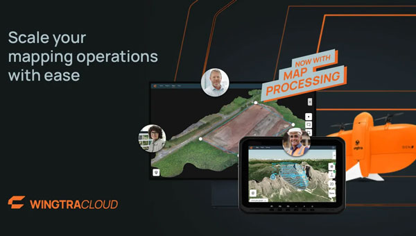
Wingtra has upgraded its WingtraCLOUD software platform by adding map processing capabilities. This upgrade aims to streamline the integration of aerial insights into industries such as construction, mining and urban planning.
The latest updates seek to help engineering firms and users transition more smoothly from UAV data to actionable insights. By consolidating all stages of aerial data management — from mission planning to insight sharing — into a single platform, WingtraCLOUD eliminates the need for multiple complex tools to simplify workflows.
This software is designed to reduce errors, prevent rework and accelerate project timelines, leading to increased productivity across key industries.
With WingtraCLOUD, large-scale mapping projects can be completed quickly. This rapid processing capability is ideal for industries such as construction, which helps avoid costly delays and resource waste, and mining, where it enhances safety through quick highwall inspections. In disaster scenarios, WingtraCLOUD’s fast mapping capabilities can aid in efficiently directing resources.
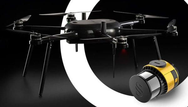
YellowScan and Nokia have entered a strategic partnership to integrate YellowScan’s Surveyor Ultra lidar scanner into Nokia’s UAV solutions.
The partnership focuses on automating 5G-based lidar scanning for various applications in sectors where precision, efficiency and safety are critical, such as telecommunications tower inspections, utility maintenance and mining operations.
YellowScan’s Surveyor Ultra, integrated with Nokia’s drone-in-a-box solution, enables real-time streaming of lidar data over 5G networks. It also allows for automated, high-resolution scans and the creation of precise digital twins.
The collaboration seeks to improve safety by reducing the need for manual inspections in hazardous environments. Automated UAV inspections, powered by 5G connectivity, serve as the foundation for consistent data quality and allow for remote operations, even beyond visual line of sight (BVLOS).
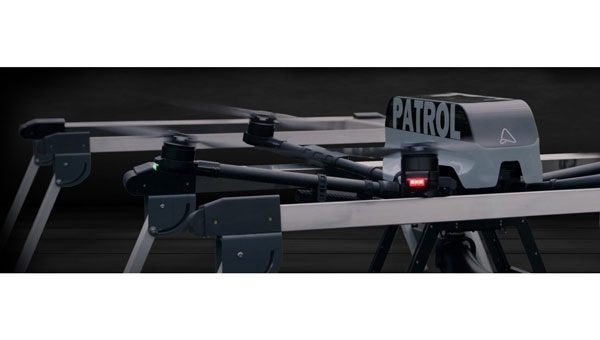
A2Z Drone Delivery has launched a portfolio of autonomous drone docks and a companion UAV adapted for the system’s automatic charging capability. The A2Z AirDock allows UAVs to autonomously move between docks for recharging and package delivery, expanding their operational range and efficiency. This system is available in four configurations: the Portable, a lightweight and foldable option suitable for transport; the Shelter, a rugged module designed for housing drones in remote areas; the Dual, which can dock and charge two UAVs simultaneously; and the Quad, an elevated installation that accommodates up to four UAVs, making it suitable for high-traffic locations. These elevated docks are designed to keep UAVs away from people and property, enhancing safety during operations.
The Longtail AirDock Edition UAV is specifically designed to integrate with the AirDock system. This hexacopter can carry payloads of up to 5 kg and travel 20 km at an altitude of 200 m. It can also move between AirDocks, which extends its operational range. Additionally, the Longtail drone employs onboard cameras, sensors, and RTK technology for precise autonomous landing, and it is built to operate in various weather conditions, including moderate rain and snow.
Users can either purchase or lease the equipment or subscribe to a drone-network-as-a-service (DNaaS) model. The company has also developed a web-based user interface for managing deliveries and patrol missions. This interface allows operators to track delivery status, request pickups, schedule patrols, and view live video feeds, contributing to overall operational management.
Is it possible that we have already oversold the potential — or at least the timing — for when we expect operational electrical vertical take-off and landing (eVTOL) air taxis? United, Delta, Southwest, and other airlines seem intent on being part of the coming air taxi game, but locking up future potential without anything delivered could be risky.
Now, this eVTOL stuff is not cheap, and it does not come quickly—it takes a massive amount of investment and effort to create a new mode of air transport, especially if it could be wholly or even partially autonomous. Most eVTOL outfits have decided to launch initially with a piloted option, leaving autonomy for later.
The initial stages of the development process involve reviewing the designs, followed by vetting and selecting subcontractors. A strategic plan is then established to develop a few operational prototypes. Alongside this, a firm strategy must be created to ensure compliance with agency regulations, resulting in the demonstration of proof of concept.
The process could be accelerated with a piloted airframe derived from a proven baseline, but eVTOLs are a new concept. Although partially derived from UAVs, eVTOLs differ significantly from existing aircraft. UAVs are not big enough to carry passengers and have not received approval to transport people. True, the automation angle has taken significant steps forward in recent years, but certifying that these systems will always operate correctly, without minimal chance of failure while flying over city centers and over many, many people – well, that’s another coat of many colors! Let’s just say these are BIG STEPS to initiate a new form of air transportation.
Nevertheless, despite the excitement and seemingly optimistic timelines for achieving FAA or other regulatory approval for fully operational eVTOL aircraft capable of safely transporting passengers, most major airlines have already committed to significant purchases and investments in this technology.
United Airlines conditionally committed to buy 200 Archer Aviation Midnight eVTOL aircraft for $1 billion in early 2021, added an option of $500 million for another 100, and recently took more partial ownership when Archer pursued a public listing through a merger with Special Acquisition Company (SPAC) Atlas Crest Investment Corp.
Archer has been moving its aspirations in several other directions while it works closely with the FAA to achieve certification of the Midnight eVTOL. Notably, the company has been granted a Part 135 Air Carrier and Operation certification by the FAA, which allows Archer to operate a for-profit airline with not only the Midnight eVTOL but also existing commercial aircraft, presumably including helicopters. Using other aircraft in the interim could allow Archer to prove out routes before having operational eVTOLs available and generate revenue. United and Archer have already selected at least one initial route in Chicago, from the city center to O’Hare airport.
Archer has also been busy signing up partners in Korea. Demonstrations are planned for Q4 2024 and in Abu Dhabi, Dubai, and other locations across the UAE. The forecasting service will start in late 2025.
Back in the U.S., Southwest Airlines — another Archer investor — is also working with the company on the West Coast to develop routes around population centers in California. Archer has signed up with a local developer to establish Vertiports, locations with suitable ground access for passengers, landing/take-off and rapid charging facilities for eVTOL aircraft and existing helicopters. Southwest plans to install these stationsat five locations: South San Francisco, Napa, San Jose, Oakland, and Livermore.
Another agreement with Signature Aviation is designed to provide Archer with access to general aviation terminals and electrical supply for eVTOL operations in New York, Los Angeles, San Francisco Bay Area, and Texas, including United Airline hubs at Newark International (EWR) and Chicago O’Hare (ORD) Airports, as soon as the end of 2025, almost the exact date that United expects to start eVTOL passenger ferry services to and from O’Hare.
Stellantis has also invested around $150 million in Archer, plus another $55 million in June 2024, as the two work on establishing a high-volume 350,000 sq ft eVTOL manufacturing facility in Georgia. A new agreement between the two companies brings additional investment, intended to take the facility to a yearly build output of 650 eVTOLs.
Photo: Joby Aviation
Unlike United, Delta Airlines and Joby Aviation aim for door-to-door service, intending to pick up passengers at their own homes and bring them directly to Delta at the airport. With fewer, larger propellers, Joby claims a top speed of 200 mph, compared to Midnight’s 150 mph. Apparently, both Midnight and the Joby eVTOL have a passenger capacity of one pilot plus four passengers.
Another significant June 2023 investment in Joby was reported to have come from SK Telecom (SKT) in Korea, which made an equity investment of $100 million in Joby. The Korean government is promoting aerial ride-sharing through a phased demonstration program, for which the partners signed up to participate in early 2022. Joby was also certified to be a Part 135 air carrier almost two years earlier than Archer.
Both Archer and Joby have already delivered eVTOL aircraft to the U.S. Air Force (USAF) for on-base evaluation. The USAF has been promoting eVTOL development for some time, not only for on-base logistics but also, apparently, evaluation for front-line resupply operations.
Eve eVTOL rolls out and is joining the flight test program. (Photo: Eve Air Mobility)
Eve Air Mobility has received significant investment from aircraft manufacturer Embraer in Brazil, and Toyota is supporting high-volume manufacturing. This year, contact was made with Air-X in Japan to buy ten aircraft with options for 40 more—just one customer of several who have placed Letters of Intent to buy over 3,000 Eve eVTOL aircraft. United Airlines is another one of those customers who also placed a conditional order for 200 Eve eVTOL and options for another 200 aircraft back in 2022.
This is a very short overview of just a few of over 200 potential eVTOL-piloted and autonomous UAV manufacturers that have turned into passenger-carrying air taxis. The partial investment story behind these companies and their air-mobility adventures indicates that even though it is going to be quite some time before these aircraft start to hop over cities to airports – making a potential two-hour journey in 10-15 minutes at the exact projected cost as existing ride-sharing, a lot is riding on a successful outcome. Maybe United’s duel track investment in both Archer and Joby will also ensure that one or the other will bear fruit. These few outfits we’ve reviewed have a long way to go, but their investing partners seem to have accepted the risk and have faith that their long-term roll of the dice will end up in their favor.
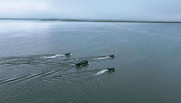
For the fourth consecutive year, Saildrone and the National Oceanic and Atmospheric Administration (NOAA) are sailing a fleet of uncrewed surface vehicles (USVs) into hurricanes to better understand how these storms develop, track and intensify.
Saildrone Explorer USVs are 23 ft long and carry a payload of sensors to measure air, surface and water temperature as well as humidity, barometric pressure, wind speed and direction, salinity and wave height. To withstand major hurricane conditions—winds over 110 mph and waves that exceed 50 ft—they have a shorter and stronger “hurricane wing,” similar to a reefed sail on a sailboat.
Saildrone USVs sail autonomously along prescribed routes, which Saildrone Pilots define according to weather conditions and to meet mission objectives. Saildrone’s science partners in the mission at NOAA’s Atlantic Oceanographic & Meteorological Laboratory (AOML) and Pacific Marine Environmental Laboratory (PMEL) will work closely with Saildrone Mission Control to guide the saildrones into oncoming hurricanes.
As the final group of saildrones was readied for deployment, Tropical Storm Debby was forming in the Gulf of Mexico. Just days after SD-1057 was deployed, the USV sailed through the eye of Hurricane Debby hours before the storm made landfall in Florida. Powered solely by renewable wind and solar energy, the Saildrone fleet will stay at sea for the duration of the mission, which will last through October 2024.
FlytBase and Pix4D have entered a strategic partnership, allowing FlytBase users to seamlessly upload their drone-captured data directly to the PIX4Dcloud online platform.
As automated UAV-docked operations become more prevalent, the volume and frequency of data collection have significantly increased. The partnership addresses this by offering users a way to conduct numerous daily missions and schedule them in advance from remote command centers.
Using FlytBase’s Pix4D Flink, users can now directly sync UAV-captured data from FlytBase to PIX4Dcloud, an online platform for aerial mapping, progress tracking and site documentation. PIX4Dcloud processes high-resolution images using photogrammetry algorithms, transforming them into accurate, georeferenced orthomosaics, 3D meshes, point clouds and elevation models. The platform can be used in construction monitoring, mapping and surveying applications.
In addition to the one-click integration, FlytBase offers the latest automation functionalities required for docked UAV operations, combined with flight safety and fleet management capabilities. It allows users to execute consistent UAV data collection operations while seamlessly integrating with beyond visual line of sight (BVLOS) hardware and software solutions, such as parachutes, detect-and-avoid systems, uncrewed traffic management and weather monitoring systems for safe operations.
Adhering to ISO 27001, SOC 2 Type II and GDPR standards, FlytBase ensures data protection through network firewalls and offers flexible deployment options to accommodate enterprise data privacy requirements.