Category: Machine Control / Agriculture

  • Kespry, DJI offer stockpile measurement solution for mining

    Image: Screenshot from Kespry video
    Image: Screenshot from Kespry video

    Kespry and DJI are partnering to offer the DJI Mavic 2 Pro drone as part of the Kespry stockpile measurement solution for mining and aggregates companies.

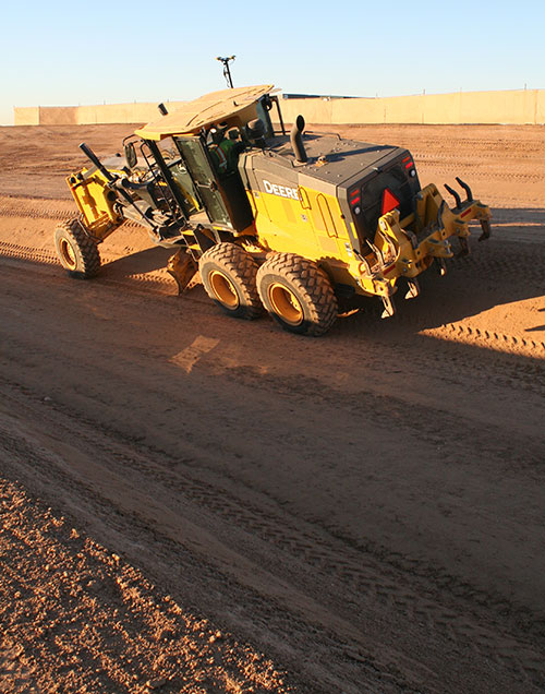
    The solution delivers the Kespry autonomous flight and aerial intelligence experience for stockpile measurement using a DJI drone. It enables large aggregates and mining companies to standardize and capture stockpile data across all their sites in the Kespry platform, while continuing to use Kespry 2s drones to support mine and site planning operations, Kespry said.

    Integration of data captured from a DJI drone is the next innovation in the development of the Kespry industrial sensor platform.

    Kespry provides inventory management and mine planning data to more than 200 mining and aggregates companies. As these customers scale their use of drone data, they are looking to standardize on a single platform to organize and analyze that data across sites, geographies and product divisions — even when those sites are highly distributed, Kespry said.


    The addition of the DJI Mavic 2 Pro to the Kespry lineup is designed to enable even more site data to be centralized in the Kespry cloud. It will be available with a new, cost-effective purchase point designed to support using Kespry across more sites.

    “Drone data is now the standard approach for measuring stockpiles at mine sites, however, millions of dollars are wasted through reconciling inconsistent data from different platforms and the time involved getting that data ready for analysis,” said George Mathew, CEO and chairman at Kespry. “Our goal with the addition of the Mavic 2 Pro to our solution is to respond to our customers wishing to use the Kespry aerial intelligence platform across all mine sites to standardize how stockpile data is generated — lowering their costs and helping drive the profitability of every site.”

    “DJI is excited to have Kespry offering the Mavic 2 Pro as part of its aerial intelligence platform portfolio,” said Jan Gasparic, director of strategic partnerships, DJI. “Pairing the Mavic 2 Pro with Kespry’s industry leading AI, ML, and analytics capabilities will be of enormous benefit to mining companies that are looking to take advantage of drone technology in a portable and powerful package.”

    According to the companies, the integration of DJI’s drone and sensors into the Kespry platform is the latest innovation in the delivery of an industrial sensor network, closely following Kespry’s recently announced high-resolution thermal capabilities for industrial inspection.

    This expansion in the range of data that can be explored and analyzed in the Kespry platform further enables customers to protect and maximize their assets across industrial sites.

    The Kespry platform is now capable of processing and analyzing a wide range of sensor data, enabling the future creation of industry-specific applications, including those under current development with leaders in the energy sector.

    “We have sites in North Carolina, Pennsylvania, Ohio and Maryland, so with the Kespry platform and DJI drone, we’ll be able to fly multiple sites at one time,” said Justin Dermont, accounting manager at Russell Standard. “I could be flying in Erie while my partners fly in North Carolina, but still be able to get the data in real time to the Kespry cloud.”

    “Having DJI as part of the Kespry system will help with the flexibility and the timeliness of us being able to take inventory at multiple locations, especially when we have to take inventory at the end of production, or month end, to make sure we have accurate readings,” said Craig Schiebel, controller at Russell Standard. “Being able to take inventory simultaneously at multiple locations is huge.”

    “We’re growing our business and recently acquired some new sites,” said Kyla Jungclaus, senior accountant at Brannan Companies. “We need all of our inventory to be done in just a couple days, so introducing the DJI drone to have another pilot surveying at some of our other locations will get inventory done even faster. I know that our measurements will be consistent and accurate even if I don’t do them myself, and I can manage them all in a single account in the Kespry cloud.”

    Kespry is offering the Mavic 2 Pro as part of its fully-managed, end-to-end annual subscription model. Kespry customers that choose the Mavic 2 Pro for stockpile measurement will benefit from the full Kespry experience, including its acclaimed support, training, customer success team, and drone up-time guarantee.

    The Kespry stockpile measurement solution with DJI will be available Q1 2019.

  • For those who served: GNSS helps expand Arizona national cemetery

    For those who served: GNSS helps expand Arizona national cemetery

    The base of the channel was just wide enough (12 feet) to fit the John Deere machine for grading the 2:1 slope. With GNSS, the operator did not have to reference grade stakes or stop for grade checks. (Photo: Topcon)
    The base of the channel was just wide enough (12 feet) to fit the John Deere machine for grading the 2:1 slope. With GNSS, the operator did not have to reference grade stakes or stop for grade checks. (Photo: Topcon)

    Noel Guevara, president and owner of JAG Construction, considers it an honor to have been involved in a project to expand the National Memorial Cemetery of Arizona.

    To get the job done as quickly and efficiently as possible, the fledgling company drew upon GNSS technology for the bulk of its grading and specialized excavation needs.

    Doing so, it was able to wrap up the major expansion on time, with as little disruption as possible.

    Additional Space Needed. The cemetery expansion will help alleviate a shortage of burial space brought about by the passing of veterans of World War II, the Korean Conflict and the Vietnam War.

    The project involves development of 22 acres adjacent to the existing cemetery including construction of two columbarium courts to house 4,688 niches for cremains; 2,180 pre-placed crypts; grading for 1,900 in-ground cremains; 650 linear feet of roadway; two retention ponds; and 1,350 feet of shotcrete drainage channel.

    A look around the expansion site — previously scrub land — revealed few grade stakes, a sign that GNSS technology was at work. “I first used GPS when I was with a company back in 2000,” Guevara said. “So I know the tremendous boost in productivity it can give, and felt that I had to have it on this project.”

    Critical Support. While Guevara may have felt at home with machine control, some of his team needed a crash course in working within a GNSS environment. RDO Integrated Controls outfitted JAG’s two motor graders with Topcon 3D-MC2 machine control in a twin-antenna, single-mast configuration.

    Guevara’s decision to place his faith in the GNSS solution put his company at what Topcon calls the “intersection of infrastructure and technology,” a conceptual crossroads where Topcon helps industry professionals best meet growing infrastructure demands through technological innovation — increasing both productivity and profitability.

    A Channel Runs Through It. Though the majority of the cemetery expansion site is relatively flat, the retention ponds and drainage channel could have proven problematic, had they been done using traditional survey methods.

    Guevara said being able to do the detail work with the Topcon system dramatically ramped up production.

    “This is easily 70% faster than doing things old-school,” he said. “Having the blades equipped with GPS gave us the confidence to walk away each day knowing that the numbers were there.”

    JAG was also contracted to excavate foundations for a pair of columbarium courts. Guevara once again turned to GNSS to streamline that effort, specifically a dual-antenna Topcon MC-i3 system with a GX-55 control box.

    “Because of the GPS system on that machine, the operator knew exactly how far down he had to go; there was no questioning or verifying depths — that was a nice solution for us.”

    In 2017, JAG invested in six GNSS-based machine control systems. This year they are looking at additional machine purchases to meet what is forecast to be more than double 2017’s numbers.

  • How to integrate autonomous CPS

    Screenshot: United Artists
    Screenshot: United Artists

    Dull, dirty and dangerous — those used to be the jobs relegated to autonomous systems. But a decade-plus of improvement in sensor and computing technology has brought autonomy into the mainstream as a defining technology of the future.

    At September’s ION GNSS+ conference, I attended a panel titled “Autonomous Cyber-Physical Systems — The Way Ahead.” I came away astounded by how much is changing, and how fast, because of autonomous CPS.

    The panel was chaired by John Raquet of the Air Force Institute of Technology and Zak Kassas of the University of California Riverside. It featured presentations covering topics such as the Columbus Smart City Challenge (Dorota Grejner-Brzezinska, The Ohio State University), benefits of precision agriculture (Steve Rounds, John Deere), robotic teammates on the battlefield (Brett Piekarski, U.S. Army), and UAV design and certification (Demoz Gebre-Egziabher, University of Minnesota).

    Autonomous cyber-physical systems (CPS) include unmanned aerial vehicles, self-driving cars and unmanned underwater vehicles. The panel addressed the state of autonomous CPS as well as challenges that need to be addressed as we integrate these systems into our environment.

    Rather than discuss a specific application, Michael Veth, CEO of Veth Research Associates, tackled a difficult question: Just how much autonomy do we give machines?

    “Rigorous risk assessment is the most critical component of machine-controlled autonomous systems,” Veth said. He said the scope of the machine’s autonomous decisions should be limited to the minimum necessary — in other words, avoid the scenario depicted in the movie WarGames.

    Another rule: “Don’t put beta software on the street,” he said, recalling the Tesla autosteer system that resulted in a death. Instead, follow DARPA’s example, with its extensive sandbox testing.

    Summing up his presentation, Veth provided five guidelines for developing autonomous machines:

    1. Perform rigorous risk assessments;
    2. limit range of action to the minimum required;
    3. use generative models whenever possible;
    4. train and evaluate using maximum available data; and
    5. always prefer the simplest models.
  • NovAtel provides SMART7 smart antennas for agriculture

    NovAtel provides SMART7 smart antennas for agriculture

    Photo: NovAtel
    Photo: NovAtel

    NovAtel has introduced its SMART7 family of SMART antennas for demanding applications like precision agriculture and machine control.

    The SMART7 family features NovAtel’s GNSS + inertial navigation system (INS) SPAN technology; future-ready GNSS; Wi-Fi and internet protocol connectivity; superior tracking performance; and TerraStar-C PRO corrections.

    It is ready to increase GNSS  availability, accuracy and reliability for major precision-agriculture equipment manufacturers, the company said.

    “Manufacturers that serve these demanding industries can now take advantage of the best in precise positioning technology, with added next-generation features including wireless connectivity, SPAN GNSS+INS integration and superior tracking performance, in an even more robust format,” said Gordon Ryley, Precision Agriculture Segment manager at NovAtel. “With this combination of technologies, guidance systems can continue to steer during satellite signal outages and under challenging conditions.”

    The SMART7-S includes NovAtel’s tightly coupled SPAN technology, an advanced GNSS+INS integration technology NovAtel said. SPAN provides accurate attitude information that can simplify the development of vehicle guidance systems and bridge GNSS signal outages.

    For easier connection to mobile devices and cellular gateways, the SMART7-W includes Wi-Fi and an integrated NTRIP client; the SMART7-I model also incorporates Ethernet. A new advanced ISOBUS-compatible CAN interface also supports NovAtel logs, commands and firmware upgrades.

    All models in the SMART7 family provide exceptional positioning availability using signals from all constellations and frequencies to deliver assured positioning anywhere.

    Each model includes a VEXXIS antenna, and supports TerraStar-C PRO, the newest offering from TerraStar correction services, which delivers 2.5 centimeters and convergence times of less than 18 minutes in most regions.

  • Hemisphere GNSS completes acquisition of Outback Guidance business from AgJunction

    Hemisphere GNSS completes acquisition of Outback Guidance business from AgJunction

    Hemisphere GNSS has closed its definitive agreement to purchase all of the assets of the Outback Guidance business from AgJunction Inc., along with a new technology licensing agreement.

    The new Hemisphere GNSS logo.

    The acquisition aligns well with Hemisphere’s continued push into the global agriculture market, the company said. In addition to the included IP (intellectual property) licenses for business into the dealer channel, a second license was finalized to allow agriculture steering solutions sales into OEM (original equipment manufacturer), VAR (value-added reseller), and all other segments of the agriculture supply chain.

    Hemisphere has assumed ownership of the Outback assets, including a global sales channel, infrastructure and trademarks. Additionally, licenses to IP and related technology have been executed. Also included are two product development, sales and support facilities, including personnel, located in Hiawatha, Kansas, and Winnipeg, Manitoba, Canada.

    “Outback’s highly knowledgeable personnel and dealer network will provide us with a key piece of the agriculture supply chain that perfectly complements Hemisphere’s current global agriculture strategy,” said Farlin Halsey, president and chief executive officer of Hemisphere GNSS.

    Jeffrey Farrar will lead the Outback business as general manager. Before joining Hemisphere, Farrar was vice president of sales for AgJunction and served in a capacity of director and senior management-level positions for both sales and marketing for AgJunction and Hemisphere GPS. “Jeffrey’s previous leadership and history with the Outback business makes him the ideal person to direct the future growth of this business,” Halsey said.

    “Outback has always been a household name in the agriculture space associated with simplicity, performance, and value, and we intend to keep it that way,” Farrar said. “I look forward to ensuring that the Outback business thrives and that the solution and technology offerings are maintained and supported, as we look to refresh and update product lineups. We are committed to helping and supporting our dealer network, farmers, and growers alike to ensure they continue feeding the world.”

    The addition of Outback represents Hemisphere’s continued effort to make significant investments to expand its presence in the global agricultural market. Hemisphere has seen successful revenues and wide-reaching positive feedback in recent years with its OEM-focused agriculture products. Hemisphere seeks to further integrate its high-precision GNSS positioning technology via systems and services offered by the Outback dealer network.

    The Outback channels of communication including customer support, sales and website, will remain as they currently operate. The Outback dealer network will not see any interruption during this transition period.

  • Excavator makers provide smart options

    Excavator makers provide smart options

    The JCB 220X Excavator at work. (Photo: JCB)
    The JCB 220X Excavator at work. (Photo: JCB)

    Makers of heavy construction equipment are enabling their latest models to become smarter.

    Topcon Positioning Group and JCB are collaborating to provide the Topcon X-53x as a plug-and-play option for the new JCB 220X crawler excavators — the first models in the next generation of JCB tracked machines for the global construction market.

    The new excavators come with a Topcon pre-wire option from the factory. The Topcon X-53x is designed to provide precise positioning of the boom, stick and bucket at all times, maximizing output up to 30 percent more than machines without a 3D system, the company said. The X-53x also provides a customizable machine control platform to address future project demands.

    Also, Topcon and Volvo CE have established a system to allow Topcon 3D machine control software (3D-MC) to seamlessly integrate with the Volvo CE Dig Assist system for a large range of excavators.

    The integration of 3D-MC software is designed to complement the Dig Assist real-time guidance capability by including the use of 3D design files and connectivity with Topcon workflow solution platforms. Topcon 3D-MC can be added as an app on the Co-Pilot platform to connect the machine to the Topcon ecosystem.

    Meanwhile, Kobelco Construction Machinery has introduced a Trimble-ready option for select excavator models that ship from the Kobelco factory. The excavators come ready for installation of the Trimble Earthworks Grade Control Platform, reducing the cost and complexity of installation for the contractor. Other Kobelco models released this year will also provide the Trimble-ready option.

    Doosan Infracore is offering a Trimble-ready option for its Doosan DX225LC-5 excavator, enabling faster, simplified installation of Trimble’s GCS900 2D or 3D Grade Control System components with no welding, re-painting, drilling or disassembly required.

    Trimble GCS900 makes design surfaces, grades and alignments accessible to the operator on a display inside the cab using GNSS, GPS, laser, sonic or total station technology to accurately position the blade or bucket in real time.

  • Hemisphere GNSS acquires Outback Guidance from AgJunction

    Hemisphere GNSS acquires Outback Guidance from AgJunction

    Hemisphere GNSS Inc. has signed a definitive agreement to purchase all of the assets of the Outback Guidance business from AgJunction Inc., along with a new technology licensing agreement.

    The transaction is expected to close in the third quarter, contingent on normal regulatory approvals.

    The Outback MAX terminal with ISOBUS. (Photo: Outback Guidance)

    The acquisition aligns with Hemisphere’s continued push into the global agriculture market, Hemisphere GNSS said. In addition to the included IP licenses for business into the dealer channel, a second license was signed to allow agriculture steering solutions sales into OEM (original equipment manufacturer), VAR (value-added reseller) and all other segments of the agriculture supply chain.

    As a result of these agreements, Hemisphere will assume ownership of the Outback Guidance assets, including channel, infrastructure and trademarks. Additionally, licenses to intellectual property and related technology have been executed.

    Also included are two product development, sales, and support facilities, including personnel located in Hiawatha, Kansas, United States, and Winnipeg, Manitoba, Canada.

    “The decision to acquire the Outback Guidance business will significantly accelerate Hemisphere’s expansion into the global agriculture market and allow stronger integration between Hemisphere’s core competency GNSS and Outback’s highly refined steering solutions,” said Farlin Halsey, president and chief executive officer of Hemisphere GNSS.

    The Outback A320 smart antenna. (Photo: Outback Guidance)

    “We are very pleased to be bringing on board additional seasoned personnel with strong agriculture domain experience, a strong product line with deeply embedded agricultural technology and a well-accepted, reputable brand in Outback,” Halsey said. “We will also be bringing back together many years of history and legacy between the two organizations.”

    The addition of Outback Guidance represents Hemisphere’s continued effort to make significant investments to expand its presence in the global agricultural market. Hemisphere has seen successful revenues and wide-reaching positive feedback in recent years with its OEM focused agriculture products. Hemisphere seeks to further integrate its high-precision GNSS positioning technology via systems and services offered by the Outback Guidance dealer network, the company said.

    The Outback Guidance channels of communication including customer support, sales, and website will remain as they currently operate. The Outback Guidance dealer network will not see any interruption during this transition period.

  • CHC Navigation acquires AMW for machine control

    CHC Navigation has acquired the business assets and personnel of AMW Machine Control Inc. The business will now be conducted by AMW Machine Control Solutions Inc. as a subsidiary of CHC Navigation.

    AMW Machine Control Solutions has more than 30 years of advanced machine guidance, machine control and GNSS experience. Its topographic and machine-control software solutions include grade, dirt, ditch, pipe, landfill and road. AMW Machine Control Solutions offers cost-effective solutions designed for equipment operators, the company said.

    The offerings of AMW Machine Control Solutions will be based on turnkey, wireless CHC Navigation Android industrial tablets and CHC Navigation’s RTK GNSS receivers.

    AMW Machine Control Solutions has appointed Phil Gabriel as president. Gabriel has more than 25 years of experience in the positioning industry. He previously served as president of Hemisphere GNSS Inc. and is currently serving as the general manager for CHC Navigation North America.

    With these changes, CHC Navigation said it is poised to significantly grow its global market share in the agriculture civil engineering and construction industry, with products catering to small, medium and large enterprise farming and construction equipment users.

    “Our customers really like CHC Navigation’s positioning products and their new Android tablets,” said Mark Williams, founder of AMW and now director of product management. “We have redeveloped our popular applications from the ground up to run Android while being more intuitive and wireless, wherever possible. With standardized hardware, AMW Machine Control Solutions will be able to better support our existing customers and to attract new ones.”

    “AMW has been innovating in-machine control for many years. We are pleased to combine forces to offer the market incredible value and simple to use products,” Gabriel said.

  • Boosting EGNOS for better precision farming

    Boosting EGNOS for better precision farming

    Precision agriculture depends on the precise positioning of augmented GNSS. In Europe, this augmentation is provided by the European Geostationary Navigation Overlay Service (EGNOS).

    Although EGNOS is widely available in Europe, coverage is lacking in remote and rural areas.

    To help fill the needs of farms in these areas, the Horizon 2020 AUDITOR project, funded by the European GNSS Agency (GSA), is developing a ground-based GNSS augmentation system that will deliver high-performance and cost-efficient services and applications for the agriculture industry.

    “The purpose of this project is to develop an improved GNSS ground-based augmentation system using modern and proven algorithms in highly configurable, cost-effect receivers,” said Project Coordinator Esther Lopez. “As a result, AUDITOR will enable cost-effective precision agriculture services for farmers, especially those with small and mid-sized farms in areas where EGNOS availability is limited.”

    The AUDITOR system is based on a radio frequency (RF) dual-band multi-constellation GNSS front-end and an embedded digital processing platform. The front-end receiver acquires the GNSS signals and embeds all analog and digital hardware required to convert the RF signal to digital samples.

    The digital processing platform then converts and customizes the signals for the AUDITOR systems. The system serves as the basis for providing higher level services for the end user via cloud-based web and mobile applications.

    Autonomous Future. With AUDITOR applications, farmers will be able to accurately measure spatial variability in soils and crops. Yield maps will allow farmers to precisely apply fertilizer, water and pesticides, reducing production costs and environmental impact.

    AUDITOR’s high-accuracy positioning will also enable the use of autonomous mobile robotic units for identifying weeds, pests and diseases, GSA said.

    “Producing precise maps of the soil and crops, as well as the spatially varying application of fertilizer that these maps enable, is completely dependent on the availability of an augmented GNSS signal,” Lopez said. “Thanks to AUDITOR, even areas in Eastern and Southern Europe that once were unable to get the required precise GNSS signal can reap the benefits of precision agriculture.”

    With the ever-increasing requirement for augmented yield and profitability and energy and cost savings, the future of farming is precision agriculture. By focusing on providing the augmentation needed to enable existing precision agriculture applications in Europe alone, Lopez is confident that AUDITOR will be well-positioned to compete on the market.


    This article is reprinted with permission of the European GNSS Agency (GSA).

  • University of Nottingham GNSS project to boost precision agriculture in Brazil

    Photo: University of Nottingham
    Photo: University of Nottingham

    The University of Nottingham is working with Brazilian and European Union (EU) partners to solve atmospheric interference problems that hamper satellite-based positioning in equatorial countries like Brazil.

    The research network will support the advancement of precision agriculture, which aims to make crop farming practices cheaper, greener and more efficient using satellite positioning and remote sensing.

    These technologies rely on GNSS (such as GPS and Galileo) to obtain centimeter-accurate coordinates on Earth. Farmers then use this real-time precise data to optimize fertilizer use, to steer driverless machinery and for soil mapping to maximize crop production in a bid to feed a rising world population.

    Despite its revolutionary potential, precision agriculture adoption rates in countries on equatorial regions such as Brazil are hindered by ionospheric scintillation in the Earth’s upper atmosphere.

    Ionospheric scintillation affects the integrity, availability and accuracy of satellite positioning. Specifically, it causes interference with the propagation of satellite signals as they pass through the ionosphere, making it difficult for GNSS receivers to lock onto satellites and track their signals. This results in not only large errors but sometimes to service outages.

    “The strong signal fluctuations that characterize ionospheric scintillation are caused by the irregular behavior of the ionosphere that is typical of the equatorial latitudes, affecting most of the Brazilian territory, hence the importance of the bilateral collaboration in the PEARL network,” said project leader Marcio Aquino from the Nottingham Geospatial Institute at the University.

    The PEARL network, which is funded by the European Commission’s INCOBRA project, aims to tackle this problem head on to ensure high-accuracy positioning by satellite is robust and achievable in real time in Brazil.

    “Solutions arising from the research will have a positive impact not only in Brazil but in the whole of Latin America, due to its geographical location near the equator and corresponding disruptive ionospheric effects,” Aquino said. “It could play a pivotal role in promoting the uptake of satellite-based positioning and the broad acceptance of the new EU system Galileo, paving the way for service implementation in other similarly affected parts of the world, such as southern China, India, Indonesia and Malaysia.”

    Research and industrial partners from both Europe and Brazil will come together on the seven-month initiative to develop strategies to map the causes of ionospheric scintillation and specialized algorithms to model and mitigate their effects on satellite-based positioning.

    These strategies will be part of a large Brazil-EU collaborative proposal to be submitted to the forthcoming H2020 SPACE-EGNSS call due out in October 2018.

    Network members include small to medium enterprises in Europe and Brazil that are keen to incorporate new solutions that will improve their satellite-based services.

    The PEARL network encompasses:

    1. University of Nottingham, UK; Sao Paulo State University and Universidade do Estado de Mato Grosso, Brazil.
    2. National Institute of Geophysics and Volcanology and SpacEarth Technology (an SME), Italy.
    3. Space Research Centre of Polish Academy of Sciences, Poland.
    4. Three small and medium-sized enterprises (SMEs): Geo++, Germany, and Alezi Teodolini and MC Engenharia Ltd, Brazil.

    The European Commission funds the INCOBRA project to increase and enhance Research and Innovation cooperation activities between Brazil and the European Union. PEARL is one of INCOBRA’s bilateral R&I cooperation networks, led by the University of Nottingham, addressing one of INCOBRA’s priority areas, namely bio-economy, food security and sustainable agriculture.

    According to the latest issue of the GSA GNSS market report (issue 5, 2017), revenue for GNSS device sales in precision agriculture will grow to nearly €3 billion by 2025, quadrupling from €750 million in 2013 (based on GNSS receiver sales to just this market segment).

  • LORD Sensing inertial sensors designed for dynamic environments

    LORD Sensing inertial sensors designed for dynamic environments

    LORD Sensing MicroStrain has launched a new line of rugged inertial sensors, which the company said will fill a void in the marketplace.

    “The sensors respond to a market need for a sensing solution that offers better attitude and positioning accuracy and dynamic response in locations such as on the boom of an excavator or frame of a wheel loader,” said Chris Arnold, LORD Sensing product manager. “Customers are replacing traditional rotary and linear position sensors that provide less rich data on machine position and motion.”

    Designed for use in demanding environments for dynamic inclination and positioning, the MV5-AR inertial sensors are designed for off-highway and military vehicles; marine and mobile robot applications; and the autonomous vehicle market.

    The rugged, compact, state-of-the-art inertial sensors utilize LORD Corporation’s proven fifth-generation high-performance industrial-grade solid-state six-degrees-of-freedom (6-DOF) micro-electromechanical (MEMS) accelerometer and gyro inertial sensor technology.

    Already successfully deployed on ground robots and heavy-machinery, intended applications include autosteer and terrain compensation; dynamic incline detection (roll, pitch, rotation); vehicle stability and leveling; platform control, alignment and stabilization; operator feedback; and precision navigation.

    The MV5-AR model has a compact and rugged reinforced PBT housing fully sealed for immersion, pressure wash (IP67, IP69K) as well as a rugged, reliable molded-in AMPSEAL 16 connector. Each sensor is fully calibrated and temperature compensated, the company said.

    The MV5-AR models offer:

    • Low-cost, compact size that is among the smallest form factor in its class.
    • Full 360-degree measurement range about all axes; it can be mounted in any orientation.
    • Full accuracy over the entire operational temperature range of -40°C to 85°C.
    • CAN J1939 communication.
    • Auto-adaptive extended Kalman filter for optimal dynamic accuracy.
    • The MV5-AR provides inertial and slope J1939 messages in its standard configuration. Customized CAN protocols and messages are available.

    LORD Sensing has also expanded its GX5 portfolio to offer the 3DM-CX5 inertial sensor. With compact chassis or board mount option for embedded applications, the CV5 and CX5 are interchangeable with the same mounting footprint and communication protocol. Each sensor is fully calibrated and temperature compensated. Models offer:

    • Low-cost, compact size and full 360-degree measurement range about all axes.
    • Full accuracy over the entire operational temperature range of -40°C to 85°C.
    • Auto-adaptive extended Kalman filter for optimal dynamic accuracy and on-vehicle performance.
  • Hexagon offers intelligent cultivation management for agriculture

    Hexagon, a global provider of information technology solutions, has launched HxGN AgrOn Production, an integrated cultivation management solution that empowers customers to optimize resource efficiency, increase yield, reduce inputs and ensure quality.

    The solution is comprised of software and hardware solutions that optimize and automate entire crop cycles from planning to cultivation.

    Hexagon officially revealed HxGN AgrOn Production today at Agrishow, one of the world’s largest agricultural technology fairs in the world taking place in Ribeirão Preto, Brazil.

    “Real-time information is the key to efficient field management. HxGN AgrOn Production brings immediate benefits to agricultural and forestry companies — providing instant control of all stages of the cultivation process and enabling resource optimisation and efficiency,” said Ola Rollén, president and CEO of Hexagon.

    According to the company, the solution will enable Hexagon’s customers to achieve a smarter cultivation by connecting, synchronizing and optimizing workflows, teams and information while reducing operating costs.

    HxGN AgrOn Production addresses resource management challenges of enterprise farms and is a future-proof investment in information technology innovations that are enabling the smart digital reality in agriculture.