AgJunction Inc. is partnering with Swift Navigation to develop near-autonomous small tractor solutions for agricultural applications with high accuracy.
The Duro enclosure. (Photo: Swift Navigation)
The partnership will combine autosteering technology pioneered by AgJunction and the Duro RTK GNSS receiver from Swift Navigation. The research resulting from this partnership will ultimately lead to lower cost autosteering products with high accuracy, the company said.
“Duro, and the robust RTK GNSS positioning it delivers, is a source of pride for Swift,” shared Tim Harris, CEO of Swift Navigation. “With a mission to enable a future of autonomous vehicles, we strive to bring that autonomy to farm equipment — such as small tractors — at an affordable price for farmers and partnering with the renowned autosteering expert AgJunction helps make that a reality.”
“AgJunction and Swift have been groundbreaking in their respective fields,” said Dave Vaughn, president and CEO of AgJunction. “I’m eager for what the future holds and how we can further deliver low-cost autosteering and navigation while delivering high accuracy down to a centimeter.”
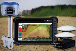
Designed for demanding positioning and heading applications
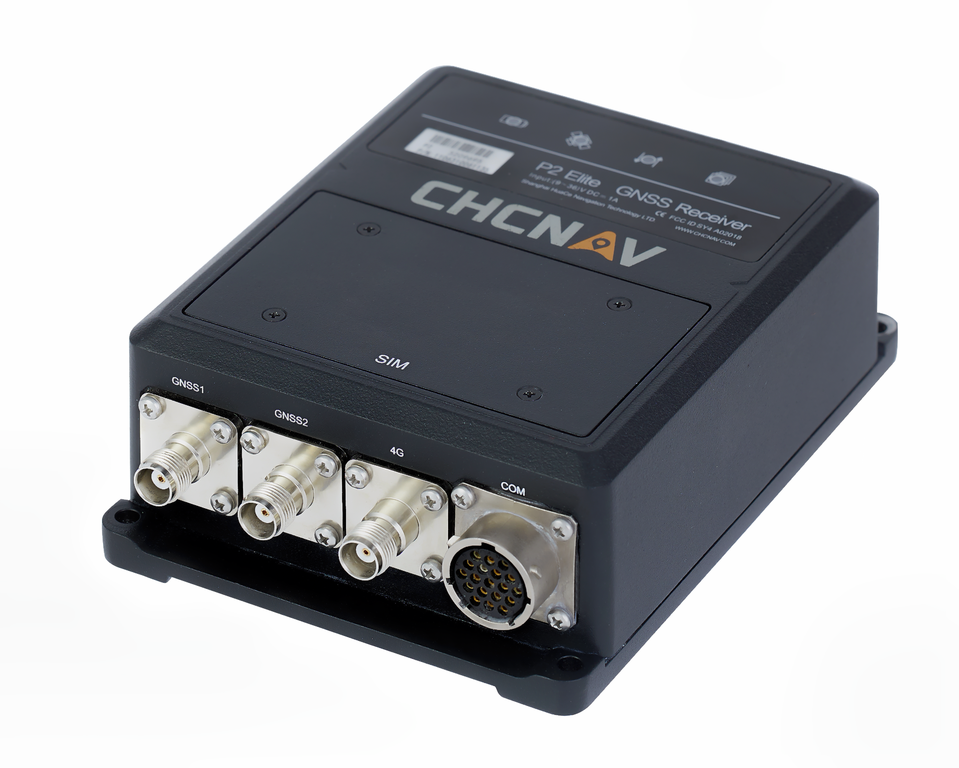
The P2 Elite GNSS sensor. (Photo: CHC Navigation)
CHC Navigation has released the P2 GNSS sensor series, which the company says provides high-accuracy positioning and heading in a compact, rugged enclosure.
The P2 GNSS sensor series is suitable for a wide variety of applications such as reference station, marine systems, unmanned navigation, industrial automation, robotics and machine control.
Integration. The P2 GNSS series is designed to significantly reduce system integration efforts by combining numerous connectivity interfaces including RS232, low-latency PPS output, Ethernet, CAN bus protocol and a comprehensive web interface for configuration set-up.
The series integrates the latest GNSS technology in an extremely rugged IP67 and lightweight enclosure. It delivers reliable, uninterrupted, high-accuracy, real-time positioning and heading measurements.
Scalable with 3 models. The P2 GNSS series is available in three different models to match various application requirements.
The P2 GNSS sensor offers cost-effective and powerful real-time kinematic (RTK) positioning.
The P2 Pro GNSS adds a dual-antenna input for precise heading data.
The P2 Elite integrates additional 4G and UHF modems to provide a powerful, all-in-one, GNSS sensor.
“The P2 GNSS sensor series is leveraging our expertise in providing high-performance and reliable GNSS solutions,” said George Zhao, CEO of CHC Navigation. “Back-up by CHCNAV’s professional integration support, the P2 GNSS sensor series offers exceptional feature set to system integrators and machine manufacturer partners.”
Hemisphere GNSS introduced its GradeMetrix platform, a machine guidance solution for high-precision GNSS-based machine control and guidance applications and systems, at bauma 2019.
GradeMetrix positioning systems — as well as the new Earthworks OEM solution toolkit — will be featured in the Hemisphere stand (A2.228) at bauma 2019 in Munich, Germany, April 8-14. Bauma 2019 is a construction machinery trade show.
GradeMetrix
Hemisphere’s GradeMetrix portfolio includes solution offerings for dozer and excavator earth-moving applications. Hemisphere continues to make significant strides forward with its next-generation GradeMetrix solutions through its network of machine control dealers and value-added resellers (VAR). Whether it is grading, mining, excavating, or compaction applications, GradeMetrix solutions provide superior performance at an exceptional value.
“GradeMetrix and Earthworks OEM platforms and design services empower dealers, VARs, and original equipment manufacturer (OEM) customers with unparalleled flexibility and price points for designing, complementing, and delivering their own scalable solutions,” said Randy Noland, vice president of global sales and business development at Hemisphere. “These offerings deliver a new generation of positioning systems by removing multiple barriers to entry and higher adoption rates, especially to smaller customers, machines, and markets.”
Earthworks OEM toolkit
Hemisphere also announced its Earthworks OEM toolkit ,which allows manufacturers to select components as à la carte or complete solutions, based on their accuracy and durability requirements to integrate into their machines and design their own IP, enabling them to maintain a competitive advantage in the marketplace.
The customizable and flexible toolkit provides the ability to tailor displays and outputs, per their requirements, providing OEMs with flexible options to build their own branded systems. This allows for much faster times to market, driving increased revenue streams for OEMs, and provides a high cost/value ratio. From grading, to mining, to excavation, Hemisphere’s Earthworks OEM toolkit increases accuracy, efficiency and profitability.
Speeding time to market and customer
In the increasingly competitive OEM marketplace, manufacturers are scrambling to get positioning and other non-native technologies out to market on their machines. As the uptake of this technology becomes more mainstream with the customer base, each OEM, VAR and even super distributor are all racing to define a profitable system design they can deploy through their own channels.
With the release of GradeMetrix and Earthworks OEM product lines, Hemisphere is addressing this demand. Typical development times for OEMs with vendors for positioning systems is measured in years, not months. With these new product lines, Hemisphere is providing a new avenue for these customers to get their own system established and into the marketplace, much faster and with lower development costs.
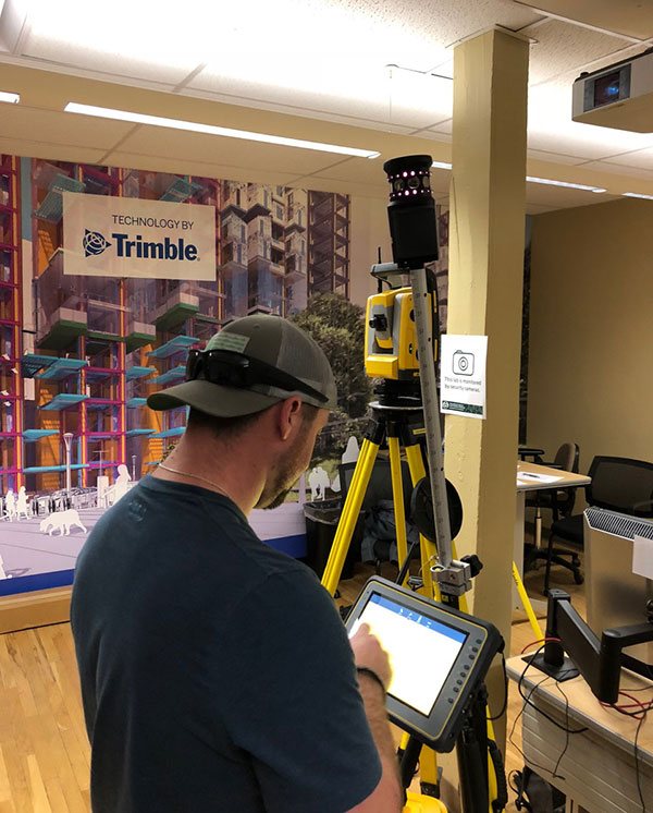
Trimble has awarded a significant in-kind gift to the Department of Construction Management at Colorado State University (CSU) that will expand the university’s leadership in training and research for 3D building design, construction management, digital fabrication, civil infrastructure, geomatics and the sustainable built environment.
The gift will enable CSU to integrate across its curricula Trimble solutions that are rapidly transforming how building and living environments are designed and constructed.
Trimble’s portfolio of building construction solutions support the Constructible Process, Trimble’s approach for enabling digital transformation of architecture, engineering and construction (AEC) workflows. This process empowers disparate teams across the construction lifecycle with actionable data to improve productivity and reduce waste.
The gift will be recognized as “Technologies by Trimble” throughout the Department of Construction Management.
Photo: Trimble
The department’s labs will include Trimble laser scanning, Trimble Field Link and Rapid Positioning Systems, UAS and surveying systems, and GNSS receivers. Trimble’s software packages will include RealWorks scanning software, Trimble Business Center, Vico Office Suite, Tekla Structures, Sefaira Architecture and its 3D modeling software SketchUp Pro, along with MEP software such as AutoBid SheetMetal and Mechanical, Sysque and AccuBid Electrical estimating packages.
Potential applications of these technologies include scanning historic and other buildings to ensure their preservation as well as planning future renovations; designing and 3D printing of architectural building models; surveying and layout; and improving construction estimating and scheduling to reduce costs.
“Working with Trimble represents the culmination of a fruitful, multi-year collaboration between CSU’s Department of Construction Management and Trimble,” said Jon Elliott, assistant department head and undergraduate program coordinator in the Department of Construction Management.
“Through numerous pieces of Trimble hardware and software applications, students gain important exposure to cutting edge technologies in surveying, virtual design and construction (VDC)-based estimating, site logistics, 3D modeling, building energy performance analysis, laser scanning, photogrammetry, and so on.
“Beyond the applications, Trimble’s dedicated employees provide outstanding educational opportunities through software demonstration and training. Through this exciting collaboration, Trimble is making significant contributions to our goal of preparing construction management students for a technologically advanced and dynamic construction industry.”
“Collaborating with CSU’s Department of Construction Management has been exciting. Trimble’s portfolio is highly relevant for students at the university,” said Roz Buick, Trimble vice president. “It will be rewarding to see the next generation of architecture, engineering, construction and building operations professionals experience the breadth and depth of our construction lifecycle solutions. We also look forward to supporting and learning from these new professionals as they experience and apply our solutions to real-world applications in their curricula.”
The gift was made to CSU’s Construction Management Program in the College of Health and Human Sciences.
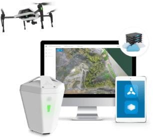
Komatsu Australia and Skycatch Inc. are partnering to boost the efficiency of construction, mining and quarry sites across Oceana with the High Precision Package.
The High Precision Package is also known as Komatsu’s Everyday Drone Solution, a key component to the Smart Construction workflow.
The Everyday Drone contains the Explore1 high-precision UAV, the Edge1 integrated GNSS base station and edge compute module, and the Viewer, an online data visualization and analysis tool, packaged into a commercial-grade kit.
High-precision package. (Photo: Skycatch)
The Everyday Drone allows a user to experience time to data without needing ground control points (GCP), and the ability to seamlessly integrate precision aerial data into their Smart Construction Workflow.
In common construction workflows, the time to data using traditional surveying methods could take weeks until project stakeholders can view or analyze their job site data. With the Edge1, customers are able to leverage a seamless GCP free workflow that consistently delivers sub 50-mm accurate data, in arbitrary or local coordinate systems within 30 minutes, saving countless hours and labor costs.
“We are now using the Everyday Drone at the start of projects to collect whole site information for pre-tender and bidding capability, comparing against 3D design surface to provide fleet and project managers real, accurate information viewed in the Smart Construction Application,” said Aaron Marsh, national technology solution expert manager, Smart Centre, Komatsu Australia. “This allows them to work out their cut and fill volumes with accuracy from the beginning, and enables the project tender team to select the right machines for the project optimising fleet recommendation and empowering the team to make the right, data-based decisions from the start.”
“Skycatch is proud to offer a better way of accessing precision data on-site. With traditional methods, the solutions are piecemeal, cumbersome, and time-consuming,” said Christian Sanz, Skycatch founder and CEO. “Now, customers are able to make informed decisions about changes to what was planned and what is actually happening on site in near real-time, ultimately providing greater productivity, increased profit and reducing project risk from beginning to end,”
Customers tested the receptiveness of the Everyday Drone Solution, said James Mackenzie, national remote support manager at Komatsu Australia. They first tested in civil construction, and then quickly expanded into quarry sites. Mackenzie was able to survey six quarries in five days for different customers, post-processed in the cloud, receiving the data back the next day.
“Compared to a traditional survey, this is 100% more productive and efficient,” Mackenzie said. “By using the Everyday Drone, customers are no longer putting themselves in harm’s way, surveying around heavy machinery or climbing up unstable stockpiles at risk of twisting an ankle.”
He also noted that customers appreciated the fast turn-around time, the ease of use, and the ruggedness of the products.
“Skycatch’s ability to provide near real-time data throughout the entire project is vital, and being able to deliver that to the customer, supervisor and give project teams the ability to make decisions throughout the project easily with usable, accurate data is key to the success of the project as a whole, not just in siloed environments is priceless,” Marsh said.
A self-driving tractor using the BeiDou Navigation Satellite System (BDS) was tested successfully March 10 in northwestern Tunisia, according to China.org.cn.
The representatives of China-Arab BDS/GNSS center and the Arab Information and Communication Technologies Organization (AICTO), as well as the academic staff of an engineering school in Mjez El-Beb region in northwestern Tunisia, attended the test ceremony.
The smart tractor, used in various agricultural activities, was equipped with a BDS receiver so that it could be controlled remotely without a driver.
“I am very impressed and surprised by the quality of the equipment offered by BeiDou,” said Sami Trimech, the strategic planning and development director at AICTO.
“We had a dream to bring BeiDou to the Arab countries,” said Nour Laabidi, the project manager at AICTO and head of China-Arab BDS/GNSS center in Tunisia.
“This is a pilot project. We are happy to implement it in our country and I hope that all Arab countries will be able to use this Chinese technology,” Laabidi said.
Hassan Kherroubi, a specialist in the mechanical industry at the Mjez El-Beb engineering school, stressed the contribution of this Chinese technology to the agricultural sector in Tunisia.
Agricultural activities, including harvest, will be more profitable and more effective with such technologies, according to Kherroubi.
“Our main concern is to benefit all Arab and African countries of this fruitful cooperation between Tunisia and China,” Kherroubi said, adding that this advanced technology will bring a bright future to the region.
BDS is compatible with other navigation systems, such as GPS, and users can receive services from both systems at the same time, improving positioning accuracy.
A series of documentary videos on automation and technology in the construction and agriculture industries covers drone inspection of infrastructure among other new trends. Filmed in the U.S., the Netherlands, United Kingdom, and Germany, the series of brief films produced by Topcon Positioning Group emphasizes how technological advancements have changed infrastructure — how it is designed, built and maintained — and what to expect going forward.
“The infrastructure industry is changing quickly, and this video series highlights how this advancement is part of a larger story of technology changing the paradigm everywhere. To stay on top, businesses will need to adopt automation and new technology,” according to Topcon spokesperson Jackie Ferreira.
A spokesperson from Intel describes how drone inspection facilitated data gathering and project planning for a complex restoration project on the Great Wall of China, in an area with very difficult access.
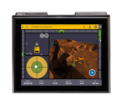
Trimble has introduced its Groundworks Machine Control System, a solution for drilling and piling operations. The next generation system that enables contractors to perform drilling and piling operations quickly, safely and accurately: with centimeter-level accuracy.
Using the large touch-screen display, operators can personalize the interface to match their workflow. In addition, a variety of configurable views make it easier for users to achieve maximum productivity. The software aligns with other solutions in the Trimble Civil Engineering and Construction portfolio to make company-wide training faster and easier.
“Engineered for ease of use, Trimble Groundworks features an updated, intuitive user interface designed for construction environments,” said Scott Crozier, general manager for Trimble’s Civil Engineering and Construction Division. “Contractors can achieve centimeter-level accuracy with stakeless navigation, which reduces rework and decreases the need for personnel working near the machine during operation.”
Drilling. Trimble Groundworks Machine Control System for Drilling gives contractors the ability to drill to the specified location, depth, orientation and inclination angle. Better rock fragmentation and lower hauling costs can be achieved by optimizing drill hole spacing, angles, and the location of the machine for a more even blasting pattern, according to the company. The auto stop feature automatically stops drilling at target elevation to reduce overdrilling, leading to flatter benches and reduced wear and tear on machines, which can result in significant cost savings.
Minimizing the need for stakes and construction surveying, Trimble Groundworks can help promote jobsite safety by reducing the number of people working near the machine while drilling. Also, avoidance zones can be set to keep operators from entering hazardous areas. With Trimble Groundworks, machines can operate 24 hours a day, 7 days a week in almost any conditions, decreasing the chance of delays due to darkness or inclement weather.
Piling. The system enables contractors to increase operational efficiency and reduce surveying costs associated with staking and as-built checks. Navigation time between piles is reduced. Less time moving the machine and more time piling maximizes daily production, which can increase revenue.
Built-in, automated quality assurance and quality control reporting includes the capture of start and end positions, time and elevation as well as actual embedment depth, blow count reporting, and inclination and orientation control. In addition, unique system logins allow managers to filter reports by operator for better accountability, production optimization and forecasting.
Senators Joni Ernst (R-IA) and Tammy Duckworth (D-IL) joined Representatives Dave Loebsack (D-IA) and Don Bacon (R-NE) in launching the Congressional GPS Caucus in March. This bipartisan, bicameral caucus will elevate the ever-increasing importance of GPS technologies to the U.S. economy and infrastructure. As evidence of that, today more than 3.3 million jobs in the United States rely heavily on GPS.
Agriculture is front and center in the states and districts these policymakers represent, and the cost savings as well as jobs and family incomes are noteworthy. Nationwide, GPS has led to $8.2 billion in savings through precision agriculture, while yielding increases in grain production across the country. Further, GPS has become an indispensable and reliable part of the country’s national infrastructure. Public and private investment in GPS-based technologies and services have produced a steady stream of innovations, making the U.S. a global leader in the sector.
The GPS Caucus will prioritize ensuring GPS signals remain continuously available, accurate, reliable and resilient. To better support the long-term health and future of GPS, the caucus plans to host educational briefings and technology demonstrations, in addition to advocating for policies that keep GPS at the forefront. On April 2, these efforts will kickoff with a “GPS 101” educational briefing on the Hill featuring remarks from Senator Duckworth, Representative Loebsack, Colonel Curtis Hernandez, US Air Force Director National Security Space Policy, National Space Council and industry leaders from Deere & Company, Garmin and Trimble.
To further reaffirm the critical importance of GPS, the GPS Caucus introduced concurrent resolutions in both the Senate and House. The resolutions outline the economic benefits of GPS, totaling more than $68 billion to the U.S. economy each year, and the sectors GPS technology supports, none of which would be possible without the contributions made by the men and women of the Air Force who maintain the GPS constellation.
As efforts to advance 5G, precision agriculture and smart cities continue, GPS will only become more valuable to modern-day operations and it remains critical that policymakers, companies and industry leaders alike, foster policy that keeps GPS at the forefront.
DIRT, the AMW Machine Blade Control Solution. (Photo: AMW)
AMW Machine Control Solutions, a subsidiary of CHC Navigation, has introduced four new solutions for the survey, construction and agriculture markets, all of which run on Android and CHC Navigation GNSS tablet hardware.
GRADE I and II Products. GRADE I runs on a CHC Navigation industrial tablet and utilizes an internal meter-accurate GNSS receiver for field workers and supervisors to view layered maps including design files, topo or Google Maps for locating elevations and topographical features.
GRADE II adds centimeter elevation and positioning accuracy with an external CHC Navigation RTK-capable GNSS receiver that wirelessly communicates with the tablet.
GRADE II collects topographic data on the jobsite by walking or driving the area, eliminating surveyor stakes and providing accurate data for earth-moving operations. The density of elevation points can be adjusted. The GRADE II “Smart Base” allows a user to establish RTK control points.
DIRT I and II Products.
DIRT combines GRADE II mapping functionality with automatic blade control for skid steer, scraper, grader or dozer applications for rough and fine land-shaping activities on large or compact equipment. DIRT is available as DIRT I or DIRT II versions depending on the type of blade control needed. Utilizing additional sensors, DIRT II adds the ability to manage cross slopes.
DIRT includes an RTK GNSS, inclinometers, tablet computer, CANBUS controller and DIRT software running on a CHC Navigation tablet. The tablet wirelessly connects to the RTK receiver and other sensors, making the system easily portable so it can be reinstalled on other equipment.
For agriculture applications, AMW Solutions’ proprietary algorithm within the DIRT solution results in accurately graded surfaces within the limits of the equipment.
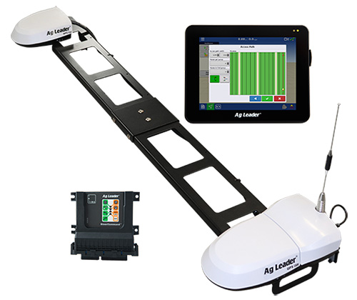
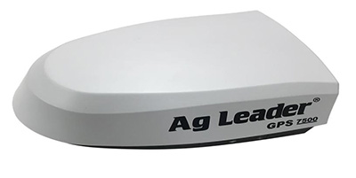
Ag Leader has unveiled new guidance and steering solutions for precision agriculture, including a dual-antenna automated steering system and the latest in GNSS technology.
The GPS 7500 GNSS smart antenna. (Photo: Ag Leader)
The GPS 7500 is a field-ready, multi-frequency GNSS smart antenna providing the latest technology including access to multiple GNSS signals for up to sub-inch accuracy and increased performance in variable terrain.
When combined with NovAtel’s TerraStar-C PRO differential correction service, GPS 7500 receives multi-constellation support for better satellite availability.
A full range of performance accuracies are available from GLIDE to RTK, offering a variety of solutions for customers. Combined with SteerCommand, the GPS 7500 offers sub-inch real-time kinematic (RTK) accuracy using the Relay 400, Relay 900 or InCommand NTRIP Client.
The receivers with InCommand software. (Photo: Ag Leader)
Wi-Fi capability within GPS 7500 allows for base-station configuration from a smartphone or tablet.When uptime is valued over absolute accuracy, integrated StableLoc technology utilizes available correction signals to provide a seamless transition between correction sources — without position jumps — and maximize signal uptime.
“SteerCommand with DualTrac brings a dual-antenna offering to the market that provides RTK accuracy and meets the needs of many farmers requiring high-accuracy automated steering at low speeds,” said Bill Cran, Ag Leader product specialist. “New GNSS technology in the GPS 7500 was leveraged to make this possible and also adds new satellite and correction offerings including TerraStar-C PRO.”
The GPS 7500 supports the new TerraStar-C PRO service, available in 3-month and 12-month subscriptions. TerraStar-C PRO offers multi-constellation/multi-frequency positioning with greater accuracy, availability and reliability than before. Its convergence is 60-percent faster and accuracy 40-percent better than TerraStar-C to overcome challenging signal conditions such as multipath, shading, interference and scintillation.
SteerCommand with DualTrac. Combining the GPS 7500 receivers with SteerCommand and InCommand displays offers automated steering control with sub-inch accuracy at ultra-low speed (as low as 0.05 mph). SteerCommand with DualTrac is designed for operations requiring precise steering such as planting or harvesting bedded crops, installing drip tape or planting and harvesting specialty crops. It provides a stable heading, even when the vehicle is not moving, as well as rapid line acquisition in forward or reverse.
Agriculture equipment maker Case IH is enhancing the robustness of its RTK+ correction signal network by adding the European Galileo system to the compatible satellites with which it works.
The move will increase levels of signal reception and reliability for farmers using Case IH RTK+-guided autosteering and related technologies.
Real-time kinematic (RTK) systems typically depend on signals from the American GPS or Russian GLONASS satellite networks, both designed primarily for non-civilian use. To give European Case IH users a reliable alternative when using RTK+-guided steering systems with their sub-1.5-centimeter repeatable accuracy, Case IH AFS RTK+ now also uses Galileo.
The addition of Galileo to the global GNSS constellation helps minimize the risk of signal failure, a key driver for the integration of its signals into the Case IH AFS RTK+ signal system. European satellite network independence is a principal objective, but Case IH AFS RTK+ is also designed to be compatible with existing and planned GNSS satellites and interoperable with GPS and GLONASS.
Galileo benefits farmers by minimizing downtime from waiting for lost signals to be regained, and ensures consistent efficient use of seed, fertilizer and crop protection products through parallel passes with minimal overlap, thereby maximizing crop potential.
“The use of GNSS technology is opening up new productivity levels and opportunities in European agriculture, providing farmers with an unprecedented level of knowledge about their crops, livestock and operations while making the sector more efficient, economically competitive and environmentally sustainable,” said Maxime Rocaboy, product marketing manager, AFS technology, at Case IH.
“Enhanced RTK+ accuracy through incorporation of signals from the Galileo satellite system is a core way in which we can help Case IH tractor and combine users be innovative and competitive as they seek to help develop a sustainable agriculture to feed an ever-increasing world population in an environmentally responsible way,” Rocaboy said.