An interactive map sheds light on which California communities are disproportionately burdened by pollution
Image: OEHHA
CalEnviroScreen was built by the Office of Environmental Health Hazard Assessment (OEHHA), part of the California Environmental Protection Agency. In it, pollution and population data combine to shed light on which communities bear the brunt of environmental and health hazards. Addressing this inequality is known as environmental justice.
“It is both a map and a way to think about the power of maps, in this case facilitating a geographic approach to realize the goals of environmental justice,” explained Stephen Gay, Equity & Social Justice blogger for Esri.
Using modern geographic information system (GIS) technology, CalEnviroScreen ranks and color codes California’s more than 8,000 census tracts to reflect vulnerability to pollution. The formula behind CalEnviroScreen considers the presence of various types of pollution, the prevalence of health problems that can be worsened by pollution, and population data.
The main map shown here illustrates the combined Pollution Burden scores, made up of indicators from the Exposures and Environmental Effects components of the CalEnviroScreen model. In addition to an overall score, CalEnviroScreen provides map-building tools to isolate 21 specific datasets.
Communities with a heavy pollution burden often experience high poverty that makes them more vulnerable to pollution’s effects. Pollution data includes cleanup sites, water quality (such as groundwater contamination, lead exposure, pesticide runoff) and air quality (including traffic exhaust, ozone, particulate matter). Deleterious health effects include asthma, heart disease, low birth weight and more.
The map itself is only the most visible manifestation of CalEnviroScreen, which CalEPA said is a screening methodology “to help identify California communities that are disproportionately burdened by multiple sources of pollution.”
ITU is the United Nations agency that deals with information and communications technology. Its remit includes coordinating spectrum use and satellite orbits.
ITU’s Radio Communications Bureau sponsors the World Radiocommunication Conference every three to four years. The issue of interference with GNSS signals was reported at the 2019 conference.
Since that time, according to this month’s circular, the group “has been informed of a significant number of cases of harmful interference to the radionavigation-satellite service…”
Despite concerns expressed by maritime and other interests, the circular focuses entirely on aviation interference. It says the reports it has received have been about “receivers onboard aircrafts and causing degradation or total loss of the service for passenger, cargo and humanitarian flights…” These have included “misleading information provided by RNSS [radionavigation satellite service] receivers to pilots.” An often cited example of this is a well-publicized 2019 incident in Sun Valley, Idaho. In that case a passenger aircraft nearly hit a mountain.
Describing interference with GNSS as a global and recurrent problem, the circular cites data collected by a major aircraft manufacturer. The company found “10,843 radio-frequency interference events … globally in 2021. The majority of these events occurred in the Middle East region, but several events were also detected in the European, North American and Asian regions.”
This year’s uptick in GNSS interference in Scandinavia, the Baltics, and around Ukraine since Russia’s February invasion of Ukraine is not mentioned. This is likely due, in part, to timing. ITU’s Radio Regulations Board met in March 2022 and directed the circular be issued.
Many within the positioning, navigation, and timing community have long asserted that interference with GNSS signals, whether deliberate or accidental, constitutes a violation of ITU rules and regulations. This month’s circular affirms this and cites several applicable provisions.
These include prohibitions on harmful interference with any authorized radio frequency transmission, requirements for users to transmit only in bands for which they have authorization, and for all to generally safeguard aviation operations.
The circular highlights provision 15.1 of ITU’s Radio Regulations as particularly applicable. It states:
“All stations are forbidden to carry out unnecessary transmissions, or the transmission of superfluous signals, or the transmission of false or misleading signals, or the transmission of signals without identification…”
As is the case with almost all international agreements, enforcement of ITU rules is the responsibility of its member states.
While most expect the advisory to have little immediate impact on reducing global interference with GNSS signals, it does help reinforce the issue as one of international concern.
According to a retired government official, “Member states that fail to comply with international rules to which they have agreed lose credibility and standing in the community of nations. Even when they have little credibility or standing to begin with, the behavior adds to their marginalization and life is just a little more difficult for them. This can, in the long run, nudge them toward being more responsible players.”
A cockpit platform from Qualcomm Technologies will power the navigation and infotainment system in the new Scorpio-N SUV from Mahindra Auto of India. The navigation system includes the option to use what3words.
Photo: Mahindra
The Scorpio-N features a 17.78-cm color driver information display and 20.32 -m infotainment system with navigation. Leveraging the third-generation Snapdragon Cockpit Platform, the Scorpio-N enables the latest in personalization and natural interaction between a vehicle and its driver. It provides virtual assistance and ultra-high-definition, as well as immersive audio and visual experiences.
The platform helps monitor driving and detect objects for the security of passengers and vehicular data. It features an advanced suite of wireless technologies to support multi-mode cellular connectivity, Wi-Fi 6, and enhanced Bluetooth technologies.
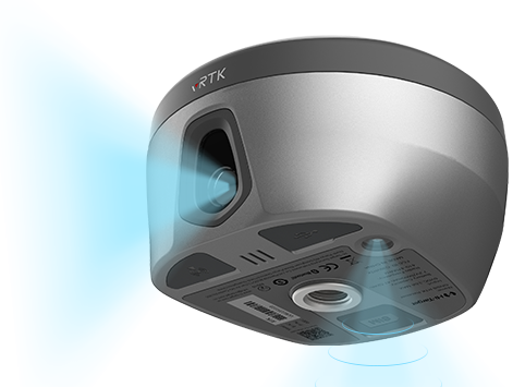
Hi-Target has launched a real-time-kinematic (RTK) GNSS receiver that has an eye for visual positioning.
The pocket-sized vRTK GNSS RTK System is equipped with professional dual cameras to enable non-contact image surveying. It also has an advanced inertial measurement unit (IMU).
vRTK is suitable for non-contact measurements in a variety of hazardous and complex environments. High-quality sensors ensure the stability of the receiver’s accuracy in working status. By combining imagery with high-precision positioning equipment, users benefit from the convenience of visual positioning technology, which allows them to obtain the location of the target with a touch of a finger from a distance.
The lightweight, innovative visual RTK receiver improves the speed of stakeout with its Live View Stakeout function. Non-contact measurement greatly improves the usable range of GNSS and efficient, safe operation, the company said, greatly improving the efficiency of surveyors and engineers.
vRTK Features
The vRTK receives 1,408 channels, including GPS, GLONASS, BeiDou, Galileo, QZSS, IRNSS and SBAS. A new generation of GNSS engine supports the new frequency points B1C, B2a and B2b RTK decoding of the Beidou-3 satellite. The introduction of multi-frequency anti-jamming technology and multi-step adaptive filtering technology features strong signal, high-quality data, fast fix and high accuracy.
The vRTK has a nine-axis IMU module with auto installation for tilt surveying. Users can easily pick it up and arrive at the target point to carry out the tilt survey with an error of less than 2.5 cm within a 60° inclination.
It is compatible with popular modeling software programs and can be used to collect point cloud and 3D modeling data in one step.
A case study describing development and use of the vRTK is available.
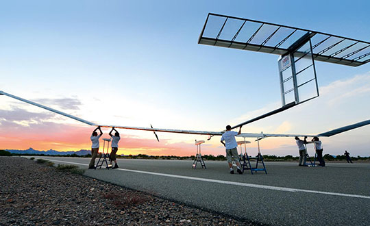
A division of the U.S. Army Futures Command is conducting stratospheric experimentation using the Zephyr ultra-long endurance stratospheric unmanned aerial system (UAS). The tests are being carried out at Yuma Proving Ground in Arizona by he Assured Positioning, Navigation and Timing/Space (APNT/Space) Cross-Functional Team (CFT), which is based in Huntsville, Alabama.
The first flight of 2022, launched June 15, demonstrated Zephyr’s energy storage capacity, battery longevity, solar panel efficiency and station-keeping abilities that will further the army’s goal to implement ultra-long endurance stratospheric UAS capabilities.
During the flight, the Zephyr accomplished a number of firsts, including
first flight into international airspace
first flight over water
longest continuous flight utilizing satellite communication controls
the farthest demonstration from its launch point while carrying a commercial, off-the-shelf payload
breaking the world record for longest duration UAS flight (26 days) set by the same aircraft in 2018. This flight has completed 36 days and is still flying over Yuma Proving Ground.
“Ultra-long endurance unmanned platforms have the potential to provide significant military capabilities and enhanced confidence as part of the Army’s diversified multi-layered architecture,” said Michael Monteleone, director of the APNT/Space CFT. “We have seen incredible progress in high-altitude platforms in recent years. This experimentation allows us to build on that knowledge by demonstrating multiple payload types, fully exploring the military utility of stratospheric operations, and modernizing areas of deep sensing, long-range targeting and resilient communications.”
Zephyr is prepared for a flight test. (Photo: Airbus)
Upcoming Second Launch. A second Zephyr flight will launch in the coming weeks and travel over the Pacific Ocean. The flight will demonstrate a prototype payload, developed by the Army Futures Command, over multiple combatant commands, and continue to inform high-altitude requirements.
The Airbus-developed Zephyr is the first high-altitude UAS of its kind, providing a persistent and adaptable longevity in the stratosphere. The experiments are performed with cooperation of the Intelligence, Surveillance and Reconnaissance (ISR) Task Force, U.S. Army Program Executive Office – Aviation, and multiple combatant commands under an Other Transaction Authority (OTA), with T2S Solutions LLC as the integrator.
The APNT/Space CFT is responsible for accelerating the delivery of advanced APNT, tactical space and navigation warfare capabilities to the soldier. Working with a core team of experts, the CFT informs technology and system requirements through continuous experimentation and prototyping, technology integration and soldier feedback. Through this process, the APNT/Space CFT supports the Army Futures Command in delivering next-generation weapons, vehicles and equipment at an accelerated rate, giving Army forces the ability to deploy, fight and win decisively against any adversary, anytime and anywhere.
A roundup of recent products in the GNSS and inertial positioning industry from the July 2022 issue of GPS World magazine.
OEM
RTK Receiver
Hybrid high-precision GNSS
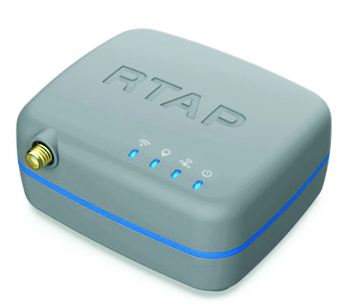
Photo: PP Solutions
The handheld RTAP2U is a hybrid high-precision, dual-frequency GNSS receiver. It can receive and process GPS, GLONASS, BeiDou, Galileo and QZSS signals. Its user-friendly web interface accesses and configures signal reception, skyplot, data collection, stop-and-go surveying, map display and more. With u-blox’s ZED F9P module, RTAP2U provides 2 cm or better accuracy within a few seconds. A firmware upgrade can provide precise point positioning (PPP) and real-time kinematic (RTK) capability.
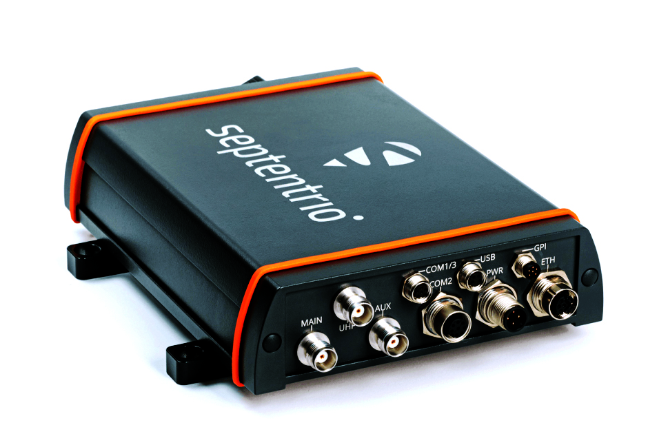
The AsteRx-U3 Marine GNSS receiver offers accurate positioning near shore and offshore via centimeter-level real-time kinematic (RTK) or the built-in Fugro precise point positioning (PPP) sub-decimeter subscription service, delivered either over NTRIP internet or L-band satellite. Corrections delivered over L-band allow dredging, bathymetry or marine construction projects even in areas where there is no internet service. The AsteRx-U3 Marine receiver, enclosed in an IP68-rated housing, offers a dedicated L-band demodulator with a separate L-band RF input, which allows for the use of dedicated antennas for excellent reception of L-band signals even at high latitudes.
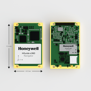
The HGuide o360 is a compact single-card, all-attitude GNSS/inertial navigation system (INS) that delivers accurate and robust position and attitude even in GNSS-challenged or denied environments to industrial and autonomous applications. The HGuide o360 contains a multi-frequency, multi-constellation, real-time kinematic (RTK) GNSS receiver with dual antennas, Honeywell’s i300 inertial measurement unit (IMU) technology, and a high-grade calibrated magnetometer. It is designed for platforms that require high-performance navigation data in an ultra-low size, weight and power (SWAP) package.
Offers optimal heading performance and resistance to vibration
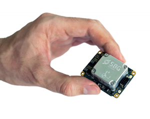
Photo: SBG Systems
The Quanta Micro GNSS-aided inertial navigation system (INS) offers a high level of navigation performance despite its low size, weight, power and cost (SWAP-C). It brings direct georeferencing to UAV and land-based surveying. Quanta Micro leverages a survey-grade inertial measurement unit (IMU) for optimal heading performance in single-antenna applications, and high immunity to vibrating environments. An optional secondary antenna enables fast heading initialization in low dynamic applications.
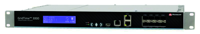
The GridTime 3000 GNSS time server is a software-configurable solution for utilities, providing redundancy, security and resiliency to protect against surges, adverse weather and cyberattacks. It generates precise time and frequency signals to synchronize analog and digital communication systems. The resilient timing platform incorporates multiple timing inputs for protection in the event of a GNSS signal disruption caused by severe weather, environmental disturbances or signal jamming or spoofing.
The Auterion OS serves enterprises that need component and payload flexibility, alongside a centralized and streamlined software workflow. Features include availability of precise mapping data in real time, automated processing for fast decision-making, standardization across Auterion-powered vehicles, connectivity that enables automated end-to-end workflows with no need for manual data transfer, and integration with third-party data-processing software such as Esri Site Scan or Propeller.
Designed to meet the need for highly accurate data
Photo: YellowScan
The YellowScan Vx20 lidar is the most accurate, fully integrated system of YellowScan’s product range. It can fly up to 330 feet (100 meters) while maintaining high accuracy throughout the point cloud. The Vx20 series is designed for applications that require sharp, accurate descriptions. Its Applanix APX-20UAV GNSS/inertial sensor provides precision of 1 cm and accuracy of 2.5 cm. With battery, the lidar scanner weighs 6.25 pounds (2.84 kg). It can be integrated with either multirotor or helicopter drones.
The WingXpand seven-foot expandable-wing drone folds to fit in a backpack. Its U.S.-made patented design combines the small size of a quadcopter with the horsepower of an airplane. The drone expands in less than 2 minutes and weighs less than 10 pounds. It can carry high-resolution cameras and other modular payloads such as a real-time pattern analysis system. More than 10 WingXpand UAS can fit in a public safety vehicle, more than 30 in a pickup, and 250 on a standard airlift pallet. WingXpand maximizes capability, efficiency and safety for the military and public safety officials. It also can be used by farmers, surveyors and inspectors.
The E300 drone package includes the E300 real-time kinematic (RTK) drone, flight-control software and an optional camera. It is suitable for topographic survey, urban construction, forestry investigation, emergency rescue, 3D modeling, mining and surveying. The drone is embedded with a high-precision K8 GNSS module that supports GPS L1/L2/L5, BeiDou B1/B2/B3/B1C/B2a, GLONASS L1/L2, Galileo E1/E5-a/E5-b/AltBOC/E6 and QZSS L1/L2/L5. With its intelligent recognition algorithms, the E300 can capture high-resolution images consistently even in complex environments.
The AR3 unmanned aerial system (UAS) now has a “hot-swappable” vertical-takeoff-and-landing (VTOL) capability, able to switch from horizontal launch to vertical. It also now has integrated synthetic aperture radar (SAR). The AR3 is a shipborne UAS that supports multiple types of maritime and land-based missions up to 16 hours. With the upgrade, the AR3 becomes more operationally flexible. The newly added SAR provides the AR3 with a vastly greater operational range, and the ability to effectively detect, recognize and identify targets under any weather condition. Covering more than 20,000 square nautical miles per mission, the new AR3 is suitable for wide-area surveillance missions.
The P300 is a high-precision, in-cab Android tablet designed for precision agriculture, autonomous driving and machine control. Embedded with the K8 OEM module, the P300 tracks GPS, BeiDou, BeiDou-3, GLONASS, Galileo and QZSS signals to achieve centimeter-level accuracy. It provides enhanced heading and positioning performance for everyday field use. The P300 series is available as the P300 Plus (10.1-inch) and P300 Mini (8-inch).
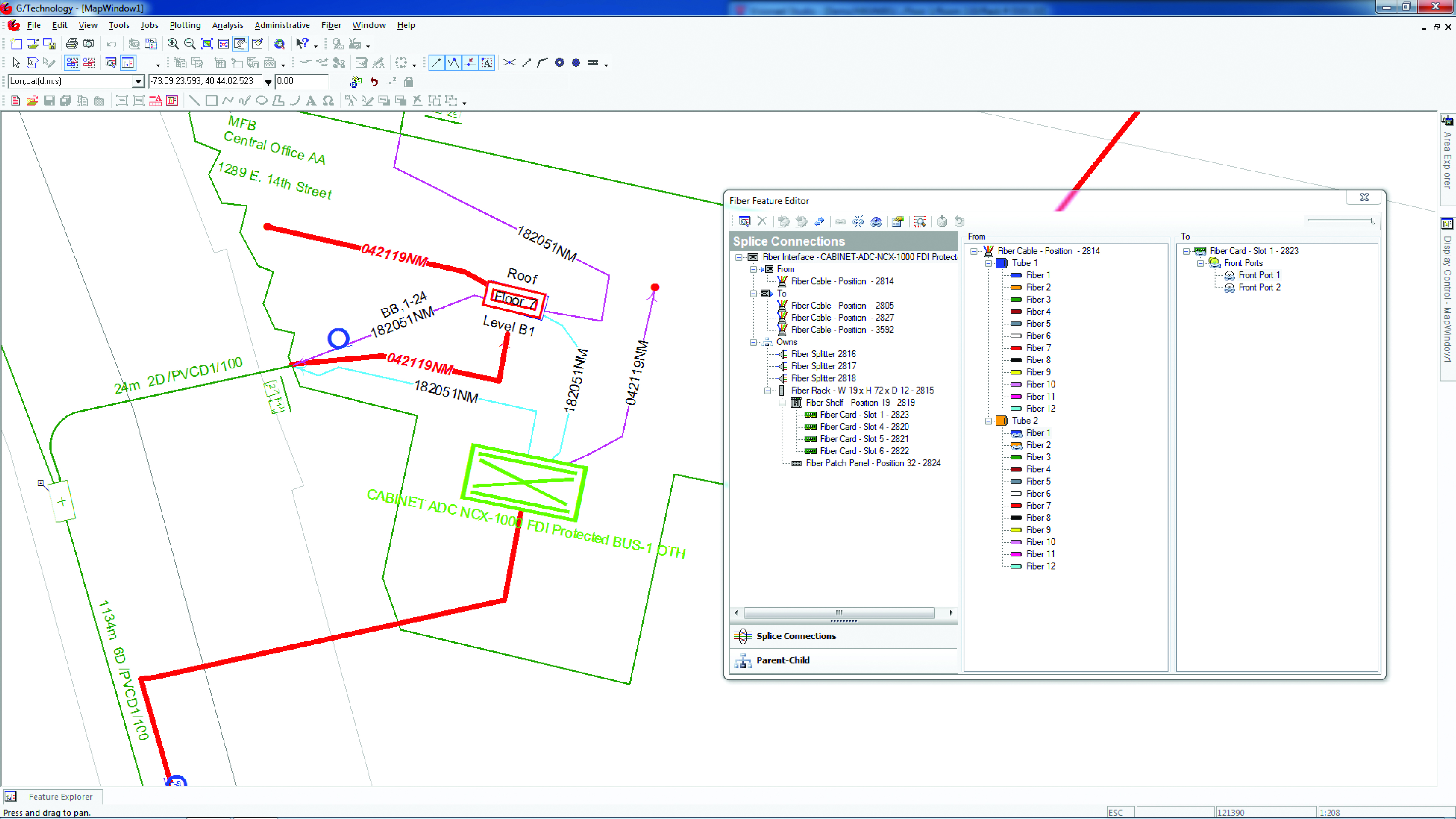
Intergraph G/Technology, an advanced utility geographic information system (GIS), enables utility companies to plan, design and document networks. It acts as a definitive source of reliable, location-based information that can be shared with users and systems across an organization. Available on the Oracle Cloud Marketplace, G/Technology provides utility operators with a scalable, secure and highly available GIS solution with reduced start-up costs and needed infrastructure. Running G/Technology on Oracle Cloud Infrastructure eases initial system deployment, enhances performance and automates scalability, availability and cybersecurity protection, ensuring the system is always up to date with the latest features and enhancements.
The Mosaic X mobile mapping camera captures extremely accurate photos and 360° videos, while simultaneously creating photorealistic 3D photogrammetry models, without the use of lidar. It can achieve 1-cm accuracy on road surfaces. The built-in CPU and GPU allow users to operate the camera and capture data without the need for a computer within the vehicle. Meticulous mechanical engineering and design ensure reliable and dependable use in harsh conditions such as moisture, mechanical shock and extreme temperatures. It can create high-quality 3D models, 3D reconstructions, and dense point clouds without the use of lidar. It comes with an AUX port to connect with external GNSS devices or lidar.
This month, we have developments across the globe, with drones inspecting power distribution systems and nuclear waste disposal in the United Kingdom, counter UAS (C-UAS ) systems deployed in Greece, and news of cutbacks in the UAV industry affecting two major suppliers.
UK Turns to Drone Power
The UK has reduced coal power generation significantly since 2013 by increasing use of natural gas, nuclear power and renewable sources. Power is distributed throughout the UK by the National Grid Electricity Transmission (NGET) via 4,000 miles of overhead high-voltage lines carried on 21,900 steel pylons. With another 330 substations to also look after, the infrastructure for power distribution in UK always has required a huge maintenance effort. This picture is likely reflected in the power distribution networks of most countries around the world.
Helicopters have carried a large portion of the workload to enable inspection of cables and insulators, with additional necessary manual inspections taking significant effort to gain access and analyze data. Helicopter time is expensive, and manual inspection processes and data analysis are tedious and time consuming.
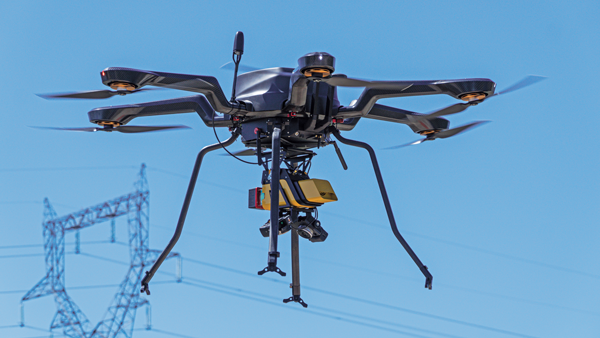
Drones are being used for power-line inspection — flown manually by onsite operators — by many organizations in several countries around the world, including by FPL in Florida. But the real reduction in time and effort comes from automating the whole process, and gathering data that provides the detail necessary to assure defects are detected and operational integrity is maintained. The automation of data analysis and generation of useful reports is another area which could yield major savings, and bring rapid focus to areas needing immediate corrective action.
A pylon inspection automation. (Photo: NGET)
Hence, a 12-month trial is being undertaken involving ultimate approval by the UK Civil Aviation Authority (CAA) for beyond-visual-line-of-sight (BVLOS) multiple drone operations. Artificial intelligent (AI) analysis tools are being developed to determine critical changes in collected visual, lidar and positioning inspection data that might herald deterioration in pylon or other infrastructure components.
During an initial test in Nottingham, an autonomous drone was dispatched with minimal instructions. It was able to find its inspection target and complete the programmed inspection in a few minutes. A manual inspection could take up to an hour for the same task. If things go well, it is not impossible to be able to project multiple drones operating with minimal human control, taking on huge swaths of pylons, cabling, insulators and other elements during regular inspections, saving a lot of time and money.
The trials so far have also included remote inspection of the Sellafield nuclear waste decommissioning site, rail infrastructure and a telecommunications network along with investigations towards transport of medical supplies.
Sellafield is where spent fuel ends up from the UK’s 31 nuclear power plants. Also, nuclear waste from reactors in neighboring European countries is reprocessed here. Nuclear waste is processed into 50-ton concrete blocks and spent fuel is “vitrified” into huge chunks of glass, which are encased in an outside metal jacket. Both processes minimize any emitted radiation and allow the contents to safely cool over long term. The staff uses robots inside the facility to remotely dismantle contaminated areas and load material into 55-gallon drums, which might be further processed by robot crushing machines. No one has any real idea how all this nuclear waste could be permanently disposed of, but it’s possible most will ultimately be buried in the ground.
This type of power might seem a “green” boon for humanity, but in a somewhat countrified area on the West Coast of England and in other similar sites around the world, nuclear waste disposal is costly and very, very long-term. The half-life of uranium is between 159,200 years and 4.5 billion years. Monitoring the waste could be a long-term task for drones, such as those now used to detect radiation inside the Fukushima nuclear plant. Certainly, there’s plenty of time to evolve improved drone detection capability for radiation monitoring.
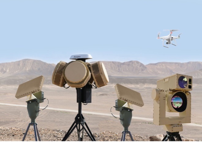
Greece Employs Counter-UAS against Turkish Incursions
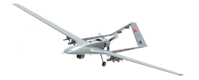
On a defense-related note, apparently the long-running rivalry between Turkey and Greece is, unfortunately, continuing. It seems that Turkey has been repeatedly flying its Baykar-TB2 surveillance drone over Greek islands, perhaps to monitor the movements of Greek warships or island defense installations. And Greece is a little bit more than peeved.
Having established a defense-related relationship with Israel in 2021, Greece has brought Israeli drone defense systems to the Greek islands, installing a “veritable umbrella against enemy unmanned aerial vehicles.” The Israeli system has a number of moving parts: detect and identify; generate related alerts; a directional jamming system that can disable drones in flight (presumably by jamming GPS or the control link); and a laser that can lock onto a small target and, if manually fired, can apparently destroy an intruder drone.
DroneDome elements (Photo: Rafael Advanced Defense Systems)
Because of the directional, narrow beamwidth of the jammer, Rafael claims that the system can be activated within crowded civilian airspace without affecting the navigation of other users. Good news for Greece and their popular, attractive Greek island tourist destinations.
UAV Defense Contractors Struggle — with Each Other
Meanwhile, current economic uncertainty is apparently impacting at least a couple of UAV defense contractors: Boeing/Insitu and Orbital UAV. The two made news when Orbital, as an Australian public company (ASX symbol OEC), had to halt trading. The company was then able to reinstate trading largely because of news of cancellation of a development/production agreement with Insitu.
Apparently, Orbital has previously been delivering two-engine versions to Insitu and was contracted to develop and deliver a third derivative engine. However, Insitu had to scale back Orbital’s work in February, given its sales of the popular ScanEagle and other UAVs may have fallen off in recent months.
Orbital UAV Propulsion System (Photo: Orbital)
This has affected Orbital’s revenue forecast for the year. The company now expects to lose AUD $7 million for the year. It has subsequently prepared a claim under the supply agreement for Insitu’s Termination for Convenience of AUD $1.8 million in costs incurred in the development of the third engine program, which Insitu/Boeing disputes. There will obviously be some wrangling, but hopefully both parties will settle things amicably so as not to damage their ongoing relationship for supply of the existing two engine types.
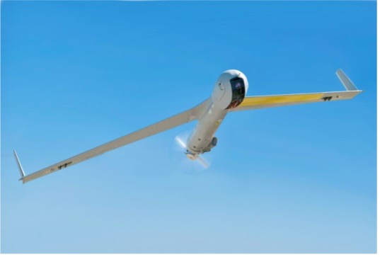
ScanEagle UAV (Photo: U.S. Navy)
To sum up, for this month we have a trial in the UK which will hopefully lead to significant savings in effort and costs for ongoing power infrastructure inspections, along with some background on UK nuclear waste disposal. Greece is bristling and defending against unwanted Turkish drone overflight using Israeli C-UAS systems. Finally, there’s somewhat negative news for the Orbital UAV engine and Insitu ScanEagle relationship — apparently, not everything in the UAV garden is roses.
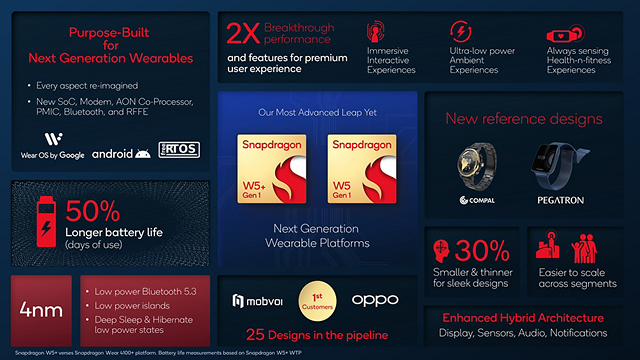
Qualcomm Technologies has unveiled new wearable platforms, the Snapdragon W5+ Gen 1 and Snapdragon W5 Gen 1.
The platforms are designed to advance ultra-low power and breakthrough performance for next-generation connected wearables with a focus on extended battery life and premium user experiences. They incorporate a series of innovations including low power islands for GNSS, Wi-Fi and audio; ultra-low power Bluetooth 5.3 architecture; and low power states such as Deep Sleep and Hibernate.
New enhancements to the flagship Snapdragon W5+ platform offer 50% lower power, 2X higher performance, 2X richer features, and 30% smaller size, compared to our previous generation, enabling wearable manufacturers to deliver the differentiated experiences consumers demand. Based on the hybrid architecture, the purpose-built platform is comprised of a 4 nm-based system-on-chip and 22 nm-based highly integrated always-on co-processor.
By using these platforms, manufacturers can scale, differentiate and develop products faster in the continuously growing and segmenting wearables industry, Qualcomm said.
Qualcomm also announced two reference designs from Compal and Pegatron, which showcase the capabilities of the platform and the company’s collaboration with ecosystem partners, helping customers develop products faster.
Fugro has completed a hydrographic survey to determine a safe channel through the Star Reef Passage in Papua New Guinea.
Fugro worked with the National Maritime Safety Authority (NMSA) and with funding from the Asia Development Bank (ADB) on the survey, which will be used to update nautical charting and improve coastal zone management.
The project is a key initiative contributing to Papua New Guinea’s sustainable economic development.
Fugro used its LADS HD+ Airborne Lidar Bathymetry (ALB) system, which was deployed with a team of surveyors from both the NMSA and Fugro working in collaboration.
Fugro’s ALB system meets International Hydrographic Organization (IHO) standards with the data now set to be used to update nautical charts. The data was collected safely and with minimal environmental impact on the sensitive reef environment or local marine activity.
Through this Maritime and Waterways Safety Project, Fugro has successfully worked with the NMSA and ADB to help deliver both hydrographic data and training of NMSA staff.
The project is designed to improve the safety and efficiency of international and national shipping in coastal areas and waterways of Papua New Guinea by improving maritime safety information infrastructure and practices and capacity. Safer maritime activities that improve trade and tourism, as well as information to help manage the environment, will bring direct benefit to PNG’s coastal communities.
JCB has launched its Fastrac iCON tractor to the public featuring the Hexagon | NovAtel’s SMART7 GNSS receiver. The tractor also offers optional TerraStar Correction Services driving the iCONNECT precision technology package and offering operators an easy-to-use customizable experience.
The SMART7-I included in the new Fastrac iCON tractor is a rugged, waterproof, all-in-one GNSS smart antenna designed and tested specifically for the agriculture industry.
Connectivity is with Wi-Fi and Ethernet. TerraStar and RTK corrections provide the centimeter-level accuracy required for any farming application. With multi-constellation and multi-frequency capabilities, it is a dependable solution for farms with treelines and obstructions that may impede satellite signals.
With the availability of TerraStar Correction Services, operators can have the highest accuracy and year-over-year repeatability globally. TerraStar offers fast, consistent positioning through the planting, spraying and harvest cycle with 99.999% uptime and availability.
“The iCON tractor is designed around the farmer. We wanted a GNSS solution farmers can rely on that stands up to harsh agriculture environments while providing the accuracy to support our precision technology,” said Greg Fitton, general manager, Fastrac Sales at JCB. “We chose NovAtel as our GNSS experts because of their demonstrated reputation for quality, cutting-edge technology and performance, and their willingness to adapt to our needs.”
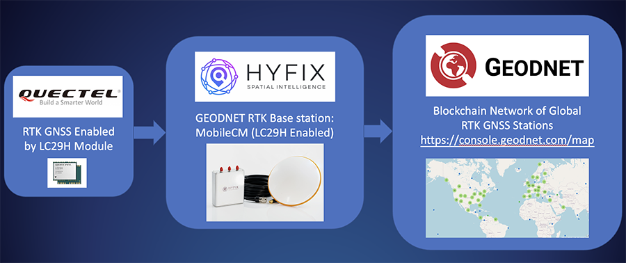
HYFIX.AI, an internet of things (IoT) GNSS and precise location company, has announced the availability of a GEODNET base-station using the LC29H module from Quectel Wireless Solutions.
The Mobile Centimeter (MobileCM) base station is a dual-band GNSS base station for real-time kinematic (RTK) precise-positioning applications in autonomy, agriculture, construction/survey, drones and geo-science applications.
Introduced at the Institute of Navigation’s 2021 ION GNSS+ conference, the Global Earth Observation Decentralized Network, GEODNET, received a best presentation award and has rapidly grown since official launch in early 2022.
The MobileCM station automatically uploads real-time satellite data to GEODNET via a Wi-Fi-based internet connection. MobileCM base-stations are self-hosted and receive GEODNET token rewards while powering both commercial AIoT as well as citizen science climate change applications.
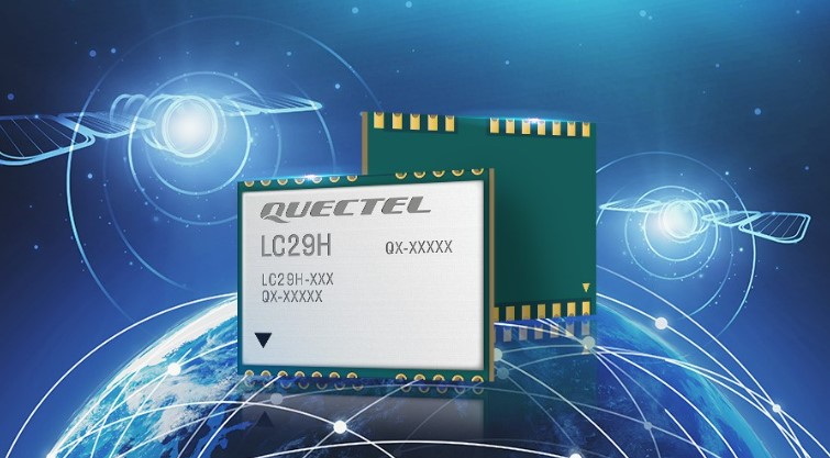
The Quectel LC29H module is a surface-mount low-power 135-channel dual-band receiver that hosts both RTK and dead-reckoning algorithms such as the HYFIX.AI Embedded Centimeter (EmbedCM) stack. Using GNSS corrections from a service such as GEODNET or other network, the LC29H modules can achieve position accuracy of 10 cm in a variety of real-world conditions.
The HYFIX.AI MobileCM base-station embeds the LC29H as well as the ATECC608B CryptoAuthentication engine. An included installation kit provides a survey-grade triple-band GNSS antenna, primary antenna cable, and roof-top installation hardware.
“Quectel is excited to continue its partnership with HYFIX.AI to deliver precise GNSS positioning accuracy of 10 cm in the real world using our dual-band LC29 family of GNSS modules,” said Mark Murray, vice president of sales for GNSS and automotive at Quectel Wireless Solutions.
“HYFIX.AI is pleased to continue support of Quectel’s dual-band LC29 GNSS modules and introduce a new turn-key GEODNET base station for global precise positioning,” said Mike Horton, chief executive officer of HYFIX.AI.
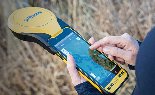
Trimble has announced a new high-performance data collector for its Mapping and Geographic Information Systems (GIS) portfolio — the Trimble TDC650 handheld. Built for GIS data collection, inspection and asset management activities, the TDC650 provides users a rugged solution with scalable high-accuracy GNSS positioning for professional field workflows.
The TDC650 is fully integrated with today’s demanding GIS data environment, powered by the Trimble Software Development Kit (SDK) that enables precision GNSS positioning for apps such as Esri ArcGIS Field Maps and Trimble TerraFlex software. The TDC650 is also a scalable solution that allows customers to choose their desired accuracy down to the centimeter-level to meet needs and budget requirements.
“This is an ideal tool for customers tasked with modernizing critical utilities including electric, gas and telecommunications networks,” said Gareth Gibson, marketing director, Trimble Mapping and GIS. “The precision, quality and data integration workflows needed to map the physical world to a digital one in these projects requires a modern data-collection platform like the TDC650.”
City, state and local governments and utilities will benefit from this solution, which is part of the larger Trimble Public Sector ecosystem that includes Cityworks software for stormwater inspections and Trimble Unity for monitoring municipal water pressure and hazards. As GIS data continues to grow more complex, Trimble helps simplify, visualize and make sense of the data so customers can make better decisions in managing their communities’ assets.