Category: Applications

  • Launchpad: GIS platform, handheld rover,  UAV camera

    Launchpad: GIS platform, handheld rover, UAV camera

    A roundup of recent products in the GNSS and inertial positioning industry from the March 2022 issue of GPS World magazine.


    OEM

    Correction Service

    Achieves RTK-level accuracy

    Photo: Hexagon
    Photo: Hexagon

    “RTK From the Sky” technology has been integrated into the core of the TerraStar-C PRO corrections service. As a result, TerraStar-C PRO provides centimeter-level accuracy, not just in open-sky environments but also across challenging conditions created by buildings and foliage. TerraStar-C PRO now converges in less than three minutes by utilizing quad-band receiver and antenna technology to leverage modernized BeiDou 3, GPS III and Galileo E6 signals. The resulting process generates state-of-the-art corrections for all GNSS frequencies. The service improvements are accessible through the 7.08.10 firmware release for users of OEM7700, OEM719 and OEM729 cards and their associated enclosures for land and air applications.

    Hexagon | NovAtel, novatel.com

    GNSS Antenna

    North orientation mark added

    Photo: Tallysman
    Photo: Tallysman

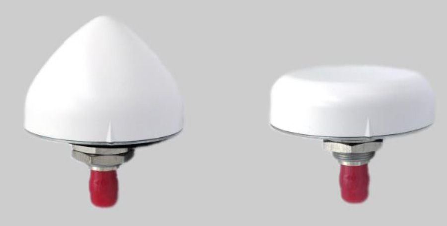
    A north orientation mark is being added to the TW3000 family of Accutenna precision antennas and the TW5000 family of smart antennas. The new feature allows customers to align their antennas, standardize radiation patterns, and increase the synchronicity of their azimuth gain readings across multiple devices. The new north mark design has been thoroughly tested to ensure it conforms to or exceeds customer expectations and maintains each antenna’s stringent IP69K rating.

    Tallysman Wireless, tallysman.com

    Protection Module

    Adds resilience to critical GPS timing services

    Photo: ViaLite
    Photo: ViaLite

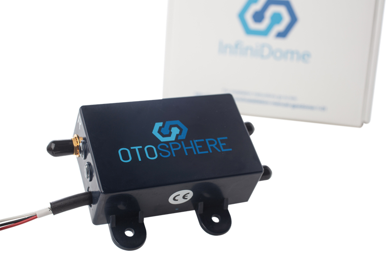
    OtoSphere is a small, add-on module to the ViaLite GPS RF over fiber link and any GNSS-based system, providing GNSS protection against GPS jamming attacks, making any receiver more resilient. It ensures continuity of timing and navigation capability and enables normal operation during a jamming attack. According to ViaLite, no other solution that offers such protection is as small, light, affordable, or easy to install. The Otosphere protection module adds resilience to critical GPS timing services.Using OtoSphere, GPS receivers are up to 50 times more resilient to jamming attacks on positioning, navigation and timing (PNT) systems compared with having no protection. The GPS receiver can continue working normally throughout the attack. Timing-critical infrastructures in areas such as defense and cybersecurity can now be protected from these attacks. The Otosphere has a unique interference filtering algorithm that combines patterns from two external omnidirectional antennas that pinpoints the direction of the attack, then directs a null toward the unwanted signal to reject and reduce disruptions.

    ViaLite, vialite.com


    TRANSPORTATION

    Control Tower

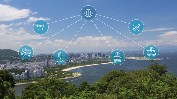
    Infrastructure system for autonomous transportation

    Photo:
    Photo: Seoul Robotics

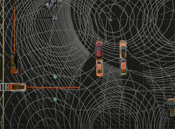
    The Level 5 Control Tower (LV5 CTRL TWR)) is a mesh network of sensors and computers on infrastructure that guides vehicles autonomously without requiring that sensors be placed on individual vehicles. The technology is automating last-mile fleet logistics at BMW’s manufacturing facility in Munich. The system has the potential to transform operations for a wide range of business applications, from vehicle distribution centers to car rental companies and trucking logistics.

    Seoul Robotics, seoulrobotics.org

    Navigation App

    Designed for boaters and pilots

    Photo: Savvy Navvy
    Photo: Savvy Navvy

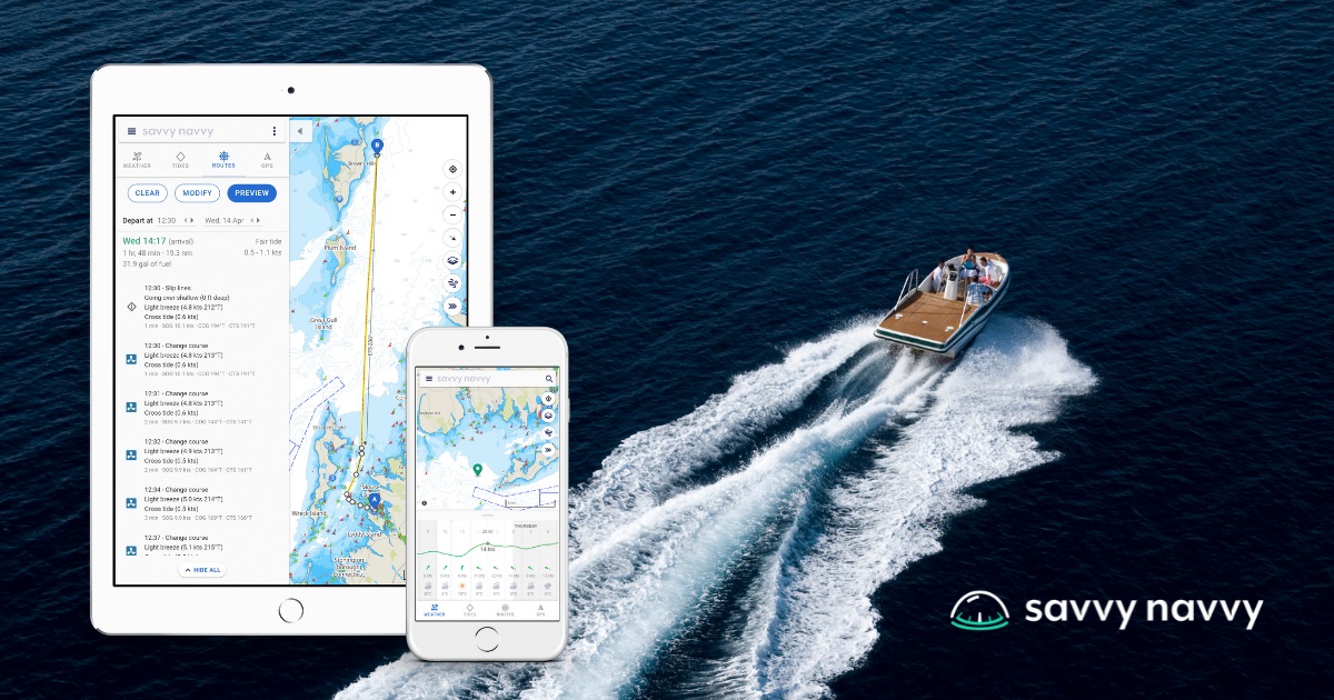
    Savvy Navvy provides essential marine information, allowing boaters to cross-check their traditional navigation plans. It integrates plotting charts, weather and tide data, marina details and passage planning into one app. The app reduces the risk of human error as well as the stress of voyage preparation. It is used by boaters in more than 100 countries around the world, with more than 43 million miles plotted. It works on phones or tablets using Android, IOS, PC or Mac.

    Savvy Navvy, www.savvy-navvy.com


    SURVEYING & MAPPING

    RTK Rover

    For IOS handhelds

    Photo: Pix4D
    Photo: Pix4D

    The Pix4D viDoc RTK handheld rover attaches to iOS devices to bring RTK accuracy to terrestrial scanning on iPhones and iPads. When paired with the PIX4Dcatch mobile app, the viDoc rover can replace survey tools such as RTK GNSS rovers and terrestrial scanners, the company said. The two products create a workflow that turns iPhones or iPads into an accurate terrestrial scanning device, with centimeter-accurate RTK positioning from an existing NTRIP network. The tools can be used to 3D model small areas or structures.

    Pix4D, pix4d.com

    Android Support

    For laser-offset workflow

    Photo: Bad Elf
    Photo: Bad Elf

    Bad Elf now provides an integrated laser-offset workflow for acquiring high-accuracy field data in GNSS-challenged environments using Esri ArcGIS Field Maps for Android, as well as iOS. The workflow integrates Bad Elf and Laser Tech (LTI) hardware in collaboration with ArcGIS technology from Esri. The Bad Elf Flex connects to any LTI TruPulse rangefinder over a wired or Bluetooth connection to deliver high-accuracy location data to Esri ArcGIS Field Maps. Mobile workers can efficiently complete position and height data collection in access-limited situations, saving time, money and effort.

    Bad Elf, bad-elf.com

    Global Map

    For use in web applications

    Photo: MapTiler
    Photo: MapTiler

    A free global map created from processed satellite imagery is available. To create the world image, satellite imagery was processed to remove clouds and balance shades and tones, and then carefully stitched together to create a seamless map layer with beautiful colors. The input data is recent, from 2020 and 2021, and rendered as one tiled file with 13 zoom levels 0-13 for use in web applications. It is a viable, up-to-date alternative to Google maps for software developers, without privacy issues.

    MapTiler, maptiler.com
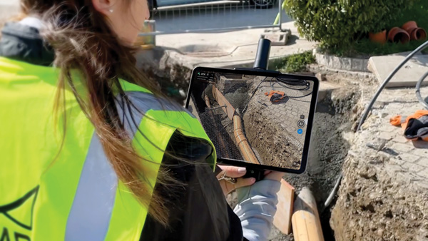
    GIS Platform

    Shares 3D map datasets

    Photo: MetaGeo
    Photo: MetaGeo

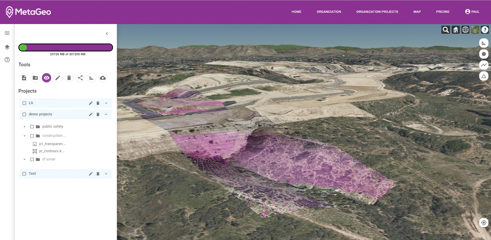
    The MetaGeo geographic information system (GIS) platform enables organizations of all sizes to host, analyze, find and share 3D map datasets among any internet-capable devices. The platform processes location-based map or sensor data from the real world, combines it into a single 3D virtual environment, and streams it to any device or mapping platform. The affordable and easy-to-use platform can load data from multiple sources: satellites, drones, mobile devices, public and crowdsourced repositories, internet of things (IoT) sensor data, 3D models and topographic maps. The data is then processed by the MetaGeo platform into a 3D world and streamed to any internet-connected device, enabling live collaboration between the office and field via mobile or augmented reality device. A plug-in software development kit (SDK) allows for third-party tools to scale and fit user needs.

    MetaGeo, metageo.io

    GNSS-inertial platform

    For mobile mapping

    Photo: Applanix
    Photo: Applanix

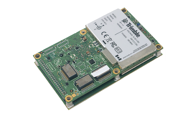
    Trimble has launched the Trimble AP+ Land GNSS-inertial OEM platform for accurate and robust position and orientation for georeferencing sensors and positioning vehicles in land mobile-mapping applications. The platform enables users to accurately and efficiently track and monitor fleets and produce high-definition (HD) maps and 3D models. It can also serve as a reference solution for advanced driver-assistance systems (ADAS) testing, even in challenging GNSS environments. The comprehensive Trimble AP+ Land is small enough to integrate into compact mobile-mapping systems. It is compatible with virtually any type of mapping sensor, including single- or multi-lidar systems, video cameras, photogrammetric and panoramic cameras, and similar sensors.

    Applanix, applanix.com


    UAV

    UAV Camera

    Professional cinema-grade

    Photo: DJI
    Photo: DJI

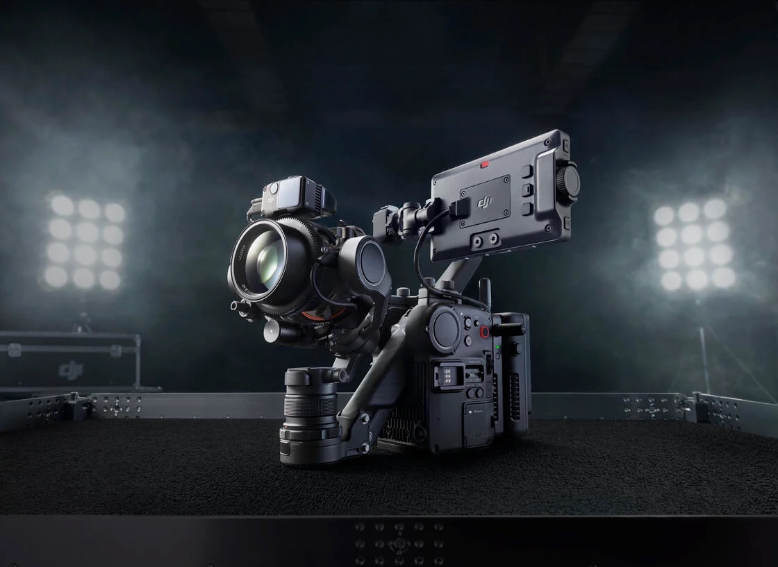
    Ronin 4D, a professional cinema camera from DJI, incorporates the full-frame Zenmuse X9 gimbal camera, active four-axis stabilization, lidar focusing, and wireless transmission. Firmware available at launch will allow the remote monitor to view and control the main monitor, interface with mirror control mode, and allow a clean video stream over HDMI and SDI ports on the Remote Monitor Expansion Plate with no overlaid information. It will also support automatic calibration for some third-party auto lenses to realize Lidar Focusing System functions.

    DJI, DJI.com

    Heavy-Lift Drone

    Reduces response times

    Photo: Parallel Flight Technologies
    Photo: Parallel Flight Technologies

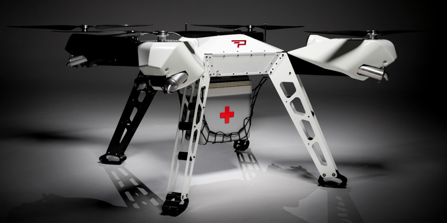
    Parallel Hybrid Electric Multirotor (PHEM) drone technology improves flight time with a heavy payload, yielding increased efficiency and eliminating the large battery used in other hybrids. It has the potential to extend a UAV’s flight time from 15 minutes to well over an hour and drastically increase range. In the search-and-rescue field, a heavy-lift drone can enhance first responder capabilities by allowing for substantially quicker response times to remote locations. Other applications include military platforms, fighting wildfires, and medical and logistics missions.

    Parallel Flight Technologies, parallelflight.com

  • Spire constellation helps detect GPS jamming in space

    Spire constellation helps detect GPS jamming in space

    Image: Spire Global
    Image: Spire Global

    Spire Global Inc., a provider of space-based data, analytics and space services, is using its constellation of about 40 geolocation satellites to detect GPS jamming. Spire is collecting data for use by the U.S. Space Force, a particularly important task in light of Russia’s invasion of Ukraine.

    “All of our fellow space companies… everyone is playing a vital role for humanity in this battle for freedom and democracy,” Spire CEO Peter Platzer told analysts March 9 in an earnings call, according to Space News.

    In September 2021, Spire won a contract to supply Slingshot Aerospace with GPS telemetry data. Slingshot’s pLEO Data Exploitation and Enhanced Processing (DEEP) prototype will automate manual data exploitation techniques to deliver intuitive, easily digestible data products at low latencies for military operations.

    The DEEP prototype contract is funded through the the Commercially Augmented Space Inter-Networked Operations (CASINO) program of the Space Systems Command (SSC), which develops and demonstrates the military utility of proliferated LEO satellite architectures.

    Identifying and mitigating ground-based radio-frequency (RF) and GPS interferences is a critical component of national security and U.S. Space Force operations. RF signals intercepted in open airspace are liabilities that directly threaten on-orbit space assets and military missions.

    Even in the absence of enemy interference and intentional jamming, RF signals from radio stations, cell phones, and various electronics cause interruptions and interferences — a problem exacerbated by the growth of modern communications technology.

    The DEEP prototype is an effort by the U.S. military to take advantage of existing commercial satellite telemetry data to readily identify these sources of interference and correct any potential problems before they become a threat.

    Spire’s cubesats use GPS radio occultation, a remote sensing technique that measures properties of the Earth’s atmosphere from space.

  • Leica AP20 AutoPole provides tilt-compensation for surveyors

    Leica AP20 AutoPole provides tilt-compensation for surveyors

    Photo: Leica Geosystems
    Photo: Leica Geosystems

    Leica Geosystems, part of Hexagon, has introduced the Leica AP20 AutoPole — a solution for automated total stations that boosts productivity with tilt compensation, automatic pole-height readings and unique target identification.

    The AP20 AutoPole combines an intelligent sensor module with the new AP Reflector Pole and operates with Leica Geosystems’ existing automated total stations to create a solution for autonomous workflows.

    It is designed to solve three workflow challenges:

    • holding the pole vertical and stable
    • entering the pole height manually into the field software
    • locking to a foreign target on a site with multiple reflectors.

    The tilt compensation of the AP20 AutoPole increases efficiency when working with total stations. It is no longer necessary to level the pole for measurements and stakeout. Tilt compensation decreases measurement time and increases flexibility and safety on site by enabling the measuring of points in locations that are inaccessible or put the user at risk. By updating the pole height automatically in the field software, the system ensures that the height on record is always correct, which avoids errors, time-consuming postprocessing and returning to the field to remeasure.

    Additionally, the AP20 AutoPole’s target identification ensures the user’s instrument will always lock to the correct target.

    “At Leica Geosystems, we understand that tight time schedules, growing expectations for accurate on-demand data and budget constraints put a lot of pressure on surveyors and construction professionals,” said Hans-Martin Zogg, business director, Total Stations, Leica Geosystems. “The AP20 AutoPole is a game changer because it solves several challenges simultaneously. Its tilt compensation and automatic pole height readings are absolutely unique in the industry and will transform how professionals measure with total stations.“

    “As a surveying company, the only way we can stay competitive and profitable is to acquire spatial data simply, quickly and efficiently,” said Clifton Webb, director of Warner Surveys. “The Leica AP20 helps us stay ahead of the curve by increasing our productivity and flexibility. It allows us to measure points that were impractical or unsafe to measure before.”

  • ESA app turns smartphones into space monitoring tools

    ESA app turns smartphones into space monitoring tools

    Image: ESA
    Image: ESA

    A new Android app released by the European Space Agency (ESA) turns smartphones equipped with dual-frequency GNSS receivers into instruments for crowdsourced science.

    The CAMALIOT app, developed through ESA’s Navigation Innovation and Support Programme (NAVISP) with the support of the GNSS Science Support Centre, is suitable for more than 50 smartphone models.

    Using the CAMALIOT app, the phones will record small variations in satellite signals, gathering data for machine learning analysis of meteorology and space weather patterns.

    As well as helping to create new Earth and space weather forecasting models, participants are also in with the chance to win prizes including new phones and Amazon vouchers. This four-month “citizen science” campaign runs until the end of July.

    “The precisely modulated signals continuously generated by the dozens of GNSS satellites in orbit are proving a valuable resource for science, increasingly employed to study Earth’s atmosphere, oceans and surface environments,” said ESA navigation engineer Vicente Navarro. “Our GNSS Science Support Centre was created to help support this trend.”

    For instance, tens of thousands of permanent GNSS stations are continuously recording GNSS data. As the satellite signals travel down to Earth they are modified by the amount of water vapor in the lower atmosphere, helping to forecast rainfall in particular.

    GNSS signals also undergo delay and fading — known as scintillation — as they pass through irregular plasma patches in the ionosphere. This electrically charged upper atmospheric layer is continuously changing, influenced by solar activity, geomagnetic conditions and the local time of day. Dual-frequency GNSS receivers can compensate for this effect by comparing their two frequencies.

    “The combination of Galileo dual band smartphone receivers and Android’s support for raw GNSS data recording is what opened up the prospect of supplementing data from these fixed GNSS stations with tens of millions of smartphones, vastly increasing our density of coverage,” Vincente said. “We took inspiration from the famous ‘SETI@home’ initiative, where home laptops help seek out signs of extraterrestrial life.”

    The results can then undergo a Big Data machine learning approach, seeking out previously unseen patterns in both Earth and space weather.

    “This is our first step in enlarging GNSS data acquisition using an internet of things data-fusion approach, employing novel sources such as fixed sensors and drones as well as smartphones,” Vincente said. “A wide range of other applications are also possible for the system, including improving the performance of GNSS systems.”

    Formally known as the Application of Machine Learning Technology for GNSS IoT Data Fusion project, CAMALIOT is run by a consortium led by ETH Zurich (ETHZ) in collaboration with the International Institute for Applied Systems Analysis (IIASA).

    “The CAMALIOT effort was underpinned by Element 1 of our NAVISP research programme, spurring innovation in satellite navigation,” said Pierluigi Mancini, ESA’s NAVISP program manager.

  • Positioning system for subways begins construction in Beijing

    Positioning system for subways begins construction in Beijing

    Photo: dk1234/iStock/Getty Images Plus/Getty Images
    Photo: dk1234/iStock/Getty Images Plus/Getty Images

    A “BeiDou positioning system for subways” began construction March 20 on the Beijing subway capital airport express line. The project will cover a 30-kilometer-long section of the express line, including five stations.

    To provide positioning, the BeiDou Navigation Satellite System (BDS) will be combined with 5G for indoor positioning or in areas where the satellite signals are blocked.

    The system will improve the positioning accuracy in subways to less than two meters, making it available for vehicle dispatching, passenger transport organization and emergency response. In addition, it allows passengers to use their phones to navigate and position in complex environments in subway stations through three-dimensional navigation.

    “We will combine indoor and outdoor positioning in subways, that is, Beidou and its augmented reality technology will be used outdoors to achieve high-accuracy positioning, and indoor positioning technology integrated with 5G will be used to allow users to receive indoor positioning signals,” said Lin Luzhou, vice president of the GNSS and LBS Association of China.

    The project is the largest indoor space navigation and positioning system in China, according to ECSN.com, and is expected to be finished within this year.

  • GNSS signals help map sea-surface topography

    GNSS signals help map sea-surface topography

    News from the European Space Agency

    Monitoring the constantly changing shape of the sea surface is important for scientific and societal applications such as ocean current forecasting, climate research, ship routing, cable laying and debris tracking.

    A project supported by the Discovery element of ESA’s Basic Activities recently investigated a technique to precisely measure sea-surface topography. The project was based on an idea submitted by the Institute for Space Studies of Catalonia (IEEC) through the Open Space Innovation Platform (OSIP) — ESA’s place for your space ideas.

    The technique involves GNSS reflectometry — signals that have been reflected off of the sea surface at very low angles. At these “grazing” angles, waves and surface roughness have little impact on the reflection process; the sea surface acts as a very smooth mirror.

    “In a mirror-like reflection the phase of the signal can be tracked — it is continuous,” explained IEEC’s Estel Cardellach, principal investigator and submitter of the OSIP idea. “Different surface heights result in different phase measurements. It gives a very precise measurement of the surface altitude at a few centimetres’ precision.”

    Balearic Islands Project

    The ESA-funded activity involved developing a GNSS receiver and setting up an experiment in the Balearic Islands to collect GNSS signals reflected off the sea surface. The team — made up of IEEC, imedeaSOCIB and DLR — then processed the signals for optimized measurements of the shape of the sea surface.

    “Thanks to OSIP and ESA Discovery we have been able to conduct this experiment on grazing GNSS reflectometry under monitored conditions,” said Manuel Martin-Neira, ESA technical officer for the project. “We have linked the coherence of the reflected signals to wave height and the elevation angle of GNSS satellites. These results have been very useful for preparing the PRETTY mission.”

    ESA’s PRETTY (Passive REflecTomeTry and dosimetry) CubeSat mission is a small satellite that will carry out grazing angle GNSS altimetry from orbit. It is due to launch later this year.

    Image: ESA
    Image: ESA
  • Qualcomm and Trimble join on meter-level location for smartphones

    Qualcomm and Trimble join on meter-level location for smartphones

    Photo: simon2579/iStock/Getty Images Plus/Getty Images
    Photo: simon2579/ iStock/Getty Images Plus/Getty Images

    The Trimble RTX GNSS correction  service will soon be available for Snapdragon 8 Gen 1 and Snapdragon 888 Mobile Platforms from Qualcomm Technologies Inc.

    Expected to be available in the second quarter of this year, Trimble’s RTX service will enable superior location capabilities in premium Android smartphones worldwide.

    The integration of Trimble RTX GNSS technology, a correction services platform, with Snapdragon contributes to a higher quality, more accurate location-based user experiences such as car navigation with lane-level guidance.

    Coupling the Trimble RTX technology with premium Snapdragon Mobile Platforms will enable smartphone manufacturers, service providers and application developers using Snapdragon to provide mobile users with robust meter-level accuracy (or about 3 feet) when used with a Trimble RTX-based correction service. This represents a five times improvement in location accuracy compared to typical accuracy.

    Location information accuracy can significantly improve the smartphone’s user experience when using mapping, driving or other mobile applications. For example, with more accurate positioning for a ridesharing app, both driver and rider can have a better experience when the pick-up destination is more precisely displayed. In addition, lane-level accuracy enables drivers to gain greater map detail and more accurate directions when using real-time navigation applications.

    The new collaboration expands Trimble’s existing relationship with Qualcomm Technologies to provide high-accuracy positioning solutions for connected vehicles, advanced driver-assistance systems (ADAS) and autonomous driving solutions to automotive OEMs and Tier 1 suppliers.

    “Trimble and Qualcomm Technologies have a history of innovation in mobile location technologies, both separately and collaboratively,” said Lisa Wetherbee, general manager of Trimble Advanced Positioning. “Together, we are boosting premium Android phone functionality, helping mobile applications provide better information about the user’s immediate surroundings.”

    “Precise positioning, where accuracies are down to a meter or less, is a necessary capability in next-gen premium Android phones, providing better mapping, more accurate navigation and new exciting services to consumers,” said Francesco Grilli, vice president, product management, Qualcomm Technologies. “Snapdragon is again taking location-based experiences to a new level through this collaboration with Trimble.”

  • New app helps local governments reduce traffic

    New app helps local governments reduce traffic

    Photo: Geoxphere
    Photo: Geoxphere

    A new software app helps local governments in the UK plan alternative routes, infrastructure and access that facilitate walking and cycling in cities, reducing traffic. XMAP, a cloud-based web geographic information system (GIS) for local governments from Geoxphere, now offers Isochrone. It provides a detailed and visual insight into existing transport infrastructure, assessing accessibility and the local environment to calculate and compare travel times by foot, cycle and car. The tool enables planners to understand how the existing infrastructure is enabling or restricting green journeys. It also helps them model and visualize how improvements to the transport network can be made and engage with communities to promote specific schemes and opportunities for active travel.

    The XMAP Isochrone tool allows a user to create polygons on a map showing how far it is possible to drive, walk or cycle in a set amount of time. Using algorithms that take into consideration the actual road, foot path or cycle network, as well as historic speed data and average walking and cycling rates, it provides a more accurate methodology of calculating travel times compared to traditional concentric circles based on straight line distances.

    XMAP is accessible from any web-enabled device, without plug-ins, bolt-ons or additional installations. It includes a suite of inbuilt workflows to support delivery of local government services such as planning, housing, waste and recycling, and street services. XMAP comes complete with more than 250 geospatial data layers, from a variety of government agencies, as well as a fully maintained Ordnance Survey map stack.

    Provided as a Software as a Service (SaaS), XMAP allows users to create and share business-critical map data without the risks involved in using open-source silos of GIS or the high cost of traditional GIS solutions. XMAP gives access to Ordnance Survey mapping, aerial photography, together with third party and in-house datasets, for more than 1,700 government organizations as well as a range of commercial clients. 

  • Northrop Grumman provides handheld targeting device

    Northrop Grumman provides handheld targeting device

    Photo: KaninRoman/iStock / Getty Images Plus/Getty Images
    Photo: KaninRoman/iStock / Getty Images Plus/Getty Images

    The U.S. Marine Corps has selected Northrop Grumman Corp. to provide it with the Next Generation Handheld Targeting System (NGHTS), a compact device that provides high precision targeting and can operate in GPS-denied environments.

    The laser-based device will give Marines an enhanced capability to identify and designate targets from extended ranges, enabling them to identify ground targets under a wide range of conditions.

    NGHTS can perform rapid target acquisition, laser terminal guidance operation and laser spot imaging functions. Its high-definition infrared sensors provide accuracy and grid capability over extended ranges.

    Additional features include a high-definition color display and day/night celestial compasses.

  • Inertial sensors vital to Mayflower autonomous voyage

    Inertial sensors vital to Mayflower autonomous voyage

    Photo: IBM
    Photo: IBM

    The Mayflower Autonomous Ship (MAS) is set to re-embark on its three-week trans-Atlantic journey in April 2022 equipped with two of Silicon Sensing’s AMU30 inertial measurement units (IMUs). These devices send highly precise motion data to the new ‘AI captain’ that guides the vessel. They also assist in measuring sea surface height as part of detailed scientific analysis of ocean topography.

    AMU30 is a micro electro-mechanical system (MEMS) unit with excellent inertial performance, including very good bias stability and low noise characteristics, plus an embedded Kalman Filter-based AHRS (attitude and heading reference system) algorithm. It delivers precise 3-axis outputs of angular rate and acceleration, plus roll, pitch and heading angles, altitude and pressure, and temperature, at 200 Hz — all critical to precise maritime navigation.

    “The two AMU30 are used to make real-time, precision measurements of the movement of the Mayflower Autonomous Ship in 6 degrees of freedom (DOF) so that the AI Captain may make minute manoeuvring adjustments to optimise vessel performance in a complex wavefield, while also providing redundant general navigation capability at sea,” said Brett Phaneuf, co-director of the project. “Furthermore, when coupled with optical and RTK (real time kinematics) GPS data, the AMU30 assists the ship in making highly accurate measurements of sea surface height, which are important for studying ocean tides, circulation and the amount of heat the ocean holds.”

    The MAS journey across the Atlantic will celebrate the voyage of the original Mayflower some 400 years ago. It is just one element of an extensive scientific data gathering and research programme the vessel will complete in the coming years.  The ship is guided by its new AI Captain, built using IBM cloud, artificial intelligence (AI) and edge computing technologies, and uses a hybrid engine that draws on solar power. Working with scientists and other autonomous vessels it provides a flexible platform for deepening understanding of issues such as climate change, ocean plastic pollution and marine mammal conservation. In parallel, the development of marine autonomous systems such as this will transform ocean-related industries such as shipping, oil & gas, telecommunications, security & defence, fishing & aquaculture.

    Featured Photo: IBM

  • Finnish airline finds GPS interference near Russian border

    Finnish airline finds GPS interference near Russian border

    Photo: william87/ iStock editorial/Getty Images Plus/Getty Images
    Photo: william87/ iStock editorial/Getty Images Plus/Getty Images

    Finnair planes flying close to the Russian border near and south of Finland are reporting unusual activity with their GPS receivers in the last few days.

    No cause for the abnormalities has been determined, but the vicinity to the Russian border during the Ukraine war seems to indicate intentional interference. In particular, interference occurs near the Russian province of Kaliningrad situated between Lithuania and Poland, both NATO members.


    An aircraft operated by Lithuanian carrier Transaviabaltika has been unable to fly from Tallinn to Savonlinna for three days.


    Traficom, the Finnish Transport and Communications Agency, has received numerous occurrence reports regarding GPS signal interference observed by aircraft. The interference began during the weekend and is still continuing.

    On Tuesday, several aircraft reported GPS signal interference in the region around Mikkeli, Jyväskylä and Kuopio. An aircraft operated by Lithuanian carrier Transaviabaltika has been unable to fly from Tallinn to Savonlinna for three days.

    Kaliningrad is the capital of the Russian province of the same name, sandwiched between Poland and Lithuania along the Baltic Coast. (Map: Google)
    Kaliningrad is the capital of the Russian province of the same name, sandwiched between Poland and Lithuania along the Baltic Coast. (Map: Google)

    After receiving reports about GPS interference, Traficom on Monday requested Fintraffic Air Navigation Services Ltd (Fintraffic ANS) to issue a Notice to Airmen for pilots flying in the area.

    “Flying is still safe. Airlines have procedures they follow if the GPS signal is lost,” said Director Jari Pöntinen. “Aircraft can use other systems to navigate and land safely. Air traffic control supports aircraft pilots with the help of other landing systems.” For final approach, traditional approach systems do not require a GPS signal.

    Airlines make their own decisions on whether they can operate in an area where there is known to be interference to the GPS signal.

    Traficom does not know what is causing the interference, but stated it will continue to monitor the situation and gather more information on the matter.

  • AEC firms use aerial mapping to share infrastructure funding

    Photo: Nearmap
    Photo: Nearmap

    With Congressional approval of $17 billion in infrastructure funding, the largest single allocation ever, the scramble to win contracts is about to get red hot and AEC firms are gearing up. In this very competitive game, top engineering firms are relying on their experience, technology, business acumen and ability to execute.

    Advances in aerial mapping play a key role in how AEC firms pursue these contracts. Savvy firms have been using this technology for years. Rather than rely on lower resolution satellite imagery or local drone imagery, they use wide-area-coverage aerial maps to clearly display the detail needed to plan and execute.

    Over the past decade, maps made using aerial photogrammetry have played an important role in the AEC space. Using high-performance cameras, fleets of planes capture hundreds of square miles per plane per day, provided that the weather is clear. The imagery is processed and made available to engineering companies within days of capture, allowing them to see very clear imagery.

    AEC organizations use different forms of aerial maps to evaluate sites, improve their survey designs, and build and maintain infrastructure (roads, highways, bridges, tunnels, overpasses, rail, airports, housing, commercial building development, water resources, parks, pavement and more). Imagine you’re a state or local government that needs to build a bridge, or a developer who wants to contract with an engineering and construction firm to build affordable housing. Why travel to perform time-consuming site evaluations when you can meet with engineering teams in your office and review hundreds of potential sites instantly using current aerial photos that show change over time?

    The engineering teams point out elevation changes, the presence and height of vegetation, neighboring communities, bodies of water, ponding and more. They easily navigate from one location to another as you discuss where the entrance to the community could be, how the road network might be configured, and the proximity to retail, schools and healthcare. Within minutes you measure risk, understand the landscape, make decisions, and begin to estimate the project costs. Your teams collaborate, discuss the pros and cons, measure distances and navigate across the terrain virtually.

    Aerial mapping provides a competitive advantage for AEC companies to win their fair share of the infrastructure bill. It also gives governments and developers the confidence they need to make the right decisions. Typically, this involves looking at sites from all angles. The classic form of aerial mapping used by engineers is a top-down perspective. Increasingly, these organizations have used oblique imagery captured at an angled perspective, which shows height.

    Artificial Intelligence and Aerial Photography

    Starting a few years ago, 3D imagery and digital surface models began to allow engineers to navigate through the imagery and query it based on elevation. More recently, aerial mapping has leveraged artificial intelligence (AI) to classify properties and the landscape. Do you need to see nearby construction sites? AI applied to aerial photography can do that automatically. This rich set of data includes attributes such as tree overhang, roof condition, roof material, building footprints, vegetation height, surface material, swimming pools and even solar panels.

    The blend of all these imagery types and AI into a single solution makes everything discoverable. Users can search by address, city, location or point of interest. They can visualize the imagery along with lat/long coordinates and quickly switch from top-down views to obliques to 3D. As they learn more about the landscape, they begin to turn on AI attributes, gaining deeper insights.

    Sometimes, the analyses go even further. Engineering organizations export the imagery to tools of their choice from such companies as Autodesk, Esri or Bentley Systems, use field-collected ground control points to ensure that it is survey grade, then use it as a base layer for their designs. They even create marketing presentations and video content to help them win the business. Current high-resolution aerial maps have become a cornerstone of how these organizations operate.

    This approach provides unique advantages for engineering firms. For example, they can combine geospatial and construction datasets in a common operating environment to reduce complexity, streamline communication, ensure that all stakeholders are up to date, and check their progress toward meeting contractual obligations.

    Planners have current, contextual designs and models to make accurate decisions about planning and development activities. They can view asset locations and conditions to facilitate maintenance and upgrades, leverage aerial maps inside other platforms to improve work orders and reduce field visits, and ensure regulatory compliance.

    Whether it’s improving highway safety, constructing ferry terminals, improving transportation systems, developing land or building a network of recreational trails, aerial imagery provides engineering and construction companies with a competitive advantage to win new business, improve client satisfaction and meet growth targets. With $17 billion on the line, sophisticated firms are finding a way to secure their fair share of the pie.