Category: Applications

  • Locana and Bent Ear Solutions form strategic alliance

    Locana and Bent Ear Solutions form strategic alliance

    Combined geospatial solutions improve operations using location intelligence and mapping

    Locana logoLocana and Bent Ear Solutions  are collaborating to provide location-based solutions that help customers improve their performance and decision-making across the organization, including their operations center. Locana was formerly known as Critigen.

    The companies will work closely with clients and identify issues, challenges and mission priorities to modernize their geospatial capabilities and improve organizational effectiveness using location intelligence and mapping.

    “Leveraging the complementary skills and expertise each company provides, clients gain tremendous value with focused and optimized technology, services, training, and support,” said Mike Eggenberger, VP, North America Sales, Locana. “Locana and Bent Ear Solutions understand the power of location for gaining an accurate understanding of circumstances and acting with clarity and precision.”

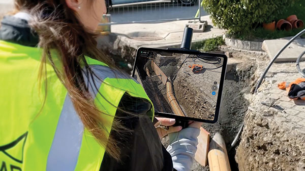
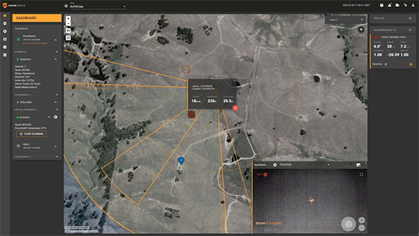
    Bent Ear Solutions maintains deep domain expertise in operations, crisis management and business continuity. The organization has a track record of providing configured, situational awareness based on geographic information systems (GIS) combined with targeted workflows that support multiple requirements.

    Locana has an extensive history of successfully designing and delivering robust, large-scale geospatial projects. Integrating business systems with scalable GIS, Locana helps clients spatially enable their enterprise with location analytics and high-powered mapping.

    “Locana and Bent Ear Solutions are both dedicated to being a trusted partner for our clients,” said Chris McIntosh, CEO, Bent Ear Solutions. “We have a unique opportunity to combine our areas of excellence to address their complex challenges. We believe our collaborative approach will help them maximize the value and use of GIS across the enterprise.”

    Locana and BES combined will deliver tailored GIS solutions and integration that organizations need to overcome system silos and enable situational awareness. The partnership will supply strategic and tactical planning, workflow development, team-building processes, documentation, procedural support and systematic training and exercises.

    The result is long-term value in the form of access to sophisticated analysis and actionable intelligence, the companies said.

  • MetaGeo launches 3D mapping platform

    MetaGeo launches 3D mapping platform

    Screenshot: MetaGeo
    Screenshot: MetaGeo

    MetaGeo has launched a geographic information system (GIS) platform to enable organizations of all sizes to host, analyze, find and share 3D map datasets among any internet-capable devices.

    The platform processes location-based map or sensor data from the real world, combines it into a single 3D virtual environment, and streams it to any device or mapping platform.

    The affordable and easy-to-use platform can load data from multiple sources: satellites, drones, mobile devices, public and crowdsourced repositories, internet of things (IoT) sensor data, 3D models and topographic maps.

    The data is then processed by the MetaGeo platform into a 3D world and streamed to any internet-connected device, enabling live collaboration between the office and field via mobile or AR device. A plug-in software development kit (SDK) allows for third-party tools to scale and fit user needs.

    Applications include academia, architecture, engineering, construction, energy, natural resource management, environmental monitoring, utilities and public safety. Uses include planning and managing construction sites, organizing layouts of events, creating maps for public safety, and visualizing inspection imagery from drones and mobile devices.

  • Pix4D offers RTK rover for iOS devices

    Pix4D offers RTK rover for iOS devices

    Photo: Pix4D
    Photo: Pix4D

    Pix4D is now offering a real-time kinematic (RTK) rover for use with iOS devices.

    The Pix4D viDoc RTK handheld rover attaches to iOS devices to bring RTK accuracy to terrestrial scanning on iPhones and iPads.

    When paired with the PIX4Dcatch mobile app, the viDoc rover can replace survey tools such as RTK GNSS rovers and terrestrial scanners, the company said.

    Together, the products create a workflow that turns iPhones or iPads into an accurate terrestrial scanning device, with centimeter-accurate RTK positioning from an existing NTRIP network.

    The tools can be used to 3D model small areas or structures.

  • Net Insight partners with Meinberg on time synchronization solutions

    Net Insight partners with Meinberg on time synchronization solutions

    Net Insight’s sync solution becomes fully PTP-standard compliant with synchronization module for 5G and other mission-critical networks

    NetInsight logoNet Insight has selected Meinberg’s precision time protocol (PTP) software stack — Precision TimeNet — to implement full PTP functionality in all of its platforms.

    The Precision TimeNet solution offers a GNSS-independent delivery of high-accuracy timing across any IP vendor network, which can significantly reduce the cost and rollout times of 5G and other mission-critical networks.

    In 2021, Meinberg also delivered a synchronization module to Net Insight’s Nimbra MSR 300 series, providing full PTP IEEE 1588v2 interoperability and GNSS integration for 5G networks. The new module is part of the Nimbra Time Node, an important component of the Precision TimeNet solution.

    Net Insight licensed the PTP stack from Oregano Systems, owned by Meinberg, to deliver network synchronization for both media and 5G networks. Meinberg leverages Net Insight’s network synchronization capabilities to serve customers across the telecom, fintech, government, and power telecom industries. The expansion into a strategic technology partnership means that both companies will utilize their expertise in time synchronization to deploy solutions that remove the challenges of reliable precision timing over any IP network.

    “The shift to IP is accelerating, making precision timing key to the successful deployment of new applications,” said Heiko Gerstung, managing director of Meinberg. “Net Insight’s Precision TimeNet offers a unique solution on the market that we see a strong and growing need for, across multiple industries. We’re excited to be working with Net Insight, a leader in mission-critical IP transport, to drive innovation and enable our customers to benefit from GNSS-independent time synchronization.”

    “Net Insight has been developing time transfer for nearly two decades, delivering industry-leading time accuracy and resilience over IP networks,” said Per Lindgren, CTO and co-founder at Net Insight. “When expanding our synchronization business into new markets, integrating with the IEEE 1588 PTP standard was key to enhancing our interoperability. Teaming up with Meinberg, a leader in time and frequency synchronization, was the obvious choice.. We’re excited that our joint expertise in IP networking and time synchronization will enable us to reinvent precision timing for our customers.”

  • France develops GNSS backup service using nanosatellite

    France develops GNSS backup service using nanosatellite

    Image: Rick_Jo/iStock/Getty Images Plus/Getty Images
    Image: Rick_Jo/iStock/Getty Images Plus/Getty Images

    France has begun the Synchrocube project with an aim to provide a complementary service to GNSS. In the project, a low-Earth-orbit nanosatellite will provide synchronization functions when GNSS navigation signals are unusable.

    Development of the Synchrocube is part of the French recovery plan for the space sector. Planned to be 6U in size (typically 20 × 10  × 34.05 cm),  the satellite platform is being developed by Syrlinks, which will provide both the payload and the ground receiver necessary to provide the location and timing service.

    Consortium

    Besides Syrlinks, companies taking part in the Synchrocube project include U-Space, (nanosatellite platform supplier), Anywaves (miniature antennas for satellites constellations) and Comat (satellite instruments).

    By pooling their technologies, the companies in this consortium demonstrate their ability to provide effective and competitive solutions to respond to ambitious space programs.

    “Synchrocube represents a major evolution for Syrlinks,” said Guy Richard, Syrlinks CEO. “The implementation of a project as sizeable as this opens up new commercial prospects for the company. Syrlinks, initially known as a satellite subsystem manufacturer, is on its way to becoming a service provider.”

  • Advanced Navigation launches Boreas digital FOG

    Advanced Navigation launches Boreas digital FOG

    Photo: Advanced Navigation
    Photo: Advanced Navigation

    Advanced Navigation has launched a new fiber-optic gyroscope inertial navigation system (INS), named Boreas. It is an ultra-high accuracy, strategic-grade INS, offering a reduction in size, weight, power and cost. Boreas is the first product to be released based on Advanced Navigation’s new DFOG (digital fiber-optic gyroscope) technology, which is the culmination of 25 years of development involving two research institutions.

    The Boreas is targeted at applications requiring always-available, ultra-high accuracy orientation and navigation including marine, surveying, subsea, aerospace, robotics and space.

    “Boreas is the first product on the market to offer our patent-pending DFOG technology,” said Advanced Navigation CEO Xavier Orr. “DFOG represents a step-change for fiber-optic gyroscopes. With Boreas’ ultra-high-accuracy and strategic-grade performance combined with the reduction of size, weight, power and cost by 40%, we will be able to enable new industries and applications that were never possible before.”

    The Boreas delivers strategic-grade bias stability of 0.001 deg/hr. This allows it to achieve ultra-high roll/pitch accuracy of 0.005 degrees and heading accuracy of 0.006 degrees. Boreas allows for full independence from GPS with dead-reckoning accuracy of 0.01% distance traveled with an odometer or Doppler velocity log.

    The Boreas features ultra-fast gyro compassing, taking only 2 minutes to acquire heading in both stationary environments or on the move. Gyro compassing allows the system to determine a highly accurate heading of 0.01 degrees secant latitude without relying on magnetic heading or GPS.

    The Boreas contains Advanced Navigation’s sensor-fusion algorithm, which is more intelligent than the typical extended Kalman filter. The algorithm is able to extract significantly more information from the data by making use of human-inspired artificial intelligence. It was designed for control applications, with a high level of health monitoring and instability prevention to ensure stable and reliable data.

    Advanced Navigation designed Boreas from the ground up for reliability and availability. Both the hardware and software are designed and tested to safety standards, and it has been environmentally tested to mil standards.

    The system is designed for a mean time between failures of 500,000 hours. Additional features include Ethernet, CAN and NMEA protocols, as well as a disciplined timing server providing PTP. An embedded web interface provides full access to all of the device’s internal functions and data. Internal storage allows for up to one year of data logging.

  • OxTS releases Georeferencer 2.0 with lidar data

    OxTS releases Georeferencer 2.0 with lidar data

    Screenshot: OxTS
    Screenshot: OxTS

    OxTS Georeferencer 2.0 is now available, introducing several key improvements, particularly for professional lidar surveyors.

    Version 1, introduced almost two years ago, has since been upgraded with integration of 30 new lidar sensors, as well as providing multiple user-experience enhancements.

    Surveyors can use Georeferenceer alongside any OxTS inertial navigation system (INS) to quickly and easily georeference lidar data from multiple sensors to create precise 3D point clouds.

    Version 2.0 highlights

    Global coordinates. OxTS Georeferencer 2.0 users can now process data in a range of coordinate systems. These include local coordinates, ECEF and LLA (latitude, longitude and altitude).

    New processing options. Users can maximize the usability of their point clouds and minimize data size through a range of processing options, including:

    • filter points by position uncertainty keeping every point within a specified accuracy
    • maximize the accuracy of the data while minimizing data size with a Voxel sampling algorithm
    • filter points by intensity, azimuth and elevation angle of the lidar
    • ilter points by speed and range from a vehicle.

    Improvements in map file creation. OxTS Georeferencer 2.0 can add the direction from which each point is surveyed into the point cloud, allowing mesh surfaces to be easily reconstructed.

    Furthermore, OxTS Georeferencer 2.0 gives surveyors the ability to add point-normal information into the point cloud and view the vehicle trajectory as a point cloud.

    Processing advances. Users benefit from better performance due to revisions of the OxTS Georeferencer processing algorithms. With version 2.0, users can process point clouds faster than before and take advantage of improved precision and consistency of the boresight calibration feature, which now utilizes target dimensions.

  • DroneShield and Teledyne FLIR join on drone detection

    DroneShield and Teledyne FLIR join on drone detection

    DroneShield Limited and Teledyne FLIR are collaborating on a joint sensing and mitigation solution for unmanned aerial threats.

    Teledyne FLIR is extending its counter-UAS thermal-imaging sensing technology to the DroneShield platform, which has developed and applied its artificial intelligence and machine-learning software algorithms via radiofrequency (RF) sensing and computer vision technologies.

    The addition of Teledyne FLIR thermal camera hardware and expertise will enable military customers to improve detection, including identifying and tracking numerous unmanned threats in the thermal and RF spectrums at considerable range, providing the capability within a single system.

    A major Western military agency will be deploying the combined system at one of the best-known military testing ranges in the world.

    The DroneShield DroneSentry-C2 command-and-control system with Teledyne FLIR thermal imaging sensing technology. (Screenshot: DroneShield)
    The DroneShield DroneSentry-C2 command-and-control system with Teledyne FLIR thermal imaging sensing technology. (Screenshot: DroneShield)
  • EU requires Galileo for smartphone emergency calls

    EU requires Galileo for smartphone emergency calls

    Galileo-supported E112 will result in faster response times and more lives saved. (Image: EUSPA)
    Galileo-supported E112 will result in faster response times and more lives saved. (Image: EUSPA)

    As of March 17, all smartphones sold in the European Union must be leveraging Galileo signals in addition to other GNSS for calls to the European 112 (E112) emergency number.

    Using Galileo enhances pinpointing locations of 112 calls in Europe, resulting in faster response times and more lives saved, according to the EU Agency for the Space Programme (EUSPA).

    The 112 emergency number is operational in nearly all EU Member States, as well as other countries. People in danger can call it 24/7 to reach the fire brigade, medical assistance and the police.

    Most calls to the 112 emergency number are placed from mobile phones. These calls already support the sending of location information to emergency services. However, this information was not based on GNSS capabilities until recently.

    Three years ago, the Commission Delegated Regulation anticipated measures to take advantage of GNSS and Wi-Fi location capabilities in smartphones placed on the European Union market, starting March 17.

    GNSS versus cell-ID

    Until now, the 112 caller’s location information was established through identification technology based on the coverage area of a cellular network tower (cell-ID). The average accuracy of this information varies from two to 10 kilometers, which can lead to significant search errors following emergency calls.

    By contrast, GNSS location information pinpoints the call within a few meters. This level of accuracy will have a major impact in terms of response times, ultimately allowing for quicker intervention in emergency situations.

    Galileo 112 rollout

    The ability for 112 to communicate a caller’s location to emergency services automatically is already being rolled out. The protocol — Advanced Mobile Location (AML) — is being deployed across the European Union. When a caller dials 112 from their smartphone, AML uses the phone’s integrated functionalities and data from Galileo to accurately pinpoint the caller’s location and transmit it to a dedicated endpoint, usually a Public Safety Answering Point (PSAP), which makes the caller location available to emergency responders in real time.

    According to the European Emergency Number Association (EENA), at least 18 EU Member States have already completed AML deployment, while others are in the process of doing so. This implementation is because of EU initiatives and projects such as the Help 112 project, which was set up to evaluate the merits of handset-based technologies in improving the location of emergency callers.

  • ADVA releases software to boost timing resiliency

    ADVA releases software to boost timing resiliency

    Screenshot: ADVA
    Screenshot: ADVA

    ADVA has released new software that extends its Oscilloquartz timing assurance technology to synchronization networks using Network Time Protocol (NTP).

    ADVA’s Ensemble Sync Director management system provides assurance control, helping mission-critical services across many industries that depend on reliable and accurate NTP timing.

    The new NTP capabilities are extended from ADVA’s robust Oscilloquartz Precision Time Protocol (PTP) product range and supported by Syncjack GNSS monitoring. They also leverage multiple form factors with redundant synchronization devices, multiple holdover options and versatile multi-technology gateways between GNSS, PTP and NTP, ensuring robust, scalable and highly resilient NTP timing architectures.

    “Despite the availability of PTP, NTP remains the most widely used time synchronization protocol,” said Gil Biran, GM of Oscilloquartz, ADVA. “It’s applied in many legacy networks as well as new IoT (internet of things) applications. What’s more, the sophistication of NTP timing is increasing, while the NTP protocol itself remains unchanged. Now we’re enabling our customer to deploy robust, reliable and secure NTP implementations built on our unique expertise and experience in delivering assured synchronization.”

    ADVA uses a combination of NTP architecture and highly accurate GNSS timing backed up with PTP timing domains.

    Because ADVA’s products now support assured NTP technology, they offer customers virtually unlimited scale, Biran said. “With hardware-implemented NTP functionality, even the smallest SFP (small-form factor pluggable) NTP server can support up to 500,000 transactions per second.”

    To ensure NTP delivery is able to withstand a broad range of risk scenarios, ADVA’s resilient synchronization solution is engineered for both device and network redundancy. It features multiple backup options such as PTP- and GNSS-delivered time, as well as a variety of oscillator solutions that allow different levels of holdover.

    Comprehensive monitoring by ADVA’s Ensemble Sync Director management system helps guarantee the levels of performance required for time-critical network applications. Designed from the bottom up to support continuous assessment and assured timing precision, it automatically responds to any issues before applications can be disturbed by timing inaccuracies.

    ADVA’s solutions also offer centralized GNSS monitoring and assurance, protecting timing networks from vulnerabilities, including jamming and spoofing attacks.

    Customers can build NTP-based networks today and switch to PTP with one click, commented Nir Laufer, vice president of product line management at Oscilloquartz, ADVA. “Our customers no longer need to hope for the best from their NTP servers,” Laufer said. “With real-time GNSS monitoring and comprehensive probing and analysis of timing quality, they can rest assured that their synchronization services have the highest levels of accuracy, integrity, availability and scale.”

  • Russian jamming GPS in Ukraine war, to no effect

    Russian jamming GPS in Ukraine war, to no effect

    Image: PeterHermesFurian/iStock/Getty Images Plus/Getty Images
    Image: PeterHermesFurian/iStock/Getty Images Plus/Getty Images

    U.S. forces have detected Russian jamming of GPS signals in the Ukraine region, according to Breaking Defense. But Pentagon officials say the jamming has not affected U.S. support operations.

    U.S. reconnaissance aircraft have detected jamming over the Black Sea, but when asked about Russian jamming, a U.S. Space Command spokesperson told Breaking Defense, “There are no impacts to U.S. and Allied forces in Europe at this time.”

    Russia has been suspected of localized GPS jamming before, and officials believe it has significant electronic warfare capability.

  • Hexagon | Veripos expands SPAN GNSS+INS portfolio for dynamic positioning

    Hexagon | Veripos expands SPAN GNSS+INS portfolio for dynamic positioning

    Ensures safe operations through reliable, robust and continuous positioning with GNSS+INS integration

    Hexagon | Veripos has expanded its inertial solution SPAN GNSS+INS technology from NovAtel, also part of Hexagon, to dynamic positioning (DP) applications and vessels.

    SPAN technology delivers a deeply coupled GNSS and inertial navigation system (INS) that provides robust, reliable and continuous centimeter-level positioning for operators to maintain safety and maximize uptime.

    With a GNSS+INS solution, DP vessels can bridge outages in GNSS tracking and through short periods of radio-frequency interference, jamming or spoofing.

    Veripos is a leader in offshore high-precision positioning, delivering reliable and trustworthy GNSS solutions such as the LD900 receiver, PPP correction services and positioning visualization software. This expertise is demonstrated through SPAN technology’s deep coupling of GNSS and inertial measurements.

    Deep coupling describes how inertial measurements enhance the signal tracking for GNSS solutions, leading to improved resiliency against GNSS outages and enabling rapid reacquisition in case of interruptions. SPAN technology builds system robustness against potential signal outages, interference or disruptions while optimizing operational efficiency.

    “The robust positioning, heading, velocity and attitude measurements generated from a deeply coupled GNSS and inertial solution like SPAN technology is a game-changer to dynamic positioning operations,” said David Russell, marine segment portfolio manager at Hexagon’s Autonomy & Positioning division. “SPAN technology has a proven track record of bridging outages, enabling rapid reacquisition of signals, and building a reliable and robust positioning system. It’s the best option for vessels to ensure an added layer of resiliency and achieve continuous centimeter-level accuracy across all conditions.”

    SPAN GNSS+INS technology is compatible with commercial inertial measurement units (IMUs) and scalable with the LD900 GNSS receiver, Quantum visualization software and APEX correction services.

    Image: Hexagon
    Image: Hexagon