The Arrow Gold+ and Arrow 100+ plus models build upon the company’s highest demand GNSS receivers
Eos Positioning Systems, the global manufacturer of the Arrow series of GNSS receivers, has released two new Arrow Series GNSS receiver models: the Arrow Gold+ and Arrow 100+.
These plus model receivers expand upon the features of Eos’ two most popular GNSS standard receiver models, the Arrow Gold and Arrow 100.
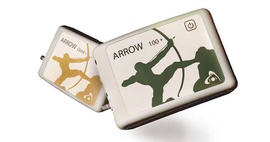
Arrow Gold+
The Arrow Gold+ (Photo: Eos Positioning)
The Arrow Gold+ includes all the features of the standard Arrow Gold GNSS receiver model. However, the plus model also includes several enhanced features:
A battery life 3.5 hours longer, for a total of 11 hours of field autonomy
Support for additional GNSS signals, including concurrent use of BeiDou B3 and GPS L5 signals when using RTK corrections
Support for the upcoming Galileo E6 High-Accuracy Service (HAS), which will broadcast differential corrections for GPS and Galileo satellites directly from the Galileo satellites
Built-in capabilities of the Eos Bridge to connect with external sensors
The ability to connect multiple mobile devices to a single Arrow GNSS receiver via Bluetooth (sometimes called “multipoint”)
Arrow 100+
The Arrow 100+ (Photo: Eos Positioning)
Arrow 100+ includes all the features of the standard Arrow 100 GNSS receiver model. However, the plus model also includes several enhanced features:
A battery life 6 hours longer, for a total of 18 hours of field autonomy
Support for Atlas H50 (Basic) service subscriptions, which provides 30-50 cm positioning accuracy worldwide when no SBAS or RTK network is available
Built-in capabilities of the Eos Bridge to connect with external sensors
The ability to connect multiple mobile devices to a single Arrow GNSS receiver via Bluetooth (sometimes called “multipoint”)
For a full comparison between standard and plus model Arrow GNSS receivers, view this FAQ article.
An Eos representative can help customers determine whether the new plus models are right for your needs. Authorized Arrow GNSS receiver reseller, contact Eos online.
Topnet Live coverage map for 2021. (Image: Topcon)
Topcon Positioning Group has expanded its Topnet Live GNSS network of correction solutions with more types of correction services and subscription options. According to Topcon, the growth is a result of the increasing demand for digitalization in various industries including construction, surveying, machine control and agriculture.
Flexible service options include Realpoint, the real-time kinematic (RTK) service, and Starpoint, a Precise Point Positioning (PPP) service. The different services have varying delivery methods, coverage and reliable centimeter-level accuracy.
Under a flexible subscription model, customers can purchase to suit their needs. An RTK service supported by precise point positioning (PPP), Skybridge, is available to maintain connectivity and productivity if the customer temporarily leaves RTK coverage.
Topnet Live uses all four GNSS constellations — GPS, GLONASS, Galileo and BeiDou — to provide continuous accuracy and always-on service coverage. The service provides advantages for these industries:
Survey, Construction and Machine Control. Topnet Live removes the need for individual base stations, dramatically increasing flexibility, productivity and safety, and can drive large-scale projects with constant, reliable accuracy.
Precision Agriculture. The solution delivers fast, consistent, accurate positioning at any time day or night for soil preparation, seeding, spreading, spraying and harvesting.
OEMs, System Integrators, Product Designers. The solution provides scalable precise positioning and supports the implementation of flexible business models tailored to fit both OEMs’ and their customers’ needs.
“The Topnet Live RTK network, first established over a decade ago, continues to grow, with 5,100 reference stations globally, a 14% increase in the last year,” said Ian Stilgoe, Topcon vice president. “We are growing throughout the world in areas where there is an increasing demand for productivity and accuracy through digitalization, with strong growth particularly in North America and Europe. We are focused on continued expansion to maximize support for our customers, so they always have the best options globally.”
Original equipment manufacturers (OEMs) supplying automotive, industrial internet of things (IoT), autonomous robotics and all sectors that require positioning, navigation and guidance also benefit from the enhanced robustness of the network, Topcon said. OEMs can sell their hardware with correction services onboard and preconfigured for immediate use by customers, regardless of geographic location, with flexible subscription and licensing options to suit exact needs.
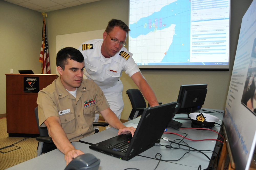
A surveillance system is demonstrated during a Naval Information Warfare Systems Command (NAVWAR) exercise. (Photo: Rick Naystatt/U.S. Navy)
The U.S. Defense Innovation Unit (DIU) is asking for commercial solutions to fight GNSS disruptions, including jamming and spoofing.
DIU is particularly asking for “solutions leveraging machine-driven analytics and datasets derived from publicly/commercially available information to provide a situational awareness capability” against intentional disruptions.
Responses to “HARMONIOUS ROOK — Situational Awareness for Intentional Disruption of Global Navigation Satellite System (GNSS) Users” are due by Aug. 22.
DIU is a Department of Defense organization focused exclusively on fielding and scaling commercial technology across the U.S. military to help solve critical problems.
The solicitation is focused on “persistent, large-area coverage of falsified GNSS emitters that result in localized spoofing phenomenology.”
It cites intentional manipulation of GNSS signals as enabling “nefarious activities, to include narcotics trafficking, unapproved operation of autonomous vehicles, illegal fishing and sea-borne piracy.”
“Additionally, nation-state use of GNSS jamming or spoofing systems may extend beyond the area of conflict, causing deleterious effects on civilian populations,” the solicitation states. “Such activities degrade or deny critical geolocation capabilities and further introduce hazards to safety-of-life-navigation, critical infrastructure, and emergency response services. “
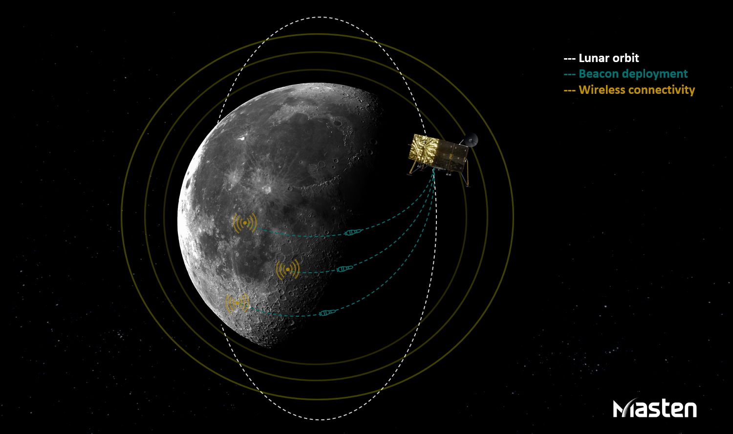
PNT beacons can be deployed in orbit to penetrate the lunar surface and enable consistent wireless connectivity. (Image: Masten Space Systems)
Masten Space Systems has been awarded a U.S. Air Force contract to develop and demonstrate a lunar positioning and navigation network prototype that functions much like GPS.
The Phase II Small Business Innovation Research (SBIR) contract was awarded through the Air Force Research Laboratory’s AFWERX program. AFWERX connects innovators across government, industry and academia.
The navigation network will enhance cislunar security and awareness by enabling navigation and location tracking for spacecraft, assets, objects and astronauts on the lunar surface or in lunar orbit. As the lunar infrastructure grows, the network will help advance lunar science and resource use by improving landing accuracy and hazard avoidance near critical lunar sites.
“Unlike Earth, the Moon isn’t equipped with GPS so lunar spacecraft and orbital assets are essentially operating in the dark,” said Matthew Kuhns, vice president of research and development at Masten. “As a result, each spacecraft is required to carry heavy navigation hardware and sensors on-board to estimate positioning and detect potential hazards. By establishing a shared navigation network on the Moon, we can lower spacecraft costs by millions of dollars, increase payload capacity, and improve landing accuracy near the most resource-rich sites on the Moon.”
In Phase I, Masten completed the concept design for the network prototype that offloads positioning, navigation, and timing (PNT) beacons from a spacecraft into a dedicated sensor array on the Moon.
In Phase II of the project, scheduled to be complete in 2023, Masten will develop PNT beacons equipped to survive harsh lunar conditions. Masten is collaborating with Leidos to build shock-proof beacon enclosures that can be deployed in lunar orbit to penetrate the lunar surface and create an autonomous surface-based network. Similar to a mesh network, the surface-based network can enable consistent wireless connectivity to lunar spacecraft, objects, and orbital assets.
“Leidos is proud to collaborate with Masten Space Systems in their quest toward a successful lunar surface-based positioning and navigation network,” said Thomas Sereno, vice president and division manager of the Applied Science operation at Leidos. “We are prepared to support the team as they progress through the next phase of the contract.”
In Phase II of the project, the PNT technology will also be tested aboard Masten’s rocket-powered lander, Xodiac, to demonstrate payload integration and beacon operations in a terrestrial environment, enabling a path towards lunar demonstration.
Masten has more than a decade of experience maturing PNT systems, including Jet Propulsion Laboratory’s lander vision system that was tested on Masten’s Xombie rocket to enable a successful Mars mission for the NASA Perseverance rover.
“As one of the first commercial companies sending a lunar lander to the Moon, we’re in a unique position to develop and deploy a shared navigation system that can support other government and commercial missions and enable a thriving lunar ecosystem,” said Masten CEO Sean Mahoney. “We are literally blazing the trail with this effort, creating the pathway for regular, ongoing and reliable access to the Moon.”
Deere & Company has signed a definitive agreement to acquire Bear Flag Robotics for $250 million USD. Founded in 2017, Bear Flag is a Silicon Valley-based startup that develops autonomous-driving technology compatible with existing machines.
The deal accelerates the development and delivery of automation and autonomy on the farm and supports John Deere’s long-term strategy to create smarter machines with advanced technology to support individual customer needs.
Deere first started working with Bear Flag in 2019 as part of the company’s Startup Collaborator program, an initiative focused on enhancing work with startup companies whose technology could add value for Deere customers. Since then, Bear Flag has successfully deployed its autonomous solution on a limited number of farms in the United States.
The Bear Flag team consists of agriculture professionals, engineers and technologists focused on autonomy, sensor fusion, vision, data, software and hardware. They will remain in Silicon Valley where they will work closely with Deere to accelerate innovation and autonomy for customers across the world.
The U.S. Space Force will host the 2021 Public Interface Control Working Group and Open Forum in September and November. The meetings are open to the public in person and virtually on Wednesday, Sept. 29, 8:30 a.m. to 4 p.m., and Tuesday, Nov. 19, 8 a.m. to 4 p.m. (Pacific Time).
The meeting and forums will discuss the following documents:
The purpose of the meeting is to update the public on GPS public document revisions and collect issues and comments for analysis and possible integration into future GPS public document revisions.
The meeting will be held in person at
Los Angeles Air Force Base
Great Room, -PCT Campus
100 Sepulveda, Blvd.
El Segundo, CA 90245
Attendees are highly encouraged to participate virtually. It can be accessed at this link or at this link.
The official public notice in the Federal Register provides further information, including how to register, submit comments and dial in on the telephone.
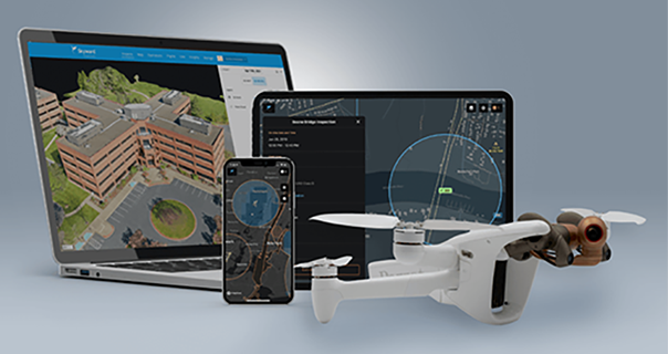
The Parrot ANAFI Ai is powered by Verizon 4G LTE and integrated with Skyward software to pave the way for near real-time data transfer, remote deployment and beyond-visual-line-of-sight (BVLOS) flight operations.
Verizon, Parrot and Skyward have entered a partnership to bring an out-of-the-box 4G LTE connected drone to the United States.
The Parrot ANAFI Ai is an off-the-shelf drone that connects to Verizon’s 4G LTE network. Verizon 4G LTE connectivity is provided exclusively to Skyward subscribers at no additional cost. The Skyward Connected Drone Solution gives enterprises one complete experience for planning, flying, data transfer and processing data.
The Parrot ANAFI Ai professional drone is open to developers with a full open-source app, autonomous one-click photogrammetry and new levels of cybersecurity. Combined with the Skyward Connected Drone Solution, the ANAFI Ai makes complex missions simpler, safer and quicker in photogrammetry, mapping, modeling in construction, infrastructure, inspection, surveying, public safety and enterprise.
The drone features an omni-directional obstacle-avoidance system, 48 MP imaging accuracy, 4K 60 fps smooth videos, and up to 32 minutes of flight time in an airframe that weighs less than 2 pounds.
Parrot ANAFI Ai’s embedded Secure Element secures the 4G LTE link between the drone and the user’s device. Parrot’s streaming software quickly optimizes the definition and frame rate for the connected 4G network.
Parrot ANAFI Ai pilots can subscribe to a paid account or a free trial of the Skyward Connected Drone Solution to:
plan with Skyward’s airspace map and fleet management tools
obtain fast, automated access to controlled airspace from the Federal Aviation Administration with LAANC
fly over Verizon 4G LTE with the Skyward InFlight mobile app
process with Skyward Mapping & Modeling, powered by Pix4D
transfer data during flight over 4G LTE.
Users can activate 4G LTE connectivity in a few taps exclusively in the Skyward InFlight mobile app. Once activated, the connectivity provides a seamless backup connection to the flight controller in case of interference or interruption. It paves the way for near real-time data transfer, remote deployment and BVLOS flight operations, allowed with a waiver from the FAA.
“Enterprise drone programs are pushing the limits of technology available today and advanced operators are ready for a connected, trusted and capable drone to take their drone programs to the next level,” said Mariah Scott, Head of Verizon Robotics Business Technology. “Parrot ANAFI Ai connected to Verizon 4G LTE marks an industry milestone toward distributed, remote, persistent operations that lets users fly to anywhere from anywhere with near real-time data transfer.”
“Cellular connectivity is the new communications standard for the professional drone industry and Parrot ANAFI Ai seeks to set new standards for drones at work” said Henri Seydoux, Founder and CEO of Parrot. “We designed ANAFI Ai’s 4G LTE connectivity, which enables precise, robust and secure control at any distance with a 4G LTE connection that avoids obstacles. Advanced artificial intelligence, autonomous flights, best-in-class imaging, photogrammetry accuracy and reliable 4G LTE connectivity on the Verizon network, put powerful new tools in the hands of professionals like never before and we truly believe it is a game changer for the professional drone industry.”
The Skyward Connected Drone Solution with Parrot ANAFI Ai on Verizon 4G LTE will be available in the second half of 2021 through Skyward.
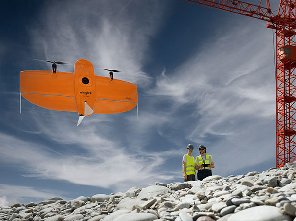
A new vertical-takeoff-and-landing (VTOL) drone — the WingtraOne GEN II — is now available. The GEN II offers industrial reliability and mapping versatility with an oblique camera configuration for high-quality 3D drone-mapping data capture.
Drone maker Wingtra spent six years developing the GEN II, and tested it over 100,000 flights. Its WingtraOne is being used by professionals worldwide across many industries.
According to Wingtra, the GEN II represents a solid step forward in industrialization and reliability along with new perks that push the previous limits of commercial mapping drones.
The WingtraOne GEN II. (Photo: Wingtra)
Oblique 3D Mapping Payload
“We wanted to make the WingtraOne drone even more versatile for our customers. So next to our flagship 42MP Sony RX1, we’re including new, high-end mapping payloads,” said Maximilian Boosfeld, co-founder and CEO of Wingtra. “I’m especially excited to announce our oblique solution, which offers outstanding 3D mapping results. It’s the perfect choice for capturing infrastructure — from a single industrial plant to entire cities.”
WingtraOne’s GEN II oblique mapping solution is backed by signed partnership agreements with Bentley Systems and Esri. To demonstrate the power of GEN II carrying its Oblique Sony A6100 payload, the Wingtra team mapped the city of Zurich, Switzerland, in six flight hours, producing a 3D model processed with both Bentley ContextCapture and Esri’s Site Scan for ArcGIS. Bentley and Esri’s software are both recommended for processing Wingtra oblique datasets.
“Bentley Systems is delighted to partner with Wingtra to transform high-resolution oblique imagery from WingtraOne drones into 3D reality meshes — an ideal starting point for infrastructure digital twins,” said Phil Christensen, VP, Industry Solutions, iTwin Context, Bentley Systems. “This enables our common users to perform analytics on the resulting models as well as leverage Bentley’s iTwin platform to share performant, city-scale digital twins.”
“Our partnership with Wingtra unlocks new capabilities for Site Scan for ArcGIS users by allowing them to create wide-scale and accurate 3D meshes leveraging the oblique payload on the WingtraOne Gen II,” said Richard Cooke, director of Global Business Development at Esri. “These high-resolution images processed through Site Scan produce an enriched 3D GIS for our users who require modelling of open-pit mines, accurate construction updates, creation of digital twins for cities, and more.”
The WingtraOne GEN II drone was used to map Zurich and create a digital twin of the city. (Image: Wingtra)
Integrated PPK and Self-Diagnosis
WingtraOne GEN II features post-processed kinematic (PPK) ability integrated on every drone, including multispectral Altum and RedEdge payloads, as well as advanced fail-safe and self-diagnosis algorithms and services for dependable operations.
“We have studied over 100,000 flights and all incoming customer reports to understand what the limits might be so we can push them further,” said Julian Surber, Wingtra product manager. “As a result, we’ve designed many reliability tools for GEN II to guarantee uninterrupted operations.”
Wingtra’s engineering team has redesigned the electronics of the GEN II from its predecessor WingtraOne for increased reliability, including a more powerful onboard computer, optimized PCB designs, and a new navigation and heading unit developed inhouse.
The GEN II runs through health-monitoring algorithms for motors, servos, batteries, camera, PPK and onboard sensors, health self checks that minimize the potential of flight with unsafe equipment.
Precision Agriculture Boost
Wingtra’s top-of-the-line multispectral payloads Micasense Altum and RedEdge will now be paired with high-accuracy PPK, which improves the quality of multispectral insights for uses such as irrigation management and prescription maps for pesticides.
Topcon OEM GNSS components will be used by DDK Positioning to deliver its MAX services to Oceaneering International’s clients. These clients, primarily in the marine energy sector, can achieve accuracy to less than 5 centimeters with this new service.
Founded in 2016, DDK Positioning has combined technical ingenuity with the Iridium satellite network to create a robust, resilient and completely independent GNSS-augmenting positioning solution.
Oceaneering recently conducted an extensive review of how it delivers positioning services to its clients and evaluated the significant advances made in communications infrastructure and services over recent years.
“Our extensive research of receivers in the market, and the performance of Topcon, made the decision for our route going forward,” said Kevin Gaffney, CEO of DDK Positioning. “Topcon’s experience, their extensive support network and leadership will allow us to effectively support multiple clients, in addition to Oceaneering. We see this as a long-term partnership. Both companies worked tirelessly to bring this together.”
“With Topcon Positioning System’s extensive history in precise positioning, providing high performance and quality GNSS boards, antennas and receivers to the OEM industry for over 20 years, the company is well-positioned to supply DDK Positioning with the hardware needed to support their clients globally,” said Ian Stilgoe, vice president of Topcon emerging business. “Working closely with DDK Positioning and Iridium was key to meet the requirements of Oceaneering and the maritime market. Topcon is pleased to be part of this effort to bring the latest positioning technology to this market segment.”
In one of my previous columns, I described the National Geodetic Survey’s (NGS) plans for replacing the North American Vertical Datum of 1988 (NAVD 88) with the North American-Pacific Geopotential Datum of 2022 (NAPGD2022).
As stated in the NOAA Technical Report NOS NGS 64 Blueprint for the Modernized NSRS, Part 2: Geopotential Coordinates and Geopotential Datum, November 2017, recently revised in February 2021, orthometric heights in NAPGD2022 will be defined through ellipsoid heights and GEOID2022. This means NAPGD2022 orthometric heights will primarily be accessed through GNSS technology.
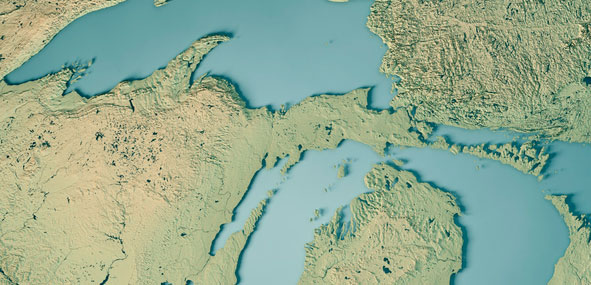
Like NAPGD2022, in the next update of the International Great Lakes Datum, denoted as IGLD (2020), the heights in the Great Lakes Region will be developed from GNSS and a gravity model. Unlike NAPGD2022, where users will be estimating GNSS-derived orthometric heights, IGLD (2020) users will be estimating GNSS-derived dynamic heights using GNSS and a gravity model.
Promote a better understanding of geodesy as a science;
Create a better appreciation of the value of geodetic surveys and thus encourage greater use of such surveys;
Promote geodetic surveys by individuals, government, and private organizations;
Foster the adoption of uniform standards and procedures for completing geodetic surveys;
Promote the processing, publishing, and disseminating of geodetic survey data and information;
Promote programs for testing, calibrating, and evaluating geodetic equipment;
Further the development and implementation of the Global Navigation Satellite System (GNSS) for geodetic, land surveying, and land information system applications;
Inform the membership of new technical developments by meetings of the association and publications in Surveying and Land Information Science (SaLIS);
Promote educational programs in geodesy, geodetic surveying, and related fields;
Cooperate with other similar organizations, both national and international, in support of the science of geodesy;
Encourage the use of geodetic surveys and mathematical coordinate systems in establishing Public Land Survey System (PLSS) corners
As stated above, AAGS cooperates with other similar organizations, both national and international, in support of the science of geodesy. AAGS is a voting member of FIG, which means AAGS has the opportunity to nominate and vote for elected officials, and develop policy that is important to all surveyors and mappers.
The theme of the FIG Working Week 2021 virtual conference was “Smart Surveyors for Land and Water Management: Challenges in a New Reality.” FIG Commission 5 focuses on meeting the highest level of accuracy for positioning and measurement (see box titled FIG Commission 5). Five 90-minute sessions described some of the efforts of FIG Commission 5.
“FIG Commission 5 focuses on meeting the highest level of accuracy for positioning and measurement. It provides the tools, techniques and procedures to educate and train surveying professionals everywhere. Appropriate methodology for data collection and processing are required to be successful in an era of global, integrated geospatial data.”
These sessions raised surveyor awareness of cutting-edge technology, techniques and procedures for using geodetic data and enhanced global cooperation and standardization in conformance with the ideals expressed by the United Nations resolution for a Global Geodetic Reference Frame. There were many good papers on positioning and measurement presented at the virtual meeting. Readers can obtain a list of presentations and papers at this website.
A paper by Jacob Heck, U.S National Geodetic Survey, and Michael Craymer, Canada Geodetic Survey titled “Updating the International Great Lakes Datum: Enabling the Integration of Water and Land Management in the Great Lakes Region” should be of interest to many U.S. and Canadian surveyors. The box below provides a link to the abstract, paper, handouts and video of the presentation.
05.1 – Managing the Land/Water Interface: WGS84 vs. the ITRS
Commission: 4 and 5
Chair: Dr. Mohd Razali Mahmud, FIG Commission 4 Chair, Malaysia
Rapporteur: Dr. Daniel Roman, FIG Commission 5 Chair, United State
Jacob Heck (U.S.) and Michael Craymer (Canada):
Updating the International Great Lakes Datum: Enabling the Integration of Water and Land Management in the Great Lakes Region (11046)
[abstract] [paper] [handouts] [video]
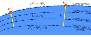
The International Great Lakes Datum uses dynamic heights instead of orthometric heights traditionally used for elevations on land. Figure 4 from Heck and Craymer’s FIG paper, illustrates the difference between orthometric and dynamic heights. See box titled “Figure 4 from FIG Paper by Heck and Craymer.” As described by Heck and Craymer, “The dynamic height represents the difference in potential above the reference surface and is the same at all points on a level surface. Orthometric height represents the actual physical distance above the reference surface which may change due to differences in gravity caused by the convergence of equipotential surfaces toward to the poles. Dynamic heights are therefore required for the proper management of water levels and flows in compliance with international regulations and treaties.”
Figure 4 from FIG paper by Heck and Craymer
Figure 4. Dynamic heights,HD, and orthometric heights, H. (from FIG 2021 paper by Heck and Craymer)
I would like to highlight, as described in the paper and stated in the summary, that access to the future IGLD will be primarily through GNSS techniques.
The International Great Lakes Datum provides a framework for water level management in the world’s foremost resource of surface freshwater. The current datum, IGLD (1985), is being updated and replaced by IGLD (2020). This updated datum will be fundamentally different in terms of definition and access to the datum. The datum will be identical to the new NAPGD2022 North American geopotential datum and will be compatible with the existing CGVD2013 (if not identical as well) at the reference epoch of 2020. IGLD (2020) is expected to be released in 2025 at about the same time as NAPGD2022. Access to both frames will be primarily through GNSS techniques. This will lead to more consistent heights across the entire Great Lakes region. Further information about the IGLD update can be found on the Coordinating Committee website.
This new paradigm is important for anyone who works in the Great Lakes region. Actually, it is important to anyone that surveys in the United States, because this new paradigm will also be used to access the North American-Pacific Geopotential Datum of 2022 (NAPGD2022). Anyone following my columns knows this is the future, and that the National Geodetic Survey (NGS) is leading the way in the United States by modernizing the National Spatial Reference System (NSRS).
Another section that I’d like to highlight is in the box titled “Excerpt from Heck and Craymer Paper on IGLD.”
For IGLD (2020), the geoid height, N, will be provided by GEOID2022 which will be used to define NAPGD2022 and the expected update to CGVD2013. IGLD (2020) dynamic heights will therefore be equivalent to dynamic heights in NAPGD2022 and CGVD2013 at the 2020 reference epoch. For IGLD (2020) heights of water levels, hydraulic correctors may also need to be applied.
An important advancement in the development of the new IGLD and North American datums will be the availability of an accurate crustal velocity model that can propagate ellipsoidal heights between different reference epochs. This will enable heights determined at any epoch to be propagated back to the adopted 2020 reference epoch used for IGLD (2020). This will effectively obviate the need to update the entire IGLD datum for the effects of GIA for a much longer period of time, except for incremental improvements to the velocity model and updates to the reference epoch.
It’s important for users to know that the IGLD (2020) dynamic heights will be equivalent to dynamic heights in NAPGD2022, and an accurate crustal velocity model will be used at any epoch to propagate back to the adopted 2020 reference epoch. The box titled “Determining Heights in IGLD (2020)” is an excerpt from Heck and Craymer’s FIG paper that describes the process that will be implemented for estimating GNSS-derived dynamic heights in the updated IGLD (2020).
In previous realizations of IGLD, spirit leveling was used to determine geopotential numbers which were converted directly to orthometric heights that could then be converted to dynamics heights using equation 4 (𝐻𝐷 =𝐶/𝛾45).
In the geoid-based IGLD (2020), heights will be primarily determined through GNSS techniques which provide a direct measure of ellipsoidal height. Although spirit leveling is more accurate over shorter distances, GNSS methods combined with an accurate geoid model are capable of providing more accurate heights over moderate to longer distances at a small fraction of the cost of leveling.
An orthometric height, H, above the geoid is obtained from a GNSS-derived ellipsoidal height, h, above the reference ellipsoid using the geoid height or undulation, N, of the geoid above the reference ellipsoid. This is represented by the simple equation:
𝐻 = ℎ − 𝑁 (5)
Using equations (2) – (5), the dynamic height can be obtained from the GNSS-derived ellipsoidal height using:
𝐻𝐷 =(𝑔̅ ∗ (ℎ − 𝑁))/𝛾45 (6)
For IGLD (2020), the geoid height, N, will be provided by GEOID2022 which will be used to define NAPGD2022 and the expected update to CGVD2013. IGLD (2020) dynamic heights will therefore be equivalent to dynamic heights in NAPGD2022 and CGVD2013 at the 2020 reference epoch. For IGLD (2020) heights of water levels, hydraulic correctors may also need to be applied.
An important advancement in the development of the new IGLD and North American datums will be the availability of an accurate crustal velocity model that can propagate ellipsoidal heights between different reference epochs. This will enable heights determined at any epoch to be propagated back to the adopted 2020 reference epoch used for IGLD (2020). This will effectively obviate the need to update the entire IGLD datum for the effects of GIA for a much longer period of time, except for incremental improvements to the velocity model and updates to the reference epoch.
As stated by Heck and Craymer, hydraulic correctors may also need to be applied to meet IGLD (2020) International policies, procedures and regulations. Information on IGLD (1985) hydraulic correctors can be found on NGS Geodetic Tool Kit Page.
Another paper presented at FIG Working Week that would be of interest to surveyors is a paper on establishing a geoid-based vertical datum given by Dan Roman, Chief Geodesist at NGS (see the box below). Again, the abstract, paper, handouts and video can be downloaded from the link.
05.1 – Managing the Land/Water Interface: WGS84 vs. the ITRS
Commission: 4 and 5
Chair: Dr. Mohd Razali Mahmud, FIG Commission 4 Chair, Malaysia
Rapporteur: Dr. Daniel Roman, FIG Commission 5 Chair, United State
Roman Daniel (USA): Determining an Optimal Geoid-Based Vertical Datum (10876)
[abstract] [paper] [handouts] [video]
Roman discusses the concept of establishing an International Height Reference System (IHRS) so all countries could provide physical heights across their boundaries and over the oceans (see the boxes titled “Excerpt from FIG Paper by Dan Roman” and “Summary from FIG Paper by Dan Roman “). I’ve highlighted several sections that are important to establishing a IHRS.
The IHRS is relatively recent compared to the ITRS. Ihde et al. (2017) discussed plans for unification of heights globally, which were updated more recently in Sanchez et al (2021). Just as ITRF realizations are made within the ITRS, there will be IHRF realizations made within the IHRS. The key concept here is that positions will first be realized in the ITRS and then expressed in the IHRS. This means that GNSS-accessed geodetic coordinates will determine your position in a realization of the ITRF. Using those ITRF coordinates, geopotential values will be determined from an equivalent IHRF model based above a datum of W0 = 62,636,853.4 m2 s-2. This effectively gives your position in the Earth’s gravity field, which is a physical height. In adopting such a model then, all countries might provide consistent physical heights across their national boundaries and over the oceans.
There is a great deal of activity in modernizing how geospatial data are collected, processed and maintained globally. International agreements are in place to have everyone adopt the Global Geodetic Reference Frame to facilitate geospatial data transfer. The approach will be to realize coordinates in the International Terrestrial Reference Frame and then obtain physical heights from the International Height Reference Frame. Countries may adopt any realization of the ITRF but are restricted to a single geopotential value in the IHRF – W0 = 62,636,853.4 m2 /s2. If comparisons to local tide gauges demonstrate this is not optimum for national definitions of a vertical datum, then an alternate geopotential datum can be determined based on an approach that requires supplemental information.
GNSS-observations on multiple tide gauges will establish local Mean Sea Level and any variations due to Topography of the Sea Surface. A model of the TSS would be required to remove TSS effects at tide gauges to determine the geodetic coordinates of MSL. Use of a geopotential model enhanced by locally obtained gravity data would yield the geopotential number(s) at tide gauge(s). Assuming multiple tide gauges, then an average or some statistical analysis might be made to determine the optimal geopotential value to select as a geoid.
NGS’s new modernized NSRS will be compatible with the concept of an International Height Reference Frame. As stated in Roman’s paper, a recent article by Laura Sanchez, et.al, describes a strategy for the realization of the IHRS (see box below.)
Authors: Laura Sánchez, Jonas Ågren, Jianliang Huang, Yan Ming Wang, Jaakko Mäkinen, Roland Pail, Riccardo Barzaghi, Georgios S. Vergos, Kevin Ahlgren and Qing Liu1
Abstract
In 2015, the International Association of Geodesy defined the International Height Reference System (IHRS) as the conventional gravity field-related global height system. The IHRS is a geopotential reference system co-rotating with the Earth.
Coordinates of points or objects close to or on the Earth’s surface are given by geopotential numbers C(P) referring to an equipotential surface defined by the conventional value W0 = 62,636,853.4 m2 s−2, and geocentric Cartesian coordinates X referring to the International Terrestrial Reference System (ITRS). Current efforts concentrate on an accurate, consistent, and well-defined realisation of the IHRS to provide an international standard for the precise determination of physical coordinates worldwide. Accordingly, this study focuses on the strategy for the realisation of the IHRS; i.e. the establishment of the International Height Reference Frame (IHRF). Four main aspects are considered: (1) methods for the determination of IHRF physical coordinates; (2) standards and conventions needed to ensure consistency between the definition and the realization of the reference system; (3) criteria for the IHRF reference network design and station selection; and (4) operational infrastructure to guarantee a reliable and long-term sustainability of the IHRF. A highlight of this work is the evaluation of different approaches for the determination and accuracy assessment of IHRF coordinates based on the existing resources, namely (1) global gravity models of high resolution, (2) precise regional gravity field modelling, and (3) vertical datum unification of the local height systems into the IHRF. After a detailed discussion of the advantages, current limitations, and possibilities of improvement in the coordinate determination using these options, we define a strategy for the establishment of the IHRF including data requirements, a set of minimum standards/conventions for the determination of potential coordinates, a first IHRF reference network configuration, and a proposal to create a component.
I have highlighted several statements in the box titled “FIG Working Group 5.3.” This working group is focused on issues associated with implementing vertical control based on an International Height Reference Frame (IHRF). NGS is working with these groups to ensure that the United States height system will be compatible with the rest of the world.
I encourage everyone to visit the FIG website and explore the papers given during 2021 FIG Working Week. Here is a list of the FIG Commissions. For more information can be obtained on each commission by clicking on the Commission’s title.
Before the American Congress on Surveying and Mapping (ACSM) disbanded, the four-member organization collaborated to convene annual surveying and mapping conferences in the United States. Topics similar to those presented at FIG Working Week were presented at these conferences. I became a member of ACSM in 1972 and learned a lot from attending and participating in these conferences.
Since these ACSM conferences are no longer being held, I encourage users of geospatial data and GNSS technology to participate in professional societies such as AAGS to enhance their understanding and knowledge of new technical developments in the field of geospatial positioning and measurement. As the current president of AAGS, I am biased, but a benefit of AAGS membership is access to the Surveying and Land Information Science (SaLIS)journal that publishes new technological developments related to geodesy, surveying, and mapping.
Counter-unmanned aircraft system (C-UAS) company DroneShield has sold its RfOne MKII long-range sensors to the Australian Army. The capability is being delivered immediately to allow the Australian Army to assess its future counter-drone requirements and options, the company said.
“As an Australian company, DroneShield is immensely proud to support the Australian Army with its long-range counter-drone strategy, said DroneShield CEO Oleg Vornik.
Deployment of the long-range sensors will highlight the flexibility, resilience and capabilities of DroneShield equipment in a dynamic field environment, while also assisting the Australian Army in establishing its counter-drone requirements and future capability options.
The sale, announced July 19, was structured as a one-off sale to the Australian Army. Similar to the standard purchases from DroneShield’s other defence and law enforcement customers, comprises a small purchase of equipment.
Australian counter-unmanned aircraft system (C-UAS) company DroneShield has sold several of its RfOne MKII long-range direction-finding sensors to the Australian Army. The deal, announced July 19. and will “allow the Australian Army to assess its future counter-[UAS] requirements and options”, DroneShield said in a statement, as well as equipping existing platforms with the sensors.
Brazilian Sale
DroneShield also has received formal approval from Anatel, the Brazilian National Telecommunications Agency responsible for issuing the concession of new radio frequencies. Following approval earlier this month, the company has sold a quantity of its DroneGun Tactical units to the Brazilian government.
“Brazil is a large and sophisticated market for military and security equipment, and we are pleased to commence active presence in the country, deploying equipment to the customers,” Vornik said. “We look forward growing our presence in Brazil with the urgent counter-drone requirements mirroring what we are seeing in other countries.”
New Kit
Immediate Response Kit. (Photo: DroneShield)
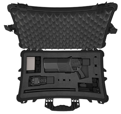
DroneShield also released its Immediate Response Kit (IRK), a rapidly deployable C-UAS detection and defeat kit. The IRK consists of an RfPatrol portable (1.2 kg/2.6 lbs incl battery) detection device and a DroneGun MKIII (2.1 kg/4.7 lbs including battery) defeat device in a rugged carry case.
Both RfPatrol and DroneGun MKIII are currently fielded by military and government customers globally.
Soon, global navigation will no longer suffice. Humanity is preparing to return to the Moon after more than half a century. U.S., European, Chinese, Indian, Japanese and Russian governments and companies want a slice of the “eighth continent.”
NASA’s Artemis program, which aims to put astronauts on the Moon’s south pole in 2024, will explore more of the lunar surface than ever before. Robots and humans will search for, and potentially extract, resources such as water, which also can be converted into other usable resources, including oxygen and fuel.
Astronauts searching for spots where robotic spacecraft have pointed to the ice on the lunar map and for equipment sent on ahead of them will need precise navigation guidance. So will astronauts and ground controllers operating the Gateway outpost in Moon orbit and the Orion spacecraft. This will require extending the reach of our Earth-centric positioning, navigation and timing (PNT) systems to cover our planet’s nearest neighbor.
A permanent and reliable source of PNT on the Moon will reduce the amount of gear each mission will have to develop and carry, making more funding and rocket-lift capabilities available for scientific equipment. It also will free bandwidth on NASA’s communications networks, which have historically provided navigation services near the Moon.
NASA and the European Space Agency (ESA) are laying the foundations for this navigation system. Their efforts include the development of a special receiver able to pick up GPS signals that, already very weak on Earth, are extremely so on the Moon; NASA’s LunaNet communications and navigation architecture; ESA’s public-private Pathfinder satellite navigation and communication mission, due to launch into lunar orbit by the end of 2023; and ESA’s Moonlight initiative, which will establish lunar communication and navigation services.
Studies already have proven that it is possible to navigate between Earth and the Moon, as well as on the latter’s surface, using the side lobes of the signals from GNSS satellites. In 2023, the Lunar GNSS Receiver Experiment (LuGRE), developed in partnership with the Italian Space Agency, will demonstrate and refine this capability on the Moon’s Mare Crisium basin. NASA will use data gathered from LuGRE to refine operational lunar GNSS systems for future missions.
Besides the low signal power, other challenges to using GNSS satellites for Moon navigation include geometry, with all the signals coming from a relatively small portion of the sky; the fact that in polar regions the Earth would be low on the horizon and therefore GNSS signals could easily be blocked by hills or crater rims; and the complete occultation of the signals when moving beyond the side of the Moon always facing Earth. Meeting this last challenge will require at least a couple of Moon-orbiting satellites. (Artificial satellites orbiting our planet’s natural satellite as a supplement to the artificial satellites orbiting our planet…)
The Moon will be our steppingstone to Mars. I bet it will not be long before the Institute of Navigation establishes a Planetary Navigation division!