Hexagon AB has acquired Immersal Oy, an innovator of spatial mapping and visual positioning solutions for producing augmented reality (AR) applications.
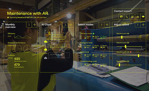
AR applications enhance real-world experiences by augmenting a user’s visual perception with the display of digital content in the physical world.
AR’s ability to weave context-specific, 3D information into physical spaces provides endless opportunities to save time, improve performance and reduce costs across a wide range of industries and applications — from surveying, construction, public safety and manufacturing to maintenance, training and navigation applications.
An immersive experience can help boost task efficiency, improve safety protocols, optimize workflows and increase collaboration.
The Immersal SDK (software development kit) allows developers to merge and “anchor” digital content to real-world objects – with precise accuracy to their actual location in the physical space — by enabling a user’s mobile device to locate and orient itself in the surrounding physical world using machine-readable maps.
The maps, which are used for visual positioning, are constructed from image data supported by various mapping devices (including mobile phones) and hosted in the Immersal Cloud Service.
“Hexagon has long been a leader in delivering smart digital realities that combine inputs from reality capture sensors with advanced visualisation software and tools to enable remote, location-based intelligence. This acquisition puts the power of these insights into the hands of those on-site, enhancing their field of view with superimposed digital information, meaning they can literally do more with what they see,” said Hexagon President and CEO Ola Rollén. “For example, direct access to information about an asset — while working with that asset — including step-by-step instructions on how to repair it, can streamline maintenance tasks while reducing material waste and re-work.”
Immersal has years of experience developing AI and machine learning-based spatial anchor technology, which “anchors” virtual objects or models for viewing on different devices in the same position and orientation. This unlocks a wide variety of location-based solutions and services — from consumer-oriented augmented reality applications in gaming and media and entertainment to digital twin solutions on an enterprise scale.
Immersal’s technology can map large spaces — both indoors and outdoors — and works both offline on-device and online using the Cloud Service.
Founded in 2015 and headquartered in Helsinki, Finland, Immersal will operate as part of Hexagon’s Geosystems division. The acquisition has no significant impact on Hexagon’s earnings.
Deal makes data from 40 Chinese satellites available through UP42 now, another 40 by late 2021
UP42 has signed an agreement with HEAD Aerospace of Beijing to make image data from more than 40 Chinese Earth Observation satellites available on the UP42 marketplace.
The broad selection of imaging capabilities from the constellations dramatically expands the range of applications in multiple sectors, with the most significant benefits expected in infrastructure, transportation, utilities, agriculture and government.
The UP42 marketplace contains more than 50 geospatial data sets, including satellite imagery from six international organizations. The newly added satellites’ diverse and often unique imaging capabilities include wide-swath imaging at very high resolution, nighttime acquisitions, frequent intraday revisits, tri-stereo collection and hyperspectral imaging.
“This partnership is an important milestone for us as a company but, more importantly, for our customers. By diversifying our data sets, we are unlocking a broader spectrum of use cases for our users in multiple sectors. This is the true meaning of ‘democratizing access to Earth insights’,” said UP42 CEO Sean Wiid.
HEAD Aerospace is an international distributor of satellite imagery collected by commercial Earth Observation missions. The UP42-HEAD agreement includes imagery from multiple constellations, including SuperView, Earthscanner, Gaofen-7, DailyVision, NightVision, Hyperscan, and Tri-Stereo ZY3. These seven constellations will total more than 80 satellites by the end of 2021.
“Sharing a similar approach facilitating users’ easy access to an agnostic data source by a centralized portal with a wide choice of satellite attributes, we are glad to have partnered with UP42. This partnership represents another new milestone for us in expanding our global network.” said Kammy Brun, managing director of HEAD Aerospace.
While each satellite constellation was designed with one or more imaging specialties, a remarkable variety of operational capabilities are shared across the constellations to support numerous applications and industries. Examples include:
Large-Area Very High-Resolution Mapping – Planning and monitoring critical infrastructure, including utility transmission grids and transportation networks, can be performed for entire states, countries and regions. Up to 40,000 square kilometers can be covered with wide-swath (136 km) imagery captured at a half-meter spatial resolution on a single pass.
Intraday and Early Morning Monitoring – The EarlyEye tasking product leverages multiple HEAD Aerospace constellations to deliver early-morning frequent images, an hour earlier than usual commercial offer at 10:30 a.m. Designed for frequent monitoring of critical assets and rapidly changing situations related to energy security, defense/intelligence and infrastructure management, a high-resolution revisit schedule of four times per day is possible, with 15-minute revisit between 09:00 and 13:30 anywhere on Earth to be possible by the end of 2021.
High Vertical Accuracy Mapping – Multiple satellites perform stereo imaging at high resolution for high-quality land use and cadastral mapping. One constellation captures single-pass tri-stereo imagery validated with onboard laser altimetry data, generating digital elevation models (DEMs), digital terrain models (DTMs), and other large-scale 3D mapping products with vertical accuracy of 5 meters. Additionally, the SuperView constellation captures daily stereo imagery with vertical accuracy of better than 2 m.
Hyperspectral Imaging – Imaging in 25 spectral bands spanning the visible, near-infrared, and mid-infrared portions of the spectrum is designed for regional natural resource management: detecting crop stress and planning pesticide/fertilizer applications, species mapping of forests and vegetative land cover, and protecting environmentally sensitive areas. These data sets can also be used in agriculture monitoring, mineral exploration and water-quality monitoring.
Nighttime Imaging – Monitoring and surveillance activities by government entities, energy utilities and security organizations can be carried out around the clock with true-color, high-resolution at 1 m optical and video imaging during daylight and dark of night. Nighttime collection is suitable for surveillance such as illegal camping, border surveillance, change detection (especially in rapidly evolving events), powerline incidents and designing streetlight placement in urban settings. Day and night video can detect vehicle and ship movement.
UP42 users have a growing selection of satellite imagery to choose from on the geospatial marketplace. UP42 technical experts are available to assist customers in selecting the best data set to meet the needs of specific end-use applications in all industries and sectors. These experts can also help in tasking a satellite for new image acquisition or querying the archive to obtain existing imagery.
Spire Global, a global provider of space-based data and analytics, has announced the continuation of its participation in NASA’s Commercial Smallsat Data Acquisition (CSDA) Program with a $6 million contract extension.
The contract continuation, Task Order 6 (TO6), is a subscription data solution that includes radio occultation (RO) data, grazing angle GNSS-RO, total electron content (TEC) data, precise orbit determination (POD) data, soil moisture and ocean surface wind speed GNSS reflectometry (GNSS-R) data and magnetometer data.
This data will be available to all federal agencies, NASA-funded researchers and, more broadly, to all U.S. government-funded researchers for scientific purposes.
Under CSDA Program TO6, Spire will deliver a comprehensive catalog of data, associated metadata and ancillary information from its Earth-orbiting small-satellite constellation. The company operates its constellation in low Earth orbit and collects upwards of 10,000 radio occultations per day with consistent global coverage.
For TO6, Spire will provide rolling access to 12 months of radio occultation data with a 30-day latency. This data will be archived and maintained by NASA under the CSDA Program’s SmallSat Data Explorer (SDX) database.
“Programs like CSDA highlight the incredible potential of private-public partnerships in the federal government to drastically accelerate our ability to confront some of the greatest challenges of our time, such as climate change,” said Peter Platzer, CEO of Spire. “With the end-user license agreements, our data is now available to all federal agencies and the larger NASA scientific community to help support Earth observation research across fields.”
The program includes end-user license agreements (EULAs) to enable broad levels of dissemination and shareability. All federal agencies and U.S. government-funded researchers will have access to Spire’s data for scientific purposes under TO6 and will be able to request access to the data via the CSDA Program’s Commercial Datasets webpage.
“At NASA, the CSDA Program has continued to blossom as a valuable resource to our team for our Earth observation research and analysis. We are committed to growing the program as well as continuing the work we have started,” said Will McCarty, project scientist at the CSDA Program and research meteorologist at NASA Global Modeling and Assimilation Office. “Spire has been a valued partner through CSDA’s development since its inception, and with this additional task order, we are excited about the new insights and results that will come not only from within NASA, but also through broader collaboration through the domestic government scientific community.”
NASA has used Spire data in its research on water and sea-ice levels in the polar regions, the height of the planetary boundary layer (PBL), and the day-to-day variability of thermospheric density at flight level.
NASA also noted that Spire data has shown positive benefit to its GEOS Atmospheric Data Assimilation System, which uses space-based data to analyze the Earth’s atmosphere and assimilate the data into its Earth observation systems.
As one of the original vendors for the CSDA Program, Spire provides NASA yearly updates to the scope of work under this agreement to ensure alignment of data to the agency’s needs.
“Crime is common. Logic is rare. Therefore, it is upon the logic rather than upon the crime that you should dwell.”
“Data! Data! Data!” He cried impatiently. “I can’t make bricks without clay.”
— Sherlock Holmes, “The Adventure of the Copper Beeches,” Sir Arthur Conan Doyle
Watson is to Holmes what information is to intelligence. Watson could listen to the client story, observe the situation, and recite to Holmes all the relevant facts, but he lacked the ability to string together the seemingly random pieces of information into a coherent chain of events leading to the correct hypothesis. A computer can become a Watson, but it takes a human to be Sherlock; however, a human misguided by cognitive biases will end up as Inspector Lestrade, always coming to the wrong conclusion.
When it comes to data, the analogy of drinking from a fire hose is an understatement. Consider that a digital image can be terabytes in size and every day millions of images are taken. Facebook generates 4 petabytes of data daily, and each day there are 500 million tweets and 306 billion emails. Additionally, there are 20 billion connected devices. Combined, the world creates 2.5 quintillion bytes of data every day. If a grain of sand represents a byte of data, then every three days more data is created than there are grains of sand on the Earth, and it is only increasing.
Somewhere in all that data are signals. Real-time threat intelligence systems are looking for those signals before the next huge event occurs. It is a high-stakes hunt for Leviathan, except that Leviathan is only a packet of sand traveling at lightspeed through a cloud obscured by dust.
Nellis Air Force Base takes part in Red Flag 15-2 at its Combined Operations Center in 2015. (Photo: Senior Airman Thomas Spangler/U.S. Air Force.)
Interpreting a Signal
The massive volume, variety and velocity of continuously flowing data far surpasses the ability of humans to process. It exceeds the bandwidth most systems can handle. And it quickly overwhelms the capacity to store, manage and act on the information in a timely and cost-effective manner. Resources are not infinite. The best model to handle an overwhelming amount of data is the human brain. Humans are biological sensors. Every moment of every second of our lives, our bodies are receiving an endless stream of stimuli from internal and external sources. Most of this stimuli registers at an unconscious level, and as long as the stimuli is normal and expected, it goes unnoticed by the conscious mind. If, however, any discomfort is experienced, the conscious mind is notified. Then that becomes the focus until normalized. Externally, the same applies to computer data systems. Normal conditions are ignored, but if there is something unusual, such as a loud constant noise, or a colder than normal temperature, it draws all the processing attention.
In the realm of intelligence that is basically how things function. Algorithms are written to learn the normal patterns of life and to identify specific events, words, names, etc. As long as data is within normal parameters, it gets little attention, but as soon as an anomaly exceeds a threshold or something triggers the algorithm, it will immediately be brought to the attention of the intel center. An example can be viewed on the Global Incident Map dashboard. I encourage you to sign up for a free 72-hour membership. If you want to see what real news looks like, this would be a sampling. The number of real incidents that happen across the country and around the world that you never hear about, many of them hair-raising and all of them open source, add to the few stories the media has been able to tell about cyber attacks. Scroll down the page. There are many filters, but I recommend turning them all off to see the full extent of information. Clicking on an incident will drill down into the actual source so you can read about it more thoroughly.
Below is the U.S. Army’s real-time critical incident dashboard called the Joint Analytic Real-Time Virtual Information Sharing System (JARVISS). It tracks and monitors activity near U.S. Army installations and standalone assets of interest around the world.
Another dashboard for cyberattacks is Check Point, which shows just how aggressive cyberthreats are throughout world. Here, you can see the patterns of coordinated attacks. A war is underway. The soldiers are cyberwarriors. No country is safe. View the Live Cyber Threat Map.
JARVISS is designed to target criminal activity and provide natural disaster information in and around Army installations and stand-alone facilities, as well as COVID-19 threats. (Image: Steve Gardner/U.S. Army}
Fast Analysis in Real Time
Monitoring this information, analysts look for connections. If a plane veers off its flight path, the local operations center is notified. An automatic query shows if any critical-infrastructure assets or other important structures and facilities are in the area. The analyst can immediately find out the type of aircraft, the call sign, who the plane is registered to and who filed the flight plan. Weather radar can be overlaid to see if that is a possible reason for the deviation. Incident reports can be displayed in real time within the area of interest, along with social media feeds and other sources of communication. Traffic patterns can be displayed.
The important question that needs to be answered is whether this is a potential threat. Is there a connection to anything going on anywhere else? A dossier is developed on the person who filed the flight plan, the one who is assumed to be the pilot and the person or organization to which the plane is registered. All of this is being done in a matter of minutes, while the airplane either returns to its flight path or continues its diversion. The air traffic control tower is contacted to share information on the aircraft and its deviation. If the tower does not have an answer, it will radio the pilot for an answer. The passenger and crew manifest also are analyzed. All the data that can be pulled together — including the remaining fuel burn and the aircraft performance limitations — are analyzed.
Patterns emerge from the data. These patterns lead backwards to a cause and forward toward the end result. Finding those clues in the data requires a team of specialists from six primary intelligence disciplines.
An imagery intelligence analyst brings in the live-streams and remote sensing.
A human intelligence analyst seeks motivating factors and ways to deescalate the situation.
A measurements and signatures intelligence specialist defines the operating limitations and the mechanics and science particular to the scenario.
An open-source intelligence analyst accesses and queries open-source data sets to provide clues.
A signals intelligence specialist focuses on the communications and electronic signatures.
A geospatial intelligence analyst brings it all together and provides spatial context through the map the team uses that shows the events unfold in real time.
These analysts and sometimes many others will collect all these pieces of information and turn them into intelligence that decision-makers can use to take action. That is the purpose of intelligence; as CIA veteran Richard Heuer stated, “Intelligence seeks to illuminate the unknown.”
Fortunately, most alerts turn out to be false positives, but every one of them is treated as if it were “the one.” These false positives turn out to be excellent, real-world exercises that hone the skills of the team and wire the brain for speed. These events can last mere minutes or several hours. It’s an adrenaline rush.
To explore live streaming data feeds, Esri has a growing volume of data in its ArcGIS Living Atlas.
“My mind rebels at stagnation. Give me problems, give me work, give me the most abstruse cryptogram, or the most intricate analysis, and I am in my own proper atmosphere…”
— Sherlock Holmes, “The Sign of the Four,” Sir Arthur Conan Doyle
William Tewelow works for the Federal Aviation Administration. He is a graduate of a management fellowship program. While on special assignment to the U.S. Department of Transportation William led the project to crowdsource the National Address Database for the White House Open Data Partnership. He is a Geographic Information Systems Professional (GISP) and a Maryland Scholar STEMnet Speaker. He has a degree in Geographic Information Technology and Intelligence Studies from American Military University and is currently earning a degree in Organizational Leadership. William retired from the U.S. Navy after serving 23 years as a Geospatial and Imagery Intelligence Specialist, a Naval Aviator, a Meteorologist, and a Tactical Oceanographer. He was among the first in the nation to earn a Geospatial Specialist Certification from the U.S. Department of Labor while working at NASA Stennis Space Center in Mississippi. He is married, enjoys traveling, solving problems, playing with data, and fascinated by new technology and historical context. His favorite quote is, “A man’s mind changed by a new idea can never go back to its original dimension.” ~ Oliver Wendell Holmes
A Censys Technologies Sentaero equipped with a Verizon 4G/LTE link. (Photo: Skyward)
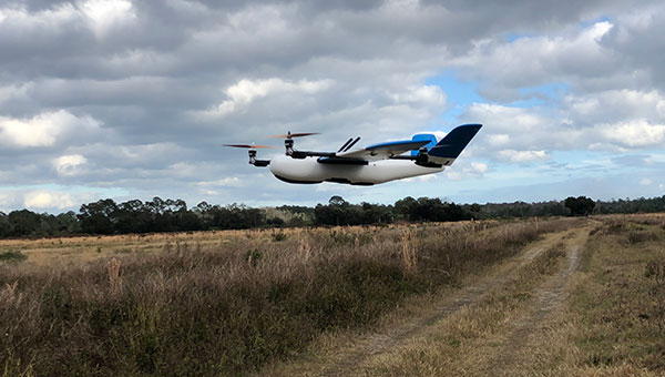
Skyward, A Verizon company, has signed a Memorandum of Agreement (MOA) with the U.S. Federal Aviation Administration (FAA) to test cellular-connected drones. Cellular-connected drones could unlock complex operations like beyond visual line of sight (BVLOS), universal traffic management (UTM) and one-to-many operations.
Titled “Unmanned Aircraft Systems (UAS) — Cellular Technologies to Support UAS Activities,” the MOA enables Skyward and the FAA to mutually research the capabilities of cellular communication networks for command and control (C2) within the National Airspace System.
Partially focused on safety-critical C2 data, the three-year MOA also allows the two groups to propose standards for operations, including BVLOS and over commercial wireless spectrum. Skyward and Verizon will also be using the data and information collected in the course of the MOA to inform its discussions on C2 and BVLOS operations in the FAA’s BVLOS Advisory and Rulemaking Committee.
Today, most commercial drones use unlicensed spectrum, which is restricted in range and subject to interference, limiting its use for complex operations. Verizon’s 4G LTE nationwide coverage, provided over spectrum protected from interference, presents an enormous opportunity for drone operations.
The MOA will inform regulations regarding spectrum used in the C2 link between the drone operator and drone. The MOA will also facilitate information sharing between the FAA and Skyward as the parties continue to explore how wireless networks can support drone operations.
The MOA is inspired by the previous industry collaborations with the FAA, but is intended to address complex UAS operations through joint data collection and analysis.
The agreement also follows Skyward’s announced emergency waiver to inspect critical communications infrastructure near the Big Hollow wildfire in Washington in September 2020. The industry’s first known fully remote BVLOS operation with no pilot or visual observer on site demonstrated low-risk operation as well as a need for analyzing and sharing fully remote data with standard bodies and the FAA.
“Cellular-connected drones play a critical role in enabling tomorrow’s safe, reliable and secure drone operations,” said Matt Fanelli, Director of Strategy and Operations at Skyward. “We are thrilled to be laying this foundation with the FAA and are confident that our efforts will help inform technical standards from which industry regulations authorizing low-risk BVLOS and one-to-many operations will flow.”
The new cost-effective small form factor is designed for NTP and PTP functionality
Photo: EdgeSync
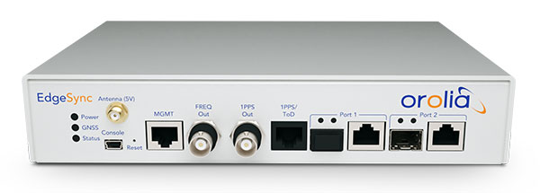
Orolia has introduced EdgeSync, a new cost-effective network timing platform that provides Network Time Protocol (NTP) and Precision Time Protocol (PTP) Grandmaster and Boundary Clock functionality for real-time edge applications.
High performance, scalability, ease of use and manageability make EdgeSync particularly suitable for a wide range of applications, including data centers, finance, mobile edge computing, enterprise, smart grid, industrial internet of things (IoT), process control or telecommunications.
“EdgeSync is a great addition to Orolia’s timing product line because it’s ideally suited to meet the demanding requirements of today’s modern networks, including 5G infrastructure,” said Jeremy Onyan, director of Time Sensitive Networks at Orolia. “It delivers NTP and PTP capability to industries like process control, broadcast and telecom in a cost-efficient form factor that doesn’t sacrifice performance while taking advantage of the growing demand for edge applications.”
EdgeSync uses a multi-GNSS receiver (GPS, Galileo, GLONASS, Beidou and QZSS), PTP and Synchronous Ethernet (SyncE) as input references and generates PTP, SyncE, NTP and timing signals (10 MHz, 1 PPS and Time of Day message) as outputs. It features dual 1 GbE ports for both copper RJ45 and optical network timing connections.
EdgeSync also can provide IEEE 1588-2008 (PTP) Grandmaster and Boundary Clock functionality. The device leverages unique PTP algorithms to deliver stringent timing for demanding, precise applications and supports multiple industry PTP profiles for interoperability. An enhanced oscillator and PTP slave capacity option allow users to choose the EdgeSync performance level to meet their specific needs.
EdgeSync is available both in the Orolia Online Store (shipping to U.S. addresses only) and directly from Orolia technical sales representatives.
BAE Systems is developing an advanced military GPS receiver and improving the capabilities of size-constrained and power-constrained military GPS applications, including precision-guided munitions and handheld devices.
Spirent Federal is qualified to provide essential test equipment and support in the pursuit of resilient, accurate PNT data in GPS-degraded Navigation Warfare (NAVWAR) situations, Spirent stated in a press release.
The Spirent CRPA Test System is a development of its GSS9000 Series platform. It can test
controlled reception pattern antennas (CRPAs)
MNSA and AES M-code
jamming and spoofing threats and mitigation
ultra-high-dynamic vehicle applications
inertial navigation systems
additional encrypted military signals, Y-code and SAASM
and more
CRPAs provide proven and effective protection against jamming in high-interference environments. The Spirent CRPA Test System can simulate 16+ individual elements with a separate RF output per antenna element.
For the 16-element test system, concurrent simulation of GNSS signals, signals from spoofers and repeaters, and interference from multiple jammers — including Blue Force Electronic Attack (BFEA) jamming waveforms — results in more than 1,000 simultaneous independent channels and signals simulated across a phase-calibrated precise wavefront.
“The CRPA Test System is the culmination of over 35 years of R&D and industry leadership and is perfectly positioned to help with next-generation MGUE modernization,” said Ellen Hall, president/CEO of Spirent Federal. “Our robust M-code test capabilities support BAE Systems’ advances in M-code technology.”
Spirent can provide GNSS and interference signal simulation solutions for every stage in the CRPA design and verification process. To learn more, visit Spirent Federal’s CRPA Test System page.
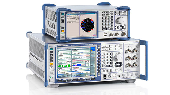
R&S CMW500 wideband radio communication tester. (Photo: Rohde & Schwarz)
Rohde & Schwarz, in partnership with Quectel, announces the verification of selected 3GPP test cases based on a system with its R&S CMW500 wideband radio communication tester against a Quectel AG15 C-V2X module.
The Quectel AG15 is an automotive grade C-V2X module designed and manufactured according to IATF 16949:2016 standards. It has an embedded multi-constellation high-sensitivity GNSS (GPS, GLONASS, BeiDou, Galileo, QZSS) receiver for positioning, which minimizes design and improves positioning speed and accuracy. It is designed for use in extremely harsh environments and provides superior ESD/EMI protection performance.
Quectel AG15 C-V2X module with GNSS. (Photo: Quectel)
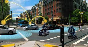
Cellular-V2X (C-V2X) is a key technology that will improve road safety and accelerate autonomous driving in the coming years. Specifically, the C-V2X PC5 interface, operating in the 5.9-GHz frequency enables direct, reliable, low latency communication between vehicles (V2V), vehicles and infrastructure (V2I) and vehicles and pedestrians (V2P). For the automotive industry to deploy this technology in a timely manner, cooperation between suppliers in this industry becomes increasingly important, the companies said.
The test cases performed by Rohde & Schwarz and Quectel are designed for automotive companies looking to pre-validate 3GPP system performance in an automated and timely manner before entering OMNIAIR or CATARC certification process. The test system provides a high degree of automation and flexible instrument configuration, which meets the requirements of the automotive industry for C-V2X testing.
A key benefit for customers is the ability to leverage existing investments in Rohde & Schwarz equipment, thereby minimizing additional capital investment.
“Through C-V2X PC5 direct communications, the AG15 will make traffic smoother and more efficient by paving the way for automated driving and achieving the goal of fully connected traffic,” said Manfred Lindacher, VP Global Sales Automotive International, Quectel Wireless Solutions. “We’re delighted to have collaborated with Rohde & Schwarz to validate these test cases and are looking forward to helping our customers on the road to build a smarter world with our automotive grade C-V2X modules.”
A team with Stanford University’s Center for International Security and Cooperation (CISAC) used BlackSky’s geospatial imagery and burst collection technology to track and monitor activity at a secretive Iranian nuclear facility in a new intelligence study. The study tracks and monitors activity at the Natanz nuclear facility in Iran.
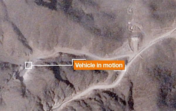
Screenshot: Janes.com video/BlueSky
“The BlackSky/CISAC research team demonstrated the power of combining rapid revisit satellite imagery, human domain expertise and AI/ML (artificial intelligence/machine learning) techniques to identify and understand activity at Natanz, which was previously unknown to much of the world,” said Patrick O’Neil, chief data scientist at BlackSky. “Observations that provide real-time, activities-based insights have the potential to change the world.”
BlackSky’s high-revisit satellite imagery enabled researchers at Stanford University’s Center for International Security and Cooperation (CISAC) to monitor the pattern of life at the Natanz nuclear facility and gain a better understanding of activity and events at the site.
BlackSky’s satellites provide high, intraday revisit capabilities, allowing CISAC’s research team to receive multiple images a day, throughout the day, rather than just one image collected at roughly the same time each day.
BlackSky satellites are also capable of capturing a sequence of up to 20 images within a matter of minutes, known as a burst collection, and then splicing them together. Instead of a single picture, burst collections are geospatially normalized and joined together to generate a moving sequence of activity. With BlackSky’s assistance, the research team was able to witness trucks emerging from the facility’s underground tunnels.
Allison Puccioni, a renowned imagery analyst and BlackSky consultant, assembled a research team at Stanford University, with help from Rose Gottemoeller, diplomat, former NATO deputy secretary, and visiting professor at Stanford. The pair enlisted two principal research assistants in geospatial science to develop a sophisticated situational-intelligence program to monitor the Natanz nuclear facility.
Natanz is Iran’s primary facility for advanced uranium enrichment and is an active political and military location driven by concerns about the country’s nuclear operations.
Earlier this year, we looked back at 2020 and reviewed how surveying has dealt with the worldwide pandemic while adapting to the new tools and technology being created. We discovered the need for surveyors did not diminish during this crisis, and in many places the demand has gone up significantly. Instruments, computers and measuring methods continue to increase in capability and complexity to help with the shortage of qualified field crews, yet we still need to expand our efforts to find the next generation of surveyors.
How do we find those future geospatial experts, data collectors and surveying professionals? The answer is right under our noses, and our current group of practitioners needs to get the word out.
What is the word, you ask?
Technology.
Younger generations understand technology better than most practicing surveyors. New devices, methods and operations are being invented at a fast pace, and our best and brightest should be considering using that technology in a rewarding career. Before we make the big pitch to them, however, we should refresh our understanding of recent surveying history to better understand why technology is a good thing.
How did we get here? A short historical look at measuring
The measurement methods, devices and instruments used by surveyors have radically changed in the past 50 years, and we have covered their evolution in past columns (Survey SceneMay 2016, May 2017 and Sept. 2019).
Instruments and devices used by surveyors vary in their function and output of information. Some are used to physically measure the distance from a stationary point to another, determine horizontal and vertical angles at a specific location, or determine grade differentials between various points. Other instruments are used to determine horizontal or vertical positions to establish locations and elevations. All these instruments are being used to gather positional data on any number of items, but the quality of the information may vary depending on the technology and method used. How?
Devices and methods for measuring distances
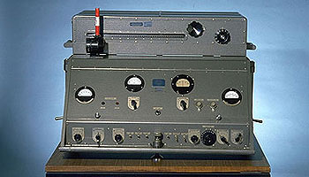
AGA Geodimeter NASM-2A. (Photo: NOAA)
Tools for measuring distances have been around for centuries. The Egyptians are famous for their “rope stretchers,” while early surveyors in Europe and the New Colonies were known to use the Gunter’s chain and a measuring wheel. In the early 1800s, steel tapes were invented to replace the chain. These measuring tapes continued to evolve well into the 20th century with varying metals, fiberglass and nylon-coated plastics.
In the mid-20th century, scientists and physicists began to experiment using light waves as a means of measuring terrestrial distances. These experiments led to the development of the first electronic distance meter (EDM), commercially produced by the Swedish company Svenska Aktiebolaget Gasaccumulator (AGA) in the early 1950s. Other methods of electronic measurement, including microwave and infrared wave technology, were also developed in the years following the introduction of the lightwave EDM.
For many years, the EDM was used independently from transits or theodolites to measure long distances. For those who needed to consistently measure long distances, the invention of the EDM was not just a time saver, but also provided much higher accuracy than manual measurements.
Other technologies were developed in the latter part of the 20th century, introducing the surveyor to laser scanning, but we can defer this topic until later in this column.
Devices for measuring angles
The T3 theodolite was introduced in 1925. With its 10.5-inch telescope, this theodolite had a range of up to 60 miles. It saw heavy use between 1952 and 1984. (Photo: NOAA)
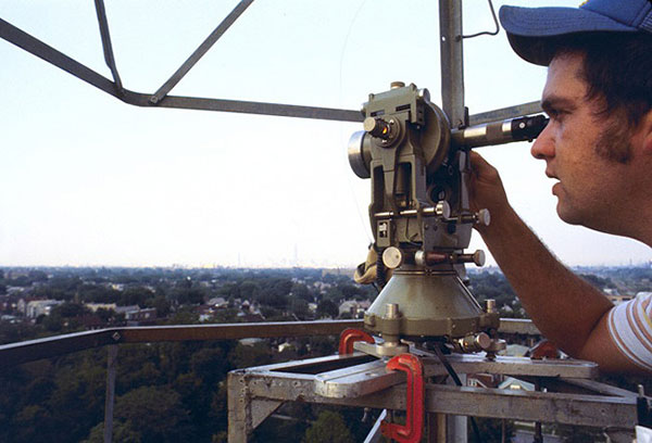
The surveyor, like the astronomer, has consistently been at the forefront of developing optical instruments. The key has been combining high optical quality with a means of measuring horizontal and vertical angles within the instrument. The creation of the theodolite and the transit revolutionized the ability of the surveyor to accurately measure angles and apply trigonometric functions to determine mathematical computations. In addition, the surveyor’s compass was also developed to assist with angle measurement — with less accuracy but greater flexibility.
By the 1920s, optical theodolite technology was rapidly improving through the work of Switzerland’s Heinrich Wild. Beginning with the T2 and T3, these instruments provided accuracy and precision not previously available to the surveyor. Other manufacturers followed suit with similar instruments for the next several decades and were used in conjunction with the EDM for larger surveys. Anticipation grew with the competition to see which instrument company could marry the theodolite and the EDM into one easy-to-use, yet accurate, optical instrument.
Introducing the total station
By the late 1960s, technology had firmly entered the surveying world with a few electronic advancements. In 1968, Zeiss — a German company known for its lenses and optical systems — produced the first known tachymeter, combining a theodolite with an electronic distance meter. The tachymeter became better known as the total station, as it was capable of measuring angles and distances in one instrument. While somewhat crude and hard to use, the Elta 14 total station introduced the world to a future generation of surveying instruments that would revolutionize the field.
In the course of a few years, several manufacturers developed their own total stations. The biggest hurdle was combining the optics of the scope with the measuring axis of the EDM. By the end of the 1970s, most total stations were coaxial, therefore measuring angles and distances was done with one sighting.
Robotics were introduced in the early 1990s, with two servo motors to drive the horizontal and vertical movements of the total station. These movements were controlled remotely by the tracking system connected to the prism pole and data collector. Not requiring a human being to remain stationary and manually operate the total station provided cost savings and additional efficiency for the field crew.
Positions, everyone! Positions!
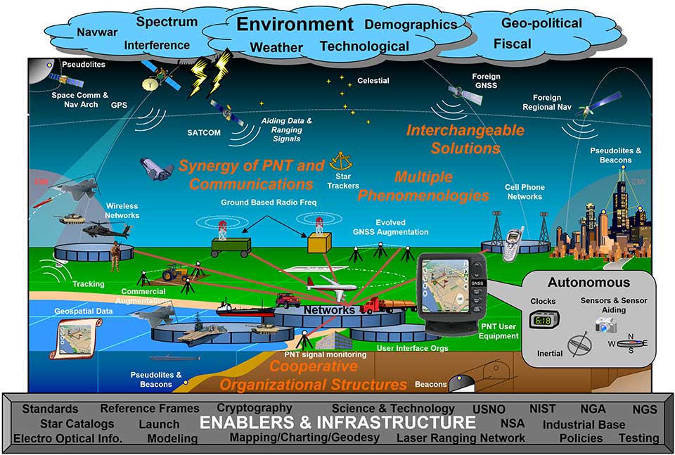
U.S. National PNT Architecture. (Graphic: U.S. Department of Transportation)
Positional measurement has revolutionized not just the surveying profession, but a large portion of everyday tasks as well. From monitoring travel times for your commute to providing your food-delivery driver with your location, position determination is the key element to these services. Satellite navigation is now the primary technology used for positioning, navigation and timing (PNT) and a big part of most aspects of surveying.
Remote sensing
Here is where we can discuss laser scanning and other remote sensing technologies. Remote sensing is the science and technology of gathering data from a distance. Traditionally this has been mostly done from aircraft, satellites and vessels. However, technology has expanded so that most practitioners now consider the use of laser scanning, lidar, photogrammetry, hyperspectral cameras, bathymetric sonar and simultaneous localization and mapping (SLAM) to be included in the category. Keep in mind that all these technologies are types of measurements; they are not the vehicle or instruments used for the measurement.
Image: NASA
These various sensor types can collect millions of data points in a short amount of time. While surveyors are adapting to working with point clouds and gigabytes/terabytes of data, it is a radical departure from our recent past using only total stations and GNSS receivers. Significant advancements in computer processing, data storage and programming have simplified the manipulation of point clouds, but they remain a challenging task for even newer surveyors to tackle.
Autonomous vehicles
Hobbyists have been building (and crashing) model airplanes and helicopters for many years. Most of the public does not realize that the big advancement in remote-control aircraft was the introduction of GNSS technology into the flight system. Sure, we all have GNSS receivers in our phones, but now to be included in our toys? This somewhat simple addition has turned unmanned aerial vehicles (UAV) into a revolutionary tool for several occupations, not just surveyors. More control and stability of the UAV means expanded uses for emergency personnel, utility providers, parcel delivery and much more. Being able to program a specific flight provides the UAV user with higher accuracy and precision, but it takes away the element of human control.
Image: Department of Transportation
Another vehicle gaining market share is the unmanned surface vessel (USV), used for performing hydrographic surveys. Like its UAV cousin, the USV is autonomous and is programmed to follow a specific route for greater accuracy and precision. Because of the shallow draft of a USV, it can be used in many areas deemed inaccessible by manned vessels.
An additional aspect of newer technology working with autonomous vehicles is collision avoidance systems. These systems have been implemented on newer UAVs and continue to improve, allowing their the use in tighter confines and spaces. By having a radar-based avoidance signal surrounding the entire UAV, collisions become less likely.
Geofencing is another advancement being implemented into more UAVs to help keep them from intruding into unauthorized spaces, by programming into their computer specific geographic areas that are off limits. UAVs are often also programmed to return to its takeoff location under certain circumstances.
Other technological advances to consider
Image: State Department
How much technology do you have in your home and office? Probably more than you realize. While one may immediately think about a smart speaker or home automation system (Alexa, Echo, Nest, etc.), other components offer simple yet productive solutions.
Remote control systems enable you to check whether your doors are locked and your garage door is shut. If not, a touch of a button does the job. Motion sensors enable you to detect intruders around and inside the house, of course. Environmental sensors now monitor for water leaks, moisture and gas/carbon monoxide and provide alerts. How about home automation that utilizes robotic technology? The Roomba vacuum, automatic pool cleaners, and even window washing systems activated when dirt is recognized on your exterior windows are just some of the robotic devices in the modern home.
Precision agriculture utilizes autonomous vehicle control to increase the precision of planting, spraying and harvesting crops. This increase in efficiency has led to higher yields and lower operating costs for the equipment. Another market starting to see more interest is the robotic lawn mowers that functions like the Roomba vacuum. While significantly more expensive than manual mowers, they offer features that can be considered for trade-offs for your time. Depending on your location and needs, they can be set on timers to run day or night and return to base when their battery runs low.
Adapting today’s technology to tomorrow’s surveying tasks
Another relevant technology that does not fit into any of the topics above is the inertial measurement unit (IMU). These sensors are now routinely paired with GNSS receivers in UAVs to help them compensate for pitch and roll. Because of their small form factor, IMUs will increasingly be incorporated into other measurement devices.
It is also safe to say that more handheld devices and smartphones will include lidar scanning capability, as the iPhone 12 Pro and iPad Pro already do. Application and software developers are writing code to make use of data from these devices, so plan on other hardware makers following Apple’s lead.
Voice and motion control will continue to be integrated into data collectors and workstations. By minimizing physical entries into an input system, computers will begin to recognize patterns and automate procedures to increase efficiencies. Programmable voice commands during field data collection will activate various procedures (for instance, specific roadway cross sections or curb island locations) and walk the user through a predetermined set of steps. The possibilities are endless, but we should prepare to take advantage of the technology.
Enticing future generations into a geospatial career
Image: Digital.gov
A geospatial career is so much more than just being a surveyor. Our profession needs bright minds who see the world differently. What does that mean?
Most surveying and mapping tasks used to produce 2D deliverables on paper. Today’s geospatial technicians fly UAVs, use point clouds, draft existing conditions in 3D, and analyze data for future applications. By applying what they are learning with new devices, technologies and software platforms, our younger generations can help the surveying and geospatial profession evolve into a data-rich environment that helps facilitate change for our planet. These efforts can help with climate change, provide better data for our communities, and bring societies back together.
Our profession is much more than gathering data; it is helping to make our world a better place through better data analysis and knowledge. Who would not want that?
The GNSS augmentation service provides real-time, verified and scalable high-precision positioning to consumer, industrial and automotive applications.
U-blox has launched its new PointPerfect location service. PointPerfect delivers an advanced GNSS augmentation data service designed from the ground up to be ultra-accurate, ultra-reliable and immediately available.
The service enables the fast-growing demand for high-precision GNSS solutions including autonomous vehicles such as unmanned aerial vehicles (UAV), service robots, machinery automation, micro-mobility and other advanced navigation applications.
Emerging automotive applications include automated driving (AD) and advanced driver assistance systems (ADAS), lane-accurate navigation and telematics.
Delivered via mobile internet or L-band satellite signals, PointPerfect broadcasts on a continental scale with homogeneous coverage in Europe and the contiguous United States, up to 12 nautical miles off coastlines to any number of end-devices, delivering sub-10-centimeter positioning accuracy and convergence of seconds. It uses the SPARTN messaging format with the lightweight, secure MQTT internet of things (IoT) delivery protocol for a real-time, bandwidth-optimized, cost-efficient solution for mass-market applications.
PointPerfect cooperates smoothly with u-blox positioning and connectivity hardware, providing a one-stop-shop solution from silicon to cloud. Because it is based on the open SPARTN GNSS correction data format, its use is not restricted to a single hardware provider, allowing customers the flexibility to optimize solutions.
PointPerfect is delivered via the Thingstream IoT service delivery platform, an enterprise-grade cloud platform that supports billions of messages. Thingstream provides a self-serve environment where users can manage their device fleet, optimizing cost and performance through flexible and predictable pricing plans.
The service is backed by a full warranty, 99.9% uptime availability and 24/7 reliability. In-house development of all the technological building blocks ensures expert technical support while eliminating any external dependencies that could otherwise lead to delays.
“PointPerfect seamlessly integrates our advanced high accuracy GNSS augmentation service with industry-leading positioning and connectivity hardware,” said Franco de Lorenzo, principal product manager services, u-blox. “Designed for increased flexibility, PointPerfect lowers barriers to adoption and supports scaled-up high precision positioning solutions, even in segments where such solutions would previously have been considered impractical. Moreover, innovative delivery options fully integrated into our easy-to-use Thingstream IoT service delivery platform eliminate complexities and allow users to engage more efficiently, reducing time-to-market.”
The HawkEye 360 constellation detects and geolocates RF signals for maritime situational awareness, emergency response, national security and spectrum analysis applications.
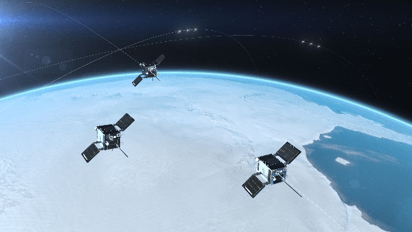
Cluster 3 satellites fly in formation, joining Clusters 1 and 2. (Artist’s rendering: Hawkeye 360)
HawkEye 360 Inc. announced the successful launch of its Cluster 3 radio frequency geolocation microsatellites built by Space Flight Laboratory (SFL). Carried aboard the June 30 SpaceX Transporter 2 mission, the Cluster 3 formation-flying microsatellites quickly established communication with the company’s satellite operations center. They join in orbit the HawkEye 360 Cluster 2 and Cluster 1 Pathfinder satellites.
The HawkEye 360 Constellation detects and geolocates RF signals for maritime situational awareness, emergency response, national security and spectrum analysis applications. Cluster 3 significantly expands HawkEye 360’s capacity, and is part of its second generation of advanced RF-sensing satellites.
“With the addition of our second-gen satellites, we’ll offer more frequent, timely and actionable data and insights to our government, commercial and humanitarian partners,” said CEO John Serafini.
“The increased revisit frequency and capacity Cluster 3 brings to our constellation are essential to detecting, characterizing, and understanding the continuously changing RF activity important to our clients,” said Alex Fox, Executive Vice President for Sales and Marketing.
Seven more clusters are fully funded and scheduled for launch in 2021 and 2022 to achieve collection revisits as frequent as every 20 minutes, Fox said. “Each cluster will offer new innovations to address a rapidly growing set of requirements needed by our defense, security and commerce clients. We plan on expanding the constellation past the initial 10 clusters to achieve near-persistent monitoring of global RF activity, which will drive even more value and ensure our continued dominance in the industry.”
HawkEye 360 delivers a layer of intelligence to help understand human activity on Earth. The constellation detects, characterizes and precisely geolocates these RF signals from a broad range of emitters, including VHF marine radios, UHF push-to-talk radios, maritime and land-based radar systems, L-band satellite devices and emergency beacons.
By processing and analyzing these RF data, the company delivers actionable insights for national, tactical and homeland security operations, maritime domain awareness, environmental protection and new applications in the commercial sector, the company said.
The HawkEye 360 launch brings to 20 the total number of SFL satellites placed into orbit in less than a year. The Cluster 3 satellites were built on SFL’s 30-kg Defiant microsatellite bus.
HawkEye 360 selected SFL due to the importance of formation flying by multiple satellites for successful RF geolocation. SFL is the acknowledged leader in developing and implementing high-performance attitude control systems that make it possible for relatively low-cost nanosatellites and microsatellites to fly in stable formations while in orbit.
The previous HawkEye 360 satellite clusters built by SFL were the Pathfinder launched in 2018 and Cluster 2 in January. Each Cluster is comprised of three satellites.
Other launches of SFL-built satellites in the past year include missions developed for the Norwegian Space Agency (NOSA) in Norway, the Dubai-based Mohammed Bin Rashid Space Centre (MBRSC) in the United Arab Emirates, GHGSat Inc. of Canada, Space-SI of Slovenia, and a Canada-based telecommunications company.