A technician scans for UXO on steep terrain in a wooded GPS-denied area. (Photo: Kaarta)
Kaarta and Exploration Instruments have announced a collaboration and distribution agreement to address the needs of the unexploded ordnance (UXO) and geophysical industries.
Kaarta provides real-time mobile 3D reality capture, and Exploration Instruments LLC (EXI) has expertise in near-surface geophysical equipment and applications.
EXI now offers rental, sales, and training for Kaarta’s SLAM-based mobile mapping systems and the integration with geophysical equipment such as digital geophysical mapping (DGM) and advanced geophysical classification (AGC) sensors.
Contamination and munitions from former combat areas or military training grounds is a global hazard. In the U.S. alone, more than 5,400 sites covering millions of acres have been identified for investigation and environmental restoration according to the U.S. Army Corps of Engineers.
The general remediation approach pinpoints buried ordnance location using electromagnetic and magnetic detection systems with GNSS positioning technology. While these systems perform well in open areas, other common environments such as steep terrain and wooded areas under tree canopy are challenging to find and remediate UXO.
The most common method for achieving required positional accuracy for DGM or AGC in wooded terrain is the use of robotic total stations (RTS) to tie surveyed locations to detection systems. However, RTS line-of-sight requirements make mapping and classification difficult and time-consuming, resulting in slower production rates and increased effort as data-collection teams must revisit common data gaps in the RTS coverage to achieve 100% coverage of the mappable areas.
Kaarta’s simultaneous location and mapping (SLAM) solution provides accurate global positions within several centimeters in these demanding environments. Kaarta Stencil 2-16 mobile mapping system combines lidar, an inertial measurement unit (IMU) and visual odometry measurements to build a 3D map of the environment while updating global position data in real-time when moving through the map, without the need for external signals such as GNSS.
The U.S. Army Corps of Engineers tested Kaarta’s Stencil 2-16 to provide rapid positioning data in GNSS-denied areas and found it provides positional data with the required accuracy for DGM and AGC at military munitions response sites.
Kaarta systems are successfully integrated and used with a range of geophysical equipment including Geometrics MetalMapper 2×2, Geonics EM-61, and White River Technology’s APEX systems. EXI ties it together by providing geophysical expertise, training and access to the latest equipment through both rental and sales. Stencil 2-16 integration with other sensors is easy using customizable GNSS NMEA strings and supports a wide range of RS-232, USB and Ethernet interfaces.
“It’s exciting when a combination of technologies come together to address such a significant problem as locating UXO in the most challenging of environments,” said Dave Duggins, UXO applications specialist at Kaarta. “We’ve been out in the woods with customers and are thrilled with the results we’ve achieved which include increased production rates with fewer personnel. Partnering with EXI to bring this solution to market is a perfect match.”
“There are hundreds of thousands of wooded acres that still need to be remediated,” said Dennis Mills, EXI’s President, “Providing geophysicists with a proven integrated solution that significantly improves productivity over current methods is a win all around.”
Kaarta systems can also be integrated with other sensors that use GNSS for positioning – ground penetrating radar, magnetometers, terrain conductivity meters — for a wide range of applications where positioning is needed in GNSS-denied areas. Kaarta was recently issued a patent covering its novel approach to fuse data captured by SLAM systems with data from other sensors to measure and localize sensed data in the scanned environment.
EXI will be the primary provider of Stencil 2 rentals, sales, and training to the UXO and geophysical industry.
Skyward, a Verizon company, has announced its integration with Pix4D, a photogrammetry software suite for drone mapping. The partnership gives customers the ability to turn drone data into 2D maps and 3D models.
Enterprises and drone pilots can now plan flights, receive approval to fly in controlled airspace with LAANC, fly with Skyward’s InFlight ground control station, and process data using Pix4D — all from within the Skyward platform.
“Skyward has been bringing our customers tools to access airspace, plan and fly — now they can produce business-ready data deliverables without leaving Skyward,” said Mariah Scott, Skyward president. “Enterprises in construction, energy and utilities, and the public sector can get even more ROI out of their drone programs when combining Skyward’s drone management platform with Pix4D’s market-leading photogrammetry tools.”
Skyward Mapping & Modeling, powered by Pix4D, enables customers to create, view, measure, and export 2D orthomosaic maps and 3D photogrammetric models right from Skyward’s web app. With the processing power of Pix4D, Skyward customers can get business-ready data sets through a seamless plan, fly, process workflow.
“Enterprises are seeking to scale their drone operations and transform their businesses with better data and faster time to insight. Skyward’s platform, along with the power of Pix4D, delivers a powerful, comprehensive solution,” said Christopher Cressy, Pix4D managing director for North America.
To learn more about Skyward’s mapping and modeling features, join a webinar on June 8 at 2 p.m. ET. Enterprises and commercial operators can try Skyward Mapping & Modeling powered by Pix4D free for 30 days.
As part of an ongoing global correction service strategy, the company is adding more than 400,000 square kilometers (156,000 square miles) to its European footprint, which now totals 2.5 million square kilometers (975,000 square miles).
VRS Now delivers reliable, easily accessible, centimeter-level accuracy that is ideal for professionals in the surveying, GIS and mapping, construction and agriculture industries, as well as many emerging autonomy applications in the automotive and robotics industries.
The subscription service is brand agnostic and works with most GNSS receivers. It is supported by a global team of GNSS network specialists and customer service representatives around the world, ensuring users have a consistent, reliable, high-performing service whenever they need it.
“Launching Trimble VRS Now services to Norway significantly expands our correction services footprint across Europe, offering a robust and reliable accuracy solution to farming, construction and mapping professionals across the region,” said Lisa Wetherbee, general manager of Trimble’s Advanced Positioning Division. “Trimble solutions are helping customers optimize workflows, improve productivity and deliver operational efficiency, while increasing user safety.”
The Indian Institute of Technology (IIT) Roorkee is offering a free online course on GNSS and Applications on the NPTEL platform. The four-week course will provide a basic understanding about digital elevation models (DEMs) and their applications in civil engineering and Earth sciences.
During the course, various DEMs and their sources, generation techniques, derivatives, errors and limitations will be discussed extensively. Surface hydrologic modeling using DEMs, modeling derivatives and their applications will also be discussed.
Intended audience. Under- and post-graduate engineering and post-graduate science students and faculty.
Pre-requisites. Current students of engineering, post-graduate science students and Ph.D. students should have basic knowledge of geographic information systems (GIS) and remote sensing.
Industry support. Geoinformatics companies (such as NIIT, Esri India, Leica Geoinformatics, MapmyIndia, ISRO and more).
The course will be taught by Arun K. Saraf, professor in the Department of Earth Sciences at IIT Roorkee. He teaches courses on remote sensing, digital image processing, GIS, advanced GIS, geomorphology and related topics to undergraduate and postgraduate students of Geological Technology and Applied Geology. He has a Ph.D. in remote sensing from the University of Dundee, United Kingdom.
The course takes place July 26-August 20. Registration is open until August 2 and can be done through the SWAYAM platform.
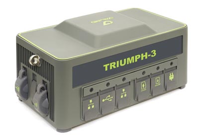
Javad GNSS has launched the TRIUMPH-3 receiver for surveyors and geodesists. It is capable of efficient tracking even in difficult conditions. It can track all current signals and is ready for any future satellites.
TRIUMPH-3 is designed to operate as a base together with TRIUMPH-LS and TRIUMPH-LS Plus to efficiently accomplish any geodetic job. Its real-time kinematic (RTK) system communicates via integrated UHF, 4G/LTE, Wi-Fi and Bluetooth channels, and eliminates the need to subscribe to a real-time network for corrections.
The new powerful and reliable receiver for high-precision navigation systems is based on the Javad GNSS 874-channel chip. It is equipped with an internal 4G/LTE/3G card and secure and accessible microSD and microSIM cards. It also supports “lift & tilt” technology.
The TRIUMPH-3 receiver can operate as a receiver for post-processing, as a continuously operating reference station (CORS) or portable base station for real-time kinematic (RTK) applications, and as a scientific station collecting information for individual studies, such as ionospheric monitoring.
Features include:
UHF 1 W Transceiver
4G/LTE module
Wi-Fi 5 GHz and 2.4 GHz (802.11 a, b, g, n, d, e, i)
Dual-mode Bluetooth and Bluetooth LE
Full-duplex 10BASE-T/100BASE-TX Ethernet port
High Speed USB 2.0 Host (480 Mbps)
High Speed USB 2.0 Device (480 Mbps)
High Capacity microSD Card (microSDHC) up to 128GB Class 1 O;
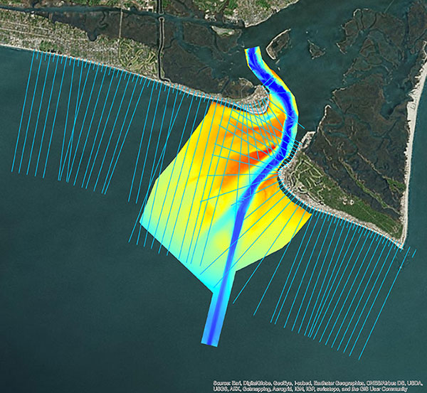
Multi-beam bathymetry and topo/bathy beach profiles of the Cape Fear River Inlet (USACE Wilmington). (Image: NV5 Geospatial)
Following its March 29 acquisition of Geodynamics LLC, NV5 Geospatial has built a comprehensive suite of solutions for geospatial surveys of deep-water and near-shore environments. Geodynamics will operate as a wholly owned subsidiary of NV5 Global as part of the NV5 Geospatial group.
The acquisition brought together complementary, advanced technologies — Geodynamics’ full ocean-depth sonar-based hydrographic and geophysical surveying with NV5 Geospatial’s topographic and bathymetric capabilities. Together, the technologies deliver detailed insights for a variety of applications, including coastal management, flood monitoring, ecosystem protection, research and more.
“This acquisition was a natural evolution toward our common goal of delivering valuable geospatial insights to our clients,” said Kurt Allen, vice president, Federal Vertical for NV5 Geospatial, powered by Quantum Spatial. “Our decades’ of combined experience and expertise using the most sophisticated technology for data acquisition and analysis will enable us to meet the most demanding client requirements.”
Geodynamics is a pioneer in collecting and processing single-beam, multi-beam, sidescan, geophysical and acoustic backscatter hydrographic data in some of the most challenging coastal environments, including dynamic tidal inlets, high-energy surf zones, and rapidly changing shoal systems that challenge navigation.
Geodynamics has completed large-scale hydrographic survey projects in the coastal and adjacent ocean areas of the entire United States, including detailed hydrographic surveys to support federal nautical chart updates in the Atlantic, Gulf of Mexico and Great Lakes region for the Office of Coast Survey of the National Oceanic and Atmospheric Administration (NOAA).
With a research focus on coastal geology, Geodynamics’ offshore geophysical surveys have supported mapping of marine minerals, benthic habitat and identification of potential submerged archaeological resources.
The relationship between the companies began with a joint venture in 2019. Working collaboratively as MarineGeoSpatial LLC, the partnership provided aerial- and ship-based remote sensing for offshore/marine survey and data collection, mapping and data analysis, and marine enterprise GIS services.
“We are excited to embark on this new chapter with NV5,” said Geodynamics CEO Sloan Freeman, PLS. “It is the perfect strategic alignment of aerial, subsea survey and geospatial services. Together, we have the technology, tools and experience to provide the best solutions to our clients and continue to advance scientific knowledge about coastal environments.”
BAE Systems Inc. has received a $325.5 million contract from the Defense Logistics Agency for advanced military code (M-code) GPS modules that will provide reliable and secure positioning, navigation and timing data with anti-jamming and anti-spoofing capabilities.
The modules will help warfighters conduct operations in contested electronic warfare environments.
“Our state-of-the-art GPS technology works with the advanced military M-code signal to provide reliable information to the warfighters who depend on it,” said Greg Wild, director of Navigation and Sensor Systems at BAE Systems. “This contract will ensure the availability of M-code module inventory to build advanced, next-generation GPS receivers.”
Under the multi-year contract, BAE Systems will deliver Modernized GPS User Equipment (MGUE) Increment 1 Common GPS Modules (CGMs) compatible with the advanced M-code signal to support the U.S. Department of Defense and international allies through 2030.
BAE Systems will manufacture the modules, manage their inventory on behalf of the Defense Logistics Agency, and use them to build military-grade GPS receivers for ground and precision-guided munitions.
BAE Systems’ portfolio of M-code GPS receivers provides flexible, efficient, and reliable navigation and guidance solutions for airborne systems, precision munitions, handheld receivers, and embedded applications.
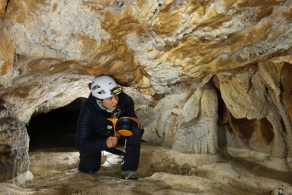
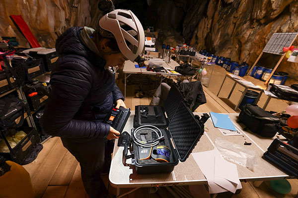
The versatility of the ZEB Horizon device enabled the Deep Time team to map the complex and challenging environment. (Photo: GeoSLAM)
Geospatial 3D mapping specialist GeoSLAM provided the technology to scan one of Europe’s largest caves as a part of the Deep Time isolation study.
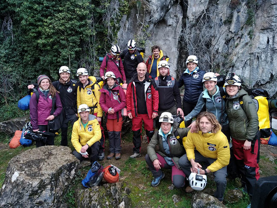
For 40 days, 15 participants set up camp in the Lombrives cave in southwestern France with no clocks or sunlight, and zero contact with the outside world. Conducted by the Human Adaptation Institute, the experiment aimed to explore the links between the human brain and time, in order to gain insight into the limits of human adaptability to isolation.
Throughout the mission, the “deeptimers” organized tasks to complete within the cave setting to help structure their days. Their first task was to conduct a recce of the location.
GeoSLAM technology was called upon to conduct a digital scan of the 3-km Lombrives cave — a cave system consisting of both narrow passages and expansive chambers up to 70 meters in height, formed more than 125 million years ago.
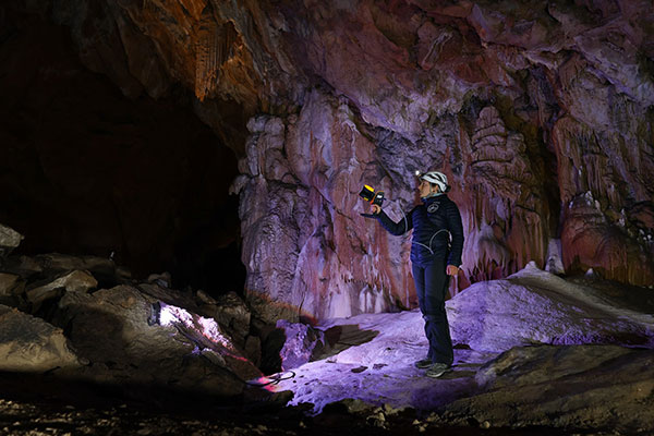
The handheld ZEB Horizon is put to the test by a Deep Time participant. (Photo: GeoSLAM)
The team used the lightweight ZEB Horizon device, which harnesses GeoSLAM’s unique SLAM (simultaneous localization and mapping) algorithm, putting to the test the device’s 100-m range capabilities. Its versatility and walk-and-scan method of data collection allowed the team the flexibility to crouch, crawl and scan the depths and narrow canals of the cave, including 90-m deep wells.
Traditional tripod-based systems used for digital mapping rely heavily on GPS to collect accurate data. SLAM technology however, overcomes this limitation by cutting out GPS altogether, enabling scans to be carried out in complex and enclosed spaces, including underground.
A Deep Time participant sets up GeoSLAM’s ZEB Horizon scanner. (Photo: GeoSLAM)
With low light levels, an ambient temperature of 10 degrees and humidity levels of 100 percent, the physical and psychological impacts the team experienced were documented on camera.
“We are thrilled to have been associated with the Human Adaption Institute on such an exciting and historic project,” said Tomas Blaha, GeoSLAM channel manager for Europe. “The handheld capabilities of the ZEB Horizon device provided easy-to-use technology for the members of the team with no professional surveying experience. The study tested the limits of human endurance in a challenging environment, and the same can be said of the technology to survey the Lombrives cave. Using traditional static and GPS-based scanners would have been impossible for this project, so we are delighted that the ZEB Horizon’s adaptability and ruggedness played its part in an historic piece of research.”
The 15 participants stand outside the Lombrives cave, France. (Photo: GeoSLAM)
The Earth Archive Initiative is an unprecedented scientific effort to create a digital twin of the entire surface of the Earth – and everything on it.
By scanning the planet’s land surface with very high-resolution lidar, the Earth Archive will create a true three-dimensional digital twin of our world — an open source, digital record of the Earth that will reflect the landscape exactly as it was at the time of scanning.
The geospatial data captured will serve as the baseline for understanding and exploring our world.
A virtual conference, billed as the “Chapter I : The Amazon,” takes place June 15-16, and will provide updates on the unique project from academics, non-government organizations, technology providers and the public. Registration is free.
The Amazon Basin is the first region chosen for scanning and the focus of the conference. “While our scope is the entire planet, we’ve tasked ourselves with first scanning areas that are not only most susceptible to change, but also deep in value for understanding our past,” a project spokesperson explained.
“The 2021 inaugural Earth Archive Congress is centered on our initial campaign to scan the entire Amazon Basin. The Amazon rainforest plays a monumental role in the Earth’s climate, has an incredibly rich Indigenous history, and boasts a remarkable level of ecological diversity — but is vanishing before our eyes.
“With the ability to digitally preserve landscapes at any moment in time, very high resolution lidar can enhance archaeological, anthropological, and conservation studies and provide needed information to help advance sustainable development, as well as provide us with more groundbreaking revelations of the Amazon’s astounding past.”
Registration at the Earth Archive Virtual Congress is complimentary.
A roundup of recent products in the GNSS and inertial positioning industry from the May 2021 issue of GPS World magazine.
OEM
GNSS/LTE Antenna
Low profile for covert installations
Photo: Maxtena
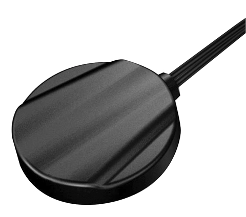
The MEA-GNSS-LTE-MM is a two-in-one low-profile antenna solution that combines GNSS and LTE antennas in one. It is suitable for asset tracking as well as industrial and internet of things (IoT) applications. The antenna offers an ultra-low profile rugged IP67-rated design with a magnet mounting and customizable cables and connector options. The small size makes it a desirable solution for covert installations.
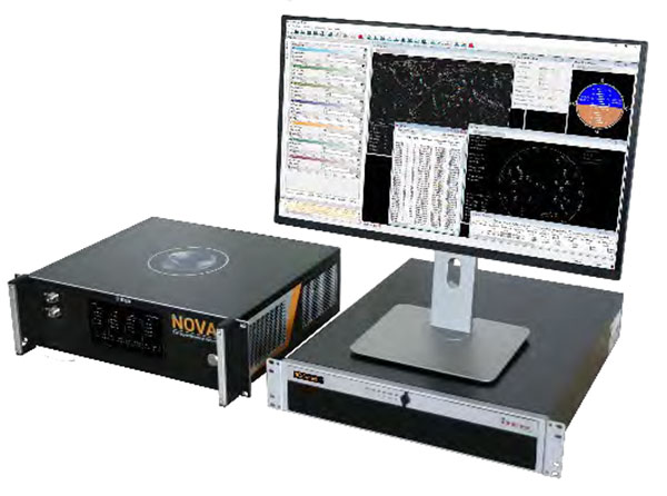
The NCS Nova GNSS simulator now fully supports the simulation of Galileo Open Service (OS) signal improvements based on the new Galileo OS SIS ICD V2.0. The NCS Nova GNSS simulator is a high-end, powerful and easy-to-use satellite navigation testing and R&D device, the company said. It is fully capable of multi-constellation and multi-frequency simulations for a wide range of GNSS applications. It provides multiple GNSS frequencies in one box. A key enhancement to the NCS Nova GNSS simulator is comprehensive support of new Galileo OS signal message improvements on E1B. By enabling real-time simulation of the Galileo OS message improvements, the NCS Nova GNSS Simulator expands the user’s Galileo signal capability.
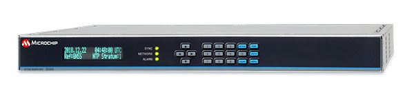
The SyncServer S600 Series network time server and instrument is now integrated with BlueSky technology signal-anomaly detection software. With the upgrade, the SyncServer S600 Series now provides GPS jamming and spoofing detection and protection, in combination with local radio-frequency data-logging and analysis. The Stratum 1 instrument continuously monitors local GPS constellation health and examines GPS and local RF signal integrity to assure validity. If an anomaly is detected, the solution sends an alarm and, if necessary, the SyncServer instrument can be shifted to alternative time sources or an internal oscillator. This protects ongoing timing outputs while ensuring only minimal, predictable timing degradation to vital network and business operations in applications ranging from banking and stock trading to electric utilities and aerospace and defense.
Microchip Technology, microchip.com
L1+L5 receiver
Provides fast updates, multipath resistance
Photo: Telit
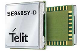
The SE868SY-D is a multi-frequency, high-precision GNSS receiver module for applications that require high accuracy, fast updates, multi-constellation support and multipath resistance. At 11 x 11 mm, the SE868SY-D accommodates ultra-compact devices and internet of things (IoT) trackers. Available now, the high-precision SE868SY-D module is Telit’s first multi-frequency, multi-constellation GNSS receiver module, featuring an ultra-sensitive -167 dBm (tracking) RF front end. By using both the L1 and L5 bands, the SE868SY-D supplies a higher location accuracy than single-frequency devices, even in high-multipath environments such as urban canyons.
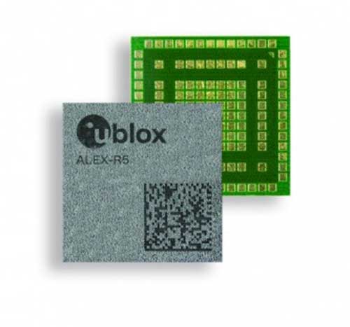
The ALEX-R5 miniature cellular module integrates low-power wide-area connectivity and GNSS technology into an ultra-small system-in-package (SiP) form factor. It is based on the secure UBX-R5 LTE-M/NB-IoT chipset platform with out-of-the-box Secure Cloud functionality and the u‑blox M8 GNSS chip for location accuracy. It has a 14 × 14-mm footprint and 23-dBm cellular transmission power, enabling devices to operate effectively in all signal conditions. A dedicated GNSS antenna interface enables independent, simultaneous operation of the u‑blox M8 GNSS chip. The ALEX-R5 is suitable for wearables and connected medical devices.
The TSC5 is a rugged, lightweight field data controller for land construction and surveying. Its backlit alphanumeric keypad is usable while wearing gloves. The battery provides all-day power on a single charge, with an optional external battery nearly doubling the power for extended use. It has a lightweight, ergonomic design and is suitable for rugged environments, with resistance to shock, dust and water. Running on the Android 10 operating system, the TSC5 is fully integrated with Trimble Access 2021 Field Software and Siteworks Software as well as Trimble Forensics Capture. The EM100 Empower module provides GNSS connectivity.
INSITE is a comprehensive cloud-based platform that enables users to more efficiently manage geospatial data, from acquisition to delivery. With applications designed for electric utilities, telecommunications and governments, INSITE provides tools to support the entire geospatial data lifecycle — project tracking, data collection and delivery, quality control, on-demand reporting, analytics and enterprise integration. INSITE enables users to import, search, analyze, manage, integrate and export all types of geospatial data and multimedia. As a cloud-based platform, INSITE improves speed and efficiency, minimizes storage expenses and supports greater collaboration.
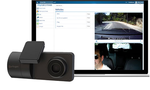
The Surfsight AI-12 camera solution is designed to help improve fleet safety through its continuous recording and advanced machine vision (MV) and artificial intelligence (AI) technology. Offered by Lytx, it integrates with Geotab’s telematics platform to provide fleets with insight into driver behavior through a combination of MV+AI, sensors, and live video streaming. The Surfsight AI-12 provides distracted driving detection, audio and visual alerts and the ability to connect auxiliary cameras. Its MV+AI technology can help identify risky driving behaviors including smoking, eating and drinking, handheld device use, unbelted driver and distracted driver. When connected with Geotab’s GO9 device, it can also capture video evidence of sudden acceleration, sharp turns and harsh braking. Through access to these insights, fleet managers can help prevent avoidable accidents and reduce the likelihood of driver or pedestrian injury, insurance claims, maintenance costs and downtime.
Suitable for rolling stock, automotive and heavy-duty applications
Photo: Eurotech
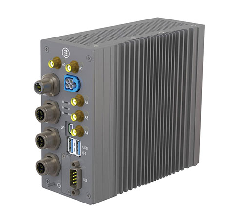
The BoltGPU 10-31 is a GPU-accelerated subsystem for machine vision and artificial intelligence (AI) applications at the edge and on vehicles. The BoltGPU 10-31 provides multi-constellation GNSS with untethered dead reckoning for geolocation. A factory option for high-precision real-time kinematic (RTK) GNSS is available. It also has Wi-Fi 6, Bluetooth 5.1 and option for LTE cellular. It is powered by NVIDIA Jetson Xavier NX and combines a 6-core, high-performance ARM CPU with a 384-core GPU and 48 Tensor Cores, offering power efficiency and accelerated computing. The rugged, fanless unit allows for simultaneous execution of neural models and the processing of multiple high-resolution, high-frame-rate sensors, even in harsh environments.
High-frequency change management for map platforms
Screenshot: Carmera
Carmera’s Change-as-a-Service (CaaS) uses consumer-grade cameras from its fleet partners and customer vehicles to detect and log changes, reducing the cost of map maintenance. With a network of commercial fleet–mounted visual probes, it overcomes the problem of GPS canyons in urban areas using a blended algorithm to localize its auto-based probes with pinpoint accuracy. CaaS is designed to be an add-on to existing map systems (both HD and SD), and will identify, analyze and localize both road inventory changes and traffic-impacting events, such as construction. A live sandbox has launched in the San Francisco-Silicon Valley area for companies to test the CaaS technology on real urban and suburban streets.
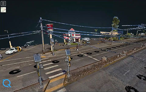
Parkopedia is designed to address challenges in navigating indoor parking facilities: system blackouts, finding a vehicle within large parking facilities, and locating services such as EV charging stations. Parkopedia provides indoor maps based on high-definition 3D models of indoor parking facilities for in-vehicle navigation. Parkopedia technology can also be used for automated valet parking. Its proprietary SLAM system integrates lidar, IMU, GNSS and high-resolution imagery.
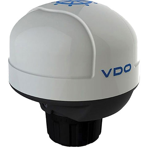
The Acqualink NavSensor can be used with any multifunction N2K-networked multifunction display. Its GPS receiver module provides position, speed and vector data, and UTC time. The inertial sensor delivers pitch and roll data. An integrated fluxgate compass with a +/- 40° tilt angle delivers course heading and the information needed by a networked autopilot to stay on course. Built-in barometer and air temperature sensors offer indicators of impending weather changes. The radome has an IPX6 extended protection rating. It is powered by the NMEA network and operates between –4° and 158° F.
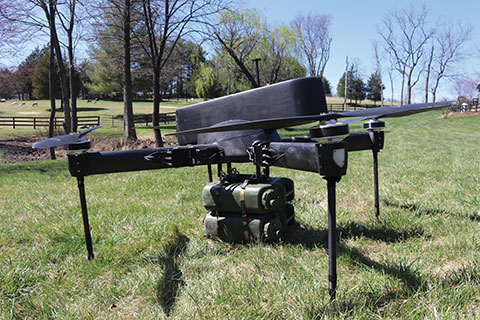
The Periscope tactical-grade UAV provides efficiencies in flight time, endurance and payload capacity. Designed for military and other federal government customers, the high-performance UAVs accomplish mission-critical tasks with speeds of up to 100 mph. They are optimized for specific mission requirements including tactical resupply, remote communications, and enhanced C4ISR. In September, Periscope Aviation won a contract to deliver prototype Tactical Resupply Unmanned Aircraft Systems (TRUAS), which the U.S. Marine Corps will field test at Yuma Proving Grounds this year. The UAVs will fly 60–90 pounds of cargo to locations 10–20 kilometers away, delivering supplies such as food, water, fuel and ammunition to marines on the front line.
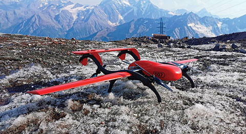
The Fixar 007 is a vertical takeoff and landing commercial drone with primary application in the mapping and surveying, monitoring, mining, oil and gas, energy and agricultural sectors. The intuitive approach to working with its ground control station simplifies use (flight preparation is estimated to take only 5 minutes). With inertial orientation, the Fixar 007 can work stably under magnetic anomalies and in the event of satellite loss. A wide range of modifications is available. The Fixar 007 uses a closed, specially designed hardware and software system that guarantees security of information. The applications and UAV use a special communication protocol that eliminates control interception.
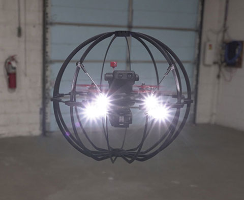
Skycopter is a ready-to-fly UAV designed to work in extreme conditions and tight spaces. The drone is enclosed and protected by an external ultra-light and ultra-resistant cage to ensure safety and avoid damage to inspected structures and to the airframe itself. The Skycopter‘s tiltable camera can record 1920 x 1080 video at 60 FPS while sending latency-free images to the ground in 5.8 GHz for first-person view on a display or (optional) high-definition goggles. It uses an ultra-bright LED system for applications in complete darkness. The Skyloc real-time location and monitoring system provides control and tracking with high accuracy in indoor scenarios or where GPS is not available.
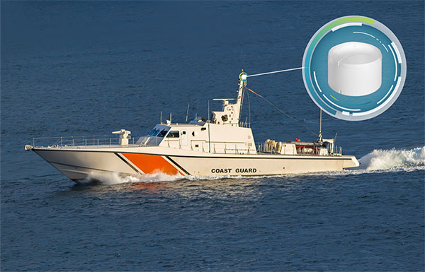
The GAJT-410MS provides anti-jamming to marine vessels. (Image: NovAtel)
Hexagon | NovAtel has released the GAJT-410MS in response to the increase of interference and jamming in marine environments worldwide. The GAJT-410MS is the company’s latest addition to its proven GPS Anti-Jam Technology (GAJT) for the commercial and defense marine markets.
The low size, weight and power (SWaP) variant protects civil and military operations from interference and jamming, with jammer direction-finding capabilities for enhanced situational awareness in the marine environment.
The GAJT-410MS provides dynamic protection on both GPS L1 and L2 bands, as well as Galileo E1, QZSS L1 and L2 and SBAS L1 to combat intentional and unintentional interference. If a vessel experiences jamming, the device’s direction-finding capabilities provide improved situation awareness of their RF environment to identify and locate the source of the jamming signals.
The commercial off-the-shelf, non-ITAR solution is easy to install or retrofit onto existing fleets, enabling assured PNT for continuous operations, cybersecurity and safe navigation at sea, NovAtel said.
Interference, both benign and malicious, is a challenge facing civilian and military operations. Commercial marine applications like shipping, tankers and bulk carriers are under threat from interference targeting their navigation and cybersecurity. Without assured positioning, these vessels can drift off-course and place the vessel, crew and cargo at risk.
Nearshore marine applications like survey, construction and piloting also require reliable positioning for uninterrupted operations in crowded waterways and RF environments. Interference mitigation and jammer direction-finding for advanced situation awareness ensure users acquire assured positioning, navigating and timing (PNT) while identifying and limiting risk from interference sources.
“Assured navigation and cybersecurity defenses are growing priorities for marine users as global threats from interference and jamming increase,” said David Russell, marine segment portfolio manager for Hexagon’s Autonomy & Positioning division. “The GAJT-410MS is an anti-jam solution protecting vessels from interference and jamming disruptions to ensure continuous operations wherever your application takes you. With GAJT, your position, navigation and timing are protected and assured.”
The GAJT-410MS is the latest iteration of proven, high-performance anti-jam products from NovAtel. It includes flexible mounting options, jammer presence and direction-finding capabilities for advanced situation awareness.
After 15 years of planning and development, the ShakeAlert earthquake early warning system is now available to more than 50 million people in California, Oregon and Washington, the most earthquake-prone region in the conterminous U.S.
ShakeAlert provides alerts to the general public through public alert systems such as TV, radio and mobile phones. It also slows down trains, opens firehouse doors, closing water and gas valves and
May’s addition of Washington State to the system completes the U.S. Geological Survey and partners’ West Coast rollout of ShakeAlert.
ShakeAlert first launched in California in 2019 and expanded to Oregon in March of this year. People in all three states can now receive alerts from FEMA’s Wireless Emergency Alert system, third-party phone apps, and other technologies.
The ShakeAlert system relies on sensor data from the USGS Advanced National Seismic System. ANSS is a USGS-facilitated collection of regional earthquake monitoring networks operated by partner universities and state geological surveys on the West Coast and throughout the nation.
Part of that data comes from GPS, which the USGS uses to measure crustal deformations over time. The USGS measures the precise position (within 5 mm or less) of GNSS stations near active faults relative to each other.
USGS works closely with ANSS partners and state emergency management agencies on the system’s development as well as public communication, education and outreach. “USGS science is the backbone of hazard assessment, notification, and response capabilities for communities nationwide so they can plan for, and bounce back from, natural disasters,” said David Applegate, associate director for Natural Hazards Exercising the Delegated Authority of the USGS Director.
“Systems powered by ShakeAlert can turn mere seconds into opportunities for people to take life-saving protective actions or for applications to trigger automated actions that protect critical infrastructure,” Applegate said. “An effort like this takes the dedication, ingenuity and hard work of dozens of partners with the same vision, and the USGS is proud to have been part of a collaborative team that made this robust public safety system available for millions of citizens on the West Coast.”
The ShakeAlert earthquake early warning system can save lives and reduce injuries by giving people time to take protective actions like drop, cover and hold on before potentially dangerous earthquake shaking arrives at their location.
In addition to supporting public alerts to mobile phones, ShakeAlert system data has, since late 2018, been used to develop applications that trigger automated actions. Automatic actions can be used to slow down trains to prevent derailments, open firehouse doors so they don’t jam shut and close valves to protect water and gas systems.
The technology will continue to improve over time with the addition of more seismometers to the network, by expanding alert delivery area and by improving messaging speeds.
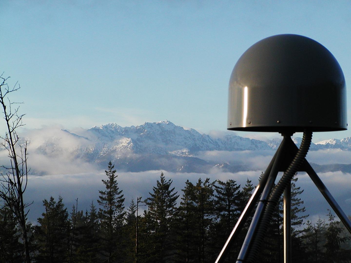
A GNSS station in the Pacific Northwest geodetic array. (Photo: Central Washington University)