Anritsu Corporation and Orolia announce immediate support of assisted GPS (A-GPS) test functionality to meet 5G New Radio (NR) Carrier Acceptance Testing (CAT) requirements for multiple North American operators on the Anritsu ME7834NR 5G mobile device test platform.
As part of the strategic partnership between the two companies, Anritsu leverages Orolia’s GNSS simulation capabilities to deliver A-GPS CAT testing platforms featuring the new Orolia GSG-SKY-ANR solution. The Anritsu MR7834NR supports A-GPS, FR1, FR2, FR1+FR2 NSA and SA US operator signaling requirements on the same platform.
The ME7834NR 5G NR mobile device test platform. (Photo: Anritsu)
The A-GPS simulation component of Anritsu’s ME7834NR-based test solution leverages Orolia’s GSG-SKY-ANR simulation platform. The GSG-SKY-ANR is powered by Orolia’s award-winning SKYDEL simulation engine, which delivers flexible, scalable, and efficient GNSS/GPS simulation solutions. The GSG-SKY-ANR GNSS simulator is exclusively available to Anritsu ME7834NR customers.
Anritsu ME7834NR A-GPS-enabled solutions for 5G NR CAT requirements are available immediately. The test solutions support the rollout of nationwide 5G networks by helping to ensure device compliance and optimum operability.
“Anritsu continues to address the needs of our customers globally,” said Shinya Ajiro, general manager of Anritsu Corporation. “By partnering with Orolia, a worldwide leader in GPS simulation technology, we are introducing a reliable, accurate, and cost-effective A-GPS CAT solution that conforms to operator requirements and delivers repeatable results. We remain committed to provide the validation tools necessary for mobile operators, device makers, chipset manufacturers, and test houses to verify designs and ensure product performance. This benefits everyone in the mobile ecosystem.”
“Orolia is proud to support North American operators through our partnership with Anritsu,” said Lisa Perdue, simulation director at Orolia. “Our resilient GPS simulation solutions deliver proven high-end capabilities for critical technology challenges such as the implementation of 5G.”
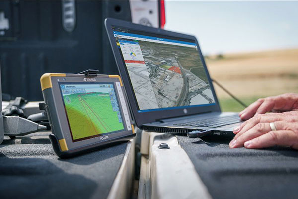
Survey and construction software suite MAGNET7 is now available from Topcon, using cloud-based connectivity to streamline workflows through GNSS receivers and other equipment.
Photo: Topcon
Survey and construction software suite MAGNET 7 is now available from Topcon Positioning Group.
MAGNET7 uses cloud-based connectivity to streamline workflows through GNSS receivers, total stations and other positioning tools and instruments. It addresses common needs to increase productivity, efficiency and profitability levels across the job site.
The software is also designed to improve accuracy while efficiently managing data and collaboration — in real time — with the project team.
Enhancements in the MAGNET7 field version improve 3D model support, reporting and interactivity in working directly on a visual map. Also improved is data handling for large and complex 3D projects.
Productivity features include an ability to connect to the newest version of the Sitelink3D job-site monitoring and management system. This enables office personnel to send machine models via the web portal directly to machines on site.
The new connection also allows access to the Haul Truck app, which dramatically improves efficiency in the mass-haul environment by sending real-time data — including haul volumes and truck locations — directly to the master schedule.
MAGNET7 provides new capability for calculating the International Roughness Index (IRI), a valuable indicator for resurfacing projects. The IRI data exports directly to ProVAL formats, commonly used in the paving industry, to report and validate road-surface smoothness against government guidelines.
Also provided are enhanced terrain-modeling capabilities for surveyors and an overall increase in file-type capability.
Addressing COVID-19
COVID-19-related demands placed on construction and survey professionals underscore the need for comprehensive, integrated software solutions to meet those challenges head on, according to Alok Srivastava, senior director, product management.
“The push to ramp up production levels and increase efficiency, while operating profitably, has never been greater,” Srivastava said. “Our suite — made up of field software, cloud services, tightly integrated office software and third-party integrations — is a key component of our digital ecosystem, all designed to enhance productivity in the field while helping the office efficiently manage the project dataset. It does so by tapping the power of integrated solutions to provide end-to-end workflows, superior data exchange and a far better level of collaboration.
“We’ve long recognized that many of the basic needs and challenges of today’s survey and construction disciplines are similar. With that in mind, this solution provides compatible, comprehensive, connected answers to many of those shared issues.”
“The need for digital connectivity, both on site and between the office and the job site, has never been greater,” Srivastava said. “With the continued push toward digitization in all facets of their jobs, today’s construction and survey professionals regularly risk loss of efficiency — and the financial costs associated with it — due to issues of incompatibility between equipment and systems. This upgrade of the MAGNET suite of productivity solutions takes connected field and office management to a new level, making the long sought-after ‘end-to-end workflow’ a reality while helping projects stay on schedule and under budget.”
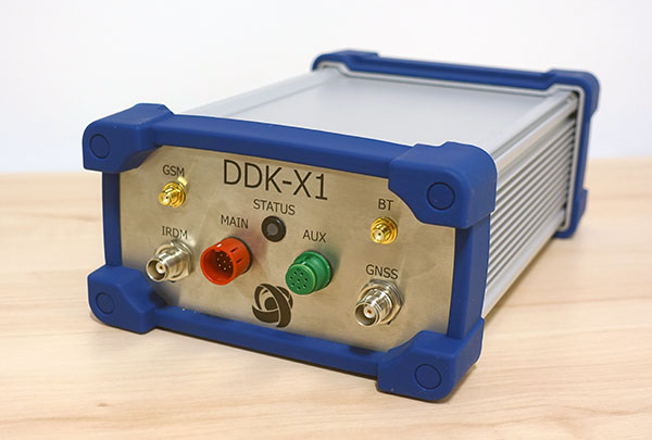
DDK Positioning’s precise GNSS positioning solution provides an accuracy of less than 5 cm
NSSLGlobal has entered a strategic alliance with DDK Positioning, to incorporate enhanced GNSS positioning navigation and timing solutions into NSSLGlobal’s maritime portfolio.
NSSLGlobal will now provide, install and service DDK’s GNSS precise point positioning (PPP) solution which enhances the ability of NSSLGlobal’s customers to precisely locate and track their assets.
DDK’s independent GNSS technology is provided exclusively through Iridium’s global satellite constellation, and creates a robust, resilient and completely independent GNSS solution that has an enhanced accuracy of less than 5 cm, compared to the standard GPS accuracy of 10 m.
“This partnership is a fantastic fit for DDK Positioning,” said Kevin Gaffney, DDK Positioning CEO. “We are now in a place to provide our clients with our precise positioning solutions globally and we are delighted to formalize our working relationship with NSSLGlobal with the signing of this new strategic alliance.
Photo: DDK Positioning
“To continue the journey with such a strong and well-respected company such as NSSLGlobal, and with their reach in the market, makes great sense and we are looking forward to the journey that we will have together.”
“DDK Positioning is leading the field in advanced GNSS positioning,” said Paul Rutherford, service director, NSSLGlobal. “We’re pleased to partner with such an innovative company and to be able to add this technology offering on top of the already extensive navigation and communication portfolio we offer our customers. The system will provide greater location accuracy, along with the ability to help detect and mitigate spoofing.”
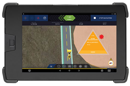
The Trimble GuidEx machine guidance system is an advanced navigation solution to guide machines along route corridors or to specific target areas.
Photo: Trimble
Trimble has introduced the Trimble GuidEx Machine Guidance System, an advanced machine navigation solution intended to quickly and efficiently guide machines along route corridors or to specific target areas, while providing local awareness using customer-provided mapping or engineering data to create exclusion and inclusion zones.
Trimble GuidEx uses an integrated GNSS and inertial navigation system (INS) to compute a virtual reference point and precise heading, pitch and roll.
Users can install the Trimble GuidEx system on anything from utility terrain vehicles (UTVs) to heavy equipment, on- or off-road.
Trimble GuidEx provides streamlined design-stakeout navigation that eliminates the need for advance survey stakeout operations. This enables machine operators to navigate to an exact point without stakes or surveyors, such as for core-sampling operations.
Corridor navigation allows users to efficiently complete a range of tasks including clearing paths for access routes and plowing snow. With comprehensive local machine data-logging, contractors can capture a range of data including position, time and speed.
“Trimble GuidEx was built to meet the needs of natural resource exploration activities, but can be used for many other applications,” said Scott Crozier, vice president of Trimble Civil Construction. “This system improves productivity and awareness with easy, efficient, task-specific navigation.”
To ensure work is done exactly where it should be, proximity and zone breach alarms can be set based on custom exclusion and inclusion zones.
Regardless of the equipment or the application, Trimble GuidEx uses customer-provided data to keep operators aware of prohibited or dangerous areas and decrease time and money wasted on unnecessary work.
Trimble GuidEx provides crossline navigation along predefined routes via an integrated software-based lightbar viewed on the display, including visual and audible alarms when operators breach user-defined distances from a centerline. The system also provides point and pad navigation information with intuitive navigational arrows, supported by a wide variety of data recording settings.
Compatible with virtually any machine type, Trimble GuidEx connects equipment to the office to keep everyone aligned. Operators and supervisors can send mapping data to and from the machine and office to avoid rework.
Reliable guidance data allows contractors to track machines by time or user-defined event triggers for a more accurate representation of the machine utilization cost of a project. Trimble GuidEx can leverage real-time kinematic (RTK) and CenterPoint RTX correction services for enhanced high-accuracy positioning.
Geospatial data is key to logistics, including for the huge increase in e-commerce we are experiencing following the 2020 COVID-19 shutdown.
The best customer service is if the customer doesn’t need to call you, doesn’t need to talk to you. It just works. — Jeff Bezos
This past year has been a boon for the e-commerce industry. It increased from 4% of retail sales a decade ago and pushed past 20% in 2020, reaching nearly $800 billion — a 32% jump in 10 years.
Online businesses climbed to all-time highs. A few examples stand out. Amazon’s stock increased in value 83% over the course of last year. That type of growth happens with startups and small-cap companies but is usually unheard of with large blue-chip stocks.
Along with Amazon’s growth last year, FedEx had $69 billion in annual sales. DoorDash, an e-commerce food delivery company, has a market valuation of $45 billion, making it larger than Domino’s Pizza, Texas Roadhouse and Yum! Brands combined; and Yum! Brands owns KFC, Pizza Hut and Taco Bell.
The e-commerce global trend in online sales is expected to reach $4.9 trillion in four years based on only 2.14 billion online shoppers. That is less than one-third of the world’s population. There is a lot more room to grow. This past year moved the trend several years forward.
Where are all those goods stored?
Photo: Navy Petty Officer 2nd Class Jasen Moreno-Garcia/U.S. Navy
Each consumer requires an average logistics space of 35 square feet. In the United States alone, there are more than nine billion square feet of warehouse space, and when online sales increase another 10% it will require 3 to 4 billion square feet more of space to keep up with demand.
The increase in freight driven by this trend is captured in the chart below published by the Federal Reserve, with data provided by the U.S. Department of Transportation. The blue line is increasing freight transportation services, while the red line indicates on-hand inventories.
As transportation increases and becomes more reliable — a reflection of the overall health of the logistics supply chain — the amount of on-hand inventory decreases, allowing sellers to free up space and save money, or offer greater variety knowing that stocks can readily be backfilled.
However, when inventories get too low, the system is subject to severe supply shocks, making prices more sensitive to the law of supply and demand. The grey-shaded areas on the chart are economic downturns officially recognized as recessions.
If delivery took six-to-eight weeks these days, it would signal a crisis somewhere in the world.
21st-century logistics
Goods from global corporations now arrive at each customer’s doorstep. This is 21st-century logistics. Home delivery in two days or less is the expectation. The compression of time in this industry is astounding when compared to “the way things used to be.” The way things are compared to the way things used to be reminds me of hearing my grandparents talk about life before automobiles.
Back in my day, ordering from a catalog required calling the company and speaking to a representative. The call had to be made from a corded landline, and long-distance charges might apply. If ordering a gift for someone in the household, it was difficult to be clandestine with everyone nearby. The other option was to mail in an order form. Either way, delivery took a minimum of six to eight weeks, and sometimes more. If delivery took that long these days, it would signal a crisis somewhere in the world.
Knowing where to pre-position supplies ahead of anticipated demand is a geospatial problem. Most think of this in terms of sales to customers and deliveries ahead of seasonal demands, but many countries in the world are facing this dilemma right now figuring out the best way to distribute COVID-19 vaccines. That challenge is taking place in your own community and has been a long-standing public health challenge.
Beginning in the mid-2000s, geospatial information systems (GIS) were brought in to help control outbreaks of the deadly Ebola virus. In 2014, I took a Penn State geospatial intelligence course. The final exam addressed the geospatial challenges of fighting an epidemic. Theoretically, it was difficult to get the required goods to the right place at the right time. But now, it’s not an exercise, and getting it right is not an option.
If you have received the COVID-19 vaccine, you can appreciate the pharmaceutical industry for developing vaccines in record time. However, getting the vaccines to everyone is a logistics challenge, and GIS is the unsung hero. Logistics is the life blood of empires — it is the game of kings and generals. With it, wars are won and commonwealths prosper; without it, empires crumble to dust.
How Geospatial Data Guides the Goods
Back to the traditional understanding of supply chains from seller to buyer. The needs of the buyer are simple: faster, better, cheaper. For the seller, it is much more complex, and considerations deal heavily with location.
Where is the best place to have a distribution center?
Is it more important to be close to a multi-modal transfer station, or to population centers, or are land prices more important?
What about access to highways?
What are the trade-offs in delivery times being further away from the population?
Is the trade-off worth it for the cost of land and lower taxes?
Geospatial data can answer all of these questions, even going so far as to run “what-if” scenarios.
At the local level, transportation logistics schedules the most efficient routing to deliver more packages along the shortest path. This saves time and fuel, as shown in the image below using Maptitude software. Radiuses can also be calculated based on drive times instead of distances.
Caliper truck routing software can be used for planning deliveries that account for vehicle capacities, time windows, multiple depots and more. (Image: Caliper)
Navigation routing applications are dynamic, and pick-ups are automatically routed to drivers while out on delivery runs. Dynamic routing avoids delays such as accidents and road closures.
This same type of technology is used for emergency services to respond to a call. Ambulances, police and fire trucks all use dynamic routing to get to distress calls as soon as possible.
Global transportation logistics also need to account for international laws and regulations as cargo passes through each country. These regulations can be onerous, but the logistics industry has worked out the legalities to ensure a seamless, uninterrupted flow from ship to train to airplane to truck and to final delivery. It is symbolized by the universal 40-foot international shipping container standardized throughout the world.
At each facility, inventories are tracked. Each item passing through receives a time and location stamp. Estimated delivery times are sent via text message to your mobile device or email. When the item is out for delivery, it is possible to watch it on a map as the delivery truck makes its way towards your location. When the item is delivered to your doorstep, a picture of it is sent to your phone with an alert that the package was delivered.
Only a few days earlier, the manufacturer — perhaps on the other side of the world — placed the item in a box and taped it shut; even though you ordered it in your language, the order received by the manufacturer was in their language. The package started its journey to you at the next scheduled pickup, maybe within an hour of you placing the order. Shortly afterward, your order was on a ship or an airplane. As you went about your usual business, the incredibly efficient system of e-commerce sped your package around the world to deliver it to your doorstep.
Logistics has undergone a revolution built upon the most advanced technological innovations: robotics, artificial intelligence, machine learning, mobile devices, cloud computing, electronic payment processing, and a vast geospatial framework.
In fact, it is a continuously operating, seamless, geospatial mesh running on a global scale across all time zones that allows the industry to function. Every aspect of the logistics supply chain relies upon GIS in some way, from land, air and sea navigation from global location-based systems down to inside a warehouse for storage and retrieval of merchandise. Modern-day logistics is a geospatial industry connecting goods and services to consumers, putting the GIS in lo-gis-tics.
Image: U.S. DOT
Can GIS predict the future?
Regarding whether GIS can predict a market correction… I’ll not make a prediction, but the Transportation Services Index (TSI) for March is due to be released today, May 12. If it is down from February, it would mean two months of back-to-back decline. April’s numbers won’t come out until June. However, here is an indicator of where things currently stand. The ports of Long Beach and Los Angeles, CA, the largest shipping ports in the United States is five days behind schedule, which is down from over 10 days in January.
The TSI is a leading indicator of the economy. When 20% of sales are online in a consumer-based economy, the wellbeing of the commonwealth is measured one delivery at a time.
“Trade isn’t about goods. Trade is about information. Goods sit in the warehouse until information moves them.” — C. J. Cherr
William Tewelow
William Tewelow works for the Federal Aviation Administration. He is a graduate of the FAA management fellowship program. He served on special assignment to the U.S. Department of Transportation leading a national strategic geospatial initiative for the White House Open Data Partnership. He is a Geographic Information Systems Professional (GISP) and a speaker for the Maryland STEMnet Scholar program.
He was among the first in the nation to earn a Geospatial Specialist Certification from the U.S. Department of Labor while working at NASA Stennis Space Center. He has degrees in Geographic Information Technology, Intelligence Studies, and is completing a masters degree in Organizational Management.
William is a 23 year veteran for the U.S. Navy serving as a Geospatial Specialist, Imagery Intelligence Specialist, a Naval Aviator, a Meteorologist, and a Tactical Oceanographer. He is married, enjoys writing and traveling.
His favorite quote is, “A man’s mind changed by a new idea can never go back to its original dimension.” — Oliver Wendell Holmes
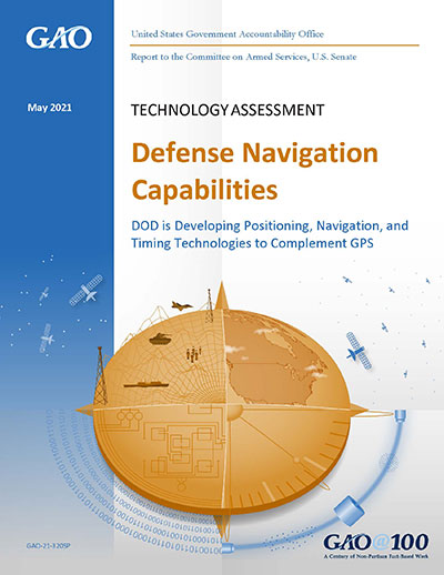
It said policymakers “could consider selecting the most resilient technologies as the cornerstone of the PNT suite for military missions, rather than defaulting to GPS.”
The 51-page report takes a comprehensive view of alternative PNT policy and leadership across the department. Its findings are an interesting and informative look at issues and efforts.
Increasing demands
The report comes at a time when U.S. forces have been seeing increasing interference with their own and allied GPS-enabled systems. The Organization for Security and Cooperation in Europe has regularly reported that its surveillance drones in the Ukraine have been jammed. Chinese press recently bragged that jamming caused U.S. Navy ships in the South China Sea to switch from using GPS to the Chinese BeiDou system. Additionally, U.S. military commanders have regularly described the Middle East as the most contested electronic warfare area on the planet, in large part because of regular interference with GPS signals.
The GAO study also comes on the heels of a provision in the National Defense Authorization Act (NDAA) for this year which directs DOD to provide non-GPS PNT to combatant commanders by 2023. The act says this timeline is consistent with responding to Joint Urgent Operational Needs, a formal method for commanders to communicate with department leadership. According to some sources, this suggests that the Pentagon has been receiving such requirements from field commanders, but has not responded to them in what Congress considers a timely manner.
Alternative PNT “not a priority,” resisted
Despite chronic GPS signal interference across the globe, outside experts and officials across the DOD told the GAO study team that developing alternative sources of PNT was not a priority for DOD. One example cited was the lack of a central program office.
One expert said, “PNT — It’s everyone’s need, but nobody’s business.” Another expert said, “Everyone wants to use [PNT], no one wants to pay or care for [PNT].” One DOD official characterized alternative PNT as an afterthought. DOD’s PNT Roadmap states that PNT capabilities, despite being mission critical, are not normally considered a key requirement, but rather may be treated as “a second-tier requirement.”
Worse, the report indicated that some forces within the department resist alternative PNT efforts.
According to one DOD official cited anonymously in the report “bureaucratic and political obstacles [represent] the biggest challenges for alternative PNT” and “anything that threatens GPS, such as alternative PNT technologies, faces pushback.”
The report cited another DOD official as agreeing that “there is an impression that the GPS program has a lot of political clout within DOD, and that those trying to develop alternative PNT technologies may face political challenges.”
Realistic requirements
Many missions do not need the accuracy provided by GPS, according to the report. Nevertheless. DOD programs often default to GPS performance standards when developing requirements. Many alternative technologies, while more resilient, are unable to achieve the same accuracy as GPS and therefore fail to meet the over-stated requirements.
Open architecture
Both DOD and GAO see development of modular open system architecture (MOSA) as key to PNT success in the future. This will allow addition of new PNT sources to a platform without the need for a major retrofit. With MOSA, all that would be needed is a new sensor module for the desired PNT source.
The GAO report endorsed this approach and encouraged DOD to institutionalize it with dedicated funding.
Working with industry
Decades of civil GPS use have benefited DOD in many ways. Broad academic and commercial research has resulted in a host of applications and improvements in the size, weight, and power requirements of equipment, as well as lowered costs. These benefits would almost certainly not have been realized at the current scale if the market for GPS equipment and apps had been restricted to military users.
The 2021 NDAA directs the department to “…enable civilian and commercial adoption…” of the GPS alternative technologies it develops for field commanders. The GAO report suggests DOD also work to leverage industry advances in technologies.
Scope and recommendations
GAO’s tasking for this effort did not include examining efforts to make GPS signals and equipment more resilient to disruption, nor use of non-U.S. satellite navigation systems. Neither were non-defense uses of PNT, nor improvements in such things as tactics, techniques, and procedures considered.
The study focused solely on department efforts to complement GPS services.
Six recommendations for policymakers are included in the report:
Increase Collaboration — Consider mechanisms to coordinate across DOD to clarify responsibilities and authorities in prioritizing the need for alternative PNT technologies.
Focus on Resiliency — Consider selecting the most resilient technologies as the cornerstone of the PNT suite for military missions, rather than defaulting to GPS.
Clarify Requirements — Consider opportunities to clarify what level of PNT performance is actually needed for missions, rather than defaulting to requirements that match GPS performance.
Coordinate with Industry — Consider ensuring that DOD and commercial industry coordinate so that industry is prepared to meet DOD’s needs, and DOD can leverage industry advances.
Institutionalize Open Architecture — Consider making the open architecture initiative more permanent, including providing funding.
Analyze Vulnerabilities — Consider having DOD conduct ongoing analysis of vulnerabilities of different PNT systems.
The May 2021 GAO report “Defense Navigation Capabilities: DOD is Developing Positioning, Navigation, and Timing Technologies to Complement GPS” is available here.
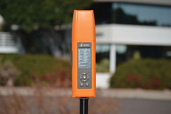
The new display can be easily read in sunlight. (Photo: Bad Elf)
When survey receiver maker Bad Elf set out to make its new Flex device, they knew they had to make the battery last longer. But the device’s screen was eating up power, shortening surveyors’ time in the field.
“As we were building out the idea for Bad Elf Flex, we knew surveyors wanted four things: sunlight readability, a backlight for night visibility, ability to read the screen from a distance of one meter, and a long battery life,” explained Larry Fox, vice president of marketing and business development at Bad Elf. “We found many different display types, but they were all power hungry and not a great fit for surveyors who need to be in the field for a full day.”
After researching options, Bad Elf determined that transflective display technology could offer the power savings and visibility required. The Flex uses Azumo’s reflective LCD technology — a sheet of plastic the width of a human hair. Adhered to the device’s screen stack, it uses a front light instead of a power-hungry back light. The change allows for 90% energy savings.
The new Flex is popular with Bad Elf customers. “They’re getting the kind of quality they want in a high-end receiver, with the affordability they desire. It’s easy to see in the sun, and compatible with a wide variety of apps,” Fox said.
There’s strength in numbers. That’s why antenna systems are increasingly upgrading from single-input/single-output (SISO) architectures to multiple-input/multiple-output (MIMO).
Whether it’s military communications, public safety, smart meters or smartphones, more antenna elements increase channel capacity, reduce transmitting power and increase resistance to multipath fading.
But the smaller the device, the more challenging MIMO becomes from a design perspective, such as providing ample isolation between each antenna element.
The Pantheon MA750 antenna. (Photo: Taoglas)
That’s key for ensuring that they don’t interfere with one another, which would reduce channel capacity and system performance. For example, the Taoglas Pantheon MA750 is just 85.7 mm tall, with a 145.6 mm diameter, yet its five antennas have 20 dB+ of isolation.
Three additional key features to look for are high radiation efficiency, low envelope correlation and a built-in ground plane, which provides the flexibility to mount the antenna on metal or plastic without affecting performance.
For applications with long cable runs, such as 10 m, low-loss cables are critical for ensuring that a MIMO antenna can establish and maintain a reliable connection. If the antenna is likely to get wet or struck, it is best to use models with IP67 housings made with ultra-durable materials, such as Wonderloy PC-540 PC/ABS alloy.
Enova Robotics makes security robots. “At Enova Robotics, we know reliability is imperative when you are in the business of security and surveillance. That’s why we chose to work with Taoglas and chose their Pantheon MA750 for our PGuard Robot,” said Ahmed Dimassi, production and supply manager, Enova. “This unique antenna delivers powerful MIMO antenna technology, and we knew we could rely on their team to reduce the risks and time associated with integrating it into our technology.”
GPS-based navigation tool with multi-band GNSS provides reliable, accurate heading and position information
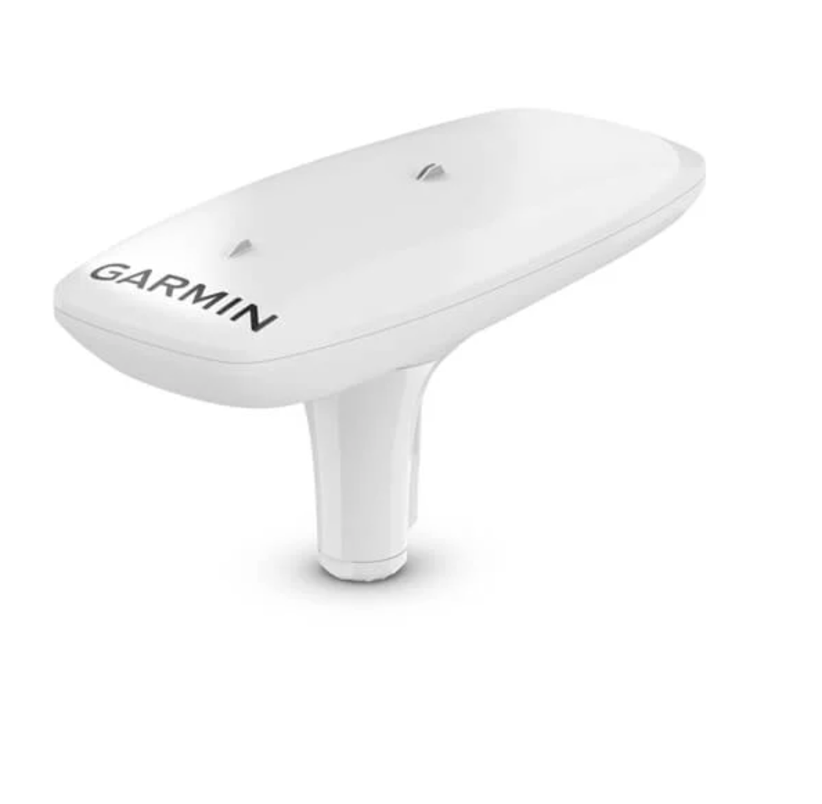
Garmin International Inc. has launched the MSC 10 marine satellite compass with multi-band GNSS and a fully integrated attitude and heading reference system (AHRS) for a smooth and accurate GPS-derived heading and position on the water.
“Garmin was the first to deliver a marine positioning receiver and antenna utilizing multi-band GNSS support, and we’re pleased to continue to bring this innovative technology to our customers with the MSC 10 satellite compass,” said Dan Bartel, Garmin vice president of worldwide sales. “An advanced navigation tool, the GPS-based MSC 10 won’t be impacted by magnetic interference, so even in challenging situations, you’ll know exactly where you’re headed.”
Utilizing both L1 and L5 GPS frequencies, along with multi-constellation support (GPS, Galileo, GLONASS and BeiDou), the MSC 10 provides precise positioning and heading accuracy within 2 degrees. Its 10-Hz position update rate delivers better, more detailed tracking information. By using satellite signals, it eliminates magnetic interference, which can degrade heading accuracy.
The MSC 10 is easy to install and can be used as the primary position and heading sensor across multiple systems, including autopilots. Along with heading, the MSC 10 will also deliver reliable, precise pitch, roll and heave information — even in rough seas — to a compatible Garmin chartplotter via the NMEA 2000 network. In the rare case that satellite signal is lost, it will seamlessly transition from GPS-based to a backup magnetometer-based heading.
NMEA 2000 certified, the MSC 10 is compatible with a wide range of Garmin chartplotters, including the GPSMAP 8400/8600 series, the new GPSMAP 7×3/9×3/12×3 series, and the keyed GPSMAP 10×2/12×2 series.
The MSC 10 is expected to be available this month.
Edge of Tropical Storm Eta seen from NOAA WP-3D Orion N42RF Kermit on Nov. 10, 2020. (Photo: NOAA)
Hurricane season starts June 1. Every year on that date, two Lockheed WP-3D Orion aircraft and a crew from NOAA’s Aircraft Operations Center deploy as “Hurricane Hunters,” flying directly into violent hurricanes to perform aerial weather reconnaissance.
Data gathered helps forecasters make accurate predictions on hurricane strength, direction and threats to land and life. But what is it like to fly these missions? What navigation tools and instruments are used? How do weather conditions impact these flights?
On May 27, the Institute of Navigation will host a webinar presented by Lt. Cmdr. Brian Richards, WP-3D Orion navigator and training section chief for NOAA’s Aircraft Operations Center. Deborah Lawrence, Federal Aviation Administration, will moderate. Space is limited; register early to secure a spot.
“Hurricane Hunters: Navigating a Plane through a Hurricane” Thursday, May 27, at 11:00 a.m. EDT
A May 5 webinar about the GPS Backup Technology Demonstration by the U.S. Department of Transportation (DOT) provided valuable insights about the project and intended way forward for PNT efforts in the department.
It also evolved into a policy discussion with former government leaders saying establishing alternative positioning, navigation, and timing (PNT) systems would make GPS safer by “taking the bullseye off,” and that “the time is now, before it is too late.”
The webinar, titled “What Technologies Can Secure GPS?”, was hosted by the Space Policy Institute at George Washington University (GWU). A bipartisan constellation of civil PNT stars gathered to participate in the event.
Featured in the webinar were:
introductory remarks by Robert Hampshire, chief scientist for the U.S. Department of Transportation (DOT). He has also been nominated to be DOT’s assistant secretary for research and technology.
a presentation by Karen Van Dyke, director, Positioning, Navigation and Timing for DOT, and Andrew Hansen of DOT’s Volpe Transportation Systems Center.
discussion of the issues by Diana Furchtgott-Roth, adjunct professor at GWU and a DOT deputy assistant secretary during the Trump administration, and Greg Winfree, director of the Texas Transportation Institute at Texas A&M University and DOT assistant secretary during the Obama administration, both of whom led civil PNT issues for the federal government during their time in office.
Scott Pace, director of GWU’s Space Policy Institute, serving as moderator; he was executive secretary of the Space Council during the Trump administration.
Hampshire opened the event with an address that touched on Biden administration themes of “building back better,” modernizing infrastructure, reducing transportation deaths, making transportation more efficient, and preserving America’s technological leadership. All of these were linked to the need to improve PNT resiliency and reliability.
Robert Hampshire, U.S. DOT chief scientist, speaking at GWU webinar on May 5. (Image RNT Foundation)
Backup tech demo did not close any doors
Van Dyke and Hansen then gave a presentation on the results of the department’s technology demonstration project.
Van Dyke pointed out that, while “GPS backup” may be a popular term, we need complementary capabilities that come into play not just when GPS is unavailable but work alongside it and provide additional capability and resilience all the time.
She also mentioned that the department is well aware there are more candidate technologies than those selected for the demonstration. Companies offering other ways of providing PNT will not be excluded from future consideration and efforts just because they were not part of the demonstration project.
Also, while the government collected the data during the demonstrations, she acknowledged that the effort was designed to “showcase the technologies in their best light.” Further study, stress testing, and evaluation will be needed for any system or technology that might be of interest to the government.
Key elements in the demos
Hansen discussed the particulars of how the technology demonstrations were conducted and some of the results. While the department evaluated 14 measures of effectiveness during the project, Hansen said that two were key — accuracy and coverage per unit of infrastructure.
All the technologies demonstrating timing showed accuracy that would be useful across a wide range of applications, he said. Positioning accuracy, though, varied from a “ones of meters to around 300 meters” depending on the technology.
Hansen said that coverage per unit of infrastructure varied exceptionally between the technologies. These included satellite systems that provide global coverage with a fixed infrastructure, and radio frequency systems with widely different coverage areas per transmitter.
He also observed that the technology demonstration project was not the end of the department’s technical inquiries. In fact, some of its results—such as eLoran performance in an underground scenario—were unexpected and are being further examined.
Transportation has some of the most stringent PNT requirements for accuracy, integrity, availability, and reliability, he said. And not all safety-critical transportation requirements may be met by market-based business models. Commercial systems lack the open standards and specifications that have made GPS so useful and widely adopted. Hansen said that the department will be working on these issues going forward, as well as performance monitoring for alternative systems.
A recurring theme throughout the webinar from all participants was that there is no single solution, no silver bullet, to achieve sufficient national PNT resilience. A systems-of-systems approach was needed. In Hansen’s words “a plurality of complementary systems” is required to ensure PNT reliability and safety, as well as efficient transportation.
Take the bullseye off GPS! — An urgent national security issue
While agreeing with the systems-of-systems approach, Greg Winfree pointed out that a first step still needs to be taken. He said that the nation has known about the need for alternate PNT since a 2001 report by DOT’s Volpe Center. Twenty years later, still no long overdue first step has been taken.
Just establishing the first alternative and complementary system, Winfree said, will make GPS and the United States much safer. “We need to take the bullseye off of GPS,” he said. GPS is so critically important to this country that it is a very attractive target for those who would do us harm. Having even one just alternative in place would make it much less of a target.
Diana Furchtgott-Roth pointed out that China, Russia, Iran and others have terrestrial systems that complement space-based PNT. About establishing alternatives, she said “The time is now, before it’s too late.”
Provisions in the United States National Space Policy provide that “[a]ny purposeful interference with or an attack upon the space systems of the United States or its allies that directly affects national rights will be met with a deliberate response at a time, place, manner, and domain of our choosing.”
Scott Pace also commented that an having an alternative to GPS will contribute to national security and improve global stability. It will “lower the pressure on us to escalate and respond” should GPS satellites be damaged, or services disrupted, he said.
Next steps
One of the questions posed at the end of the session was about actions and expected accomplishments in alternate PNT at DOT in the next 18 months. When could the first alternative system be expected?
The DOT technology demonstration report recommended that the department work next to develop standards and requirements for alternative systems. Current government employees were appropriately reluctant to say much more.
Calling upon her recent experience in government, however, Diana Furchtgott-Roth that said she believed that the department needed time to stress test technologies, develop standards and finalize requirements. Since many capable technologies were mature, some already in operation, she thought the first capability could be up and running within a year after that.
The only missing element according to Furchtgott-Roth is funding, and the focus needs to be on motivating Congress to provide it. The stage is set, she said, with all parties agreeing on the importance of resilient PNT.
She observed that it is very difficult to get the two parties in Congress to agree, and to pass legislation. Yet this has happened three times in support of establishing GPS alternatives. And PNT is such a critical capability that the entire executive branch even came together to protect it last year opposing the FCC’s decision in the Ligado Networks application.
She also related that, when she was in office, she requested $15M for the current fiscal year to do needed stress testing and standards development, but the funding did not appear in the budget.
One reason could have been questions she was asked about whether it is the government’s job to pay for an alternative to GPS, she said.
As a conservative economist her answer was and is a resounding “Yes.” The national need is beyond the business model of one company or private entity. That is something also suggested in DOT’s report on the tech demo.
Also, “enormous value and vast efficiencies” come from one entity funding such a utility, she said. “Just as the government funds national defense, it should also provide a complement to GPS.”
George Washington University’s Space Policy Institute reports a recording of the webinar will be posted on YouTube within the next week.
Dana A. Goward is President of the Resilient Navigation and Timing Foundation.
The world is moving quickly toward 5G communication networks and devices to reach better performance with exponentially higher data speeds and greater reliability. However, these systems require the right combination of hardware, signal and software compatibility to work, and operating standards vary depending on the environment and the required transmission speed.
With these variables in play, global telecom, defense, and critical infrastructure organizations are in the process of thoroughly testing the functionality of this new technology on their particular systems in the appropriate operating environment before deploying 5G.
The fifth-generation technology standard for telecommunications is here, and it is already being tested and deployed in locations worldwide. This informative webinar will provide updates on the testing and implementation of 5G infrastructures, highlighting use cases in automotive and other mission-critical applications.
Panelists will discuss key factors for the successful implementation of 5G, the testing requirements needed to ensure consistent operations, and resilient positioning, navigation and timing (PNT) technologies that can help ensure accurate, continuous operations for critical applications during interference or signal loss.
What: Orolia Presents: GPS World Webinar, “Resilient PNT for a 5G World” When: May 20 at 1 p.m. EDT Where: Online, Register here
Confirmed panelists:
Lisa Perdue, Product Line Director, Simulation, Orolia