“Seen & Heard” is a monthly feature of GPS World magazine, traveling the world to capture interesting and unusual news stories involving the GNSS/PNT industry.
The Mayflower autonomous ship. (Photo: Tom Barnes for IBM)
No pilgrims needed aboard
The autonomous Mayflower trimaran launched Sept. 16 from Plymouth, England, on a mission to traverse oceans and gather vital environmental data, guided by Veripos GNSS and inertial measurement units from iXBlue and Silicon Sensing. Ocean research non-profit ProMare joined with IBM on the Mayflower Autonomous Ship — an artificial intelligence and solar-powered marine research vessel, two years in the making. Designed to provide a safe, flexible and cost-effective way of gathering data about the ocean, the Mayflower works in tandem with scientists and other autonomous vessels to help understand critical issues such as global warming, micro-plastic pollution and marine mammal conservation.
Photo: nycshooter/E+/Getty Images
A Guardian on the Bus
A school bus app aims to help monitor students’ exposure to others. App developer CalAmp’s Bus Guardian uses the same technology from its Here Comes the Bus app with an added layer of contact tracing. With Bus Guardian, parents can opt-in and invite their student to check on and off the bus. It uses telematics to convert a school bus into a contact tracing solution. Schools can deliver instant and actionable reports of ridership based on contact tracing — important if a student or driver becomes ill.
The Erta Ale volcano. (Photo: guenterguni/E+/Getty Image)
Rift splits Africa in two…eventually
GPS data is refining predictions of when Africa will split into two continents. In 5 to 10 million years , the Gulf of Aden and the Red Sea will flood the Afar region and the East African Rift Valley, creating a new ocean and continent. GPS data is precisely measuring ground movement as three tectonic plates peel away from each other at a triple junction, said Ken Macdonald, professor emeritus, University of California, Santa Barbara. “With GPS measurements, you can measure rates of movement down to a few millimeters per year,” Macdonald said. “As we get more and more measurements from GPS, we can get a much greater sense of what’s going on.”
Image: Rosie Bisset
Dangerous Retreat
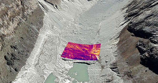
In a first for mapping glacier retreat in the Peruvian Andes, the CASCADA UK + Peru glacier project used a drone fitted with a FLIR Vue Pro R 640 thermal-imaging camera for insight. A thicker layer acts as insulation. Researcher Rosie Bisset, Edinburgh University, is building a mosaic of the images to better understand how surface cover is affecting the melt rate. The glaciers have shrunk by about 30% in the past few decades, and pose a serious threat to the water supply of in the Ancash region.
A roundup of recent products in the GNSS and inertial positioning industry from the October 2020 issue of GPS World magazine.
OEM
GNSS antennas
Active and passive
Photo: 2J Antennas
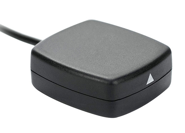
A new range of high-precision GNSS antennas is designed for superior accuracy and reliability, with both active external antennas and passive internal ceramic antennas. The antennas provide precision, high bandwidth, and an advanced signal design for GPS, GLONASS, BeiDou, Galileo, IRNSS and SBAS navigation. They are designed for demanding GPS applications that require centimeter-level accuracy by combining precise point positioning (PPP) of L1 and L2 or by combining L1 and L5 bands with real-time kinematic (RTK) satellite navigation. Applications include aviation safety, UAVs, transportation, autonomous vehicles, agriculture and land and hydrographic surveys.
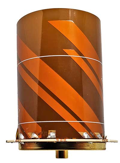
The HC976 housed and HC976E embedded helical antennas are light and compact, suitable for applications ranging from autonomous navigation to GNSS timing. Both models support GPS/QZSS-L1/L2/L6, GLONASS-G1/G2, Galileo-E1/E6, and BeiDou-B1/B3 frequency bands as well as regional augmentation systems and high-precision L-band correction services. The HC976 and HC976E support QZSS-L6, Galileo-E6 and BeiDou-B3. The HC976 is 44 x 62 millimeters and weighs 42 grams. It features a precision-tuned helical element that provides an excellent axial ratio and operates without the requirement of a ground plane, making it suitable for a wide variety of high-precision applications.
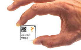
The mosaic-T GPS/GNSS receiver module is built for resilient and precise time and frequency synchronization under challenging conditions. Its multi-frequency, multi-constellation GNSS technology with AIM+ Advanced Interference Mitigation algorithms allows mosaic-T to achieve maximal availability even in the presence of GNSS jamming or spoofing. The compact surface-mount module is designed for automated assembly and high-volume production. Mosaic-T delivers timing and has additional inputs for an external high-accuracy clock.
The HGuide n380 inertial navigation system (INS) communicates an object’s position, orientation and velocity when GNSS signals are unavailable. It is built to withstand harsh environments in the air, on land or at sea. It is designed to meet the need for a small, high-performance INS for 3D mapping, surveying and other applications where space is at a premium. It is composed of Honeywell’s HGuide i300 inertial measurement unit (IMU), a GNSS receiver and Honeywell’s proprietary sensor-fusion software, which is based on the algorithms used for navigation on millions of aircraft every day.
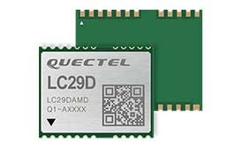
The LC29D eMobility module is a sub-meter-level GNSS module that integrates dead-reckoning and multi-band (L1/L5) real-time kinematic (RTK) algorithm technologies with fast convergence times and reliable performance. The module supports dual-band GNSS raw data output and integrates a 6-axis IMU sensor to deliver high-accuracy positioning performance in seconds. Based on the Broadcom BCM47758 GNSS chip, the LC29D can concurrently receive signals from up to six constellations (GPS, GLONASS, Galileo, IRNSS, BeiDou and QZSS), which maximizes the availability of sub-meter level accuracy. It offers a position update rate of up to 30 Hz (fusion output), enabling dynamic applications like shared emobility, delivery robots and precision agriculture to receive position information with lower latency.
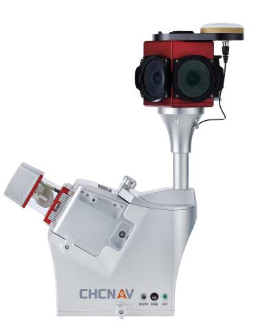
The AlphaUni 300/900/1300 lidar series provides light, versatile long-range laser scanner systems for the high-end market. The series provides optimized data sets powered by advanced GNSS/inertial navigation system (INS) sensors and long-range Riegl scanners. AlphaUni’s design adapts to a variety of applications and can be installed on a variety of platforms, including multi-rotor UAV, fixed-wing vertical-takeoff-and-landing (VTOL) UAV, vehicles, rail trolleys, backpacks, boats and more.
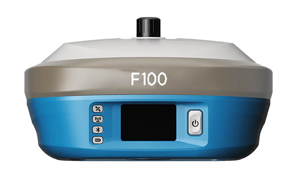
The F100 GNSS receiver, an upgrade to the F90, is designed to meet surveyors’ demands for high field performance, flexibility and cost-effectiveness. It tracks multiple constellations (GPS, GLONASS, Galileo, BeiDou) and can maximize the acquisition and tracking process with all-in-view GNSS frequencies. The 1.45-inch color LCD display is a multi-touch capacitive screen. The F100 has 32GB of internal memory. Its integrated second-generation web user interface control is compatible with all devices and browsers.
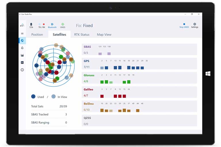
Eos Tools Pro for Windows 10 implements powerful new features that enable users to exploit all four global GNSS constellations and a state-of-the-art NTRIP client to access real-time kinematic (RTK) bases and RTK networks all over the world via NTRIP, Direct IP and wireless radios. It provides the latest support for Windows Geolocation and other features by Microsoft to allow customers to use high-accuracy locations directly in their apps, such as RTK network/RTK base connectivity, support for all new Beidou and Galileo satellites, and SafeRTK functionality for areas with marginal cellular coverage. Features for app developers are also available.
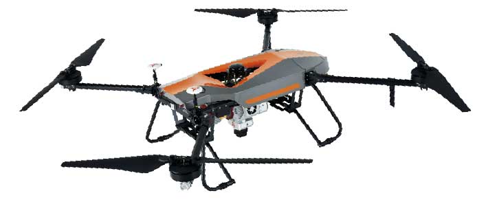
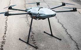
The BB4 UAV high-end multi-rotor drone is optimized for the AlphaUni 300/900/1300 lidar series. Its modular design simplifies deployment in just a few minutes. Its 7-kg payload breaks the capacity barrier, and its more than 45 minutes of flight time increases the airborne lidar survey ability. The redundant CHCNAV and DJI inertial measurement unit (IMU) and GNSS unit provide reliable centimeter real-time kinematic (RTK) positioning, meeting the demand for high accuracy in the geospatial and mapping industries.
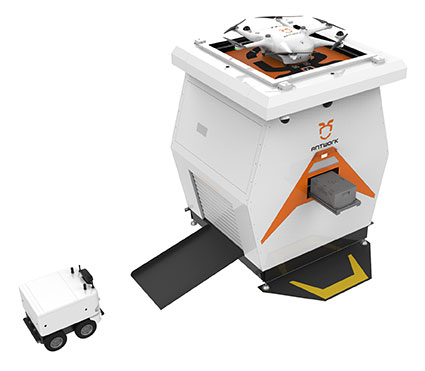
The ADNET autonomous delivery network is a technical solution to transport medical samples and quarantine materials in cities. It uses an RA3 drone, unmanned vehicle RG1 and RH1 hub station to deliver medical supplies without relying on manpower, alleviating time spent in traffic and the cost of traditional delivery. Supplies retrieved by the RG1 vehicle are delivered to the RH1 hub for sorting and redirecting, while the drone transfers the supplies between hubs. The RG1 then delivers goods on the receiving end. The system was demonstrated during China’s COVID-19 epidemic prevention and control period, reducing contact between samples and personnel.
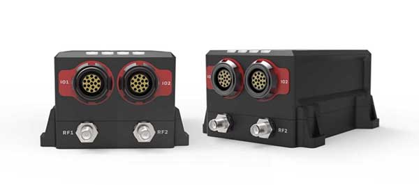
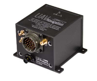
The VECTOR-400 is a compact autopilot designed specifically for unmanned aerial vehicles. It features a robust enclosure and a military-grade connector for harsh environments (MIL-STD 810 and MIL-STD 461). Features enable sea-skimming (extremely low-level flight) and the capability to navigate without GNSS. The VECTOR-400 is able to continue a mission in case of individual sensor failure and when subject to jamming, maintaining accurate estimations of attitude and position. Advanced algorithms provide stall prevention and the ability to carry out an efficient gliding maneuver in case of engine failure. Its air data attitude and heading reference system and inertial navigation system provide high-precision attitude information and reliable navigation under demanding circumstances.
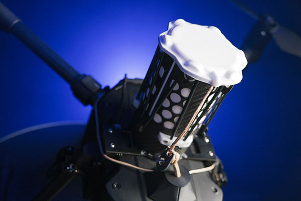
The F700 DroneHunter UAS is a radar-based autonomous interceptor drone for tracking and stopping dangerous drones. Its flexible undercarriage offers interchangeable counter measures for single, multiple or swarm-based threats, while its lightweight carbon-fiber frame enables quick speed and response. The F700 can carry multiple types of anti-drone countermeasures and deploy them in real time, based on which dynamic threat is detected miles beyond the protected area. The pogo pins and payload snaps of the undercarriage are integrated with artificial intelligence for firing and flight software.
Drones equipped with cost-intensive cameras and sensors need protection in the event of a flight-system failure. A parachute system for the DJI M210 drone is now available. Both commercial and emergency response operations are using the M210; its design and flexibility allow for a variety of industry-specific applications. The DRS-M210 parachute system is designed to ensure high pendulum and wind stability, allowing a damaged drone to land safely with minimal impact.
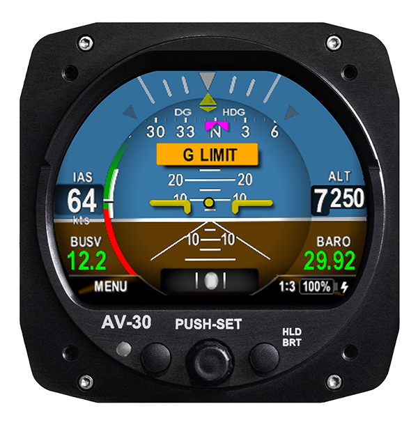
Altitude indicator (AI) or directional gyro (DG) replacement
Photo: uAvionix
The AV-30-C aircraft panel display adds a suite of in-flight information for pilots, including GPS navigational data, a probeless angle of attack indicator, baro-corrected altitude, indicated/vertical/true airspeed, non-slaved heading, bus voltage and G load. It is designed to fit into any aircraft with a 3 1/8-inch round instrument slot without cutting or modifying the panel. It is authorized for FAR Part 23 Class 1 and Class 2 aircraft listed on the AV-30-C Approved Model List (AML), containing 635 aircraft models including Cessna, Piper, Beechcraft, American Champion, Maule, Boeing, Swift, Mooney, Aviat and others.
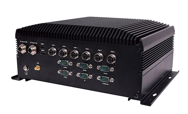
The R3S series of rugged, EN-50155-certified fanless vehicle/rail computers is equipped with a u-blox NEO-M8N module, which receives GPS, Galileo, GLONASS and BeiDou with the default set for GPS + GLONASS dual band. The series offers power-efficient performance for consolidating in-vehicle workloads such as video surveillance, control/monitoring, passenger information and Wi-Fi hotspot sharing. For edge-to-cloud connectivity, R3S uses its internal GPS/GLONASS chipsets for GPS tracking and has two M.2 slots with up to 4x SIM card readers for failover LTE connection. To ensure proper operations in moving vehicles, the series is certified with EN50155, EN50121-3-2, EN50121-4, EN50125-3, EN45545 and E13 standards and has passed MIL-STD-810G shock and vibration resistance certifications. The series can operate under a wide temperature range and offers excellent reliability in harsh railway settings. It has one external removable 2.5-inch HDD/SSD drive bay for recorded footage storage. For consolidating in-vehicle workloads such as in-vehicle control/monitoring and passenger information, the R3S features a variety of I/O support, including 2x HDMI, DI/DO, 3x COM/CAN BUS and 4xUSB ports.
GNSS augmentation solution targets North America and Europe with safe and precise centimeter-level accuracy performance from two geostationary satellites.
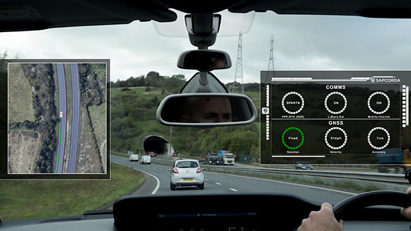
Sapcorda Services GmbH is now testing its GNSS augmentation services for the L-band signal in North America and Europe. The testing lays the foundation for a Dec. 1 launch of what Sapcorda said will be the strongest, most reliable GNSS augmentation signal for safety-critical navigation in autonomous vehicles and machinery.
Available in areas without GSM coverage or mobile internet signal, the new Sapcorda L-band beam solutions from two geostationary satellites provide PPP-RTK data-feed redundancy in real-time by swapping to a second data feed when internet connectivity is not available. This automated swapping significantly improves reliability for life-critical applications such as autonomous cars.
“To use GNSS in mass-market safety-critical applications, manufacturers need GNSS augmentation services that provide correction data with safety-critical positioning,” said Botho zu Eulenburg, CEO, Sapcorda. “By expanding our SAPA services with L-band transmission, we enable a high-power correction data stream for homogeneous performance and end-to-end data security with continental coverage in the United States and Europe — thus improving accuracy, reducing convergence time, and enabling the use of lower-cost receivers and antennae.”
The Sapcorda L-band signal will be transmitted in the open SPARTN format, a format specifically developed for IP-based and geostationary satellite distributions. It will be invaluable for safety-critical applications in automotive (such as V2X and autonomous driving, AD/ADAS) and maritime, as well as a wide variety of uses across sectors such as industrial, robotics and drones.
The L-band satellite beam coverage will be available on December 1, 2020. Sapcorda’s safe and precise augmentation (SAPA) service will broadcast SAPA Basic and SAPA Premium correction data streams.
These data streams feature:
99.9% service availability with fast convergence and an accuracy of less than 10 cm, delivering the precision required for safety- and life-critical applications
Redundancy through dual data streams when internet connectivity isn’t available, ensuring uninterrupted broadcast streaming
Demodulation by any L-band demodulator on the market, simplifying hardware design and reducing bill of materials
Availability of service coverage areas in North America and Europe, allowing manufacturers to use a single GNSS augmentation services’ solution for major global regions
Distributed in the same open format as IP-delivery channels (SPARTN)
Sapcorda’s SAPA services are supported by experienced engineering teams dedicated to systems integrators and enterprise business customers. The Basic and Premium SAPA services for L-band signal operation begins in both regions on Dec. 1.
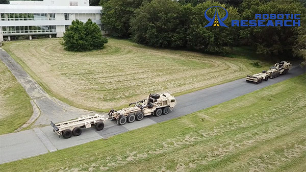
Robotic Research LLC has added Retrotraverse to its AutoDrive-M autonomy kit. The autonomy kit is equipped on the U.S. Army’s Palettized Load System (PLS) logistics trucks.
Robotic Research demonstrated the Retrotraverse capabilities with three of the U.S. Army’s PLS trucks, each towing trailers. “This is a major step forward for our company and has broad application both in autonomy and platooning. The capability solves the potentially life-threatening problem of an autonomous platoon of military vehicles being unable to navigate out of a dangerous situation,” said Alberto Lacaze, president of Robotic Research. “This automated platooning capability will ultimately extend the reach of soldiers without putting them in harm’s way.”
The Retrotraverse feature allows a platoon of heavy-duty trucks with trailers to autonomously reverse. Several autonomous vehicle providers in the trucking industry are demonstrating platooning in benign conditions, where the weather is ideal and road surfaces are smooth and marked.
Robotic Research has been specifically focusing on addressing the edge cases, such as poor weather, dust and off-road conditions, to ensure a robust autonomous system that is necessary for operating in all conditions and during mission-critical operations for the military.
If a platoon drives into a dead end, or similar edge case where it cannot make a U-turn, the platoon of vehicles with trailers needs to be able to reverse out of the situation. Retrotraverse can make this happen.
“Anyone who has backed up a truck with a trailer knows how difficult it is to navigate,” said Joe Putney, director of commercial systems at Robotic Research. “The autonomous Retrotraverse feature was able to reverse a truck and trailer faster than even our most skilled drivers. This feature is not just lifesaving, it’s time-saving, and it has the ability to reduce one of the greatest pains truck drivers have.”
In 2018, Robotic Research was awarded a three-year, $49.7 million contract by the U.S. Army to provide its autonomy kit for large convoy resupply vehicles. Robotic Research has since delivered nearly 100 unmanned platooning trucks.
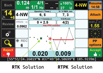
Javad GNSS introduced a new solution, Real-Time Post-processed Kinematics (RTPK), at Intergeo Digital 2020.
With the new option, the Javad Triumph-LS combines the strengths of RTK and PPK into a system that can post-process RTK data and verify its results in parallel and real time.
If RTK fails, RTPK is available in a fraction of a second, the company said.
Screenshot: Javad GNSS
“The RTPK feature is about as simple as any feature can get,” said Darren Clemons, PLS. “When you are on a point and stop the session, the LS automatically starts downloading the data for the time period matching that session from your base (or RTN) and then internally in the LS (no internet connection required) runs the post processing and gives you the PPK solution right there on your point in real time. […] It is a very nice and ingenious feature and, for us anyway, is a great check on our RTK results.”
The global smart agriculture market size was valued at $16,747.7 million in 2019 and is estimated to reach $29,234.6 million by 2027, with a CAGR of 9.7% from 2021 to 2027, according to Valuates Reports.
The market is expected to rise as a result of rising population, increasing strain on the food supply system, the growing use of new technology in agricultural products and farmers’ growing focus on tracking livestock.
According to the report, the global competition between players will be increased by new players joining the global smart agriculture market, which will in turn increase advancements in technology. Top companies in the smart agriculture market include Trimble, Deere & Co., Topcon Positioning Systems, DeLaval, AgEagle Aerial Systems, Afimilk, Raven Industries, Ag Junction, AGCO Corporation and GEA Group, the report said.
Current trends influencing smart agriculture market size include the growing adoption of automation and control systems, such as GPS/GNSS receivers, irrigation controllers, and guidance and steering systems, has created a new approach to farming practices. The report said it also expects growing investment, R&D spending on agricultural technology and increased popularity of land-based recirculating aquaculture systems to fuel market growth.
The report also touched on COVID-19’s impact on the smart agriculture market, noting the market is expected to see a marginal fall in 2020 as movement restrictions and lockdowns have led to supply chain disruptions.
Despite this, the precision farming segment held the largest market share in 2019 and is expected to retain its dominance during the forecast period, the report said. North America is expected to hold the largest smart agriculture market share during the forecast period, and Asia Pacific is expected to witness the highest growth during the forecast period.
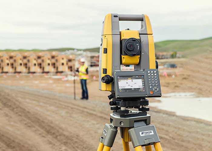
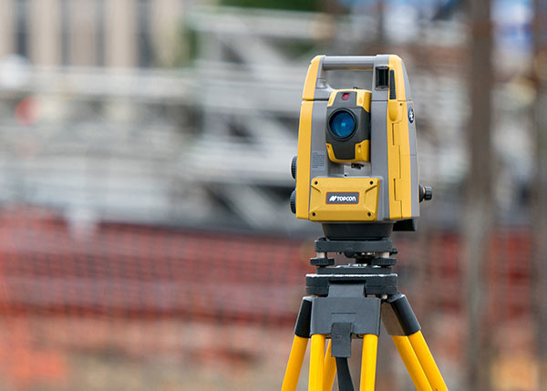
The new the GT series of total stations are part of a full workflow solution, including a new field computer, a full-version update to Topcon field and office software and GNSS receivers. The system is designed to work in sync for improved performance and better data handling with built-in, field-to-office connectivity.
The speed, tracking and accuracy of the GT series, combined with the intuitive software system, creates a flexible solution capable of satisfying the technology needs of surveyors and contractors performing survey, layout or machine guidance projects, Topcon said.
“The new total stations perform at a faster 10-Hz positioning update rate,” said Ray Kerwin, director of global product planning. “Combining the GT series with the new field computer and software enhancements, this tracking improvement makes layout easier and guidance more fluid, within an intuitive map view. More layout and survey points can be collected in less time.”
“Surveyors, contractors, as well as heavy machinery automation operators and other construction professionals can benefit from the time-savings and accuracy the series provides,” Kerwin said.
Advanced UltraTrac prism tracking combines optical sensing with a new ultrasonic motor control algorithm designed to maintain superior prism lock.
“Tracking fast-moving targets and maintaining prism lock is now easier on challenging job sites as well as in machine guidance applications. If you’re performing a machine control project where the prism is vibrating on the end of the blade, for instance, the GT will lock onto the prism better and provide smoother machine guidance,” Kerwin said.
Magnet software improves field-based quality reporting and data handling for larger files, graphical processing, and 3D models. Magnet Field features more visual- and map-based workflows in addition to menu-driven functionality popular with power users.
An optional upgrade incorporating hybrid positioning technology helps advanced users get instant location updates via GNSS receivers so positioning data points can be captured, even with the loss of line-of-sight from job site obstructions.
The complete GT series workflow solution — Magnet software, FC-6000 field computer, and HiPer Series GNSS receivers — combine for easy-to-use digital processes designed to help surveyors and contractors increase precision, reduce rework and improve quality control.
Vision-RTK enables applications in previously unreachable areas and unlocks new possibilities for autonomous ground robots and drones
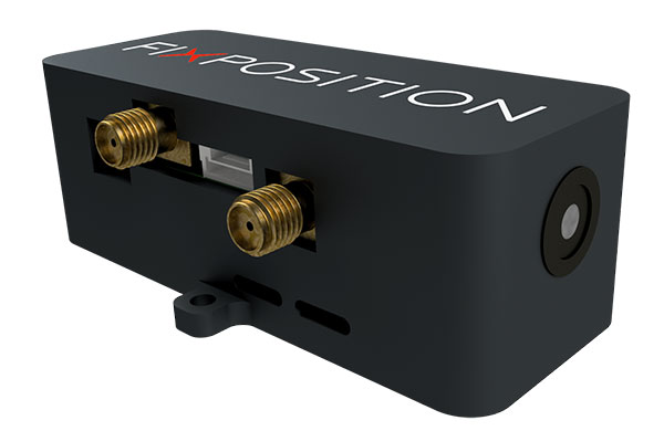
At this year’s Intergeo Digital event, taking place Oct. 13-15, Fixposition is debuting the Vision-RTK positioning sensor, a compact centimeter-accurate solution with high reliability and availability in environments that are challenging for traditional GNSS.
Photo: FixPosition
The Vision-RTK’s sensor-fusion algorithm is based on the deep integration of satellite, camera and inertial sensors, and enables unprecedented reliability and availability in diverse and challenging applications, the company stated.
“The highly integrated nature of our Vision-RTK sensor and our deep expertise in computer vision and real-time kinematic (RTK) GNSS enabled us to implement completely new approaches in sensor fusion, resulting in previously unseen performance,” said Lukas Meier, CTO and co-founder of Fixposition.
Traditional GNSS sensors suffer from limited reliability in GNSS-challenging and denied areas. On the other hand, standalone computer vision is sensitive to light conditions (such as snow, strong sunlight and rain) and struggles in situations where there is a lack of features such as cornfields and grass. Errors accumulate over time with standalone inertial technology, causing large drifts.
As a result, devices using either sensor are limited in their range of operation and are likely to fail in certain conditions. Fixposition’s solution increases the potential of these sensors with its unique sensor-fusion technology by increasing the trustworthiness of the positioning accuracy and the range of operation in different environments.
The real-time sensor fusion provides centimeter-accurate absolute positioning at any time, in any outdoor environment. This small module integrates two RTK-GNSS receivers and visual inertial navigation, and is suitable for applications where size and accuracy are of paramount importance.
The dual-receiver configuration, together with Fixposition’s advanced algorithms, provides a true-heading output and increased resistance to electromagnetic radiation.
The sensor provides USB and Wi-Fi connectivity and a web interface. It enables straightforward integration in state-of-the-art autopilot control systems for drones and robots. It’s also plug-and-play compatible with platforms such as PX4, ROS and Apollo.
For ground robotics and drones applications, Vision-RTK increases the device uptime and efficiency while enabling new market segments in areas previously inaccessible. For end-device manufacturers, this technology eliminates the need for an in-house development of advanced localization solutions, shortening their sales cycle and reducing costs and investments.
Visit the Fixposition booth and meet the team at Intergeo Digital 2020 to learn more about the Vision-RTK sensor.
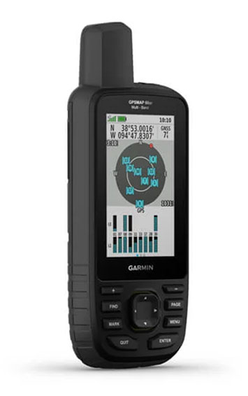
Garmin has debuted the GPSMAP 65, 65s and 66sr, three new portable devices with improved technology, precision and connectivity. GPSMAP is the company’s line of premium outdoor navigation units.
The GPSMAP 65, 65s and 66sr offer multiband technology for positioning and tracking anywhere. They are the first Garmin portable devices to receive and use multiple satellite navigation frequencies.
The multi-band technology and expanded GNSS support with addition of the L5 frequency (GPS, GLONASS, Galileo, QZSS and IRNSS) allows for reduced estimated position error, giving users improved accuracy and awareness of their surroundings.
The new models include TopoActive maps of Europe, smartphone notifications, color screens, battery improvement, compatibility with the Garmin Explore app and more. All three are rugged, dust, shock and water resistant (IPX71 rated).
“We are excited to grow our popular lineup of GPSMAP handhelds and introduce multiple GPS frequencies into the series,” said Dan Bartel, Garmin vice president of global consumer sales. “We’ve expanded our satellite support so you can explore with confidence, no matter where you go or what the conditions are.”
GPSMAP 66sr
The premium version, GPSMAP 66sr, has a 3-inch color screen readable in all lighting conditions and is compatible with night-vision goggles. In addition, it has been designed to military standards for thermal performance and resistance to shock and water (MIL-STD-810G), and includes a built-in S.O.S. LED flashlight for assistance. To give the user even more confidence, incorporates ABC sensors (3-axis electronic compass), accelerometer and barometric altimeter), allowing users to obtain the most accurate data available at all times.
GPSMAP 66sr also provides global forecasts and weather through the Active Weather feature, updated through wireless connectivity via Bluetooth and ANT +. Via the Wi-Fi connection, users can download satellite maps.
The European Space Agency (ESA) has launched a call for proposals to demonstrate the capabilities of new 5G cellular networks to support positioning and timing applications to complement satellite navigation.
5G will bring higher speed, larger traffic capacity and ultra low-latency (or signal delay) communications. 5G will also usher in a range of new possibilities for positioning, navigation and timing (PNT).
ESA is inviting proposals to implement pilot projects to demonstrate the viability of 5G PNT solutions in a number of use cases:
Indoor PNT for Industry 4.0, as needed to support the operations of smart warehouses and factories or smart city applications requiring transition from indoor to outdoor environments.
Outdoor applications where a robust back-up to satellite navigation is essential to meet safety requirements, such as autonomous driving or drone navigation.
Applications where robust time and frequency synchronization is necessary, both in outdoor as well as indoor environments, like smart energy grids or the 5G networks themselves.
5G networks will allow new types of measurements made possible by advanced antennas and by new positioning signals at higher frequencies, at both base stations and the user receivers. 5G networks will also bring enhanced connectivity to improve cloud-based positioning applications and value-added services.
While satellite navigation works optimally in outdoor environments with a wide view of the sky, 5G PNT has the potential to bring PNT to deep urban canyons in high-rise city centers and indoor warehouses, wherever 5G networks are deployed.
The combination of satellite navigation and 5G brings the promise of high performance, secure and resilient PNT services, as well as a seamless application of PNT applications from outdoor to indoor environments and from rural to urban areas, ESA said.
This call for ideas is supported through ESA’s Navigation Innovation and Support Programme (NAVISP), working with European industry and academia to develop innovative navigation technology.
Webinar on PNT 5G
To support the call, an information webinar is being held on 21 October, in which the various PNT 5G use cases will be presented by key speakers from each sector. Details of the call and how to apply will also be presented by ESA.
A networking platform has also been established to allow webinar participants and general stakeholders interested in the call to get in touch and discuss possible cooperation. This platform will be kept open during the entire period of the call’s duration.
For more information on the call and the agenda of the webinar visit ESA’s NAVISP website.
To register for the webinar and the networking platform, click here.
The United States Army has awarded Collins Aerospace a Phase III contract to build the second generation of its Mounted Assured Position Navigation and Timing System (MAPS).
The MAPS program adds anti-jamming capability for soldiers in GPS-contested environments. In 2019, MAPS Gen I units were installed on Stryker vehicles of the 2nd Cavalry Regiment in Germany.
Phase 3 of the MAPS Gen II program “begins combat platform integration in preparation for low-rate initial production,” according to an Oct. 7 Army press release.
MAPS Gen II includes M-code GPS receivers, provided by BAE Systems, along with anti-jamming antennas, sensor fusion and inertial measurement units to deliver assured PNT to soldiers.
MAPS Gen II is part of the Army’s goal to accelerate the development and fielding of modernized soldier capabilities.
“Less than a year after we equipped the first generation of MAPS in Europe we’re already pushing forward with the development of Gen II,” said Willie Nelson, director of the the Assured Positioning, Navigation and Timing (APNT) Cross-Functional Team (CFT). “This award comes less than a month after our Mounted APNT requirement was approved. The timing could not be better.”
MAPS Gen I includes A and B kits, consisting of cable and mounts to use on a vehicle and a military GPS paired with non-radio frequency technologies.
The Phase III Other Transaction Authority contract covers product maturation and begins combat platform integration, clearing the path to low rate initial production.
Army Stryker ground combat vehicle. (Photo: Karolis Kavolelis / Shutterstock.com)
The MAPS GEN II is comprised of the NavHub-100 PNT Distribution Device, the Multi-Sensor Antenna System (MSAS-100) and an optional speed sensor. The NavHub-100 works in concert with the MSAS-100 to produce a trusted A-PNT solution that can be distributed through serial interface, Victory Ethernet and RF distribution to multiple client systems.
MAPS GEN II supports the U.S. Army PNT Reference Architecture by leveraging modular technologies from across Collins’ A-PNT portfolio and industry. This scalable architecture builds upon the modular open system architecture (MOSA) standards and includes the All Source Positioning and Navigation (ASPN) generic message definition to support plug-and-play sensor integration and the Future Airborne Capability Environment (FACE) to host portable software capabilities.
The MAPS GEN II system not only supports direct replacement of the Defense Advanced GPS Receiver (DAGR) on military platforms, it also provides exceptional A-PNT performance in GPS-contested and GPS-denied environments.
According to a report by InForGrowth, the global GPS tracking devices market was valued at $1,567 million in 2018 and is expected to grow at a CAGR of 12.2% during the forecast period 2026.
Increasing demand for fleet telematics and affordable prices of GPS tracking devices are expected to drive the growth of the GPS tracking devices market.
However, the report says, environmental obstacles and non-standard products are expected to impede the growth of the market in the coming years.
The growth of the GPS tracking devices market is attributed to the increasing demand for fleet telematics in the transportation and logistics sector. Government authorities are making rules and regulations for fleet tracking systems in commercial vehicles for improving the safety of passengers, the report said. In addition, vehicle rental companies are deploying an increased number of GPS tracking devices in their fleets.
Next, technological advancements such as self-driving vehicles and connected car technology mainly rely on GPS-based tracking systems for improving the accuracy and reliability of navigation. According to the report, many developing countries, such as India, are focusing on the advancement of their navigation technology. The adoption of 5G communication technology will also help in the advancement of driverless cars technology, which uses GPS tracking devices for movement and route planning.
Finally, the affordability of GPS tracking devices has encouraged market growth, the report said. This in turn has increased competition between manufacturers to develop updated technology-enabled GPS tracking devices.