Category: Applications

  • GSA’s MyGalileoSolution competition deadline is Sept. 30

    GSA’s MyGalileoSolution competition deadline is Sept. 30

    MyGalileoSolution is the biggest competition ever organized by GSA with a prize pool of almost €1.5 million

    News from the European GNSS Agency

    The European GNSS Agency (GSA) has launched the MyGalileoSolution competition. The contest is targeting European innovators and entrepreneurs ready to develop location-based solutions, such as mobile applications, wearable-based solutions, asset management and tracking solutions, or robotics, leveraging Galileo as a source of positioning, navigation and/or timing. A wide participation from all Member States is expected.

    GSA has a successful track record in supporting and boosting GNSS-based innovative applications. For years, the agency has been leading several research and innovation initiatives such as the Galileo Masters, Horizon 2020 projects, and more recently European competitions like the 2019 MyGalileoApp and Hackathons across Europe and beyond.

    Two tracks for 56 prizes

    With a prize pool of almost € 1.5 million, MyGalileoSolution is the largest competition ever organized by the GSA. It consists of two independent and parallel tracks, each one with a list of goals and deliverables.

    Track 1 , From Idea to Prototype, aims to develop a beta version of an application or a prototype of a solution implementing an idea, reaching a minimum of 50% of its functionality.

    Track 2, From Prototype to Product, aims to develop a fully functional solution ready to be commercialised starting from a beta version of an application or a prototype.

    Participants are expected to leverage Galileo’s robust positioning and accurate timing and synchronization capabilities, showing how it can enable the development of the next generation of applications and services across a wide range of areas. In this competition the GSA is challenging innovators in four different areas: Crisis & Emergency Response, Smart Transport for Green Deal, Solution for Digital Age, and Cybersecurity.

    Galileo for location-based services

    With more than 1.5 billion Galileo-enabled smartphones and more than 51 million GNSS-enabled wearable devices in the market, location-based services (LBS) are booming. Accurate positioning and timing are at the heart of the growth and evolution of LBS, in addition the access to Android GNSS raw measurements has allowed for the creation of advanced GNSS positioning algorithms that enable the development of more ambitious smartphone-based applications.

    ‘’Galileo has set the trend for dual-frequency chipsets, which provide better accuracy and are more resistant to multipath in urban environments,” said Pascal Claudel, GSA acting executive director. “We are looking forward to seeing innovators launching their disruptive GNSS solutions and turning them into real businesses, hence leading to European growth, competitiveness and sustainability. There is ‘space’ for all types of innovation and we expect the participation of all Member States.”

    “Competitions like MyGalileoSolution are a great opportunity to quickly move from idea to market,” said Francesco Fiorito, leader of Argeo, the winning team of the 2019 MyGalileoApp competition. “It is a confidence boost for young entrepreneurs and their capacity to grow and generate new solutions and business,” Claudel concluded.

    Deadlines and more information

    The deadline for submission for both categories is Sept. 30. Projects will be evaluated in terms of their innovative nature, market potential, feasibility and Galileo relevance by a panel of GSA experts.

  • Companies achieve extended-range 5G data call over mmWave

    Companies achieve extended-range 5G data call over mmWave

    Photo: JamesBrey/E+/Getty Images
    Photo: JamesBrey/E+/Getty Images

    U.S. Cellular, Qualcomm Technologies Inc. and Ericsson have successfully achieved the first extended-range 5G NR millimeter Wave (mmWave) data call in the U.S. on a commercial network.

    The extended-range data call milestone was completed in Janesville, Wisconsin, over a more than 5-km distance with speeds greater than 100 Mbps. According to the companies, the achievement redefines the perception of 5G mmWave spectrum as an urban- or high-density-only deployment technology and offers new opportunities to use current infrastructure for broader 5G coverage.

    This milestone demonstrates that mmWave can help close the “connectivity divide” and expand broadband services throughout rural, suburban, and urban communities. This breakthrough gives communications service providers a cost effective way to expand their coverage and deliver 5G experience to communities that previously were not serviced or may have lacked a reliable connection.

    It will also open the door for new use cases, which will bring 5G benefits to homes and business everywhere, from urban to rural communities. For example, Fixed Wireless Access (FWA) installations can provide a cost-effective way to deliver fiber-like internet speeds wirelessly over mmWave to institutions such as schools, hospitals and town halls, and for addressing some of the “last mile” challenges in rural areas. FWA provides the bandwidth required to support high definition streaming services that can improve experiences like remote education and remote healthcare in suburban and rural environments.

    Mike Irizarry, chief technology officer, U.S. Cellular, said, “This is a key strategic milestone in our 5G evolution. Expanding 5G mmWave coverage enables us to offer high-speed broadband services to consumers and businesses in rural areas and underserved communities and reinforces our commitment to technological leadership for rural America. It is a concrete example where U.S. Cellular is driving innovation leadership in extended range technology from Ericsson and promoting the high-power device ecosystem enabled by Qualcomm Technologies.”

    “This major milestone of using mmWave for an extended-range 5G data transfer is paving the way to implement fixed broadband services for broad coverage in urban, suburban and rural environments,” said Alejandro Holcman, senior vice president, engineering, Qualcomm Technologies. “With the introduction of the Qualcomm QTM527 mmWave antenna module as part of the Qualcomm Snapdragon X55 5G Modem-RF System, we are empowering operators and OEMs to offer high-performance, extended-range multi-gigabit 5G broadband to their customers — which is both flexible and cost-effective, as they can leverage existing 5G network infrastructure.”

    Per Narvinger, head of product area networks, Ericsson, said, “Ericsson is constantly pushing the boundaries of 5G technology to bring its benefits everywhere across the globe. Ericsson has a long and successful track record in extending coverage across generations of mobile technologies. Working with our partners, Ericsson has now demonstrated the commercial viability of long-range 5G radio capability for mmWave spectrum.”

    The milestone was achieved by applying extended-range software to commercial Ericsson hardware — including AIR5121 and Baseband 6630 — and a 5G CPE device powered by the Snapdragon X55 5G Modem-RF System with the Qualcomm QTM527 mmWave antenna module.

  • New autonomous Mayflower launches from Plymouth to gather ocean data

    New autonomous Mayflower launches from Plymouth to gather ocean data

    Photo: Tom Barnes for IBM
    Photo: Tom Barnes for IBM

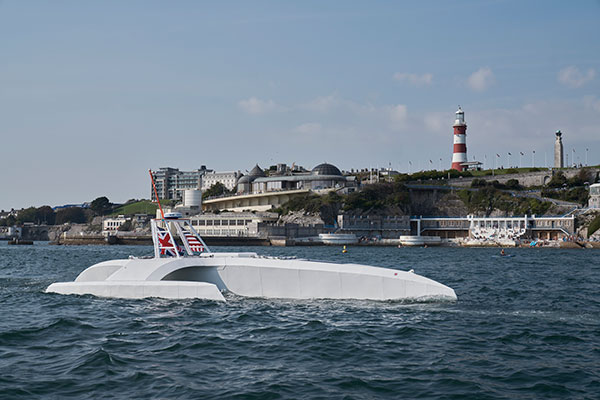
    An autonomous ship launched Sept. 16 on a mission to traverse oceans and gather vital environmental data, guided by GNSS and inertial measurement units (IMUs).

    Ocean research non-profit ProMare joined with IBM on the Mayflower Autonomous Ship (MAS) — an artificial intelligence (AI) and solar-powered marine research vessel. Following two years of design, construction and training of its AI models, the fully-autonomous trimaran was launched from Plymouth, England.

    The ship is guided by both GNSS and IMU technology. It uses two Hexagon | Veripos LD8 receivers, each with two V560 marine antennas. The onboard IMUs include an iXBlue Octans and two Silicon Sensing AMU30s.

    Designed to provide a safe, flexible and cost-effective way of gathering data about the ocean, the new-generation Mayflower promises to transform oceanography by working in tandem with scientists and other autonomous vessels to help understand critical issues such as global warming, micro-plastic pollution and marine mammal conservation.

    ProMare is coordinating the scientific studie,s working with IBM Research and leading scientific organizations.

    MAS features an AI captain built by ProMare and IBM developers that gives MAS the ability to sense, think and make decisions at sea with no human captain or onboard crew. The new class of marine AI is underpinned by IBM’s latest advanced edge computing systems, automation software, computer vision technology and Red Hat Open Source software.

    “Able to scan the horizon for possible hazards, make informed decisions and change its course based on a fusion of live data, the Mayflower Autonomous Ship has more in common with a modern bank than its 17th century namesake,” said Andy Stanford-Clark, Chief Technology Officer, IBM UK & Ireland. “With its ability to keep running in the face of the most challenging conditions, this small ship is a microcosm for every aspiring 21st century business.”

    Photo:
    Artie — short for Artemis and artificial Intelligence — is a stowaway hitching a ride on the Mayflower who answers questions about the ship, the ocean or himself on mas400.com. (Photo: IBM)

    Interactive web portal follows voyage

    To enable followers around the world to stay updated with MAS as it undertakes its various missions, IBM and ProMare have also launched an interactive web portal. Built by IBM iX (the business design arm of IBM Services), the MAS400 portal is designed to provide real-time updates about the ship’s location, environmental conditions and data from its various research projects.

    Live weather data is streamed from IBM’s The Weather Company, as MAS receives forecast data and insight from the new IBM Weather Operations Center.

    ‘Octopus’ aboard answers questions

    The portal even features a seven-armed, stowaway octopus chatbot called Artie, who claims to be hitching a ride on the ship. (With seven arms, he’s technically a septopus.) Powered by IBM Watson Assistant technology and created in partnership with European startup Chatbotbay, Artie has been trained to provide information about MAS and its adventures in a lively, and accessible format.

    “MAS400.com is one of the most advanced ocean mission web portals ever built,” says Fredrik Soreide, Scientific Director of the Mayflower Autonomous Ship project and Board Member of ProMare. “Protecting the ocean depends on our ability to engage the public in important matters affecting its health. This MAS400 portal is designed to do exactly that and tell people where the ship is, what speed it’s travelling at, what conditions it’s operating in and what science we are conducting. Users can even help Artie the Octopus fish out surgical masks, cigarette butts and other increasingly common forms of ocean litter from a virtual ocean of facts and data.”

    MAS will spend the next six months in sea trials and undertake various research missions and voyages before attempting to cross the Atlantic in Spring 2021. MAS’s transatlantic voyage will be based on a similar route and pioneering spirit to the 1620 Mayflower which made the same crossing 400 years ago.

  • Space weather bill passed by US Congress to improve forecasting, mitigation

    Space weather bill passed by US Congress to improve forecasting, mitigation

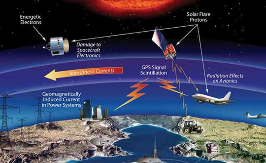
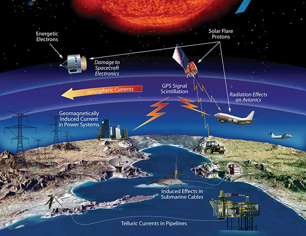
    The effects of space weather on critical Earth systems. (Image: NASA)
    The effects of space weather on critical Earth systems. (Image: NASA)

    The United States Congress has passed bipartisan legislation to address how the government deals with threats posed by emissions from the Sun to critical infrastructure such as GPS.

    The Promoting Research and Observations of Space Weather to Improve the Forecasting of Tomorrow (PROSWIFT) Act S.881 now awaits signature by the president.

    The bill sets forth provisions to improve the ability of the United States to forecast space weather events and mitigate its effects.

    It provides statutory authority for the National Science and Technology Council’s Space Weather Operations, Research, and Mitigation Working Group, which coordinates executive branch efforts to understand, prepare, coordinate, and plan for space weather.

    The bill directs the Office of Science and Technology Policy, National Oceanic and Atmospheric Administration (NOAA), National Science Foundation, Air Force, Navy, National Aeronautics and Space Administration (NASA), National Security Council, and Federal Aviation Administration (FAA) to carry out specified space weather activities.

    The legislation

    • assigns roles and responsibilities to agencies involved in space weather research and forecasting
    • ensures agency coordination to better predict severe space weather events and mitigate impacts
    • calls for coordination between the government and the non-governmental space weather community including academia, the commercial sector and international partners.

    Senators Gary Peters (D-MI) and Cory Gardner (R-CO) introduced the first version of the bill in 2016 and a successor passed the Senate in 2017. Reps. Ed Perlmutter (D-CO) and Mo Brooks (R-AL) shepherded it through the House, which passed it Sept. 16.

  • CHC Navigation introduces i73 GNSS and iBase GNSS receivers

    CHC Navigation introduces i73 GNSS and iBase GNSS receivers

    An IMU-RTK GNSS receiver that fits in your hand and a fully integrated GNSS base station add a new scale to GNSS surveying applications.

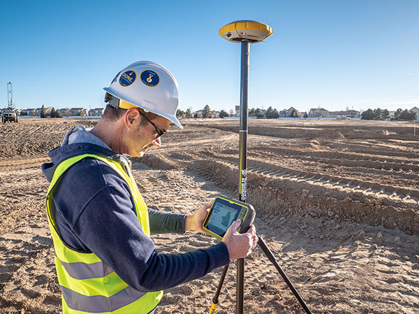
    CHC Navigation (CHCNAV) has announced the immediate availability of the i73 GNSS, a versatile pocket-sized IMU-RTK GNSS rover with an integrated inertial module and the iBase GNSS, a rugged base GNSS receiver.

    The combination of the i73 GNSS and the iBase GNSS offers a productive and affordable solution for measuring and staking out points in any surveying, mapping or construction application.

    “Surveyors and construction professionals are forced to carry heavy and cumbersome GNSS receivers in most situations, resulting in unnecessary fatigue and lower productivity,” said Hans Huang, product manager of CHC Navigation’s Survey and Engineering Division. “Taking this into account, we have developed our pocket-sized i73 GNSS, the lightest GNSS rover powered by the latest IMU-RTK technology, and much more. Our iBase GNSS station follows the same concept of an all-in-one solution, making the need for external radio modems and other bulky accessories obsolete.”

    The i73 Pocket IMU-RTK GNSS: A new scale to GNSS

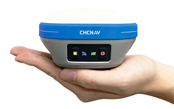
    The i73 Pocket IMU-RTK GNSS. (Photo: CHCNAV)
    The i73 Pocket IMU-RTK GNSS. (Photo: CHCNAV)

    Weighing only 730 grams yet with 15 hours of operating time, the i73 GNSS is one of the lightest and most rugged RTK GNSS receivers on the market.

    Easy to carry and use, the i73 will not tire out field workers. It offers superior GNSS signal tracking enables surveys beyond the usual constraints. It features full 624-channel GNSS technology and connects seamlessly to RTK GNSS networks as well as to UHF GNSS station over its embedded UHF modem.

    Automatic pole-tilt compensation. The i73 GNSS internal interference-free inertial module (IMU) allows automatic pole tilt compensation of up to 45 degrees. Projects are completed 30% faster and with increased efficiency and safety when measuring hard-to-reach points.

    The iBASE GNSS: Redefining the concept of GNSS base station

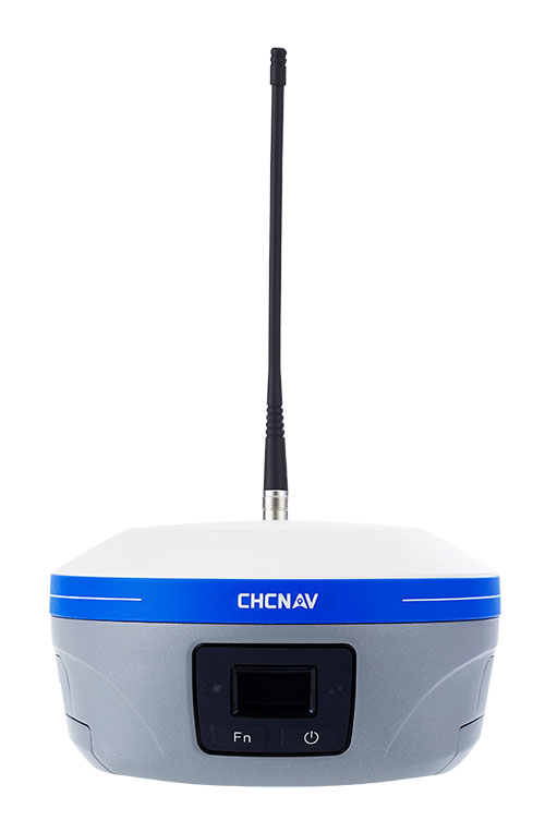
    The iBASE GNSS receiver. (Photo: CHCNAV)
    The iBASE GNSS receiver. (Photo: CHCNAV)

    The GNSS iBase is a fully integrated GNSS base station, specifically designed to meet 95% of surveyors’ needs when working in UHF GNSS base and rover mode. The performance of the iBase UHF base station compared to a conventional external UHF radio modem is virtually identical. But its unique design eliminates the need for a heavy external battery, bulky cables, an external radio, and a radio antenna. Its 5-watt radio module provides operational GNSS RTK coverage up to 8 km.

  • Spirent Federal announces M-code updates with SimMNSA v2.0

    Spirent Federal announces M-code updates with SimMNSA v2.0

    Photo: Spirent Federal
    Photo: Spirent Federal

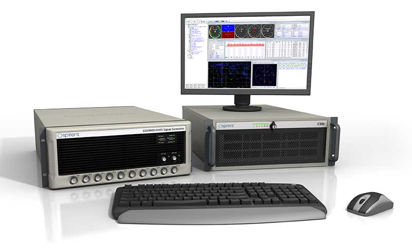
    GNSS simulator company Spirent Federal Systems will soon release SimMNSA 2.0. The release adds advanced scenario controls that enable full recreation of government test vectors while retaining the simple key and fly option of the initial release.

    Spirent Federal developed software that supports M-code signals using the Modernized Navstar Security Algorithm (MNSA). SimMNSA 1.0 was released in 2018 and is now used in laboratories throughout the country with receivers from all M-code manufacturers.

    “SimMNSA is the first MNSA-based M-code signal simulation to receive government security approval,” said Ellen Hall, President and CEO. “We pride ourselves in being leaders in innovation and we will continue to push ourselves to meet the growing needs of our customers.”

    Release 2.0 of Spirent Federal’s SimMNSA is scheduled for later this year. It will be available to authorized users of the GSS9000 Series, at no additional cost to current SimMNSA users under maintenance contracts.

  • Esri acquires nFrames for 3D capabilities

    Esri acquires nFrames for 3D capabilities

    Esri has acquired nFrames, a technology company that develops SURE, an imagery and lidar 3D surface reconstruction software.

    According to Esri, this will enable the fusion of imagery with 3D GIS, allowing nFrames and Esri users to seamlessly capture and analyze 3D data from aerial, drone and ground-based sensors in an automated end-to-end process.

    SURE scales 3D data creation to large city and countrywide airborne image datasets and projects. According to nFrames, it gives professional photogrammetry workflows improved precision, speed and simplicity on premises or in the cloud. SURE can be used for a number of industries, including those in government; national mapping; insurance; and architecture, engineering, and construction (AEC).

    Through this acquisition, Esri gains a robust production engine that transforms imagery and lidar data into point clouds, phototextured 3D meshes and true orthos, Esri said.

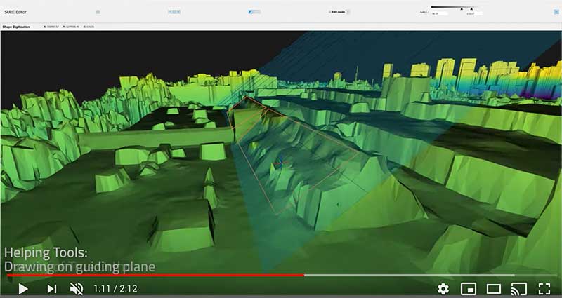
    SURE software editor (Screenshot: nFrames)
    SURE software editor (Screenshot: nFrames)

    In addition, SURE allows its users to generate 3D maps at scales from individual construction sites to entire cities and countries. These maps are fully automated at high resolution and repetition rates, nFrames added.

    “nFrames is a leading provider of 3D image reconstruction software and services, and I am excited to welcome the company to the Esri family,” said Jack Dangermond, Esri founder and president. “As Esri continues down its path of innovation to create a multidimensional experience, this acquisition enhances our ability to create extremely high-quality 3D data from imagery, which is critical for our customers in the municipal, planning and AEC industries.”

    SURE software will become a part of Esri’s ArcGIS platform. According to Esri, it will make SURE capabilities available in ArcGIS Drone2Map and Site Scan for ArcGIS so users can create better meshes, point clouds and true orthos from their drone imagery.

    “Together with Esri, we will be able to unlock the full value of 3D surface data through GIS by connecting geometry with metainformation to provide spatial context,” said Konrad Wenzel, CEO and co-founder of nFrames. “This fully automatic chain from data capture to analytics will enable smarter decision-making.”

    The nFrames headquarters will now serve as a new Esri research and development center based in Stuttgart, Germany.

  • Spectra Geospatial GNSS receiver chosen for around-the-world yacht race

    Spectra Geospatial GNSS receiver chosen for around-the-world yacht race

    Photo: Spectra Geospatial
    Photo: Spectra Geospatial

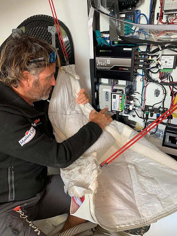
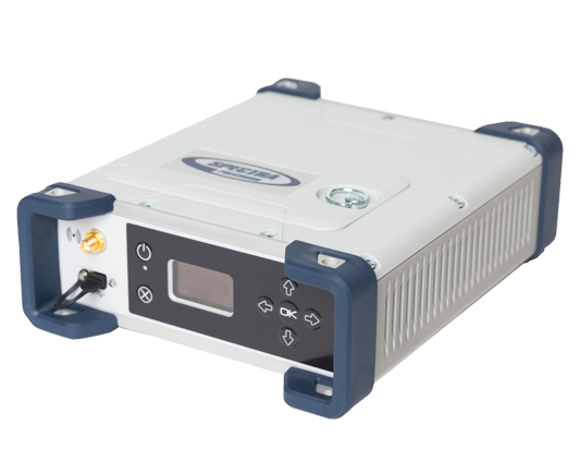
    The Spectra Geospatial SP90m GNSS receiver will guide the racing yacht Maître CoQ for the 2020 Vendée Globe, single-handed, non-stop around-the-world yacht race. The Vendée Globe is an extreme endurance test for both sailor and boat and widely considered the ultimate challenge in ocean racing. The race starts Nov. 8 and is expected to finish in late January or early February.

    The SP90m will provide the skipper of the Maître CoQ, Yannick Bestaven, with precise position and boat heading information. The SP90m information is integrated to a separate attitude information source, and the entire package of the position, heading and attitude is sent to the boat’s autopilot.

    Photo: Spectra Geospatial
    Photo: Spectra Geospatial

    Bestaven, responding to the changing sea and wind conditions, strategically adjusts the autopilot to keep the boat moving at top speed to the desired destination as he changes and trims sails and trims foils to achieve maximum sailing efficiency.

    The Maître CoQ is an advanced design mono-hull foiling sailing yacht in the category of IMOCA (International Monohull Offshore Class Association) which have a fixed length of 18.28 meters (60 feet), Antoine Connan, head of engineering for the Maître CoQ racing team, selected the SP90m.

    The hostile environment and requirements for precise position information at sea far from land made the selection of the SP90m an important technical choice. It always delivers an accurate position and precise heading with no GNSS corrections.

    Commenting on the performance of the SP90m in the recent July 2020 2,800-mile qualifying race, the Vendée- Arctique-Les Sables D’Olonne, Connan reports, “We are already very happy with its installation on board.”

    The SP90m is a rugged design for marine environments. With 480-channel tracking and dual GNSS antenna inputs, the SP90m is an integrated onboard rover receiver offering minimal size and low power consumption.

    When the Maître CoQ technical team, based in La Rochelle, decided they needed to upgrade the boat’s navigation system, they contacted Cadden, a specialist in supplying advanced electronic precision measurement sensors. In addition to the requirement for delivering fast, precise position and heading data, the new sensor had to be lightweight, small, require little power, be easy to integrate, and flawlessly withstand a hostile saltwater environment. Cadden’s analysis concluded the Spectra Geospatial SP90m fit the spec perfectly.

    “We are thrilled that the Maître CoQ racing team selected the Spectra Geospatial SP90m,” said Olivier Casabianca, vice president Spectra Geospatial. “It’s one more confirmation that Spectra Geospatial provides truly the highest quality rugged and precise GNSS receivers.“

    About the Vendée Globe 2020. Held every four years, the Vendée Globe is a single-handed (solo) non-stop yacht race around the world without assistance. It starts and finishes in Les Sables-d’Olonne in the Département of Vendée in France. The course is a circumnavigation from Les Sables- d’Olonne, that heads south in the Atlantic Ocean to the Cape of Good Hope, then east in the Southern Ocean clockwise around Antarctica, keeping Australia’s Cape Leeuwin and South America’s Cape Horn to port (to the left); and then back north in the Atlantic returning to finish in Les Sables-d’Olonne.

  • Trimble VRS Now covers 1M square miles with acquisition of MidStates VRS

    Trimble VRS Now covers 1M square miles with acquisition of MidStates VRS

    Trimble continues to increase its footprint to deliver high-accuracy positioning correction services

    Photo: Trimble
    Photo: Trimble

    Trimble has acquired MidStates VRS, a network previously owned by Butler Machinery and Frontier Precision. The addition of the network, in North and South Dakota, increases the footprint of Trimble’s VRS Now GNSS corrections service to cover more than one million square miles in North America. Financial terms were not disclosed.

    As part of an ongoing expansion strategy, the new coverage for the VRS Now subscription service helps users in more places achieve high-accuracy positioning to increase productivity, reduce operational costs and improve safety.

    The correction service is designed for professionals in agriculture, geospatial and construction as well as emerging autonomous applications including lane-keeping for passenger vehicles, vehicle-to-everything (V2X) position identification and unmanned aerial system guidance.

    Adding 105,000 square miles of coverage, the acquisition expands Trimble’s VRS Now network to be one of the largest in North America — over one million square miles, contributing to Trimble’s shift toward a software, services and subscription business emphasis.

    When using the Trimble VRS Now service, land and construction surveyors, GIS professionals and farmers — with a Trimble or third-party commercial GNSS receiver — can leverage instant high-accuracy corrections delivered via cellular network to improve productivity.

    Enabling users to work without a GNSS base station, the service is cost-effective and simple to use. It is ideal for a variety of applications that require sub-inch level accuracy and is an important component of the connected construction site and connected farm workflows.

    “The MidStates VRS network covers significant farmland, oil fields and rapidly developing urban areas, providing farmers and surveyors in the region with the real-time GNSS correction services they need to improve their day-to-day work,” said Patricia Boothe, senior vice president of Trimble’s Autonomy Sector. “The purchase of the MidStates network demonstrates Trimble’s ongoing commitment to provide a wide range of correction services for autonomous solutions — delivering unmatched access to fast, reliable and highly accurate positioning in more areas than ever before.”

    Trimble networks are supported by a global network operations team made up of GNSS system engineers, geodesy experts and IT professionals. The team monitors the networks 24/7 from operation centers located on three continents, providing consistent and reliable service uptime and performance integrity.

    Trimble VRS Now. The correction service offers instant access to centimeter-level positioning tailored to the users’ geographic location; the service is always on wherever and whenever needed within the network coverage area. With no base station or setup required, it is cost-effective, efficient and simple to use.

    VRS provides positioning professionals with instant access to real-time kinematic (RTK) and post-processing (PP) corrections utilizing a network of permanent (fixed) continuously operating reference stations (CORS).

    Trimble-owned VRS networks are accessible now in areas throughout the U.S. and Canada as well as Eastern Australia and Tasmania, France, Belgium, the Czech Republic, Estonia, Germany, Great Britain, Ireland, Luxembourg, the Netherlands, Sweden and New Zealand.

  • The expanded role of positioning through advancements in GNSS

    The expanded role of positioning through advancements in GNSS

    Auto Mining: A driverless Cat 793F CMD truck leaves an iron ore pit. (Photo: Caterpillar)
    Auto Mining: A driverless Cat 793F CMD truck leaves an iron ore pit. (Photo: Caterpillar)

    Individuals who use GNSS today may not know the significant advancements that have been accomplished over the past 30 years to obtain accurate GNSS-derived coordinates, especially GNSS-derived orthometric heights.

    Thirty years ago, there were two limiting factors for estimating GNSS-derived heights — estimation of accurate ellipsoid heights in a timely manner and the availability of an accurate geoid model. The geoid model was only good to the decimeter level, between two stations relatively close together. A significant improvement of the measurement of the Earth’s gravity field (such as from the GRACE mission) and digital elevation data (from the Space Shuttle Radar Topography Mission) facilitated the creation of more accurate geoid models. Geoid models went from decimeter values to centimeter, and then sub-centimeter values between closely spaced marks.

    A new national network

    During the past three decades, the U.S. National Geodetic Survey (NGS) has developed a national network of Continuously Operating Reference Stations (CORS). These CORS, along with the states’ real-time networks (RTNs), have provided the ability to compute accurate GNSS-derived coordinates in an efficient and effective manner. The modeling of antenna phase patterns was a critical development for combining different types of antennas.

    Today’s GNSS processing software is basically a “hands-off black-box” system. But 30 years ago, the analyst had to identify cycle slips and ensure that all unknown cycle ambiguities of the carrier-phase data (integers) were determined correctly. It was a time-consuming task, and analysts needed to understand the data. So many things can go wrong when someone relies on an answer from a black box. That said, federal agencies such as NGS and GNSS software companies have produced hands-off software that provides statistics and warning messages, as well as guidelines for ensuring results are consistent and accurate.

    The advancements in estimating GNSS-derived coordinates (including orthometric heights) have changed the way many industries do business. Farmers use it to drive their tractors and combines, mining companies control driverless vehicles, construction companies use automated machine guidance to build roads, and, of course, it has improved how individuals navigate from one location to the next.

    Hands-off farming and mining

    Thirty years ago, few farmers thought they would be able to sit in their cab and let their combine harvester drive itself. Geodesist, surveyors, and engineers had a vision of using GNSS to automate the use of farming and construction equipment, which became a reality.

    What will it be like in another 30 years? Will it be routine for individuals to program their car for a destination, and then sit back and read a book?

    Positioning with GNSS will be critical for the safety factor of driverless vehicles and the use of drones for delivery. Geodesists, surveyors and engineers, once again, need to lead the way to meet the positioning requirements of the future.

  • Defense small-vehicle navigation system designed for export

    Defense small-vehicle navigation system designed for export

    Photo: Etion Create
    Photo: Etion Create

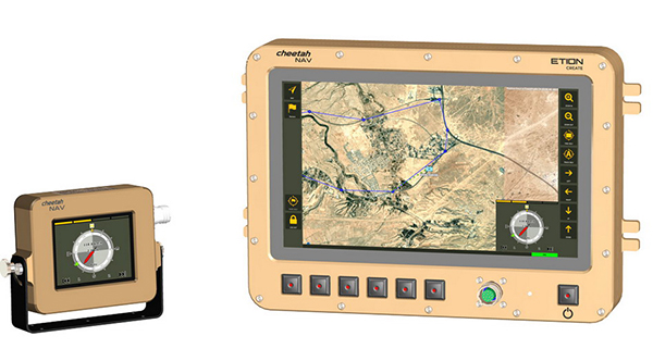
    A new military vehicle navigation system designed and developed by South Africa-based Etion Create is ready for the local and export markets.

    Designed for harsh environments and battlefield conditions, the CheetahNAV provides outstanding situational awareness, according to Etion Create. The crew of a light military vehicle can count on highly accurate position information, irrespective of whether they are denied satellite navigation. This is achieved through an advanced inertial measurement system (IMS), comprising several aids, including a gyro-compensated compass and an advanced Kalman filter-based algorithm.

    A brochure on CheetahNAV is available here.

    “We are confident that the system provides dead-reckoning horizontal position accuracy of 0.2% of distance travelled in a GNSS denied situation,” said Jan Hurter, senior product manager. “This translates, by way of example, to accuracy of just 200 metres over a distance of 100 kilometers.”

    The CheetahNAV can integrate with any number of different inertial navigation systems (INS) and can be aligned with any of the satellite navigation constellations. Combined with GNSS and compass information, the system enables dead-reckoning and accurate positioning of the vehicle in tactical situations. The tactical grade integral inertial measurement unit (IMU) ensures jamming-free operation.

    Some of the guidance cues the system provides to the crew during tactical maneuvers include the vehicle’s current position, true heading and desired heading towards the next waypoint, current speed and desired speed to reach the next waypoint or destination on time, and the next waypoint or destination. It also shows the pitch and roll attitude of the vehicle and the track it has travelled.

    This data is displayed on a sunlight-readable touch-screen enabled moving map display unit measuring 11.6-inch diagonal, in 16:9 TFT format, with a 1920×1080 resolution. Etion Create is also offering a slave unit for the vehicle driver, as the main display might be positioned elsewhere in a space constrained vehicle. This slave unit, measuring 3.5-inch diagonal TFT, displays information that is specifically required by the driver.

    Significant benefits of the CheetahNAV system include ruggedness for extreme battlefield conditions and 28V or 12V DC operation in line with military standards. Moreover, it boasts a high operational reliability.

    “It is important to note that Etion Create, as original design manufacturer, is focusing the CheetahNAV on the export market, including the possibility of technology transfer for indigenous manufacturing,” said Hurter. “Besides we offer a multi-language option, which is certainly a key advantage in multinational operations that are almost the norm nowadays.”

    The CheetahNAV is non-ITAR controlled, which is the preference of most land forces around the world today to meet their battlefield management requirements.

    Having utilized the building blocks of previously developed military off-the-shelf technologies, Etion Create considers the system to be at a high TRL (technology readiness level), and thus available for the export market.

    Previously called Parsec, Etion Create is a South African original design manufacturer (ODM) with a long-standing international reach and a professional portfolio of technology offerings and experience across a wide range of business sectors, including defence and aerospace, information security, and mining and industrial sectors.

  • Construction robot market grows with 9.5% CAGR for 2020-2026

    Construction robot market grows with 9.5% CAGR for 2020-2026

    Photo: ThossapholiStock/Getty Images Plus
    Photo: ThossapholiStock/Getty Images Plus

    The global construction robot market was valued at USD 231.5 million in 2018 and is expected to reach USD 464.8 million by 2026, growing at a compound annual growth rate (CAGR) of 9.5% during the forecast period, according to an InForGrowth market report.

    The construction industry is one of the least automated industries that features manual-intensive labor as a primary source of productivity. However, with the advancement in technology, the construction industry is utilizing robots to excel at repetitive tasks in a controlled environment.

    Construction robots have a major impact on the construction industry. The construction industry is looking to automate more and more tasks for the sake of productivity and efficiency, which in turn is increasing the demand for construction robots.

    The use of robots has grown considerably with increasing speed, efficiency, safety and profit concerns. Construction robots have provided a transformative experience for the entire industry and have helped in replacing or improving existing processes, making them more proficient as well as more precise.

    Companies are deploying these new commercially viable robots in various applications such as 3D printing of large structures, disaster relief situations, construction of tall structures, and for assisting workers performing laborious tasks. These robots have helped in automating laborious and dangerous tasks to keep laborers away from hazardous activities and enable them to focus on more productive work.

    3D printing. Moreover, the evolution of 3D printing in the construction industry is expected to create opportunities in the market. This will further enhance the market size of the global construction robot market. An increase in research and development activities to minimize the cost of robots will also enhance the market size over the forecast period.

    However, the high cost associated with the deployment of robotic solutions is expected to hamper the growth of the global construction robot market during the forecast period.

    Key findings. Based on the product type, the traditional robot segment accounted for the largest market size in the global construction robot market in 2018.

    Based on automation, the semi-autonomous robot segment accounted for the largest market size in the global construction robot market in 2018.

    Based on function, the demolition robot segment held the largest share in the global market in 2018.

    Based on applications, the public infrastructure segment is expected to dominate the market during the forecast period. Europe accounted for nearly 30% share of the global market in 2018.

    Recent industry news. In September 2019, Built Robotics closed a US$ 33 million Series B funding round, led by Next47, the global venture fund backed by Siemens, for autonomous construction equipment.

    In August 2019, John Sisk & Son used MULE at Sisk’s residential Wembley Park E05 site in London to reduce fatigue and injuries among workers and increase productivity.

    In June 2019, Boston Dynamics launched an inspection robot named SPOT, which is mounted with 3D cameras to inspect and map construction sites and identify hazards and work progress.

    Browse the full report with TOC.