Category: Applications

  • New DJI map tracks drone-assisted rescues worldwide

    New DJI map tracks drone-assisted rescues worldwide

    Global reference includes more than 400 people rescued by drones to date

    DJI has launched an online reference to track events around the world when a drone helped rescue someone from peril. The Drone Rescue Map shows how more than 400 people around the world have been helped by drones in more than 200 emergencies, and will be continually updated as new rescues occur.

    The DJI Drone Rescue Map has been compiled from news stories and social media posts from authoritative sources such as police departments, fire departments and volunteer rescue squads.

    Each entry on the map includes the location and date of the incident, a brief description, a link to the original story or post, and an easy way to share those incidents online. To make the map as definitive as possible, DJI encourages public safety agencies to share additional drone rescues so they can be included.

    Once a week on average

    The map includes rescues recorded in 27 countries across five continents, and shows how drone technology has moved from an experimental concept to standard public safety equipment.

    The first drone rescue was recorded in Canada in 2013, the next one was more than a year later, and early examples of drone rescues were as likely to be performed by helpful bystanders as by professionals.

    Today, drone rescues are reported about once a week on average, and public safety agencies routinely share those success stories on social media.
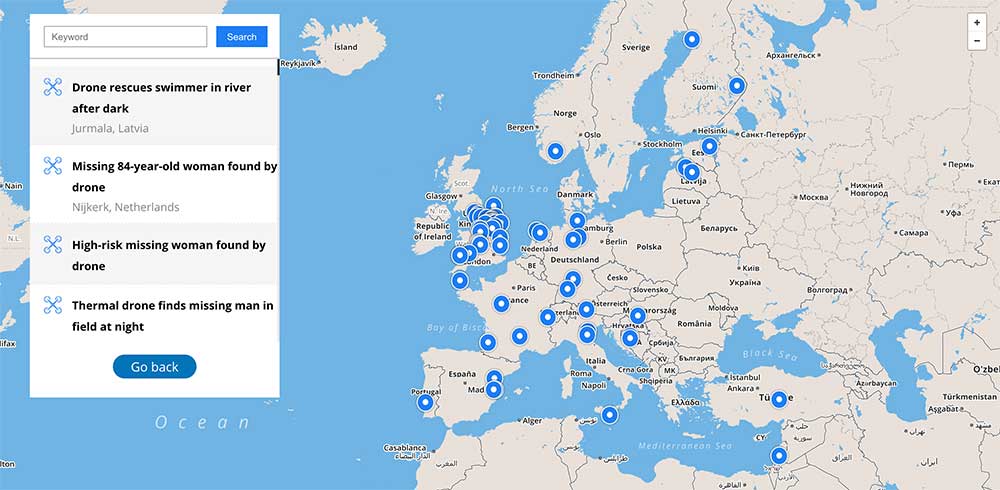
    Screenshot: DJI Drone Rescue Map
    Screenshot: DJI Drone Rescue Map

    “The DJI Drone Rescue Map is now the best global reference for how effective drones are in emergencies, and allows the world to see the tremendous impact drones have had in finding lost people, shortening searches, reducing risks to rescuers and saving lives,” said Romeo Durscher, DJI senior director of public safety integration. “Public safety workers already know how drones are revolutionizing their work, and now the rest of the world can see their amazing stories in one place. The DJI Drone Rescue Map honors the incredible rescues they’ve made, and will allow everyone to see how drones help save people in the future.”

    Types of rescues

    The map includes instances of drones:

    • finding people lost in forests, fields and mountains, often in darkness using thermal imaging cameras
    • dropping life preservers to people struggling in water
    • locating boaters stranded on remote waterways
    • helping rescue people who were at risk of harming themselves.

    The map does not include incidents when a drone is simply used as part of a larger search process; instead, a drone must have directly located, assisted or rescued a person in peril.

    Many of these incidents illustrate how drones can find missing people more quickly than a traditional ground-based search, allowing victims to be brought to safety faster, more easily and with less risk and burden for their rescuers.

    In some of the incidents on the DJI Drone Rescue Map, the drone helped accelerate a rescue and allow first responders to operate more efficiently.

    In other incidents, the drone clearly made the difference between life and death.

    Volunteer rescue

    “I know how important drones are for people in distress, because a drone saved my life,” said Jason Mabee, a Maryland man who was injured and near death last year in a local park when he was found by a volunteer drone pilot. “My family and I are eternally grateful that a total stranger was able to use his drone to find me. It’s comforting to know that drones are helping so many other people around the world too, and I hope the DJI Drone Rescue Map demonstrates just why drones are so important in emergencies.”

    “Drones have changed the game for finding and saving people lost in difficult conditions, and twice last year drones made the difference for us in finding and saving stranded hikers in dangerous terrain at night,” said Kyle Nordfors, Drone Team Coordinator for Weber County Search and Rescue in Utah. “Drones helped make these rescues possible while reducing risk and strain on our volunteer rescue force. We’re excited to see our successful efforts represented on the DJI Drone Rescue Map, and we hope it shows people all over the world how important drones are for saving lives and protecting the rescuers.”
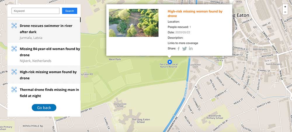
    Screenshot: DJI Drone Rescue Map
    Screenshot: DJI Drone Rescue Map

    Rapid increase in rescues

    DJI has previously released two detailed reports on how drones have been used to rescue people from peril around the world. The first, in 2017, counted 59 people rescued by drones, and the second saw the global total rise to 124 by 2018.

    PC Tom Shainberg, senior drone pilot of the Alliance Drone Team for the Devon & Cornwall and Dorset police forces in England, said, “The Alliance Drone Team is proud to be a leader in adapting drone technology for police incidents, and we’re glad to see our successful drone rescues — such as finding a vulnerable man huddled near the edge of a cliff — being shared wider, along with similar accomplishments from other public safety agencies from around the world via the Drone Rescue Map.”

    “Hundreds of examples now make clear that making drones widely accessible, with low barriers to entry and subject to a progressive set of operational regulations, leads inevitably to saving more lives around the world,” said Brendan Schulman, DJI Vice President of Policy & Legal Affairs. “The DJI Drone Rescue Map is a powerful resource for policymakers to understand the impact drones have on protecting vulnerable people in their own communities, and the detrimental consequences of policies that would restrict or discourage the use of drones, or increase the cost of using them. Regions with less favorable operating rules for drones appear to have substantially fewer reports of drone rescues.”

    Seeking submissions

    DJI monitors global news coverage, drone-related social media, and other sources to find new examples of drone rescues, but understands that many similar incidents may not yet be recorded on the map.

    Anyone who knows of a drone-involved rescue not included on the DJI Drone Rescue Map can submit it through a form at the bottom of the map page.

    These submissions will be reviewed for publication on the map, so DJI asks anyone submitting information about a rescue to respect the privacy rights and expectations of the persons involved, and to not share any confidential or sensitive information about agency operations.

  • Using location data in the fight against COVID-19

    Using location data in the fight against COVID-19

    San Francisco, captured by HERE’s 3D mapping technology. (Image: HERE)
    San Francisco, captured by HERE’s 3D mapping technology. (Image: HERE)

    In 1854, English physician John Snow mapped the London cholera epidemic to determine the exact location of a contaminated water pump on Broad Street, pioneering the use of location mapping and data to manage public health crises.

    Today, governments and public health officials are utilizing location data to help fight the COVID-19 global pandemic. Location data and maps are at the frontlines to aid emergency responders and healthcare providers, while GIS professionals, data scientists and many others rely on maps and location data to allocate supplies, manpower and assets where they are needed most.

    Data as a source of truth

    Location data has been one of the most valuable tools to guide crisis response. By referencing professionally managed, comprehensive geospatial databases, public health officials are able to precisely locate key medical and emergency resources, including hospitals, medical centers, medical and emergency services, pharmacies, and food and water distribution centers.

    For example, the HERE location platform continually validates the freshness and features of its map through thousands of data sources. This includes field-collected data, third-party data from government sources, and crowdsourced data from expert communities. Taken together, the process rapidly delivers clear, timely location information to end-users such as key medical stakeholders.

    It is critical that all levels of government — local, state and federal — have access to these types of valuable datasets during times of emergency. In response to the pandemic, we have seen incredible agility from facilities that have been converted to provide critical medical services.

    For example, the Javits Center in New York City has been used as a field hospital, a sports facility has been converted into a drive-through testing center, and schools are being used to distribute food. By tracking these updates, authorities have real-time awareness of these facilities and their availability to provide services.

    Use Case #1

    Social distancing efficacy

    At this stage of the pandemic, the Federal Emergency Management Agency has tapped into location data to track the efficacy of social distancing policies and the spread of the virus. It’s valuable to map the virus’s spread for many reasons, but a few key reasons include:

    • Predicting the movement of COVID-19. By mapping the spread, we can proactively align the medical supply chain behind these predictions.
    • Understanding the effectiveness of social distancing. Social distancing is one of the most powerful ways to stop the spread of the virus. By tracking the efficacy of these measures and regulations and ensuring that citizens are complying with shelter in place, we’re able to predict how we are able to slow or flatten the spread.
    • Predicting the economic impact. As we consider reopening America for business, it’s important to understand where the virus is most prevalent, and the timeline for recovery.

    Use Case #2

    The strained medical supply chain

    The coronavirus has caused strain across most industry supply chains, but most notably, the medical supply chain. Medical resources, including hospital beds, masks and life-saving ventilators have become scarce and unevenly distributed.

    In times of crisis, with thousands of lives at stake and the potential for further economic fallout, it’s critical that public health officials are equipped with authoritative, comprehensive datasets to guide decision-making. When organizations are equipped with this valuable data, they can harness the power of location data for good and follow in the footsteps of the location data pioneer John Snow.

  • Taking to the field during the coronavirus pandemic

    Taking to the field during the coronavirus pandemic

    City officials in Sarasota, Florida, kept their staff actively working during COVID-19 social distancing mandates by training and tasking them with mapping utility data in the field.

    The city’s plan to rebuild its GIS database had an estimated five-year timeline. GIS Coordinator William Rockwell suggested to city manager Tom Barwin that those unable to work from home be trained to collect the data. Rockwell worked with Sarasota IT Director Herminio Rodriguez to calculate the cost of acquiring enough GNSS receivers for the idle staff to use, and discovered a substantial cost savings.

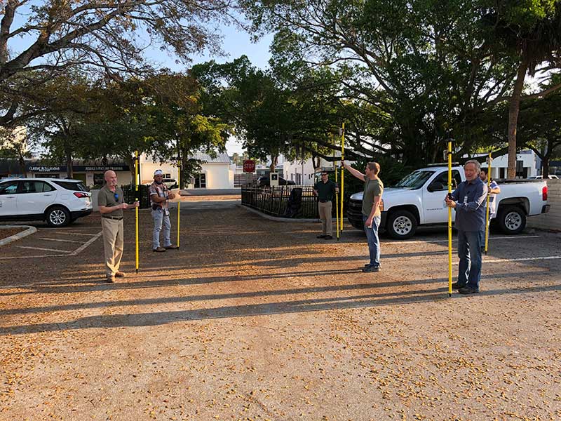
    Hands-on training took place in the Sarasota City Hall parking lot, with trainees practicing social distancing. (Photo: Eos Positioning)
    Hands-on training took place in the Sarasota City Hall parking lot, with trainees practicing social distancing. (Photo: Eos Positioning)

    “By implementing this project, we not only keep city staff productive, but we’ll also be collecting data that would otherwise cost hundreds of thousands of dollars if we outsourced the work,” Rockwell said.

    Training from a Distance. Rockwell obtained affordable Arrow 100 GNSS receivers from an Eos Positioning distributor and hosted small-group training sessions in the city hall parking lot. Employees from a multitude of different departments were trained, such as a parking enforcement officer and a transportation planner.

    All employees were carefully kept six feet apart. From a maintained distance, Rockwell explained the basic concept of data collection using high-accuracy Arrow 100 receivers with ArcGIS Collector.

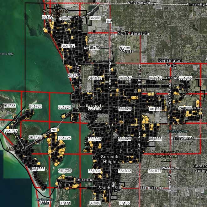
    The new team mapped 93% of street lights and road signs in one month. (Photo: Eos Positioning)
    The new team mapped 93% of street lights and road signs in one month. (Photo: Eos Positioning)

    The employees took turns collecting sample data so Rockwell could address any initial concerns. He also gave each of them a printed map series, created in ArcGIS Pro, that showed the city divided into 28 grids. This allowed the team members to easily mark off where they collected data each day.

    At the end of each day, the workers synced their data, collected by the Arrow 100s, to ArcGIS Online, which allowed Rockwell to monitor progress.

    To date, 14 field workers have collected 93% of the city’s 6,000 street lights and 16,000 road signs. Although the 30-day project pilot has finished, the city plans to collect the remaining lights and signs, as well as the city’s 35,000 trees, later this year. High-accuracy GIS data collection has received encouraging feedback from management.

    “I’m thrilled the city is supporting this initiative,” Rodriguez said. “To be able to take employees doing very, very different jobs and put them in the field — this wouldn’t have been possible in a normal environment. We are excited that everyone is chipping in.”

  • Microchip updates BlueSky GNSS Firewall Software

    Microchip updates BlueSky GNSS Firewall Software

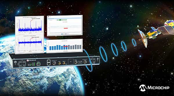
    Image: Microchip
    Image: Microchip

    U.S. Department of Homeland Security’s live-sky testing evaluations influenced development of BlueSky GNSS Firewall Software Release 2.0

    Microchip Technology Inc. has released a major software update for its BlueSky GNSS Firewall product, providing a higher level of resiliency against GPS vulnerabilities for systems dependent on GPS signal reception.

    Such systems include critical infrastructure such as power utilities, financial services, mobile networks and transportation that rely on GPS-delivered timing to ensure ongoing operations.

    Microchip’s BlueSky GNSS Firewall Software Release 2.0 performs real-time analysis to detect jamming and spoofing for protecting reception of the GPS signal and hardening response and recovery to avoid signal disruption.

    Release 2.0 includes charting and advanced threshold settings of GNSS observables such as satellites-in-view, carrier-to-noise, position dispersion, phase time deviation and radio frequency (RF) power level to simplify system turn-up and deployment.

    The release also includes improvements developed by Microchip as a result of participation in a 2019 industry live-sky testing event hosted by the U.S. Department of Homeland Security (DHS) Science and Technology Directorate.

    Microchip’s participation in the DHS-hosted GPS Testing for Critical Infrastructure (GET-CI) events included scenarios with spoofed signals, and helped the company identify new solutions to prevent signal disruptions. As a result, Microchip developed the Release 2.0 to address operators’ evolving requirements.

    As a leader in frequency and time systems, Microchip continuously innovates GPS signal reception security technologies for commercial and military operators similar to how network firewalls protect against virus threats. Updates are essential to defend against rapidly-evolving GNSS disruptions and enable critical infrastructure operators to avoid interruptions of service.

    When connected to Microchip’s TimePictra management software, critical infrastructure operators can monitor and analyze GNSS signals in cities, across geographic regions, throughout a country and even globally.

    Other complementary devices and software in Microchip’s suite of GPS systems and services include the TimeProvider 4100 Precise Timing Grandmaster with Gateway Clock, SyncServer 600/650 timing and frequency instrument, miniature atomic clock (MAC), Time Cesium and 5071A cesium primary frequency standard.

  • Geotab launches public works solution for government fleets

    Geotab launches public works solution for government fleets

    Helps enable state and municipal government agencies to improve fleet operations and increases operational efficiencies

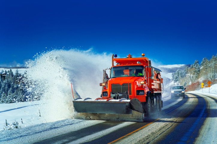
    Photo: THEPALMER/E+/Getty Images
    Photo: THEPALMER/E+/Getty Images

    Geotab, an Internet of Things (IoT) and connected transportation company, has launched its Geotab Public Works solution in North America.

    The all-in-one solution offers fleet managers full visibility into the operational data of all government vehicle types on a single platform,and provides the toolsets to effectively remain compliant, reduce costs and maintain road safety.

    Designed to help government agencies better manage vehicles such as salt spreaders, snowplows, street sweepers and waste management vehicles, the Geotab Public Works solution is integrated with an extensive number of spreader controllers.

    The solution is built to support key government business drivers including material management, compliance, accountability and liability. Providing public works departments with improved fleet management capabilities, fleets can utilize the solution to more accurately measure material usage, such as salt, allowing government fleet managers to feel more confident that community roads are not over- or underserviced.

    With Geotab Public Works, government fleets are better able to control costs while reducing the impact that excessive material usage can have on the environment.

    “Empowered by an industry-leading number of spreader controller integrations alongside various geospatial capabilities, the Geotab Public Works solution is designed to help government fleets optimize both their seasonal and ongoing fleet operations,” said Chris Jackson, associate VP of Business Development, Public Works and Smart Cities. “Spreader controllers provide fleet managers with rich insights that can help government agencies ensure that their fleets are adequately servicing roads without sacrificing the health of the environment.”

    Available as a configurable add-in on the MyGeotab platform, the Geotab Public Works solution allows governments, including municipalities of all sizes, to customize their database to help meet the specific needs of their fleet.

    In addition, users can add further value and customization through access to the Geotab Marketplace, an extensive portfolio of mobile apps, software add-ins and hardware add-ons that enable Geotab customers to further customize the fleet management solution.

    “As many governments continue to look for ways to optimize their operations, Geotab Public Works is the type of robust, scalable, secure solution that provides real value by giving government fleet managers and local constituents unprecedented visibility to their public services,” said Jean Pilon-Bignell, vice president of Business Development, Government and Smart Cities at Geotab. “With high-frequency, near real-time reporting, the Geotab Public Works solution allows governments to know where their fleets are and how they are operating at all times, enabling fleet managers to more efficiently leverage their fleet data to provide better and more transparent services to their residents.”

  • ComNav launches R550 GNSS data collector for the field

    ComNav launches R550 GNSS data collector for the field

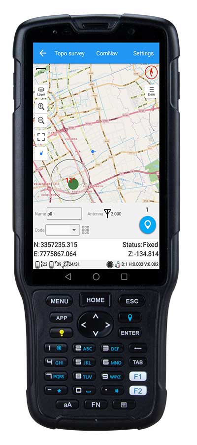
    Photo: ComNav
    Photo: ComNav

    ComNav Technology has released the new-generation data collector R550.

    With its new industrial-level design and new hardware platform, the R550 is designed to ensure efficiency and productivity in the field.

    The IP67 dust-and-waterproof rating protects the R550 from most harsh environments. Equipping it with 7,000 mA Li-ion battery allows more than 14 hours of continuous operation, while fast-charging technology means it only takes four hours to fully charge the collector via the type-C interface port.

    The 5-inch-wide sunlight-readable, high-resolution screen provides a smooth experience for any operation. The integrated autofocusing camera helps enhance job documentation by taking photos on site and sharing job information with colleagues.

    Survey Master field software available on the R550 controller ensures efficient surveys in the field, including topographic surveys, stakeouts, coordinate geometry (COGO) and more.

    Powered by the Android 8.1 operating system and designed with 4G RAM, 64GB ROM and 4G/BT/Wi-Fi on board, users can run other third-party apps based on their specific requirements.

    The R550 data collector now is available through ComNav Technology authorized local distributors or ComNav Technology directly.

  • CHC Navigation introduces BB4 UAV and AlphaUni lidar combination

    CHC Navigation introduces BB4 UAV and AlphaUni lidar combination

    Lidar series paired with professional drone provides multi-platform, high-accuracy 3D laser scanning for geospatial and mapping professionals

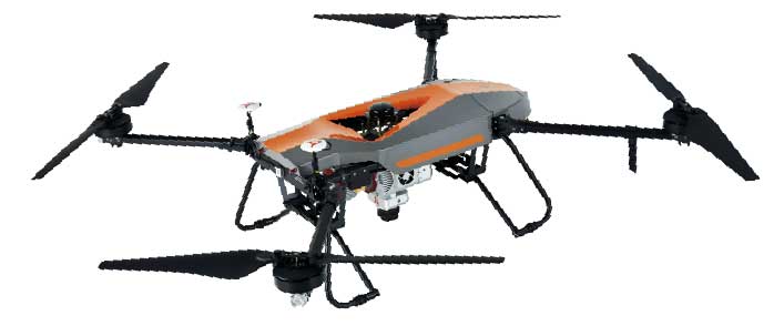
    CHC Navigation (CHCNAV) has launched the multi-rotor BB4 drone and AlphaUni 300/900/1300 lidar.

    Photo: CHCNAV
    Photo: CHCNAV

    The combination of the AlphaUni 300/900/1300 lidar and BB4 UAV solutions creates a comprehensive and versatile range for 3D mapping and geospatial data acquisition in land, air and marine applications.

    “The purchase of a 3D mobile mapping system is too often constrained to a specific purpose, such as airborne or ground survey,” said George Zhao, CEO of CHCNAV. “A lot of our customers expressed the need to have a professional lidar solution that can be used in different scenarios, offering optimal adaptability to their current and future needs.

    “With our AlphaUni series, we are now introducing an innovative response with a multi-platform lidar system that can be used with an aerial or marine drone, on a vehicle or carried as a backpack,” Zhao said. “In addition, the long flight autonomy of our new BB4 UAV allows missions over large areas in a single flight for exceptional productivity.”

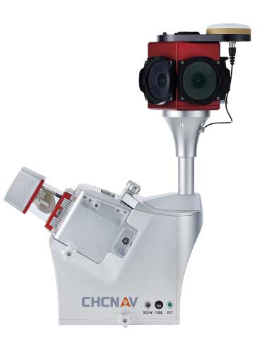
    AlphaUni lidar series

    Photo: CHCNAV
    Photo: CHCNAV

    The new AlphaUni series enhances CHCNAV’s Alpha Mobile Mapping family with a light, versatile long-range laser scanner systems available on the high-end market.

    The series provides optimized data sets powered by advanced GNSS/inertial navigation system (INS) sensors and long-range Riegl scanners.

    AlphaUni’s design adapts to a variety of applications and can be installed on a variety of platforms, including multi-rotor UAV, fixed-wing vertical-takeoff-and-landing (VTOL) UAV, vehicles, rail trolleys, backpacks, boats and more.

    BB4 UAV

    The BB4 UAV is a high-end multi-rotor drone optimized for the CHCNAV AlphaUni 300/900/1300 lidar series. Its modular design simplifies deployment in just a few minutes.

    Its 7-kg payload breaks the capacity barrier, and more than 45 minutes of flight time increases the airborne lidar survey ability.

    The redundant CHCNAV and DJI inertial measurement unit (IMU) and GNSS units provide reliable centimeter real-time kinematic (RTK) positioning, meeting the demand for high accuracy in the geospatial and mapping industry.

  • ComNav releases cost-effective M300 Plus GNSS CORS receiver

    ComNav releases cost-effective M300 Plus GNSS CORS receiver

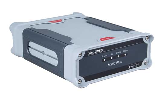
    ComNav Technology has released the M300 Plus GNSS receiver to the international market.

    The M300 Plus is designed to supplement the company’s M300 Pro, which is aimed at clients who need a more economical version for their CORS networks. The M300 Plus not only can be used as a CORS receiver, but is a good choice for monitoring projects and other applications.

    With ComNav Technology’s new-generation GNSS engine, the M300 Plus can track all current and future constellations. By using a powerful, adaptive detecting and canceling technology, the M300Plus provides enhanced anti-jamming capability, which is critical for a reference station providing reliable GNSS data.

    Photo: ComNav
    Photo: ComNav

    The M300 Plus’ powerful built-in web server provides full remote control of the receiver configuration, status checking, firmware update and data download. It supports multiple independent data transfer through TCP/UDP/Ntrip protocol in RTCM, ComNav binary, NMEA and BINEX data formats, combined with Email Alert and FTP push, which improves the efficiency and profitability of businesses.

    In addition to its standard Ethernet port for data transmitting, the M300 Plus GNSS receiver also fully implements a 4G module as an internet backup, which enhances the stability of data connections.

    M300 Plus is now available through ComNav Technology authorized local distributors or ComNav Technology directly.

  • GMV creates mobile app to for safe return to work

    GMV creates mobile app to for safe return to work

    GMV logoTechnology multinational GMV has launched Covclear, a mobile app to ensure a safer and more efficient return to work after the COVID-19 lockdown.

    The application helps to make sure offices will be a safe workplace while minimizing the risk posed to the health of employees or other persons who are working in open workplaces in an environment of maximum safety and protection.

    The app is collaborative and relies on a principle of co-responsibility between the company and its employees to protect their own health and the health of their relatives and workmates.

    Covclear integrates all the following in a single platform: a daily medical health check of all employees; recording of trips to restricted sites; contact tracing within the firm; control of office access by means of temperature readings; quarantine management; and control of site occupancy. It also publishes the company’s healthcare crisis rules.

    First and foremost, it offers a self-check prepared by clinicians to assess the state of people and pinpoint any contagion risk before they commute to work. On the basis of employees’ daily responses, the app determines their risk level on their own phone, generating a workplace accessing QR color code.

    A red code would trigger automatic three-day contract tracing, giving all these contacts instant and anonymous warning so they can act accordingly. All this is conducive to the ongoing safety of all work colleagues.

    Covclear also allows for management of site occupancy, assigning days of on-site working to employees and thereby ensuring maintenance of optimum occupancy levels in places with a large number of workstations.

    The app developed by GMV has been designed to protect information at source, thereby guaranteeing data-protection compliance at all times. The company will have access only to the QR code color for carrying out the corresponding access control and to gain an overview of the company’s state of health.

    Covclear, which is already successfully up and running in some company offices, springs from the company’s own safety needs. It has been set up in only a few weeks thanks to the company’s wealth of expertise in the development of technology and mobile apps.

    At the same time, and mindful that it could be useful for third parties, GMV is also making this app available to its clients and suppliers and to any other firm that might be in need of such safe going-back-to-work services.

    Covclear includes four applications: iOS and Android user apps, an Android personnel access control app, and an administration web tool for the company. The data is kept in totally dependable, GDPR-compliant cloud servers.

  • GeoCue releases 3D UAS systems with Applanix inside

    GeoCue releases 3D UAS systems with Applanix inside

    Photo: GeoCue
    Photo: GeoCue

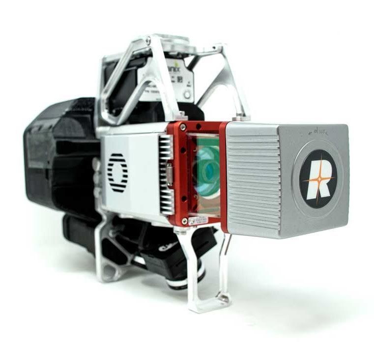
    GeoCue Group has released the True View 615 and True View 620 UAS lidar 3D imaging systems. The True View systems are compact, survey-grade 3D imaging sensors designed for small unmanned aerial systems.

    True View 615 and 620 are equipped with Riegl’s miniVUX-2UAV laser scanner integrated with dual photogrammetric cameras. Position and orientation is provided by an Applanix APX-15 (True View 615) or extreme accuracy APX-20 (True View 620).

    All True View 3D imaging systems are bundled with Applanix POSPac, True View EVO post-processing software and True View Reckon data management solution.

    The Riegl laser scanner and dual photogrammetric cameras have been carefully configured to provide a fused lidar/imagery field of view of up to 120°. The system includes full post-processing software that generates a stunning ray-traced 3D colorized point cloud and geocoded images.

    An upgrade path will be available to promote a True View 615 to a True View 620 by adding the Applanix APX-20 external inertial measurement unit.

    The True View product line gives mappers and surveyors the ability to deliver high-quality analytic data with exact accuracies. These deliverables are generated using workflows and tools within GeoCue’s post-processing software, True View EVO. Examples of derived products include bare Earth models, profiles, cross sections, topographic contours, volumetric analysis and more.

    “Our Quanergy-based True View 410 has rapidly become the standard for general purpose drone 3D Imaging, where moderate vegetation penetration and accuracies of 5 cm RMSE are adequate,” said GeoCue’s President, Lewis Graham. “The True View 615/620 provides a solution for situations where deeper vegetation penetration, wire extraction and extreme accuracy are required. These are great new additions to the True View product line.”

    The True View 615/620 will be available for shipment late June.

  • Draganfly, MicaSense partner on agriculture package for crop imaging, data

    Draganfly, MicaSense partner on agriculture package for crop imaging, data

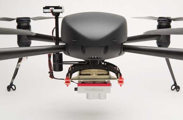
    The Draganflyer Commander Ag-Pro Package. (Photo: Draganfly)
    The Draganflyer Commander Ag-Pro Package. (Photo: Draganfly)

    Draganfly has launched the Draganflyer Commander Ag-Pro Package, designed for the agricultural industry.

    According to Draganfly, its Draganflyer Commander Ag-Pro Package includes everything needed to perform crop health assessment, irrigation monitoring and yield optimization.

    The Ag-Pro Package, which combines the MicaSense RedEdge-MX multispectral sensor and the Draganflyer Commander UAV, is suitable for projects requiring long flight times, a high level of data resolution and accuracy and data security, the companies added.

    The Draganflyer Commander is an electric multirotor UAV built on Draganfly’s patented carbon fiber folding airframe. Its dual-battery system powers 35-minute flight times, and its automated flight planning tool allows users to quickly create coverage areas and flight plans.

    The MicaSense RedEdge-MX multispectral sensor features five narrowband imagers that capture high-quality images that can produce maps for a multitude of agricultural uses. In addition, the sensor boasts two calibration methods that produce accurate data that can be compared across time, allowing for temporal analysis throughout the season and from year to year.

    “We’re excited about bringing this affordable new multispectral option to market,” said Cory Baker, production manager at Draganfly. “We have been working with the MicaSense lineup of cameras for several years and have been very pleased with their seamless integration support and high-quality data outputs. Our skilled engineers can incorporate any of the powerful sensors from the MicaSense portfolio onto our UAVs.”

    The Draganflyer Commander Ag-Pro Package features a secure controller, as well as a lightweight yet durable air frame.

  • How aerial imagery helps protect natural resources

    How aerial imagery helps protect natural resources

    Photo: Lake County Forest Preserves
    Photo: Lake County Forest Preserves

    An upcoming GPS World webinar shows how high-definition aerial imagery can help protect and maintain natural resources.

    In Transforming Land and Asset Management with HD Aerial Imagery, four
    mapping experts discuss how Lake County Forest Preserves of Illinois uses HD aerial imagery to manage and track changes.

    The webinar, sponsored by Nearmap, takes place June 25 at 1 p.m. EDT / 10 a.m. PDT / 7 p.m. (1900h) Central European Time. Registration is free.

    Managing and protecting the nearly 31,000 acres of the preserves is no small task, so the ability to see the environment at scale in crystal-clear clarity is a must. Aerial imagery provides an “eye in the sky” to get better context of truth on the ground.

    Lake County Forest Preserves uses Nearmap aerial imagery to:

    • monitor and track change over time with historical and current captures
    • assess and address invasive species growth with high-resolution imagery
    • manage remote work challenges during COVID-19 to locate assets.

    Joining Brett Clark of Nearmap are three experts from Lake County Forest Preserves.

    Nick SpittlemeisterNick Spittlemeister
    GIS Analyst, Planning and Land Preservation Dept.
    Lake County Forest Preserves District (IL)

    Nick Spittlemeister has been with Lake County Forest Preserves since 2016, working to create an enterprise solution that employs web GIS in all facets of the organization. He helped the district secure a license with Nearmap in 2018 and has deployed it across their GIS system, from Desktop software to web applications and native apps. He has been using GIS for more than 15 years and holds a bachelor’s degree in geography from Northern Michigan University.

    Dave CassinDave Cassin
    Manager of Landscape Ecology
    Lake County Forest Preserves District (IL)

    David Cassin’s remote sensing training began in the US Navy (1990-94) where he was trained as an Intelligence Specialist / Air Photo Interpreter, put into practice during Operation Desert Shield / Storm. Post military service, he continued his craft in college with incorporation of ArcGIS. He combined his skillset and his love of nature by getting a degree in Natural Resource Management. Integrating remote sensing skills into landscape scale restoration projects by utilizing historical air photos and land survey data, he is able to determine historic land uses and alterations. Specific to Nearmap, he was able to map populations of Phragmites australis (an invasive species in Illinois) by utilizing the fall 2019 Nearmap imagery remotely during the COVID-19 stay at home order.

    Kevin KleinjanKevin Kleinjan
    Senior Engineer
    Lake County Forest Preserves District (IL)

    Kevin has utilized aerial imagery and geospatial technologies for over 25 years to inform and support planning and infrastructure related decisions. He utilizes Nearmap’s high-resolution imagery with multiple captures throughout a calendar year to analyze and update infrastructure assets quickly and accurately from both the office, and in the field using mobile devices. This enables him to efficiently manage the District’s sign shop, site amenity and heavy equipment crews. He has dual degree in Landscape Architecture and Geography from South Dakota State University and is a Registered Landscape Architect in Illinois and Wisconsin.

    Brett Clark

    Brett Clark
    Senior Account Executive
    Nearmap
    Brett graduated from Brigham Young University with a degree in communications. He was employee #2 for Nearmap, U.S., and focuses primarily on serving the public sector – both state and local. Brett lives in the Indianapolis area with his wife and three daughters.

    Register for the free webinar here.