Hyundai is the first Uber Elevate partner with manufacturing capabilities to mass produce Uber Air Taxis
Uber and Hyundai Motor Company announced at CES 2020 a new partnership to develop Uber Air Taxis for a future aerial ride-share network and unveiled a full-scale aircraft concept. Hyundai is the first automotive company to join the Uber Elevate initiative, bringing automotive-scale manufacturing capability and a track record of mass-producing electric vehicles.
CES 2020, the massive annual consumer electronics show, is taking place Jan. 7-10 in Las Vegas. Hyundai Motor’s innovative smart mobility solutions including UAM, PBV, Hub and more are showcased at Booth 5431 in the Las Vegas Convention Center North Hall.
The taxi concept was created in part through Uber’s open design process, a NASA-inspired approach that jump starts innovation by publicly releasing vehicle design concepts so any company can use them to innovate their air taxi models and engineering technologies.
In this partnership, Hyundai will produce and deploy the air vehicles, and Uber will provide airspace support services, connections to ground transportation, and customer interfaces through an aerial ride-share network. Both parties are collaborating on infrastructure concepts to support take-off and landing for this new class of vehicles.
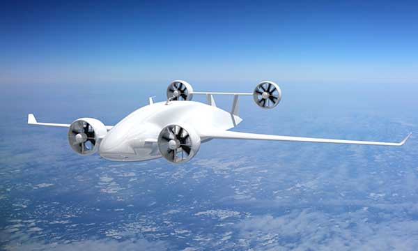
The SA-1 air taxi. (Photo: Uber/Hyundai)
“Our vision of urban air mobility will transform the concept of urban transportation,” said Jaiwon Shin, Executive Vice President and Head of Hyundai’s Urban Air Mobility (UAM) Division. “We expect UAM to vitalize urban communities and provide more quality time to people. We are confident that Uber Elevate is the right partner to make this innovative product readily available to as many customers as possible.”
“Hyundai is our first vehicle partner with experience of manufacturing passenger cars on a global scale. We believe Hyundai has the potential to build Uber Air vehicles at rates unseen in the current aerospace industry, producing high quality, reliable aircraft at high volumes to drive down passenger costs per trip. Combining Hyundai’s manufacturing muscle with Uber’s technology platform represents a giant leap forward for launching a vibrant air taxi network in the coming years,” said Eric Allison, head of Uber Elevate.
In preparation for this announcement, Hyundai worked with Uber Elevate to develop a PAV (personal air vehicle) model, S-A1, that uses innovative design processes to optimize electric vertical take-off and landing (eVTOL) aircraft for aerial ridesharing purposes. S-A1 previous eVTOL designs Uber Elevate has released in the following ways:
It is designed for a cruising speed up to 180 miles/hr (290 km/hr), a cruising altitude of around 1,000-2,000 feet (300 – 600 mt) above ground, and to fly trips up to 60 mile (100 km).
The Hyundai vehicle will be 100% electric, utilizing distributed electric propulsion and during peak hours will require about five to seven minutes for recharging.
Hyundai’s electric aircraft utilizes distributed electric propulsion, powering multiple rotors and propellers around the airframe to increase safety by decreasing any single point of failure. Having several, smaller rotors also reduces noise relative to large rotor helicopters with combustion engines, which is very important to cities.
The model is designed to take off vertically, transition to wing-borne lift in cruise, and then transition back to vertical flight to land.
The Hyundai vehicle will be piloted initially, but over time they will become autonomous.
The cabin is designed with four passenger seats, allowing riders to board and disembark easily and avoid the middle seat with enough space for a personal bag or backpack.
Ushering in the era of seamless mobility, Hyundai’s exploration of future urban transportation incorporates the electric PAV concept with a new ground transportation, the Purpose Built Vehicle (PBV) concept.
Hyundai’s vision for creating communities from future transit systems comes into focus with yet another new infrastructure concept, called the Hub. When many PBVs and PAVs are docked and connected to a Hub, they make a new public space where diverse groups of people can come together.
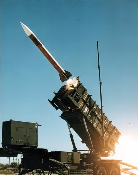
U.S. forces and air-defense missile batteries across the Middle East were placed on high alert Jan. 7 in preparation for possible Iranian drone attacks, reports CNN, including all Patriot batteries and forces in the area.
U.S. officials told CNN that intelligence mounted about a threat of an imminent attack against U.S. targets in the wake of the U.S. drone strike that killed Iranian general Qasem Soleimani. U.S. intelligence also observed Iran moving military equipment, including drones and ballistic missiles, over the last several days.
The movement may be an Iranian effort to secure its weapons from a potential U.S. strike, or put them in positions to launch their own attacks.
Iran has put missiles on its drones that have been used in other attacks, including a significant attack on Saudi oil installations last year (see below).
Targets of concern are U.S. locations in Iraq, Kuwait, Saudi Arabia, the United Arab Emirates and Jordan.
2019 Drone Tensions
Drones forces from both sides targeted assets in 2019. In June, Iran shot down a U.S. military drone that it claimed was an intruding American spy drone entering its territory. The U.S. said the drone was shot down in international airspace over the Strait of Hormuz.
In July, U.S. Marines jammed and destroyed an Iranian drone in the Strait of Hormuz from aboard the USS Boxer, an amphibious assault ship, because the drone has closed too close, to approximately 1,000 yards. Iran denied losing any of its drones.
In September, Iran was blamed for an attack on the Saudi oil industry, with drones and cruise missiles assumed launched from an Iranian base in Iran close to the border with Iraq. The Abqaiq oil plant was struck by more than a dozen projectiles.
Maritime Alert
On Monday, the U.S. Maritime Administration issued an alert to commercial vessels operating in the Middle East, citing multiple maritime threats and stating “there remains the possibility of Iranian action against U.S. maritime interests in the region.”
According to the alert, “The U.S. government is continually assessing the maritime security situation in the region to safeguard freedom of navigation, ensure the free flow of commerce, and protect U.S. vessels, personnel, and interests.
“U.S. Fifth Fleet Naval Cooperation and Guidance for Shipping (NCAGS) has the latest information on the dynamic maritime security threats and operational environment in this region. U.S. commercial vessels are advised to exercise caution and coordinate vessel voyage planning for transits of the Persian Gulf, Strait of Hormuz, Gulf of Oman, North Arabian Sea, Gulf of Aden, and Red Sea with NCAGS and follow NCAGS’s recommendations and guidance whenever possible.”
A collaboration between AVL and Rohde & Schwarz, two providers of measuring and automotive testing systems, now permits the reproduction of realistic GNSS reception conditions for testbed vehicle testing. As a result, users can reliably test all aspects of GNSS-based vehicle positioning — a core functionality of autonomous vehicles.
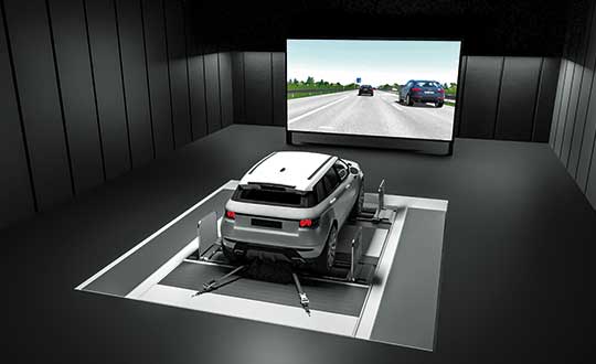
AVL DRIVINGCUBE enables the reproducible testing of driver assistance systems and driving features for self-driving vehicles using a real vehicle within a virtual environment in a variety of different traffic situations. For that purpose, test drives are performed with a real, ready-to-drive vehicle on a chassis dynamometer or powertrain testbed.
With the help of realistic virtual driving scenarios, it is possible to test peripheral sensors, control systems and actuators inside the vehicle in a fully reproducible and reliable manner. Automated vehicle functions are thus sufficiently validated during development and even before testing on the proving ground.
The range of environment simulations carried out with AVL DRIVINGCUBE can now be extended to include GNSS signals, bringing simulation closer to reality than ever before. The vehicle’s GNSS receiver is stimulated realistically using GNSS signals generated on the testbed.
This way, technical engineers can identify exactly how sensors, automated driving features and other actuators respond inside the vehicle. The now possible GNSS-based vehicle positioning feature is a core functionality of automated driving, and the approach ensures that it is reliably tested.
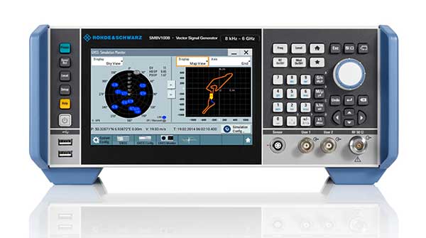
The SMBV100B GNSS simulator. (Photo: Rohde & Schwarz)
For generating GNSS signals, Rohde & Schwarz GNSS simulators are used (R&S SMBV100B or R&S SMW200A), which allow the generation of signals for all of the available satellite navigation systems (GPS, Glonass, Galileo, BeiDou, QZSS, SBAS) across all frequency bandwidths (L1, L2, L5). This also makes them suitable for testing multi-frequency receivers, which are playing an increasingly important role in automated driving.
“In Rohde & Schwarz, we now have a strong and reliable partner for GNSS stimulation. By generating consistent GNSS signals in connection with environment simulation, AVL DRIVINGCUBE now provides a test system that allows users to validate GNSS-based driver assistance systems and autonomous driving features,” explains Dr.-Ing. Tobias Düser, Head of Advanced Solution Lab at AVL Deutschland GmbH.
Christoph Pointner, Head of Signal Generators at Rohde & Schwarz, adds: “We are very pleased to bring our expertise in the field of signal generation to this collaboration with AVL and contribute to such an important innovation and trendsetting solution for testing automatized driving features.”
The additional GNSS stimulation makes testbed testing not only more realistic, it is above all a further step in moving testing from the road to the rig. This leads to a much sharper reduction of test drives than was the case previously and major savings in the kilometers driven.
Rohde & Schwarz GNSS stimulators form a flexible, modular system that can be adapted to your requirements and is easily integrated in the AVL DRIVINGCUBE environment. The stimulator is controlled automatically from the simulation platform. GNSS extensions for AVL DRIVINGCUBE are available with immediate effect.
AVL DRIVINGCUBE enables the reproducible testing of driver assistance systems for self-driving vehicles. (Photo: AVL)
Photo: icholakov/iStock Editorial/Getty Images Plus
BahamasAir has missed the U.S. deadline for the new ADS-B mandate and is now forbidden from flying certain three of its four jets in United States airspace. The airline said it has adjusted its aircraft deployment accordingly, reports Forbes.
The U.S. Federal Aviation Administration mandated in 2010 that aircraft be equipped with hardware to use NextGen, a satellite-based air traffic control management system, to replace traditional ground radar technology. This step of the transition requires aircraft to have Automatic Dependent Surveillance-Broadcast Out (ADS-B) capability either at time of manufacture or retrofitted with a kit.
BahamasAir was unable to equip three of its Boeing 737-500s with ADS-B before the Jan. 1 deadline, so those aircraft have been taken off the routes it flies to Florida. It has one 737-700 and five ATR regional airliners that have ADS-B, and is using those aircraft for Florida. It also leased some planes to meet holiday season demands.
The airline says it’s maintaining its full schedule with no changes and the old 737s should be fixed in the next few months. Meanwhile, the agency has granted an exemption to the government of Canada for two of its old airframes.
Canadian Changes
The Royal Canadian Air Force operates four Challenger 601 business jets to take government and military officials on shorter flights in the U.S. and Canada. Two of those jets are too old to receive the ADS-B upgrade, so the FAA has said it will be allowed into U.S. airspace but may not get the most convenient routing from air traffic control, according to AVWeb. The FAA does have a process to waive the ADS-B requirement, but it has warned that the exemptions will be issued only under exceptional circumstances.
On Jan. 2, an Air Canada flight leaving Saint John was forced to avoid United States airspace on Thursday and take a longer path to Toronto, avoiding flying over Maine because of the mandate, reports the New Brunswick Telegraph-Journal. The change in flight pattern added roughly 20 minutes to the trip. Air Canada won’t speculate if the longer flight path and extended travel time will happen again.
Quectel Wireless Solutions, a global supplier of cellular and GNSS modules, debuted at CES 2020 a series of communication modules targeting the 5G connected car sector.
CES 2020, the massive annual consumer electronics show, is taking place Jan. 7-10 in Las Vegas. The three new modules are showcased at Quectel’s booth No. 2601.
Quectel’s new automotive-grade modules include the AG550Q, a new 5G New Radio (5G NR) Sub-6GHz module, the AG215S automotive EAP module, dedicated for C-V2X scenarios, and the AF50T Wi-Fi module.
All three modules are based on the Qualcomm Automotive Wireless Solutions from Qualcomm Technologies, Inc., a subsidiary of Qualcomm Incorporated. They are designed to provide multi-gigabit cloud connectivity, improved location services, and enhanced security to support the increasing requirements of connected car and autonomous driving use cases.
Image: Quectel
The AG550Q 5G NR module, supporting both NSA and SA modes, is based on the AEC-Q100 qualified Qualcomm Snapdragon Automotive 5G Platform. The module is compliant with IATF 16949 requirements, and follows automotive quality processes such as APQP and PPAP to address the demanding requirements of automotive devices.
Adopting the 3GPP Rel. 15 technology, the AG550Q supports high speeds and ultra-low latency to facilitate better security and quality-of-service for mission-critical services. The multimode 5G NR module is backward compatible with existing 4G, 3G and 2G technologies. This ensures that cars will remain connected regardless of where they travel within the network.
Supporting optional C-V2X PC5 direct communications, AG550Q provides superior performance in vehicle-to-vehicle (V2V) and vehicle-to-roadside infrastructure (V2I) communications for improved traffic efficiency and safety. Furthermore, the module supports optional Dual SIM Dual Activation (DSDA), which allows car and driver each to choose their own independent network operator subscription in order to support a variety of emerging mobility service models.
Additionally, the highly-integrated AG550Q module supports multi-constellation and multi-frequency GNSS (L1/L2/L5), as well as optional Qualcomm Dead Reckoning (QDR) 3.0 technology which provides quick and highly accurate location positioning. The module will be commonly found in telematics boxes (T-Box), telematics control units (TCU), advanced driver-assistance systems (ADAS), C-V2X (V2V, V2I, V2P) systems, on-board units (OBU), roadside units (RSU), and other automotive/traffic systems.
Quectel AG550Q module offers powerful cyber-security features, which include firmware secure boot, Trusted Execution Environment (TEE), network firewall, SELinux strong access control, TLS/SSL security protocols and more.
“We are proud to deliver global OEMs and Tier 1 suppliers the most advanced wireless connectivity available, which allow them to integrate the latest 5G technology into their next-generation car designs,” said Min Wang, vice general manager of Quectel. “Leveraging our relationship with Qualcomm Technologies and its cutting-edge chipsets, we have been able to offer auto customers secure and reliable connected car solutions. Our complete automotive portfolio ranging from LTE, C-V2X to 5G and Wi-Fi can satisfy the continuity of automakers’ future product planning.”
“As the automotive industry accelerates its adoption of cellular-based communications technology, our priority is to work with innovative partners like Quectel Wireless Solutions to meet the needs of the automotive industry as it delivers on the promises of automated mobility,” said Matt Eichenberger, senior director, business development, Qualcomm Technologies. “The hallmark of our work with partners is to engineer highly scalable cellular technology-based platform that enable automakers to reimagine the speed of innovation. This translates to more connected experiences and improved vehicle safety, as more cars are capable of communicating not only with the cloud but also with other vehicles, pedestrians and transportation infrastructure.”
Besides AG550Q, Quectel also unveiled an automotive EAP module AG215S at the show, which is dedicated to C-V2X applications, and features the Qualcomm Snapdragon 2150 platform. The module integrates powerful application processor to host an ITS stack and applications. Along with having a hardware crypto engine embedded to fulfill powerful ECDSA verification capability (with support for up to 2500 verifications/sec). AG215S supports the global, U.S., EU and China National Security Algorithm, which can greatly boost security in vehicle communications. Quectel will also provide the reference design platform with full functionality (Application Processor + Modem + Connectivity + GNSS + SW SDKs), for customers and application developers.
The Quectel AF50T Wi-Fi module targets the connected car sector and supports Wi-Fi 2.4GHz + 5GHz & BT 5.1, and 802.11a/b/g/n/ac/ax standards.
The AG550Q module is in the engineering sample stage, with the evaluation board available to reduce development time for OEMs and Tier 1 suppliers. The AG215S module will be sampling starting January 2020.
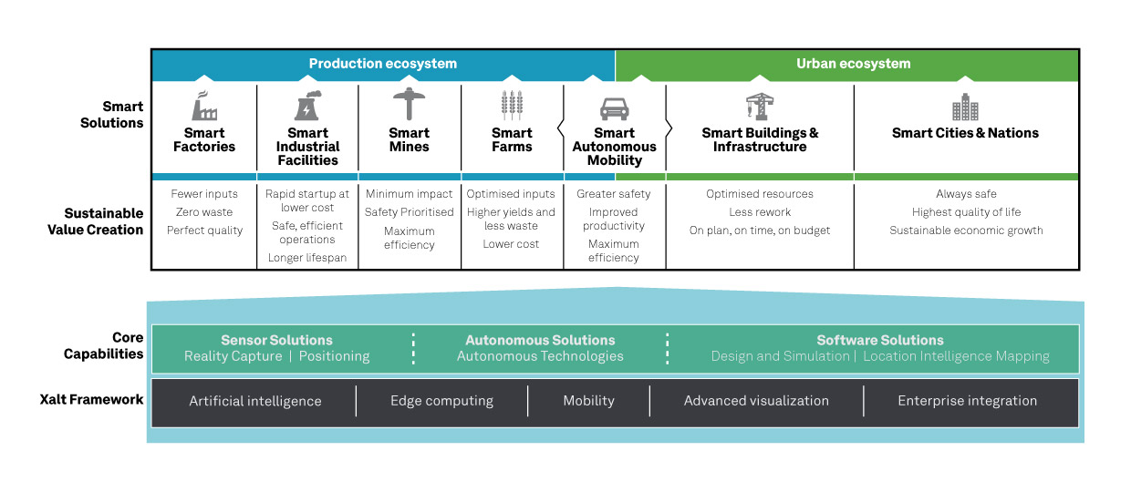
Hexagon AB, a global leader in sensor, software and autonomous solutions, introduced its Smart Autonomous Mobility solutions portfolio today at CES 2020, bringing together all the necessary sensors, software and services to make autonomous driving possible.
CES 2020, the massive annual consumer electronics show, is taking place Jan. 7-10 in Las Vegas. Hexagon’s Smart Autonomous Mobility solutions portfolio will be demonstrated in Hexagon’s pavilion CP-15.
Hexagon said it is on a mission to enable all customers to accelerate and deploy a bold autonomous mobility vision — from research and development to advanced machine learning and simulation, to full integration and production into industry ecosystems.
“Through our Smart Autonomous Mobility solutions portfolio, Hexagon is empowering an autonomous future that can transform ecosystems, protecting millions of lives and dramatically lowering carbon emissions,” said Ola Rollén, Hexagon president and CEO. “We are committed to providing complete technology solutions that enable our customers to build, test and put fully autonomous fleets to work safely.”
The Smart Autonomous Mobility portfolio includes three solution sets: Enable, Accelerate and Deploy.
Enable. Hexagon enables customers to fast-track R&D with hardware, software, and services to quickly enable autonomous driving systems across a variety of vehicle platforms and applications. From providing a turn-key automated driving research vehicle platform for field testing, integrating a customisable and assured positioning engine with reliable correction services, and offering baseline simulation tools and high-accuracy ground truth, Hexagon has already enabled thousands of customers worldwide with these technologies.
Accelerate. Hexagon enables customers to create Smart Digital Realities — seamless workflows between real-world and simulated environments. To drive even 20% better than a human driver requires 11 billion miles of validation, which is equivalent to 500 years of non-stop driving in the real world with a fleet of 100 cars.
With machine learning, simulation and testing for entire system performance and engineering and integration services, and high-definition digital reality capture, visualization and on-demand feature extraction, Hexagon allows customers to optimise, verify and validate the necessary billions of miles of driving required to safely deploy autonomous vehicles to the road.
Deploy. Hexagon allows customers to quickly scale from prototype and R&D phases to production for any autonomous application. The automotive-grade hardware solutions, autonomy software technologies, and functionally safe positioning solutions and services available in Hexagon’s Smart Autonomous Mobility portfolio are ready to deploy at scale for:
Mass production of passenger vehicles
Neighborhood electric vehicles (NEV)
Tractor trailers (class 8)
Off-road vehicles for mining, agriculture and defense
Technology includes vehicle-grade computing platform solution, high-dynamic range camera and ADS synchronization controller
DeepRoute, an international self-driving startup and CES 2020 Innovation Award Honoree, will be debuting three innovative technologies at CES 2020 including a vehicle-grade computing platform solution, DeepRoute-Tite, high-dynamic-range camera and ADS synchronization controller.
CES 2020, the massive annual consumer electronics show, is taking place Jan. 7-10 in Las Vegas. The company will be located at Booth no. 25647 at South Hall 2 LVCC throughout the show.
“It is an honor to be joining international innovators at CES 2020,” said Shuang Gao, Chief Operating Officer of DeepRoute. “We’ve worked hard over the last year to perfect our technologies and reinforce the safety of autonomous vehicles. We are excited to unveil the fruits of our team’s hard work, creativity and talent to the world at the prestigious and highly anticipated global technology show.”
DeepRoute-Tite, the company’s computing platform solution that migrates the algorithm required for L4 level autonomous driving to the vehicle-level computing platform, Nvidia Xavier, significantly reducing the cost, size and power consumption down to 45 watts. DeepRoute’s computing platform solution uses Nvidia’s vehicle-specific computing platform Xavier to process L4 level autonomous driving modules such as perception, prediction, decision-making, planning and control, along with navigation.
Along with the debut of the computing platform, DeepRoute will be launching its first-generation vehicle camera, DeepRoute-Vision. The vehicle camera has a higher dynamic range than other products on the market, allowing optimal performance even under bright sunlight or from within a dark tunnel. Designed to handle LED bulb flicker, the camera can also accurately capture information displayed on LED screens. The vehicle camera will be on display and demonstrated by DeepRoute representatives at the show.
DeepRoute also plans to unveil its second-generation ADS Synchronization Controller, DeepRoute-Syntric. The ADS controller can synchronize information from different types of sensors, enabling the perception algorithm to process sensor data aligned in the same standard. In the event that the sensors malfunction, the ADS controller can take control of the vehicle and perform emergency tasks such as braking.
The company recently announced the availability of DeepRoute Sense, their driving sensing solution technology which will be on display at the show alongside their Level 4 full-stack self-driving technology using a demo vehicle with an independently designed roof box equipped with 8 vehicle cameras, 3 lidars, GNSS and a series of other sensors.
At any given moment, more than 5,000 airplanes are flying over the United States. In a single year, nearly 778 million passengers will take to the skies — more than twice the population of the U.S., and the number increases each year. Aviation is the safest form of transportation. It is 100 times safer than driving. For every 100 traffic deaths, only one aviation related fatality occurs; and the Federal Aviation Administration (FAA) is working hard to make aviation even safer.
Safety is the FAA’s primary focus. The FAA Strategic Plan FY 2019– 2022 states its mission is to provide the safest, most efficient aviation system in the world. To achieve this goal, the FAA is implementing several initiatives. The technical aspects of these efforts fall under a framework called NextGen designed to modernize the nation’s air traffic control system. NextGen began in 2003 in the VISION 100 – Century of Aviation Reauthorization Act. At its core, NextGen is a geospatial framework with satellite navigation as its backbone.
The Geospatial Data Act (GDA) became law when President Trump signed the FAA Reauthorization on Oct. 5, 2018. You might have wondered how the GDA came to be included in the bill. It makes sense in the context of technology advancements towards a smart transportation network, specifically in aviation.
The smart transportation concept integrates all forms of transportation to provide economic and environmental benefits as well as increase safety and reduce wait times and congestion. A large part of smart transportation is based on geographic information technology. The aviation component of this smart transportation initiative falls within the FAA’s authority under the overarching framework named NextGen.
NextGen is an integrated concept improving the efficiency and safety of flight operations both on the ground and in the air. The use of geospatial technology enables precision time-management for controlling air traffic. The system allows each airplane to digitally coordinate with other aircraft in the area, taking into account such things as terrain and other known hazards to safely reroute air traffic as necessary. The FAA refers to this as trajectory-based operations. Those with a knowledge of GIS will recognize it as four dimensional: it calculates direction, speed, distance and time relative to position in x-y-z, and coordinates that information with other known data. Additionally, the system uses historical flight data and predictive analytics to maximize airspace for routing air traffic such as what is experienced during the holidays.
NextGen also uses a system called Optimal Profile Descents (OPD), which allows an airplane to trim its engines and descend along a glide slope from flight level into the airport. The point at which a plane begins its descent is a geospatial calculation to determine the precise point in space for the airplane based upon its altitude, weight, glide slope and distance to the airport. The benefits of OPD are reduced engine noise, fuel savings, less carbon emissions and a positive economic impact. NextGen is an across-the-board win for the airline industry, airline passengers, the economy and the environment.
According to an interview with Michael Whitaker, former deputy administrator of the FAA who was the Chief NextGen Officer, NextGen revolutionizes aviation by enabling digital data communication. It replaces radar-based navigation and tracking with satellite-based air traffic control. The cornerstone of NextGen is the Automated Dependent Surveillance Broadcast (ADS-B) system.
ADS-B is an aviator’s version of Waze, but with a lot more information. ADS-B(out) broadcasts an airplane’s Flight ID, ICAO Code, speed and location in three-dimensional space to air traffic controllers and to everyone who is equipped with ADS-B(in). The combination of ADS-B(out) and ADS-B(in) greatly increases situational awareness for aviators. On Jan. 1, 2020, all airplanes operating in controlled airspace needed to have ADS-B(out) installed. ADS-B transforms the entire National Airspace System into a satellite-based geospatial network. It integrates multiple sources of real-time data, such as weather, pilot reports, aircraft positions, 3D airspace information, and other sources of data, which can be overlaid on top of various basemaps and terrain elevation models, allowing pilots to make more informed and safer decisions.
Switching to ADS-B opens up more capacity in already crowded skies by decreasing the required vertical and horizontal separation distances between aircraft. At Hartsfield-Jackson International Airport, the busiest airport in the world, changing to performance-based operations allowed 8 to 12 more departures per hour; and in Memphis International Airport, one of the busiest airports for cargo operations, arrivals increased by 20%.
Rune Duke, senior director of government affairs, Airspace, Air Traffic and Aviation Security for the Aircraft Owners and Pilots Association (AOPA), said that ADS-B will allow much faster update rates for air traffic controllers on the order of once every second, compared to legacy radar systems that report positions every 8 to 12 seconds. For an airplane traveling at 350 knots, that is about 1 mile. A lot can change in a mile in densely packed airspace.
If you are reading this because of your love of maps and aviation, then I highly recommend the FlightAware and ForeFlight smartphone apps. FlightAware turns the phone into an ADS-B(in) receiver showing the location and flightpath of each aircraft in the immediate area on a basemap. I sit on my back deck and watch airplanes coming and going because I live under the flightpaths for Dulles International Airport, Reagan International Airport, Leesburg Executive Airport, the Montgomery County Airpark and the TERPZ waypoint. On occasion I see helicopters flying to Camp David because I am under that flight path as well.
So, I get to see a variety of aircraft. You can select the airplane icon to see information such as aircraft type, airline, Flight ID, departing and arrival airports, altitude, and groundspeed. Even more information is available by selecting the pop-up window. This is ADS-B information. ForeFlight, on the other hand, is a pilot’s flight bag on a tablet.
In the future, ADS-B will integrate Aircraft Hazardous Areas (AHA): temporary no-fly zones due to commercial space launches. Because of ADS-B, planes will automatically reroute around the AHA, and when the AHA expires, airplanes will be routed back through the area.
ADS-B supports evolving technologies such as remote towers, another significant change to air traffic control. Remote towers allow air traffic controllers to be at a location other than the actual airfield. Remote towers use a suite of sensors mounted at the airfield, including high-definition video, thermal and night vision that can be combined with the digital information provided by ADS-B, all of which is displayed on widescreen panels in a room duplicating the experience of being at the airport and directing aircraft. This allows smaller airports that cannot afford the huge expense of building and staffing an air traffic control tower to be part of a remote tower network. One remote tower center will be able to support several airfields. Leesburg Executive Airpark recently finished successful testing of one of the first remote tower operations in the United States.
“Over the next 10 years, we are going to see logistics and transportation open up, from being limited by currently rigid road infrastructure to operating on fully flexible and responsive aerial transportation networks,” said Patrick Watson, director of business development for Animal Dynamics.
The envisioned Platform Unmanned Cargo Aircraft. (Photo: PUCA)
ADS-B will also support the integration of unmanned aerial systems (UAS) into the airspace, specifically unmanned cargo aircraft (UCA). In the not too distant future, carrier air fleets without pilots or aircrew will be taking to the skies. UCAs do not require crews, so there will be no need for water, toilets, sewage containment, kitchens or a cockpit (in the traditional sense). Taking those out will allow for more space in the plane to carry cargo and fuel. Plus, without crews on board, there will be no time restrictions on crew hours — planes will be able stay aloft longer and travel further. ADS-B greatly enables the success of this technology.
Septentrio’s GNSS devices are being used for high-accuracy positioning solutions by two companies.
Compact multi-frequency GPS/GNSS receiver module provides robust centimeter-level positioning for advanced driver assistance systems (ADAS) provided by NXP.
Septentrio and Analog Devices collaborate on high-performance GNSS/INS solutions.
Image: Sepentrio
NXP V2X Integration
NXP, a leader in communication technology for embedded applications, is integrating Septentrio GNSS technology into its V2X (vehicle-to-everything) reference design and development boards.
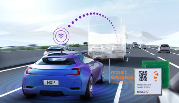
Septentrio, a leading high-accuracy GNSS positioning company, is providing to NXP its mosaic module. Mosaic is a multi-frequency, multi-constellation GNSS receiver that delivers accurate and reliable global localization even in harsh environments.
V2X technology enables cars to communicate with infrastructure as well as other vehicles, making driving safer and more efficient. It enables cars to “see” what’s around the corner or through the dense urban environment warning the driver about road works, traffic congestion and emergency vehicles.
Precise GNSS-assisted localization combined with V2X communication enables a wide array of ADAS functionality such as automatic braking if slowing traffic is detected ahead or truck platooning.
Septentrio’s mosaic is a compact high-accuracy GNSS receiver module which is integrated into NXP’s V2X development boards. True multi-frequency multi-constellation technology gives mosaic access to every possible signal from all available GNSS constellations including the U.S. GPS, European Galileo, Russian GLONASS, Chinese BeiDou and Japanese QZSS satellites.
Septentrio’s advanced, field-proven algorithms exploit this signal diversity to deliver maximum positioning availability even in difficult environments such as under foliage or in urban areas.
“Reliable lane-accurate positioning is vital for many road-safety applications of V2X, such as queue and emergency stop warnings or blind spot warning,” said Andrew Turley, NXP’s senior director of innovation and V2X business development. “Septentrio’s unique easy-to-integrate GNSS module provides field-proven, reliable and robust positioning. Integration of mosaic into our reference design gives our customers a direct solution for developing these and other advanced V2X services.”
”We are excited that NXP selected our GNSS solution for their V2X reference design,” said Jan Van Hees, business development director at Septentrio. “NXP is a world-leader in complete solutions for V2X communications for active safety systems and intelligent transport system (ITS) management. Working with NXP gives us an excellent opportunity to bring the best of V2X and reliable GNSS to our customers.”
Inside a car GPS signals can become “jammed” by nearby electronics or illegal devices called “jammers” which are used by some drivers to avoid road tolling. mosaic uses jamming-resistant signal processing making it robust against interference. Its design is centered around continuous, reliable high-accuracy positioning making mosaic suitable for safety-critical applications such as ADAS and autonomous navigation.
Consumer Electronics Show. The Septentrio mosaic GNSS module will be showcased at CES in Las Vegas, January 7-10. Visitors are welcome to see mosaic and talk to Septentrio GPS experts about V2X, ADAS, INS and other automotive positioning solutions in booth 1135 at the Paradise West Center. A personal meeting can be booked in the Septentrio Suite at the Westgate Las Vegas Resort & Casino.
Combining with Analog Devices on INS
In December, Septentrio announced a collaboration with Analog Devices. The two companies are combining Analog Devices’ high-quality inertial measurement units (IMUs) with Septentrio’s multi-frequency, multi-constellation GNSS receivers.
The resulting high-performance GNSS/inertial navigation systems (GNSS/INS) deliver centimeter-accurate positioning together with 3D orientation (heading, pitch and roll), suitable for applications such as automotive ADAS and industrial automation.
“We are excited to work with Septentrio,” said Tony Zarola, general manager of inertial sensors, Analog Devices. ”Septentrio’s GNSS technology provides a unique combination of accuracy and robustness which is aligned well with the capabilities of our sensors. The company’s deep know-how of GNSS and focus on providing reliable solutions even in harsh environments complements Analog Devices’ focus to solve the toughest engineering challenges for our customers.”
“ADI’s high-end industrial IMU systems are a reference in the industry and we are very pleased to be working together with them,” said Danilo Sabbatini, product manager at Septentrio. “Combining ADI’s IMU experience with our GNSS expertise enables creation of high-performance, easy-to-integrate systems that allow our customers to tackle demanding applications. As a result, customers can expect a faster go-to-market due to the interoperability between the GNSS and INS components.”
Septentrio will incorporate Analog Devices’ advanced industrial-grade IMUs into a selection of its GNSS/INS products. Working directly with Analog Devices allows Septentrio to provide faster and more efficient GNSS/INS integration solutions for high-volume customers. This collaboration promises a solid foundation for design and production of top-performance integrated positioning and inertial solutions, with first products available in spring 2020.
u-blox’s Bluetooth low-energy module features direction finding, bringing the benefits of high-precision positioning to indoor applications
U-blox, provider of positioning and wireless communication technologies, has announced the u-blox NINA-B4 Bluetooth low-energy module series. Based on Nordic Semiconductor’s recently announced nRF52833 chip, NINA-B4 enables a number of Bluetooth features including Bluetooth long range, Bluetooth mesh and Bluetooth direction finding.
The module is tailored to the needs of applications in the connected industry, smart homes, buildings and cities, asset tracking and eHealth.
The NINA-B4 offers a new direction-finding feature, a key component of the Bluetooth v5.1 specification that brings the benefits of high-precision positioning to indoor applications. It is the first u-blox module designed to act as both a transmitter and a receiver in angle of arrival (AoA) and angle of departure (AoD) direction finding and indoor positioning applications.
In AoA-based implementations, stationary beacons equipped with multi-antenna arrays determine the angle of arrival of signals emitted by a tracking device to pinpoint the tracker’s location with sub-meter-level accuracy. When AoD is used, the tracking device triangulates its position by calculating the angle of departure of signals from the stationary Bluetooth beacons’ multi-antenna arrays.
Mesh, long range, and extended temperature range
The u-blox NINA-B4 enables wireless mesh networks, which offer robust communication between large numbers of connected devices, extending the reach of messages by relaying them from node to node until they reach their destination. By simplifying the control of groups of devices, mesh networks are well suited for applications such as smart lighting systems in cities and buildings, which further benefit from the module’s enhanced operating temperature range (up to 105 °C).
Featuring Bluetooth long range, the NINA-B4 series can be deployed in harsh environments, for instance, to enable wirelessly connected and configurable equipment. Long range not only increases the distance that Bluetooth signals can travel in undisturbed environments, but also makes communications more robust and reliable in unfavorable ones, a common need in production plants or on factory floors.
The NINA-B4 series comes with u-blox u‑connect software, simplifying integration of Bluetooth into new and existing products by providing an easy-to-use interface to configure the connectivity required.
NINA-B4 has a powerful Arm Cortex-M4F MCU with an open CPU architecture, allowing customers to run their own applications on the module. Supporting Zigbee and Thread, the first members of the NINA-B4 family come with an internal PCB antenna, or alternatively with a U.FL connector for an external antenna of choice.
Samples of the NINA-B4 will be available in December.
In 2019, military forces witnessed the global threat of GPS/GNSS interference grow, with more sophisticated threats and increasing military demand for assured operations in Navigation Warfare (NAVWAR) and GPS-denied environments.
Enemy forces are deploying more advanced jamming and spoofing technologies worldwide, jeopardizing the security and reliability of positioning, navigation and timing (PNT) data that feeds into GPS receivers, downstream networks and subsystems.
Military forces must vigilantly protect their information advantage from malicious attacks by delivering situational awareness, mission planning and warfighter solutions.
For these priorities, proven and efficient signal integrity solutions will be even more critical in 2020.
Requirements to Ensure Signal Integrity in 2020
Any critical system that relies on PNT data should go into the field with two known states:
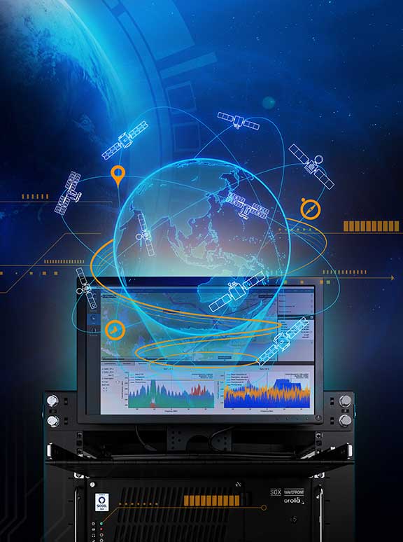
First, it should withstand a GPS outage during testing and simulation — including rigorous jamming and spoofing simulation to predict how the system will react under various conditions. Simulation scenarios can vary in complexity, and newer software-defined simulators provide flexibility to meet current requirements while future-proofing investments in test equipment.
Second, the system should have a signal threat detection and alert mechanism. Critical systems also need backup layers such as anti-jam antennas, threat mitigation technology and alternative encrypted signals to ensure continuous operations, even in compromised environments.
Going into 2020, GNSS simulation and interference detection and mitigation (IDM) will continue to adapt to emerging threats and provide the essential foundation for Assured PNT.
For more about Resilient PNT and NAVWAR solutions, visit www.Orolia.com.
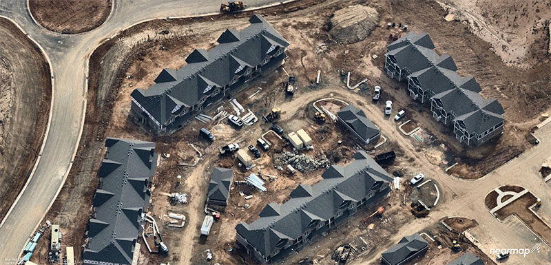
Aerial imagery company Nearmap has acquired technology and assets from Pushpin, a deep learning and analytics technology company that extracts data from 3D models to provide roof geometry insights to a variety of sectors including roofing, solar and government.
The technology acquisition allows Nearmap to rapidly extract and disseminate roof geometry from its wide-scale 3D models and offer a new form of location content to its customers.
‘‘By acquiring Pushpin’s 3D geometry extraction technology and pairing it with our rich data, we bring the best of both worlds together at unprecedented scale’’ said Rob Newman, Nearmap CEO. “Over the past couple of years, we’ve evolved our offering from 2D imagery to a multi-product portfolio, and this acquisition is an important milestone in our approach to continue adding new content types for our customers. This addition aides our company mission by providing 3D geometry data at unmatched speed, thereby changing the way our customers perform their work.”
With this new technology, Nearmap can provide a semi-automated calculation and extracted representation of any roof geometry within an hour, significantly reducing turnaround time. The combination of Nearmap’s 3D content and Pushpin’s geometry extraction technology opens up a diverse range of use cases, enabling businesses to fast-track job estimation, determine solar irradiance, plan drone delivery routes and model 5G propagation.
“The addition of Pushpin’s 3D geometry extraction technology into our large-scale 3D reality models will enable us to further evolve our offering and produce at scale roofing geometry,” said Tom Celinski, Executive Vice President, Technology and Engineering at Nearmap. “With the added ability to provide roof geometry data, we will be able to provide even deeper insights on what’s happening on the ground, and help businesses and government organizations transform the way they work and do their job more efficiently.”
The roofing and solar industries are poised for significant growth. Currently, 1% of the United States population has solar panels on their homes. According to the Solar Energy Industry Association (SEIA), total U.S. solar capacity will more than double over the next 5 years.
Additionally, a significant number of U.S. residential homes have their roofs replaced every year due to roof damaging storms and changes in roofing trends and material. This new product offering from Nearmap is poised to significantly impact these markets, as companies are expanding their use of technology to assist with tasks such as roof material and project quoting through reports, project management through roofing specific software, and customized sales and marketing tools for the roofing industry.