What improvements will GPS III bring to high -precision surveying? When? Will these improvements require any changes in equipment and/or processes?
Tony Agresta, Nearmap
“The biggest impact of GPS III to high precision surveying will be a full constellation of L5 satellites. Triple frequency will bring faster convergence times and better accuracy in more difficult conditions. GPS III will better align with Galileo and BeiDou with L1C which means better availability in restricted sky conditions. Users will want to have equipment capable of supporting these new signals, in antenna and receiver HW as well as the signal processing done on board.” Tony Agresta
Nearmap
Jean-Marie Sleewaegen
“Of all the improvements brought by GPS III, the new L1C signal will probably have the biggest impact on high-precision surveying. Compared to L1 C/A, L1C brings better reception in difficult environments, improved availability thanks to the “pilot” component, enhanced resilience to jamming attacks, and better interoperability with Galileo, BeiDou and QZSS. Many receivers do support L1C already, but the benefits will become more tangible as the GPS III constellation grows.” Jean-Marie Sleewaegen
Septentrio
Members of the EAB
Tony Agresta Nearmap
Miguel Amor Hexagon Positioning Intelligence
Thibault Bonnevie SBG Systems
Alison Brown NAVSYS Corporation
Ismael Colomina GeoNumerics
Clem Driscoll C.J. Driscoll & Associates
John Fischer Orolia
Ellen Hall Spirent Federal Systems
Jules McNeff Overlook Systems Technologies, Inc.
Terry Moore University of Nottingham
Bradford W. Parkinson Stanford Center for Position, Navigation and Time
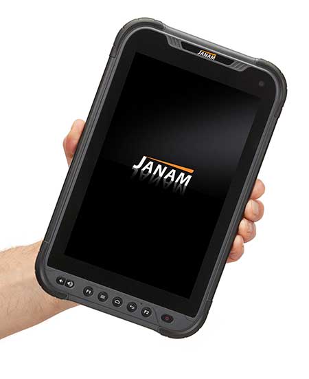
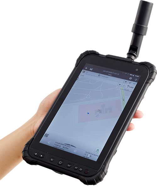
The HT1 is a slim, light, powerful “Android Enterprise Recommended” tablet
Photo: Janam
Janam Technologies, a provider of rugged mobile computers that capture data and communicate wirelessly, has introduced a powerful and advanced 8-inch rugged tablet. The HT1 is designed to improve line of business applications including put-away and replenishment, cross docking, shipping and receiving, inventory management, merchandising and clientele management.
Besides a stylish design paired with military-grade ruggedness, the HT1 offers dual-frequency GNSS using the u-blox M8 chip. It can provide accuracy within three feet in open skies and 15 feet in denser environments.
Janam introduced the tablet at the National Retail Federation Annual Conference and Expo (NRF 2020), taking place Jan. 11-14 in New York City.
As part of Google’s Android Enterprise Recommended (AER) program, Janam’s HT1 completed rigorous testing and is guaranteed to meet the most demanding enterprise-level requirements. AER certification also ensures a seamless deployment, familiar user experience and secure managed updates to deliver immediate improvements in productivity.
HT1 Facts
The HT1 rugged tablet provides latest-generation speed and performance and is purpose-built to thrive in any industry including retail, warehousing, manufacturing, field service, transportation, construction, law enforcement, hospitality and other tough work environments.
As a rugged tablet running Android 9 (with ability to be upgraded to future generations of Android) in Google’s AER program, the HT1 delivers a premium experience for mobile workers. Timely security updates extend the HT1’s product lifecycle while providing IT teams with more control to keep business-critical data safe and secure.
With LTE speeds up to three times faster than most 4G LTE devices, advanced Wi-Fi and Bluetooth technology, Janam’s HT1 provides robust connectivity and lightning-fast voice and data inside four walls and out on the road.
The versatile HT1 features a 14-pin pogo connector to easily attach accessories such as Janam’s optional 2D imager module to provide high-performance scanning of printed and mobile barcodes. High-resolution front and rear cameras provide HT1 users with additional data capture support for proof-of-delivery, proof-of-condition, proof-of-service and more.
Sealed to IP67 standards, the HT1 provides reliable operation in the rain, snow or dust. It is MIL-STD-810G certified to withstand tumbles, vibration, ballistic shocks and repeated drops to concrete across a wide temperature range.
Equipped with an 8200 mAh hot-swappable and rechargeable battery, as well as a low-power Qualcomm octa-core processor with efficiency-boosting features, the HT1 provides all-day battery life for uninterrupted usage and maximum productivity.
A standard two-year warranty provides customers with both peace of mind and the level of service they expect, at no additional cost, with optional comprehensive service plans available to those that want to further extend their mobile computing investment.
Carlson Software has released its Scan2K Laser Scanner, a versatile, fast, easy-to-use solution for the creation of accurate 3D survey data up to a range of 2K (2,000) meters. Carlson introduced the product at the Pennsylvania Society of Land Surveyors’ 2020 Conference.
Carlson’s Bradley Husack, Special Projects Engineer, and Michael Hyman, Regional Director with the Scan2K at the Pennsylvania Society of Land Surveyors’ conference. (Photo: Carlson)
Built with surveyors in mind, the Scan2K is at home in the field with its weather-proof housing, user-friendly sunlight-visible touch screen interface with simple, menu-driven operations for quickly collecting and georeferencing point cloud data. With an integrated high-resolution camera, inclinometers, a compass, and an L1 GNSS receiver, the Scan2K can be deployed in many environments and orientations, including mobile operations.
Carlson’s partner on the Scan2K project is Teledyne Optech, a world leader in 3D survey systems. Carlson will be the exclusive global distributor of the OEM Scan2K solution.
“The Scan2K addresses the diverse range of applications for a laser scanner in the surveying and mining industries,” said Bradley Husack, a Special Projects Engineer at Carlson. “Carlson is bringing to market an all-in-one solution that now leads the market in versatility, speed, and value.”
The Carlson Scan2K has a simple, sunlight-visible touchscreen interface. (Photo: Carlson)
Beyond its impressive 2,000 meter range, the Scan2K also has short- and medium-range modes, as well as the capability to record over 500,000 points per second, all within the chosen scanning target window.
Additionally, each laser pulse from the Scan2K records up to four returns, providing the capability to record the first return for a blocking object (such as a leaf) as well as the last return for an object behind it (such as a wall), and the versatility to exclude one or the other.
The Carlson Scan2K comes bundled with ATLAScan software, a powerful yet simple solution for registering the point cloud, as well as Carlson Point Cloud Advanced for feature extraction into Carlson’s suite of CAD office products.
The Scan2K comes ready to be equipped with an additional external camera, an external GNSS receiver, or for mobile operation.
Whether on a tripod, a vehicle, or another moving platform, the performance offered by the Scan2K easily makes it a versatile terrestrial laser scanner for the market.
The months-long wildfires raging in Australia have killed at least 25 people. Millions — possibly 1 billion — animals have died. More than 2,000 houses have been destroyed. Around 150 fires are still burning in New South Wales and Queensland, with hot and dry conditions accompanied by strong winds fueling to the fires’ spread.
With this conflagration rocking the continent down under, satellite imagery has become important to understanding the scope of the disaster. Here are some of the recent captures.
As seen from the ISS
“Talking to my crew mates, we realized that none of us had ever seen fires at such terrifying scale,” European Space Agency astronaut Luca Parmitano tweeted on Monday, sharing photos taken from the International Space Station.
The astronaut posted images showing what he described as “an immense ash cloud” captured at the time the ISS was flying toward sunset.
An immense ash cloud covers Australia as we fly toward the sunset.
Another social media image, shared widely, was interpreted as a map showing the live extent of fire spread, with large sections of the populous eastern coastline molten red. Because of widespread misinterpretation, the original poster then explained that the image was a 3D visualization and not a photograph of Australia, and showed some areas where fires have been extinguished.
NASA and the U.S. Geological Survey’s Landsat 8 satellite imagery from Jan. 9 shows Kangaroo Island, home to nature reserves. The images were taken using the Operational Land Imager (OLI) on Landsat 8. Using natural-color observations, the images show burned land and thick smoke covering the island, of which at least 156,000 hectares have burned.
Photo: NASA/USGS
The U.S. National Oceanic and Atmospheric Administration (NOAA) satellites are also capturing images, including the resulting plumes of smoke.
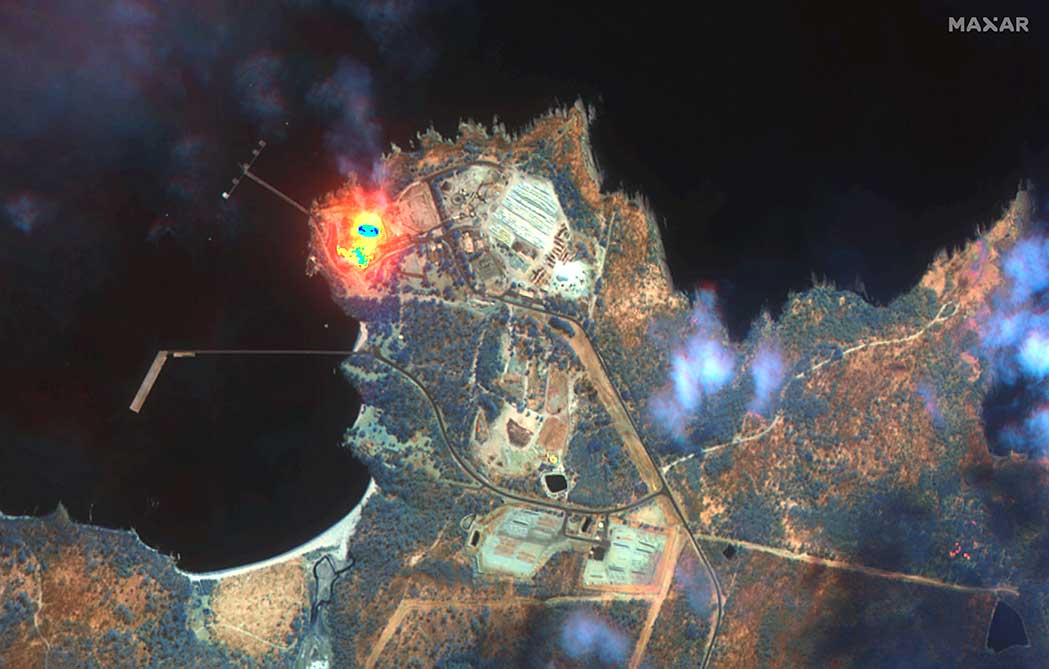
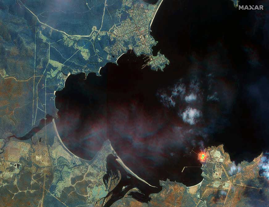
Maxar collected satellite imagery Jan. 12 of the wildfires in New South Wales (NSW). The imagery shown below focuses on the area near the town of Eden, and demonstrates the value of the shortwave infrared (SWIR) sensor.
In an image taken with Maxar’s normal RGB color imagery, the smoky air prevents a clear view of the fires and the hot spots. With Maxar’s WorldView-3 satellite, however, the team is able to penetrate through the smoke using its SWIR sensor for a detailed look at the fire lines and burned vegetation.
With SWIR imagery, burning areas are apparent and show up in a glowing orange-red. Healthy vegetation shows up in shades of blue, and burned vegetation appears in shades of brown.
Satellite Photo: :ESA
Copernicus Sentinel-3 imagery
Europe’s Copernicus Sentinel-3 mission has captured the multiple bushfires burning across Australia’s east coast.
In the above image, captured on Nov. 12, 2019, at 23:15 UTC (Nov. 13, 09:15 local time), the fires burning near the coast are visible. Plumes of smoke can be seen drifting east over the Tasman Sea. Hazardous air quality owing to the smoke haze has reached the cities of Sydney and Brisbane.
Flame retardant was dropped in some of Sydney’s suburbs as bushfires approached the city center, and many residents were evacuated. Firefighters continue to keep the blazes under control.
The Copernicus Emergency Management Service – Mapping was activated to help respond to the fires. The service uses satellite observations to help civil protection authorities and, in cases of disaster, the international humanitarian community, respond to emergencies.
Quantifying and monitoring fires is fundamental for the ongoing study of climate, as they have a significant impact on global atmospheric emissions. Data from the Copernicus Sentinel-3 World Fire Atlas shows that there were almost five times as many wildfires in August 2019 compared to August 2018.
The U.S. Department of Transportation on Wednesday released updated guidelines for autonomous vehicles.
“Ensuring American Leadership in Automated Vehicle Technologies: Automated Vehicles 4.0” (AV 4.0) was announced by U.S. Transportation Secretary Elaine L. Chao in a keynote speech at CES 2020 in Las Vegas.
AV 4.0 unifies efforts in automated vehicles across 38 federal departments, independent agencies, commissions and executive offices, providing high-level guidance to state and local governments, innovators and stakeholders on the U.S. government’s approach toward autonomous vehicles.
“AV 4.0 will ensure American leadership in AV technology development and integration by providing unified guidance for the first time across the federal government for innovators and stakeholders,” Chao said.
AV 4.0 establishes federal principles for the development and integration of automated vehicles, consisting of three core focus areas: prioritize safety and security, promote innovation, and ensure a consistent regulatory approach.
It also outlines ongoing administration efforts supporting autonomous vehicle technology growth and leadership, as well as opportunities for collaboration including federal investments in the sector and resources for innovators, researchers and the public.
“AV 4.0 brings all of the important work happening on automated vehicle technologies across the federal government under one unified approach. The federal principles released today help foster an environment for innovators to advance safe AV technologies, and put the U.S. in a position of continued leadership in the future of transportation,” said U.S. Chief Technology Officer Michael Kratsios.
The USDOT is preparing for emerging technologies by engaging with new technologies to address legitimate public concerns about safety, security and privacy without hampering innovation, the department said in a press release.
With the release of “Automated Driving Systems 2.0: A Vision for Safety” (ADS 2.0) in September 2017, the USDOT provided voluntary guidance to industry, as well as technical assistance and best practices to states, offering a path forward for the safe testing and integration of Automated Driving Systems.
In October 2018, “Preparing for the Future of Transportation: Automated Vehicles 3.0” (AV 3.0) introduced guiding principles for autonomous vehicle innovation for all surface transportation modes, and described the USDOT’s strategy to address existing barriers to potential safety benefits and progress.
“AV 4.0 builds on these efforts by presenting a unifying posture to inform collaborative efforts in automated vehicles for all stakeholders and outlines past and current federal government efforts to ensure the United States leads the world in AV technology development and integration while prioritizing safety, security, and privacy and safeguarding the freedoms enjoyed by Americans,” the press release stated.
AV 4.0 will be published in the Federal Register for public review and comment. More information on the USDOT’s work on automated vehicles can be found at https://www.transportation.gov/av/4.
A roundup of recent products in the GNSS and inertial positioning industry from the January 2020 issue of GPS World magazine.
OEM
Heavy-duty antenna
For challenging environments
AT311 antenna. (Photo: CHC Navigation)
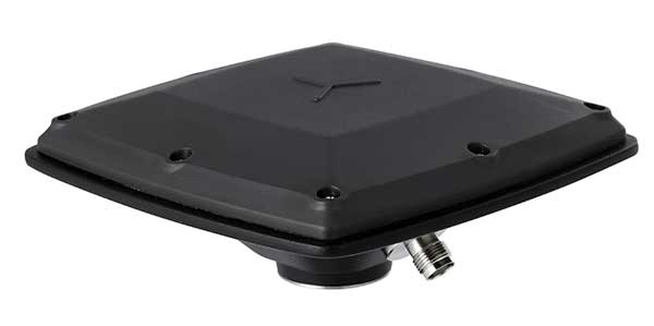
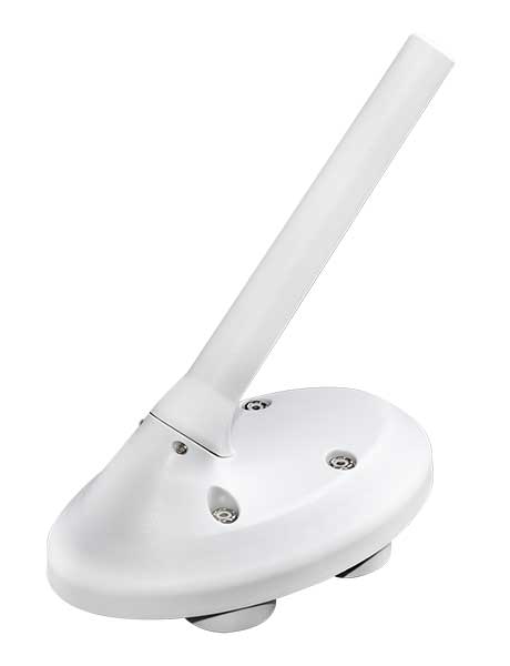
The heavy-duty CHCNAV AT311T is designed for demanding applications subject to shocks and vibrations. With advanced filtering and robust signal tracking, it provides survey-grade GNSS signals to enhance position reliability for marine applications, machine control, precision agriculture and industrial automation. Features include multi-constellation GNSS tracking using GPS, GLONASS, BeiDou, Galileo, QZSS, IRNSS and SBAS. Its IP68 water-resistant design makes it safe to use in extreme conditions with a wide temperature range (–40° C to +85° C). Its internal stacked structure enhances performance in high-interference environments, and the 40-dB signal gains, advanced signal filtering and multipath rejection design provide superior and robust GNSS signal tracking in challenging surroundings.
The UAS1 GNSS receiver module has been designed for UAV/UAS applications requiring centimeter accuracy in a small package.(Photo: Trimble)
The UAS1 compact, high-precision GNSS board was designed for unmanned aerial systems (UAS). It allows UAS system integrators to add upgradeable GNSS-based positioning using rugged connectors and Trimble’s software interface. Its 336-channel GNSS engine is capable of tracking L1/L2 frequencies from GPS, GLONASS, Galileo and BeiDou for centimeter-level, real-time kinematic (RTK) positioning. The compact board provides capabilities from high-accuracy GPS-only to full GNSS features. The receiver supports fault detection and exclusion (FDE) and receiver autonomous integrity monitoring (RAIM). System integrators also have the ability to detect interference with an RF spectrum monitoring and analysis tool embedded in the receiver.
The Onyx multi-frequency GNSS OEM board offers integrated StarFire/real-time kinematic (RTK) GNSS capabilities. It features 255-channel tracking, including multi-constellation support for GPS, GLONASS, BeiDou and Galileo. It provides high performance in GNSS receiver sensitivity and signal tracking as well as patented multipath mitigation, interference rejection and anti-jamming capabilities. Through software options, the Onyx ,allows upgrades from free differential GPS signal sources such as WAAS, to increased accuracy services such as StarFire and RTK Extend. The software-enabled features are sold in bundles, but can also be purchased individually to suit changing application needs.
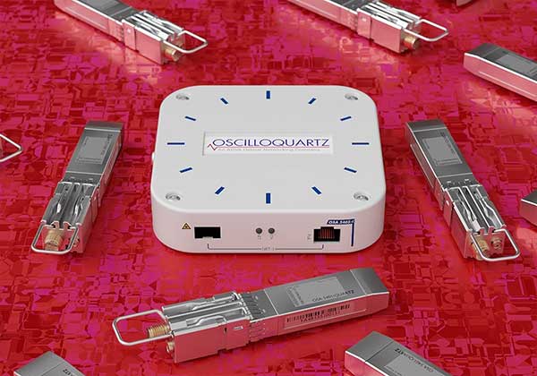
The OSA 5401 and OSA 5405 now enable power utility and broadcast networks to achieve sub-microsecond synchronization. (Photo: Business Wire)
The OSA 5401 and OSA 5405 upgraded PTP grandmaster clocks deliver precise, robust timing in a compact form factor. Oscilloquartz PTP timing technology enables power utility and broadcast networks to achieve sub-microsecond synchronization. The pluggable OSA 5401 is a small PTP grandmaster clock, and the OSA 5405 is an integrated PTP grandmaster with dual GNSS antenna and receiver. With spoofing and jamming detection capabilities, they also provide high availability. The OSA 5401 and 5405 provide new levels of accuracy and resilience for infrastructure and support emerging bandwidth-intensive, latency-sensitive applications. With sub-microsecond synchronization, smart grids can perform flexible, real-time decision making, as well as monitoring and automated maintenance. The OSA 5401 and OSA 5405 comply with the latest PTP profiles for time, frequency and phase synchronization in both power utility and broadcast networks. These include the IEC/IEEE 61850-9-3 Power Utility Profile for precise time distribution and clock synchronization in electrical grids with an accuracy of 1μs, and SMPTE 2059 for synchronizing video and audio equipment over packet networks.
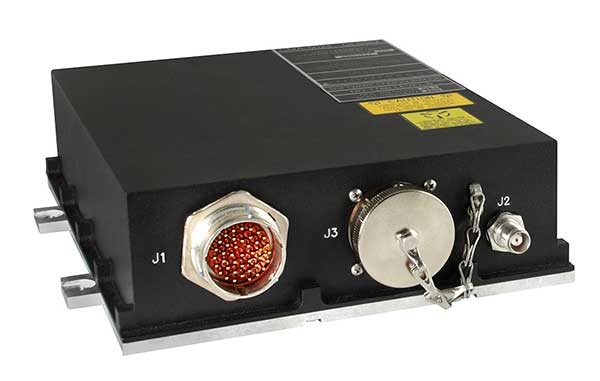
The SBAS-capable CMA-5024 GPS has received U.S. Federal Aviation Administration (FAA) approval for installation on Boeing 737 Next-Generation aircraft. It enables B737NGs to comply with worldwide ADS-B Out mandates as well as SBAS/GPS navigation, enabling the first localizer performance with vertical guidance (LPV) approaches for B737NGs. The CMA-5024 GPS is a cost-effective alternative to replace a multi-mode receiver (MMR). The approved DO-260B ADS-B Out positioning source can be paired with any DO-260B compliant transponder, allowing operators to meet FAA and EASA ADS-B Out requirements, the UAE’s ADS-B Out and RNP requirements mandated by GCAA as well as India’s GAGAN requirements.
The U.S. Federal Aviation Administration (FAA) has approved the VTU-20 automatic dependent surveillance – broadcast (ADS-B) transmitter for airport surface management. Adhering to the performance and design assurance specifications of FAA-E-3032, the externally mounted VTU-20 ensures integration and interoperability with Airport Surface Detection Equipment, Model X (ASDE-X), Airport Surface Surveillance Capability (ASSC) and ADS-B receiver surveillance solutions for airport. The VTU-20 can be permanently or magnetically mounted to all airside vehicles, including utility, emergency, snow-removal and maintenance equipment. Each vehicle is clearly and uniquely identified, providing an essential addition to any surface movement guidance and control system.
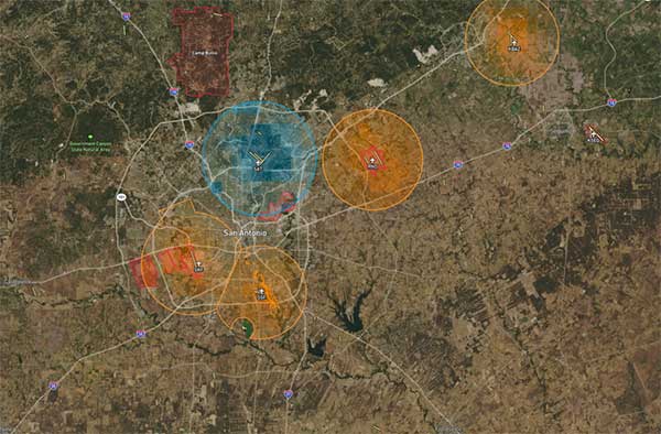
Skyward’s Advanced Airspace Intelligence drone airspace maps provide airspace data combined with essential ground intelligence including 3D views of key structures, transmission lines, and more than a million vertical obstacles. The platform also provides access to LAANC, the Low Altitude Authorization and Notification Capability program provided by the U.S. Federal Aviation Administration. Data available for situational awareness includes vertical structure obstacles, power lines, airports, runways, national parks, stadiums, hospitals and schools.
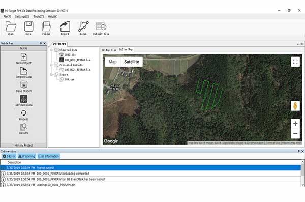
Hi-Target PPK GO precision add-on enables Phantom 4 RTK drones to achieve the accurate and reliable camera positioning data in any coordinate system without measure targets or ground control points. With 2-centimeter accuracies on XYZ, the output text file with position information or geotagged images can be used directly in major photogrammetric mapping or 3D survey software. The add-on allows selection of GPS/GLONASS/Beidou/ Galileo L1+L2+L5 and further parameter adjustments for position calculation in the PPK process to ensure the most reliable and accurate camera positioning even in poor single satellite system signals.
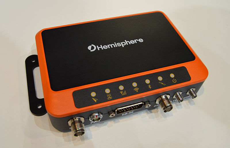
The R620 GNSS receiver is a complete refresh of Hemisphere’s previous version, the R330. (Photo: Allison Barwacz)
The next-generation R620 receiver is designed for land and marine applications requiring high-precision positioning. It is a complete refresh of the previous version (R330) and has a new low-profile ruggedized enclosure. Customers can start with sub-meter positioning accuracy and upgrade the receiver through activations and subscriptions to add functionality and improve performance capability to centimeter-level accuracy. Powered by the Vega series, the R620 GNSS receiver processes and supports more than 1,100 channels. It simultaneously tracks GPS, GLONASS, BeiDou (including Phase 3), Galileo, QZSS, IRNSS, SBAS and Atlas L-band corrections. It has status LEDs , a powerful WebUI, UHF (400-MHz and 900-MHz) radio, cellular modem, Bluetooth, Wi-Fi, Ethernet (including power over Ethernet), CAN, serial and USB.
For land surveying and geospatial information systems (GIS)
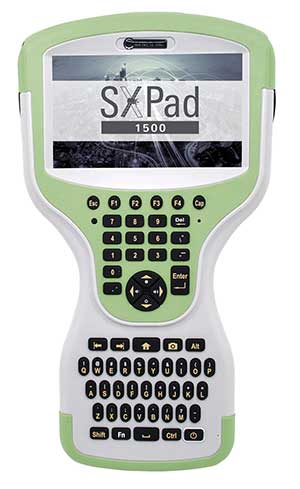
Photo: Geneq
The rugged SXPad 1500 data collector features an alphanumeric keypad and long-range Bluetooth, and was designed to meet the rigorous IP67 standard for challenging field conditions. It has a 5-inch sunlight-readable touchscreen. The SXPad 1500 can be connected to any GNSS receiver or compatible robotic total station. Driven by a 1-GHz processor and the Windows Mobile 6.5 operating system, providing the power to work with maps and large data sets in the field. Its integrated cellular modem and Wi-Fi provides wireless connectivity for internet access and GIS data transfer — helpful for configuring a real-time kinematic (RTK)-compatible GNSS receiver. Equipped with an internal memory of 1 GB (memory can be expanded to 16 GB with an SD card), the SXPad 1500 provides enough storage space for data recording. Its high-performance lithium battery allows uninterrupted field operation for up to eight hours.
The LT700H RTK Android tablet is designed to increase efficiency and productivity of the mobile field workforce in applications requiring centimeter-to-decimeter positioning accuracy. Portable, rugged and versatile, the LT700H enables precision GIS data collection, forensic mapping, construction site layout, environmental surveys, landscaping and earthmoving jobs. Powered by 184-channel high-performance GPS, GLONASS, Galileo and BeiDou module and a superior tracking GNSS helical antenna, the LT700H provides position availability in demanding environments. Its integrated 4G modem ensures seamless communication from field-to-office and robust connectivity to RTK correction networks.
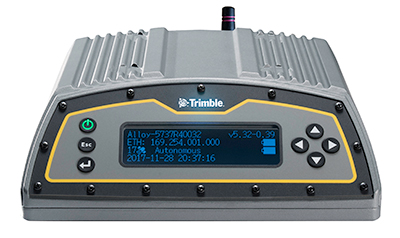
The Trimble Alloy GNSS reference receiver now supports BeiDou Generation III (BDS-3) signals. This will enable operators to meet the ongoing demand from surveyors, mapping professionals and precision farmers for accurate, reliable corrections derived from real-time networks. Released in 2018, the Alloy has the processing power needed for high-quality data from multiple constellations. Alloy version 5.42 firmware tracks all available and planned GPS Block IIIA L1C and BDS-3 signals.
Hexagon showcased the Leica DSX utility detection solution at Intergeo 2019. (Photo: Allison Barwacz)
The Leica DSX utility detection solution can be used together with Leica GPS/GNSS systems to generate highly accurate, georeferenced maps. The DSX uncovers utilities for repair and maintenance, civil engineering and surveying projects. The ground-penetrating radar system includes portable hardware and software that automates data analysis and creates a 3D utility map.
DroneShield has released a vehicle-mounted drone detection and defeat product, DroneSentry-X.
Lightweight at about 10 kilograms, it can be easily mounted on most vehicles. DroneShield expects the product to be of interest to military, law enforcement, security and VIP the markets. The product is suitable for both vehicle/convoy and fixed site installations. The product was developed in response to substantial customer interest, according to the company.
“Vehicle market for counterdrone protection is rapidly rising,” said DroneShield’s CEO Oleg Vornik. “In addition to catering for that segment, DroneSentry-X provides a more affordable detect-and-defeat solution for price-sensitive customers as an alternative to purchasing full-functionality DroneSentry product from us. DroneShield offers a complete suite of detection and defeat solutions to our customers, and this new product covers the customer need which we identified in our recent engagements.”
Undersecretary of Defense Michael Griffin. (Photo: DOD)
Augmenting GPS with other systems was suggested as the most promising area of improvement in a recently released memo establishing a Defense Science Board task force on positioning, navigation and timing (PNT).
On Dec. 16, the Department of Defense released a memo from Undersecretary Michael Griffin to the chair of the Defense Science Board. In it he outlined terms of reference for a year-long study of defense “position, navigation and timing control.”
Setting the stage for the effort, Griffin, who serves as undersecretary for research and engineering, outlined some challenges of relying too heavily on GPS. “The current system has less susceptibility to jamming and spoofing, but challenges remain — slow fielding of user M-code capability, cyber and kinetic threats. Degradation can occur in canyons, cities, and high signal multipath environments.”
He also seemed to indicate that, while further improvements to GPS were possible, they would likely yield only marginal returns and be very expensive.
“While performance and resilience continue to improve, the system has matured to the point that these changes have resulted in incremental improvement to overall system performance,” Griffin said. “The cost of the system and ongoing upgrades have experienced significant growth, making it hard to increase the density of the satellites to address the more challenging environments.
The memo suggests that, rather than focusing entirely on continual improvements to GPS, adding other systems to a PNT architecture for users will likely be more effective and economical.
One such addition may well be leveraging thousands of planned commercial communications satellites to also provide PNT.
“A future multi-mission constellation that can transmit and receive RF signal[s] across a broad spectrum will allow both the ability [to] provide and deny communication and PNT globally and will provide support to all essential warfighting missions,” Griffin said.
This idea is already being explored by Army Futures Command in partnership with the University of Texas at Austin’s Radionavigation Laboratory.
Yet Griffin cautions that using commercial communications satellites may or may not be a good idea. The memo asks the group to evaluate the benefits and risks of the military depending upon commercial systems.
Reinforcing the theme of focusing on architecture, Griffin’s final question to the study group deals with “the performance and resilience benefits” of adopting other PNT sources such as portable atomic clocks, visual sensors, and terrestrial-based navigation and timing.
This parallels the recently released DoD PNT Strategy, which calls for a wide diversity of PNT sources to create an architecture for greatly increased resilience and mission assurance. It envisions a multi-layered architecture of PNT sources with GPS providing a global layer, wide-area terrestrial systems like DARPA’s STOIC or eLoran for the regional layer, and short-range systems, interials, sensors and clocks providing the local layer.
The task force’s efforts are to conclude no later than February 2021, with a report by August of that same year.
A copy of Undersecretary Griffin’s memorandum is available here.
BCM4776 chip utilizes 30 new L5 signals to deliver higher navigational accuracy and yield
Photo: Broadcom
Broadcom introduced in 2017 the first mass-market implementation of dual frequency: BCM4775. This chip makes use not only of the classic L1 frequency broadcast by every satellite, but also of the more advanced L5 signal broadcast by a subset of the satellites.
The use of this enhanced L5 signal improves the accuracy of GNSS in an urban scenario, as it mitigates the main source of error: the reflections in the nearby buildings, also known as multipath. It also improves GNSS in an open-sky scenario, allowing submeter accuracy, a previously unmet performance bar in smartphones until now. Ever since, the BCM4775 has been adopted in flagship smartphones, smartwatches and fitness devices.
Given the unabated need for better precision and accuracy, Broadcom has introduced its second-generation dual-frequency GNSS solution — the BCM4776.
The new chip is capable of using the new BeiDou-3 constellation’s B2a signals (the Chinese indicator for L5). It will be able to track 30 new L5 signals (60 percent more) with a significant impact on accuracy. End users will experience much higher reliability of the submeter accuracy inherent to dual-frequency L1-L5.
Image: Broadcom
Second generation dual-frequency GNSS will be used for innovative lane-level driving navigation instructions, allowing driving applications to know which highway lane the vehicle is in. Expect instructions like “move one lane to the right so you don’t miss your next highway exit” or “move one lane to the left to take the pool lane and save 10 minutes.”
Qualcomm Technologies unveiled at CES 2020 its newest addition to the company’s portfolio of automotive products — the Qualcomm Snapdragon Ride Platform.
Snapdragon Ride is an advanced, scalable and open autonomous driving solution consisting of the family of Snapdragon Ride Safety system-on-chips (SoCs), Snapdragon Ride Safety Accelerator and Snapdragon Ride Autonomous Stack.
CES 2020, the massive annual consumer electronics show, is taking place Jan. 7-10 in Las Vegas.
Snapdragon Ride aims to address the complexity of autonomous driving and ADAS by leveraging its high-performance, power-efficient hardware, industry-leading artificial intelligence (AI) technologies and pioneering autonomous driving stack to deliver a comprehensive, cost and energy efficient systems solution.
The unique combination of Snapdragon Ride SoCs, accelerator and autonomous stack offers automakers a scalable solution designed to support three industry segments of autonomous systems, namely L1/L2 Active Safety ADAS for vehicles that include automatic emergency braking, traffic sign recognition and lane keeping assist functions; L2+ Convenience ADAS for vehicles featuring Automated Highway Driving, Self-Parking and Urban Driving in Stop-and-Go traffic; and L4/L5 Fully Autonomous Driving for autonomous urban driving, robo-taxis and robo-logistics.
The Snapdragon Ride Platform, based on the Snapdragon family of automotive SoCs and accelerator, is built on scalable and modular heterogeneous high-performance multi-core CPUs, energy efficient AI and computer vision (CV) engines, industry-leading GPU.
The platform with combination of SoCs and accelerator can be used as needed to address every market segment offering industry-leading thermal efficiency, from 30 Tera Operations Per Second (TOPS) for L1/L2 applications to over 700 TOPS at 130W for L4/L5 driving.
The platform can therefore result in designs that can be passively or air-cooled, thereby reducing cost, and increasing reliability, avoiding the need for expensive liquid cooled systems and allowing for simpler vehicle designs, and extending the driving range for electric vehicles. The Snapdragon Ride SoCs and accelerator are designed for functional safety ASIL-D systems.
Snapdragon Ride is expected to be available for pre-development to automakers and tier-1 suppliers in the first half of 2020. Qualcomm Technologies anticipates Snapdragon Ride-enabled vehicles to be in production in 2023.
While the company believes the next wave of innovation may be in the L2+ Convenience ADAS segment, the hardware solutions utilized in Snapdragon Ride from a single system-on-chip (SoC) for an Active Safety ADAS system driven by regulatory mandates to a highly scalable architecture of multiple SoCs and dedicated autonomous driving accelerators allowing for fully autonomous self-driving systems.
Qualcomm Technologies’ family of ADAS SoCs and accelerators are built on the fundamental approach of heterogeneous compute capabilities designed for application requirements.
These ADAS SoCs and accelerators effectively manage a large amount of data from onboard systems, leveraging Qualcomm Technologies’ next generation AI engines; image signal processors for camera sensors; enhanced digital signal processors (DSPs) for sensor signal processing; high-performance CPUs for planning and decision making; cutting-edge GPU technology for high-end visualization and immersive user experience; dedicated safety and security subsystems across the SoC and autonomous driving accelerator.
Through the autonomous driving accelerator, Qualcomm Technologies brings energy efficient compute capabilities to mainstream vehicles, which has so far been largely unavailable to the automotive industry due to exceptionally complex and expensive thermal solutions that are fundamentally unscalable because of their power consumption requirements.
Snapdragon Ride Benefits
Proven and integrated safety board support package with safe OS and hypervisors
Safety frameworks from automotive industry leaders, including Adaptive AUTOSAR
Optimized and comprehensive foundational function libraries for computer vision, sensor signal processing, and standard arithmetic libraries
AI tools for improving model efficiencies, as well as optimizing runtime on heterogeneous compute units
Comprehensive autonomous driving stack for highway functions, such as perception and planning for highway driving functions
Cost-efficient localization solution with Qualcomm Vision Enhanced Precise Positioning (VEPP)
Hardware and Software in Loop Test environment
Data Management Tools for intelligent data collection and automated annotation
Autonomous Stack
Integrated as a part of Snapdragon Ride is Qualcomm Technologies’ new purpose-built autonomous driving software stack, a modular and scalable solution available to automotive OEM and tier-1 suppliers to accelerate their development and innovations.
The software stack facilitates automakers’ abilities to offer increased safety and comfort to everyday driving by offering optimized software and applications for complex use cases, such as self-navigating human-like highway driving, as well as choice of modular options like perception, localization, sensor fusion and behavior planning.
The software infrastructure for Snapdragon Ride supports customer specific stack components to be co-hosted with the Snapdragon Ride Autonomous Stack components.
“Over the years, we have consistently demonstrated our prowess in large-scale deployment of high-performance and highly intelligent cockpit and connected car solutions that operate in power-constrained environments across virtually every class of vehicle. Today, we are pleased to be introducing our first-generation Snapdragon Ride platform, which is highly scalable, open, fully customizable and highly power optimized autonomous driving solution designed to address a range of requirements from NCAP to L2+ Highway Autopilot to Robo Taxis. Combined with our Snapdragon Ride Autonomous Stack, or an automaker or tier-1’s own algorithms, our platform aims at accelerating the deployment of high-performance autonomous driving to mass market vehicles,” said Nakul Duggal, senior vice president, product management, Qualcomm Technologies, Inc. “We’ve spent the last several years researching and developing our new autonomous platform and accompanying driving stack, identifying challenges and gathering insights from data analysis to address the complexities automakers want to solve.”
The company also announces that HERE Navigation On-Demand is OEM-ready with APCOA as partner
HERE Technologies has introduced at CES 2020 its High Definition Global Navigation Satellite System (HD GNSS) positioning, a cloud-based solution that enables mass-market devices to achieve sub-meter accuracy across the globe.
CES 2020, the massive annual consumer electronics show, is taking place Jan. 7-10 in Las Vegas. Here’s booth is at Central Plaza, Tech East.
HD GNSS enables new user experiences with lane-level navigation, augmented and virtual reality. It combines precise point positioning (PPP) and real-time kinematic (RTK) positioning methods, allowing for fast convergence time, high availability and global coverage.
It also supports off-the-shelf mobile devices and internet of things (IoT) trackers equipped with dual frequency chipsets such as the Broadcom BCM47765 and BCM47755.
Photo: HERE
More mass-market devices and vehicles are being equipped with dual-frequency GNSS receivers. With the HD GNSS service, the receivers enable high-precision positioning, HERE said, a capability that was cost and geographically prohibitive less than two years ago.
HERE HD GNSS accelerates chipset, hardware and software makers’ ability to offer a step change in what can be delivered to consumers in new product capabilities, features and user experiences, the company said.
HERE HD GNSS data delivery is optimized for mobile devices, requires no additional hardware and comes equipped with spoofing detection and phone sensor integration. It provides global coverage (including China and Japan), with single-frequency mobile device support in the future.
HERE is also working across a partner ecosystem — including reference station operators, chipset manufacturers, module makers, hardware vendors, mobile network operators and system integrators — to jointly improve the positioning accuracy to centimeter levels, and in more challenging environments such as urban canyons.
Automotive use cases
Autonomous driving. For safety, it’s critical that automated vehicles are designed with high levels of redundancy in positioning systems. If an automated vehicle gets caught in bad weather conditions which are degrading optical sensor operations, <0.2m positioning accuracy available via HD GNSS increases safety and operation time in autonomous mode.
Assisted driving. In case of an obstacle on the road, HD GNSS combined with HERE HD maps provide obstacle indication and avoidance functionality.
Mobile device use cases
Road lane guidance and improved ETAs on mobile devices. If a driver is unfamiliar with the roadway, HERE HD GNSS, combined with precision HERE map data, shows the driver the correct lane and path to navigate to the destination fast and safely.
Improved gaming and augmented reality experience. Location-based games are growing and widely popular, however they currently rely on less accurate positioning technologies that inhibit next generation use cases. HERE HD GNSS bring exciting opportunities to design the next version of games with sub-meter positional accuracy.
HERE Navigation On-Demand is OEM-ready with APCOA as partner
HERE Navigation On-Demand is now available for integration in OEM infotainment programs. APCOA Parking is the first non-automotive company to use the Service Package SDK to make its parking services available on HERE Navigation On-Demand.
HERE Technologies’ software-as-a-service solution HERE Navigation On-Demand is available for integration in OEM infotainment programs. With HERE Navigation On-Demand, OEMs and Tier 1 vendors get to deliver both connected services and expandable navigation experiences on both embedded and mobile platforms.
The connected solution cuts development and lifecycle costs by offering cutting-edge, off-the-shelf functionalities while enabling OEMs and Tier 1 vendors to use an SDK to build their own features or integrate third party services.
As a software-as-a-service offering, HERE Navigation On-Demand enables OEMs to remotely configure and monitor the deployed navigation solution making it possible to update and upgrade the experience anytime, even after the sale of the vehicle.
OEMs can further offer any functionality as a subscription option and thus generate new, recurring revenue streams. The end-user accesses the navigation experience through client software which downloads the Service Packages from the cloud.
The highly modular Service Packages include map data, software features, UX elements and references to Cloud Service APIs. Smart caching of these Service Packages ensures that HERE Navigation On-Demand also works offline.
Alexa, Amazon’s cloud-based voice service, is pre-integrated into HERE Navigation On-Demand, making it faster and easier for automakers to deliver an intuitive, voice-first navigation experience to customers in the car.
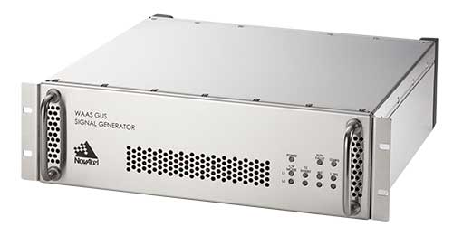
Next-generation NovAtel ground uplink station signal generators delivered for SBAS modernization
Photo: NovAtel
Hexagon/NovAtel announced that shipments of next-generation ground uplink station (GUS) signal generators have commenced in fulfillment of its contract with the United States Federal Aviation Administration (FAA) to support the FAA’s safety of life wide-area augmentation system (WAAS) navigation service.
Developed by the FAA for civil aviation, WAAS is a safety-critical navigation aid that provides integrity monitoring and differential corrections for all phases of flight. The next-generation NovAtel GUS signal generator replaces the legacy product that has operated successfully for more than 15 years and ensures continued operation for years to come.
Along with the GUS signal generator modernization, the contract includes ongoing engineering support services for the complete portfolio of NovAtel ground reference receiver products deployed by the FAA.
“We have a long-standing relationship with the FAA and worked very closely with the WAAS program team to deliver this critical next-generation technology for SBAS modernization,” stated Jonathan Auld, NovAtel Vice President of Engineering and Safety Critical Systems. “We’re very pleased to continue our commitment to support the FAA and their safety of life WAAS service.”