The U.S. Federal Aviation Administration (FAA) has approved two Supplemental Type Certificates (STCs) for CMC Electronics, to help airplanes comply with automatic dependent surveillance-broadcast out (ADS-B Out) requirements.
Boeing 737 Next-Generation Aircraft
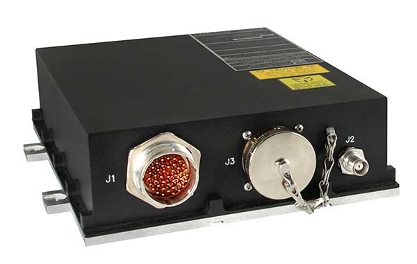
CMA-5024. (Photo: CMC Electronics)
The FAA has approved an STC to install the SBAS-capable CMA-5024 GPS on Boeing 737 Next-Generation aircraft to comply with worldwide ADS-B Out mandates as well as SBAS/GPS navigation enabling the first localizer performance with vertical guidance (LPV) approaches for B737NGs.
CMC’s solution, developed in collaboration with the FAA’s Navigation Programs office, offers operators the advantage of a cost-effective alternative to replacing their current multi-mode receiver (MMR).
The CMA-5024 is an approved DO-260B ADS-B Out positioning source that may be paired with any DO-260B compliant transponder, allowing operators to meet FAA and EASA ADS-B Out requirements, the UAE’s ADS-B Out and RNP requirements mandated by GCAA as well as India’s GAGAN requirements.
The CMA-5024 is the only solution available that is approved to introduce LPV on B737NG aircraft. With the CMA-5024, the B737NG aircraft can take advantage of satellite-based augmentation system (SBAS) navigation throughout all phases of flight.
An LPV approach is the highest precision GPS instrument approach available not requiring specialized crew training. It aims to reduce costs associated with flight delays or cancellations and provides airlines with a safe approach into airports when ILS is unavailable.
The CMA-5024 meets the requirements for an IFR civil certified GNSS and is compatible with all SBAS systems operating around the world such as WAAS, EGNOS, GAGAN and MSAS. SBAS augments GPS to provide an extremely accurate navigation solution throughout all phases of flight, from departure to en-route, through LPV CAT-l equivalent approach. The CMA-5024 complies with published Communication Navigation Surveillance/Air Traffic Management (CNS/ATM) navigational mandates.
EASA approval of the STC is in progress. Future growth to GBAS GLS precision approach capability can be obtained by upgrading to CMC’s new CMA-6024 GPS/SBAS/GBAS receiver system.
For Business Jets
CMC Electronics and DAC International received an FAA STC (ST00934DE) for aircraft equipped with Honeywell’s Primus II avionics suite.
The new STC provides a low-cost alternative to upgrading the existing onboard Honeywell equipment while meeting the DO-260B ADS-B Out worldwide mandate. This is achieved by replacing the existing non-compliant Primus II transponder with the Becker BXT6553 Diversity Transponder, paired with CMC Electronics’ CMA-3024 GPS/SBAS (GNSSU) receiver.
The STC extends the operating life of a broad range of aircraft such as Bombardier’s Challenger 600 series, Hawker 800/800XP, Learjet 45, Gulfstream G-IV and GIV-X, Cessna Citation II and V, and many more.
This is the latest addition to already existing STCs (ST03424CH and ST04159CH), which pair CMC’s CMA-3024 with the Rockwell Collins TDR-94/94D or Honeywell RCZ-8XX Primus II Com/Transponder to meet the DO-260B ADS-B Out standards mandated by the UAE’s GCAA, FAA and EASA for 2020.
Claude Chidiac, Vice President, Sales and Marketing, at CMC Electronics said: “These STCs bring together the best that CMC and DAC have to offer to economically support business jet operators. They combine the respective technological strengths of both companies, namely the most advanced GPS receiver with DAC’s worldwide distribution channels and FAA approved kits. Our joint ADS-B Out solutions deliver high integrity and the cost-effectiveness that business aviation has been waiting for.”
The CMA-3024 aviation sensor provides fully ADS-B compliant SBAS/GPS primary means navigation for business, regional, commercial air transport and helicopter aircraft. It is fully compatible and operational with all SBAS signals worldwide.
With SBAS coverage, differential corrections are incorporated to further improve RNP capability, providing RNP0.1 with outstanding navigation system availability.
Full installation kits, including the CMA-3024 and STC package, are provided by DAC International.
With the proliferation of jamming devices readily available, maritime vessels need to be situationally aware of GNSS interference and disruption. The threat of GNSS jamming is made even more critical in situations that require navigation through narrow straits under poor visibility, with no sea lane markers in sight.
Case in point being the British-flagged oil tanker Stena Impero, which was seized by Iran’s Revolutionary Guards while sailing through the Strait of Hormuz. Iranian Islamic Revolutionary Guard Corps stated that Stena Impero had taken a wrong route when entering the Strait of Hormuz.
This happened during a time when an advisory warning by the U.S Maritime Administration had already been released, stating that vessels operating in the Persian Gulf, Strait of Hormuz and Gulf of Oman may encounter GPS interference, bridge-to-bridge communications spoofing or other communications jamming with little to no warning.
This episode could have been avoided if better awareness of the navigation system was employed.
Jamming protection at sea. ST Engineering has developed AgilLOC Antenna Element Compact (AEC), which provides GNSS protection against three simultaneous jamming/interference sources with its adaptive nulling algorithm for the maritime sector, ensuring continuous GNSS protection to connected systems.
AgilLOC AEC was designed for easy integration with new or existing legacy systems that required uninterrupted GNSS reception. Despite its lightweight and compact design, AgilLOC AEC provides a robust response to narrow and wideband interference, the company said.
When disruption happens. In a disruption, the crew onboard can only rely on radar or cross bearings using compass, terrestrial radio navigation or even sextants.
The loss of GNSS input to the ship’s surface search radar, gyro units and electronic chart display and information system (ECDIS) will result in a lack of GNSS data for position fixing, radar over ground speed inputs, gyro speed input as well as the loss of collision avoidance capabilities on the ECDIS radar display. It is imperative that all ship’s crew are aware of the status of their GNSS reception.
Many GNSS receivers currently installed onboard vessels do not provide for jamming monitoring or mitigation. Deliberate or unintentional GNSS inference are becoming more prevalent, increasing the risk of receivers being overwhelmed by elevated levels of interferences.
Satellite navigation is essential for all maritime applications under all weather conditions. The AgilLOC AEC protects the GNSS signals for a smooth navigation and precision landing alongside with other navigational systems.
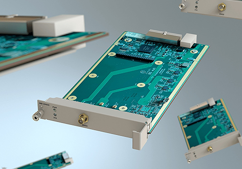
Adva has launched a modular multi-band GNSS receiver for ePRTC and PRTC-B synchronization, bringing increased precision timing to 5G networks.
The new solution is engineered to overcome ionospheric delay variation that causes timing inaccuracy, enabling communication service providers (CSPs) and enterprises to deliver nanosecond precision.
Previously, this was achieved with expensive, rubidium clocks.
Installed synchronization infrastructure can be installed to increase accuracy and reliability. The multi-band, multi-constellation GNSS receiver card plugs into Adva’s OSA 5430 and OSA 5440, advanced core grandmaster clocks able to support PTP, NTP and SyncE over multiple 1Gbit/s and 10Gbit/s Ethernet interfaces.
This enables network operators to meet the requirements of the ITU’s stringent PRTC-B specifications and support advanced 5G applications.
“What we’re offering the market is an entirely new route to high-precision UTC-traceable network timing that doesn’t require significant investment. Our future-proof technology gives businesses and CSPs a way to boost synchronization performance and meet the ITU’s tight PRTC-B specifications without resorting to expensive alternatives.”
Photo: Adva
“Our new multi-band GNSS receiver is a major milestone for network synchronization. For the first time, operators can harness a solution with multi-band GNSS capabilities combined with our core devices, which can deliver line rates up to 10Gbit/s and support ePRTC levels of timing accuracy,” said Gil Biran, general manager, Oscilloquartz.
“Our modular technology offers a way to enhance equipment in the field, achieve PRTC-B levels of timing and improve the timing accuracy of ePRTC. All that’s required is a simple antenna upgrade. Then our multi-band solution can be plugged into the available slot of our OSA 5430 or OSA 5440 for the nanosecond accuracy that will be key to the services of tomorrow. And, as enhanced availability is also essential for emerging applications, the new technology features unrivalled jamming and spoofing detection capabilities combined with our centralized AI-powered GNSS assurance suite.”
Today’s launch answers the urgent demand for improved precision in GNSS-based timing. Currently, most synchronization networks rely on single-band receivers, which can only be accurate to a limited degree as delay between satellites and receivers is affected by space weather. This creates delay variations leading to time information being out of step by up to several tens of nanoseconds.
Adva’s Oscilloquartz multi-band technology receives GNSS signals in several frequency bands, enabling it to use the delay differences between them to calculate delay variation and compensate for it. This method is more cost-effective than other techniques, such as deploying GNSS receivers with a filter implemented by a costly high-stability rubidium oscillator. The OSA 5440 can utilize two multi-band cards, providing ultimate hardware redundancy.
“What we’re offering the market is an entirely new route to high-precision UTC-traceable network timing that doesn’t require significant investment. Our future-proof technology gives businesses and CSPs a way to boost synchronization performance and meet the ITU’s tight PRTC-B specifications without resorting to expensive alternatives,” commented Nir Laufer, senior director, product line management, Oscilloquartz. “Combined with our OSA 5430 and OSA 5440 core grandmasters, the technology creates a scalable, fully hardware-redundant solution. Its built-in security also guarantees the most sophisticated detection of malicious attacks. By supporting GPS, GLONASS, BeiDou and Galileo, our multi-band, multi-constellation line card offers a versatile and resilient solution for migrating from legacy to next-generation timing. Simply put, there’s no other technology available today that can match the accuracy, redundancy, capacity and price point of our core devices combined with our new multi-band GNSS cards.”
The new multi-band GNSS receiver will be officially launched this week at ITSF and can be viewed on Oscilloquartz’s stand Nov. 4-7.
A famous quote applies to almost everything in our lives: “There is nothing permanent except change.”
This well-known saying is generally credited to the Greek philosopher Heraclitus (500 B.C.E.), although many historians and philosophy experts tend to agree the quote is a combination of many topics found in writings by Heraclitus.
However the quote came to be, it aptly describes the world we live in; especially now with lightspeed advancements in technology. Change is markedly evident in today’s surveying world, and almost no practitioner is exempt from revolutionary enhancements and necessary upgrades to stay current in our profession.
Change is on the horizon
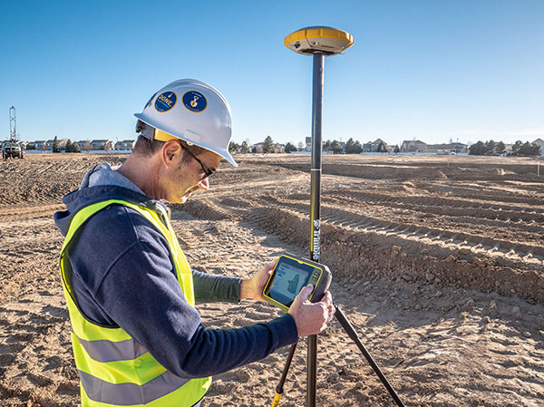
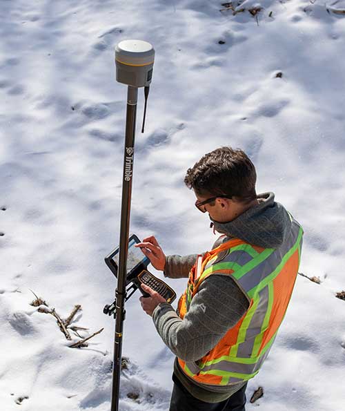
Photo: Trimble
The upcoming NGS 2022 datum change, triggered by advancements in positional accuracies and measurement techniques, has quietly created a groundswell of questions, concern and curiosity of how and why we are at these crossroads. In my September 2019 Survey Scene article, we discussed the background behind the necessity of the upgrade and moving toward a standardized measurement unit, (the “foot”). (For purposes of this article, let’s put aside any mention of using the meter/metric system; the U.S. went down that road in the late 1970s / early 1980s, yet crashed and burned upon implementation. I agree the meter is a more practical unit of measurement, but we need to leave that talk for another day.)
This article will be concentrating on the actual coordinate systems and how significant changes are coming for almost everyone performing surveying measurements. Yes, this means all those construction-based users of GNSS receivers and total stations performing pre-, in-progress and post- construction tasks. Our coordinate world will be turning upside down but, in this case, it will be changes for the good.
Origins of X/Y (otherwise known as Northing/Easting)
We have another philosopher to credit for the concept of coordinate geometry; he is the French scientist Rene Descartes (1596-1650) who was heavily influenced by Plato.
While he may be more well known for his famous quote “I think, therefore I am,” Descartes created what is believed to be the first graphical depiction of geometrical expressions and assigning coordinate values to the results; hence the background behind “Cartesian coordinates.” It is this coordinate system that was utilized by late 1800s/early 1900s surveyors who began using this system to create small networks within urban settings, including New York City, Cincinnati and Atlanta.
As economic expansion continued through the Great Depression and beyond, the need for larger survey networks became more evident. The first state plane coordinate system (SPCS) began in North Carolina in 1933-34 with more states quickly falling in behind them. The main force behind this effort was the U.S. Coastal & Geodetic Survey (now known as National Geodetic Survey), as they utilized many surveyors and engineers that were unemployed due to the Stock Market Crash of 1929 and Great Depression. Technology for the era was limited to theodolites and steel tapes, with most computations being based upon triangulation.
Enter the Electronic Age of surveying
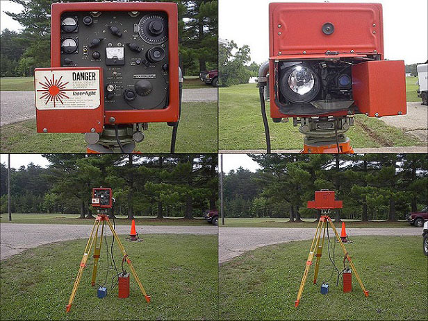
“Big Red” Geodimeter 4D (Photo: National Oceanic and Atmospheric Administration)
Positional and measurement technology remained stagnant until the 1950s and 1960s with the introduction of the electronic distance meter (EDM). Longer measurements could be made with increased accuracy and helped expand our coordinate system capabilities.
These enhancements also led to faster expansion of a nationwide highway system (championed by President Dwight Eisenhower) by simply surveying more efficiently. It is along these highway corridors that state plane coordinate systems were expanded into remote areas and used to verify fractured SPC systems created through solar and/or astronomical means. While positional values at common monuments were found to have significant differences by today’s standards, most error was distributed throughout the network.
Because of the work necessary to complete a survey using a SPCS, it was not practical for any non-governmental project to attempt tying into a known system. Fundamental use of coordinate geometry (CoGo) typically utilized a project base point with a low assumed positional value, (i.e. northing of 1,000, easting of 2,000).
Most surveyors used the same coordinate values for each project and did not have any positional relationship between their projects. While the field portion of the project took a significant amount of time to traverse and collect, the office calculations and manual drafting were also tedious and time-consuming tasks.
Prior to the introduction of the handheld calculator in the early 1970s, traverse computations were completed manually using sine/cosine/tangent tables, traverse adjustment (i.e. compass, transit and Bowditch rule) and double distance meridian (DMD) methods. Even as the programmable calculator became the computation method of choice, regularly producing survey data in SPCS was still years away.
Along with the electronic theodolite and the personal computer with computation software, the introduction of the data collector quietly revolutionized the amount of data that could be stored and efficiently plotted for surveys. But even with the increased efficiencies, there was one big drawback to utilizing this electronic data collection with SPCS; most hardware was limited to values and significant figures not acceptable to using large coordinate values. Some tried truncating SPCS values but often found the trouble not worth the effort, not to mention having projects large enough to be affected by grid-to-ground scale factors (another topic for another day).
Fast forward to the 1980s and the introduction of ultimate surveying black box, the GPS receiver. Positional accuracy through static GPS sessions was now better than ever and allowed surveyors to cover greater distances in shorter time periods. It was the implementation of the GPS receiver (and subsequent reduction in cost of entry for its use) that allowed the surveyor to embrace the state plane coordinate system more than ever. Also addressed with the new technology was the ability for the data collector to handle larger coordinate values with increased significant figures.
As RTK and subsequent RTN systems have allowed for more efficient use of GNSS technology, the surveying profession has now overwhelmed the existing monument network and exposed the deficiencies of NAD83 and our various SPCS zones nationwide. NGS has done an excellent job for many years refining and adjusting the national datums (both horizontal and vertical) by augmenting the systems with new data and “turning the screws” as deemed necessary to provide a reliable network.
If it is not broken, why fix it?
The existing SPCS zones and overall NAD83 system works well but we will need to circle back to the quote in the opening paragraph: “There is nothing permanent except change.”
Research, not just completed by NGS but many other respected agencies and laboratories worldwide, has shown that our existing datums have significant flaws due to many factors. These factors include, but are not limited to, tectonic plate shifting, previous survey data that doesn’t meet today’s positional and measurement standards, and limitations in terrestrial measurements.
We are overdue for an upgrade to the national system and design of new policies and procedures has taken time and lots of hard work. NGS has created a new framework that will adapt to the changing needs of a state and/or regional authority.
But what does this mean for the surveyor, the contractor and anyone else in the geospatial world that uses state plane coordinates for the basis of data?
Image: National Geodetic Survey (Michael Dennis)
As discussed in the last article, NGS has been busy creating a new framework with a proposed implementation of 2022-2023. While NGS is creating the specifications, policies and procedures for the new system, it will be up to each state to decide if they want to keep their existing SPCS zones, change to a new scheme, and/or request that additional smaller zones be included for consideration. NGS, in keeping with existing policy, will work with each state to update their SPC definitions, but only if the state engages NGS during the setup period. Otherwise, NGS will apply the new datum specification to the existing zone(s).
What does this mean to the everyday surveyor?
For an example on how a state can revise their SPCS, let’s use Illinois and its plan to revise current zones. Illinois currently implements a two-zone system (East and West, lengthwise through the state) based upon a transverse Mercator projection.
For several years, GIS users and other agencies have discussed creating a single-zone system across the entire state for ease of use. Because of the size of the state and availability of RTN coverage to some remote areas, the realization of this new system has been on hold. Also, it is understood the distortion in data accuracy across a system this large would not be suitable for survey-grade applications.
Forward to 2019 and the NGS datum upgrade along with a substantial effort by several equipment manufacturers to install CORS stations across the state for broader RTN coverage (and the not-too-distant future rollout of 5G cellphone service). RTN coverage for mapping grade data collection is now readily available nearly everywhere in Illinois, so the potential of a single-zone system is now not far-fetched.
It should be noted that if Illinois decides to convert to a single-zone system, NGS will only recognize that system for future computations and documentation and the two-zone system will be scrapped. It will fall to each practitioner to convert their existing data and projects to the single-zone system if they choose to use it, but it will have some drawbacks due to the distortion of the larger system.
Image: National Geodetic Survey (Michael Dennis)
Enter the low distortion projection (LDP) system. Like other states, Illinois is discussing a potential LDP system containing 32-34 regions statewide for more accurate coordinate system development. These regions are being studied to concentrate on larger urban centers and areas where growth potential is predicted. Regions such as the Chicago, St. Louis and Peoria metropolitan areas are being highlighted for major LDP system use by not just surveyors but government and GIS analysts.
Having a coordinate system with less distortion and more accuracy can provide more reliable information for the survey but also provide more value for the residents and businesses. By concentrating the coordinate system on smaller areas through an LDP, surveyors will literally be using a communal network like their old calibrated or localized network systems of days past. The coordinates will still be large but the integrity of the data will be higher due to the reduced distortion of the system projection.
This system will also virtually eliminate the need to have a grid-to-ground scale factor because of the lack of distortion. So we will now have a large statewide system for mapping and smaller regional systems for accurate survey data going forward; sounds like a good plan, right?
Making a significant change increases our capabilities
Not to sound like a broken record, but let’s revisit the quote by Heraclitus one more time: “There is nothing permanent except change.”
Most people don’t like change, even if it is for the better. Surveyors are notoriously famous for not wanting change. Many surveyors I know would not embrace early GPS not simply due to cost, but more of not understanding how it works. They also didn’t understand how to embrace state plane coordinates and having survey data that will be compatible with their competitors. Most of those surveyors now are using it, but only because the data collectors have become more user friendly.
But why will this change be harder for most? Depending on where one is and how their state is going to adapt will affect that change. If your state is not changing any zones, they will have a -2 to +4.5-meter coordinate shift depending on where they are located. For states like Illinois and potentially changing from two zones (East and West) to a single zone and dozens of regional LDP systems, it will be a bit harder to translate all your existing survey data to the new systems if necessary.
There are several potential pitfalls in front of us if we aren’t careful. Here are a couple of scenarios to consider:
Image: National Geodetic Survey (Michael Dennis)
Understanding the general change in datum values
Converting old data to new system for reuse (additional time consideration)
For practitioners working in several LDP regions, emphasize the importance of correct zone
Software and equipment firmware updates
Older unsupported data collectors
Compatibility with current and archived GIS data
Conversions of government agency-specific data and benchmark
Major milestone dates:
Establishing a date in which all new survey data will use the new datum
Establish a date in which all design projects will utilize the new datum
Establish a date when all construction layout will utilize the new datum
These zone/LDP system changes also will be affected if your state is currently recognizing the U.S. Survey Foot and will be changing to the “foot” per my last article and ongoing NGS discussions. That change will also precipitate additional review and care for compliance of any old data to new systems.
As creatures of habit, change and adaptation moves us forward
Here’s the bottom line: We need to make this change in order to efficiently address future mapping needs and positional accuracies. Because of technology and evolution of measuring devices, we now know there are other factors that play into our coordinate systems.
As the world becomes more reliant on digital data and information, it will be critical that the right geospatial information is tied to it. There is nothing permanent except change, but change can also be for the better.
Trimble has introduced the the R12 GNSS receiver, a high-performance GNSS surveying solution. Powered by a new real-time kinematic (RTK) and Trimble RTX positioning engine, it features Trimble ProPoint GNSS technology that empowers land surveyors to quickly measure more points in more places than previously.
Surveyors who work in challenging GNSS environments can use the Trimble R12 receiver to help reduce both the time in the field and the need for conventional techniques such as using a total station.
The new Trimble ProPoint GNSS technology allows for flexible signal management, which helps mitigate the effects of signal degradation and provides a GNSS constellation-agnostic operation.
In head-to-head testing with the Trimble R10-2 in challenging GNSS environments such as near and among trees and built environments, the Trimble R12 receiver performed more than 30 percent better across a variety of factors, including time to achieve survey precision levels, position accuracy and measurement reliability.
“As a leader in the field of GNSS technology and innovation, Trimble dedicated many years of intensive research into developing the Trimble R12,” said Ronald Bisio, senior vice president of Trimble Geospatial. “This has culminated in a first-class solution, which enables our users to extend the reach of their systems to places where other RTK GNSS systems experience degraded performance.”
Epson has launched the Epson SureColor T3170x 24-inch wide-format wireless printer. Engineered to enhance workflow, the new model in the SureColor T-Series product line offers cartridge-free printing in a clean, space-saving design.
The new, easy-to-fill, refillable ink tanks eliminate time spent purchasing and changing ink cartridges. Ideal for low-cost POP and education posters, as well as blueprints and line drawings up to 24 inches, the SureColor T3170x produces accurate, A1/D-size prints in 34 seconds.
“This SureColor T3170x joins the popular T-Series line that delivers powerful printing solutions for many industries, including architecture, engineering, construction, creative professionals and graphic design,” said Matt Kochanowski, product manager, professional imaging, Epson America. “The new refillable ink tank design provides greater flexibility and productivity for workgroups — taking away the worry of changing ink cartridges and lowering running costs — while also delivering the advanced features and space-saving design our customers expect.”
The SureColor T3170x leverages an Epson PrecisionCore MicroTFP printhead with Precision Droplet Control to produce output with crisp lines and outstanding clarity. Whether printing from a roll or the Auto Sheet Feeder, the 4.3-inch color LCD touchscreen makes tasks simple and intuitive, and integrated wireless and Wi-Fi Direct connectivity, allows users to easily print from virtually anywhere in the office using a tablet or smartphone.
Additional product features include:
Cartridge-free printing – High-capacity ink bottles with auto-stop for easy, mess-free filling
Ultra-fast print speeds – A1/D-size prints in as fast as 34 seconds
Low running costs – Ink included in the box can print a substantial number of posters or technical drawings
Easy to operate – Large, intuitive 4.3-inch color LCD screen simplifies print tasks
Compact, clean design – Ultra-small footprint,4 and sleek, minimal design enhances workspaces; easily fits on a desktop or on its own with optional stand, sold separately
Print from virtually anywhere in the office – Easily print from tablets, smartphones and more with integrated wireless plus router-free Wi-Fi Direct printing
Outstanding image quality – PrecisionCore MicroTFP printhead with Precision Droplet Control for outstanding clarity, plus commercial-grade reliability with Nozzle Verification Technology
Versatile media handling – Accommodates rolls up to 24-inch wide and sheets up to 11”x17” through the auto sheet feeder
Precise, sharp details – Print posters, blueprints, line drawings, and more up to 2400 dpi
Easy setup – Get up and running out of the box in as quickly as 30 minutes
Availability
The SureColor T3170x 24-inch wireless printer will be available through authorized Epson Professional Imaging resellers in December 2019. The SureColor T3170x offers a standard Epson PreferredSM Limited Warranty, a one-year program that includes toll-free advanced telephone access Monday through Friday. The Epson SureColor T3170x is designed to work exclusively with Epson ink. For additional information, visit www.proimaging.epson.com.
Raytheon has delivered the Wide Area Augmentation System Geosynchronous Earth Orbiting 6 satellite navigation payload to the U.S. Federal Aviation Administration (FAA) to broadcast the WAAS message, which corrects errors in GPS satellite signals, provides expanded coverage, improves accuracy and increases reliability.
The WAAS GEO 6 payload is now operational and fully integrated into the WAAS network, working with two other WAAS satellite payloads already in orbit.
The SES-15 satellite hosting Raytheon’s WAAS GEO 6 payload was launched in 2017 and completed extensive system integration in July 2019.
GEO 6 replaces an older WAAS geostationary satellite that had reached its end-of-service life.
About WAAS. Developed and installed by Raytheon for the FAA, WAAS is a North American satellite-based augmentation system that increases GPS satellite signal accuracy for precision approach at 200 feet altitude to meet strict air navigation performance and safety requirements for all classes of aircraft in all phases of flight.
WAAS contains space and ground equipment that works together to identify GPS satellite corrections.
Operational since 2003, the WAAS network consists of three geostationary satellites and 49 terrestrial-based stations dispersed across the continental U.S., as well as Alaska, Canada, Hawaii, Puerto Rico and Mexico.
“Never has a consistent and precise GPS signal been more critical to ensuring safety of flight,” said Matt Gilligan, vice president of Raytheon’s Intelligence, Information and Services business. “As the airspace increases in complexity, there is absolutely no room for error.”
To learn more about Raytheon’s portfolio of air traffic management solutions, visit here.
MicroSurvey has released MicroSurvey CAD 2020. MicroSurvey CAD is powered by the latest IntelliCAD 9.2 engine, providing users with unencumbered survey drafting and calculation workflows, including COGO, point tools for gridline-based projects, traverse input and adjustment, misclosure reporting, common data collector support, 3D surface representation and computation, corridor design, point cloud management and more.
MicroSurvey CAD is perpetually licensed and is powered by IntelliCAD, which is compatible with AutoCAD drawing files. With five available feature levels — Basic, Standard, Premium, Ultimate and Studio — MicroSurvey CAD gives users the choice between several tiers of features to ensure they are getting precisely the tools and price point they need.
Notable improvements in MicroSurvey CAD 2020 include:
IntelliCAD 9.2 which includes full support for AutoCAD 2018-2020 .dwg files, performance enhancements, new BIM tools, a block editor, start page, drawing cleanup tools, selection cycling, digital signatures, and much more;
Arc Labels have been drastically improved to utilize ArcAlignedText objects, which can be slid along an arc or polyline arc, in/out from the radius point, flipped upside down, and detected in the Lot Closure routine. Text on Arc also utilizes the ArcAlignedText objects to be editable as a single entity;
Upgraded CSMap Library includes over 125 new coordinate systems for Africa, Asia, Europe, Australasia and the U.S.
Details are available in the MicroSurvey CAD 2020 Release Notes.
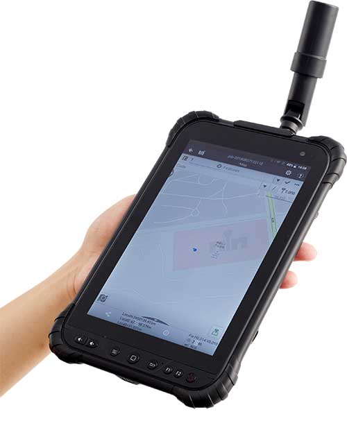
CHC Navigation has launched its LT700H RTK Android tablet, designed to increase efficiency and productivity of the mobile field workforce in applications requiring centimeter-to-decimeter positioning accuracy.
Photo: CHC Navigation
Portable, rugged and versatile, the LT700H enables precision GIS data collection, forensic mapping, construction site layout, environmental surveys, landscaping and earthmoving jobs.
Powered by 184-channel high-performance GPS, GLONASS, Galileo and BeiDou module and a superior tracking GNSS helical antenna, the LT700H provides position availability in demanding environments. Its integrated 4G modem ensures seamless communication from field-to-office and robust connectivity to GNSS real-time kinematic (RTK) networks corrections.
“With the LT700H RTK Tablet, we are offering a professional and accurate GNSS solution to any mobile applications requiring high-portability,” said George Zhao, CEO of CHC Navigation. “The LT700H enables further use of GNSS technology, from single operator to companies with large field crew.”
Combined with CHCNAV Landstar 7 field data-collection software, the LT700H has a vibrant 8-inch IPS sunlight-viewable screen that perfectly displays GIS data tables, vector and raster maps or high-resolution pictures.
The LT700H Google GMS certification guarantees compatibility with any common GIS and mapping Android applications.
Eos Locate for Collector combines three core technologies: Eos Arrow GNSS receivers, Esri Collector, and the Vivax-Metrotech vLoc Series of locator devices.
With Eos Locate for Collector, one field worker can collect both GNSS locations and locator data (such as depth below cover) for any buried asset including water, sewer, electric, cable, gas, fiber infrastructure and more. They can do so quickly, accurately and without the need for any additional field or office support.
“We are giving our Arrow GNSS customers a solution today that allows them to combine both locator data and high-accuracy locations in web maps,” Eos CTO Jean-Yves Lauture said. “This greatly simplifies their workflow by allowing one person to do underground locates and GIS mapping simultaneously.”
“This is a big step forward for utility organizations who need to gain better visibility of their infrastructure,” said Doug Morgenthaler, Esri program manager. “With today’s technology, utilities can already see where new assets are being put in the ground. The challenge historically has been figuring out where existing assets are.”
Eos Locate for Collector not only streamlines underground-asset mapping, but also improves office production times. It eliminates the need to manually combine datasets from the locator and GPS devices within ArcGIS.
“Seeing all that information from utility locators and GPS receivers packaged directly into a GIS application is exceptional,” Vivax-Metrotech Eastern Regional Sales Manager Kelvin Cherrington said. “This solution will help utilities create maps of their underground assets with a much more modern and efficient methodology.”
Indiana American Water Early Adoption
Earlier this year, Indiana American Water approached Eos to seek a solution that consolidated their utility-locate workflow with their Arrow and Collector field work.
“We had the manpower to put paint down,” said Todd Chapman, Indiana American Water Senior GIS Analyst. “But we would need to hire another person to map the locations with our Arrow Gold GNSS receivers.”
Chapman estimates Eos Locate for Collector will cut their field time in half as well as enable the creation of extremely accurate buried-infrastructure maps in ArcGIS.
“Previously, we were seeing that our old water mains could be off by up to 20 feet,” Chapman said. “With the new Eos Locate for Collector, we’re seeing that it’s accurate to under an inch.”
The initial release of Eos Locate for Collector runs on Apple’s iOS iPhones and iPads and supports the vLoc Series from Vivax Metrotech. Future releases of Eos Locate for Collector will support additional locator models including the vScan series.
With accurate digital twins of their buried infrastructure, utilities across sectors can expect improvements to safety, damage prevention, field efficiency and regulatory compliance.
“Not only does this mean quicker responses to 811 tickets and fewer liabilities during field digs,” Lauture said. “But it also constitutes a major step forward toward the highly efficient future of 3D asset management and viable augmented-reality workflows.”
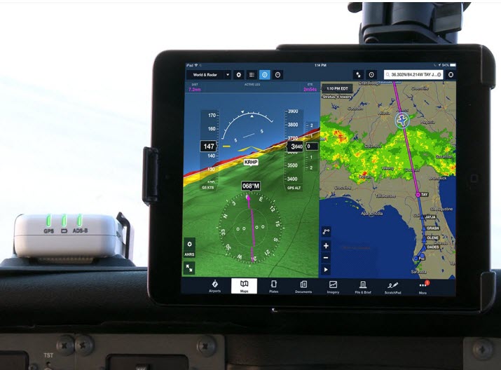
A cockpit equipped with ADS-B controls. (Photo: FAA)
Canada will be delaying the implementation dates for Phases 1 and 2 of its ADS-B Out Performance Requirements Mandate, according to a report by the Canadian Owners and Pilots Association.
ADS-B stands for Automatic Dependent Surveillance – Broadcast. Deadline for aircraft in the United States to be equipped with ADS-B Out capability is Jan. 1, 2020.
The original deadline for implementation in Canada was set for Feb. 25, 2021, for Phase 1-Class A airspace and Class E airspace above FL600, and Jan. 27, 2022 (Phase 2-Class B airspace).
Because numerous industry operators have stated they will not be able to meet those deadlines, new Phase 1 and 2 implementation dates will be set.
Transport Canada-Civil Aviation (TCCA) has also stated that some regulatory matters must be dealt with before implementation can take place.
There is no word yet on how this might affect the implementation of remaining phases — C, D and E), according to the report. Nav Canada’s performance requirements mandate document states that implementation of the different phases will be a minimum of one year apart.
ADS-B Out. ADS-B Out broadcasts information about an aircraft’s GPS location, altitude, ground speed and other data to ground stations and other aircraft once per second.
Air traffic controllers and aircraft equipped with ADS-B In can immediately receive this information.
Tbe ADS-B offers more precise tracking of aircraft compared to radar technology, which sweeps for position information every 5 to 12 seconds.
SA2012 offers customers configurable GPS tracking device on the latest 4G network
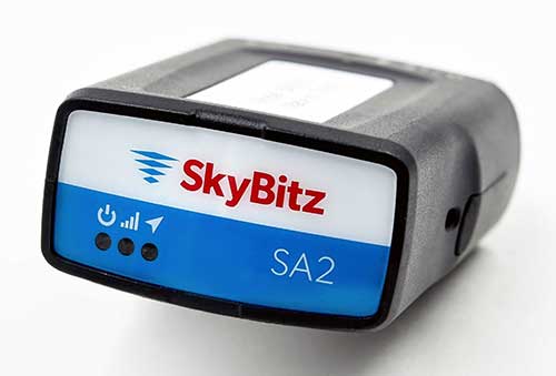
Photo: SkyBitz
SkyBitz has launched the SA2012, equipped with the latest 4G LTE with 3G fallback, positioned for the light- to medium-duty vehicle tracking market.
With the option to purchase a range of price packages with configurable feature sets, the SA2012 is designed for customers looking for a scalable vehicle telematics solution they can use to increase profit margins and satisfy customer demand.
The hardware can be installed using the Ops Center mobile device, either directly plugging it into the vehicle diagnostic port or covertly installing it behind the dashboard, depending on customer preference.
Once installed, the device feeds into the SkyBitz Ops Center platform, where users can manage the new device alongside all others via a single interface. Customers will have coverage across North America, including Mexico and Canada.
The basic package includes GPS location data and estimated odometer and engine hours. With several options leading up to the Pro package, SkyBitz offers a variety of location, engine, and safety data that can be selected based on the customers’ operational goals and budget.
Customers can configure their solution with minimal training, adding features such as advanced alarms and notification schedules and over-the-air upgrades when future features are released.
“SkyBitz strives to bring the latest technology to market that meets industry demand but also exceeds our customers’ expectations. This is one more device added to the SkyBitz product line that is now delivered on the latest network, and integrated into the SkyBitz Ops Center platform so customers can easily see vehicle and asset data on one dashboard,” said Debbie Sackman, senior product manager with SkyBitz. “This device targets small and medium businesses and offers a flexible package choice where customers can add additional features with OTA upgrades as their business grows.”