Category: Applications

  • Trimble XR10 includes Microsoft HoloLens 2 for field work

    Trimble XR10 includes Microsoft HoloLens 2 for field work

    Trimble is offering a wearable hard hat compatible device that enables workers in safety-controlled environments to access holographic information on the worksite — the Trimble XR10 with HoloLens 2.

    In addition, an expanded set of Trimble software and services will be available to provide field-oriented workflows that leverage constructible 3D models and mixed reality to solve daily work tasks.

    The announcement was made with Microsoft at MWC Barcelona (formerly Mobile World Congress), being held this week.

    The Trimble XR10 with HoloLens 2 is the first device created with the Microsoft HoloLens Customization Program and integrates the latest spatial computing technology into a certified solution for use with a hard hat for worker safety.
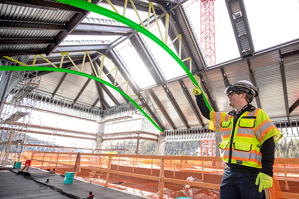
    Photo: Trimble
    Photo: Trimble

    With a wider field-of-view, improved usability and a unique, flip-up viewscreen, the Trimble XR10 with HoloLens 2 combines state-of-the-art mixed reality and safe operation in restricted access work areas.

    The full solution provides even greater accessibility to 3D models by front-line workers. Field-oriented workflows enable broad adoption of mixed-reality for jobsite activities to improve efficiency, productivity and quality of work. Continued development of the cloud-based collaboration platform, Trimble Connect for HoloLens, is enabling workers in the field to get more value from constructible 3D models and transform daily work such as assembly and inspections.

    “Microsoft has provided both the vision and execution needed to stay at the forefront of the mixed-reality evolution,” said Aviad Almagor, director of Trimble’s Mixed-Reality Program. “We’re excited to extend our collaboration with Microsoft in producing a safety-first mixed-reality solution that can be used in production environments such as construction, where workers are building, monitoring and inspecting products and services that deliver tangible value every day.”

    “The ability to access and interact with holographic content has inspired new visualization, collaboration, and production workflows in enterprise markets,” said Alex Kipman, technical fellow, AI and Mixed Reality at Microsoft. “For people that spend their days on the work site, the Trimble XR10 with HoloLens 2 and Trimble’s portfolio of software unlocks the power of mixed-reality to help them get more work done.”


  • Rohde & Schwarz GNSS simulator works with Vector for V2X testing

    Rohde & Schwarz GNSS simulator works with Vector for V2X testing

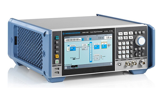
    Rohde & Schwarz has expanded the capabilities of its R&S SMBV100A/B GNSS simulator and R&S CMW500 LTE network simulator to operate with Vector CANoe .Car2x, a software tool for simulation, development and test of V2X-based communication applications.

    URLLC will enable automated driving. (Image: Rohde & Schwarz)
    Image: Rohde & Schwarz

    The solution enables engineers to easily verify critical end-to-end safety-related V2X scenarios in a lab environment. It uses the C-V2X software package for the R&S CMW500 to simulate the physical- and MAC-layer, transmitting and receiving data over the simulated PC5 interface. This covers ideal, faded and congested channel conditions to the device under test (DUT). In its current form, the solution supports both GNSS and PSSS/SSSS sidelink synchronization options.

    Rohde & Schwarz and Vector have successfully demonstrated its solution, which is designed to configure and run traffic scenarios to comprehensively test the physical layer 3GPP Rel. 14 up to the application layer of C-V2X ECUs in a lab environment.

    Rohde & Schwarz is demonstrating the test solution at Mobile World Congress 2019 in Barcelona in hall 6, booth 6C40, Feb. 25-28.

    The automotive industry is evolving toward connected and autonomous vehicles that offer many benefits, such as improved safety, less traffic congestion, reduced environmental impact, and lower capital expenditure. With the trend to equip vehicles with 3GPP Release 14 C-V2X ECUs, peer-to-peer data transfer in ad-hoc networks between vehicles will be realized. All vehicles share location, speed and trajectory, enabling warnings regarding on-road dangers to be shared between drivers.

    Applications cover use cases such as vehicle-to-vehicle (V2V) communication, data exchange with roadway infrastructure (V2I), and interaction with vulnerable road users such as pedestrians (V2P). Data communication is implemented in the 5.8 GHz and 5.9 GHz intelligent transportation system (ITS) spectrum bands.

    Traffic scenarios

    CANoe .Car2x offers a range of functions designed to configure and run traffic scenarios. This allows the stimulation of a C-V2X control unit according to a defined traffic situation that tests the implemented application in a structured manner.

    The included Car2x Scenario Editor supports the creation of traffic scenarios using a graphical interface. CANoe .Car2x generates the corresponding ITS communication based on the test scenario. The scenario is then played back with the R&S CMW500 providing the radio access layer with the specific physical interface. This verifies data transmission and reception over the PC5 interface so that the functions of the ECU can be tested comprehensively.

    The combined solution covers all layers – the complete stack, 3GPP Radio Access Layers for C-V2X Mode 4, region specific ITS protocol layers such as EU ITS-G5 and U.S. WAVE and the ITS application message sets.

    This enables testing of specific use cases such as Emergency Electronic Brake Light (EEBL), Left-Turn Assist (LTA) or Intersection Movement Assist (IMA), as well as more complex scenarios with multiple simulated vehicles such as a congested highway.

    Additionally, security mechanisms could also be verified running simulations with both valid and invalid signed certificates. On top of this CANoe supports all common automotive bus connectivity such as CAN, LIN, MOST, FlexRay and Automotive Ethernet, enabling the test engineer to analyze or stimulate the ECU within an entire system from their desk.

    By extending the solution with the VN4610 interface from Vector, customers can access IEEE 802.11p and CAN (FD) networks as well. This enables users to analyze and test C-V2X and IEEE 802.11p (DSRC) communication and related applications with a single setup and a common user interface.

    “C-V2X device testing through the application layer is a significant step towards achieving the goal of having fully connected vehicles to improve road safety,” said Anton Messmer, vice president of Mobile Radio Testers at Rohde & Schwarz. “Our efforts in developing and verifying C-V2X end-to-end application scenarios are enabling user equipment manufacturers and OEMs to reduce the time needed to roll out C-V2X technology on a worldwide basis.”

    “CANoe .Car2x has a strong focus on testing V2X based protocols and ADAS applications. This combined solution, CANoe .Car2x with the R&S CMW500, enables our customers to stimulate the V2X ECU with real scenario data in order to perform tests from physical layer up to the application,” said Stefan Krauß, director of Tools for Network and Distribution Systems at Vector. “The collaboration on this solution shows what can be achieved when leading players from the automotive and telecommunication industries work hand in hand.”

  • Skyhook to provide location service protections to Rivetz network

    Skyhook to provide location service protections to Rivetz network

    Image: iStock/hanibaram
    Image: iStock/hanibaram

    Skyhook is partnering with Rivetz to integrate Skyhook’s global mobile location services to enhance the Rivetz platform.

    Skyhook is the operator of a worldwide independent location services platform. The company’s technology provides the foundation for mobile location services in the global market for connected devices.

    Skyhook’s hybrid positioning system locates devices using observed radio signals — including GNSS, Wi-Fi and cellular — ensuring that all devices can be located in all environments.

    Rivetz offers decentralized, embedded cybersecurity tools.

    By enabling Skyhook’s advanced location capabilities on the Rivetz Network of cybersecurity tools, Rivetz users can take advantage of location service protection in any signal environment, regardless of GPS availability.

    Accurate and accessible device location services are a critical component of all end-to-end security solutions, particularly in regulated environments or other markets where trusted and verifiable location is a requirement.

    “We are pleased to partner and collaborate with Rivetz, a trusted leader in decentralized mobile security,” said Kipp Jones, Chief Technology Evangelist of Skyhook. “We share the values that our products must be built on the pillars of trust and respect for individual privacy. We look forward to providing Skyhook’s industry-leading location services to the Rivetz Network.”

    “We are proud to join forces with Skyhook to enable powerful location services to the Rivetz Network,” said Steven Sprague, co-founder and CEO of Rivetz. “A simple and safe security model is our greatest priority, and precise device location is a cornerstone of protecting our cybersecurity solutions.”

    Rivetz’s security solutions hinge upon access to the Trusted Execution Environment (TEE), which is an isolated, measured computer environment separate from the operating system. By provisioning all digital transactions through the TEE, Rivetz assures that users’ private keys cannot be altered or stolen if the operating system were tampered with or infected by malware.

  • Rugged Trimble T7 tablet designed for survey and construction

    Rugged Trimble T7 tablet designed for survey and construction

    Photo: Trimble
    Photo: Trimble

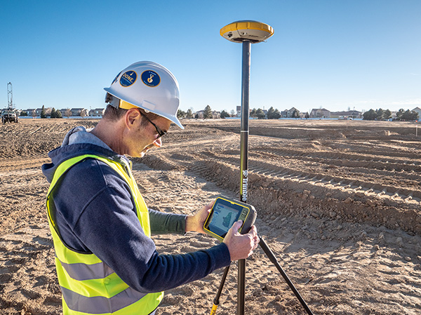
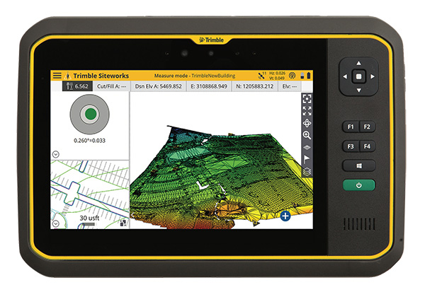
    Trimble has introduced its T7 Tablet, a rugged, lightweight and versatile device designed for construction surveying applications.

    Using Trimble Siteworks Software for construction surveying, the Trimble T7 provides real-time data to visualize cut/fill levels, calculate material volumes, check grade and communicate work orders to increase productivity and enable better decision-making.

    The T7 brings powerful processing to the field — a sunlight readable 7-inch touchscreen that supports pinch, tap and slide gestures and a digital keyboard. Users can interact with the T7 intuitively — zooming, panning and selecting items on the touchscreen.

    The T7 also leverages the power of Windows 10 Professional, driven by an Intel Pentium 64-bit quad-core processor. The processor and operating system make it easy to process data in spreadsheets and run office software programs. Using third-party apps, front- and rear-facing cameras allow contractors to video conference from the field for on-the-job support and capture of high-definition videos and images, the company said.

    The Trimble T7 tablet. (Photo: Trimble)
    The Trimble T7 tablet. (Photo: Trimble)

    The lightweight T7 is built to withstand the wear-and-tear of daily construction work in various weather conditions. It meets stringent MIL-STD-810G for drops, vibration, immersion and temperature extremes and with IP65 and IP68 ratings, is sealed against water and dust. The full-color, 7-inch screen uses a Gorilla Glass display that is scratch and impact resistant.

    “The Trimble T7 Tablet is the next step in the evolution of our data collection portfolio,” said Scott Crozier, general manager for Trimble’s Civil Engineering and Construction Division. “Surveyors, supervisors and inspectors can complete tasks with less downtime, combining Trimble reliability with the flexibility to adapt to a variety of configurations and jobsite conditions.”

    Optional, user-interchangeable Trimble Empower modules make the T7 a flexible solution for a variety of applications. The Empower platform is a modular expansion system that gives users the power to customize their mobile computing solution to their workflow. Optional modules such as barcode imager, a barcode imager/RFID combo and sub-meter GNSS give users the confidence of knowing that that their investment is scalable for future needs.

    The T7 is optimized for use with Trimble Siteworks Software, survey software tailored for construction workflows. Siteworks Software features an interface optimized for ease-of-use and productivity. Configurable views, colorful graphics and natural interactions and gestures make Siteworks Software intuitive and easy to learn. The release of the T7 increases the available hardware configuration options for Siteworks users.

  • Rohde & Schwarz and Bluetest partner on A-GNSS OTA antenna testing

    Rohde & Schwarz and Bluetest partner on A-GNSS OTA antenna testing

    Testing the antenna performance of GNSS signals such as GPS, GLONASS, Beidou, Galileo and Metropolitan Beacon Systems (MBS) is key to location accuracy performance of a mobile device.

    To address the testing need for A-GNSS services, Rohde & Schwarz and Bluetest are partnering in creating test concepts for over-the-air (OTA) antenna measurements.

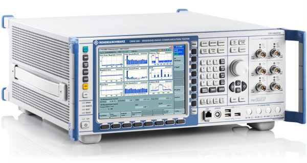
    The CMW500 wideband radio communication tester. (Photo: Rohde & Schwarz)
    The CMW500 wideband radio communication tester. (Photo: Rohde & Schwarz)

    The two companies integrate the R&S LBS Server, a software component running on the R&S CMW500 wideband radio communication tester, and the Bluetest OTA test solution for A-GNSS systems based on Bluetest’s RTS65 reverberation chamber and Bluetest’s Flow measurement software.

    In the test setup, the R&S LBS Server controls the Rohde & Schwarz base-station simulator R&S CMW500 for LTE, WCDMA and GSM, and uses the R&S SMBV100B vector signal generator for simulation of GNSS and MBS signals.

    A simple and straightforward upgrade of the setup for 5G will be available soon, making sure that investments are protected and most relevant standards can be tested with the same system.

    The R&S LBS Server is an essential part of the R&S TS8991 OTA Performance Test System. This cooperation between Rohde & Schwarz and Bluetest marks the first time that the R&S LBS Server, used here as a software tool on R&S CMW500, is available also for third parties.

    “We are delighted to collaborate with Bluetest to contribute with our test and measurement expertise to OTA 4G/3G/GSM and GNSS technology development,” said Alexander Pabst, vice president, Systems and Projects at Rohde & Schwarz. “With a strong global footprint for location based services LBS and close cooperation with partners, Rohde & Schwarz is committed to accompanying the evolution path from OTA testing for GPS, GLONASS, BeiDou and Galileo with innovative test and measurement solutions.”

    “The addition of A-GNSS measurements means that the full range of wireless technology in a modern cellular device can be verified with just one test solution,” said Robert Rehammar, Bluetest CTO. “Bluetest has enjoyed the close cooperation with Rohde & Schwarz on this project, leading to a very strong joint solution and customer offering.”

  • Nurlink launches GNSS and NB-IoT system on chip

    Dragonfly (Image: CEVA)
    Dragonfly (Image: CEVA)

    CEVA Inc. and Nurlink have introduced Nurlink’s NK6010 3GPP Rel.14 eNB-IoT system-on-chip (SoC), powered by the CEVA-Dragonfly NB2 IP solution.

    The companies made the announcement in advance of Mobile World Congress, which takes place Feb. 25-28 in Barcelona, Spain.

    According to the companies, NK6010 is a cost- and power-efficient NB-IoT system on chip (SoC) designed specifically to enable narrowband connectivity in massive internet of things (IoT) devices such as smart meters, wearables, asset trackers and industrial sensors.

    The SoC, built around the CEVA-Dragonfly NB2 solution, incorporates an RF front-end, RF transceiver, cellular baseband, power management unit and application processor, all highly integrated to minimize the size and cost of the device.

    The SoC includes an extremely low-power multi-GNSS subsystem, supporting GPS/Beidou/Galileo/GLONASS global navigation systems, to ensure highly-accurate device tracking and locating, worldwide, the companies said.

    It also supports all NB-IoT frequency bands and major global carriers, ensuring smooth and rapid certification of devices on any NB-IoT commercial network around the world.


    The CEVA-Dragonfly NB2 IP solution is a modular technology, composed of the CEVA-X1 IoT processor, an optimized RF transceiver, baseband, and a protocol stack to offer a complete Release 14 Cat-NB2 modem IP solution that significantly reduces time-to-market and lowers entry barriers.

    It is a fully software-configurable solution and can be extended with multi-constellation GNSS and sensor fusion functionality. The IP includes a reference silicon of the complete modem design, including an embedded CMOS RF transceiver and PA, an advanced digital front-end, physical layer firmware and a protocol stack (MAC, RLC, PDCP, RRC, and NAS).

    “We developed NK6010 to meet the exceptional demand for NB-IoT chipsets to power the multitude of new use cases and applications that narrowband cellular connectivity serves,” said Xiaohua Kong, Nurlink CEO. “The CEVA-Dragonfly NB2 enabled us to massively accelerate our time-to-market by providing many of the key building blocks for our SoC design, already silicon proven and pre-integrated.

    “In addition, through the programmable nature of the Dragonfly solution, our engineering team were able to add our innovation during the communication system development and SoC customization,” Kong said. “This framework eventually helped us to create a truly differentiated product. Our path from licensing to silicon was achieved in under one year, and we’re now engaged with operators worldwide to certify our SoC.”

    “NB-IoT has reached critical mass, with more than 60 operators around the world already supporting the standard and dozens more launching coverage imminently,” said Michael Boukaya, vice president and general manager of the wireless business unit at CEVA. “Now the drive towards ultra-low cost NB-IoT chipsets and modules has begun and Nurlink, powered by our CEVA-Dragonfly NB2 IP solution, is one of the early entrants into this fast growing space. We applaud their efforts to reach the market so quickly and look forward to monitoring their success.”

  • Research Roundup: Modeling lidar data for positioning

    By Daniela E. Sánchez, Harvey C. Gómez and Thomas Pany, Institute of Space Technology and Space Applications (ISTA)

    This paper presents how our system, consisting of a GNSS receiver antenna, an inertial measurement unit (IMU) and a lidar, is used to obtain high-precision maps through the geo-referencing of lidar point clouds. An accuracy assessment of the system is conducted, which also gives us insights on the quality of lidar range measurements for autonomous driving applications.

    The assessment is done by geo-referencing the obtained point clouds of extracted buildings and comparing them against a supporting measuring system like a total station. The building extraction is done by performing an approximation of the mathematical model of a plane to the facades that composes the building in both, the lidar and the supporting measurement system data.

    The paper also indicates the proposed pose determination method of a mobile agent using lidar data. Thanks to the advantages of active, 3D sensors, diverse objects in the environment can be detected as individual point sets, or clusters. Each of the segmented objects can be used as a landmark to figure how the agent is located with respect to those structural elements. The algorithm is capable of detecting the clusters in one point cloud, and finding the most alike point set on a subsequent scan. This is achieved by comparing global descriptors for point cloud data.

    The Ensemble of Shape Functions (ESF) is selected as the cluster descriptor. The cluster matching is performed by comparing the clusters one-to-one, calculating the minimum Chi-squared distance among their descriptors. The smaller this distance, the greater the probability of being the same cluster in distinct epochs.

    Figure 2. Direct geo-referencing of lidar data at different times. (Image: Authors)
    Figure 2. Direct geo-referencing of lidar data at different times. (Image: Authors)

    The resultant cluster correspondences for the whole point cloud allow finding the rigid transformation between the point clouds. An initial coarse alignment among the clouds based on the centroids of each matched cluster was performed, followed by a fine alignment in order to reduce errors by the use of the Iterative Closest Point (ICP) algorithm. This approach is valid for urban environments, or for those where many objects can be segmented as clusters.

    Finally, a practical case is described in order to show how we plan to use the outcome of the highly precise geo-referenced point clouds and the pose estimation method using lidar.

    More info at www.ion.org/publications/ browse.cfm.

  • FAA restricts drones over more DOJ and DOD facilities

    The Federal Aviation Administration (FAA) has issued additional drone flight restrictions over U.S. federal prisons, military bases and Pearl Harbor, effective Feb. 26.

    At the request of its federal security partners, the FAA is using its existing authority under Title 14 of the Code of Federal Regulations (14 CFR) § 99.7 — “Special Security Instructions” — to address concerns about drone operations over national security sensitive facilities by establishing temporary unmanned aircraft system (UAS) specific flight restrictions.

    This is in addition to previous restrictions over prisons, NGA facilities, DoD ships and other facilities.

    Information on the FAA Notice to Airmen (NOTAM), which defines these restrictions, and all of the currently covered locations, can be found at the FAA’s UAS Data Display System, which provides an interactive map, downloadable geospatial data, and other important details.

    A link to the restrictions is also included in the FAA’s B4UFLY mobile app.

    Additional, broader information regarding flying drones in the National Airspace System, including frequently asked questions, is available on the FAA’s UAS website.

    In cooperation with Department of Justice (DOJ) and Department of Defense (DOD), the FAA is establishing additional restrictions on drone flights up to 400 feet within the lateral boundaries of the following federal facilities:

    Federal Correctional Institution Allenwood Medium in Allenwood, PA
    Federal Correctional Institution Beaumont Medium in Beaumont, TX
    Federal Correctional Institution Butner Medium I in Butner, NC
    Federal Correctional Institution Butner Medium II in Butner, NC
    Federal Correctional Institution Coleman Medium near Sumterville, FL
    Federal Correctional Institution Florence in Florence, CO
    Federal Correctional Institution Forrest City Medium in Forrest City, AR
    Federal Correctional Institution Hazelton near Bruceton Mills, WV
    Federal Correctional Institution Lompoc in Lompoc, CA
    Federal Correctional Institution Oakdale I in Oakdale, LA
    Federal Correctional Institution Oakdale II in Oakdale, LA
    Federal Correctional Institution Petersburg near Hopewell, VA
    Federal Correctional Institution Pollock in Pollock, LA
    Federal Correctional Institution Terre Haute in Terre Haute, IN
    Federal Correctional Institution Tucson in Tucson, AZ
    Federal Correctional Institution Victorville Medium I in Victorville, CA
    Federal Correctional Institution Victorville Medium II in Victorville, CA
    Federal Correctional Institution Yazoo City Medium in Yazoo City, MS
    Federal Detention Center Honolulu in Honolulu, HI
    Federal Detention Center Houston in Houston, TX
    Federal Detention Center Miami in Miami, FL
    Federal Detention Center Philadelphia in Philadelphia, PA
    Federal Detention Center SeaTac near Seattle, WA
    Federal Medical Center Carswell near Fort Worth, TX
    Federal Medical Center Fort Worth in Fort Worth, TX
    Federal Medical Center Rochester in Rochester, MN
    Metropolitan Correctional Center Chicago in Chicago, IL
    Metropolitan Correctional Center New York in New York City, NY
    Metropolitan Correctional Center San Diego in San Diego, CA
    Medical Center for Federal Prisoners Springfield in Springfield, MO
    Metropolitan Detention Center Brooklyn in Brooklyn, NY
    Metropolitan Detention Center Guaynabo in Guaynabo, PR
    Metropolitan Detention Center Los Angeles in Los Angeles, CA
    Fort Detrick in Frederick, MD
    Fort Gordon near Augusta, GA
    Fort Lee near Richmond, VA
    Holston Army Ammunition Plant near Kingsport, TN
    McAlester Army Ammunition Plant in McAlester, OK
    Radford Army Ammunition Plant in Radford, VA
    Joint Base McGuire near Trenton, NJ
    Pearl Harbor Naval Defense Sea Area in Honolulu, HI

    These changes, which have been highlighted by FAA NOTAM FDC [9/2586], are pending until they become effective on Feb. 26. Note that there are only a few exceptions that permit drone flights within these restrictions, and they must be coordinated with the individual facility or the FAA.

    Operators who violate the flight restrictions may be subject to enforcement action, including potential civil penalties and criminal charges.

    The FAA is continuing to consider additional requests by eligible federal security agencies for UAS-specific flight restrictions using the agency’s § 99.7 authority as they are received. Additional changes to these restrictions will be announced by the FAA as appropriate.

  • Hangar repeater solution enables indoor avionics testing of GPS signals

    Photo: Foxcom
    Image: Foxcom

    Foxcom, a subsidiary of Global Invacom, has launched a solution that enables aircraft ground engineers to undertake 24/7 avionics testing of Inmarsat, Iridium and GPS satellite signals indoors.

    The Hangar Repeater Solution enables engineers involved in maintenance, repair and overhaul (MRO) of aircraft to undertake testing 24/7 regardless of the weather, without having to move aircraft in and out of a hangar, as is the current practice.

    The dedicated repeater greatly reduces aircraft-on-ground time, work hours and overall maintenance costs, providing a rapid return on investment.

    While Inmarsat and Iridium satellite equipment has been deployed worldwide, its use was limited to outdoor, as building structures block satellite signals. Foxcom’s unique and all-inclusive repeater solution provides communication inside buildings or underground without the need for a direct line of sight to the sky. An existing Foxcom repeater can be easily upgraded to add Inmarsat compatibility.

    Beyond the aviation sector, GPS, Inmarsat and Iridium repeaters can be deployed across a range of locations and industries, such as underground civil defence and military bunkers, oil rigs and ships and large buildings.

    Foxcom launched its first range of repeaters in 2013. Established in 1993, Foxcom specializes in radio frequency over fiber equipment. It is a top supplier to satellite operators, broadcasters and integrators worldwide, with products that offer high performance, bandwidth and reliability.

  • Research Roundup: Mapping reveals Easter Island secrets

    Research Roundup: Mapping reveals Easter Island secrets

    Point-process mapping links Easter Island statuary to freshwater sources.

    By Robert DiNapoli, University of Oregon; Carl Lipo, Binghampton University; Tanya Brosnan and Matthew Becker, California State University, Long Beach; Terry Hunt, University of Arizona; Sean Hixon, Pennsylvania State University; Alex E. Morrison, University of Auckland.

    Rapa Nui (Easter Island, Chile) is famous for its elaborate ritual architecture: more than 300 monumental platforms (ahu) and nearly 1,000 monumental, multi-ton anthropomorphic statues (moai). To date, however, we lack explicit modeling to explain spatial and temporal aspects of monument construction.

    Photo: Steven Sullivan/Shutterstock.com
    Photo: Steven Sullivan/Shutterstock.com

    In a span of only about 500 years, from the 13th century A.D. to European contact in A.D. 1722 and into historic times, the Rapanui islanders sculpted and erected these famous megalithic statues.

    Why? And why were they placed where they stand?

    For many years, scholars thought that the island must have supported a larger and more complex society under more prosperous environmental conditions that then collapsed following a self-imposed “ecocide.” In recent years, nearly every major component of this narrative has been shown to lack empirical sufficiency.

    In this paper, we use spatially explicit point-process modeling to explore the potential relations between ahu construction locations and subsistence resources, namely rock-mulch agricultural gardens, marine resources and freshwater sources — the three most critical resources on Rapa Nui.

    Through these analyses, we demonstrate the central importance of coastal freshwater seeps. Our results suggest that ahu locations are most parsimoniously explained by distance from freshwater sources, in particular coastal seeps, with important implications for community formation and inter-community competition in precontact times.

    The island’s marginal ecology limited the food options available to the inhabitants. These environmental constraints could be a key factor in the emergence of monuments on Rapa Nui, such as their role as adaptive responses to environmental uncertainty or as territorial signals of control over limited resources.

    We quantitatively modeled how the spatial distribution of ahu is explained by different resources thought to be the focus of competition.

    Point-process models (PPM) are a wide class of spatially explicit models that facilitate formal analysis of the relationship between point-patterns and a range of spatial covariates. PPM works by fitting a spatial intensity function to the intensity of an empirical point pattern and finding the values of the predictor variables (i.e., parameters) that best fit the data.

    The technique is similar to geographically weighted regression or maximum entropy modeling but has a number of strengths, such as its ability to simultaneously model both first-order and second-order properties in the underlying point-pattern and how these properties may be dependent upon a set of underlying spatial covariates.

    Our full paper in the January 2019 issue of PLOS One, an open-access scientific journal published by the Public Library of Science, presents a series of formal models that indicate that if Rapa Nui’s monuments did indeed serve a territorial display function (in addition to their well-known ritual roles), then their patterns are best explained by the availability of the island’s limited freshwater.

    More info at https://journals.plos.org/plosone/article?id=10.1371/journal.pone.0210409.


  • Topcon’s MAGNET gets new upgrade, service plans

    Topcon’s MAGNET gets new upgrade, service plans

    Photo: Topcon
    Photo: Topcon

    Topcon releases upgrade of MAGNET software suite with new features and organization.

    Topcon Positioning Group released the newest edition of its suite of software solutions — MAGNET 5.1. The upgrade is packed with new features, modules and support, as well as a reconfiguration of the Office portfolio designed for simplicity.

    The HiPerVR GNSS receiver. (Photo: Topcon)
    The HiPerVR GNSS receiver. (Photo: Topcon)

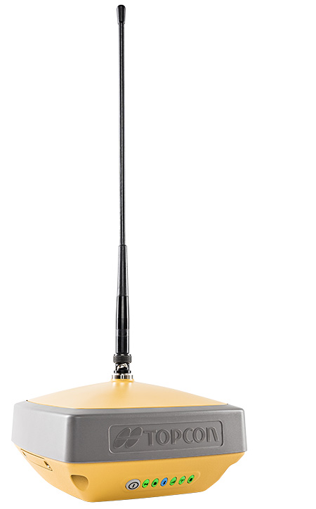
    New updates to MAGNET Field include support for the new HiPer VR GNSS receiver, a piping and trenching module with new capabilities specifically for the oil and gas segment, as well as the ability to orient and scale a PDF directly on a field controller and set it as a background image.

    “The new piping and trenching module greatly improves the COGO, mapping, and exchange functions for in-field oil and gas pipeline design and construction,” said Jason Hallett, vice president of global software business development at Topcon. “Simplified workflows deliver an alignment, profile, and cross-section set for loading into 3DMC for pipe trench excavation. Additionally, customers can now import a PDF drawing as a background image in MAGNET Field. Simply set the insertion point and then rotate and scale by selecting points or lines,” said Hallett.

    New additions to MAGNET Office include a reconfiguration of the portfolio, designed for simplicity, integrated workflows and better service plans. The service plans and subscriptions for MAGNET Office now include MAGNET Enterprise, license check-in and check-out, direct email support and an eLearning fundamentals course.

    Additionally, the E-commerce user-experience has been greatly improved with a new webstore. Direct email user support is currently offered at this web address.

    “The newly optimized product portfolio allows customers to easily select the appropriate Office software product best for their common project demands. The new office structure includes five main products named: project, construction, site, survey and layout, which are consolidated packages of the various MAGNET software services for ease of use and bundling.

    “MAGNET Site, MAGNET Construction, and MAGNET Project now include all of the Viasys VDC Modeler and Explorer functionality for infrastructure BIM modeling and visualization, and MAGNET Project adds even more power by including the DynaRoad mass-haul modules Plan, Schedule and Control,” said Hallett.

    Additionally, MAGNET Enterprise now offers concurrent login to MAGNET Field, Enterprise and Office with a single set of login credentials.

  • Luggage that uses GPS to follow you

    Chinese company Forward X Robotics showed off its Ovis luggage at the 2019 Consumer Electronics Show.

    Ovis uses cameras for facial recognition and a movement tracking algorithm to lock in on its owner and stick with her or him at a speed of six miles per hour. Ovis is able to avoid collisions as it makes its way through crowds, according to its maker, which is now producing the suitcase after an IndieGoGo campaign.

    Image: Forward X Robotics
    Image: Forward X Robotics

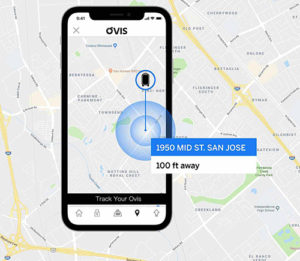
    The Ovis suitcase comes with a smart wristband that sounds and vibrates if the case gets more than six feet away. Its embedded GPS provides real-time monitoring and tracking via smartphone; the location tracker is in an uncuttable luggage tag.

    Similar following suitcases include 90Fun’s Puppy 1, which uses remote control to follow, and the Travelmate Robotics, which provides a removable GPS chip to enable tracking of the bag or anything else of value.