Category: Applications

  • Launchpad: Autonomous vehicle software, GNSS avionics, more

    Launchpad: Autonomous vehicle software, GNSS avionics, more

    A roundup of recent products in the GNSS and inertial positioning industry from the February 2019 issue of GPS World magazine.

    New survey & mapping products

    OEM

    Dead-reckoning module

    For industrial and automotive

    Photo: Quectel
    Photo: Quectel

    The L26-DR dead-reckoning GNSS module is a multi-GNSS receiver embedded with a dead-reckoning solution to greatly improve positioning accuracy and speed while simplifying customer designs. The dead-reckoning capability ensures the module delivers the highest performance positioning solution available, even when GNSS signals are absent or compromised. Equipped with six-axis sensor MEMs and a powerful GNSS core, the module provides high sensitivity, fast GNSS signal acquisition and tracking with low system integration effort. The L26-DR can acquire and track any mix of GPS, GLONASS, BeiDou, Galileo and QZSS signals.

    Quectel Wireless Solutions, quectel.com

    Tracker

    Offers a long battery life

    Photo: Arvento/u-blox
    Photo: Arvento/u-blox

    The Arvento Treyki Mini is a compact people and asset tracking device with eight operating modes, including special settings for tracking children (with geofencing) and senior citizens (with an integrated fall sensor). It is also suitable for use in sports, racing and asset management and can be used as an emergency beacon. It has an onboard positioning receiver, and reports its location using an internal GSM/GRPS modem. It can operate for up to seven days from its 900mAh LiPo rechargeable battery before it needs to be recharged. It uses the u-blox ZOE-M8Q concurrent multi-GNSS module, which is able to receive 72 channels simultaneously.

    u-blox, www.ublox.comArvento Mobile Systems, www.arvento.com

    Small device antenna

    Pinpoints location to within centimeters

    Photo: Antenova
    Photo: Antenova

    The new Antenova Raptor achieves high accuracy using the L2 1200-MHz GNSS bands. The L2 band combines multi-band satellite signal reception and GNSS correction data, helping to mitigate position errors. The antenna is the latest addition to Antenova’s lamiiANT range of rigid FR4 antennas designed for easy insertion onto a printed circuit board (PCB). It is a GPS single-feed antenna in surface mount (SMD) form, measuring 16.0 x 8.0 x 1.6 millimeters, suitable for small PCBs within all kinds of small electronic devices. Raptor is supplied in tape and reel for ease in high-volume manufacturing applications.

    Antenova, www.antenova.com

    GNSS receiver

    Miniaturized anti-spoofing module
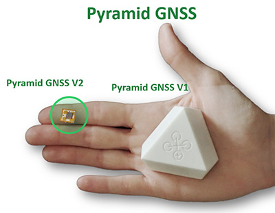
    Photo: Regulus
    Photo: Regulus

    The Regulus Pyramid is a fully functional GNSS receiver fortified with spoofing detection capability. The receiver contains patented technology that enables it to differentiate between real GNSS signals and fake ones generated by an attacker. It is availble both as a fortified GNSS receiver (v1), capable of detecting spoofing attacks, and at the chip level (v2), allowing mobile phones, cars and internet of things (IoT) devices to receive GNSS spoofing protection. A Pyramid GNSS Add-On can be integrated with another satellite receiver to enable spoofing detection capabilities for any GNSS board.

    Regulus Cyber, www.regulus.com

    GNSS antennas

    For high-precision positioning
    The AGR6302/6303 antenna. (Photo : Allystar)
    The AGR6302/6303 antenna. (Photo : Allystar)

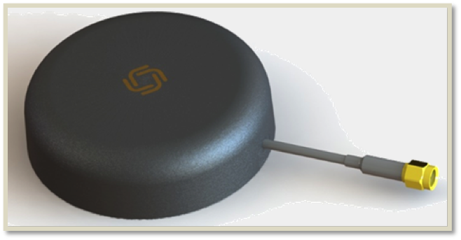
    The AGR6302 and AGR6303 GNSS patch antennas are designed for precision dual-frequency positioning. The AGR6302 is capable of receiving L1/L2 bands, and the AGR6303 is capable of receiving L1/L5 bands. They are designed for UAVs, precision agriculture, autonomous vehicles and other applications where precision matters. The AGR6302/AGR6303 active antenna is designed to cover GPS, BDS, Galileo, GLONASS, IRNSS and the QZSS system. It employs a stack four-feeds architecture with hybrid to achieve the multi-band operation, lower axial ratio, wider half-power beamwidth and excellent right-hand circular polarization. It is housed in a compact, industrial-grade waterproof and magnet mount enclosure.

    Allystar Technology, www.allystar.com


    UAV

    Multi-rotor drone

    Lifts 20-lb payload 12–15 minutes
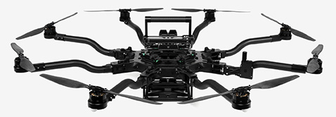
    Photo: FreeFly
    Photo: FreeFly

    The Alta 8 Pro multi-rotor drone includes waypoint technology to allow preprogrammed movements and autopilot functionality. The Alta Pro flight controller runs open PX4 flight stack for quick and powerful interfacing. The Alta 8 Pro fuses readings from accelerometers, barometer, and GPS to create high-bandwidth height control flight mode. By fusing GPS data with an IMU and barometer, the drone is able to hold position even in difficult weather conditions.

    FreeFly, FreeFly.com

    Post-processing

    Third-party GNSS use enabled
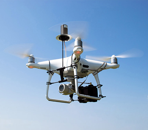
    DJI Phantom 4 Pro with Loki PPK system. (Photo: GeoCue)
    DJI Phantom 4 Pro with Loki PPK system. (Photo: GeoCue)

    The DJI Phantom 4 Pro RTK (P4R) drone is now integrated into the AirGon Sensor Processing Suite (ASPSuite). ASPSuite is a post-processing solution for GeoCue’s Loki direct geopositioning system for DJI and other drones. The ASPSuite enables integration of the P4R with third-party L1/L2 GNSS base stations such as systems from Septentrio, Leica, Trimble, Topcon, CHC and others in a high-accuracy PPK workflow. It includes support for engineering-grade survey options such as vertical transforms, creation of and transformation between collection datums and local coordinate systems, application of antenna static and dynamic lever-arm corrections, and full support for Loki direct geopositioning systems.

    GeoCue Group, geocue.com

    360-degree UAV camera

    11K eight-lens VR cinema camera

    Photo: Insta360
    Photo: Insta360

    The Insta360 Titan is an eight-lens cinematic virtual reality (VR) camera that captures 360-degree photos and video at up to 11K resolution. The Titan uses eight micro four thirds (MFT) sensors, the largest sensors available in any Insta360 standalone VR camera. It has a GPS signal antenna and a Wi-Fi signal antenna. The sensors maximize image quality, dynamic range, low-light performance and color depth, increasing realism in high-end professional VR capture.

    Insta360, www.insta360.com


    SURVEY & MAPPING

    Integrated receiver

    For diverse RTK applications
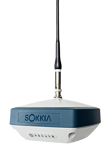
    Photo: Sokkia
    Photo: Sokkia

    The GRX3 is designed to provide a smaller, lighter and fully integrated GNSS solution to Sokkia’s GNSS receiver line. Its compact and lightweight housing has been tested to meet IP67 certification for protection against harsh weather. The receiver features Sokkia Tilt technology, which includes a nine-axis inertial measurement unit (IMU) and compact eCompass designed to compensate for misleveled field measurements by as much as 15 degrees. UTC technology automatically tracks signals from all available and planned constellations, including GPS, GLONASS, Galileo, Beidou, IRNSS, QZSS and SBAS.

    Sokkia, www.sokkia.com

    Airborne 3D scanning

    Designed to gather large area data

    The Faro Focus scanner attached to a Stormbee UAV. (Photo: Stormbee)
    The Faro Focus scanner attached to a Stormbee UAV. (Photo: Stormbee)

    The Faro–Stormbee airborne solution includes the Faro Focus laser scanner, the Stormbee S series UAV and the Beeflex software suite. It enables wide-area scanning missions such as highways, train infrastructure and buildings. It allows users to capture complex environments traditionally inaccessible to ground-based scanning. It has no need for control points. Users can create centimeter-level accurate point clouds directly from the in-flight data.

    Faro, faro.com; Stormbee, stormbee.com

    Documentary Series

    Experts discuss value of automation and new technology

    Screenshot: Topcon
    Screenshot: Topcon

    The new Infrastructure and Technology series of documentary videos is designed to foster awareness of growing global infrastructure demands and the technology that can help meet them. Experts interviewed include representatives from Intel, SAP, Industry Consultants, Constructech, Solar City and Topcon. They discuss how, by adopting technology, the construction and agriculture industries can increase productivity and help address infrastructure needs now and in the future.The series was filmed globally in the U.S., the Netherlands, the United Kingdom and Germany.

    Topcon Positioning Group, topconpositioning.com

    Project software

    Updated to latest intellicad technology consortium release

    Photo: Carlson Software
    Photo: Carlson Software

    The specialized drafting package Carlson iCAD 2019 allows technicians to supplement the finished product in their project deliverables. New additions and functions to the iCAD 2019 release are new tool palettes, new 3D solid commands, additional DGN support, and new express tools. iCAD features Google Earth import and export KML/KMZ, standard CAD entities and the drawing inspector tool.Carlson iCAD 2019 has been built with and updated to the IntelliCAD 9.0 engine from the previous IntelliCAD Technology Consortium 8.3 release. IntelliCAD 9.0 supports direct read of DGN files, allowing users to make edits without converting drawing formats, and features a CUI interface for custom workspaces, toolbars and ribbons.

    Carlson Software, www.carlsonsw.com
    IntelliCAD Technology Consortium, www.intellicad.org

    Geographic calculator

    Includes geocalc geodetic registry
    Screenshot: Blue Marble
    Screenshot: Blue Marble

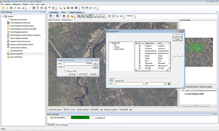
    The 2019 Geographic Calculator features a universal copy and paste function, a new angular unit conversion tool, support for NADCON 5.0 and updated seismic survey conversion functionality. The foundation of the calculator’s geodetic data-processing functionality is the embedded GeoCalc datasource, which is continually revised and improved with updates through the online GeoCalc Geodetic Registry. The datasource included in the 2019 release mirrors the most current EPSG database definitions. The calculator’s copy and paste function can be used to quickly capture data for use in a third-party application or to insert new coordinate values in an existing job.

    Blue Marble Geographics, www.bluemarblegeo.com


    TRANSPORTATION

    Positioning software

    For autonomous vehicles

    Photo: Shutterstock.com/Allies Interactive
    Photo: Shutterstock.com/Allies Interactive

    The InvenSense Coursa Drive software is an inertial-aided positioning solution for autonomous vehicle platform developers. It is a high-performance extension of the InvenSense Positioning Library (IPL), which has provided sensor-aided positioning to more than 50 million devices worldwide. Coursa Drive enhances inertial-only vehicle positioning to <0.2 percent of distance traveled, accuracy critical to maintaining decimeter lane-level vehicle positioning in challenging GNSS/perception system environments. Coursa Drive’s inertial navigation system (INS) calibrates using absolute position inputs from either high-accuracy GNSS receivers or from perception-based systems (camera, radar, lidar) with high-definition (HD) maps. In real time, Coursa Drive provides high-rate, 100-Hz delta positions and orientation to the autonomous vehicle system, complementing the lower rate position references from GNSS and perception systems. For non-real-time applications such as HD map creation and maintenance, Coursa Drive’s offline mode reprocesses INS data at two to three times higher accuracy than real-time mode, providing HD map companies alternative position references to verify HD map accuracy, even without GNSS, for up to 60 seconds.

    TDK Corporation, www.invensense.com

    Video surveillance

    Mobile Network Video Recorder (NVR)
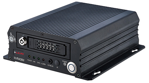
    Photo: Lillin
    Photo: Lillin

    The mobile NVR408M with GPS navigation is designed for use in moving vehicles, remote locations or rugged environments. The rugged compact design works in harsh and demanding conditions to deliver quality video surveillance. Typical applications are in law enforcement or public transportation, using vehicles such as trains, buses, trucks, cars, airplanes and ships. NVR408M is an EN50155-certified product, able to withstand severe vibration and shock and making it suitable for railway applications.

    Lilin, www.meritlilin.com

    Car2X/V2X Interface

    Accesses IEEE 802.11 and CAN networks
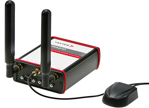
    Photo: Vector
    Photo: Vector

    The VN4610 is a powerful interface for accessing IEEE 802.11p and CAN (FD) networks for Car2X/V2X communication using a USB PC connection. The VN4610 provides precise position, time and speed information that can be used by the application as test stimulus or for documentation. The absolute GNSS timestamps can be used to synchronize recordings of distributed measurements for subsequent analysis. The u-blox NEO-M8U supports GPS, GLONASS, Beidou and Galileo — up to three systems simultaneously. The IEEE 802.11p-based dedicated short-range communication (DSRC) communicates in the 5.9-GHz range. The VN4610 supports the unfiltered receiving and sending of IEEE 802.11p frames used for the implementation of Car2X/V2X applications. The received IEEE 802.11p radio-signal-based frames are transferred to the application synchronously to the CAN (FD) messages.

    Vector, www.vector.com

    FAA-certified avionics

    With enhanced ADS-B, SBAS and georeferenced charts

    Photo: Collins Aerospace
    Photo: Collins Aerospace

    The Pro Line Fusion avionics upgrade for Pro Line 4-equipped Bombardier Challenger 604 series aircraft has been certified by the U.S. Federal Aviation Administration (FAA). The all-in-one upgrade complies with pending mandates while modernizing the flight experience for pilots. The upgrade includes ADS-B mandate compliance, SBAS-capable GNSS, localizer performance with vertical guidance (LPV) approaches, radius-to-fix (RF) legs, geo-referenced electronic navigation charts, widescreen LCD screens and synthetic vision.

    Collins Aerospace, www.collinsaerospace.com
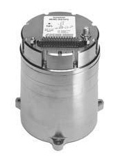
  • Systron Donner updates SDN500-xE MEMS INS/GPS

    Systron Donner updates SDN500-xE MEMS INS/GPS

    Photo: Systron Donner
    Photo: Systron Donner

    Systron Donner Inertial (SDI) has released an update to its SDN500 digital quartz MEMS GPS inertial navigation system (GPS/INS).

    Introduced in 2011, the SDN500 is a platform extension of SDI’s proven, tactical-grade SDI500 IMU.

    The modular, compact, 25 in3 SDN500 provides for maximum packaging flexibility in dense systems and delivers accuracies to within 1.0 mrad in attitude, 0.1 m/s in velocity and 3.9 meters spherical error probability (SEP), the company said.

    The SDN500-xE product update provides a newer generation JF2 (C/A) Code GPS receiver and tightly couples the 1 PPS GPS signal to the SDI505 IMU synch pulse to improve heading performance and reduce jitter after long periods of operation without dynamic inputs. The specifications for the updated SDN500-xE will remain the same as the current SDN500-xD INS/GPS device.

    The SDN500 offers superior tactical-grade performance  integrating SDI’s latest generation quartz gyros capable of 0.5°/hr. bias in-run stability and exceptionally low ARW (0.02°/√ hr.), quartz accelerometers delivering 0.5 milli-g in-run bias stability and low VRW (80 µg/√ Hz.), plus high speed digital signal into a tightly coupled GPS-aided Inertial Navigation System for tactical navigation and geo-location applications.

  • Pentagon inspector general to look at SpaceX launch certification

    Pentagon inspector general to look at SpaceX launch certification

    (Photo: SpaceX)
    A SpaceX Falcon 9 rocket lifts off from Space Launch Complex 4E at Vandenberg Air Force Base, California, Jan. 14. (Photo: SpaceX)

    Starting this month, the inspector general for the U.S. Pentagon will be reviewing how SpaceX’s rockets became certified to launch payloads for the U.S. Air Force, a decision made in May 2015.

    “Our objective is to determine whether the U.S. Air Force complied with the Launch Services New Entrant Certification Guide when certifying the launch system design for the Evolved Expendable Launch Vehicle-class SpaceX Falcon 9 and Falcon Heavy launch vehicles,” wrote Michael J. Roark, deputy inspector general for Intelligence and Special Program Assessments, in a Feb. 11 memorandum to the Air Force.

    A SpaceX Falcon 9 rocket carried the first GPS III satellite into orbit on Dec. 23, 2018.

    In April 2016, the U.S. Air Force awarded SpaceX the first competitively sourced National Security Space (NSS) launch services contract in more than a decade, when the company won the GPS III Launch Services contract, fixed at $82,700,000.

    Less than one year later, SpaceX was awarded a second contract for launch services to deliver a GPS III satellite to its intended orbit.

    The evaluation will be performed at the Space and Missile Systems Center, a unit of Air Force Space Command, headquartered at Los Angeles Air Force Base in El Segundo, California. Additional locations may also be identified as part of the audit.

  • Garmin’s GPS 3000 enables ADS-B and WAAS/SBAS operational capability

    Garmin’s GPS 3000 enables ADS-B and WAAS/SBAS operational capability

    Photo: Garmin
    Photo: Garmin

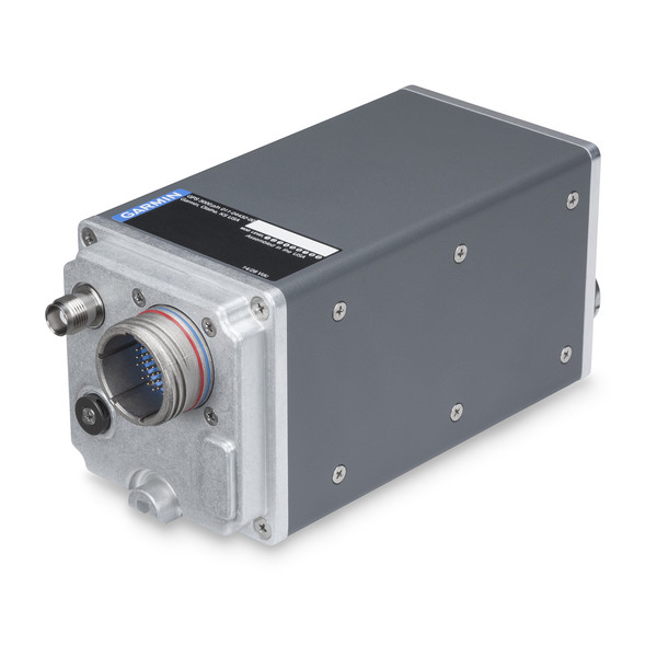
    Garmin International Inc., a unit of Garmin Ltd., has launched the GPS 3000, a high-integrity GPS position sensor that interfaces to existing avionics to help meet Automatic Dependent Surveillance-Broadcast (ADS-B) Out requirements.

    Also, targeting the air transport and defense markets, the GPS 3000 is designed as a WAAS/SBAS position source for select Flight Management Systems (FMS).

    Aircraft that are eligible to utilize the GPS 3000 as an ADS-B position source include the Embraer E135/E145 and the Legacy 600/650. Supplemental Type Certification (STC) for the GPS 3000 in these aircraft is currently available from FTI Engineering, in cooperation with Atlas Air Service in Germany, and can be installed throughout the entire Garmin dealer network.

    “Garmin continues to lead the industry with the most fielded ADS-B solutions that span all segments of aviation, including a wide-range of commercial, defense, regional and business aircraft,” said Carl Wolf, vice president of aviation sales and marketing. “We are thrilled to provide these aircraft with a solution that is cost-effective and is an easy to install alternative to the existing avionics manufacturer’s service bulletin.”

    A rugged, stand-alone and certified Wide Area Augmentation System (WAAS)/Satellite-Based Augmentation System (SBAS) GPS, the GPS 3000 meets DO-160 and DO-178B standards and is designed specifically for the harsh environmental conditions encountered by commercial aircraft.

    This compact and remote-mount solution utilizes enhanced WAAS/SBAS GPS satellite signals to provide precise position data through a standard interface. It also meets applicable high-integrity ADS-B position source standards, including TSO-C145d Class 3, the company said.

    The GPS 3000 is also designed to interface with select FMS to support GPS guidance throughout terminal, enroute and approach navigation. When configured appropriately, the GPS 3000 is capable of providing position information to an existing FMS to meet requirements for Required Navigation Performance (RNP) and can support GPS-based vertical approach navigation, such as Localizer Performance with Vertical (LPV) approach guidance.

    European Aviation Safety Agency (EASA) STC of the GPS 3000 in the Embraer E135/E145 and Legacy 600/650 is available from FTI Engineering, in cooperation with Atlas Air Service, as well as Garmin dealers. FAA validation of the STC is pending.

  • No-charge GNSS smartwatch uses u-blox technology

    No-charge GNSS smartwatch uses u-blox technology

    Photo: u-blox
    Photo: u-blox

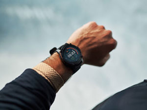
    U-blox, a global provider of positioning and wireless communication technologies, is partnering with TransSiP and Matrix Industries to create PowerWatch 2, a GPS smartwatch that doesn’t need to be charged.

    The smartwatch features the ultra-small, ultra-low power u-blox ZOE-M8B GNSS receiver to track position, in addition to calories burned, activity level, and sleep, making it an ideal companion for runners, hikers, and swimmers. All this is enabled by TransSiP PI technology which ensures energy harvested is used at maximum efficiency and provides crystal clean power enabling optimum performance.

    The PowerWatch 2 does away with cables and external batteries by continually topping up its battery using thermoelectric energy generated from body heat as well as solar energy. The watch also connects to smartphones and displays notifications on your wrist, tracks activities and visualizes them using dedicated iOS and Android apps, as well as with popular third party health and fitness platforms.

    The PowerWatch 2 delivers location tracking using the low-power u-blox ZOE-M8B GNSS receiver module that consumes as low as 12 mW. Packaged as a (System-in-Package), the 4.5 x 4.5 x1.0 mm module helps achieve the watch’s comparatively low 16-mm thickness. And concurrent reception of up to three GNSS constellations means that it delivers high accuracy positioning in challenging situations such as urban or dense forest environments and when swimming.

    Satellite-based positioning is typically the most power-hungry process on a sports watch. Providing highly efficient conversion of harvested energy into a very quiet supply of DC power, TransSiP PI enhances the ability of the ZOE-M8B GNSS receiver module incorporating u-blox Super-E technology, to strike an ideal balance between power and performance. Working on a tight power budget, the watch supports 30 minutes of continuous GNSS tracking per day, with unused time accumulating in the watch’s battery pack, such as powering two hours of location tracking every four days.

    “We put a lot of effort into tailoring the ZOE-M8B to the needs of small battery powered applications. We couldn’t have wished for a better product to showcase our ZOE-M8B’s potential for wearables than the PowerWatch 2,” says Florian Bousquet, principal product manager in Standard Precision GNSS at u-blox.

    Douglas Tham, CTO of Matrix Industries added, “TransSiP PI makes it possible to deliver high performance and high efficiency simultaneously by reducing system noise, eliminating time spent re-acquiring data, and minimizing the need for additional processing. This means power savings across-the-board and enables applications which can be powered solely by energy harvesting.”

    “Not only were size, cost and power constrained in developing the PowerWatch 2, we also had to make sure that it met the high performance demands that athletes expect,” said Akram Boukai, CEO and co-founder of Matrix Industries. “The combination of TransSiP PI and the ZOE-M8B solved all of these pain points for us, enabling the watch to quickly lock in on its position even in weak signal environments.”

    Backers of the project on Indiegogo are expected to receive their orders in June 2019.

  • 3D cm achieved with UAV/van mapping system MapKITE

    3D cm achieved with UAV/van mapping system MapKITE

    All photos: GeoNumerics
    All photos: GeoNumerics

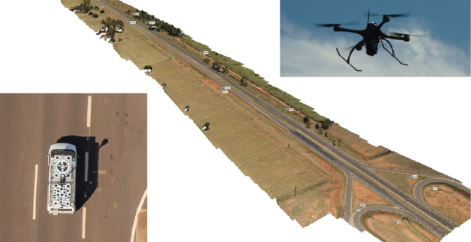
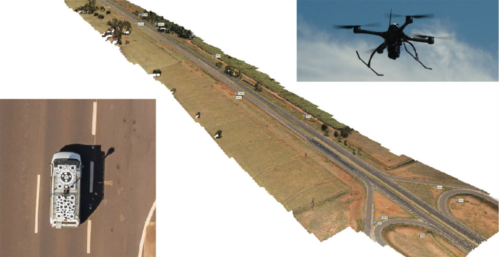
    Kinematic Ground Control point for UAV photogrammetry: A dynamic duo of UAV and mobile van combine to deliver the accuracy of conventional methods with only 2+2 ground control points at the ends of the corridor.

    By Ismael Colomina, Pere Molina and Roberto da Silva Ruy

    A Brazilian and a Spanish company, ENGEMAP and GeoNumerics respectively, have finalized the accuracy evaluation of a mission conducted with the latter’s mapKITE technology on a Brazilian motorway in 2018.

    The goal of the evaluation was to confirm the advantages of the mapKITE method and its kinematic ground control point (KGCP) concept over conventional corridor mapping methods.

    The mapKITE and the conventional method delivered comparable accuracy results — the difference being that the latter requires a dense set of surveyed ground control points (GCPs) while mapKITE does the job with almost no GCPs.

    For this purpose, a 4-kilometer segment of the Rodovia Raposo Tavares in São Paulo state was populated with a set of 37 evenly distributed, signalized, accurately surveyed ground points. The set was divided into two subsets of 23 GCPs and 14 ground check points (GChPs) — the ground truth — respectively. The 4-km road segment was also covered by 189 drone images and their corresponding 189 KGCPs. The image set was processed as a conventional aerial corridor block:

    • with the integrated sensor orientation (ISO) method in a 23 GCP + 14 GChP configuration, and
    • as a mapKITE aerial corridor block in a 4 GCP + 14 GChP + 189 KGCP configuration.

    The two processes produced similar accuracy results: mean (μ), empirical standard deviation (σ) and root mean square (rms) error of the photogrammetric determination of the horizontal (EN) and vertical (h) coordinates of the GChPs against the ground truth. (All units are stated in millimeters.)

    The conventional method delivered: μEN = 17, μh = 26, σEN = 26, σh = 44 and RMSEN = 32, RMSh = 51.

    The mapKITE method delivered: μEN = 26, μh =-20, σEN = 22, σh = 48 and RMSEN = 34, RMSh = 52.

    The mapKITE configuration uses only four GCPs (two at each end of the road segment) in contrast to the 23 GCPs of the conventional method. Nominal flying height of the drone was 120 meters above ground, producing an average ground sampling distance (GSD) of 2.3 cm. Forward image overlap was 80% resulting in a base-to-height ratio of 0.157.

    MapKITE is a GeoNumerics patented method for 3-dimensional corridor mapping that combines the two latest geodata acquisition methods, terrestrial mobile mapping and aerial drone-based mapping. MapKITE is a tandem terrestrial-aerial mapping method and system composed of:

    • a terrestrial mobile mapping system (land vehicle and sensors) carrying
      • an optical metric target on its roof;
      • a drone aerial mapping system; and
      • a real-time virtual tether and post-mission software.

    In a mapKITE mission, the drone follows the land vehicle, and thus the vehicle target becomes a kinematic ground control point visible and measurable on each image. It is a high-accuracy, high-resolution Earth observation method. MapKITE combines the advantages of mobile land-based encompassing images and 3D point clouds. MapKITE combines the advantages of mobile land-based (manned) and aerial drone (unmanned) mapping systems.

    GeoNumerics (Castelldefels, Spain) is a research and development company specializing in geomatics and accurate navigation.

    ENGEMAP (Assis, Sao Paolo, Brazil) is one of the largest and oldest mapping companies in Brazil. It has more than 100 employees, three aircraft, two mapping land vehicles, a number of rotary- and fixed-wing drones and a record of accomplished mapping and cadastral projects. ENGEMAP is officially authorized by the Brazilian Ministry of Defence (MD) and the Brazilian Department of Airspace Control (DECEA) to conduct mapKITE commercial flights in Brazil.

    MANUFACTURERS

    The mapKite campaign was conducted with a Sensormap SMM terrestrial mobile mapping system and a UAVision UX Spyro drone equipped with a NovAtel OEM2 GNSS dual-frequency receiver with a Maxtena antenna and a Sony α7R camera with a 25-mm camera constant lens. The INS/GNSS system in the Terrestrial Vehicle was a Span-CPT (Novatel) including dual-frequency antenna and DMI wheel sensor.


    ISMAEL COLOMINA is chief executive and chief scientist at GeoNumerics. He has a Ph.D. in mathematics from the University of Barcelona.

    PERE MOLINA is advanced applications program manager at GeoNumerics. He holds a master’s degree in mathematics from the University of Barcelona and a master’s in photogrammetry and remote sensing from the Institute of Geomatics, Catalonia.

    ROBERTO DA SILVA RUY is technical manager at ENGEMAP. He has a Ph.D. from the Universidade Estadual Paulista.

  • Mapping method provides parking data for urban navigation

    Mapping method provides parking data for urban navigation

    A new map method opens up parking continuous-environment mapping for enhanced low-cost urban navigation. Collectively recorded context data by many identical platforms gather similar sensor readings when operating in a given area. Further processing integrates the data with a map and feeds the summarized results to a user.

    By Ivan Smolyakov, Evgeny Klochikhin and Richard B. Langley

    Complex, dynamic urban environments comprise millions of devices with localization capabilities. While GNSS remains a primary positioning tool, its performance is subject to significant degradation from blocked signals, multipath and non-line-of-sight (NLOS) signal reception. In aided navigation, a positioning filter with GNSS measurements integrates data from various sensors and correction streams to compensate for these disadvantages.

    Low-cost platforms are limited with the variety and quality of sensors on board, as well as by processor performance and battery capacity. Positioning routines must be computationally light, energy efficient and make the most productive use of available data.

    One new research area covers use of crowd-sourced GNSS data. Many vehicles now include some type of native wireless connection capability, which could be complemented by a designated third-party device.

    The growth in connectivity brings an opportunity to access a stream of sensor data produced by a high number of devices operating in a localized urban area. Here, we explore the idea of creating a GNSS signal-strength map using the connected vehicle GNSS data stream and then use the map as statistical information for Kalman filter parameters tuning. This approach improves filter reaction to the environment and produces a positioning accuracy improvement.

    SYSTEM ARCHITECTURE

    C/N0 levels of reflected and diffracted signals are more likely to be lower than that of the LOS signals. We propose that the C/N0 level averaged during a given period among all satellites tracked in a given area would correlate with a higher probability of multipath-contaminated and NLOS signal reception.

    A sufficient number of C/N0 readings associated with a given space-time cube should be collected to compute the statistics populating the signal-strength map. However, the city environment does not remain static: new construction occurs, traffic congestion shifts, and so on. Therefore, the C/N0 space-time statistics must be continuously updated in real time to reflect these changes. Additionally, the solution must be highly scalable as the market of connected vehicles is growing and so is the volume of the streamed data.

    A recent advance in cloud-based data-stream processing, a data flow model treats an input data stream as something that will never become complete. A derivative of that model is Flink, an open-source framework capable of both unbounded data (stream) and bounded data (batch) processing, while treating bounded data as a special case of the streaming applications.

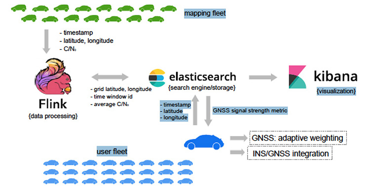
    We use Flink as a core library for the environment mapping architecture as it fits the needs of event-time processing while being a highly scalable solution. The processing enables calculating necessary statistics based on a moment of time a reading occurred rather than based on a moment of time the reading arrived at the cluster. The proposed system architecture is presented in Figure 1.

    Figure 1. Continuous GNSS signal strength environment mapping architecture. (Image: Authors)
    Figure 1. Continuous GNSS signal strength environment mapping architecture. (Image: Authors)

    The connected vehicle mapping fleet transmits packets of the GNSS receiver readings via cellular Internet connection to the server at 1 Hz. Each packet contains a timestamp in the UTC time system, the geographic coordinates determined by the proprietary positioning algorithms of a connected vehicle, and the C/Nmeasurements per each tracked satellite.

    The geospatial processing block calculates the average C/N0 metric among the readings of a given space-time cube. Computed statistics are sent to Elasticsearch, updating the map in real-time. Elasticsearch is an open-source, distributed search and analytics engine integrated with Kibana, an open-source data visualization tool. User platforms request the average C/N0 metric from the search engine with their UTC timestamp and coordinates and apply it in the processing filter.

    PILOT PROJECT

    The system is currently in prototype. Collection of the data populating the map was performed with two positioning boards designed by Parkofon Inc. and installed on the dashboard of a vehicle (Figure 2).

    Figure 2. Mapping setup: Parkofon board is installed on the dashboard of a vehicle. (Image: Authors)
    Figure 2. Mapping setup: Parkofon board is installed on the dashboard of a vehicle. (Image: Authors)

    Lack of a high number of vehicles for the data collection campaign was compensated with an extensive piloting time (17 hours, 43 minutes) in a limited area, driving the same roads repeatedly. Two areas of New York City were the subject of extensive mapping.

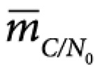
    Tests concentrated on two sectors with different GNSS signal strengths: sector A, a relatively open-sky area; and sector B exhibiting deep urban canyon conditions. The mapped average C/N0 is denoted as Photo:.

    The Photo:of the less obstructed sector A = 39.3 dB-Hz, while that of the more obstructed sector B is lower: 18.1 dB-Hz. This tendency is repeatable throughout the surveyed area and allows for further GNSS signal-strength map integration into the algorithms at the user side.

    MAP-AIDED WEIGHTING FUNCTION

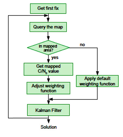
    Figure 3 Map-aided automatic weighting adjustment algorithm. (Image: Authors)
    Figure 3. Map-aided automatic weighting adjustment algorithm. (Image: Authors)

    It is a challenge to find an optimal set of urban navigation filter parameters, as the signal obstruction environment changes significantly with the moving positioning platform. Our approach adjusts parameters of the GNSS observation weighting function with respect to the retrieved from the map. The algorithm scheme appears in Figure 3.

    When the first position fix is obtained, the algorithm sends a request to the server with the timestamp and the coordinates determined at the previous epoch. If one is available in the current user area, the server response includes the metric retrieved from the GNSS signal-strength map. Next, the GNSS observation weighting function is adjusted according to equations given in the full technical paper (see Acknowledgment section).

    PRACTICAL RESULTS

    Algorithm performance was evaluated by analysis of the distances between the coordinates calculated with our engine and the centerline of the road in two downtown and two residential areas. For an estimated 86 percent of the track, our proposed map-aided weighting performed better than when the default weighting function was applied during the whole track.

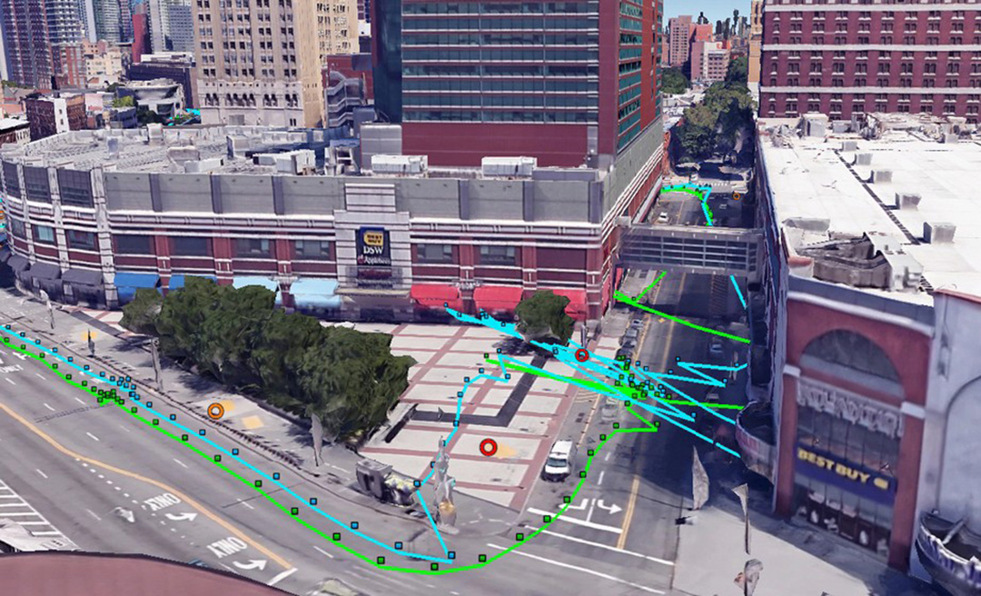
    The map-aided weighting of the observations brings approximately 25 percent and 35 percent accuracy improvement in the dense urban area and in the intermediate residential environment respectively. Additionally, there were instances of faster solution re-convergence when fix was lost due to insufficient number of the satellites tracked in narrow streets or under obstructions (see Figure 4).

    Figure 4. Example of faster map-aided solution re-convergence. (Image: Authors)
    Figure 4. Example of faster map-aided solution re-convergence. (Image: Authors)

    FUTURE WORK

    For the mapped average C/Nlevels to be unbiased, normalization procedures must be implemented. This would soften or eliminate hardware constraints on the mapping fleet and facilitate its growth. With more data available, the temporal discretization of the map needs to be implemented as satellite geometry and multipath environment change throughout the day.

    Optimal dimensions of the mapped space-time cube remain an open question: more real-world data needs to be collected to provide better mathematically-derived estimations. We plan to investigate the benefits of a variable-dimension space-time cube with respect to the area and the mapping fleet density. We also plan to extend the environment map-aided filter tuning to a multi-constellation GNSS approach integrated with inertial navigation systems and other sensors.

    The technique is commercially implemented in Parkofon, a fully automated parking payment and guidance system that helps people find cheaper, safer and easier parking. The platform includes a mobile app and device placed in the car to guide drivers to open parking spaces in real time and charge them only for actual time parked in designated garages. Parkofon also offers real-time on-street space availability.

    Acknowledgments

    This article draws on a paper presented at ION GNSS+ 2018. For the full paper, see www.ion.org/publications/browse.cfm. Research is supported by the Natural Sciences and Engineering Research Council of Canada.

    MANUFACTURERS

    Experimental datasets were collected with a Septentrio AsteRx-m2 receiver and Maxtena M1227HCT-A2-SMA antenna. Parkofon boards carry a u-blox M8N receiver module and a Taoglas CGGBP.25.4.A.02 patch antenna.


    IVAN SMOLYAKOV is a Ph.D. student in the Department of Geodesy and Geomatics Engineering at the University of New Brunswick (UNB).

    EVGENY KLOCHIKHIN is CEO of Parkofon Inc., a smart mobility company utilizing the Internet of Things to guide drivers to open parking. He holds a Ph.D. in Public Policy and Management from the Manchester Business School, UK.

    RICHARD B. LANGLEY is a professor in the Department of Geodesy and Geomatics Engineering at UNB.

    Opening photo:  Norbert Schindler

  • Peering behind the mapping curtain

    Peering behind the mapping curtain

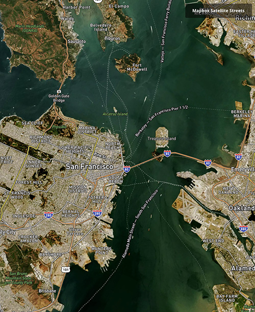
    Photo: Mapbox
    Photo: Mapbox

    Location intelligence powers applications with data and “live maps” updated continuously.

    According to Forbes, 70 percent of telecommunications companies consider location intelligence critical to their success. The intelligence data is provided by specialists such as Google, Esri, Here and PlaceIQ.

    In January, Sprint and location intelligence startup Mapbox launched precision mapping technology with the Curiosity IoT network. The 5G network’s extreme bandwidth and low latency will allow Mapbox to collect higher volumes of richer data to create “live maps.” A live map is built not from traditional data surveys months or years before, but from data collected from hundreds of millions of location-enabled sensors that feed back information about the world in real time, including high-resolution video.

    Mapbox uses artificial intelligence (AI) to turn the massive data flows into a picture of real time transit paths that can be used for precise, up-to-date routing.

    Augmented Reality view from the Mapbox Vision SDK. (Image: Mapbox)
    Augmented Reality view from the Mapbox Vision SDK. (Image: Mapbox)

    According to Mapbox CEO Eric Gundersen, maps that constantly update are essential to the internet of things (IoT). “As maps guide new smart machines on IoT networks, you remove the human in the middle that used to compensate for differences between the map and the real world,” he said. “Precision mapping services need to reflect the world as it is, at that precise moment so that those smart machines can travel safely and efficiently.“

    According to Mapbox, smart machines such as drones and autonomous delivery carts will be able to make fast location and routing decisions using its detailed, updated maps.

    Other companies that use Mapbox’s location services include IBM, Lonely Planet, Square, Tableau and The Weather Channel.

  • Planet’s breadloaf-sized satellites capture Earth surface

    Planet (formerly Planet Labs) has put about 300 satellites into space, in charge of photographing the entire land mass of the Earth every day.

    The satellites weigh 5 kg (12 pounds) and measure 20 x 20 x 44 centimeters, about the size of a loaf of bread. They are packed with commercial-off-the-shelf electronics and are built in downtown San Francisco. Mission control consists of a single engineer for dozens of satellites.

    Aptly named “doves,” the satellites circle the Earth in 90 minutes, their cameras continuously rolling. “It gives you a perspective of the planet as a dynamic and evolving thing that we need to take care of,” said company co-founder Will Marshall.

    Each day, the satellites transmit 1.2 million images at a spatial resolution of 3–5 meters, far more than enough to fully occupy all the analysts at the National Geospatial Intelligence Agency (NGA), one of Planet’s more than 200 customers.

    Historically, the NGA has relied on three or four very large, very expensive — and to global adversaries, very predictable — spy satellites. The agency has found Planet’s approach intriguing and challenging.

    Planet has devised computer algorithms to look for new features day to day, such as roads or buildings th

    at may signal activity of a significant or nefarious sort. Other customer uses are more mundane, such as agricultural companies monitoring crop health.

    Boundless. In December 2018, Planet entered into an agreement to acquire Boundless Spatial Inc., a St. Louis-based geospatial software solutions company, to further support its commercial business with the U.S. government and agricultural clients.

  • AMW offers new construction and ag products

    AMW offers new construction and ag products

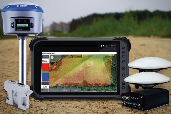
    DIRT, the AMW Machine Blade Control Solution. (Photo: AMW)
    DIRT, the AMW Machine Blade Control Solution. (Photo: AMW)

    AMW Machine Control Solutions, a subsidiary of CHC Navigation, has introduced four new solutions for the survey, construction and agriculture markets, all of which run on Android and CHC Navigation GNSS tablet hardware.

    GRADE I and II Products. GRADE I runs on a CHC Navigation industrial tablet and utilizes an internal meter-accurate GNSS receiver for field workers and supervisors to view layered maps including design files, topo or Google Maps for locating elevations and topographical features.

    GRADE II adds centimeter elevation and positioning accuracy with an external CHC Navigation RTK-capable GNSS receiver that wirelessly communicates with the tablet.

    GRADE II collects topographic data on the jobsite by walking or driving the area, eliminating surveyor stakes and providing accurate data for earth-moving operations. The density of elevation points can be adjusted. The GRADE II “Smart Base” allows a user to establish RTK control points.

    DIRT I and II Products.

    DIRT combines GRADE II mapping functionality with automatic blade control for skid steer, scraper, grader or dozer applications for rough and fine land-shaping activities on large or compact equipment. DIRT is available as DIRT I or DIRT II versions depending on the type of blade control needed. Utilizing additional sensors, DIRT II adds the ability to manage cross slopes.

    DIRT includes an RTK GNSS, inclinometers, tablet computer, CANBUS controller and DIRT software running on a CHC Navigation tablet. The tablet wirelessly connects to the RTK receiver and other sensors, making the system easily portable so it can be reinstalled on other equipment.

    For agriculture applications, AMW Solutions’ proprietary algorithm within the DIRT solution results in accurately graded surfaces within the limits of the equipment.

  • UK tests tracking UGVs in military exercise

    UK tests tracking UGVs in military exercise

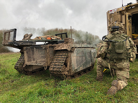
    In December 2018 near Salisbury, England, four Milrem Robotics’ and QinetiQ TITAN unmanned ground vehicles (UGVs) were put through three weeks of rigorous tests by British troops during the Army Warfighting Experiment 2018 (AWE18).

    The goal was to determine how new unmanned technologies can enhance soldier’s survivability and effectiveness on the modern battlefield.

    The modular base can be adapted for various missions, including casualty retrieval. (Photo: Milrem Robotics)
    The modular base can be adapted for various missions, including casualty retrieval. (Photo: Milrem Robotics)

    The test was conducted in three phases: conduct combat operations without the benefit of new technologies; conduct combat operations using new technologies but without changing tactics; and, lastly, conduct combat operations using new technologies and adapting tactics according to the capability that the new technology provides.

    The UGVs were used in a number of different roles with missions conducted in urban, open and forested terrain.

    In remote-control mode, a command-and-control station allows the operator to receive real-time sensor data from the UGV and to transmit command data to the vehicle through a tactical data link. Various third-party sensor packages can be installed.

    Of the four Milrem UGVs, two were deployed by Milrem Robotics and two by QinetiQ. The Milrem-fielded systems included one configured as a casualty evacuation and logistical support unit and a second unit equipped with a tethered multi-rotor drone pod provided by Threod Systems.

    One of the four UGVs was TITAN Strike, a prototype system carrying a Kongsberg remote weapon station, fully controlled by a remote operator and using QinetiQ’s Pointer system as a means of integrating the capability with dismounted infantry.

    The second system, TITAN Sentry, also enabled with Pointer, featured a Hensoldt-provided sensor suite including electro-optical and thermal-imaging cameras and a battlefield radar.

  • Tesla granted US patent for positioning tech

    Tesla granted US patent for positioning tech

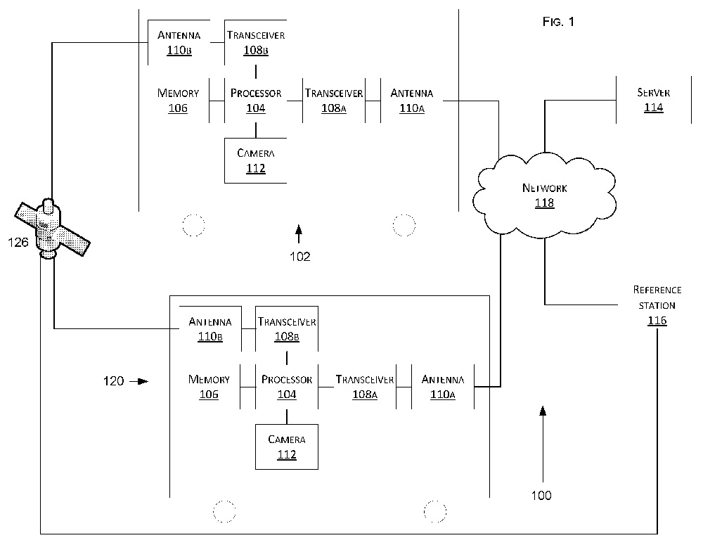
    Tesla has developed a technology aimed at providing more accurate positioning for autonomous cars by sharing data between vehicles, according to a U.S. patent application.

    The patent, “Technologies for vehicle positioning,” was filed in 2017 and made public in December 2018.

    Solutions include cameras detecting matching locations and using other vehicles in its fleet as “cooperative reference stations” to share raw GNSS data and make positioning corrections.

    Tesla describes in the patent, “The inventions increase such positioning accuracy via determining and applying offsets (corrections) in various ways, or via sharing of raw positioning data between a plurality of devices, where at least one knows its location sufficiently accurately, for use in differential algorithms.”

    Techniques include:

    • a reference station sharing a positional offset with an automobile,
    • a reference station calculating and sharing a set of parameters (offsets and corrections) for various error components including atmospheric, orbital and clock,
    • a reference station sharing its raw GNSS data so that vehicles can remove errors through differencing or other calculations.

    Tesla also would correct GPS data by matching camera data with vision maps to detect the exact location of a vehicle. With this vision-map matching localization approach, “a location estimate is varied until the location estimate makes a camera-reported lane boundary coincide with a map-reported lane boundaries,” the patent reads.

    Schematic of Tesla’s system shows two vehicles (102, 120) feeding data to a network, a server and a reference station. (Image: Tesla)
    Schematic of Tesla’s system shows two vehicles (102, 120) feeding data to a network, a server and a reference station. (Image: Tesla)