Category: Applications

  • Oscilloquartz launches enhanced PRTC system for 5G network timing

    Oscilloquartz has launched its enhanced primary reference time clock (ePRTC) system to enable unprecedented timing accuracy and stability, even when the GNSS signal is lost.

    The system provides a timing source for mission-critical transport systems, such as utility networks, government infrastructure and radio access networks, and provides the strict synchronization needed for LTE-A and 5G applications, the company said.
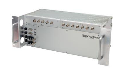
    The Oscilloquartz 3230B.

    Featuring the OSA 3230B ePRC atomic cesium clock connected to an Oscilloquartz clock combiner and grandmaster, the new solution offers the extremely stable frequency of a cesium clock with the UTC-traceable signal provided by GNSS.

    When combined with the OSA 5430, the OSA ePRTC system provides full hardware redundancy and multiple fan-out options including PTP over 10Gbit/s.

    “With our ePRTC system, we’re taking reliability and accuracy to the next level. This solution meets the requirements of next-generation mobile networks, offers the precise synchronization needed by many of today’s industries and removes vulnerability to GNSS outages,” said Gil Biran, general manager, Oscilloquartz.
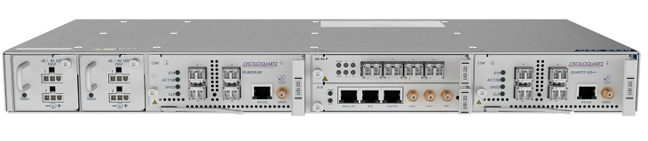
    The Oscilloquartz OSA 5430.

    “Combining our advanced multi-constellation GNSS receiver with our atomic cesium clock technology creates an outstandingly accurate source of time with guaranteed holdover performance,” Biran said. “This provides vital protection against loss of satellite signal due to jamming, which can be a major problem.

    “With the flexibility and redundancy of our OSA 5430, operators can deploy a precise, secure and robust UTC-traceable time and frequency source with high capacity. What’s more, the Syncjack sync probing and assurance technology embedded in our ePRTC enables detection and reporting of inconsistencies between the different references provided to the ePRTC as well as detection of the GNSS spoofing.”

    GNSS interference concerns

    The dangers of reliance on GNSS alone have become a serious concern across a wide range of industries. Without backup, loss of signal would have a profound impact on critical infrastructure, financial institutions, and military capabilities.

    PTP packet-based mobile networks are also highly susceptible to outages unless they are able to hold time and maintain accuracy when GNSS is unavailable.

    The OSA ePRTC system removes this vulnerability while delivering higher performance levels than standard PRTC systems and giving operators control of their network synchronization.

    The solution comprises two OSA devices: an OSA 3230B ePRC cesium clock compliant to G.811.1 ePRC, which is connected to either an OSA 5421 or OSA 5430 clock combiner and grandmaster clock compliant to G.8272.1 ePRTC. This provides phenomenal holdover accurate to UTC within +/-100 nanoseconds for up to two weeks, ensuring resilience and optimized performance.

    “Our OSA ePRTC system is about leveraging the advantages of both timing methods, ensuring the long-term accuracy of GNSS alongside the stability of a cesium beam atomic clock. It even provides major benefits when locked to GNSS by delivering a three-fold improvement in timing accuracy,” said Nir Laufer, product line director, Oscilloquartz.

    “In recent years, we’ve seen a big increase in GNSS vulnerabilities due to deliberate spoofing and jamming attacks as well as the natural threats of solar flares and space weather events,” Laufer said. “From global data centers to government institutions, there’s now an urgent need to move away from reliance on GNSS alone. Ensuring backup is now a mandatory step towards secure synchronization. And with our OSA ePRTC, this can be achieved without adding a lot of cost and complexity. We’re giving operators peace of mind and the power to do more with existing infrastructure.”
  • Trimble Catalyst now supports GLONASS

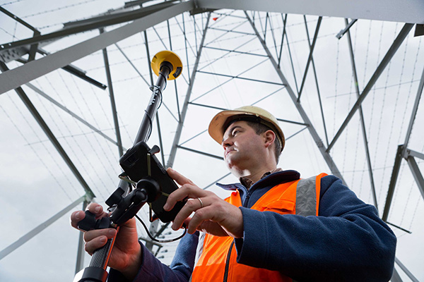
    The Trimble Catalyst software-defined GNSS receiver for Android phones and tablets has been updated to support GLONASS. The update demonstrates the advantages of software GNSS for delivering new functionality faster and easier, according to Trimble.

    Access to the GLONASS constellation increases the number of GNSS satellites visible when working in the field. As a result, it improves the ability to maintain lock on enough satellites to keep working when sky visibility is limited or obstructed, such as under tree canopy and in urban high-rise environments, Trimble said. Users also spend less time waiting for the receiver to achieve an accurate position, and convergence time is faster and more reliable.

    Trimble Catalyst provides users with positioning-as-a-service to collect highly accurate location data with Trimble or third-party apps on Android smartphones and tablets. When combined with a small, lightweight, plug-and-play DA1 digital antenna and Catalyst subscription, the receiver provides on-demand GNSS positioning capabilities, and transforms consumer devices into centimeter-accurate mobile data collection systems.

    “Adding GLONASS to Trimble Catalyst provides productivity improvements and more robust positioning for Catalyst users,” said Gareth Gibson, Catalyst business development manager at Trimble. “In addition, since the service is provided via an Android app, performance updates are available through the Google Play store. As a user, receiving updates is easy and automatic.”

  • Esri User Conference to highlight mapping technology

    Esri will be hosting its 38th annual Esri User Conference July 9-13 at the San Diego Convention Center in San Diego. The company expects more than 18,000 mapping and GIS users to attend the event, which will include 345 technical workshops and 243 presentations.

    Futurist Juan Enriquez will present the keynote speech, “Evolving Ourselves — Redesigning the Future of Humanity.” According to Esri, his talk will explore the future of humanity as it depends on the intersection of geography and genetics as we design our places and ourselves.

    Attendees will also hear presentations from users who are creating smarter organizations that can tackle complex global issues, including how to create more sustainable businesses, address homelessness, diminish poverty and counter the effects of climate change, Esri added.

    Other presenters will include:

    • Civil rights leader and activist Dolores Huerta, who will discuss how the Dolores Huerta Foundation utilizes Esri technology to inspire and organize communities to build volunteer organizations empowered to pursue social justice;
    • New York Times best-selling authors James and Deborah Fallows, who will discuss their book “Our Towns: A 100,000-Mile Journey into the Heart of America,” which provides anecdotal stories about the challenges small-town America faces; and
    • Felix Finkbeiner, a recent college graduate and recipient of the German Federal Cross of Merit, will detail his Trillion Trees Campaign — a commitment to the environment that has grown from planting 1 million trees to planting more than 15 billion trees in 190 countries under the guidance of the United Nations Environment Programme.

    “The Esri User Conference is truly as the name suggests — a conference for our users,” said Jack Dangermond, Esri founder and president. “This is an opportunity for all of us to come together and learn from each other so we can take part in personal development and organizational advancement to further the impact that we can have on our planet.”

  • GEO 5 joins WAAS, giving FAA better coverage across US

    The Federal Aviation Administration’s Geosynchronous Earth Orbiting 5 Wide Area Augmentation System (WAAS) navigation payload, developed by Raytheon’s Intelligence, Information and Services business, is now operational and fully integrated into the WAAS network.

    The GEO 5 payload joins two others already on orbit in correcting GPS satellite signal ionospheric disturbances, timing issues and minor orbit adjustments, giving users increased coverage, improved accuracy and better reliability, Raytheon said.

    “GPS alone can’t meet the FAA’s stringent requirements for accuracy, integrity and availability,” said Matt Gilligan, vice president of Raytheon’s Navigation, Weather and Services mission area. “The WAAS network corrects even the slightest errors, and that provides peace of mind when it comes to safety of flight.”

    In operation since 2003, WAAS increases GPS satellite signal accuracy from 10 meters to 1 meter, ensuring GPS signals meet rigorous air navigation performance and safety requirements for all classes of aircraft in all phases of flight, Raytheon added.

    WAAS provides precision navigation service to users across the United States from Maine to Alaska, as well as portions of Canada and Mexico.

    For aviation users, WAAS offers pilots more direct flight paths, precision airport approaches and access to remote landing sites without depending on local ground-based landing systems.

    Raytheon is the system integrator on the GEO 5 system, which includes a WAAS navigation payload on Eutelsat’s GEO satellite, two ComSAT ground sites and SED Systems specialized equipment.

  • ESA trainees compete in Galileo app contest

    ESA trainees compete in Galileo app contest

    News from the European Space Agency (ESA)

    Testing of the three Galileo apps took place in May. (Photo: ESA)

    ESA challenged its young graduate and national trainees to develop a smartphone app to perform satnav fixes using only Galileo satellites.

    Three teams developed apps in their spare time, presenting their results to a jury of experts from ESA, the European Global Navigation Satellite Systems Agency (GSA) and Google.

    “I’m very impressed,” said Javier Benedicto, ESA’s Galileo programme manager. “With little detailed knowledge of satellite navigation, these teams have developed something that didn’t exist just a few months ago. Working on Galileo we love to see that the systems we’re putting together can reach widespread application and inspire new uses.”

    The winning Galfins Team put together the GNSS Compare app that promises to turn a smartphone into a “research lab in your pocket” to test Galileo performance in isolation or in combination with other systems. Their prize is to attend an ESA and European Commission-sponsored GNSS Summer School in Austria.

    The final presentation and results of ESA’s internal Galileo smartphone app competition took place in the Erasmus centre of ESA’s Erasmus technical centre on May 31. (Photo: ESA)

    “Only one of our four-strong team started the challenge with any knowledge about satellite navigation,” said Mateusz Kraiński of the Galfins team. “The rest of us come from different areas — for example, I’m working on the European Robotic Arm project, due to launch at the end of next year. We have learnt a lot and the radio navigation experts at ESTEC were a great source of support.”

    “We see a need on the market for such an application, so we will definitely continue with the development. The application will be made available for download when ready, and the project will be released as open source soon after.”

    The other two teams were also commended for their work; Chocolateam developed a richly-designed game-based app, giving the user the feeling of observing the Galileo satellites from a spacecraft, while Team 5G distinguished themselves by writing all their own navigation algorithms from scratch rather than relying on open source software.

    The challenge was to design an Android smartphone app that allows users to compute and visualize their position based solely on Galileo measurements, as well as the possibility of selecting a combination of satnav constellations to assess their performance.

    Testing the three apps entered in the Galileo smartphone app competition in the grounds of ESTEC, working in pedestrian mode. (Photo: ESA)

    The receiver chipsets inside smartphones make use of Galileo signals in combination with several other satnav constellations — the U.S. GPS, Russian GLONASS and Chinese BeiDou. These chipsets function like “black boxes,” making the resulting positioning fix accessible to users, but not giving any option for the user to select which constellation to employ.

    Current phone applications only display general satnav status information, such as which satellites are contributing to the positioning fix, their visibility parameters and overall power levels. This is not sufficient to single out Galileo’s contribution to the phone’s overall positioning performance.

    However, in newer Android smartphones it has become possible to access the raw signal measurements used to compute position, opening the door to the development of applications where the user can indeed select which satellites to use.

    The teams received one Galileo-enabled smartphone each for developing and testing the app.

    ESA’s Director of Technology, Engineering and Quality supported the teams by supplying dedicated software modules to simplify computations of the phone position. During the competition, a technical advisory team also developed an internal app as a benchmark.

    The app, named Galileo PVT and developed by ESTEC engineers Paolo Crosta and Tim Watterton, includes an augmented reality system allowing users to “see” the Galileo satellites from which they were receiving signals in the local sky.

    “This was a very useful exercise because it helps us understand the needs of satnav app developers in Android,” said the lead advisor, Paolo Crosta. “Then, once the apps were complete, we tested them together, here on the grounds of ESTEC, working in stationary, pedestrian and vehicular modes.”

    “Congratulations to all the teams here today,” said Frank Van Diggelen from Google, who had just come from a satnav raw measurements workshop hosted by GSA. “It’s been great to be here and see all the activity around raw signal measurements. Our aim has always been to raise standards by making these measurements available, to let developers see what’s happening inside. And the work you’re doing here is feeding back to chip and smartphone manufacturers, to help change and improve them for the future.”

  • OGC calls for proposals for Indoor Mapping and Navigation Pilot Initiative

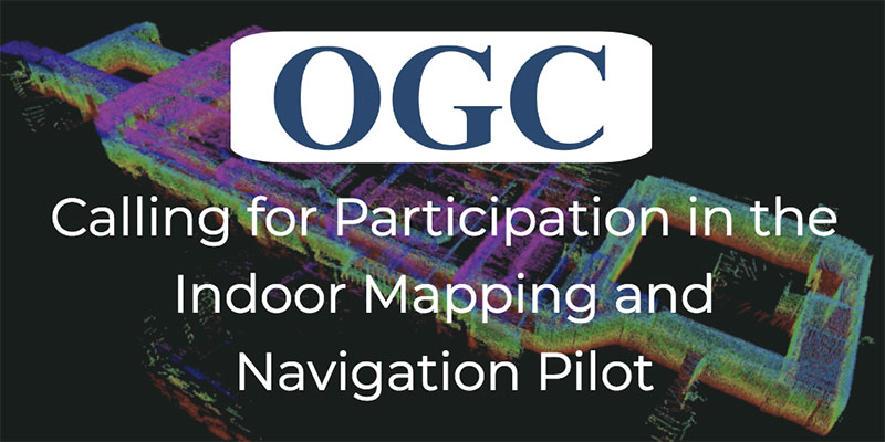
    The Open Geospatial Consortium (OGC) has released a call for participation to solicit proposals for the its Indoor Mapping and Navigation Pilot Initiative.

    According to OGC, the Indoor Mapping and Navigation Pilot Initiative, sponsored by the Public Safety Communications Research Division of the National Institute of Standards and Technology (NIST), will create and advance solutions to complex geospatial challenges related to indoor mapping and navigation for first responders.

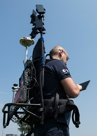
    First responders typically survey high-risk facilities in their jurisdiction at least once per year as part of a preplanning process. The preplanning process can be time-consuming and inefficient, according to OGC, so the Public Safety Communications Research Division of the NIST Communications Technology Laboratory has identified mobile 3D light detection and ranging (lidar) as a potentially transformational technology for first responders. Using lidar and 360-degree camera imagery coupled with advanced software processing, first responders could efficiently capture 3D point clouds and a wealth of other information, both observed and derived, while walking through buildings as part of their routine preplanning operations, OGC said.

    In addition to creating point clouds for visualization and mapping, 3D lidar can be used in localization, object classification, integration with virtual/augmented reality solutions, change detection and more. OGC’s Pilot Initiative will call upon a diverse array of leading organizations in the field and leverage standardized, open GIS frameworks, data models and data exchange formats to stimulate the rapid generation of prototypes and demonstrations for these activities.

    According to OGC, best practices and lessons learned from the Pilot Initiative shall be captured in engineering reports or other means and, where appropriate, forwarded to the respective standards committees under the OGC and International Standards Organization for consideration.

    Participation is only open to OGC members; however, proposals from non-members will be considered provided that a completed application for OGC membership (or a letter of intent to become a member) is submitted prior to (or with) the proposal.

  • Hexagon Positioning demonstrates lane-level accuracy with Ligado Networks

    Hexagon Positioning demonstrates lane-level accuracy with Ligado Networks

    Hexagon’s Positioning Intelligence division has successfully deployed TerraStar X GNSS correction technology, which enables instant lane-level accuracy for autonomous automotive planning programs, the company said.

    “In partnership with Ligado Networks, we have demonstrated delivery of TerraStar X technology over both satellite and cellular networks to position vehicles with 5-centimeter (2-inch) accuracy in under a minute,” Hexagon stated in a press release. “Combining TerraStar X technology with multiple delivery channels is a significant step towards the future of Autonomous X, where cars, UAVs, industrial vehicles, trains and more will operate safely, securely, reliably and efficiently.

    TerraStar X technology is built on the latest precise point positioning algorithms. According to the company, it leverages existing Hexagon capabilities in ground network infrastructure, correction data generation and data packaging for delivery.

    By eliminating convergence time while providing high-accuracy global positioning, TerraStar X will form the future of Hexagon’s correction services for safety-of-life applications and Autonomous X.

    When combined with automotive-grade GNSS receivers available through Hexagon Positioning Intelligence, the technology allows automotive customers to evaluate positioning performance in real time using data delivered over the cellular network or the L-band frequency using Ligado’s SkyTerra satellite in North America.

    Trial networks for customer evaluation are available in California, Arizona and Michigan over satellite or cellular network, and in Germany using cellular delivery. The infrastructure is scalable, enabling timely geographic expansion to accommodate automotive development programs globally.

    Commercial solutions designed for the automotive market will be available in 2019.

    “Ligado’s expertise in satellite delivery and proactive involvement in this project enabled rapid deployment of our TerraStar X correction technology over the test area,” said Sara Masterson, positioning services segment manager with Hexagon’s Positioning Intelligence division. “Their unique spot-beam technology enables efficient delivery of the higher bandwidth correction data required for this application and adds a delivery method providing continental scale coverage.”

    The geostationary Skyterra satellite operated by Ligado uses a 22-meter reflector-based antenna to deliver an L-band signal over North America. Several of the L-band DGPS/PPP service providers, including Terrastar, have used the Skyterra-1 satellite since its 2010 launch to support North American coverage.

    Hexagon has been providing highly reliable, precise GNSS corrections under VERIPOS, TerraStar, Oceanix, and SmartNet brands for more than 20 years, the company said. It operates the world’s largest reference station network, consisting of more than 4,500 stations.

    “Hexagon is uniquely positioned to offer end to end solutions from correction data generation through to GNSS positioning solutions in the vehicle,” said Brian Deobald, vice president, strategic product and ecosystem development, Ligado Networks. “We are excited to partner with Hexagon on this opportunity to demonstrate the delivery of TerraStar X technology, using high throughput, cost-efficient satellite connectivity to enable superior performance and reliability for autonomous driving applications.”

    Ligado. This development has no relationship to the current Ligado Networks petition before the Federal Communications Commission to repurpose some of its mobile satellite systems spectrum to broadcast from ground-based transmitters. That matter is still pending, and there is currently no such signal being broadcast.

    Featured Image: Hexagon

  • With Brexit looming, EU and UK tangle over Galileo

    An increasingly bitter political and economic argument between the United Kingdom (U.K.) and the European Union (EU) has alternately stalled and unfrozen progress on Galileo.

    Why does this matter from a defense and security viewpoint? Because it’s all about access to Galileo’s Public Regulated Service (PRS), the military-grade service and signal — in addition to billions of pounds and euros.

    The byzantine maneuvering on both sides may have further implications, in the form of a much-expanded role for the current European GNSS Agency (GSA), with a corresponding reduction in funding scope for the European Space Agency (ESA).

    ESA is not directly affected by the Brexit brouhaha, but indirectly, the impacts mount and extend. ESA is technically independent of the EU, but acts as the union’s procurement body for space programs. It is run by the 22 member states on the ESA council — which crucially includes the U.K., as well as non-EU members Norway and Switzerland. Thus, the Brits, while exiting the union in March 2019, will continue to play a voting role in the space agency.

    In an second-round gambit, the U.K. had threatened to use its veto on the ESA council to delay procurement of future Galileo satellites. This was seen as an attempt to bring the EU into negotiations over U.K. access to the highly encrypted Galileo PRS.

    A navigation and timing signal restricted to use by authorized government agencies, armed forces, police, emergency and other security services, the PRS is designed to be robust to jamming and spoofing and available even in times of crisis.

    Under EU rules, only EU member states can access or work on the PRS. Similar to GPS M-code, PRS could be said to be the prime motivating factor for the origins of the European GNSS: the desire, some would say the compelling requirement, to have a military-grade signal under one’s own control.

    The U.K. says it will encounter “significant gaps” in a wide range of areas including prisoner transfers, asset recovery, sharing of financial intelligence, victim compensation and access to criminal records for child protection vetting, should it be shut out from the PRS. This doesn’t begin to reveal the real reason: the ability to conduct military, security and defense operations confidently undertaken with a secure and enrypted GNSS signal.

    The European Commission maintains that the U.K. will have to “apply” to use the PRS, like any other non-EU country, tacitly as a “foreign entity.” PRS is for EU member states only.

    U.K. companies such as CGI U.K. have developed much of the programming and coding of the PRS signal. Current EU rules bar all U.K. companies from bidding on new contracts unless they transfer their work to EU countries before Brexit. The EU wants CGI U.K. to hand its encryption security intellectual property to the Franco-Italian firm Thales Alenia Espace.

    This would poke Britain’s defense ministry where it hurts most: access to the key source codes, and a measure of security in military, defense and police operations. The U.K. government also wishes to retain the encryption expertise and personnel, rather than see them outsourced.

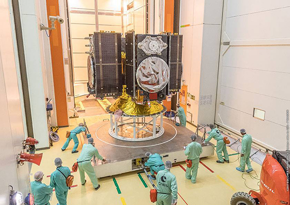
    Four Galileo satellites placed in the payload container prior to December 2017 launch, which brought the total Galileo constellation to 22. (Image courtesy of ESA)

    Whither GSA?

    In a separate but closely related debate within the EU, a strategic repositioning is proposed for the GSA: renaming and remaking it into the EU Agency for the Space Programme. This would not only greatly enlarge its sphere of activity and authority, it could create two sparring space agencies in Europe, one wholly under the control of the EU and one with the maverick U.K. on its ruling council.

    A draft EU document states ESA’s decision-making procedures “cannot lead to a call into question of the decisions of the [European] Commission or the European Space Agency within the framework of the actions and space programmes of the union.”

    ESA is naturally bitterly opposed to its parent organization creating a rival. It has long struggled — behind closed doors — with its semi-independent, semi-subservient role to the EU, which after all holds the ultimate purse strings.

    Some in Europe see indications that the GSA rebadging could lead to a gradual transfer of space funding from ESA to the newly rechristened agency if EU discontent rises. “A creep in power” was the term used by one official.

    The EU has long expressed concerns over ESA’s governance of the funds handed to it by the EU for space projects. The long stall in Galileo getting up a full head of steam, a period that could be said to have extended from 2002 to 2008 or thereabouts, was seen by some atop the EU as evidence of ESA over-extension: technically expert but fiscally untrained or unqualified.

    Opening Salvos

    In what now appears to be a dead issue, the U.K. had first demanded reimbursement for the €1 billion it contributed to Galileo. The EU rejected that out of hand, saying it would not negotiate “under threat.”

    In a follow-up, the U.K. claimed that while it wished to continue participating in Galileo, it could well start up its own GNSS if it did not receive adequate access to Galileo PRS. The EU stuck to its guns, so to speak: “Third countries [and their companies] cannot participate in the development of security-sensitive matters.”

    The U.K. has also bruited blocking Galileo from use of ground tracking stations in British overseas territories, such as the Falklands.

    A U.K. minister stated: “The U.K. genuinely wants to remain a major player in the project, with privileged ongoing access from outside the EU, and views its capabilities and contribution to date as giving it the right to that ticket.”

    A European spokesperson countered: “For the EU, the decision to leave inevitably entails relegation to a different role and status in the project, and, let’s be candid, offers scope for EU-located firms to take contractual business away from U.K. ones.”

    Oh, what a tangled web these mortals weave.

  • New Leica Aibot facilitates accurate, safe aerial surveys

    Leica Geosystems has released the Leica Aibot, its latest unmanned aerial vehicle (UAV) system based on DJI’s aerial platform, the M600 Pro, designed to rapidly and autonomously enable digitizing of critical infrastructure.

    Leica Geosystems’ UAV technology enables users to get a complete data set in less time with a user-friendly and innovative interface, opening new business opportunities while reducing time, costs and effort from with traditional data collection methods.

    A proprietary software suite supports the new UAV workflows. Using Leica Infinity for point cloud, digital surface model and orthophoto generation enables surveyors to process and visualize aerial data, increasing productivity and speeding data delivery. Supporting users to share data to Cylcone and Cloudworx, the integration of the UAV point cloud with terrestrial scan data enables informed decisions, while complete data sets increase project efficiency.

    Use in construction

    Throughout a construction project lifecycle of planning, designing and construction, Aibot provides easy access to critical information to perform volume calculations and monitor site progress. From creating digital terrain models to stripping and bulk earthworks and trenching to finally fine grading, paving and compaction, the solution facilitates actuals comparisons. This provides a more transparent view of site progression monitoring and volume calculations with safer operations, to keep projects on schedule.

    High-definition imagery and 3D mapping enable viewing of site mapping or progress documentation, meaning users identify gaps early with high accuracy, and save time and money at all project stages.

    Automating operations

    The new technology, developed in partnership with UAV manufacturer DJI, allows users to process and analyze millions of data points gathered from above and to visualize the data for actionable information. UAV data can be combined with existing survey technologies, such as TPS, GPS and laser scanning, for a more complete set of information.

  • Dual-frequency GNSS smartphone hits the market

    Dual-frequency GNSS smartphone hits the market

    Mobile brand Xiaomi has launched a dual-frequency GNSS smartphone.

    Fitted with a Broadcom BCM47755 chip, the Xiaomi Mi 8 provides up to decimeter-level accuracy for location-based services and vehicle navigation, the company said.

    The Mi 8 smartphone represents a breakthrough in GNSS technology as the first commercial deployment of Broadcom’s dual-frequency BCM47755 chip designed for the mass market and introduced in September 2017.

    Until now, mobile location-based applications have been powered by single-frequency GNSS receivers whose location accuracy is limited to a few meters. However, in recent years GNSS systems have been launching satellites broadcasting signals on new frequencies to open up new possibilities. Specifically, Galileo has the majority of satellites with E1/L1 and E5/L5 frequency capabilities.

    The E1/L1 + E5/L5 GNSS chip can compute location with an accuracy of up to a few decimeters.

    Leveraging Galileo for increased accuracy

    According to the company, users of the Xiaomi Mi 8 and future models with dual-frequency GNSS will benefit from better positioning and navigation experience in urban environments. This is due to the unique shape of the E5/L5 frequency, which makes it easier to distinguish real signals from the ones reflected by buildings, reducing the multipath effect, a major source of navigation error in cities and other challenging environments.

    The numerous Galileo satellites broadcasting E5 make this improvement available for users all around the world. In addition, the simultaneous use of two frequencies reduces other sources of error, such as those due to the ionosphere, and the frequency diversity is more robust to interference and jamming.

    In addition to making existing applications more accurate, the enhanced position precision offered by dual-frequency GNSS will also create opportunities for new applications in areas such as augmented reality, vehicle navigation and mapping.

    Commenting on the product launch, European GNSS Agency (GSA) head of market development Gian Gherardo Calini said that the arrival of the first dual-frequency GNSS smartphone to the mass-market represents a breakthrough for users all over the world.

    “The enhanced accuracy provided will empower developers to create new applications that meet the growing high-accuracy location requirements of users and also open up applications that previously only ran in dedicated devices intended for professional use,” Calini said.

    “Broadcom is glad to gear up Xiaomi’s flagship smartphones with the very latest dual-frequency GNSS technology,” added Alex Chou, vice president of product marketing for the Wireless Communications and Connectivity Division at Broadcom. “Xiaomi Mi 8, the world’s first smartphone with BCM47755, will take smartphone GNSS navigation to a whole new performance level.”

    ”The importance of GNSS to modern life is undisputed, and is particularly important for smartphones,” said Zhiyuan Zang, Xiaomi’s director of product marketing. “Navigation and LBS-based apps these days require greater positioning accuracy to work effectively, and dual-frequency GNSS is the key to delivering a great user experience when using these apps. Xiaomi is delighted and honored to be the world’s first smartphone manufacturer to support dual-frequency GNSS. We will continue to pursue innovation for everyone to enjoy.”

    Access to raw measurements for geolocation

    The launch of the first dual-frequency GNSS smartphone, together with the opportunities offered by the availability of GNSS raw measurements in Android, creates exciting opportunities for the geolocation community, the company said.

    Access to raw measurements opens the door to algorithms once restricted to more advanced GNSS receivers. This, in turn, allows users to fully benefit from the differentiators offered by Galileo.

    Recognizing these opportunities, in 2017 the GSA engaged with academia and industry in the areas of navigation and positioning to innovate around this new feature as part of a GNSS Raw Measurements Task Force.

    Then, in January, the GSA published a white paper on the use of GNSS Raw Measurements in Android, providing developers with in-depth information on accessing and using raw measurements to implement advanced GNSS techniques in mass-market devices.

    Building on this work, the GSA and the Raw Measurements Taskforce shared their latest updates at a dedicated workshop — “GNSS Raw Measurements: From Research to Commercial Use” — held at the GSA headquarters in Prague on May 30, where Broadcom presented its encouraging test results from the dual-frequency BCM47755.

  • Ukrainian MiG-29 fighter jet upgraded with GNSS navigation

    Ukrainian MiG-29 fighter jet upgraded with GNSS navigation

    A Ukranian MIG-29. (Photo: Ministry of Defense, Ukraine)
    A Ukranian MIG-29. (Photo: Ministry of Defense, Ukraine)

    Ukrainian Lviv Aircraft Repair Plant is upgrading the country’s MIG-29 fighter jets with domestically developed GNSS-assisted navigation capability, reports defenseworld.net.

    GNSS data will be viewed on a 8-inch, highly informative Cockpit display alongside the map of the terrain being overflown, target data and weapons parameters.

    Also being upgraded is the jet’s air-to-ground and surface attack capability, making it a “multi-role” fighter aircraft.

    The air-to-ground capability will be achieved through the use of TV-guided missile-bomb weapons of the X-29T and KAB-500KR types. The MiG-29 was originally designed as an air-superiority fighter to provide cover to ground attack planes such as the MiG-21.


  • Sensofusion’s counter-UAS Airfence preps for production with DOD

    Sensofusion’s counter-UAS Airfence preps for production with DOD

    In the spring of 2017, the U.S. Marine Corps Warfighting Laboratory (MCWL) — via the Defense Department’s Defense Innovation Unit Experimental (DIUx) — engaged in a one-year prototype contract with Sensofusion to develop a ground-based mobile counter-UAS solution stemming from Sensofusion’s pre-existing core product Airfence.

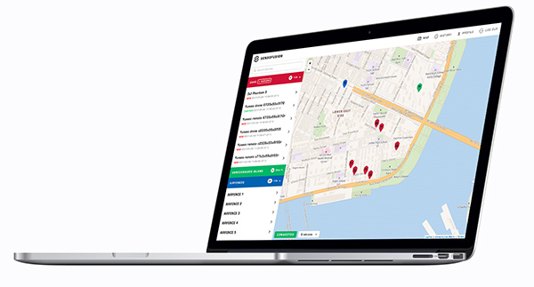
    Sensofusion acted as lead integrator and further advanced Airfence to integrate radar and optics systems on board vehicles enabling all systems to work in unison, with Airfence being the core counter-UAS solution by means of RF detection and transmission.

    The DIUx project has been active for more than 12 months, growing and expanding since its late March 2017 launch.

    Airfence is now fully ruggedized, meeting IP67 ruggedization requirements. Furthermore, Airfence has outperformed all tests for range of detection and counterattack capabilities and has also greatly increased the number of drones within its library it can detect, track and defeat yielding zero false positives, Sensofusion said. The system has outperformed range testing at the Marine Corps Base in Quantico, Virginia.

    In addition, Airfence exceeded expectations against a large variety of small UAVs — including fixed wings and rotorcrafts — while Marines operated the technology under extreme weather conditions in Arizona at Yuma Proving Grounds. YPG is the largest U.S. military installation in the world and has been a key site for testing military equipment since World War II.

    Through its work with the U.S. Marine Corps, Sensofusion has brought its system to a single sensor solution, which is beneficial for tactical use in a mobile convoy scenario.

    Airfence also can be used for fixed installations when protecting areas such as military bases, airports, prisons, oil refineries and pipelines, nuclear power plants, power plants, government buildings and border walls.

    Sensofusion has made major leaps in its ability to detect and defeat rogue drones by means of protocol demodulation and manipulation.

    “Our work in the past year with the Marines enables us to meet production readiness with our flagship counter-UAS solution, AIRFENCE, and are now prepping for production with the Departments of Defense and Homeland Security,” said Sensofusion Vice President Kaveh Mahdavi. “We’re now at a point where DoD, DHS — really, any government organization — can order our standardized counter-UAS platform, Airfence, in large quantities. This is a significant advancement within our developing drone defense industry and will act as the benchmark for all future solutions.”

    Extension to Sensofusion-U.S. DoD contract signed. As Sensofusion ramps up production for AIRFENCE across government agencies in America, it continues to align with MCWL, signing a one-year extension to the agreement with the DoD to innovate and implement new capabilities within signal intelligence.