BlackBerry Limited and Baidu Inc. are collaborating to accelerate the deployment of connected and autonomous vehicle technology for automotive OEMs and suppliers worldwide.
The companies have signed a statement of intent to make BlackBerry QNX‘s ISO26262 ASIL-D certified safety operating system (OS) the foundation for Baidu’s Apollo autonomous driving open platform.
Also, BlackBerry and Baidu will work together to integrate Baidu’s CarLife, the leading smartphone integration software for connected cars in China, as well as its conversational artificial intelligence system DuerOS, and high-definition maps to run on the BlackBerry QNX Car (Infotainment) Platform.
Blackberry QNX will host demonstrations of its foundational software for autonomous and connected vehicles at the Consumer Electronics Show (CES) 2018, at North Hall Booth 7523. The show takes place Jan. 9-12 in Las Vegas.
“BlackBerry QNX has established itself as the OS platform for safety-certified production-based systems,” said Li Zhenyu, general manager of Intelligent Driving Group, Baidu. “We aim to provide automakers with a clear and fast path to fully autonomous vehicle production, with safety and security as top priorities. By integrating the BlackBerry QNX OS with the Apollo platform, we will enable carmakers to leap from prototype to production systems. Together, we will work toward a technological and commercial ecosystem for autonomous driving, intelligent connectivity and intelligent traffic systems.”
“Joining forces with Baidu will enable us to explore integration opportunities for multiple vehicle subsystems including ADAS, infotainment, gateways and cloud services,” said John Wall, senior vice president and GM of BlackBerry QNX. “Baidu has made tremendous strides in artificial intelligence and deep learning. These advancements paired with their high-definition maps and BlackBerry’s safety-critical embedded software and expertise in security will be crucial ingredients for autonomous vehicles.”
Announced by Baidu in April 2017, Apollo is an open platform that provides a comprehensive, secure, and reliable solution that consists of cloud services, an open software stack and reference hardware and vehicle platforms. It supports all major features and functions of an autonomous vehicle.
More than 70 global partners are involved with Apollo, including OEMs, Tier 1 suppliers, developer platforms and technology start-ups. The project was named after the historic lunar landing program to illustrate its scale and complexity. BlackBerry provides OEMs with cybersecurity technology to protect and mitigate, including hardware, software, applications and end-to-end systems from cyberattacks.
BlackBerry’s pedigree in security and continued innovation has led to recent automotive design wins with Delphi, Denso, Qualcomm, Visteon and others.
From April 1 onward, car manufacturers are required to equip new vehicles for sale in the European Union with an eCall module. In the event of a serious accident, this emergency call system automatically sends data to the uniform European emergency phone number 112 to facilitate faster response by emergency services.
The independent test house CETECOM has now certified the eCall test solution from Rohde & Schwarz, which can be used to simulate a public-safety answering point, in accordance with the EN standard. This puts manufacturers and suppliers in a very good position for acceptance tests of their installed emergency call systems, and the Russian emergency call counterpart ERA-Glonass can also be tested with an extension.
The Rohde & Schwarz eCall test solution is the first of its kind to be certified by an independent test body, according to the company. CETECOM has examined the implementation of the eCall test public safety answering point (PSAP) in the Rohde & Schwarz solution for the pan-European emergency call system and certified it as compliant with the CEN EN 16454:2015 standard. This is a prerequisite for tests compliant with Commission Delegated Regulation (EU) 2017/79.
CETECOM has been officially designated as a technical service for eCall by the German Federal Motor Transport Authority. After March 31, manufacturers must equip new vehicles for sale in the EU with an eCall module. The R&S CMW-KA094 test solution is the first independently certified test PSAP system based on a wireless communications test platform.
Rohde & Schwarz thus offers a compact solution for reproducible end-to-end functional tests and standard-compliant conformance tests of eCall and ERA-Glonass modules. The prescribed conformance tests can be performed with the test solution.
Manufacturers and suppliers use these tests to check whether the installed modem properly initiates an emergency call in the event of a motor vehicle accident, correctly acquires the relevant data and sends it via the mobile network, and is able to establish a voice connection to the PSAP.
Test houses and vehicle manufacturers use this solution for type approvals and for other tests requiring the emulation of mobile networks, such as location-independent testing of a car telephone.
The certification of an eCall test solution by an independent body demonstrates that Rohde & Schwarz is a reliable partner for the automobile industry — the majority of global OEMs use the R&S CMW500 wideband radio communication tester and rely on the field-proven Rohde & Schwarz test solution.
The company is also developing test features for the next-generation eCall over LTE system and making the corresponding solution fit for the future and for testing new vehicle telematics units.
Along with eCall, Rohde & Schwarz supports the automobile industry with test solutions for V2X communications (from a vehicle to other users).
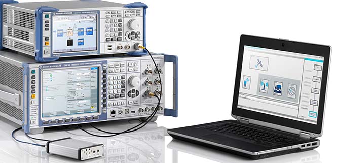
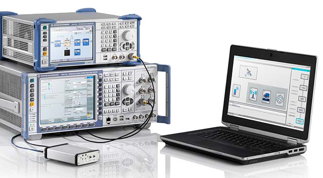
The eCall test solution based on the R&S CMW500 platform in combination with the R&S SMBV100A GNSS simulator is the first to be certified by CETECOM. (Photo: Rohde & Schwarz)
Technical basis. The R&S CMW-KA094 application software specifically developed for eCall is based on the R&S CMW500 platform in combination with the R&S SMBV100A GNSS simulator.
The software simulates a PSAP and controls the R&S CMW500, which emulates a mobile network in the lab. It also controls the GNSS simulator, which provides the position data of the accident location.
The R&S SMBV100A additionally supports the GNSS receiver performance tests in accordance with Commission Delegated Regulation (EU) 2017/79 Annex VI.
The eCall test solution can be fully automated with the R&S CMWrun sequencer software for further conformance tests, enabling users to directly utilize ready-made test sequences for eCall and ERA-Glonass modules compliant with ETSI TS 103 412, CEN EN 16454 or GOST 33467. This additionally facilitates demonstration of the functional capability of the overall system in accordance with Commission Delegated Regulation (EU) 2017/79. For more information on how to test eCall and ERA-Glonass system modules, visit www.rohde-schwarz.com/ad/press/ecall-cetecom.
Q: How will safety issues raised by increasing autonomous traffic — in the air and on roads — affect the GNSS industry?
Sanchit Agarwal, VP, Field Operations, Nearmap
A: Due to increasing autonomous traffic, the GNSS industry will have to adopt the concepts of collective tracking mechanisms in the shared ecosystem. Inherently, all the cars/drones (rovers) will have the sensors to track the traffic “on-the-fly” and make intelligent navigation decisions, but in case of any system malfunction, the collective tracking of devices can facilitate “social” interactions between the rovers. This will serve as an added layer of security in case an autonomous social member goes rogue!
Zak M. Kassas, Assistant Professor, University of California, Riverside
A: Future autonomous vehicles will demand full situational awareness and extremely reliable, accurate and secure navigation systems. GNSS will not meet the stringent demands of these autonomous vehicles. To address the inevitable situations where GNSS signals become unusable (due to attenuation or interference) or untrustworthy (due to spoofing), receivers should be coupled with sensors such as IMUs, lidar and cameras, and exploit the plenitude of ambient signals of opportunity such as cellular, digital TV and Wi-Fi.
Jonathan Auld, VP of Engineering and Safety Critical Systems, Novatel
A: Safety issues raised by increasing autonomous automotive and airborne traffic will escalate the product development standards and performance requirements of GNSS software, hardware, and correction services used. The GNSS industry is challenged to increase accuracy on lower cost platforms by utilizing multi-frequency, multi-constellation, sensor fusion and precise point positioning. To be able to rely on GNSS in auto-guidance applications, the industry also needs to incorporate GNSS integrity functionalities into our products.
As another holiday season passes us by, it is customary to look back at the year and recall the trends, new products and services, and breakthroughs we experienced with the GNSS environment and its effect on the professional surveyor. While 2017 was not filled with groundbreaking instruments and programming, it did provide a good look at what are going to be trends and gamechangers for the near future. From new innovations on GNSS receivers, new UAV platforms, and geospatial advances, it was also a year that saw location spoofing of shipping vessels, trade relations among super powers being tested, and more opportunities to put satellites into orbit from the private sector. Let us look back at what the surveying community experienced with the GNSS industry:
The constellation scorecard
GNSS continued to expand to all reaches of the globe with enlargement of existing constellations along with introductions of several new ones, (see GPS World magazine “The Almanac,” December 2017). The European satellite system, Galileo, has led the expansion with four (4) new vehicles. This joint venture of the European Commission and the European Space Agency was declared operational at the end of 2016 and looks to keep increasing its coverage in the coming years. For surveyors, this means additional redundancy for our positional data. More confirming redundancy translates into increased confidence in our work product.
Next in numbers of vehicles being sent to space is the Japanese effort named Quasi-Zenith Satellite System (QZSS) and operated by the Japan Aerospace Exploration Agency (JAXA). While their first bird was sent up in 2010, this was the breakout year with three (3) more satellites installed this past year. It is anticipated that the constellation will be operation in 2018 and we can expect most of the GNSS manufacturers to include the positional data from QZSS if they haven’t already built in this capability.
Coming in next are the Chinese with their regional-based system called BeiDou with two (2) more satellites installed in 2017. Their current program is scheduled to have several more vehicles included in the constellation and provide worldwide positional coverage by 2020. With the rapid expansion of China as a world leader, we can anticipate more GNSS developers to work closely with BeiDou as the system becomes more effective on the global stage.
The other world leader, Russia, continues their expansion of GLONASS with the installation of one (1) new satellite in 2017 with plans to upgrade several existing vehicles in the coming years. The inclusion of GLONASS signal reception by survey-grade GNSS receivers has greatly increased the redundancy of data collection, (as mentioned with Galileo). It has also expanded our timeframes in which we can work with reliable positional solutions, thus keeping our downtime to a minimum.
The United States is by no means bringing up the rear in GNSS constellation development but 2017 was a transitional year for the program. A new government administration has led to revisiting our national budget, with the Department of Defense looking to prosper under preliminary plans. While the schedule for constellation expansion have been in place for several years, the installation of Block III satellites has become a higher priority. These satellites will provide higher positional accuracy than previously experienced without any correction signal utilized. This will help the surveyor with better positional accuracies in shorter timeframes and looking forward to its expanded capability.
Once these constellations are operational (with more to come), the ability to record positional locations and attribute data will be greater than ever. A potential challenge to these satellite constellations, however, is the ever-growing fear of potential conflicts between the United States and several countries, including North Korea, Syria, Iran, and Russia. The threat of nuclear war with North Korea could result in our GPS network being shut down to civilians or blocked by an electromagnetic pulse weapon. Cold War tactics with Russia could lead to spoofing or blocking of GLONASS signals that many of our GNSS receivers have become reliant upon. There are alternatives being developed in case our GPS goes away (see “The Day GPS Went Away,” September 2017) but we are several years from having a true secondary option. We will need to keep our fingers crossed we can maintain peace across the globe but do not look forward when something happens and takes our GNSS ability away.
Data mining and the surveyor
One thing that has emerged from 2017 has been the importance of data; where it is housed, how we use it, and what it can tell us about our future endeavors. GNSS has revolutionized the data mining industry with the surveying industry being right in the middle of the fray. Prior articles were published about geolocation (see Geolocation and the surveyor: Looking back to the future) so the rapid expansion of the data collection into most business environments shouldn’t surprise most readers, especially if one reads technical sources like GPS World magazine. The surveying community has watched and experienced the astronomical growth of this data collection in various arenas, none of which was more obvious than the “Geospatial 4.0” initiative at Intergeo 2017 in Berlin, Germany. While summarizing to readers on a trip through the annual conference in the last article (Intergeo 2017: A surveyor’s perspective), it was also here that a bigger picture was coming into focus regarding data and its effect on our world.
While doing homework for this article, the term “Geospatial 4.0” was coined for the 2015 Intergeo conference in Stuttgart, Germany. This term was developed by the conference team regarding the advancing developments in the data world that incorporate geolocation, time, and unlimited information attributes, all while stored in a central location “in the cloud.” This environmental condition exists for most us already, as it is estimated there are three to four billion smartphone users worldwide. The data that is being collected every day is a small part of how our lives and relative actions have become digital snapshots to assist those charged with forecasting and planning of our future cities and environments. Much of this data is being used to advance the places where we live through an initiative called “Smart Cities.” Installation of data collection sensors and control systems in various applications monitor and store information to help make necessary changes to the existing systems. The organizations and municipalities behind this effort are attempting to create better work and home environments with increased efficiency and sustainability.
The professional surveying community plays a big part in the continuing development of geospatial world around us. Our job is not only to collect data for a boundary survey, topographical information for an engineering design, or provide layout assistance for construction; we are also historians in establishing the current positions of required information at a specific point in time. The world around us can move quickly, so providing the precise moment in time when data is collected is sometimes just as important as the location itself. Our role as surveyors becomes even more important as the increased development and implementation of geographical information systems (GIS) emerges within more public and private entities. Where the surveyor previously shunned being included within the collection process and framework of GIS, our profession has become quite efficient at the data acquisition and database maintenance necessary for geospatial success.
The surveyor’s friend in the technical world of geodesy, the geodesist, has not always been an accepted member of the GIS world, either. Once seen as mathematicians stuck in laboratories calculating “perfect world geometric solutions,” the geodesist carries a significant amount of beneficial information to the realm of geospatial data. It has been through their data collection and research that has brought our shifting continents to light and the simple fact our land-based coordinate systems must be modified to change positions as time rolls along. The common theme here is that spatial data comes down to several distinct factors: position, navigation, and time.
PNT (not just another dull government acronym…)
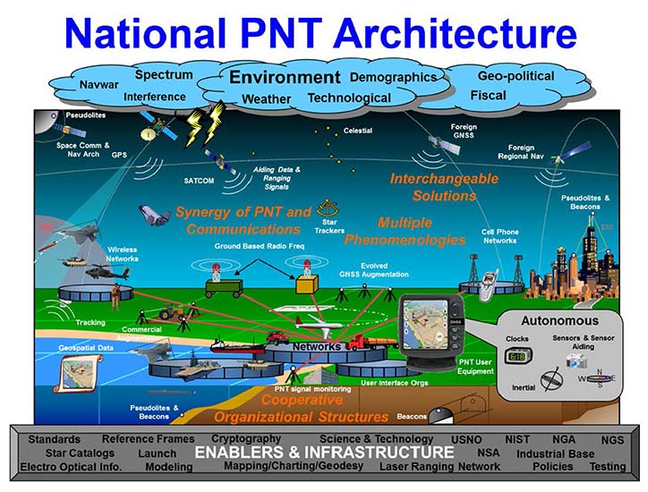
Another big step forward taken in 2017 was the continued implementation of positioning, navigation, and timing, otherwise known as PNT. These three bits of information provide the geographic basis of collected data for any GIS or other environmental study. According to the U.S. Department of Transportation website, here is the definition of PNT:
“…a combination of three distinct, constituent capabilities:
Positioning, the ability to accurately and precisely determine one’s location and orientation two-dimensionally (or three-dimensionally when required) referenced to a standard geodetic system (such as World Geodetic System 1984, or WGS84);
Navigation, the ability to determine current and desired position (relative or absolute) and apply corrections to course, orientation, and speed to attain a desired position anywhere around the world, from sub-surface to surface and from surface to space; and
Timing, the ability to acquire and maintain accurate and precise time from a standard (Coordinated Universal Time, or UTC), anywhere in the world and within user-defined timeliness parameters. Timing also includes time transfer.”
The basis for PNT can be used for any data collection. From fixed monuments utilized by surveyors to any municipal utility installation, the use of PNT now becomes an important part of the GIS database, if not for anything more than simple tracking. By establishing the location of any entity at any given time and comparing its position to an earlier collection, we can determine the navigation of that entity. A good example of PNT and our daily interaction is the satellite navigation systems installed in our phones and vehicles. When we utilize our favorite mapping program on our phone or in our car, we are implementing a PNT system to show us where we are, how fast we are going and help determine how soon we will be getting where we are going. This wonderful practice is being made possible by GNSS data collection and computer processors turning the positional data into useful information.
Surveyors are doing the same thing by the data collection they are performing every day. Any data that is collected by a modern survey instrument is being tagged with two of the main components of PNT; position and time. When the same entity is collected again later, its navigational information can be determined if needed as well. This type of data collection is becoming more apparent with laser scanning and lidar point clouds, as this data can be revisited to determine how much entities within the project area has changed. I foresee a time in the not-to-distant future where much of the Earth is scanned for historical purposes and can be analyzed by future generations for changes. A surveyor could benefit greatly by knowing where a water feature (rivers, creeks, streams, and lake and ocean shores) existed at a specific point in time and how much it has changed over time. Many land boundaries are based upon these water features as natural delineators, so knowing how much title area has changed with the natural movement of a waterway would be very beneficial to the surveyor and how land boundary disputes are handles. Same could be said of buildings and other improvements within developed areas, too. By establishing geospatial data on physical improvements, it could greatly help the surveyor determine historical and future land boundaries by their known location.
The simple fact is that our ability to collect, analyze and retain geospatial information has never been greater than now and only gets better over time. The surveyor now has similar tools to other sciences and technologies, so now is an appropriate time as any to truly embrace geospatial data collection.
UAV’s continuing growth
One market that continues growing at rapid pace is the unmanned aerial vehicle (UAV) sector. 2017 brought more aircraft innovations and expansion of sensors available for a multitude of data collection purposes. This greatly expanding segment of specialized equipment was quite evident at Intergeo 2017, where over 150 UAV vendors were provided their own space solely for the exhibiting as well as an outside arena for demonstrations. While there are other UAV trade shows that rival in the size, the Intergeo show brings the best vehicles, software and ideas for geospatial data collection and imagery directly to the surveyor’s hands.
Other innovations that are taking shape in the UAV world include larger multi-rotor aircraft with increased payloads, vertical takeoff and landing (VTOL) platforms, and a plethora of sensors designed specifically for UAV use. These modules include various methods of lidar for high accuracy scanning, hyperspectral cameras for analyzing plant characteristics, infrared scanners for heat detection, along with camera possibilities that are endless. The main reason to highlight these high-tech applications is simple; these technologies consist of location-based data collection. The surveyor, known professionally as the expert measurer, should make themselves more aware of the rapidly expanding ability to collect data of varying types new to the land surveying field but still relies heavily on accurate and precise measurement methods. The UAV, while still new to many surveyors, is becoming a standard measuring tool in our world. These latest sensors are a result of applying emerging technology for non-traditional surveying clients directly into our wheelhouse. The professional surveyor successfully adapted to new methods and instruments when electronic distance meters, GNSS receivers and laser scanners were introduced, so our profession needs to step up again and take note of what data collection methods and challenges are out there.
Wingtra One in the air. (Photo: Wingtra)
Staying on the subject of surveyors and the UAV, one of the next breakthroughs will be the introduction of affordable aircraft with RTK capability. There are currently several manufacturers of survey-grade UAV aircraft but these are sold at higher price point that is considered out of reach for the typical surveyor. Many have relied on less expensive models in conjunction with their existing RTK receivers to collect physical points or features for use with post-processing software. While not resulting in immediate data for project review, the end product of the post-processed method is quite good and at much lower cost of entry. However, there are times and places where ground control is not available or accessible so flights with photos or scans are not possible. The mainstream UAV manufacturers are taking note of the need for RTK capability and beginning to introduce models with this positional feature, so maybe the tide is turning to lowering the price point for this technology as well. Here is another place the surveyor will need to enter the UAV arena as the long-time RTK expert and utilize the latest technology for expanded data collection purposes. To my fellow surveyors: you’ve been warned, so be ready to get your checkbook out in order to stay competitive.
Survey-grade GNSS receivers
While 2017 wasn’t a breakout year for radically new GNSS technology, it did see its share of minor yet significant improvements. Along with the expansion of existing constellations and preparation for new ones, the technology behind the microprocessor within the GNSS receiver continues to allow for miniaturization and increased speed and accuracy. Several manufacturers are producing survey-grade receivers capable of acquiring hundreds of GNSS signals yet fit in the palm of your hand. Batteries, like most technologies using it, continues to decrease in size yet gain in power-up time. This rapidly shrinking footprint of the GNSS receiver is allowing for placement in more devices and places so the surveyor will need to take advantage of these gains to assist with providing positional and data collection expertise.
A sector of the positioning market that will see rapid increases is the smartphone division. Coupled with the growing GNSS constellations with increasing accuracy signals and more sophisticated computing power programmed specifically for positioning, we will see more smartphones being used for data collection purposes. Google has made significant strides in the customization of the Android operating system to allow for the processing of raw GNSS data to provide positional accuracies beyond the normal smartphone capability. It is safe to say that Apple is likely working on the same type of application for the iOS operating system, so we could see another battle for smartphone supremacy be waged on a highly technical front that surveyors can readily use for their profession.
Another advancement in GNSS technology that will see more in 2018 and beyond will be the use of the inertial measurement unit (IMU) in conjunction with receivers and sensors. Several manufacturers have incorporated IMU’s into their measuring devices to augment the data being collected. The application that has surveyor’s attention is a GNSS receiver with an IMU to record the measurement correlation of the pole tip to the center of the antenna. The IMU has also been configured on various vehicles built for mobile data collection to measure velocities and acceleration to assist with reducing errors within the GNSS measurements by environmental factors. As GNSS receivers continue to evolve and reduce in size, it will also allow for further inclusion of an IMU to help with reduce data errors. Surveyors should take note of these advancements and be prepared to upgrade their equipment and knowledge to stay current with emerging technology and data collection accuracies.
VectorNav’s new Tactical Series includes the VN-110 IMU/AHRS, the VN-210 GPS/INS and the VN-310 dual-antenna GPS/INS.
Into 2018 and beyond…
Some of the items worth watching in the immediate future include:
Autonomous travel
From Elon Musk’s Tesla projects to the Uber/Volvo collaboration with driverless vehicles, autonomous travel will dominate tech news for the next few years. Because these vehicles rely heavily on GNSS positioning in conjunction with road-reading sensors, the focus on the GNSS constellations will stay very much in front of the tech and political worlds. Another portion of the driverless equation is the effective mapping of the roadway system, which come right back into the realm of the surveyor. While we see various mapping vehicles (Google, Apple, and others) out and about digitizing our roadways, the surveyor is the professional entity that is relied upon for the location establishment for existing and future rights-of-way. Our inclusion in mapping these byways is critical to minimizing harm to the public for potential accidents and disasters.
Lightsquared 2.0
The battle over bandwidth several years ago seemed to end with the FCC denying the implementation of ground-based signal amplification by an upstart firm known as Lightsquared. Now with the new administration at the FCC and an atmosphere of deregulation, the firm has rebranded itself as Ligado and is back to try again. Hopefully the same coalition that helped defeat the prior attempt will be back, but with the new ideology running the FCC, all bets are off. The surveyor without GNSS capability (as previous discussed) will mostly be rendered lifeless without it.
Internet of Things (IoT)
Also fighting for bandwidth is a new generation of sensors and monitors being used for a multitude of products and procedures. This movement toward automation is proving to be useful in many environments but is beginning to tax an already overworked data stream. These components are more appropriate in mostly urban areas where broadband coverage is most effective but their implementation in rural America is starting to drive a greater need for more data availability in harder to get places. This push to get more broadband into rural areas will be a wonderful opportunity for those surveyors to complete their projects with similar effectiveness their counterparts in the urban areas already utilize. But the move by the FCC to repeal net neutrality poses a significant threat to that opportunity and equality, so we must wait and see how this plays out as well.
Final thoughts…
While covering a lot of ground here, the main thread is to emphasize the important link between the professional surveyor and the use of GNSS equipment and procedures. Prior to most of the emerging technology, the surveyor was relied solely for boundary determination and not much else. As engineering design became more reliant on detailed topographic surveys, the surveyor increased their responsibility to provide that vital information. As measuring and positional determination has become more complex, the surveyor has adapted to technology and provided that expertise in their duty to protect the public’s interest. Our world is getting more complex every day and we rely on specialized professions for a multitude of tasks. The surveyor can and should be relied upon for tasks discussed herein but making sure both the surveyor and the public knows that is a big key to success. Accurate positioning and reliable measurements requires someone with the knowledge of the subject and technology and the professional surveyor is that someone. To my fellow practitioners; stay involved, advance your education, and continue to be professional.
By Nesreen I. Ziedan, Zagazig University, Egypt / Presented at ION GNSS+ 2017, September 2017
Above: The constructed 3D model for 26 buildings; below: illustration of the direction of recording of surfaces. (Images: Authors)
Multipath is a major source of positioning accuracy degradation in urban areas. Advances in 3D mapping and the availability of 3D city models have encouraged a set of new techniques for multipath mitigation.
This paper presents three algorithms to enhance the accuracy of urban positioning using all the available line-of-sight, multipath and non-line-of-sight signals:
An accelerated ray tracing technique that first eliminates the 3D surfaces that are invisible with respect to a position, and then analyzes the visible surfaces to predict the existence and path lengths of reflected signals. The ray tracing algorithm is applied on the possible range of positions.
A Markov Chain Monte Carlo-based algorithm that applies both the Gibbs sampler and the Metropolis-Hastings technique to analyze the received correlated signals to estimate the delays of reflected signals for all the received signals.
A Van Rossum-based technique that measures the discrepancy between the estimated delays and the predicted ones at a range of possible positions, where the position that generates the minimum discrepancy is taken as the estimated position. Test results indicate the ability of the algorithms to successfully utilize reflected signals to enhance urban positioning accuracy.
Topcon and Bentley have joined efforts to provide opportunities designed to allow construction industry professionals to learn best practices in constructioneering, a process of managing and integrating survey, engineering and construction data, to streamline construction workflows and improve project delivery.
“The courses are designed in a dialogue format to allow Topcon and Bentley personnel to interact directly with attendees to cater the experience for their specific questions and demands,” said Ron Oberlander, senior director of Topcon Professional Services. “The future of construction automation continues to move forward with constructioneering digital workflows, which make the work of surveyors, engineers, and construction professionals automated, continuous, and continuously more valuable, throughout project lifecycles and beyond completion.”
“Topcon and Bentley’s federated constructioneering technologies enable firms to gain unprecedented digital visibility and insights into their project outcomes, as compared to traditional construction workflows. Attendees of our Constructioneering Academy will learn how their organizations can improve project delivery by leveraging constructioneering technology, methods, and best practices to execute their projects more efficiently, monitor construction performance and progress, and reduce project costs,” said Vinayak Trivedi, Bentley Institute vice president.
The Constructioneering Academy will continue with additional sessions throughout learning centers located worldwide designed to reach industry professionals with hands-on training in real-world scenarios and workflows.
Aeronyde has received $4.7 million in seed financing to develop its end-to-end infrastructure for self-flying vehicles.
Aeronyde is an aerial systems company aimed at enabling safe autonomous urban flight. The company is working to integrate artificial intelligence and augmented reality into a full-service system for the safe and secure operation of commercial drones.
The investment was led by Korean electronics manufacturing giant JASTech Co. Ltd, best known for flexible OLED/QLED display. Aeronyde is applying the strategic investment to the development of hardware and systems software for autonomous fleet management.
“In the 21st century, drones will shape global transportation and distribution and redefine the urban landscape, however we’re not there yet,” said Edgar Muñoz, CEO of Aeronyde. “Adoption of unmanned aerial vehicles (UAV) platforms depends wholeheartedly on the public’s acceptance of the technology. As an industry, we must ensure public safety is addressed prior to the commercial unmanned aerial system (UAS) industry boom. This is what Aeronyde is working on.”
Through data collection and partnerships with national, state and private stakeholders, Aeronyde aims to deliver a turnkey UAV service for emergency responders, disaster relief and commercial transportation and logistics in urban areas.
“The market is growing rapidly as more countries are looking at developing UAS regulations,” said Jason Chung, Chairman of JASTech. “We are excited to invest in Aeronyde, a leader in this revolution, as they innovate UAS technology. Aeronyde is helping to build the future of Autonomous Aerial Systems with software and hardware that ensure the responsible management of drones in urban environments.”
Other Partnerships
The Aeronyde team is also working with U.S. regulators and international associations to define standards and protocols for the safe implementation of commercial drone technology. Key partnerships include:
IBM Watson: Aeronyde is conducting rigorous testing, working with IBM Watson to run millions of flight simulations, and collecting data on the security of the system.
Leading technology, systems and regulatory partners: Unifly, the Police Foundation, iSENSYS and the Global UTM Association (GUTMA), a consortium of public and private entities working on unmanned traffic management (UTM) technology.
The Aeronyde system provides flexible infrastructure for aerial logistics, transportation and data collection including:
real-time data analysis to contextually apply sequencing, tasking, local environment, and weather.
machine learning to build situational awareness.
live flight and testing in Aeronyde research and development centers.
The end-to-end Aeronyde hardware and software system includes:
Multiple injuries and fatalities have been reported after an Amtrak train derailed Dec. 18 on the inaugural run of a new high-speed service linking Seattle and Portland.
Train 501 was going south when it derailed while crossing a bridge over Interstate 5 (I-5) near DuPont, Washington, around 7:40 a.m. Pacific Time, causing at least one car to fall onto the freeway below. At least six are dead, none of them motorists on the freeway.
Amtrak Cascades Train 501 was making a southbound run from Seattle to Portland. The Interstate northbound route is closed.
The Amtrak/Cascade trains are pulled by new Charger locomotive. While equipped with positive train control systems that automatically stop trains when trouble is detected, the PTC system isn’t due to be activated until 2018.
The last serious train accident in the United States took place May 12, 2015, when the Amtrak 188 connecting Washington to New York with 243 people on board derailed at the entrance of a curve while the train was launched at 100 miles per hour, more than twice the speed allowed. The accident killed eight people and injured more than 200.
PTC makes it possible to monitor the location of the train and the speed at which it travels, by using GPS and sensors placed both in the trains and along the tracks.
A computer system centralises the data and prevents any excess speed, any red light or collision with another convoy by acting on the locomotive instead of the driver, to curb if it goes too fast, or stop it completely if an obstacle has been detected on the tracks for example.
According to John F. Banzhaf, the accident could have been avoided with an inexpensive GPS-based speed control system. Banzhaf is an MIT-trained professor who is also an inventor with two U.S. patents.
Banzhaf argues that trains should be using a simple GPS-based system to prevent excessive speeds, and not waiting for the delayed and expensive PTC.
“Rather than waiting for so-called positive train control [PTC] systems which may not be operational soon, there is a much simpler and much less expensive GPS-only speed control system for trains which could be put into operation much more quickly, and at only a fraction of the cost of PTC,” Banzhaf said.
“It is also so simple that its basic principle is already in use in millions of automobiles and trucks now on the roads.
The new routing of the trains, which began Monday, uses Sound Transit tracks that go through Lakewood and along I-5 in the area. In all, the new routing was meant to shave about 10 minutes on the travel time and make for more on-time trips, as the Amtrak trains would no longer have to share single-track tunnels with BNSF trains near Point Defiance and along southern Puget Sound.
“One reason that PTC is so expensive, time-consuming to establish, and difficult to install is that it is designed to do far more than the simplest but most vital task of keeping trains from exceeding the speed limit — e.g., also dealing with switches left in the wrong position, hijackings, natural disasters, etc.
“It is therefore a very complex system which requires not just GPS units in each locomotive, but also many thousands of signaling devices along sections of about 140,000 miles of track which transmit cab codes to antennas on railroad cars.
“Unfortunately, for PTC to work properly, there must be close cooperation and coordination between the many different entities which own the different tracks to which the devices are attached, and the owners of over 500 different railroad companies which may run on these many different tracks.
“All of the devices must also be able to communicate seamlessly with each other, and much of the delay in installing the system has been caused by the need to unify dozens of different systems, obtain permission to use the radio frequencies necessary for the devices to flawlessly exchange information, and related coordination problems…
“Since automobile GPS units can show not only the car’s speed, but also the speed limit on that section of the road, they could also be mounted on each locomotive and prevent the posted speed from being exceeded — completely independent of the tracks on which they are traveling, and without the need for any other sensing devices, cooperation with other companies, communication between devices, etc.”
Positioning on a micro-scale is the task of a new sensor that reports on range of motion (ROM) achieved in stretching exercises and other post-operative activities by at-home patients after discharge from hospital. Telit, a company active in sensors for the Internet of Things (IoT), announced that U.K.-based 270 Vision Limited has selected Telit’s BlueMod+SR Bluetooth module for its BPMpro Mark 2 sensor for remote, precision measurement of patient ROM.
The BPS (Body Performance Measurement) wearable sensor is a medical device that measures patient ROM before and during rehabilitation. Post-surgery, patients are discharged to be remotely monitored at home as they undertake their daily routine using a BPMpro sensor. The captured sensor output displays on a patient tablet running BPMpathway software and streams live to the clinician, who can use this data to assess the patient’s progress. With the patient recovery data collected by BPMpathway, clinicians can tailor an orthopedic patient’s post-operative support to meet their individual needs, without having to wait for a face-to-face consultation.
The BlueMod+SR module is a very small form factor dual-mode Bluetooth 4.0 module (17 x 10 x 2.6 mm). Range in line of sight is about 100 meters. Dual mode means it supports classic Bluetooth basic rate (BR) and enhanced data rate (EDR) operations as well as Bluetooth low energy (LE).
New app promises better-than-GPS urban guiding
Attention, GPS World readers living in or visiting Central London, Mountain View, California or San Francisco. Public beta of a new app (iOS only) will take you by the hand — er, phone — and lead you around the fair city; those cities only, at present. More intriguing, it claims to deliver “better than GPS accuracy.”
This augmented reality (AR) navigation employs an AR-native framework, Apple’s ARKit. Blippar touts its AR City app for something it calls “urban visual positioning…which localizes users with higher accuracy than GPS, thanks to computer vision.” The app uses visual inertial odometry, interpreting movement seen through the camera, to minimize position errors, that is, in a sense, to correct GPS.
Holding the phone in front of one’s face in tourist fashion, the user receives nearby points of interest based on what he or she can actually see. The app feature three layers of information:
AR Basic Navigation. A visualization of walking routes through augmented reality.
Enhanced Map Content. Overlays of information and content related to user location in AR — for example, streets and points of interest.
Urban Visual Positioning. Recognition, positioning and directional information via computer vision.
AR basic navigation, available everywhere that is supported by Apple Maps, visualizes routes with arrows shown in augmented reality. AR basic navigation uses GPS to estimate the absolute position of the user, and visual inertial odometry (VIO) to track their local movement. Blippar integrates GPS and VIO by building on the ARCL library, which uses Apple’s ARKit for VIO and Core Location for GPS.
GPS alone doesn’t give a high enough level of accuracy when looking at the map and has an average error rate of 16 m in cities, according to Blippar, which claims its urban visual positioning provides more than twice its accuracy.
Where are all the windmills on Earth? Or oil derricks? How about baseball stadiums?
You could scan through the millions of satellite images snapped by hundreds of satellites now circling the planet. Or you could try Descartes Labs’ demo search engine.
Satellites are snapping images of the Earth every day. Alongside Planet Inc. and DigitalGlobe satellites, imaging constellations are planned from companies such as Urthecast and Astro Digital (the latter launched its first pair of satellites in July). But how do we make use of all of that data in an organized, searchable way?
New Mexico startup Descartes Labs has created a cloud-based supercomputing platform to apply machine intelligence to massive data sets, using satellite imagery to model complex systems on the planet.
While Descartes started by focusing on forestry and agriculture, its new Geovisual Search tool allows users to find similar-looking objects of any kind all over the globe. Just click anywhere on the map and a red tile appears, enabling users to search for similar objects. Descartes was inspired by a team at Carnegie Mellon University, who applied the principles of visual search to seven cities around the world in a demo called Terrapattern. Descartes has built three demo maps on three different scales: The continental United States, China and the entire world.
A free Cognizant Autonomous Systems for Safety Critical Applications (CASSCA) Workshop will be held 8:30 a.m.-5:30 p.m. on Jan. 29 at the Hyatt Regency Reston in Reston, Virginia. This is scheduled to take place the day before and at the same location as the Institute of Navigation’s International Technical Meeting and Precise Time & Time Interval Systems and Applications (ION ITM/PTTI) 2018 conference.
The workshop consists of a full day of presentations and discussions on the opportunities and challenges associated with developing fully autonomous systems that are cognizant and trustworthy for safety-critical applications by leading experts in the field. Speakers include:
David Corman, Program Manager, Cyber-Physical Systems Program; National Science Foundation (NSF). Dr. Corman’s current research interests are in the field of Cyber Physical Systems (CPS), security for CPS, unmanned systems, manufacturing, and technologies supporting Smart and Connected Communities.
Paul DeBitetto, Vice President, Software Engineering; Top Flight Technologies. Dr. DeBitetto leads all Top Flight’s Software and Embedded Systems Development. That includes product-related flight control, simulation, computing, sensing, data communications, security-related controls and software solutions.
Finch Fulton, Deputy Assistant Secretary for Transportation Policy; Department of Transportation (DOT)
Joao Hespanha, Professor and Chair of Department of Electrical and Computer Engineering; University of California, Santa Barbara. His current research interests include hybrid and switched systems; multi-agent control systems; distributed control over communication networks (also known as networked control systems); the use of vision in feedback control; stochastic modeling in biology; and network security.
Robert Peterson, Professor and Director of Center for Insurance Law and Regulation; Santa Clara University.
Mr. Peterson teaches torts, insurance law and regulation, evidence and products liability, and other courses. He is a past chair of the California State Bar Standing Committee on Insurance Law, and is director of the Law School’s Center for Insurance Law and Regulation.
Signe Redfield, Roboticist and Mission Manager; Naval Research Laboratory (NRL). Dr. Redfield’s primary interests include performance evaluation of autonomous systems, foundations of robotics, and cooperative behaviors for autonomous underwater vehicles.
Giorgio Rizzoni, Professor and Director of Center for Automotive Research (CAR); The Ohio State University. The CAR is an interdisciplinary university research center that conducts research on advanced automotive and transportation technologies and systems engineering, focusing on sustainable mobility, advanced propulsion systems, human safety and the environment.
Steven Rogers, Senior Scientist for Automatic Target Recognition and Sensor Fusion; Air Force Research Laboratory (AFRL). Dr. Rogers serves as the principal scientific authority and independent researcher in the field of multi-sensor automatic target recognition and sensor fusion.
Registration is also now open for the ION International Technical Meeting (ITM) and Precise Time and Time Interval Systems Applications Meeting (PTTI), which begin the next day (January 30-February 1) at the same location. See www.ion.org/itm for more information.
With discussions about net neutrality intensifying, Esri has created a suite of interactive maps to illustrate the current state of internet access and behavior across the United States.
From analyzing predominant internet connection types to highlighting the communities that have already been left behind in the digital divide, these maps provide critical context for understanding how and where potential changes to net neutrality will impact Americans.
All maps were created using Esri’s Market Potential and Updated Demographics data.
The map below shows where U.S. citizens currently have the greatest access to high-speed internet and explores which type of connection (cable, fiber optic or DSL) is most common in each community.
Discover where Americans are most likely to engage in the type of high-bandwidth, high-visibility behaviors (such as streaming movies or playing games online) that would be most impacted by potential changes to net neutrality. The map also shows where adults are most likely to spend 10+ hours a day online.