Category: Applications

  • Trimble introduces next-generation GNSS reference receiver

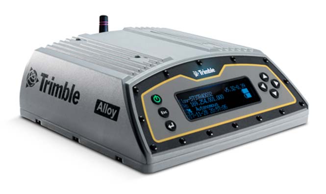
    Trimble has introduced its next-generation GNSS reference receiver for real-time network (RTN) applications: the Trimble Alloy GNSS reference receiver.

    With 672 channels, the continuously operating reference station (CORS) receiver provides users and operators with access to multiple constellations and signals, supplying robust and reliable reference data.

    With an IP68 rating for protection against dust and moisture, the Trimble Alloy performs even in the most rugged environments to meet the demands of professionals from the earth science, surveying, construction, mapping and agricultural industries.

    Delivering high-accuracy GNSS data to improve RTN performance and reliability, the Trimble Alloy GNSS receiver allows RTN owners and operators to:

    • Track and log all current and planned GNSS. Powered by the new Trimble Maxwell 7 GNSS dual chipsets, Trimble Alloy tracks and processes all of today’s current GNSS signals at data rates up to 100Hz, and is designed to be ready for planned signals and systems. The next generation receiver provides 672 channels for unrivaled GNSS constellation tracking including: GPS, GLONASS, BeiDou, Galileo, QZSS, IRNSS as well as the full range of SBAS.
    • Deliver absolute position monitoring. Leveraging Trimble RTX precise point positioning technology, the Trimble Alloy receiver is able to derive its position at centimeter-level accuracy in real-time. Combined with Trimble’s advanced Sentry monitoring technology, the receiver will automatically notify the operator of any status change including positional changes. The technology ensures users are receiving the most accurate correction data.
    • Realize new levels of user convenience. An all new intelligent receiver design brings an unprecedented level of usability to GNSS reference stations with the Trimble Alloy reference receiver. Featuring a tilted four-line OLED screen, Trimble Alloy displays key information without the need for scrolling through multiple menus. Dual hot swappable batteries, coupled with multiple power inputs, give users flexible installation options. Wi-Fi connectivity, multiple serial ports and remote access options allow users to configure the device easily, no matter how or where it’s installed.

    “Alloy provides a solution to address a variety of installation challenges faced by RTN owners and operators today,” said Mark Richter, marketing director of Trimble’s Advanced Positioning Division. “The receiver can track all satellite signals at the highest possible data rate while being easy to use, access and configure. All of these features make the receiver a compelling investment for owner/operators who are looking to modernize their networks or single station configurations. Trimble Alloy will carry them far into the future.”

    The Trimble Alloy GNSS reference station receiver is expected to be available in most of the world through Trimble’s Distribution Channel during the first quarter of 2018. For Asia and Latin America, the receiver is expected to be available in the second quarter of 2018.

  • Airbus to provide near real-time access to its satellite data

    Airbus has launched near real-time satellite imagery capabilities together with its 24/7 Emergency Image Delivery Service to aid those facing emergency situations.

    By leveraging the Kongsberg Satellite Services (KSAT) polar ground station in Svalbard, Norway, Pléiades and SPOT constellation images are now retrieved at every orbit, resulting in ultra-fast image deliveries after collection, anywhere in the world.

    In addition to this advanced reactivity, the 24/7 Service gives customers easy, immediate and round-the-clock access to a dedicated team of satellite experts who provide timely support in case of unplanned events.

    “When facing crises, time is critical. With our 24/7 Emergency Service, offering an image delivery time averaging two hours after acquisition, emergency situations can be treated with an even higher priority and our customers and partners will receive their mission critical satellite images much faster,” said François Lombard, Head of the Intelligence Business at Airbus Defence and Space.

    The 24/7 Emergency Image Delivery Service, relying on advanced Near-Real Time capability, was developed to answer customers’ specific requirements when facing unplanned events, geopolitical crises, natural or man-made disasters. It provides timely, reliable and accurate satellite images to assess damage and help mitigate the impact on those affected.

    The service ensures that satellite resources, such as the wide-swath SPOT or very high-resolution Pléiades constellations, are booked with the highest tasking priority, guaranteeing accelerated access to data worldwide.

    The service is also designed to be flexible, providing the possibility of last-minute modifications or cancellations. With this improved performance and capability, Airbus further enhances its ability to deliver timely and accurate satellite images using its smart and complete optical and radar constellations consisting of Pléiades & SPOT 6/7 satellites, DMC Constellation as well as TerraSAR-X and TanDEM-X radar satellites.

  • Next-generation EGNOS to combine Galileo, GPS for aviation

    Next-generation EGNOS to combine Galileo, GPS for aviation

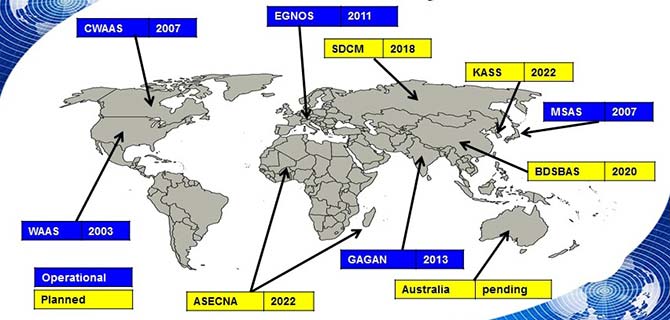
    Satellite-based augmentation systems worldwide. (Image: ESA)

    News from the European Space Agency

    The next generation of Europe’s satellite navigation overlay service, EGNOS, will combine use of GPS and Galileo signals to improve accuracy and robustness of navigation for air traffic and other uses where lives are at stake.

    A contract was signed Jan. 26 at ESA’s technical centre in the Netherlands for the second  generation  of the European Geostationary Navigation Overlay Service, EGNOS V3, planned to enter service in 2025.

    ESA Director of Navigation Paul Verhoef signs the EGNOS V3 contract Jan. 26 with Senior Vice President of Airbus Defence and Space, Mathilde Royer Germain. (Photo: ESA)

    ESA Director of Navigation Paul Verhoef signed the contract with the senior vice president of Airbus Defence and Space, Mathilde Royer Germain,  in the presence of senior managers of the European Global Navigation Satellite System Agency (GSA) and of the European Commission.

    This improved version of the service will take advantage of in-operation Galileo signals as well as new frequencies from an improved class of GPS satellites. Use of the L5 second frequency will improve service robustness against errors and propagation delays caused by the ionosphere, an electrically active outer layer of Earth’s atmosphere.

    “This will be the first such regional satellite augmentation systems worldwide to employ dual frequency, GPS and Galileo signals,” comments Didier Flament, overseeing EGNOS development for ESA.

    For aircraft with the latest avionics, EGNOS V3 will be able to guide them accurately and safely down to Category 1, a 10 m Vertical Alert Limit (also called Cat1 Autoland capability), while also providing legacy users equipped with current avionics a more robust version of the current LPV200, or 35 m vertical limit vertical guidance service.

    As well as improving services for civil aviation, the plan is to introduce new services for other sectors such as maritime navigation and rail, and extend service coverage from the European continent to link up seamlessly with other interoperable augmentation systems worldwide.

    EGNOS is Europe’s other satellite navigation system, next to the global Galileo system.  Comparable to the US WAAS, the Wide Area Augmentation System, and other regional augmentation systems in the rest of the world, EGNOS is an overlay system based on a network of ground stations and transponders on geostationary satellites. These stations gather data on the current accuracy of US GPS signals and embed correction data in the EGNOS signal, which is uplinked via geostationary satellites to EGNOS users.

    The current EGNOS augments the accuracy of GPS signals across Europe and informs users of their current reliability level within six seconds. EGNOS belongs to a family of systems called Satellite Based Augmentation Systems (SBAS); the EGNOS V3 second generation will augment both GPS and Galileo.

    Designed against global standards set by the International Civil Aviation Organisation, EGNOS began offering its Open Service for non-safety-of-life uses in October 2009. In March 2011 its Safety-of-Life Service became available for aircraft navigation.

    Dozens of European airports are today employing EGNOS for vertical guidance approaches, as an economic alternative to ground-based infrastructure, like Instrument Landing Systems. It is estimated that that around 110 000 aircrafts worldwide are today equipped and using SBAS systems.

    The development of satellite-based augmentation systems around the world is being coordinated in particular by the international SBAS Interoperability Working Group, which last week held its 33rd meeting at ESA’s centre in Madrid, chaired by ESA and the US Federal Avigation Authority, joined by current or planned service providers from Africa, Australia, Canada, China, India, Japan, Russia and South Korea.

    Initiated by ESA in cooperation with the EU and Eurocontrol, the EGNOS Exploitation phase is managed by GSA and funded by the EU. ESA manages the EGNOS development under a working arrangement signed between GSA and ESA.

  • Danlaw releases through-glass integrated V2X antenna

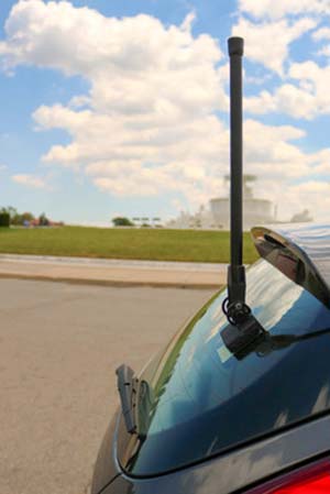
    Danlaw Inc. has released its Through Glass Integrated V2X Antenna for vehicle-to-vehicle and vehicle-to-everything (V2X) communications.

    The design incorporates an integrated GNSS antenna on the interior coupler. Optional cellular, Wi-Fi, and other antennas are also available on request.

    The antenna pairs with dedicated short-range communications (DSRC) devices to enable vehicle-to-vehicle, and vehicle-to-infrastructure communications.

    Traditional aftermarket antennas require drilling holes or passing cables through window and door openings, which risks damaging vehicle seals.

    Danlaw’s dual-radio, glass-mounted antenna eliminates the risk of damaging the vehicle by using a coupling pair-to-pass DSRC signals between the vehicle’s interior and exterior.

    The easy-to-install antenna can be mounted on the rear, front or side windows using automotive grade glass adhesive. This flexible installation allows the shortest cable route to the V2X device, reducing signal losses due to cable length, the company said.

    “Our customers running pilot programs want to install V2X DSRC systems on vehicles with best-in-class RF performance without modifying their cars,” said Scott Morell, Danlaw’s vice president of engineering. “Combined with our Aftermarket V2X Safety Device, this enables V2X capabilities to be installed on vehicles simply and easily.”

    The antenna enhances Danlaw’s Connected Vehicle portfolio which includes an aftermarket safety device (ASD) and V2X development tools.

    The ASD has been selected by pilot programs supporting multiple applications, including critical safety advice, driver access solutions, and real-time road condition and congestion information.

    Danlaw development tools include the OmniAir-certified Mx-DSRC Conformance Test System and Mx-Drive Mobility Simulator.

    Detailed specifications for the antenna are available.

  • Polaris Wireless to deliver E911 indoor location to Alaska

    Polaris Wireless, a provider of high-accuracy, software-based wireless location solutions, has signed a multi-year, multi-phase contract for delivery of a wireless location solution that complies with the Federal Communications Commission’s (FCC) most recent E911 wireless location accuracy mandate with The Alaska Wireless Network, a company wholly owned by GCI Communication Corp (GCI).

    The first phase of the contract extension includes the Polaris Wireless Evolved Serving Mobile Location Center (E-SMLC) with hybrid location software for LTE networks that complies with FCC-mandated indoor location requirements. Subsequent phases include delivery of additional location technologies and hybrid algorithms as cellular networks and mobile devices continue to evolve and become more capable.

    Polaris Wireless describes its hybrid location solution as inherently future proof to take advantage of improvements in cellular networks and mobile devices. 

    “We are excited to continue working with GCI in providing our software-based location solutions,” said Amir Sattar, vice president of global operations for Polaris Wireless. “Polaris takes great pride in GCI trusting us to provide GCI E9-1-1 callers with the highest level of location accuracy when and where they need it most.”

    “We have enjoyed a long-term relationship with Polaris Wireless delivering wireless E9-1-1 location solutions for many years,” said Gene Strid, chief technology officer of GCI. “As the carriers must now locate E9-1-1 callers in challenging indoor environments, we are happy to leverage Polaris Wireless’s technological innovation and commitment in delivering high-accuracy, software-based location solutions.”

    “Polaris Wireless E-SMLC product leverages all available and emerging technology to deliver the best location position accuracy we can for our subscribers’ emergency calls,” said John Myhre, vice president of wireless technology at GCI.

  • ComNav’s new T300 Plus GNSS receiver provides tilt compensation

    ComNav Technology has introduced the T300 Plus GNSS receiver, an upgrade to its T300 receiver.

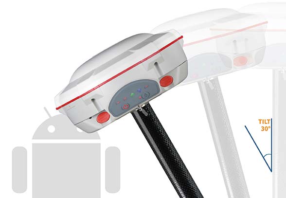
    Designed for demanding surveying tasks, the rugged T300 Plus GNSS features full-constellation tracking capability, tilt compensation, 4G/Wi-Fi connection, 8-GB internal memory and an easy survey workflow with Android-based Survey Master Software. It is designed to make collecting accurate data easy and fast, whether done by a beginner or experienced professional surveyor.

    As an upgrade of the T300, SinoGNSS T300 Plus combines a GNSS board, Bluetooth and adjustable TX/RX UHF, Wi-Fi and 4G modem into one rugged device. Its built-in 4G modem ensures the T300 Plus works with all kinds of CORS worldwide. Moreover, T300 Plus built-in tilt sensor supports maximum 30-degree pole tilt and keeps the compensation accuracy within 3 centimeters, and the user can check the electronic bubble on the controller for fast surveys in the field.

    With two hot-swappable batteries, the T300 Plus helps to extend working hours, the company said. The battery LEDs flash when the battery runs low; they can be replaced or charged directly while in the T300 Plus through an external power connection. Its consumer-grade battery design is compatible with the Canon LP-E6, which can be purchased in retail stores.

    https://youtu.be/HddhJXF8D3Y

    ComNav Technology also provides the T300 Plus GNSS surveying system with the Android-based R500 data collector and Survey Master software, providing for powerful and straightforward survey workflow in the field.

    The T300 Plus is now available through ComNav Technology authorized local distributors or directly through ComNav Technology.

  • TomTom Autostream provides map delivery for autonomous driving

    TomTom has launched TomTom AutoStream, an innovative map delivery service for autonomous driving and advanced driver assistance systems. The first partners to use the technology — Baidu and Zenuity — were unveiled at the 2018 Consumer Electronics Show.

    TomTom AutoStream enables vehicles to build a horizon for the road ahead by streaming the latest map data from the TomTom cloud. By ensuring that the map used to power advanced driving functions is always the latest, TomTom AutoStream enhances driver comfort and safety.

    “The launch of TomTom AutoStream is a game-changer for OEMs and technology companies that are working on the future of driving,” said Willem Strijbosch, TomTom’s head of autonomous driving. “TomTom AutoStream allows vehicles to access the latest, most up-to-date TomTom map data for their driving automation functions.”

    TomTom AutoStream is designed in a flexible way, allowing customers to customize the map data stream based on criteria such as sensor configuration and horizon length. It can stream a wide variety of map data including ADAS attributes such as gradient and curvature, and the TomTom HD Map with RoadDNA. This flexibility allows customers to use AutoStream to power a wide range of driving automation functions.

    Strijbosch continued, “Our early investment in the TomTom advanced map-making platform means that we can continue to deliver revolutionary innovations like TomTom AutoStream. With TomTom AutoStream we can significantly simplify and shorten the development time for our customers, accelerating the future of driving.”

    TomTom AutoStream ensures that the TomTom map data used to power advanced driving functions is the latest, most accurate available, enabling a safer and more comfortable experience.

    “With AutoStream TomTom is offering an innovative map delivery system targeted at automated driving,” said Roger C. Lanctot, director, Automotive Connected Mobility for Strategy Analytics. “The development is targeted at helping automakers bring ADAS and autonomous driving functions to market faster.”

    TomTom AutoStream will be available for production usage in 2018.

  • 2G Robotics laser systems aid in Norwegian mine countermeasures

    The first of four ULS-500 PRO laser scanning systems from 2G Robotics has been shipped to Kongsberg Maritime for integration into the Norwegian Defence Materiel Agency’s (NDMA) newly purchased Hugin autonomous underwater vehicles (AUVs).

    The acquisition signifies the Royal Norwegian Navy’s transition to autonomous systems for mine countermeasures. During operations, Hugin AUVs will be used to complete surveys of subsea environments focused specifically on locating and identifying mines.

    The Hugin systems enable users to conduct fast and efficient operations with zero surface visibility while additionally improving safety conditions by allowing personnel to remain outside the minefield. In peacetime, the AUVs contribute to hydrographic operations.

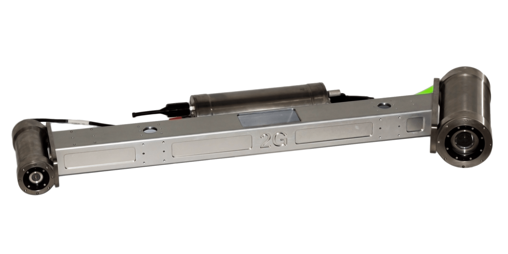
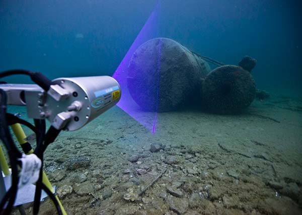
    The ULS-500 PRO dynamic underwater laser scanner system will contribute to the detection, classification and assessment of mines. 2G’s system acquires data in real time and provides users with 3D models of targets and environments accurate to the sub-centimeter.

    The complete laser scanning system also includes the 2G Observer, an ultra-sensitive stills camera able to capture images at 12 fps, and the 2G Nova, an LED panel designed specifically for AUV integration providing almost 1,000,000 lumens.

  • Handheld launches Nautiz X9 rugged Android PDA

    Handheld launches Nautiz X9 rugged Android PDA

    Image: Handheld
    Image: Handheld

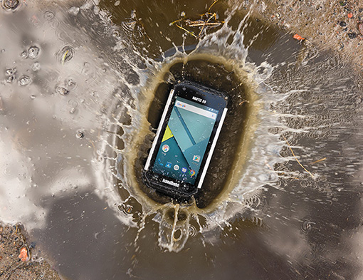
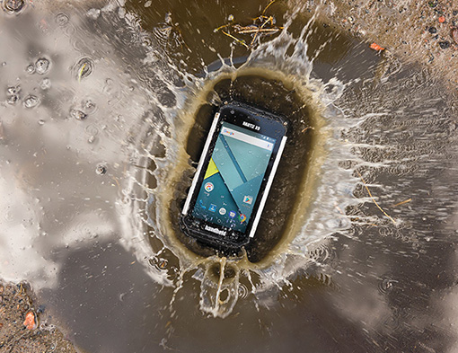
    Handheld Group has launched the Nautiz X9, an ultra-rugged enterprise handheld built for fieldwork in challenging outdoor or industrial environments. It can be used as a mobile computer, data collector or field controller, the company said.

    The Nautiz X9 offers:

    • A quad-core processor and easy-to-use Android 7 (Nougat) OS.
    • GPS/GLONASS capabilities standard.
    • Optional high-quality, high-speed 2D imager.
    • Dual cameras including 13-megapixel rear-facing with autofocus and flash, and 2-megapixel front-facing.
    • 4G/LTE Android phone functionality.
    • Google GMS for Google Maps navigation and Play Store app access.
    • A sunlight-readable 5-inch capacitive display with multi-touch sensitivity.
    • IP67 ruggedness rating for waterproof, dust-tight performance.

    The Nautiz 9 is MIL-STD 810G tested for drops, vibrations, humidity, extreme temperatures and varying altitudes.It has a fast 1.3-GHz processor with 2-GB RAM and 16-GB Flash. The 4800-mAh battery will run for a full shift, even with heavy use.

    “Adding the Nautiz X9 to our family of products reflects our commitment to bringing truly rugged field devices to market,” said Johan Hed, Handheld Group director of product management. “The Nautiz X9 also extends our wide Android offerings, which have been in increasingly high demand. GMS certification is an extra feature not always included in enterprise devices, but it has proved to be invaluable for our customers, giving them access to the full suite of Google applications. The reliability and toughness of the Nautiz X9 will bring great value to field users worldwide.”

  • Applanix offers Autonomy Development Platform for autonomous vehicles

    Applanix offers Autonomy Development Platform for autonomous vehicles

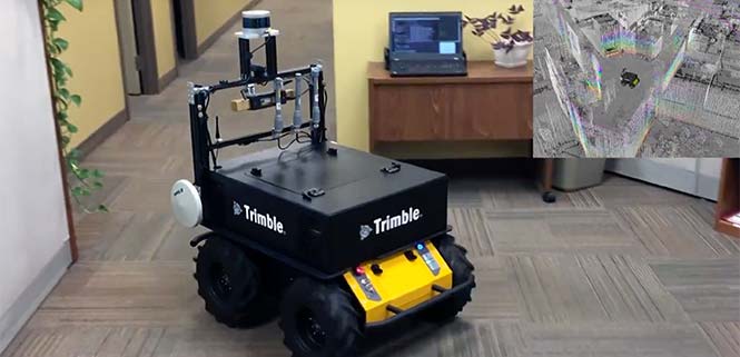
    Applanix, a Trimble Company, has introduced its Autonomy Development Platform to provide automakers, truck makers and Tier 1 vehicle suppliers the hardware, software, engineering and integration services they need to accelerate their development programs for on-road and off-road autonomous vehicles.

    By combining customized integration and engineering services along with Applanix’ GNSS-inertial positioning technologies, the Autonomy Development Platform advances driverless vehicle development projects at every stage of development and commercialization.

    “With the introduction of our Autonomy Development Platform, Applanix now offers on-road and off-road vehicle manufacturers the tools and engineering expertise necessary to support and augment their driverless vehicle development programs,” said Louis Nastro, director of Land Products at Applanix.

    “The platform delivers a navigation solution that is fully customizable and includes integration and engineering services, field-tested hardware and proprietary software for highly accurate positioning,” continued Nastro. “The navigation solution is capable of working with all sensors, including multiple cameras, lidar, radar and ultrasonic sensors, and with all vehicle types at all stages in the development and commercialization cycle.

    “The Applanix technology enables highly accurate assessments of the full 360-degree environment around a vehicle to produce a robust representation, including static and dynamic objects, critical for successful vehicle autonomy.”

    “Applanix has been committed to meeting the needs of autonomous vehicle manufacturers for more than a decade, going back to our success at the DARPA Challenges. In addition, our expertise in autonomous technologies is part of an extensive portfolio of Trimble solutions for automation and vehicle autonomy, which began more than three decades ago,” said Steve Woolven, president of Applanix. “Our refined positioning algorithms and expertise with sensor fusion and mobile robotic technologies enable us to provide a development platform that delivers the required performance and reliability for manufacturers to develop and produce self-driving vehicles for all environments and tasks.”

    The Applanix Autonomy Development Platform is available now through the Applanix worldwide sales channel.

    https://youtu.be/hF53U3MF_AE

  • Mobile device monitors fieldworkers in dangerous conditions

    Mobile device monitors fieldworkers in dangerous conditions

    Winter weather can make fieldwork more dangerous. If a worker falls off a structure, becomes trapped or is otherwise incapacitated, in a remote location or working alone, he or she could be without aid for hours.

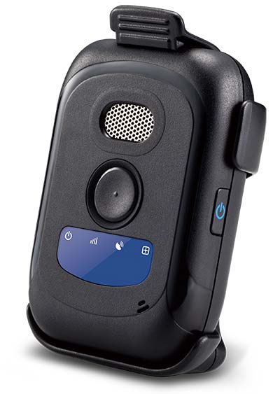
    The Mobile Defender Model-S (MD-S) by SecuraTrac is designed to monitor field workers and provide alerts to keep them safe. It provides global GPS services and is able to withstand extreme conditions and uses.

    In an emergency situation, taking out a cell phone or tablet to make a call or send a message is not always possible.

    The MD-S monitors worker status and can immediately call for help if a problem is detected. The worker can also press a button to be connected to responders.

    The MD-S features SecuraTrac’s new fall advisory capability and more than 30 days of battery life on a single charge, the company said.

  • Launchpad: Spoofer detection for surveyors

    OEM

    RF front-end board

    7-channel multi-GNSS multi-band for software-defined receiver
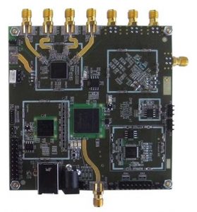
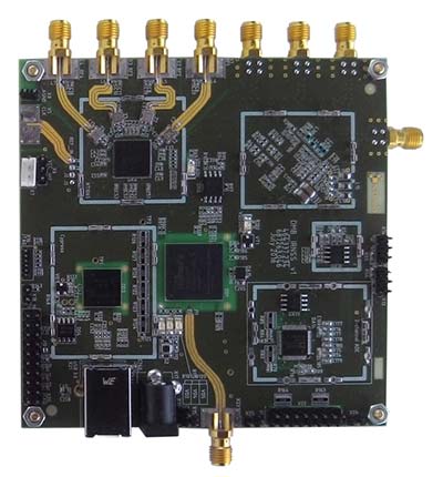
    The NT1065/66_USB3 multi-channel GNSS RF front-end board is based on NTLab’s RF ICs: NT1065 (four channels for GPS / GLONASS / Galileo / BeiDou / IRNSS / QZSS, L1/L2/L3/L5 bands) and new NT1066 (two channels for all previously mentioned GNSS signals, plus one extra-channel for IRNSS S-band). The board supports USB3 connection, allowing users to process captured satellite signals on a PC or DSP platform. The board is accompanied by comprehensive software and manuals. Features include six channels for L1/L2/L3/L5-band signals + one channel for S-band signals simultaneous reception; up to four coherent channels; IF bandwidth up to 32 MHz; acquisition of wideband signals up to 64 MHz (such as Galileo E5) by two coherent channels; USB3 interface (up to 800 Mbit/s); ability to connect four x CRPA. NTLab offers an academic discount program for universities, colleges and institutes, allowing them to purchase this powerful research tool with significant savings.

    NTLab, www.ntlab.com

    GNSS OEM RTK boards

    With rover radio for wireless applications

    Three new Tersus GNSS HRS kits feature high-precision BX305, BX306 and BX316 GNSS RTK boards. The kits consist of RTK receivers, GNSS antennas, RS05R radio station modems, radio station antennas, and related cables and converters. Embedded in the receivers are the Tersus RTK boards. They are compact-design, energy-efficient, centimeter-level accurate GNSS real-time kinematic (RTK) boards that bring high-precision positioning accuracy to the market. Different from the standard BX305/306/316 GNSS kits, the new HRS versions are equipped with the RS05R lightweight and robust UHF rover radio for wireless applications. It provides reliable data communication for demanding conditions that require a combination of stability, high performance and long-range operation. The kits can be used in a variety of applications, such as unmanned aerial vehicles (UAVs), surveying, mapping, precision agriculture, construction engineering and deformation monitoring.

    Tersus GNSS, www.tersus-gnss.com

    SURVEY & MAPPING

    Spoofer detection

    Spoofing alerts for surveyors

    Spoofer detection is now available on all JAVAD GNSS original equipment manufacturer (OEM) boards. When a receiver equipped with a JAVAD board detects more than one correlation peak for any PRN code, it warns the user of the presence of spoofing (false signals) and identifies the spoofed satellites. The receivers then switch to other signals and sensors that are not being spoofed to maintain accurate positioning. The user can also employ the receiver to try to identify the direction from which the spoofing signals are originating.

    JAVAD GNSS, www.javad.com

    Laser scanner

    Scanning range reaches 1 kilometer
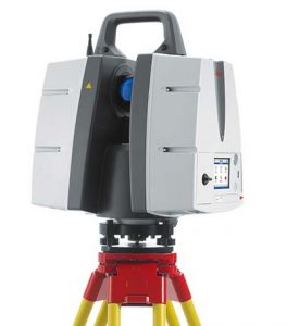
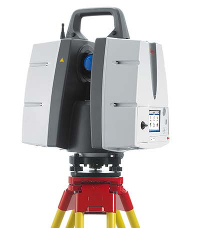
    The ScanStation P50 combines all the features of the P40 plus a longer range scanning capability of more than 1 kilometer. The rugged, versatile laser scanner enables professionals to 3D capture at great distances with angular accuracy paired with low-range noise and survey-grade dual-axis compensation. The ScanStation P50 opens new business opportunities for reality-capture professionals, helping them to scan what was previously unreachable such as big mine pits, long bridges, dams and skyscrapers. With its range, the P50 enables users to scan any tall or wide infrastructure or dangerous sites from a remote and safe position. This newest member of the P-Series provides the highest quality 3D data and high-dynamic range (HDR) imaging at an extremely fast scan rate of up to 1 million points per second and ranges of more than 1 kilometer.

    Leica Geosystems, leica-geosystems.com

    TRANSPORTATION

    Smartphone data analysis

    Integrates gamification and real-time data

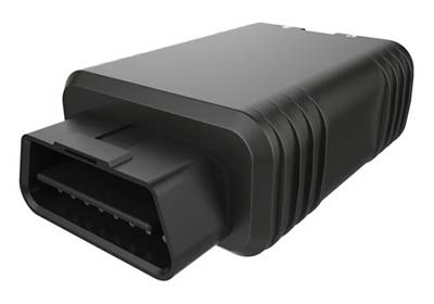
    Azuga FleetMobile: Standalone Smartphone Edition (SSE) is a smartphone-based solution for driver behavior monitoring, mobile timecard management and GPS tracking. Azuga FleetMobile SSE leverages data analysis components of the original Azuga FleetMobile application, including driver behavior monitoring, location-based timestamps for timecards, gamification and driver rewards, without requiring separate hardware installation via a vehicle’s OBD port. Azuga’s GPS fleet-tracking offerings feature a driver rewards program to help fleets reduce accidents by up to 70 percent. The standalone application, which works on both Android and iOS smartphones, integrates gamification and real-time data to encourage self-coaching and healthy competition. Azuga’s data science team can then leverage information about driving behaviors and combine them with route patterns, fleets’ vehicle health information and environmental factors to identify opportunities for performance improvements in fleet operations.

    Azuga, azuga.com

    Vehicle tracker

    Able to receive MobileEye ADAS alerts
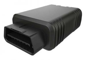
    The RIFA series of full-featured GPS trackers have built-in gyro and G-sensors, and supports OBDII and J1939 protocols. In addition to 4G/3G communication, it provides options to use low-power wide-area networks (LPWAN) such as NB-IOT or LoRa, which can reduce communication costs significantly. The unique CAN-to-ADR (automotive dead reckoning) function provides accurate positioning in situations of weak GPS signals, such as driving in tunnels, indoor parking facilities, urban canyons or when GPS signal obstruction hinders positioning, without additional cabling for wheel speed input.

    Antzer Tech, www.antzer-tech.com

    UAV

    Thermal imaging payloads

    Ethernet/IP-Based connectivity
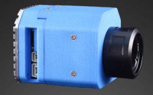
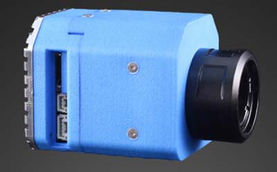
    The ThermalCapture IRnet provides an Ethernet interface for live data streaming to new and existing FLIR Tau 2 drone cores and FLIR Vue Pro/R cores. The market has increased its demand for connectivity by Ethernet, with professional drone manufacturers choosing Ethernet for communication on board UAVs. The ThermalCapture IRnet allows for real-time access via Ethernet while recording radiometric data to microSD, bringing real-time access in drone flight operations to thermal imaging data. It stores the full 14-bit radiometric thermal data on a microSD card. Real-time access remains available while radiometric data are being recorded; operators can also control the camera and settings via Ethernet. Using Ethernet also offers data privacy.

    TeAx, thermalcapture.com

    Airborne lidar mapping

    Centimeter-level accuracy for 3D mapping products

    The Think 3D Stormbee multicopter integrated with Trimble’s AP15 provides efficiency, accuracy and performance for lidar surveys from unmanned vehicles. The Stormbee is a directly georeferenced UAV lidar solution for 3D industrial mapping applications, designed to collect survey-grade spatial data more cost effectively and efficiently than static lidar. Stormbee’s 3D mapping technologies include Faro’s Focus 130 laser scanner, Trimble’s AP15 high-performance GNSS/inertial receiver, Applanix’s POSPac UAV GNSS/inertial post-processing software and Stormbee Beeflex software for lidar point-cloud generation. By using the high-performance Trimble AP15 with two antennas and the Applanix post-processing software (POSPac MMS) for georeferencing the lidar data, Stormbee provides an accurate real-time and post-mission solution for all motion variables.

    Think 3D, think3d.be

    Applanix, applanix.com