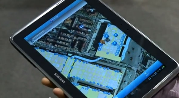
sensewhere’s crowdsourcing technology enables precise location information, with no additional infrastructure, in areas where there is no or inaccurate GPS satellite data such as indoors or in tight urban areas.
Tencent Holdings Ltd., a provider of Internet services in China, has completed a strategic investment in sensewhere Ltd., a provider of indoor location solutions based in Scotland. Tencent has also secured a license to use sensewhere indoor positioning software as part of its Tencent Map Location software development kit (SDK) that is available to numerous users across Tencent mobile platforms and mobile services of Tencent affiliate companies.
The investment will help sensewhere develop potential partnerships in China’s mobile Internet space, deliver its mobile advertising service, fuel expansion of the company and its indoor location solutions. As part of the arrangements, sensewhere will be Tencent’s preferred vendor for location-based advertising services in China.
“This investment by Tencent will be significant for the company and is an endorsement of our technology, strategy and ability to deliver low cost, highly scalable and highly accurate Universal indoor positioning,” said sensewhere CEO Rob Palfreyman. “I am thrilled with the collaboration, and having Tencent as a strategic investor will help take sensewhere to the next level and assist us growing our customer base, building new Location Based Services and investing further in R&D.”
“The investment by Tencent highlights the advantage of sensewhere’s indoor positioning technology over other solutions and further cements our position as a leading Indoor Positioning System (IPS) provider,” said sensewhere Chairman Jim Devine. “The planned roll out of multiple services to millions of users across China and contiguous territories which incorporate sensewhere’s enabling technology represents a major step forward towards our goal of providing a truly global solution for indoor positioning.”
sensewhere believes that its seamless, automatic solution for IPS and easy integration with mobile applications and devices will be the driving force behind emerging technologies, such as automatic beacon mapping, wearable technology, artificial intelligence, mobile advertising and using its live database to power next-generation location-based services.
“We believe that a superior, universal indoor positioning technology will deeply influence how people interact with each other, and significantly change how companies communicate with consumers and conduct commerce indoor across online and offline platforms,” said Julian Ma, corporate vice president of Tencent in Mobile Internet Group. “sensewhere’s unique, highly scalable approach will greatly enhance Tencent Map’s indoor positioning capabilities and enable our users to navigate indoor in a much more accurate and convenient manner.”
The video below explains sensewhere’s indoor location technology.
Garmin International Inc. has expanded its partnership with Honda Motors to provide the infotainment systems in new-model Hondas with Garmin’s navigation system. The latest vehicle platform to launch with Garmin and its navigation solution is the all-new Honda Pilot.
“We are delighted to expand our esteemed partnership with Honda across multiple new vehicle platforms, bringing our navigation expertise to their customers via an integrated system that is feature-packed and easy to use,” said Matt Munn, Garmin managing director of automotive OEM. “This growing partnership is a testament to the reliability and quality of our navigation solutions and we are honored by Honda’s continued confidence in Garmin.”
The Garmin system integrates seamlessly into Honda infotainment consoles. Preloaded maps allow users to navigate through areas that lack cell reception, while millions of points of interest make it easy to find existing or new locations, Garmin said.
Spoken turn-by-turn directions are enhanced with advanced guidance features to navigate drivers through challenging and rigorous circumstances. Lane guidance indicates the proper lane for a driver to make a turn, and photoReal junction view provides photo-realistic images of junctions and exits. The system also includes real-time traffic avoidance, speed limit display, 3D buildings, terrain views and more.
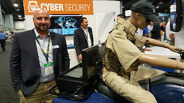
TCS’ Matt Vincent poses with public safety gear that includes Taoglas Storm Antenna at APCO.
It is refreshing to see nascent technology such as indoor location being used to enable accurate emergency services response. That’s what’s going on right now as beacons, Wi-Fi and other technology that works inside, where GPS doesn’t work, is being tested nationwide by companies hoping for government adoption. With new FCC regulations that are finally trying to keep up with commercial location products, it may be a reality soon. What really drove location into wireless handsets was the 1990s FCC regulations — will they now drive indoor positioning?
GSI Labs’ John Martin holds indoor beacon at APCO.
WASHINGTON — The same technology that allows consumers to find products indoors will allow emergency personnel to locate people in trouble in the coming years, said officials at the Association of Public-Safety Communications Officials (APCO) annual meeting here, held Aug. 16-19.
Companies are using existing commercial technologies, also used by retailers to determine customer preferences, to provide indoor location in combination with the National Emergency Address Database. This provides public-safety answering points, or PSAPs, accurate addresses and positions to dispatch emergency services to allow first responders to find people on specific floors and in rooms, not huge areas.
Beacons and Wi-Fi seem to be the lead technologies in use for emergency indoor location. Longmont, Colo.-based Intrado installed 65 Apple iBeacons at the Washington Convention Center to showcase its developing indoor positioning technology.
“Old 9-1-1 technology was just a dot on the map. Now people are saying, ‘how can Starbucks can find me, but 9-1-1 can’t?’” said John Snapp, Intrado senior technical officer.
Another company, TeleCommunication Systems, is getting into the indoor public safety market with its LocatE9-1-1 product that leverages the company’s indoor location engine, or ILE. The ILE connects to multiple databases that can be used during a 9-1-1 call to determine what location information is available for the wireless device.
“Deep inside buildings, location technology often fails us. Sometimes emergency workers have to rely on verbal information [from people at the scene],” said Tim Lorello, TCS senior vice president and chief marketing officer. “We are a location aggregator. However, we do know location won’t be deployed everywhere, but there are multiple technologies tied to Wi-Fi hotspots, barometric pressure and Bluetooth.”
In addition to government agencies, wireless carriers are taking notice of the indoor positioning capabilities for public safety. At APCO, GSI Labs, a 20-year-old business, was in the AT&T booth displaying its codeBlue-911 beacon system. “We think that for bigger venues such as warehouses and stores, this is a great public safety tool. The [Bluetooth Low Energy] beacons have about 20-to-50-foot accuracy, depending on the battery,” said GSI Labs’ John Martin. “A security company is looking at using the beacons to monitor employees during the night.”
OnStar booth features wrecked car to portray emergency messaging capabilities at APCO.
FCC Still at Forefront of Location Accuracy Requirements
In an address at the conference, FCC Chairman Tom Wheeler said that the agency has taken steps to increase the reliability of the nation’s 9-1-1 system. “Uber can pinpoint [a potential customer]. We won’t tolerate 9-1-1 failures,” said Wheeler, who also called for a national maps database.
Some people newer to the location industry don’t remember it was the enhanced 9-1-1 FCC rules that drove the installation of GPS into cell phones in the mid-1990s. In several presentations at APCO, it was noted that more than 80 percent of all emergency calls are made with a wireless device, not landline.
The FCC announced new rules this year that require wireless operators to provide dispatchable location within 50 meters with these new deadlines and conditions: 40 percent of all wireless 9-1-1 calls within 2 years; 50 percent within 3 years; 70 percent within 5 years; and 80 percent within 6 years.
If anyone doesn’t think the FCC is the 800-pound regulatory gorilla for location, then they have missed the LightSquared GPS signal interference saga. According to published reports, LightSquared has hired Reed Hundt, former FCC chairman, as an attorney representing the company.
LightSquared, which is trying to emerge from bankruptcy, has been seeking FCC approval to transfer its spectrum licenses to its new entity. The company is trying to see if the GPS interference issues can be resolved.
In other APCO news, Time Machines rolled out its TM 2000A timing device that costs $499.95. The big deal about the timing device is the price — which has many of the same features that competitors offer for more than $5,000, said Doug Ehlers, Mindshare by CSS president, a sister company of Time Machines, who also said the company is expanding its distribution in Europe.
Gimbal Partners with Do It Outdoors Media
While emergency networks are getting big, the commercial networks are continuing to make inroads with advertising agencies and partners. Location and proximity-based marketing company Gimbal recently partnered with Do It Outdoors Media in a deal that will use Gimbal’s beacon technology.
Gimbal said that Do It Outdoors Media, which is the largest national mobile billboard and field marketing company, will create a smartphone campaign that provides proximity-based consumer offers to opt-in users.
Beacons will be placed in Do It Outdoors Media’s mobile billboard units, which are owned and operated by the company. In addition, there will be product placement on Segways, jet packs, brand ambassador teams and other marketing sites.
Gimbal says that when a consumer enters into a beacon zone, which is effective from 50 meters away, content will be delivered through a push notification within an advertiser’s or a third-party mobile app.
In other location news:
While a small trade show for a focused group of government communication professionals, APCO drew 5,700 attendees, with 282 exhibitors. Conference organizers said it was the highest attended show in seven years.
An updated version of the former GPS-Wireless conference will take place Dec. 2-3 at the Crowne Plaza San Francisco Airport Hotel. The conference, Location IoT, will focus on new markets for M2M and the Internet of Things. Topics will include indoor location markets, connected vehicles and many others. Two hosted networking receptions are included. Contact me, Kevin Dennehy, at kdennehy @g psworld.com for more information.
Last year, in a massive crowdsourcing effort, eight million volunteers from around the world sat at their computers and searched high-resolution satellite imagery looking for signs of Malaysia flight 370, which had left Kuala Lumpur and never arrived in Beijing. The effort was akin to putting thousands of digital helicopters into the sky above 340,000 square kilometers of ocean. The project, organized by DigitalGlobe’s Tomnod group, didn’t find evidence of the plane. More than a year later and with wreckage recently discovered, it’s a good time to do a post-mortem of the crowdsourcing effort that involved amateur GPS citizen scientists from around the world.
Tomnod provided volunteers with images of the Thailand Gulf, Andaman Sea and areas of the Indian Ocean (West of Australia), an area that had been recommended for scrutiny by AMSA, the Australian Maritime Safety Authority. The area was organized by map tiles, each one-eighth of a kilometer. The images provided to the volunteers were still photos, a snapshot in time. The search followed the core rule of crowd sourcing — redundancy, and all map tiles were reviewed by multitudes of people.
The Tomnod crowdsourcing website from 2014.
I signed up to search images, and like others, was instructed to individually tag signs of wreckage, rafts, oil spills and interesting objects. Volunteers submitted 18 million tags for further review. Some of the tags were then inspected by analysts at Tomnod, but the vast majority were analyzed by computer programs alone. Search and rescue organizations were given the results to aid their search efforts.
With advancements in object recognition, one would think it possible for the initial search to be done by computer vision algorithms. Crowdsourcing could be used to manually clarify or further refine classifications. Tomnod believes identifying objects in the ocean is difficult and best done by humans, but has used digital object recognition in a new project. “For our project of mapping Swaziland to help eliminate malaria, Tomnod uses object recognition algorithms to locate buildings,” says Caitlyn Milton of DigitalGlobe. “Our next step is having crowdsource volunteers manually draw building footprints for each individual building. We either use volunteers or deploy our algorithm to identify the roof types (metal, wood or thatch), which are correlated with Malaria rates.”
Debris from flight MH370 washed up on Réunion Island in July.
Tomnod would have needed a trifecta: the correct geographic area, visible debris and identification of the debris to yield the actual crash site. Unfortunately, even with the discovery of plane parts found last month near Réunion Island in the Indian Ocean and even with analysis of ocean currents and weather conditions, it will be difficult to ascertain if the plane crashed within the Tomnod search area.
Crowdsourcing is not new to mapping. European countries offered hefty pouches of gold in the 1500s to people who could help solve the puzzle of determining latitude for maritime navigation. The competitors were well educated — mathematicians, astronomers and watchmakers. To contribute today, all one needs is a computer, a wireless connection and free time.
Next month, I’ll be in Las Vegas at CTIA’s Super Mobility 2015 reporting on industry developments. If you have interesting news, contact me.
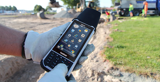
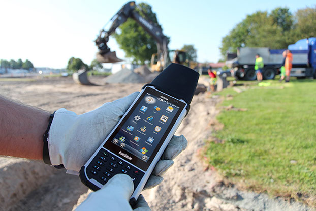
Handheld Group is offering expansion pack features for its Nautiz X8 rugged field computer. The new functionalities will make the Nautiz X8 more versatile for field workers in a number of market segments, including forestry, surveying, construction, field services, warehouse projects and logistics.
The Nautiz X8 was built to enable efficient and reliable data collection in the toughest of environments. Ultra-rugged with superior processing power, screen size and sunlight visibility, the X8 is used in the GIS, land surveying, public safety, forestry and military sectors.
Handheld now offers three expansion packs for the Nautiz X8:
Nautiz X8 Long Range Bluetooth (LRBT) Expansion Pack features a LRBT u-blox module, which allows long-range communication up to 300 meters. This option is especially well-suited for advanced forestry solutions, surveying and construction work.
Nautiz X8 Barcode Expansion Pack features an imager module (Zebra SE4750SR) with an LED aimer, which allows for competitive scanning performance without sacrificing design, ruggedness or user experience. This option is ideal for workers in field service, warehouse projects and logistics.
Nautiz X8 Basic Expansion Pack is an empty add-on cap for an extension of your choice. It increases the Nautiz X8’s customizability and flexibility for specific customer requirements. It also allows users to install custom accessories under the cap using the proprietary interface.
The new Nautiz X8 expansion packs will be available in September. All cap versions are designed to retain the Nautiz X8 IP67 classification.
“The Nautiz X8 is the world’s best rugged handheld computer, with an outstanding screen and exceptional durability, connectivity, processing power and battery life — without compromising ergonomics or design,” said Jerker Hellström, CEO of Handheld Group. “These new expansions will make it even more versatile, customizable and attractive for field users in a number of industry segments. We take pride in always working with our partners and customers to understand their specific needs and create solutions they actually want and will benefit from.”
The Nautiz X8 has an IP67 ingress protection rating and is protected against dust, sand and water immersion. It also meets MIL-STD-810G military test standards for overall durability and resistance to humidity, shock, vibrations, drops, salt and extreme temperatures.
Michael Che co-hosts Saturday Night Live’s Weekend Update.
Saturday Night Live comedian and co-anchor of “Weekend Update” Michael Che will be featured at CTIA Super Mobility 2015. Named as one of Rolling Stones’ 50 Funniest People, Buzzfeed’s 50 Hottest Men in Comedy and Variety’s Top 10 Comics to Watch, Che will report from the keynote stage with his thoughts on wireless news, hot topics and features at the industry’s annual convention.
CTIA Super Mobility 2015, the largest mobile marketplace in the Western Hemisphere, will be held Sept. 9-11 at the Sands Expo and Convention Center in Las Vegas. More than 40,000 people are expected to attend.
“CTIA Super Mobility is the best show for anyone who wants to create or improve their mobile strategy, since it’s the entire ecosystem under one roof. While wireless technology will certainly be the focal point, it’s also an opportunity to hear from Michael, who is one of America’s funniest people, share his perspective about our mobile-first lives,” said CTIA Vice President and Show Director Robert Mesirow.
Michael Che joins a lineup of keynote speakers representing the mobile industry’s diverse community, from innovative network providers to disruptors in media, retail and fitness, CTIA-Wireless said.
CTIA Super Mobility 2015 Keynote Lineup
Wednesday, Sept. 9, 9:00-10:30 a.m. PT
Meredith Attwell Baker, President & CEO, CTIA–The Wireless Association
Ron Smith, CTIA Chairman and President & CEO, Bluegrass Cellular
Tom Wheeler, Chairman, Federal Communications Commission
Marcelo Claure, President & CEO, Sprint
Show Report: Michael Che, “Weekend Update” Co-anchor, “Saturday Night Live,” NBC
Thursday, Sept. 10, 9:00-10:30 a.m. PT
Glenn Lurie, President & CEO, AT&T Mobility
Bob Pittman, Chairman & CEO, iHeartMedia, Inc.
Marni Walden, EVP & President of Product Innovation and New Businesses, Verizon
Friday, Sept. 11, 9:30-10:30 a.m. PT
Robin Thurston, Chief Digital Officer, Under Armour
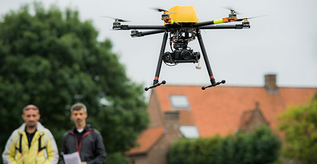
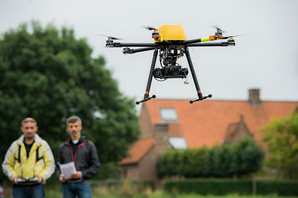
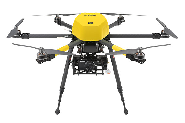
The Trimble ZX5 can reach smaller, remote environments faster, while providing accurate mapping data.
Trimble’s new ZX5 Multirotor Unmanned Aircraft System (UAS) — announced today — is an aerial imaging and workflow solution that captures and processes geo-referenced photo and video data for mapping, agriculture and inspection applications. The Trimble ZX5 complements the UAS portfolio with the ability to reach smaller, remote environments faster, while providing accurate mapping data for improved productivity in the field and back office, Trimble said.
“Unmanned aerial systems are powerful tools that are transforming geospatial-based mapping and inspection applications to positively impact our world,” said Todd Steiner, product marketing director in Trimble’s Geospatial Division. “Adding a multirotor solution to our portfolio provides options for our customers working across multiple environments to collect accurate spatial data, transform it to intelligence and create deliverables.”
With the ZX5, Trimble extends its unmanned aerial portfolio to include both fixed-wing and multirotor solutions, providing customers with a choice to meet their specific requirements. Trimble’s fixed-wing UX5 provides longer flight capabilities for large, open environments including farms, mines, canals, flood areas and forests — while the ZX5 is more suited for mapping smaller sites, including facades, obstructed areas, construction sites and standard aerial mapping applications.
The Trimble ZX5 multirotor UAS.
The ZX5 Multirotor is built for everyday jobs where image capture from tight spaces is common. Its vertical takeoff and landing capabilities allow users to work in tight places and obstructed environments where fixed-wing solutions are less suitable. It requires no launcher, is easy to assemble and includes everything needed to capture high-quality geo-referenced photos for aerial mapping and inspection applications.
The ZX5 includes a 16-megapixel camera to capture high-quality aerial imagery, down to 1-mm ground sample distance. The ZX5 also can be equipped to capture live video imagery for civil infrastructure, utility and oil and gas pipeline inspections.
Data captured by the ZX5 can be imported into Trimble Business Center Photogrammetry Module software to create detailed ortho-photos, digital elevation models, point clouds, volume calculations and 3D models, all without requiring specialized photogrammetry knowledge or experience. It also integrates with Trimble’s Inpho UASMaster module for advanced photogrammetric processing.
In addition, the Trimble ZX5 has been granted a Section 333 exemption from the Federal Aviation Administration.
GeoComm has released an ebook focusing on assessing GIS data for an NG911 system (next-generation 911). In an NG911 system, GIS data development, accuracy, and maintenance are vital, and GeoComm approaches NG911 readiness in three steps: assess, improve and maintain.
The ebook, Key Steps for Assessing Mission Critical Data for 9-1-1, focuses on the assess step.
GeoComm approaches GIS data assessment by first identifying the current state of the reader’s GIS Data. NG911 GIS assessment can be completed by:
Educating stakeholders
Developing standards
Reviewing and analyzing GIS data
In addition to outlining the tasks for each of these three steps, the eBook includes an example of how the State of Iowa approached its NG911 GIS data assessment.
“Today is the day to begin preparing GIS data for its key role in a successful NG911 system. Whether you are tackling your GIS data assessment yourself, working with outside jurisdictions, or partner with a vendor; this eBook provides a valuable guide to accomplish your GIS data assessment,” GeoComm said in a statement.
Fleet management company Omnitracs LLC will develop telematics software for Volvo Trucks North America and Mack Fleet Management Services for Mack Trucks. The two separate memorandums of understanding will provide customers of both Volvo and Mack Trucks with fleet management services such as routing and predictive analytics solutions.
According to Omnitracs, the agreements represent a move toward standardization in the trucking industry, making it easier for fleets to better control costs, safety, vehicle management and diagnostics, driver workflow and compliance. It also paves the way for other strategic partnerships within the OEM network, the company said.
“This partnership brings together two leading brands in the vehicle and technology space, and addresses the industry’s growing need for high-tech trucks offering improved productivity and compliance. As the Internet of Transportation Things moves beyond concept to reality, Omnitracs will continue to lead and become part of the larger ecosystem of OEMs that are redefining the traditional telematics landscape,” said Rich Glasmann, vice president of OEM strategy, sales and marketing for Omnitracs.
The Continuously Operating Reference Station network’s Silver Spring facility will be go offline starting at about 2 p.m. Eastern time Friday, but is expected to be back online by noon Sunday. “Our alternate facility will have full data holdings,” the National Geodetic Survey says on its CORS website.
The shutdown is for a building-wide upgrade. The Online Positioning User Service (OPUS) will be unavailable during the entire shutdown period.
Eric Gakstatter, GPS World’s Survey/GIS editor, has outlined alternatives that surveyors and GIS professionals can use during a shutdown.
Trimble has launched Trimble VRS Now correction service in Georgia. The commercial subscription service provides surveyors, civil engineers, and geospatial professionals in the region with instant access to real-time kinematic (RTK) GNSS corrections without the need for a base station.
Using both the GPS and GLONASS constellations, the Trimble service delivers centimeter-level RTK corrections customized for each GNSS receiver’s location anywhere in the network via cellular communications. The Trimble VRS Now service supplies accurate, reliable and easy-to-use GNSS positioning for a variety of applications including surveying, urban planning, urban and rural construction, environmental monitoring, resource and territory management, disaster prevention and relief, and scientific research, Trimble said.
“As we continue to expand our VRS Now network throughout the U.S., we’re excited to offer users in Georgia state-of-the-art VRS correction services powered by the latest Trimble infrastructure technology,” said Lisa Wetherbee, business area director of Trimble’s Positioning Services Division. “Now seamless coverage is available across Georgia, Alabama and Florida providing customers with reliable centimeter-level accuracy and the flexibility to work more freely across a larger tri-state coverage area.”
Service in Georgia is a continuation of Trimble’s focus on providing solutions that enable customers to increase productivity by simplifying access to high-precision positioning around the world. Similar VRS Now services are operating in Illinois, Indiana, Iowa, Nebraska, Colorado, Florida, Alabama, Mississippi, Texas, Oregon, New Mexico and parts of Europe and Australia.
Esri and FlightAware have partnered to combine the power of a flight tracking and status company with the ArcGIS mapping platform. The partnership features the ability to view and analyze large amounts of accurate, live-aviation data in one powerful spatial system.
FlightAware aggregates live flight tracking data from more than 50 government air traffic control authorities, satellite data link partners such as Garmin and ARINCDirect, and FlightAware’s own in-house ADS-B receiver network, consisting of more than 3,400 receivers in more than 100 countries.
“Esri has the tools and expertise to visualize data in a proven GIS environment,” FlightAware business development manager Max Tribolet said. “FlightAware data is the perfect addition. We’re the largest flight tracking company in the world, based on how many disparate data feeds we have coming into our system. So it’s pretty powerful when you pull our data into GIS.”
“This is a really good way to provide an additional option to our existing and potential customers, who might not have an easy way to consume larger volumes of flight tracking data,” Tribolet said. “A stand-alone app like Esri’s ArcGIS is adept at handling large quantities of data and is able to visualize it. This relationship with Esri allows FlightAware to focus on what we do best: constantly adding and aggregating quality flight tracking data and providing it to the industry.”
Airports and agencies have started exploring opportunities to use FlightAware data in GIS to improve proactive noise monitoring and airspace design as well as monitoring airspace congestion in real time. FlightAware visualizes live and historic data — such as altitude, longitude, latitude, ground speed, and estimated and actual schedule times—in 2D, 3D, and even 4D maps.
“The ability to fuse FlightAware data within the ArcGIS platform unlocks a host of new and innovative capabilities with regard to visualization, analysis and collaboration,” Esri aviation business development lead Stephen Willer said. “That results in a higher level of operational intelligence. We’re excited to bring this to our users across the globe. Real-time information access like this is essential not only today but also to our future air traffic systems.”